Mill Cleugh

Valley in Northumberland

England

Mill Cleugh

Road to Wydon Farm
Road to Wydon Farm Credit: Steven Brown

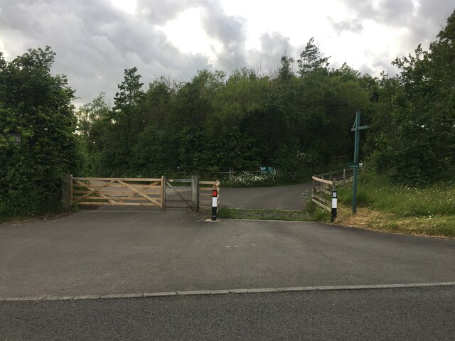
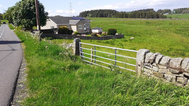
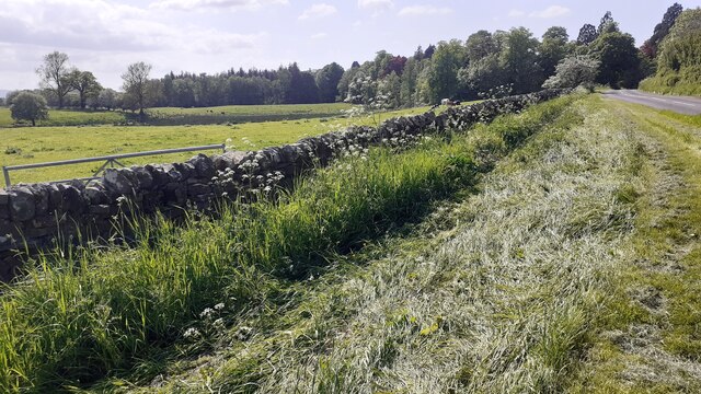
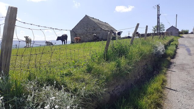
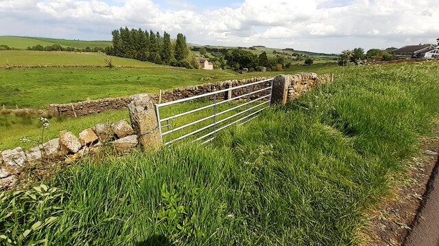
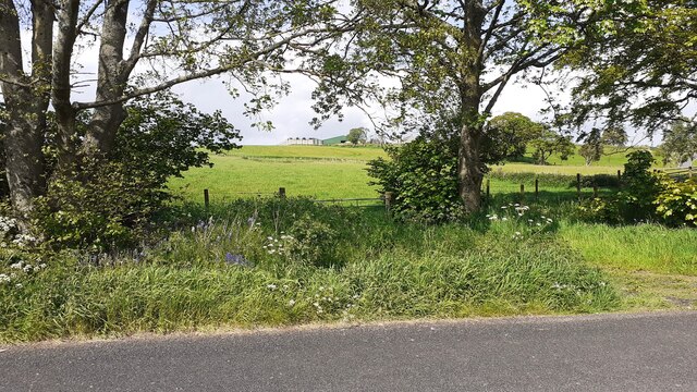
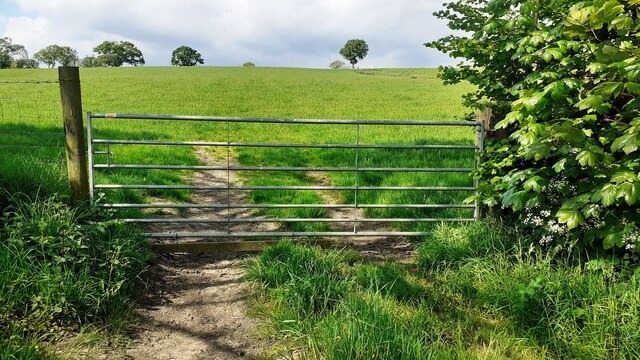
Mill Cleugh is a picturesque valley located in Northumberland, England. It is situated approximately two miles south of the village of Rothbury. The valley is renowned for its natural beauty, boasting stunning landscapes and a tranquil atmosphere that attracts visitors from near and far.

The name "Mill Cleugh" refers to the presence of a mill that once operated in the area. The mill was powered by the Cleugh Burn, a small stream that runs through the valley. While the mill is no longer operational, remnants of its structure can still be seen, adding to the historical charm of the location.

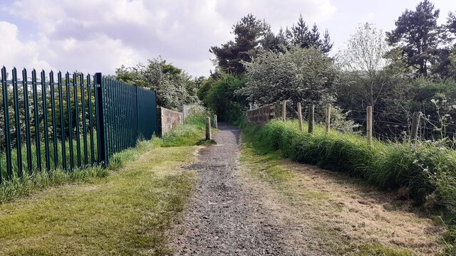
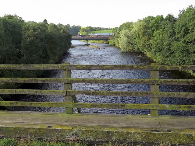
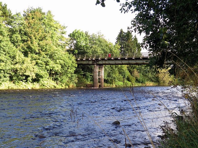
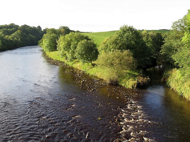
The valley is characterized by its rolling hills, dense woodlands, and meandering streams. Visitors can explore the area by following the numerous walking trails that crisscross the landscape, offering breathtaking views of the surrounding countryside. The valley is also home to an abundance of wildlife, including various bird species, squirrels, and rabbits, making it a popular spot for nature lovers and photographers.

In addition to its natural wonders, Mill Cleugh is also home to several historic sites. Close by is the picturesque Brinkburn Priory, a medieval monastery that dates back to the 12th century. The ruins of this former religious site attract history enthusiasts who are eager to learn about the area's past.

Overall, Mill Cleugh offers a serene and captivating experience for those looking to escape the hustle and bustle of everyday life. Its natural beauty, combined with its historical significance, makes it a must-visit destination in Northumberland.

If you have any feedback on the listing, please let us know in the comments section below.
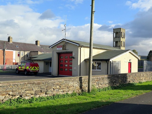
Mill Cleugh Images

Images are sourced within 2km of 54.974311/-2.4509697 or Grid Reference NY7164. Thanks to Geograph Open Source API. All images are credited.

Road to Wydon Farm
Road to Wydon Farm
Haltwhistle Fire Station (Northumberland County Council)  on south side of Park Street
Haltwhistle Fire Station (Northumberland County Council) on south side of Park Street
Gateway and house on NE side of road west of Comb Hill
Cows in field on south side of road west of Haltwhistle
Barn and cows in field opposite Fir Tree Cottage
View through field gateway on northeast side of Comb Hill Road
Benchmark on #4 Park Road Park Road according to Ordnance Survey records, but I think it may be Westlands. Ordnance Survey cut mark benchmark levelled at 127.093m above Newlyn Datum verified 1954
Benchmark on #4 Park Road
Park Road according to Ordnance Survey records, but I think it may be Westlands. Ordnance Survey cut mark benchmark levelled at 127.093m above Newlyn Datum verified 1954
#4 Park Road (Westlands?) There is an Ordnance Survey benchmark <a href="https://www.geograph.org.uk/photo/7500897">NY6963 : Benchmark on #4 Park Road</a> on the near corner, left hand face, of the house
#4 Park Road (Westlands?)
There is an Ordnance Survey benchmark NY6963 : Benchmark on #4 Park Road on the near corner, left hand face, of the house
Gateway and fields on north side of rural road west of Haltwhistle
Benchmark on pier of boundary wall of cemetery on south side of Tyne View Road Ordnance Survey cut mark benchmark levelled at 125.041m above Newlyn Datum verified 1954
Benchmark on pier of boundary wall of cemetery on south side of Tyne View Road
Ordnance Survey cut mark benchmark levelled at 125.041m above Newlyn Datum verified 1954
West end of cemetery boundary wall and Nos. 2 & 3 Hadrians Rise on south side of B6322 There is an Ordnance Survey benchmark <a href="https://www.geograph.org.uk/photo/7501049">NY6963 : Benchmark on pier of boundary wall of cemetery on south side of Tyne View Road</a> 0n the wall pier at the end of the wall
West end of cemetery boundary wall and Nos. 2 & 3 Hadrians Rise on south side of B6322
There is an Ordnance Survey benchmark NY6963 : Benchmark on pier of boundary wall of cemetery on south side of Tyne View Road 0n the wall pier at the end of the wall
Field gateway on NE side of rural road west of Haltwhistle
Bridge providing footpath over Carlisle-Newcastle railway line The bridge has identity NEC2/120
Bridge providing footpath over Carlisle-Newcastle railway line
The bridge has identity NEC2/120
A69 road bridge from Bellister Bridge The 'rocket' crossing the road bridge in the distance is part of a convey of heavy loads described here <a href="https://www.geograph.org.uk/photo/4582651">NZ1267 : Heavy load parked near Heddon on the Wall</a>

The same load was photographed near Heddon on the Wall on the following day: <a href="https://www.geograph.org.uk/photo/4675201">NZ1267 : 'Rocket' travels by road</a>
A69 road bridge from Bellister Bridge
The 'rocket' crossing the road bridge in the distance is part of a convey of heavy loads described here NZ1267 : Heavy load parked near Heddon on the Wall The same load was photographed near Heddon on the Wall on the following day: NZ1267 : 'Rocket' travels by road
Bellister Bridge Bellister Bridge was a temporary bridge built in 1967 to replace the Tyne Bridge near the station (which was no longer in use for vehicles) to give access to a plastics factory and to Plenmeller. It has now been made unnecessary since the opening of the Haltwhistle By-pass and serves as a footbridge from a residential area to the old road on the south side of the Tyne, from where the other pedestrian bridge, the Blue bridge, can be reached. It carried traffic until 1997 when the by-pass was opened. 
<span class="nowrap"><a title="http://www.bridgesonthetyne.co.uk/haltbell.html" rel="nofollow ugc noopener" href="http://www.bridgesonthetyne.co.uk/haltbell.html">Link</a><img style="margin-left:2px;" alt="External link" title="External link - shift click to open in new window" src="https://s1.geograph.org.uk/img/external.png" width="10" height="10"/></span>
Bellister Bridge
Bellister Bridge was a temporary bridge built in 1967 to replace the Tyne Bridge near the station (which was no longer in use for vehicles) to give access to a plastics factory and to Plenmeller. It has now been made unnecessary since the opening of the Haltwhistle By-pass and serves as a footbridge from a residential area to the old road on the south side of the Tyne, from where the other pedestrian bridge, the Blue bridge, can be reached. It carried traffic until 1997 when the by-pass was opened. LinkExternal link
River South Tyne from Haltwhistle by-pass bridge The confluence of the Tipalt Burn is on the right.
River South Tyne from Haltwhistle by-pass bridge
The confluence of the Tipalt Burn is on the right.
A69 bridge over River South Tyne Bellister Bridge can be seen behind. Pedestrians are protected from the fast traffic on a separate parallel roadway using the same bridge.
A69 bridge over River South Tyne
Bellister Bridge can be seen behind. Pedestrians are protected from the fast traffic on a separate parallel roadway using the same bridge.
Haltwhistle Fire Station, Park Road
Show me another place!

Mill Cleugh is located at Grid Ref: NY7164 (Lat: 54.974311, Lng: -2.4509697)

Unitary Authority: Northumberland

Police Authority: Northumbria

What 3 Words

///bluffing.ferrets.tigers. Near Haltwhistle, Northumberland

Nearby Locations

Mill Cleugh

Related Wikis

Haltwhistle Castle

Haltwhistle Castle Hill is a ruined Norman earth and timber ringwork fortress in Haltwhistle, Northumberland, England. There are no extant stone remains...

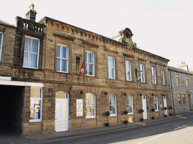
Old Town Hall, Haltwhistle

The Old Town Hall, also known as The Old Courthouse, is a former municipal building in Main Street, Haltwhistle, a town in Northumberland, England. The...

Haltwhistle

Haltwhistle is a market town and civil parish in Northumberland, England, 22.9 miles (36.9 kilometres) east of Carlisle and 36.8 miles (59.2 kilometres...

Haltwhistle War Memorial Hospital

Haltwhistle War Memorial Hospital is a health facility at Greencroft Park, Haltwhistle, Northumberland, England. It is managed by Northumbria Healthcare...

Nearby Amenities

Located within 500m of 54.974311,-2.4509697
Barrier: kissing_gate
Lat/Long: 54.9755512/-2.4575261
Turning Circle
Lat/Long: 54.9722876/-2.4572645
Post Box
Operator: Royal Mail
Post Box Type: wall
Ref: NE49 37
Royal Cypher: EIIR
Royal Cypher Wikidata: Q33102113
Lat/Long: 54.9719773/-2.4493983
Telephone
Booth: KX100
Covered: booth
Operator: BT
Phone: +44 1434 320765
Lat/Long: 54.9718559/-2.4493639
Post Box
Operator: Royal Mail
Operator Wikidata: Q638098
Post Box Type: wall
Ref: NE49 108
Royal Cypher: EIIR
Royal Cypher Wikidata: Q33102113
Lat/Long: 54.9717882/-2.4540961
Barrier: stile
Lat/Long: 54.9764504/-2.4509259
Barrier: kissing_gate
Lat/Long: 54.9756225/-2.4542245
Barrier: kissing_gate
Lat/Long: 54.9735943/-2.4546858
Designation: BMX Park
Leisure: playground
Source: Local knowledge
Lat/Long: 54.9737629/-2.4572744
Barrier: stile
Foot: yes
Lat/Long: 54.9747298/-2.4478348
Barrier: stile
Foot: yes
Stile: ladder
Lat/Long: 54.9758006/-2.4477819
Barrier: stile
Foot: yes
Stile: ladder
Lat/Long: 54.9767569/-2.4456708
Power: pole
Lat/Long: 54.975357/-2.4436909
Power: pole
Lat/Long: 54.9750429/-2.4449086
Power: pole
Lat/Long: 54.9747951/-2.4458689
Power: pole
Lat/Long: 54.9745303/-2.4469417
Power: pole
Lat/Long: 54.974247/-2.4480978
Power: pole
Lat/Long: 54.9741424/-2.4494442
Power: pole
Lat/Long: 54.9736851/-2.4509302
Power: pole
Lat/Long: 54.973796/-2.4518287
Power: pole
Lat/Long: 54.9739576/-2.4532235
Power: pole
Lat/Long: 54.9742763/-2.4559754
Power: pole
Lat/Long: 54.974421/-2.457161
Power: pole
Lat/Long: 54.9742886/-2.4575096
Power: pole
Lat/Long: 54.9740192/-2.4582499
Power: pole
Lat/Long: 54.9753185/-2.4438465
Power: pole
Lat/Long: 54.9745865/-2.4438062
Power: pole
Lat/Long: 54.9738352/-2.4437982
Power: pole
Lat/Long: 54.9729577/-2.4437794
Chimney old brickworks
Man Made: chimney
Lat/Long: 54.9752727/-2.4572126
Bench
Lat/Long: 54.9720248/-2.457447
Addr City: Haltwhistle
Addr Housenumber: 6
Addr Postcode: NE49 9EE
Addr Street: Hilton Place
Lat/Long: 54.9720233/-2.4568218
Addr City: Haltwhistle
Addr Housenumber: 4
Addr Postcode: NE49 9EE
Addr Street: Hilton Place
Lat/Long: 54.9720257/-2.4569455
Addr City: Haltwhistle
Addr Housenumber: 5
Addr Postcode: NE49 9EE
Addr Street: Hilton Place
Lat/Long: 54.9720257/-2.456886
Addr City: Haltwhistle
Addr Housenumber: 34
Addr Postcode: NE49 9EB
Addr Street: Fair Hill
Lat/Long: 54.9718244/-2.456181
Fire Hydrant
Emergency: fire_hydrant
Fire Hydrant Position: lane
Fire Hydrant Type: underground
Source: survey
Lat/Long: 54.9719885/-2.4573627
Addr City: Haltwhistle
Addr Housenumber: 7
Addr Postcode: NE49 9EF
Addr Street: Heatherlands
Lat/Long: 54.9722197/-2.4578869
Addr City: Haltwhistle
Addr Housenumber: 10
Addr Postcode: NE49 9EF
Addr Street: Heatherlands
Lat/Long: 54.972172/-2.4575432
Addr City: Haltwhistle
Addr Housenumber: 9
Addr Postcode: NE49 9EF
Addr Street: Heatherlands
Lat/Long: 54.972183/-2.4576389
Addr City: Haltwhistle
Addr Housenumber: 8
Addr Postcode: NE49 9EF
Addr Street: Heatherlands
Lat/Long: 54.9722115/-2.4578052
Addr City: Haltwhistle
Addr Housenumber: 26
Addr Postcode: NE49 9LS
Addr Street: Shepherd Terrace
Lat/Long: 54.9727587/-2.4494541
Addr City: Haltwhistle
Addr Housenumber: 1
Addr Postcode: NE49 9LS
Addr Street: Shepherd Terrace
Lat/Long: 54.9721013/-2.4496456
Power: pole
Lat/Long: 54.9776891/-2.4475077
Power: pole
Lat/Long: 54.977606/-2.4482882
Power: pole
Lat/Long: 54.9772866/-2.4477397
Material: wood
Power: pole
Lat/Long: 54.9779308/-2.4488595
Power: pole
Source: Bing
Lat/Long: 54.9736082/-2.4518555
Generator Method: photovoltaic
Generator Output Electricity: yes
Generator Source: solar
Generator Type: solar_photovoltaic_panel
Location: roof
Power: generator
Lat/Long: 54.9725191/-2.4577627
Generator Method: photovoltaic
Generator Output Electricity: yes
Generator Source: solar
Generator Type: solar_photovoltaic_panel
Location: roof
Power: generator
Lat/Long: 54.9723382/-2.4564228
Generator Method: photovoltaic
Generator Output Electricity: yes
Generator Source: solar
Generator Type: solar_photovoltaic_panel
Location: roof
Power: generator
Lat/Long: 54.9721273/-2.4550066
Generator Method: photovoltaic
Generator Output Electricity: yes
Generator Source: solar
Generator Type: solar_photovoltaic_panel
Location: roof
Power: generator
Lat/Long: 54.9712851/-2.4506265
Generator Method: photovoltaic
Generator Output Electricity: yes
Generator Source: solar
Generator Type: solar_photovoltaic_panel
Location: roof
Power: generator
Lat/Long: 54.9712282/-2.449272
Generator Method: photovoltaic
Generator Output Electricity: yes
Generator Source: solar
Generator Type: solar_photovoltaic_panel
Location: roof
Power: generator
Lat/Long: 54.9716168/-2.4539873
Generator Method: photovoltaic
Generator Output Electricity: yes
Generator Source: solar
Generator Type: solar_photovoltaic_panel
Location: roof
Power: generator
Lat/Long: 54.9716014/-2.4542502
Generator Method: photovoltaic
Generator Output Electricity: yes
Generator Source: solar
Generator Type: solar_photovoltaic_panel
Location: roof
Power: generator
Lat/Long: 54.9713589/-2.4537473
Generator Method: photovoltaic
Generator Output Electricity: yes
Generator Source: solar
Generator Type: solar_photovoltaic_panel
Location: roof
Power: generator
Lat/Long: 54.9713604/-2.4536923
Generator Method: photovoltaic
Generator Output Electricity: yes
Generator Source: solar
Generator Type: solar_photovoltaic_panel
Location: roof
Power: generator
Lat/Long: 54.9710602/-2.4540437
Bus Stop
Haltwhistle, Castle Hill
Bus: yes
Departures Board: timetable
Public Transport: platform
Lat/Long: 54.971709/-2.4539025
Bus Stop
Bus: yes
Naptan AtcoCode: 3100Y713641
Naptan NaptanCode: nldapgdj
Public Transport: platform
Lat/Long: 54.9712655/-2.4489724
Bus Stop
Bus: yes
Naptan AtcoCode: 3100Y714641
Naptan NaptanCode: nldawdjp
Public Transport: platform
Lat/Long: 54.9713114/-2.4487757
Bus Stop
Bus: yes
Public Transport: platform
Lat/Long: 54.9718381/-2.4532781
Bench
Lat/Long: 54.9718878/-2.4493976
Bench
Lat/Long: 54.9718298/-2.4493444
Barrier: kissing_gate
Lat/Long: 54.9722126/-2.4551917
The data included in this document is from www.openstreetmap.org. The data is made available under ODbL.

Have you been to Mill Cleugh?

Leave your review of Mill Cleugh below (or comments, questions and feedback).