Bidden Cleuch

Valley in Roxburghshire

Scotland

Bidden Cleuch

Small Reservoir Compound with Triangulation Pillar at Dolphinston Looking southward.
Small Reservoir Compound with Triangulation Pillar at Dolphinston Credit: Peter Wood

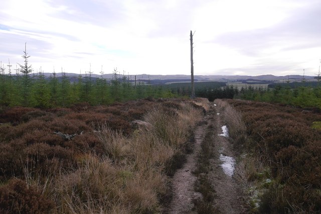
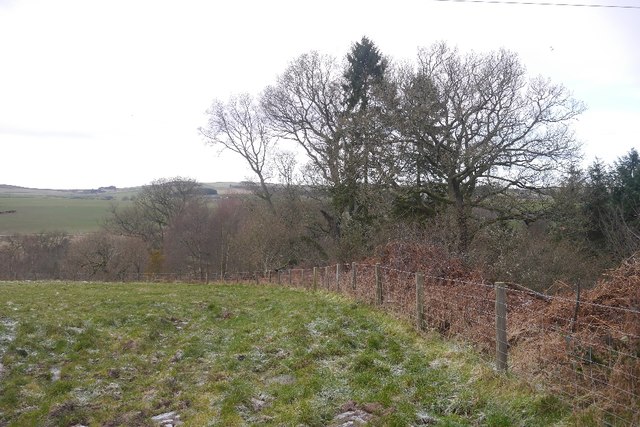
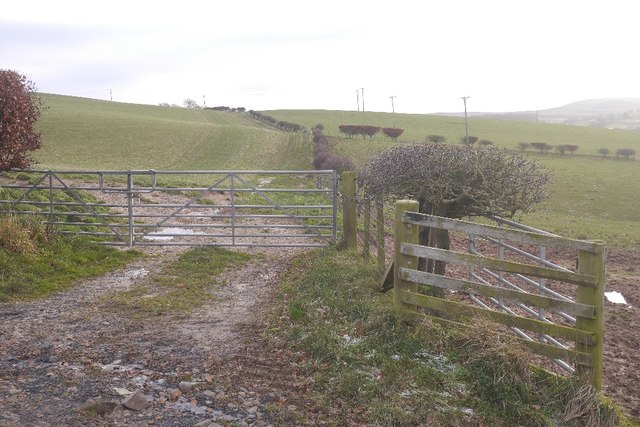
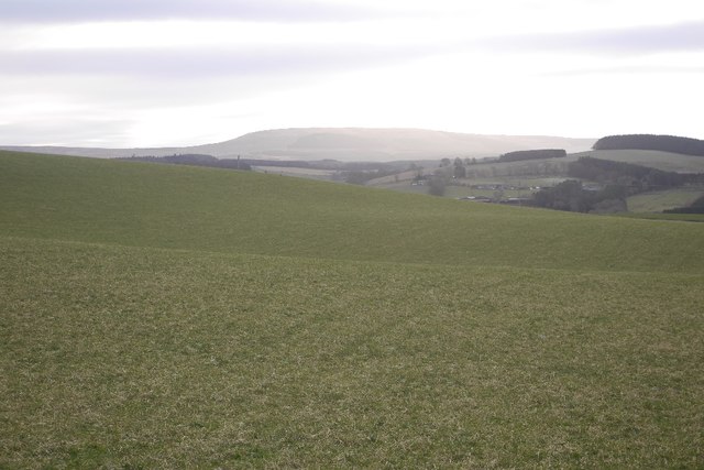
Bidden Cleuch is a picturesque valley located in the county of Roxburghshire, in the Scottish Borders region of Scotland. The valley is situated within the stunning landscape of the Southern Uplands and is known for its natural beauty and tranquility.

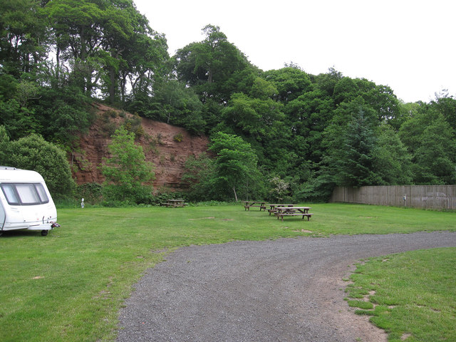
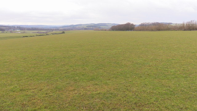
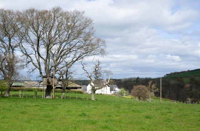
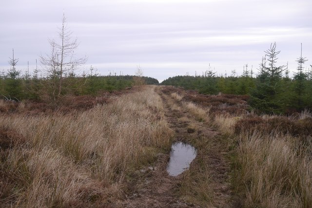
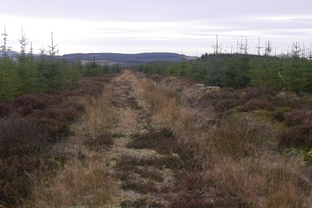
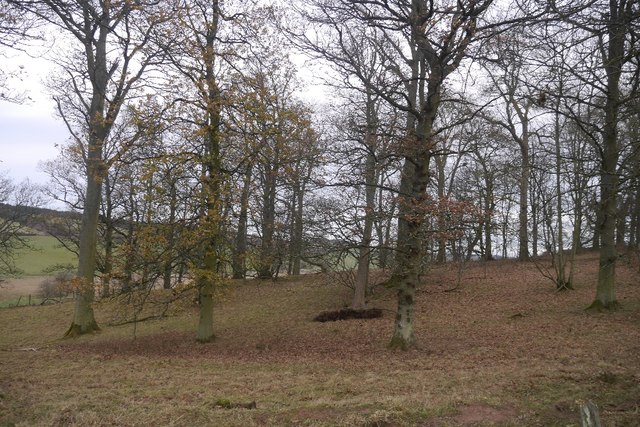
Nestled between rolling hills and towering mountains, Bidden Cleuch offers breathtaking views and an idyllic setting for outdoor enthusiasts and nature lovers. The valley is characterized by its lush green meadows, meandering streams, and dense woodlands, which provide a haven for a diverse range of flora and fauna.

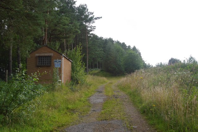
The area is renowned for its walking and hiking trails, attracting visitors who wish to explore the unspoiled countryside and discover hidden gems along the way. One popular route is the Bidden Cleuch Circular Walk, which takes visitors on a scenic journey through the valley, passing by ancient ruins, historic landmarks, and captivating viewpoints.

In addition to its natural beauty, Bidden Cleuch also boasts a rich cultural heritage. The valley is home to several historic sites, including the remains of a medieval tower and a prehistoric settlement, which offer insights into the region's fascinating past.

Visitors to Bidden Cleuch can also enjoy a range of outdoor activities, such as birdwatching, fishing, and cycling, making it an ideal destination for those seeking both relaxation and adventure in a truly enchanting setting.

Overall, Bidden Cleuch in Roxburghshire is a hidden gem in the Scottish Borders, offering visitors a chance to immerse themselves in the beauty of nature and experience the rich history and culture of the region.

If you have any feedback on the listing, please let us know in the comments section below.

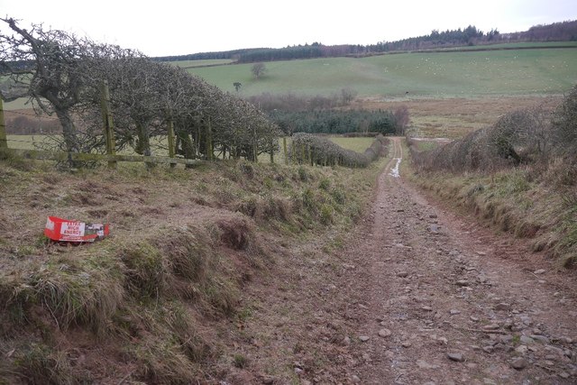
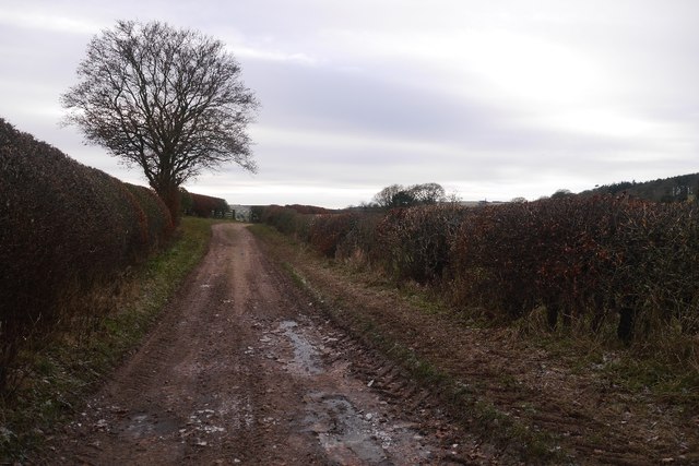
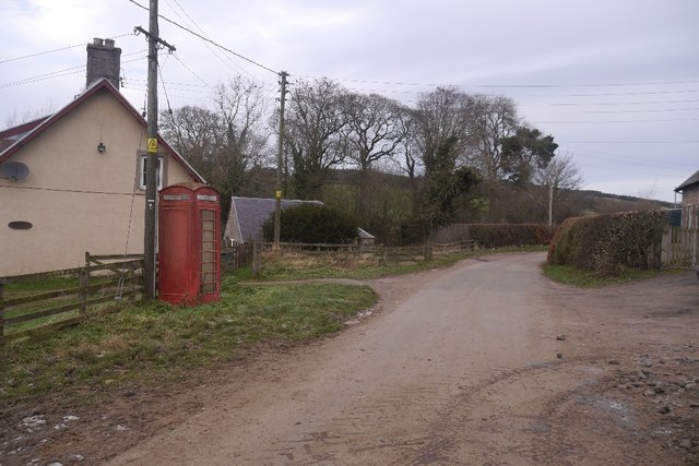
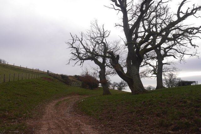
Bidden Cleuch Images

Images are sourced within 2km of 55.425899/-2.5149922 or Grid Reference NT6714. Thanks to Geograph Open Source API. All images are credited.

Small Reservoir Compound with Triangulation Pillar at Dolphinston Looking southward.
Small Reservoir Compound with Triangulation Pillar at Dolphinston
Looking southward.
Track beside the Shaw Burn A track passes a somewhat overgrown looking pumping station building.
Track beside the Shaw Burn
A track passes a somewhat overgrown looking pumping station building.
River cliff by Jed Water From Jed Water Caravan Park.
River cliff by Jed Water
From Jed Water Caravan Park.
Broad open ridge with prime grazing above Mervinslaw, Jedburgh
Entering Camptown
Entering Camptown
Tree house near to Old Jeddart The tree house is close to the buildings at Old Jeddart which are seen in the distance.
Tree house near to Old Jeddart
The tree house is close to the buildings at Old Jeddart which are seen in the distance.
Path, Birkenside A good, well used path through young trees.  The mapped path network no longer exists.
Path, Birkenside
A good, well used path through young trees. The mapped path network no longer exists.
Path, Birkenside Running along the ridge line.  The path network shown by the Ordnance Survey is from before the felling of most of the woodland. The new plantings have a different set of tracks.
Path, Birkenside
Running along the ridge line. The path network shown by the Ordnance Survey is from before the felling of most of the woodland. The new plantings have a different set of tracks.
Path, Birkenside Amongst young trees.  Many of the mapped paths have gone since replanting.
Path, Birkenside
Amongst young trees. Many of the mapped paths have gone since replanting.
Peel Clumps A circular oak wood surrounded by an earth wall.
Peel Clumps
A circular oak wood surrounded by an earth wall.
Oxnam to Mossburnford road A steep section, used as a field access route.
Oxnam to Mossburnford road
A steep section, used as a field access route.
Oxnam to Mossburnford road Approaching Mossburnford on a farm road. Looks muddy, but today it was frozen solid.
Oxnam to Mossburnford road
Approaching Mossburnford on a farm road. Looks muddy, but today it was frozen solid.
Telephone box, Mossburnford
Farm track, Mossburnford It climbs up to a couple of fields on the edge of the Birkenside woods.
Farm track, Mossburnford
It climbs up to a couple of fields on the edge of the Birkenside woods.
Mossburnford Banks Partly wooded steep slope ahead, above the Jed Water.
Mossburnford Banks
Partly wooded steep slope ahead, above the Jed Water.
Fields above the Jed Water
Field above the Jed Water Looking over grass slopes towards Carter Fell on the Border.
Field above the Jed Water
Looking over grass slopes towards Carter Fell on the Border.
Pasture, Dolphinston Grass with a young forestry plantation on Birkenside in the background.
Pasture, Dolphinston
Grass with a young forestry plantation on Birkenside in the background.
Show me another place!

Bidden Cleuch is located at Grid Ref: NT6714 (Lat: 55.425899, Lng: -2.5149922)

Unitary Authority: The Scottish Borders

Police Authority: The Lothians and Scottish Borders

What 3 Words

///september.ironclad.quick. Near Jedburgh, Scottish Borders

Related Wikis

Camptown, Scottish Borders

Camptown is a small settlement on the A68, in the Scottish Borders area of Scotland, 5m (8 km) south of Jedburgh, and the same distance south to Carter...

Bairnkine

Bairnkine is a hamlet on the Jed Water in the Scottish Borders area of Scotland, on the A68, south of Jedburgh. Other places nearby include Abbotrule,...

Edgerston

Edgerston is a village and an estate about 4 miles (6.4 km) north of the Anglo-Scottish border, and 8 miles (13 km) south of Jedburgh in the Scottish Borders...

Ferniehirst Castle

Ferniehirst Castle (sometimes spelled Ferniehurst) is an L-shaped construction on the east bank of the Jed Water, about a mile and a half south of Jedburgh...

Oxnam

Oxnam (Scots: Owsenam) is a village near Jedburgh, in Roxburghshire in the Scottish Borders area of Scotland. It is a primarily residential village. The...

Jedforest

Jedforest is an historic forest in the Scottish Borders, that has been heavily wooded in the past. It is close to Jed Water and the town of Jedburgh, from...

Capon Oak Tree

The Capon Oak Tree is one of the last surviving trees of the ancient Jedforest, close to Jed Water, a small river which has cut a course below soft sandstone...

Jedburgh

Jedburgh (; Scottish Gaelic: Deadard; Scots: Jeddart or Jethart) is a town and former royal burgh in the Scottish Borders and the traditional county town...

Nearby Amenities

Located within 500m of 55.425899,-2.5149922
Material: wood
Power: pole
Lat/Long: 55.4229417/-2.5205496
Power: pole
Lat/Long: 55.4237927/-2.5209311
Power: pole
Lat/Long: 55.4245522/-2.5212533
Power: pole
Lat/Long: 55.4252606/-2.5215716
Power: pole
Lat/Long: 55.4258972/-2.520655
Power: pole
Lat/Long: 55.4264956/-2.5197691
Power: pole
Lat/Long: 55.4270929/-2.5189232
Power: pole
Lat/Long: 55.427179/-2.517646
Power: pole
Lat/Long: 55.4272175/-2.5167159
Power: pole
Lat/Long: 55.427336/-2.5148854
Power: pole
Lat/Long: 55.4274022/-2.5130252
Power: pole
Lat/Long: 55.4274899/-2.5111649
Power: pole
Lat/Long: 55.4275778/-2.5092826
Power: pole
Lat/Long: 55.4276677/-2.5197172
Power: pole
Lat/Long: 55.4281986/-2.5204466
The data included in this document is from www.openstreetmap.org. The data is made available under ODbL.

Have you been to Bidden Cleuch?

Leave your review of Bidden Cleuch below (or comments, questions and feedback).