Sheephouse Bottom

Valley in Dorset

England

Sheephouse Bottom

A signposted crossing of the ways on the Dorset downs
A signposted crossing of the ways on the Dorset downs Credit: John Welford

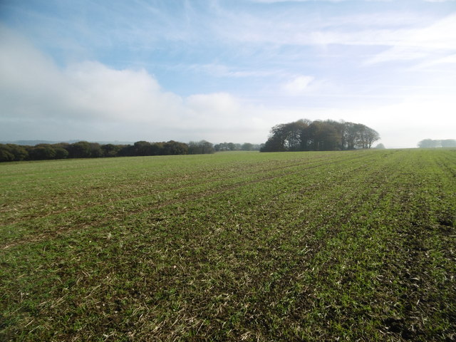
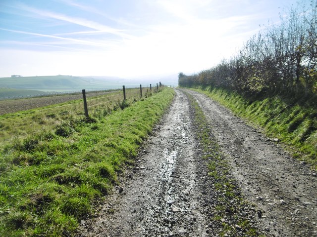
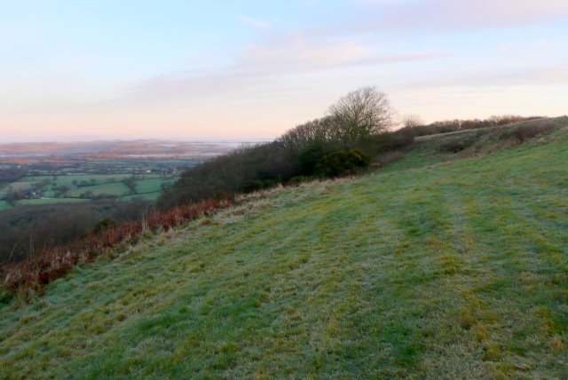
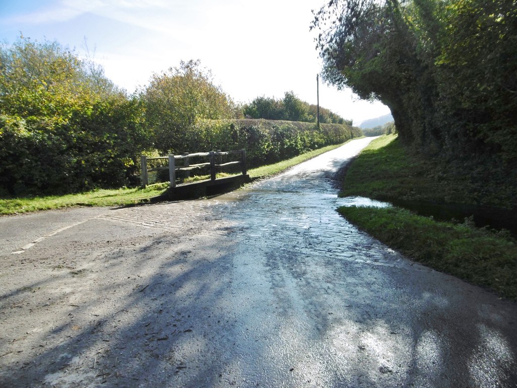
Sheephouse Bottom is a picturesque valley located in the county of Dorset, England. Situated in the heart of the Dorset Area of Outstanding Natural Beauty, this idyllic landscape offers breathtaking views and a tranquil atmosphere. The valley is named after the small stream that runs through it, known as Sheephouse Bottom Stream.

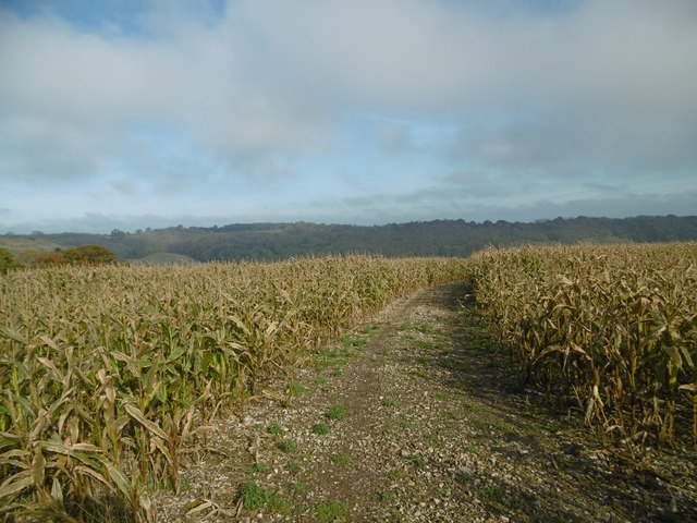
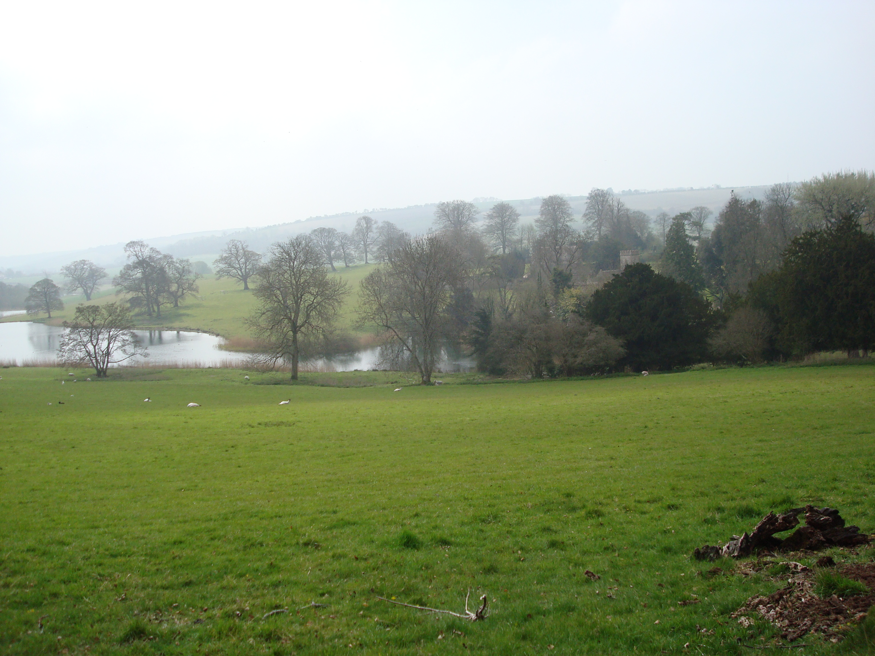
The valley is characterized by its rolling hills, lush green meadows, and scattered woodlands. It is a haven for wildlife, with numerous species of birds, butterflies, and small mammals inhabiting the area. The stream provides a source of water and sustenance for the local flora and fauna.

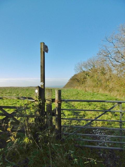
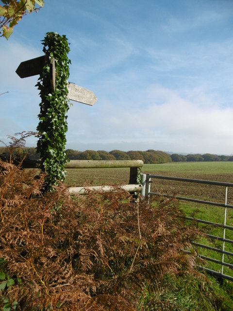
Sheephouse Bottom offers a range of outdoor activities for visitors to enjoy. Hiking and walking trails traverse the valley, allowing visitors to explore the stunning scenery at their own pace. The valley is also popular among nature enthusiasts, who can indulge in birdwatching, photography, or simply immersing themselves in the beauty of nature.

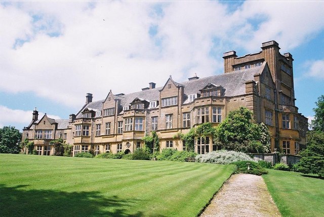
In addition to its natural attractions, Sheephouse Bottom is home to a small community of residents. A handful of traditional cottages and farms can be found in the valley, adding to its charm and authenticity.

Overall, Sheephouse Bottom, Dorset is a hidden gem that showcases the beauty of rural England. Its unspoiled landscapes, diverse wildlife, and peaceful ambiance make it a must-visit destination for nature lovers and those seeking a quiet retreat in the heart of the countryside.

If you have any feedback on the listing, please let us know in the comments section below.

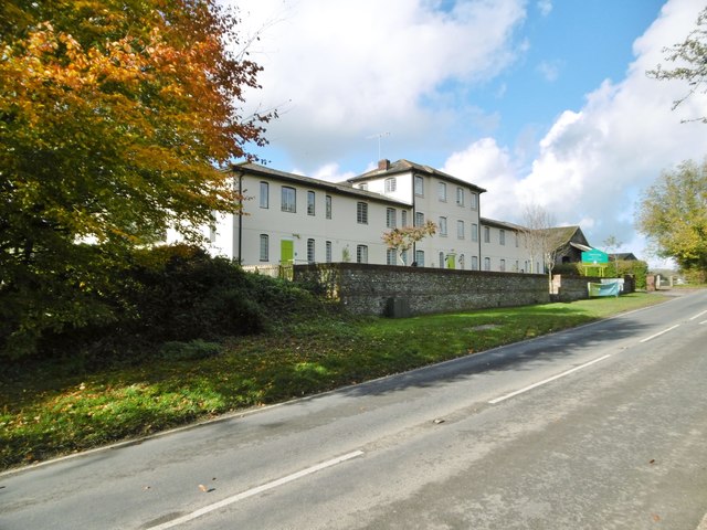
Sheephouse Bottom Images

Images are sourced within 2km of 50.824508/-2.5030728 or Grid Reference ST6402. Thanks to Geograph Open Source API. All images are credited.

A signposted crossing of the ways on the Dorset downs
Cerne Abbas, Casterbridge Manor Care home on Dorchester Road; originally C19 Union Workhouse. <span class="nowrap"><a title="http://www.casterbridgemanor.co.uk/" rel="nofollow ugc noopener" href="http://www.casterbridgemanor.co.uk/">Link</a><img style="margin-left:2px;" alt="External link" title="External link - shift click to open in new window" src="https://s1.geograph.org.uk/img/external.png" width="10" height="10"/></span>
Cerne Abbas, Casterbridge Manor
Care home on Dorchester Road; originally C19 Union Workhouse. LinkExternal link
Gore Hill, byway Leading to Redpost Hill.
Gore Hill, byway
Leading to Redpost Hill.
Gore Hill, cereal field Where is that path? Wherever, it does not seem to have been used since this large field was ploughed and seeded.
Gore Hill, cereal field
Where is that path? Wherever, it does not seem to have been used since this large field was ploughed and seeded.
Gore Hill, bridleway junction On the Wessex Ridgeway. <span class="nowrap"><a title="https://www.ldwa.org.uk/ldp/members/show_path.php?path_name=Wessex+Ridgeway+Trail" rel="nofollow ugc noopener" href="https://www.ldwa.org.uk/ldp/members/show_path.php?path_name=Wessex+Ridgeway+Trail">Link</a><img style="margin-left:2px;" alt="External link" title="External link - shift click to open in new window" src="https://s1.geograph.org.uk/img/external.png" width="10" height="10"/></span>
Gore Hill, bridleway junction
On the Wessex Ridgeway. LinkExternal link
Gore Hill, bridleway marker Across grazing land to Batcombe.
Gore Hill, bridleway marker
Across grazing land to Batcombe.
Gore Hill, footpath marker On the way to Telegraph Hill or Seldon Hill.
Gore Hill, footpath marker
On the way to Telegraph Hill or Seldon Hill.
Up Sydling, bridleway Bridleway and farm road, on the Wessex Ridgeway. <span class="nowrap"><a title="https://www.ldwa.org.uk/ldp/members/show_path.php?path_name=Wessex+Ridgeway+Trail" rel="nofollow ugc noopener" href="https://www.ldwa.org.uk/ldp/members/show_path.php?path_name=Wessex+Ridgeway+Trail">Link</a><img style="margin-left:2px;" alt="External link" title="External link - shift click to open in new window" src="https://s1.geograph.org.uk/img/external.png" width="10" height="10"/></span>
Up Sydling, bridleway
Bridleway and farm road, on the Wessex Ridgeway. LinkExternal link
Up Sydling, bridleway Junction Bridleways and farm roads: left, Wessex Ridgeway, towards Sydling St. Nicholas; right, to Up Sydling. <span class="nowrap"><a title="https://www.ldwa.org.uk/ldp/members/show_path.php?path_name=Wessex+Ridgeway+Trail" rel="nofollow ugc noopener" href="https://www.ldwa.org.uk/ldp/members/show_path.php?path_name=Wessex+Ridgeway+Trail">Link</a><img style="margin-left:2px;" alt="External link" title="External link - shift click to open in new window" src="https://s1.geograph.org.uk/img/external.png" width="10" height="10"/></span>
Up Sydling, bridleway Junction
Bridleways and farm roads: left, Wessex Ridgeway, towards Sydling St. Nicholas; right, to Up Sydling. LinkExternal link
Up Sydling, cattle trough In a field on Redpost Hill.
Up Sydling, cattle trough
In a field on Redpost Hill.
Up Sydling, bridleway Bridleway and farm road from <a href="https://www.geograph.org.uk/photo/4723897">ST6302 : Up Sydling, bridleway Junction</a> to the village.
Up Sydling, bridleway
Bridleway and farm road from ST6302 : Up Sydling, bridleway Junction to the village.
Up Sydling, gate At the beginning of a farm track towards Eastcombe Bottom.
Up Sydling, gate
At the beginning of a farm track towards Eastcombe Bottom.
Up Sydling, barn
Up Sydling, barn
Up Sydling, bridleway Farm road and bridleway, descending into the village from <a href="https://www.geograph.org.uk/photo/4723897">ST6302 : Up Sydling, bridleway Junction</a>.
Up Sydling, bridleway
Farm road and bridleway, descending into the village from ST6302 : Up Sydling, bridleway Junction.
Up Sydling, barley field
Up Cerne, maize field On Bazon Hill.
Up Cerne, maize field
On Bazon Hill.
Up Cerne, farm track Left, Fernycombe Coppice; right, a young cereal crop.
Up Cerne, farm track
Left, Fernycombe Coppice; right, a young cereal crop.
Up Cerne, Wessex Ridgeway Farm track, and part of the Wessex Ridgeway: <span class="nowrap"><a title="https://www.ldwa.org.uk/ldp/members/show_path.php?path_name=Wessex+Ridgeway+Trail" rel="nofollow ugc noopener" href="https://www.ldwa.org.uk/ldp/members/show_path.php?path_name=Wessex+Ridgeway+Trail">Link</a><img style="margin-left:2px;" alt="External link" title="External link - shift click to open in new window" src="https://s1.geograph.org.uk/img/external.png" width="10" height="10"/></span>
Up Cerne, Wessex Ridgeway
Farm track, and part of the Wessex Ridgeway: LinkExternal link
Show me another place!

Sheephouse Bottom is located at Grid Ref: ST6402 (Lat: 50.824508, Lng: -2.5030728)

Unitary Authority: Dorset

Police Authority: Dorset

What 3 Words

///seating.decorator.baffle. Near Maiden Newton, Dorset

Related Wikis

Up Cerne

Up Cerne is a hamlet lying to the west of the River Cerne between Minterne Magna and Cerne Abbas in Dorset, England. It was the birthplace of John Mount...

Minterne Magna

Minterne Magna is a village and civil parish in Dorset, England, situated midway between Dorchester and Sherborne. In the 2011 census the parish had a...

River Cerne

The River Cerne is a ten mile long river in Dorset, England, which rises in the Chalk hills of the Dorset Downs at Minterne Magna, between High Stoy and...

Telegraph Hill, Dorset

Telegraph Hill (267 metres, 876 feet high) is a hill about 1 mile northwest of Minterne Magna and about 10 miles north of Dorchester in the county of Dorset...

Cerne Abbas

Cerne Abbas () is a village and civil parish in the county of Dorset in southern England. It lies in the Dorset Council administrative area in the Cerne...

Cerne Abbas Giant

The Cerne Abbas Giant is a hill figure near the village of Cerne Abbas in Dorset, England. 55 metres (180 ft) high, it depicts a standing nude male with...

Hilfield

Hilfield is a small, scattered village and civil parish in west Dorset, England, situated under the scarp face of the Dorset Downs 7 miles (11 km) south...

Up Sydling

Up Sydling is a hamlet in west Dorset, England. It is situated at the head of Sydling Water, a tributary of the River Frome, ten miles north of Dorchester...

Nearby Amenities

Located within 500m of 50.824508,-2.5030728
Celtic fields
Historic: archaeological_site
Source: NPE
Lat/Long: 50.8223684/-2.4990894
The data included in this document is from www.openstreetmap.org. The data is made available under ODbL.

Have you been to Sheephouse Bottom?

Leave your review of Sheephouse Bottom below (or comments, questions and feedback).