Coombe Bottom

Valley in Dorset

England

Coombe Bottom

Track on Toller Down
Track on Toller Down Credit: Roger Cornfoot

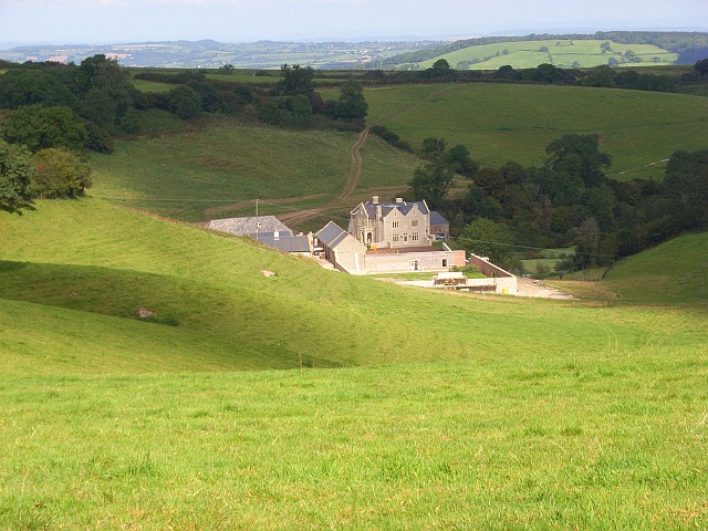
Coombe Bottom is a picturesque valley located in the county of Dorset, England. Nestled amidst the rolling hills of the South West, this idyllic valley is renowned for its natural beauty and tranquil atmosphere. It is situated near the village of Coombe Keynes, approximately 10 miles west of Wareham.

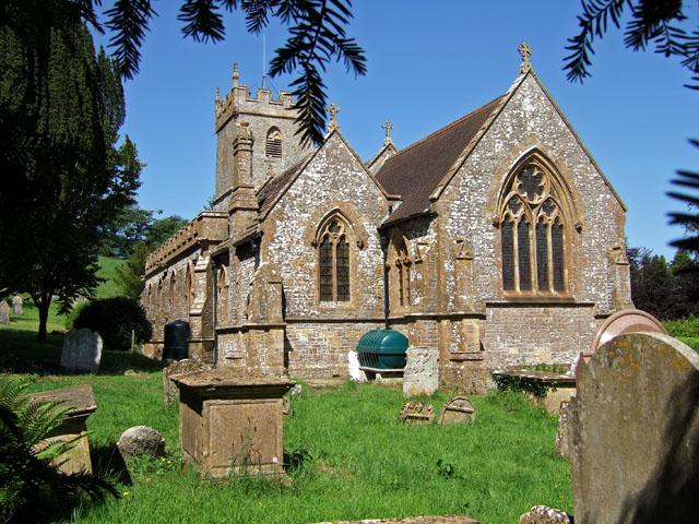
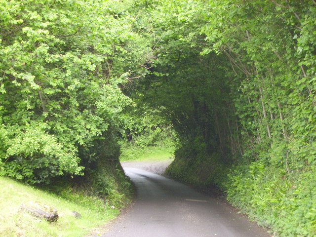
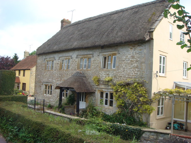
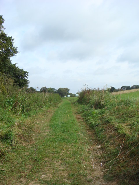
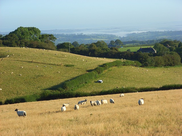
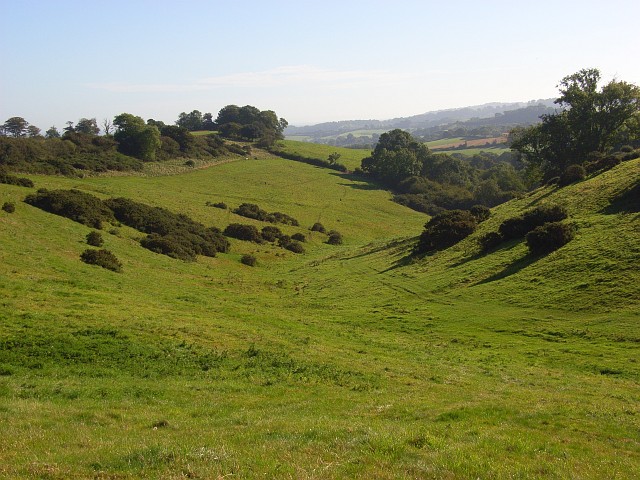
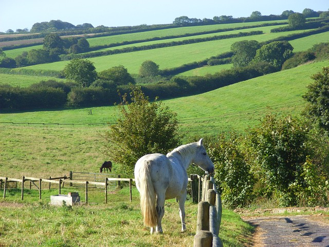
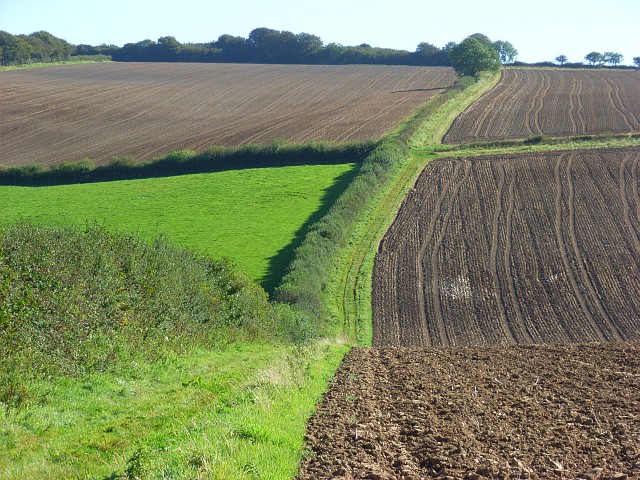
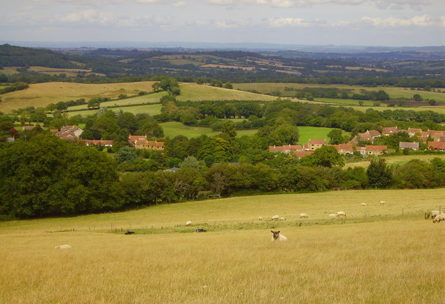
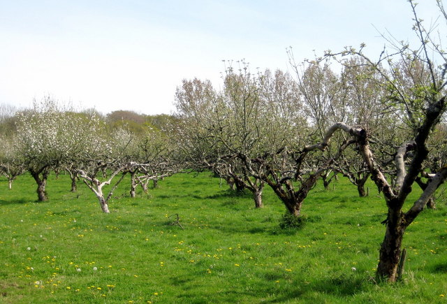
The valley is characterized by its lush green meadows, meandering streams, and dense woodlands, making it a haven for wildlife and nature enthusiasts. The landscape is dotted with charming traditional cottages, adding to its rustic charm. The valley is also home to a variety of plant species, including wildflowers and ancient oak trees.

One of the notable features of Coombe Bottom is its crystal-clear stream, which flows gently through the valley. Visitors can enjoy leisurely walks along the stream, immersing themselves in the peaceful surroundings and occasionally spotting a variety of bird species that inhabit the area.

Coombe Bottom offers a range of recreational activities, attracting visitors throughout the year. Hiking and cycling trails crisscross the valley, providing opportunities for outdoor enthusiasts to explore the stunning countryside. The valley is also a popular spot for picnicking, with several designated areas offering breathtaking views.

In conclusion, Coombe Bottom in Dorset is a quintessential English valley, offering a serene and picturesque setting for those seeking a break from the hustle and bustle of city life. Its natural beauty, diverse wildlife, and recreational opportunities make it a must-visit destination for nature lovers and outdoor enthusiasts alike.

If you have any feedback on the listing, please let us know in the comments section below.

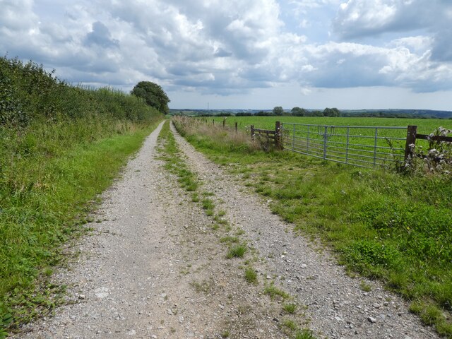
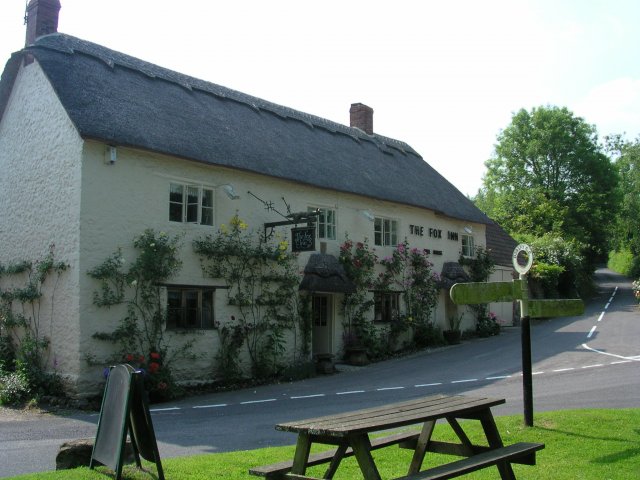
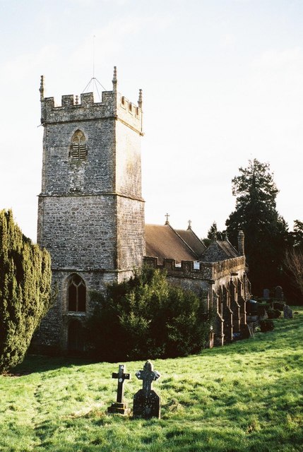
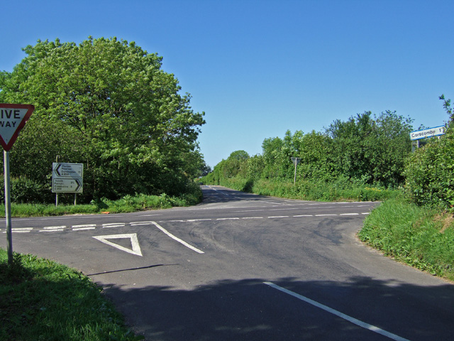
Coombe Bottom Images

Images are sourced within 2km of 50.83834/-2.6863516 or Grid Reference ST5104. Thanks to Geograph Open Source API. All images are credited.

Track on Toller Down
The Fox Inn at Corscombe
Corscombe Village View taken from country lane leading to Corscombe and Halstock
Corscombe Village
View taken from country lane leading to Corscombe and Halstock
Corscombe: parish church of St. Mary
Crossroads near Corscombe
St Mary's Church - Corscombe The church was rebuilt in 1875-7 by J. Mountford Allen of Crewkerne.
St Mary's Church - Corscombe
The church was rebuilt in 1875-7 by J. Mountford Allen of Crewkerne.
Dorset country lane Pretty country lane leading to Corscombe village
Dorset country lane
Pretty country lane leading to Corscombe village
Mill House
Mill House
Farmland near Ocean Hill
Toller Down Rolling pastures above a misty valley stretching towards Yeovil. The rooftop is at Catsley.
Toller Down
Rolling pastures above a misty valley stretching towards Yeovil. The rooftop is at Catsley.
Coombe Bottom Amongst the rather complicatedly hilly district where wooded valleys descend from the Dorset downs to the Somerset border district.
Coombe Bottom
Amongst the rather complicatedly hilly district where wooded valleys descend from the Dorset downs to the Somerset border district.
Beaminster Bottom The horses and I were beside the bridleway at Hill Farm. The right of way descends into the valley to reach the road near Kitwhistle Farm. The road is in the first hedgerow. The farm somehow manages to hide from view in the clump of trees in the middle distance to the right of picture.
Beaminster Bottom
The horses and I were beside the bridleway at Hill Farm. The right of way descends into the valley to reach the road near Kitwhistle Farm. The road is in the first hedgerow. The farm somehow manages to hide from view in the clump of trees in the middle distance to the right of picture.
Farmland, Beaminster This is on the bridleway that has been diverted to avoid Higher Langdon. The position of the bridleway is shown to be about a hundred yards further south on the 1:50000 map than on the 1:25000 map.
Farmland, Beaminster
This is on the bridleway that has been diverted to avoid Higher Langdon. The position of the bridleway is shown to be about a hundred yards further south on the 1:50000 map than on the 1:25000 map.
Urless Farm, Corscombe Looking down across undulating pastures from the A356. Building works are currently taking place at the farm. According to the planning application notice these involve converting disused stables into a farm office and staff accommodation.
Urless Farm, Corscombe
Looking down across undulating pastures from the A356. Building works are currently taking place at the farm. According to the planning application notice these involve converting disused stables into a farm office and staff accommodation.
St Mary's, Corscombe With a view over the woodlands and pasture of the Dorset/Somerset border.
St Mary's, Corscombe
With a view over the woodlands and pasture of the Dorset/Somerset border.
Stubble on Toller Down Looking across to Cox's Gorse from Wessex Water's covered reservoir.
Stubble on Toller Down
Looking across to Cox's Gorse from Wessex Water's covered reservoir.
Pastures, Corscombe The hillside above Urless Farm, with what looks like the ubiquitous strip of maize for gamebird cover.
Pastures, Corscombe
The hillside above Urless Farm, with what looks like the ubiquitous strip of maize for gamebird cover.
Toller Down Looking across the sheep pastures from the junction of the A356 with Catsley Lane.
Toller Down
Looking across the sheep pastures from the junction of the A356 with Catsley Lane.
Show me another place!

Coombe Bottom is located at Grid Ref: ST5104 (Lat: 50.83834, Lng: -2.6863516)

Unitary Authority: Dorset

Police Authority: Dorset

What 3 Words

///issue.rollover.valuables. Near Beaminster, Dorset

Related Wikis

Corscombe

Corscombe is a village and civil parish in the English county of Dorset, in the Dorset Council administrative area. The parish includes the small settlements...

Toller Down

Toller Down is one of the highest hills in the county of Dorset, England. It stands 252 metres (827 feet) high and is just 200 metres west of the main...

Weston Hill

Weston Hill is a hill, 250 metres (820 ft) high, on the A 356, 1 kilometre west of Corscombe in the county of Dorset in southern England. It is located...

Beaminster Down

At 244 metres, Beaminster Down is one of the highest hills in West Dorset, England. == Location == Beaminster Down is common land on the Dorset Downs and...

West Chelborough

West Chelborough is a village and civil parish 13 miles (21 km) northwest of Dorchester, in the Dorset district, in the county of Dorset, England. In 2001...

Chedington

Chedington is a small village and civil parish in west Dorset, England, situated near the A356 road 4 miles (6.4 km) southeast of Crewkerne in Somerset...

Toller Whelme

Toller Whelme is a small hamlet in Dorset, England, situated in the civil parish of Corscombe approximately 2.3 miles (3.7 km) east of Beaminster, 6 miles...

Adam's Green

Adam's Green is a hamlet near the village of Halstock in Dorset, England. == External links == Media related to Adam's Green at Wikimedia Commons

Have you been to Coombe Bottom?

Leave your review of Coombe Bottom below (or comments, questions and feedback).