Golden Cleugh

Valley in Cumberland Carlisle

England

Golden Cleugh

Raegill Knowes Quarry Abandoned quarry buildings.
Raegill Knowes Quarry Credit: Sandy Gerrard

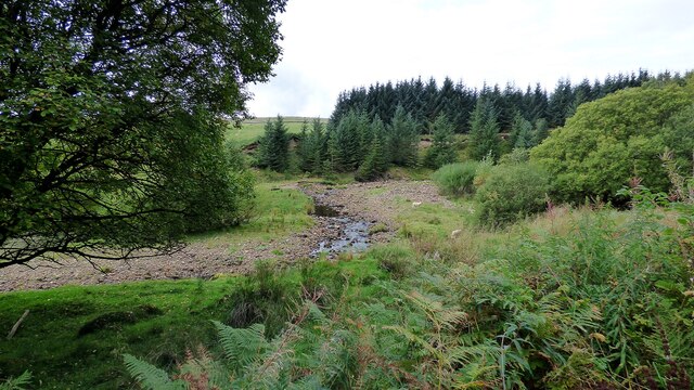
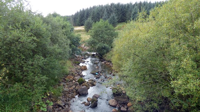
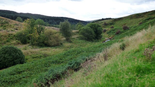
Golden Cleugh is a picturesque valley located in the county of Cumberland, England. Situated in the northern part of the Lake District National Park, it is known for its stunning natural beauty and rich history. The valley is nestled between rolling hills and is traversed by a charming river that meanders through its lush green landscape.

The name "Golden Cleugh" refers to the golden hue that the valley takes on during the autumn season when the leaves of the trees change color. This phenomenon adds to its allure and attracts visitors from far and wide.

The valley is home to a diverse range of wildlife, including various species of birds, mammals, and plants. It provides a habitat for rare and endangered species, making it an important conservation area.

In addition to its natural attractions, Golden Cleugh also boasts a number of historical landmarks. The remains of ancient settlements, including stone circles and burial mounds, can be found dotted throughout the valley. These archaeological sites provide valuable insight into the lives of the people who once inhabited the area.

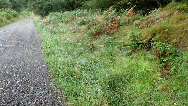
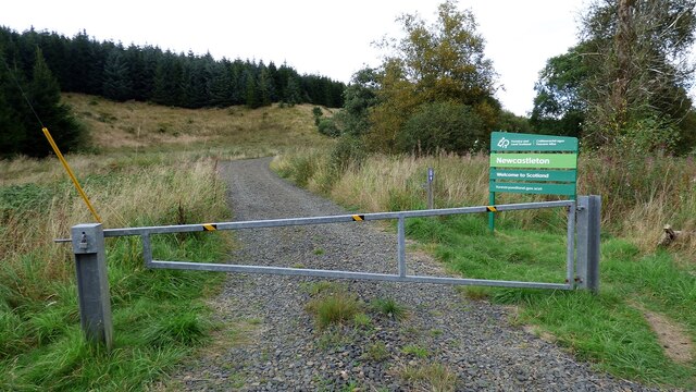
The valley offers numerous opportunities for outdoor activities, such as hiking, cycling, and fishing. There are several well-maintained trails that wind through the valley, allowing visitors to explore its hidden treasures. The tranquility and unspoiled nature of Golden Cleugh make it a popular destination for those seeking a peaceful retreat in the heart of the English countryside.

If you have any feedback on the listing, please let us know in the comments section below.

Golden Cleugh Images

Images are sourced within 2km of 55.147377/-2.7713668 or Grid Reference NY5083. Thanks to Geograph Open Source API. All images are credited.

Raegill Knowes Quarry Abandoned quarry buildings.
Raegill Knowes Quarry
Abandoned quarry buildings.
Kershope Bridge Spans the Scottish English border. Raegill Knowes Quarry and buildings beyond.
Kershope Bridge
Spans the Scottish English border. Raegill Knowes Quarry and buildings beyond.
Kershope Burn at Day Holm Views from the forest track are few and far between which may explain why most of the photographs in this grid square are taken here.
Kershope Burn at Day Holm
Views from the forest track are few and far between which may explain why most of the photographs in this grid square are taken here.
Spider webs beside the forest track at Day Holm
Welcome to Scotland Forest gate across the track leading into Scotland.
Welcome to Scotland
Forest gate across the track leading into Scotland.
Kershope Burn This river denotes the boundary between Scotland and England in this area.
Kershope Burn
This river denotes the boundary between Scotland and England in this area.
Spanning the border: Kershope Bridge The Scotland/England boundary runs down the Kershope Burn, seen here at a low level.

This photograph was taken during the Coronavirus (COVID-19) pandemic of 2020/21/22.
Spanning the border: Kershope Bridge
The Scotland/England boundary runs down the Kershope Burn, seen here at a low level. This photograph was taken during the Coronavirus (COVID-19) pandemic of 2020/21/22.
Forest track near Burnt Shields
Forest track Between Burnt Shields and Tommy's Fell
Forest track
Between Burnt Shields and Tommy's Fell
Forest track, Tommy's Fell This was the start of the Tommy's Fell stage of the 2024 Carlisle Stages rally.
Forest track, Tommy's Fell
This was the start of the Tommy's Fell stage of the 2024 Carlisle Stages rally.
Forest track, Kershope Rigg
Forest track, Kershope Forest
Forest track, Routledge Rigg
Forest track, Kershope Forest
Kershope Valley The border between England on the left and Scotland on the right.
Kershope Valley
The border between England on the left and Scotland on the right.
Log piles in Kershope Forest Extensive felling has recently taken place and huge piles of logs are awaiting transportation.
Log piles in Kershope Forest
Extensive felling has recently taken place and huge piles of logs are awaiting transportation.
A close up view of a log pile in Kershope Forest
Forest access in Kershope Forest With huge piles of recently cut timber awaiting transportation.
Forest access in Kershope Forest
With huge piles of recently cut timber awaiting transportation.
Show me another place!

Golden Cleugh is located at Grid Ref: NY5083 (Lat: 55.147377, Lng: -2.7713668)

Administrative County: Cumbria

District: Carlisle

Police Authority: Cumbria

What 3 Words

///keepers.carver.poetry. Near Langholm, Dumfries & Galloway

Nearby Locations

Golden Cleugh

Related Wikis

Mangerton Tower

Mangerton Tower is a ruined Scottish tower castle house formerly belonging to the Armstrong family. Mangerton Tower is at Mangerton in Newcastleton or...

Kershopefoot

Kershopefoot is a small hamlet in Cumbria, England, traditionally in Cumberland. It is located very close to the Scotland-England border and is near the...

Kershope Burn

Kershope Burn is a small river; a tributary of both the Liddel Water and the River Esk; its final destination is the Solway Firth. The early stages begin...

Kershope Foot railway station

Kershope Foot railway station served the hamlet of Kershopefoot, Cumbria, from 1862 to 1969 on the Border Union Railway. == History == The station opened...

Nearby Amenities

Located within 500m of 55.147377,-2.7713668
The data included in this document is from www.openstreetmap.org. The data is made available under ODbL.

Have you been to Golden Cleugh?

Leave your review of Golden Cleugh below (or comments, questions and feedback).