Bullock's Bottom

Valley in Somerset

England

Bullock's Bottom

Wraxall (Somerset) All Saints Church Destined to get many more visitors since Tyntesfield in the village was acquired and opened by the National Trust
Wraxall (Somerset) All Saints Church Credit: ChurchCrawler

Bullock's Bottom is a small rural community located in the Somerset Valley, Somerset County, England. Situated amidst the picturesque countryside, this secluded village is known for its tranquility and natural beauty.

The village gets its name from the historic practice of bullock farming, which was prevalent in the area during the 18th and 19th centuries. Today, Bullock's Bottom maintains its agricultural roots, with many residents actively engaged in farming and livestock rearing. The fertile soil and favorable climate of the valley contribute to the thriving agricultural industry.

The village itself is characterized by charming cottages, some of which date back several centuries. The architecture of the buildings reflects the traditional English countryside style, with thatched roofs, exposed timber beams, and colorful gardens. The community takes great pride in preserving its historical heritage.

Bullock's Bottom is surrounded by rolling hills, lush meadows, and dense woodlands, making it a haven for nature enthusiasts. The area offers numerous walking and cycling trails, allowing visitors to explore the stunning landscape and enjoy the peace and serenity that the valley provides.

Despite its rural setting, the village is not far from modern amenities. The nearby town of Somerset provides residents with access to schools, healthcare facilities, and a range of shops and services. Additionally, Bullock's Bottom hosts an annual village fair, which brings the community together and showcases local crafts, produce, and traditions.

Overall, Bullock's Bottom is a hidden gem in the Somerset Valley, offering a peaceful and idyllic lifestyle surrounded by nature's bounty. It is a place where tradition meets modernity, and residents and visitors alike can appreciate the beauty and simplicity of rural life.

If you have any feedback on the listing, please let us know in the comments section below.

Bullock's Bottom Images

Images are sourced within 2km of 51.458869/-2.7382119 or Grid Reference ST4873. Thanks to Geograph Open Source API. All images are credited.

Wraxall (Somerset) All Saints Church Destined to get many more visitors since Tyntesfield in the village was acquired and opened by the National Trust
Wraxall (Somerset) All Saints Church
Destined to get many more visitors since Tyntesfield in the village was acquired and opened by the National Trust
Noah's Ark Zoo Farm - goats There are various animals on the farm from the common such as goats to the more exotic such as rhino's. In the background is a maze planted in 2003 which claims to be the longest in the world at 3.2 km long.
Noah's Ark Zoo Farm - goats
There are various animals on the farm from the common such as goats to the more exotic such as rhino's. In the background is a maze planted in 2003 which claims to be the longest in the world at 3.2 km long.
Moat House Farm Moat House Farm - I was unable to see the moat. This is another view over the maze towards the farm house. The literature says that the Send a Cow charity, providing livestock for Africa, first started here in 1988.
Moat House Farm
Moat House Farm - I was unable to see the moat. This is another view over the maze towards the farm house. The literature says that the Send a Cow charity, providing livestock for Africa, first started here in 1988.
Farmland at Noah's Ark Zoo Farm From near the car park at the farm.
Farmland at Noah's Ark Zoo Farm
From near the car park at the farm.
Moat Cottages
Moat Cottages
Bus Shelter At Clapton in Gordano
Fire Wood Logs for house in the background
Fire Wood
Logs for house in the background
Stoney Steep Lane
Stoney Steep Lane
The Downs School Boarding and day school for boys & girls aged 4 to 13
The Downs School
Boarding and day school for boys & girls aged 4 to 13
Cold Harbour Systems, The Courtyard Wraxall Weblink: <span class="nowrap"><a title="http://www.coldharbour-systems.co.uk/" rel="nofollow ugc noopener" href="http://www.coldharbour-systems.co.uk/">Link</a><img style="margin-left:2px;" alt="External link" title="External link - shift click to open in new window" src="https://s1.geograph.org.uk/img/external.png" width="10" height="10"/></span>
Cold Harbour Systems, The Courtyard Wraxall
Weblink: LinkExternal link
Lean to Tree In the grounds of The Downs School near Wraxall.
Lean to Tree
In the grounds of The Downs School near Wraxall.
M5 southbound Taken from a footbridge over the motorway, a view of the M5 southbound as it begins the ascent of Naish hill.
M5 southbound
Taken from a footbridge over the motorway, a view of the M5 southbound as it begins the ascent of Naish hill.
The Tree at Wraxall, Wraxall Hill. The location is known locally as The Tree at Wraxall, it is the site of the old Market Cross, old deeds show that Wraxall used to hold a market and was called a Town.
The  tree is at the junction of Parsonage Lane which joins the B3128 and B3130, and close to Wraxall church.
The Tree at Wraxall, Wraxall Hill.
The location is known locally as The Tree at Wraxall, it is the site of the old Market Cross, old deeds show that Wraxall used to hold a market and was called a Town. The tree is at the junction of Parsonage Lane which joins the B3128 and B3130, and close to Wraxall church.
Show me another place!

Bullock's Bottom is located at Grid Ref: ST4873 (Lat: 51.458869, Lng: -2.7382119)

Unitary Authority: North Somerset

Police Authority: Avon and Somerset

What 3 Words

///vitamins.tickets.cookie. Near Easton-in-Gordano, Somerset

Nearby Locations

Bullock's Bottom

Related Wikis

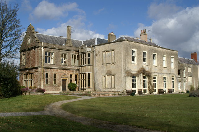
Charlton House, Wraxall

Charlton House is a historic building in Wraxall, Somerset, England. It is a Grade II listed building.The original building dates from the late mediaeval...
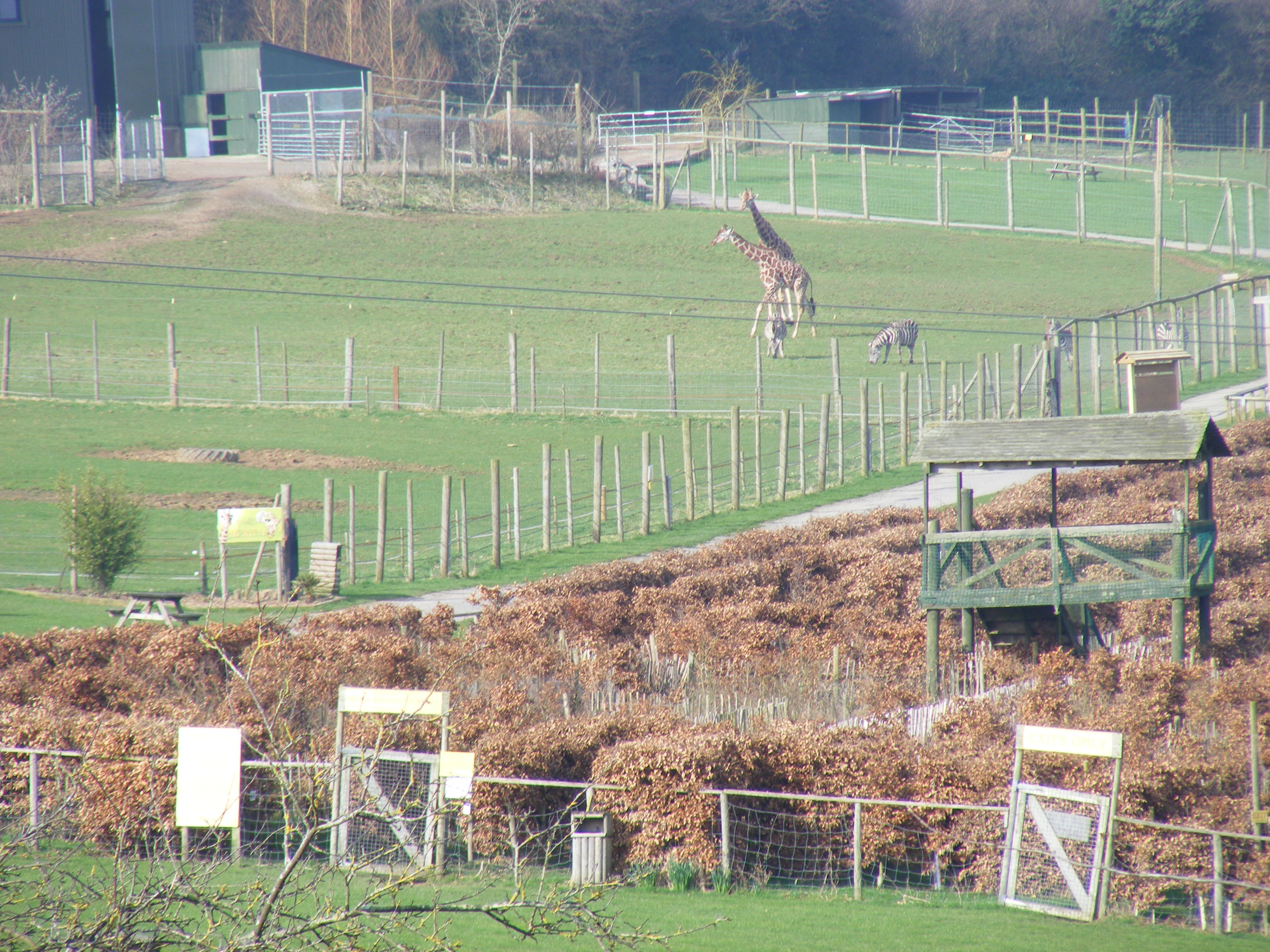
Noah's Ark Zoo Farm

Noah's Ark Zoo Farm is a 100-acre (40 ha) zoo developed on a working farm in Wraxall, North Somerset, 6 miles (9.7 km) west of Bristol, England. ��2�...

Clapton in Gordano

Clapton in Gordano is a village and civil parish in Somerset, England. It is situated within the unitary authority of North Somerset on the southern side...

Wraxall Court

Wraxall Court (originally called Wraxall Lodge) is a historic building in Wraxall in the English county of Somerset. It is a Grade II listed building.Parts...

Nearby Amenities

Located within 500m of 51.458869,-2.7382119
Barrier: kissing_gate
Bicycle: yes
Foot: yes
Lat/Long: 51.4572836/-2.7381192
Barrier: stile
Lat/Long: 51.4572483/-2.7315096
Ford: yes
Lat/Long: 51.4624229/-2.736983
Barrier: kissing_gate
Lat/Long: 51.4605785/-2.7395764
Barrier: cattle_grid
Lat/Long: 51.4604084/-2.7410274
Toilets
Lat/Long: 51.4549269/-2.7390788
Bench
Lat/Long: 51.4548985/-2.7403781
Entrance: yes
Lat/Long: 51.4547298/-2.7395069
Leisure: picnic_table
Lat/Long: 51.4547435/-2.7396811
Leisure: picnic_table
Lat/Long: 51.4547657/-2.7396654
Leisure: picnic_table
Lat/Long: 51.45479/-2.7396499
Leisure: picnic_table
Lat/Long: 51.4546505/-2.7397539
Entrance: yes
Lat/Long: 51.4545593/-2.7398529
Entrance: yes
Lat/Long: 51.4545157/-2.7393818
Entrance: yes
Lat/Long: 51.4546271/-2.7392469
Entrance: yes
Lat/Long: 51.4546434/-2.7391571
Waste Basket
Lat/Long: 51.4546001/-2.738996
Entrance: yes
Lat/Long: 51.454688/-2.7389724
Bench
Lat/Long: 51.4546829/-2.7386629
Bench
Lat/Long: 51.4547164/-2.7385775
Waste Basket
Lat/Long: 51.4547797/-2.7385489
Entrance: yes
Lat/Long: 51.4548274/-2.7386119
Bench
Backrest: yes
Lat/Long: 51.4603558/-2.738238
Ford: yes
Lat/Long: 51.4604077/-2.7380943
The data included in this document is from www.openstreetmap.org. The data is made available under ODbL.

Have you been to Bullock's Bottom?

Leave your review of Bullock's Bottom below (or comments, questions and feedback).