Barrow Bridge

Settlement in Lancashire

England

Barrow Bridge

Newsagent on Markland Hill
Newsagent on Markland Hill Credit: Bill Boaden

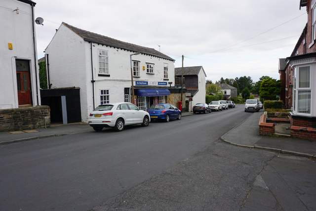
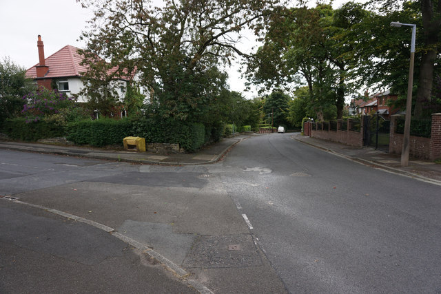
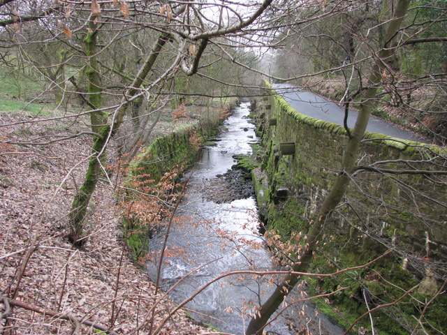
Barrow Bridge is a small village located in Lancashire, England. Situated on the southern edge of the West Pennine Moors, it lies about 2 miles north of Bolton town center. The village is known for its picturesque surroundings, with rolling hills, lush greenery, and a tranquil atmosphere.

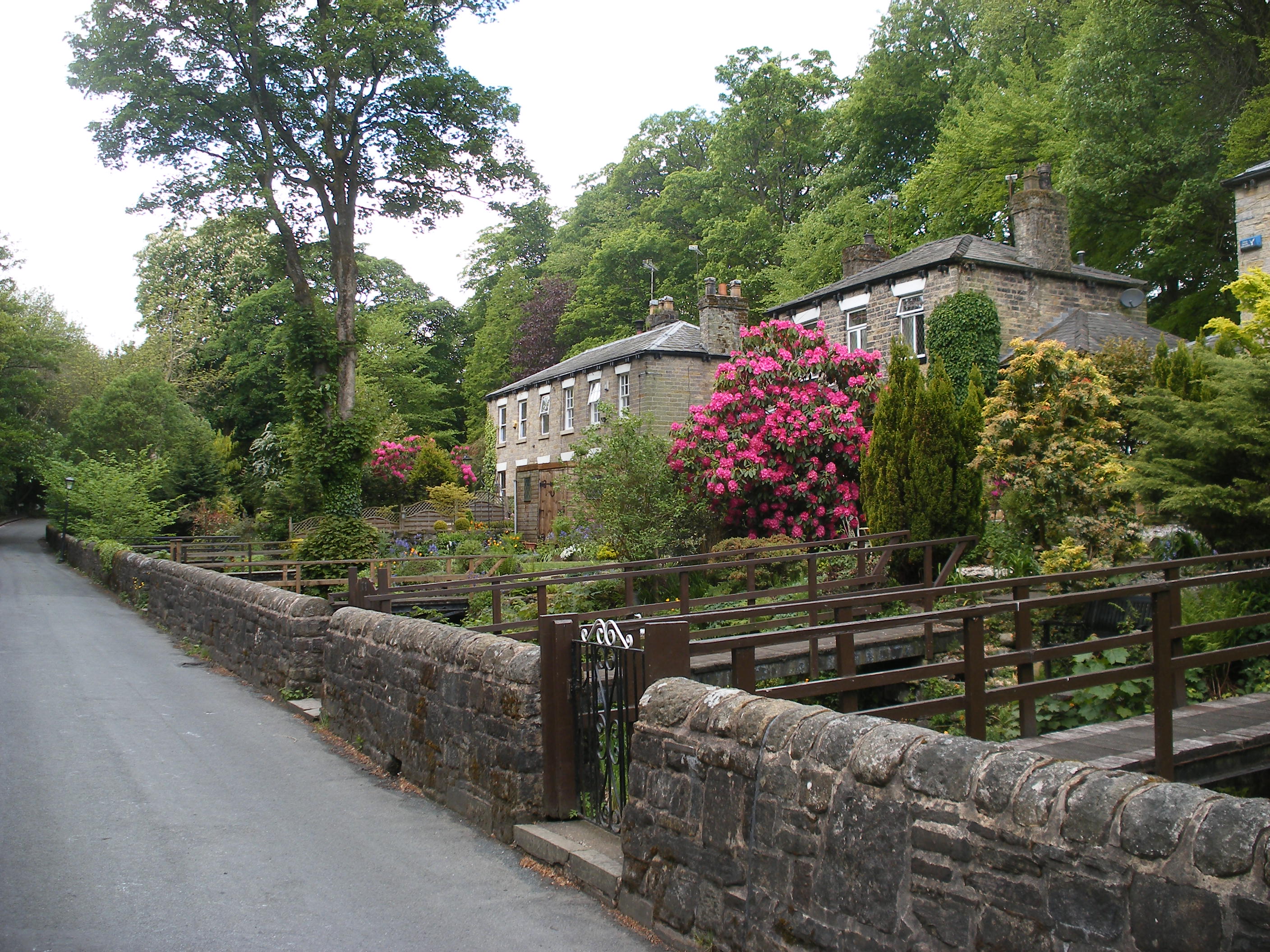
Historically, Barrow Bridge was a mill village that grew in the 19th century alongside the local textile industry. The village was developed to provide housing for workers at the nearby Barrow Bridge Mill, which produced cotton and silk. Today, many of the original mill buildings have been converted into residential properties, giving the village a unique character.

One of the standout features of Barrow Bridge is its network of stone footpaths and cobbled streets, which add to its charm. The village is also home to a number of well-preserved Victorian houses, adding to its historical appeal.

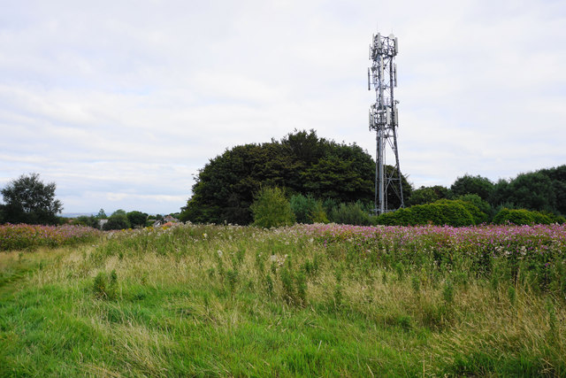
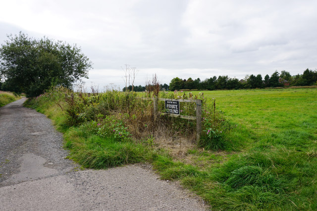
Nature enthusiasts will find plenty to explore in the surrounding area, with Barrow Bridge being a gateway to the West Pennine Moors. The village is an ideal starting point for hikes and walks, with trails leading to nearby reservoirs, woodland areas, and scenic viewpoints.

Despite its rural setting, Barrow Bridge benefits from good transport links. There are regular bus services connecting the village to Bolton and other nearby towns, making it easily accessible for residents and visitors alike.

Overall, Barrow Bridge offers a peaceful retreat with a rich industrial heritage, making it an attractive destination for those seeking a tranquil escape in Lancashire.

If you have any feedback on the listing, please let us know in the comments section below.

Barrow Bridge Images

Images are sourced within 2km of 53.600029/-2.472188 or Grid Reference SD6811. Thanks to Geograph Open Source API. All images are credited.

Newsagent on Markland Hill
Junction of Towncroft Lane and Verdure Avenue Quite a desirable part of town.
Junction of Towncroft Lane and Verdure Avenue
Quite a desirable part of town.
Mobile phone mast on Dob Hill There is also a large phalanx of Himalayan balsam.
Mobile phone mast on Dob Hill
There is also a large phalanx of Himalayan balsam.
Himalayan balsam Very attractive!
Himalayan balsam
Very attractive!
Private ground on the edge of Bolton It is private as stated by Bolton MBC, but they haven't done much to keep it private.
Private ground on the edge of Bolton
It is private as stated by Bolton MBC, but they haven't done much to keep it private.
Atlas No. 7 Mill At the junction of Mornington road and Sofa Street. There were 8 Atlas Mills with Nos. 5 & 8 originally in other ownership and acquired by the Musgrave empire at a later date. No. 7 was built in 1887 and was the only one built as a weaving shed.  No. 6's Musgrave twin tandem compound engine powered No. 6 and No. 7. Its barring engine survives only a few yards away in the Bolton Steam Museum.
Atlas No. 7 Mill
At the junction of Mornington road and Sofa Street. There were 8 Atlas Mills with Nos. 5 & 8 originally in other ownership and acquired by the Musgrave empire at a later date. No. 7 was built in 1887 and was the only one built as a weaving shed. No. 6's Musgrave twin tandem compound engine powered No. 6 and No. 7. Its barring engine survives only a few yards away in the Bolton Steam Museum.
Atlas No. 7 Mill Looking down Sofa Street. There were 8 Atlas Mills with Nos. 5 & 8 originally in other ownership and acquired by the Musgrave empire at a later date. No. 7 was built in 1887 and was the only one built as a weaving shed. No. 6's Musgrave twin tandem compound engine powered No. 6 and No. 7. Its barring engine survives only a few yards away in the Bolton Steam Museum.
Atlas No. 7 Mill
Looking down Sofa Street. There were 8 Atlas Mills with Nos. 5 & 8 originally in other ownership and acquired by the Musgrave empire at a later date. No. 7 was built in 1887 and was the only one built as a weaving shed. No. 6's Musgrave twin tandem compound engine powered No. 6 and No. 7. Its barring engine survives only a few yards away in the Bolton Steam Museum.
Moss Bank Park The road running through the park connects Moss Bank Way and Lightbounds Road.
Moss Bank Park
The road running through the park connects Moss Bank Way and Lightbounds Road.
Tennis at Moss Bank Park The cat isn't interested.
Tennis at Moss Bank Park
The cat isn't interested.
Road through Moss Bank Park The drinking fountain is no longer working.
Road through Moss Bank Park
The drinking fountain is no longer working.
Barrow Bridge Chimney The grade II listed structure was built in 1863 at Ainsworth's bleachworks. Originally 306 feet tall, the chimney height is now reduced to 246 feet for safety reasons. The vegetation growing from the brickwork suggests that, again for reasons of safety, the chimney is in need of some maintenance.
Barrow Bridge Chimney
The grade II listed structure was built in 1863 at Ainsworth's bleachworks. Originally 306 feet tall, the chimney height is now reduced to 246 feet for safety reasons. The vegetation growing from the brickwork suggests that, again for reasons of safety, the chimney is in need of some maintenance.
Ragwort in flower Growing by the side of a path in Moss Bank Park.
Ragwort in flower
Growing by the side of a path in Moss Bank Park.
Moss Bank Park
Moss Bank Park
Gateway to Smithills Hall Smithills Hall is a grade I listed building. The gateposts are probably C19.
Gateway to Smithills Hall
Smithills Hall is a grade I listed building. The gateposts are probably C19.
Formal garden at Smithills Hall To the right is the Victorian extension to the house, and to the left is the chapel which was reconstructed circa 1856 after a fire destroyed the original. The garden is maintained by a volunteer group, the Friends of Smithills Hall.
Formal garden at Smithills Hall
To the right is the Victorian extension to the house, and to the left is the chapel which was reconstructed circa 1856 after a fire destroyed the original. The garden is maintained by a volunteer group, the Friends of Smithills Hall.
Fledgling robin In the grounds of Smithills Hall.
Fledgling robin
In the grounds of Smithills Hall.
Old Colliers Row There are two rows of stone cottages on Colliers Row Road. New Colliers Row stands some metres to the east of this row.
Old Colliers Row
There are two rows of stone cottages on Colliers Row Road. New Colliers Row stands some metres to the east of this row.
Walker Fold Farm The farmhouse and farm buildings have been converted into houses. The buildings in the background are at Higher Tongs - once a farm but now a livery yard.
Walker Fold Farm
The farmhouse and farm buildings have been converted into houses. The buildings in the background are at Higher Tongs - once a farm but now a livery yard.
Show me another place!

Barrow Bridge is located at Grid Ref: SD6811 (Lat: 53.600029, Lng: -2.472188)

Unitary Authority: Bolton

Police Authority: Greater Manchester

What 3 Words

///fully.hotels.until. Near Bolton, Manchester

Related Wikis

Barrow Bridge, Bolton

Barrow Bridge is a model village in the north-west outskirts of Bolton in Greater Manchester, England. It was created in the Industrial Revolution but...

Moss Bank Park, Bolton

Moss Bank Park is a 34.25 hectares (84.6 acres) park in Bolton, Greater Manchester, England. It consists of open space, woodland, gardens and other facilities...

Smithills

Smithills is a mainly residential suburb of Bolton in Greater Manchester, England. It is 3.1 miles (5 km) northwest of Bolton, 14.5 miles (23 km) south...

Doffcocker

Doffcocker is a mostly residential district of Bolton, Greater Manchester, lying about 3½ miles from the town centre on the northwest edge of the suburbs...

The Sixth Form Bolton

The Sixth Form Bolton, formerly Bolton Sixth Form College, is a further education college for students aged 16-19 and is located in Bolton, Greater Manchester...

Smithills Hall

Smithills Hall is a Grade I listed manor house, and a scheduled monument in Smithills, Bolton, Greater Manchester, England. It stands on the slopes of...

Smithills School

Smithills School is a mixed secondary school located in Smithills, Bolton, Greater Manchester.Previously a Grammar School and then a community school administered...

Dean Brook

Dean Brook is a river in Smithills, Bolton, Greater Manchester, historically within Lancashire. Dean Brook rises on Smithills Moor and flows in a south...

Nearby Amenities

Located within 500m of 53.600029,-2.472188
Barrow Bridge
Is In: Bolton, Greater Manchester, England, UK
Place: hamlet
Source: npe
Wikidata: Q4863865
Lat/Long: 53.5994659/-2.4707566
Bus Stop
Lightbounds Road/Chatburn Road
Bus: yes
Naptan AtcoCode: 1800WA14981
Naptan Bearing: SE
Naptan CommonName: Lightbounds Road/Chatburn Road
Naptan Indicator: Nr House 81
Naptan Landmark: NR HOUSE 81
Naptan NaptanCode: manpapma
Naptan PlusbusZoneRef: MNCRPIC
Naptan ShortCommonName: Chatburn Road
Naptan Street: Lightbounds Road
Naptan Verified: no
Network: TfGM
Public Transport: platform
Source: naptan_import
Lat/Long: 53.5970774/-2.4727018
Bus Stop
Barrow Bridge Road/Barrow Bridge
Bus: yes
Naptan AtcoCode: 1800WA16281
Naptan Bearing: NW
Naptan CommonName: Barrow Bridge Road/Barrow Bridge
Naptan Indicator: Terminus
Naptan Landmark: TURNING CIRCLE
Naptan NaptanCode: manpawaj
Naptan PlusbusZoneRef: MNCRPIC
Naptan ShortCommonName: Barrow Bridge
Naptan Street: BARROW BRIDGE R
Naptan Verified: no
Network: TfGM
Public Transport: platform
Source: naptan_import
Lat/Long: 53.6003552/-2.4701428
Bus Stop
Barrow Bridge Road/Turning Circle
Bus: yes
Naptan AtcoCode: 1800WA16291
Naptan Bearing: SW
Naptan CommonName: Barrow Bridge Road/Turning Circle
Naptan Indicator: Terminus
Naptan Landmark: Turning Circle
Naptan NaptanCode: manpawam
Naptan PlusbusZoneRef: MNCRPIC
Naptan ShortCommonName: Turning Circle
Naptan Street: Barrow Bridge Road
Naptan Verified: no
Network: TfGM
Public Transport: platform
Source: naptan_import
Lat/Long: 53.6006537/-2.4696626
Bus Stop
Barrow Bridge Road/Cinder Lane
Bus: yes
Naptan AtcoCode: 1800WA19691
Naptan Bearing: NW
Naptan CommonName: Barrow Bridge Road/Cinder Lane
Naptan Indicator: Opp House 40
Naptan Landmark: HOUSE 40
Naptan NaptanCode: manpdpwd
Naptan PlusbusZoneRef: MNCRPIC
Naptan ShortCommonName: Cinder Lane
Naptan Street: BARROW BRIDGE R
Naptan Verified: no
Network: TfGM
Public Transport: platform
Source: naptan_import
Lat/Long: 53.599128/-2.4690563
Bus Stop
Barrow Bridge Road/Cinder Lane
Bus: yes
Naptan AtcoCode: 1800WA19761
Naptan Bearing: E
Naptan CommonName: Barrow Bridge Road/Cinder Lane
Naptan Indicator: Nr Open Land
Naptan Landmark: HOUSE 32
Naptan NaptanCode: manpdpwm
Naptan PlusbusZoneRef: MNCRPIC
Naptan ShortCommonName: Cinder Lane
Naptan Street: BARROW BRIDGE R
Naptan Verified: no
Network: TfGM
Public Transport: platform
Source: naptan_import
Lat/Long: 53.598951/-2.4683593
Barrier: stile
Lat/Long: 53.6038519/-2.4693084
Post Box
Operator: Royal Mail
Lat/Long: 53.6007902/-2.4708807
Turning Circle
Lat/Long: 53.5971466/-2.4709359
The data included in this document is from www.openstreetmap.org. The data is made available under ODbL.

Have you been to Barrow Bridge?

Leave your review of Barrow Bridge below (or comments, questions and feedback).