Bold Hope

Valley in Peeblesshire

Scotland

Bold Hope

Timber stacks near Glenbenna Plenty of timber awaiting transport from Traquair and Elibank Forest.
Timber stacks near Glenbenna Credit: Jim Barton

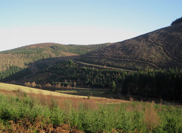
Bold Hope is a picturesque valley located in the region of Peeblesshire, Scotland. Situated amidst the stunning Scottish Borders, this idyllic valley offers a tranquil and serene atmosphere, making it a popular destination for nature enthusiasts and those seeking a peaceful retreat.

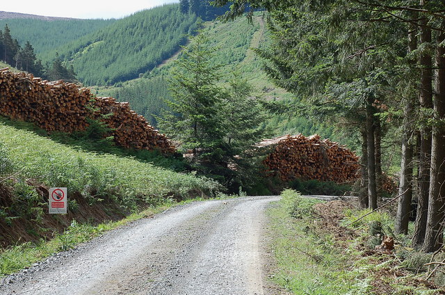
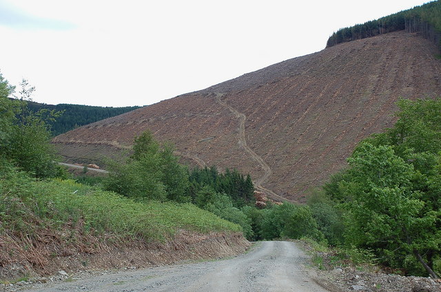
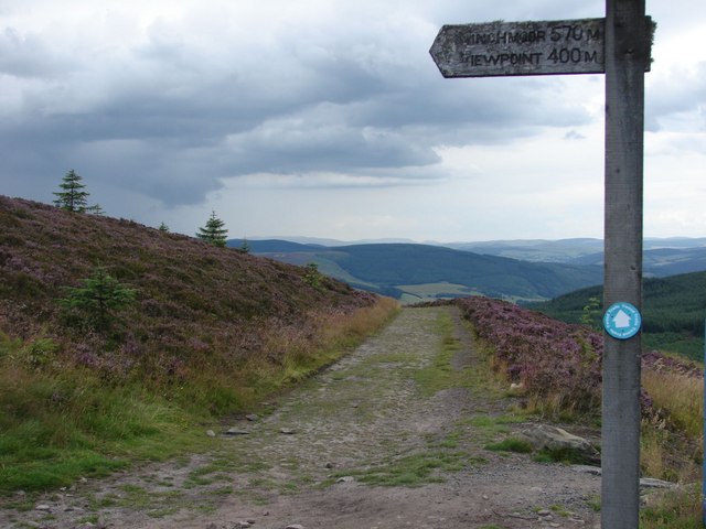
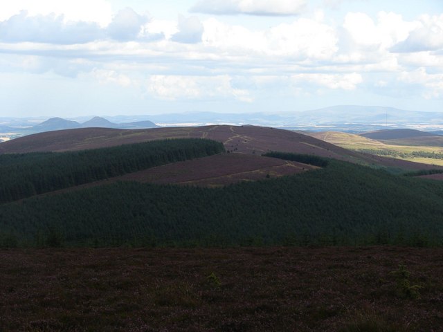
The valley of Bold Hope is characterized by its breathtaking natural beauty, with rolling green hills, lush meadows, and stunning views in every direction. The area is rich in diverse flora and fauna, making it a haven for wildlife and a delight for birdwatchers and nature photographers.

Bold Hope is also known for its charming local community. The inhabitants of the valley are warm and friendly, welcoming visitors with open arms. The quaint village nearby offers traditional Scottish hospitality, with cozy bed and breakfast accommodations, local pubs serving delicious regional cuisine, and charming shops selling handmade crafts and local produce.

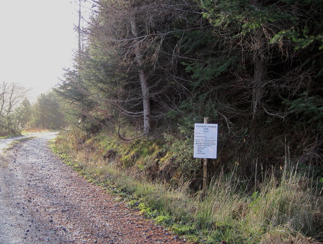
Outdoor activities abound in Bold Hope, with numerous hiking trails and cycling routes that wind through the valley and surrounding countryside. Visitors can explore the area's natural wonders, including picturesque waterfalls, ancient forests, and meandering rivers perfect for fishing or boating.

For history enthusiasts, Bold Hope has its fair share of ancient landmarks and historical sites. The valley is dotted with remnants of ancient settlements, standing stones, and castles, providing a glimpse into the region's rich past.

Overall, Bold Hope in Peeblesshire is a hidden gem nestled in the Scottish Borders, offering a perfect combination of natural beauty, warm hospitality, and outdoor adventures for all who visit.

If you have any feedback on the listing, please let us know in the comments section below.

Bold Hope Images

Images are sourced within 2km of 55.59041/-2.9900639 or Grid Reference NT3733. Thanks to Geograph Open Source API. All images are credited.

Timber stacks near Glenbenna Plenty of timber awaiting transport from Traquair and Elibank Forest.
Timber stacks near Glenbenna
Plenty of timber awaiting transport from Traquair and Elibank Forest.
Clear felled slope on Glenbenna Head Logging in the Traquair and Elibank Forest, seen here from the forest road contouring Bold Rig.
Clear felled slope on Glenbenna Head
Logging in the Traquair and Elibank Forest, seen here from the forest road contouring Bold Rig.
View of the Eildon Hills The view from the signpost for Minch Moor on the Southern Upland Way, looking to the east side towards the Eildon Hills.
View of the Eildon Hills
The view from the signpost for Minch Moor on the Southern Upland Way, looking to the east side towards the Eildon Hills.
View along the path back to the Cheese Well Looking back from the signpost for Minch Moor along the pathway towards the Cheese Well and Traquair.
View along the path back to the Cheese Well
Looking back from the signpost for Minch Moor along the pathway towards the Cheese Well and Traquair.
View from the top of Minch Moor Looking to the east side towards the Tweed valley, with The Cheviot in the far background on the right, as well as the Eildon Hills to the left.
View from the top of Minch Moor
Looking to the east side towards the Tweed valley, with The Cheviot in the far background on the right, as well as the Eildon Hills to the left.
Elibank and Traquair Forest Various stages of tree growth are in view here with clear felling on part of the ridge from Glenbenna Head and mature forest on Middlebar Knowe (L).
Elibank and Traquair Forest
Various stages of tree growth are in view here with clear felling on part of the ridge from Glenbenna Head and mature forest on Middlebar Knowe (L).
Too late to buy these trees 'Standing Timber For Sale' proclaims the notice, but the closing date of 30th November has passed.
Too late to buy these trees
'Standing Timber For Sale' proclaims the notice, but the closing date of 30th November has passed.
Southern Upland Way and cycle route, Minch Moor The cycle route down from Minch Moor summit cuts across the Old Drove Road here, used by the Southern Upland Way from Traquair (L) to Yair (R).
Southern Upland Way and cycle route, Minch Moor
The cycle route down from Minch Moor summit cuts across the Old Drove Road here, used by the Southern Upland Way from Traquair (L) to Yair (R).
Southern Upland Way, Lucken Head The Way keeps high alongside the fence E of Brown Knowe, with the line of the Old Drove Road shown slightly lower down contouring the hillside to the notch at Four Lords Land, in the dip before the plantation ahead. The Eildon Hills are L of centre and The Cheviot is the distant broad bump on the skyline.
Southern Upland Way, Lucken Head
The Way keeps high alongside the fence E of Brown Knowe, with the line of the Old Drove Road shown slightly lower down contouring the hillside to the notch at Four Lords Land, in the dip before the plantation ahead. The Eildon Hills are L of centre and The Cheviot is the distant broad bump on the skyline.
Minchmoor Road The line of the old road that climbs from Hangingshaw Rig is clear to see, with Newark Hill across the Yarrow Valley in the background.
Minchmoor Road
The line of the old road that climbs from Hangingshaw Rig is clear to see, with Newark Hill across the Yarrow Valley in the background.
Replanted forestry on Bold Rig, Minch Moor The next generation of trees on their way on this spur to the N of Minch Moor. Walkerburn is in the Tweed valley below with Cairn Hill's plantations beyond and the grassy slopes of Seathope Law to the right.
Replanted forestry on Bold Rig, Minch Moor
The next generation of trees on their way on this spur to the N of Minch Moor. Walkerburn is in the Tweed valley below with Cairn Hill's plantations beyond and the grassy slopes of Seathope Law to the right.
Approaching Minch Moor summit The boggy last 100m or so to the cairn and trig point.
Approaching Minch Moor summit
The boggy last 100m or so to the cairn and trig point.
Road works near Minch Moor summit A familiar type of sign on the bike trail descending from Minch Moor summit. The sign reads: "Trail maintenance ahead - Trail is open".
Road works near Minch Moor summit
A familiar type of sign on the bike trail descending from Minch Moor summit. The sign reads: "Trail maintenance ahead - Trail is open".
Summit cairn, Minch Moor The cairn is in much better shape than it was 3 years ago: compare with <a href="https://www.geograph.org.uk/photo/1478429">NT3533 : Damaged summit cairn, Minch Moor</a>.
Summit cairn, Minch Moor
The cairn is in much better shape than it was 3 years ago: compare with NT3533 : Damaged summit cairn, Minch Moor.
Minch Moor Easy parking beside Traquair Village Hall then up easy paths to summit on cool dry cloudy morning.

Name: Minch Moor
Hill number: 1919
Height: 567m / 1860ft
Area: 28B: The River Tweed to the English Border
Class: Ma,5D
Grid ref: NT 35865 33055
Summit feature: trig point
Drop: 213m
Col: 354m  NT313286
Minch Moor
Easy parking beside Traquair Village Hall then up easy paths to summit on cool dry cloudy morning. Name: Minch Moor Hill number: 1919 Height: 567m / 1860ft Area: 28B: The River Tweed to the English Border Class: Ma,5D Grid ref: NT 35865 33055 Summit feature: trig point Drop: 213m Col: 354m NT313286
Minchmoor Sun shining off breakable crust on the summit dome of Minchmoor. The icy snow is old and the fresher snowfalls have been blown away into huge drifts.
Minchmoor
Sun shining off breakable crust on the summit dome of Minchmoor. The icy snow is old and the fresher snowfalls have been blown away into huge drifts.
Snowladen trees, Minchmoor Snow deposited in the lee of the trees in a prolonged easterly wind.
Snowladen trees, Minchmoor
Snow deposited in the lee of the trees in a prolonged easterly wind.
Summit bald, Minchmoor There is a mountainbike trail somewhere under the snow.  The snow was not so deep here, most having been shifted by easterly gales into drifts further down the hill.
Summit bald, Minchmoor
There is a mountainbike trail somewhere under the snow. The snow was not so deep here, most having been shifted by easterly gales into drifts further down the hill.
Show me another place!

Bold Hope is located at Grid Ref: NT3733 (Lat: 55.59041, Lng: -2.9900639)

Unitary Authority: The Scottish Borders

Police Authority: The Lothians and Scottish Borders

What 3 Words

///freely.coffee.seabirds. Near Innerleithen, Scottish Borders

Nearby Locations

Bold Hope Glen Kipp

Related Wikis

Walkerburn railway station

Walkerburn railway station served the village of Walkerburn, Scottish Borders, Scotland from 1867 to 1962 on the Peebles Railway. == History == The station...

Thornielee railway station

Thornielee railway station served the smallholding of Thornielee, Scottish Borders, Scotland from 1866 to 1950 on the Peebles Railway. == History == The...

Ashiestiel

Ashiestiel is a village in the Scottish Borders area of Scotland, in the Parish of Caddonfoot, on the south side of the River Tweed, 4m (6.5 km) east of...

Yarrowford

Yarrowford is a village on the A708, in the Scottish Borders area of Scotland, 4 miles north-west of Selkirk, in the Ettrick Forest. The Yarrow Water flows...

Have you been to Bold Hope?

Leave your review of Bold Hope below (or comments, questions and feedback).