Glen Kipp

Valley in Peeblesshire

Scotland

Glen Kipp

Timber stacks near Glenbenna Plenty of timber awaiting transport from Traquair and Elibank Forest.
Timber stacks near Glenbenna Credit: Jim Barton

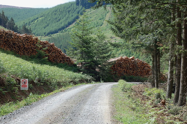
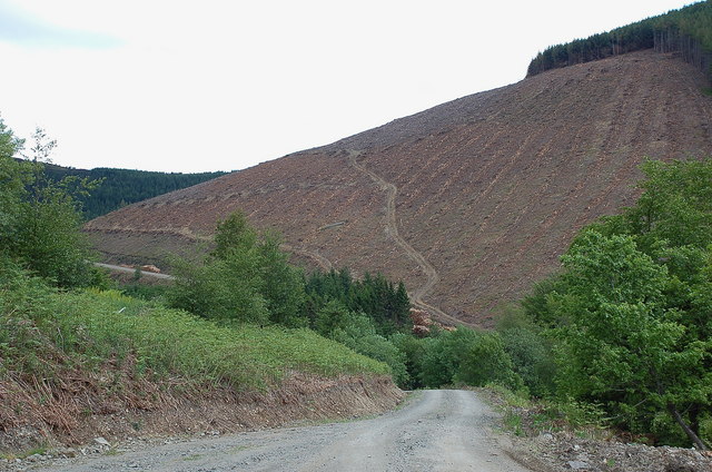
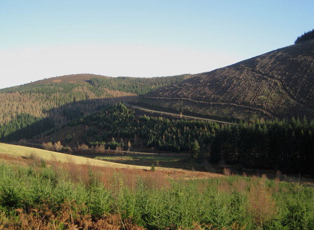
Glen Kipp is a picturesque valley located in Peeblesshire, a historic county in the southern part of Scotland. Situated in the Scottish Borders region, Glen Kipp is renowned for its stunning natural beauty and tranquil atmosphere. The valley is nestled between rolling hills and is traversed by the Kipp Water, a small river that meanders through the landscape.

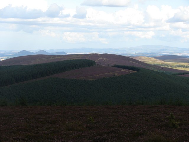
One of the distinctive features of Glen Kipp is its lush greenery. The valley is covered in a patchwork of fields, pastures, and woodlands, providing a haven for a diverse range of flora and fauna. Visitors can expect to encounter a variety of plant species, including wildflowers, ferns, and native trees such as oak and birch.

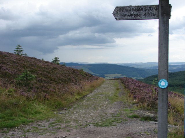
The idyllic setting of Glen Kipp makes it a popular destination for outdoor enthusiasts. The valley offers numerous opportunities for walking, hiking, and cycling, with well-maintained trails that showcase the area's natural splendor. Additionally, the Kipp Water is a haven for fishing enthusiasts, attracting anglers who hope to catch trout or salmon in its crystal-clear waters.

Glen Kipp is also rich in history and heritage. The valley is home to several ancient sites, including standing stones and burial mounds that date back to prehistoric times. These remnants of the past offer a glimpse into the region's early inhabitants and provide a sense of the deep-rooted history of the area.

Overall, Glen Kipp in Peeblesshire is a captivating destination that captivates visitors with its unspoiled natural beauty, outdoor recreational opportunities, and historical significance. Whether exploring its scenic trails or immersing oneself in its rich heritage, Glen Kipp offers a memorable experience for all who venture into its embrace.

If you have any feedback on the listing, please let us know in the comments section below.

Glen Kipp Images

Images are sourced within 2km of 55.592631/-2.9876127 or Grid Reference NT3733. Thanks to Geograph Open Source API. All images are credited.

Timber stacks near Glenbenna Plenty of timber awaiting transport from Traquair and Elibank Forest.
Timber stacks near Glenbenna
Plenty of timber awaiting transport from Traquair and Elibank Forest.
Clear felled slope on Glenbenna Head Logging in the Traquair and Elibank Forest, seen here from the forest road contouring Bold Rig.
Clear felled slope on Glenbenna Head
Logging in the Traquair and Elibank Forest, seen here from the forest road contouring Bold Rig.
View of the Eildon Hills The view from the signpost for Minch Moor on the Southern Upland Way, looking to the east side towards the Eildon Hills.
View of the Eildon Hills
The view from the signpost for Minch Moor on the Southern Upland Way, looking to the east side towards the Eildon Hills.
View along the path back to the Cheese Well Looking back from the signpost for Minch Moor along the pathway towards the Cheese Well and Traquair.
View along the path back to the Cheese Well
Looking back from the signpost for Minch Moor along the pathway towards the Cheese Well and Traquair.
View from the top of Minch Moor Looking to the east side towards the Tweed valley, with The Cheviot in the far background on the right, as well as the Eildon Hills to the left.
View from the top of Minch Moor
Looking to the east side towards the Tweed valley, with The Cheviot in the far background on the right, as well as the Eildon Hills to the left.
Elibank and Traquair Forest Various stages of tree growth are in view here with clear felling on part of the ridge from Glenbenna Head and mature forest on Middlebar Knowe (L).
Elibank and Traquair Forest
Various stages of tree growth are in view here with clear felling on part of the ridge from Glenbenna Head and mature forest on Middlebar Knowe (L).
Too late to buy these trees 'Standing Timber For Sale' proclaims the notice, but the closing date of 30th November has passed.
Too late to buy these trees
'Standing Timber For Sale' proclaims the notice, but the closing date of 30th November has passed.
Southern Upland Way and cycle route, Minch Moor The cycle route down from Minch Moor summit cuts across the Old Drove Road here, used by the Southern Upland Way from Traquair (L) to Yair (R).
Southern Upland Way and cycle route, Minch Moor
The cycle route down from Minch Moor summit cuts across the Old Drove Road here, used by the Southern Upland Way from Traquair (L) to Yair (R).
Southern Upland Way, Lucken Head The Way keeps high alongside the fence E of Brown Knowe, with the line of the Old Drove Road shown slightly lower down contouring the hillside to the notch at Four Lords Land, in the dip before the plantation ahead. The Eildon Hills are L of centre and The Cheviot is the distant broad bump on the skyline.
Southern Upland Way, Lucken Head
The Way keeps high alongside the fence E of Brown Knowe, with the line of the Old Drove Road shown slightly lower down contouring the hillside to the notch at Four Lords Land, in the dip before the plantation ahead. The Eildon Hills are L of centre and The Cheviot is the distant broad bump on the skyline.
Minchmoor Road The line of the old road that climbs from Hangingshaw Rig is clear to see, with Newark Hill across the Yarrow Valley in the background.
Minchmoor Road
The line of the old road that climbs from Hangingshaw Rig is clear to see, with Newark Hill across the Yarrow Valley in the background.
Replanted forestry on Bold Rig, Minch Moor The next generation of trees on their way on this spur to the N of Minch Moor. Walkerburn is in the Tweed valley below with Cairn Hill's plantations beyond and the grassy slopes of Seathope Law to the right.
Replanted forestry on Bold Rig, Minch Moor
The next generation of trees on their way on this spur to the N of Minch Moor. Walkerburn is in the Tweed valley below with Cairn Hill's plantations beyond and the grassy slopes of Seathope Law to the right.
Snowladen trees, Minchmoor Snow deposited in the lee of the trees in a prolonged easterly wind.
Snowladen trees, Minchmoor
Snow deposited in the lee of the trees in a prolonged easterly wind.
Footpath sign, Minchmoor The Minchmoor road under deep snow with a signpost for the summit.
Footpath sign, Minchmoor
The Minchmoor road under deep snow with a signpost for the summit.
Elibank and Traquair Forest View from the Minchmoor road.
Elibank and Traquair Forest
View from the Minchmoor road.
Minchmoor Road Looking westward from the turn off for the summit of Minchmoor.
Minchmoor Road
Looking westward from the turn off for the summit of Minchmoor.
Minchmoor Road Just to the east of the highest point.
Minchmoor Road
Just to the east of the highest point.
On Minchmoor Somewhere near the path to the summit which was buried in the snow. There was a view towards a wild and unwelcoming Windlestraw Law across the Tweed.
On Minchmoor
Somewhere near the path to the summit which was buried in the snow. There was a view towards a wild and unwelcoming Windlestraw Law across the Tweed.
Cotton grass, Brown Knowe Boggy moorland alongside the track on the high-level route of the Old Drove Road.
Cotton grass, Brown Knowe
Boggy moorland alongside the track on the high-level route of the Old Drove Road.
Show me another place!

Glen Kipp is located at Grid Ref: NT3733 (Lat: 55.592631, Lng: -2.9876127)

Unitary Authority: The Scottish Borders

Police Authority: The Lothians and Scottish Borders

What 3 Words

///images.lions.gurgling. Near Innerleithen, Scottish Borders

Nearby Locations

Bold Hope Glen Kipp

Related Wikis

Walkerburn railway station

Walkerburn railway station served the village of Walkerburn, Scottish Borders, Scotland from 1867 to 1962 on the Peebles Railway. == History == The station...

Thornielee railway station

Thornielee railway station served the smallholding of Thornielee, Scottish Borders, Scotland from 1866 to 1950 on the Peebles Railway. == History == The...

Ashiestiel

Ashiestiel is a village in the Scottish Borders area of Scotland, in the Parish of Caddonfoot, on the south side of the River Tweed, 4m (6.5 km) east of...

The Kirna

The Kirna, known locally as Kirna House (previously also as Grangehill), is a Category A listed villa in Walkerburn, Peeblesshire, Scotland. It is one...

Have you been to Glen Kipp?

Leave your review of Glen Kipp below (or comments, questions and feedback).