West Chockstone Gully

Valley in Westmorland Eden

England

West Chockstone Gully

Climbing to Fairfield from Link Hause Once on the ridge that forms one side of the Fairfield horseshoe, there is little drop between the subsidiary summits of Dove Crag and Hart Crag and the main top. The first col is unnamed on the map, but north of Hart Crag is Link Hause and a short climb above Scrubby Crag to reach the summit area of Fairfield itself. Cairns may help route finding in thick weather, but this one doesn't seem to stand out well against its rocky background in ascent. It may be of more importance in descent when falling over Scrubby Crag is to be avoided.
Climbing to Fairfield from Link Hause Credit: Andy Waddington

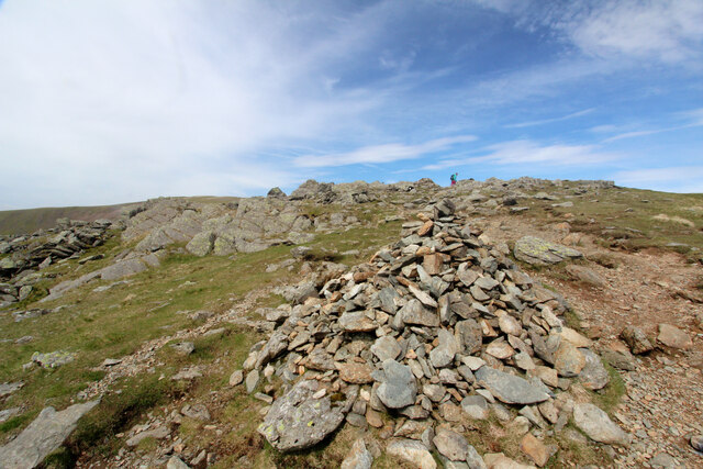
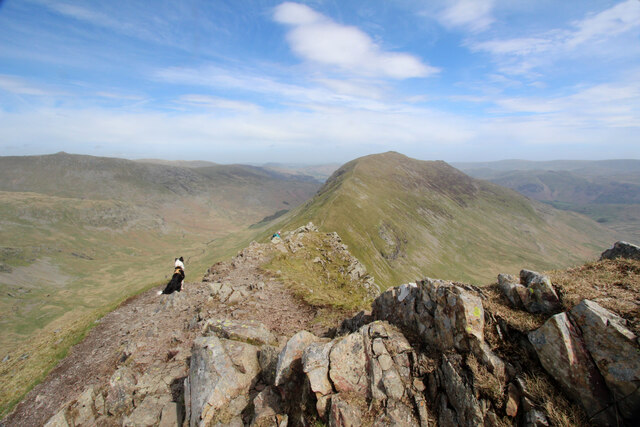
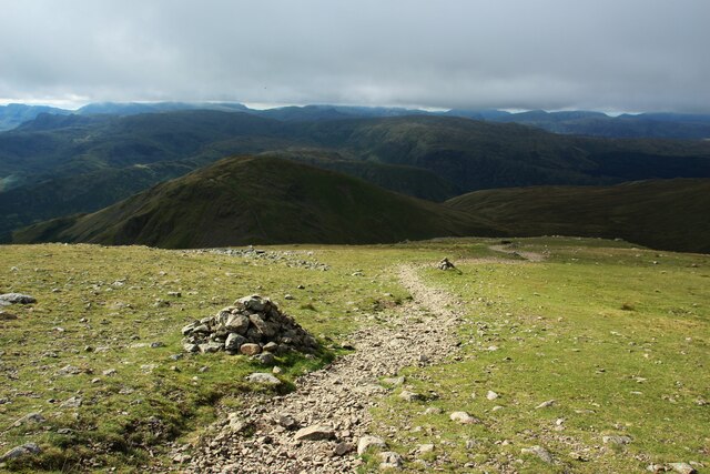
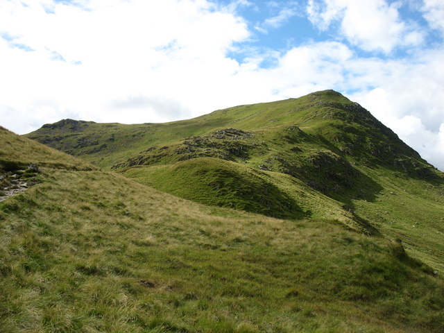
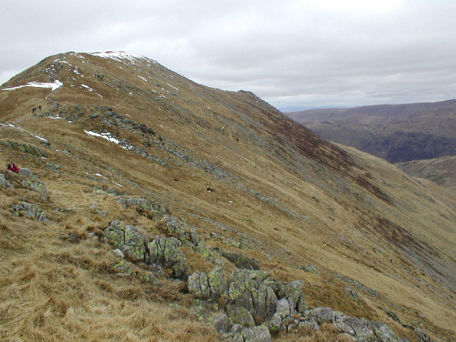
West Chockstone Gully is a prominent geographical feature located in the Westmorland Valley, nestled within the scenic Lake District National Park in northwest England. This picturesque gully is renowned for its unique rock formations and the challenging climbing opportunities it presents to outdoor enthusiasts.

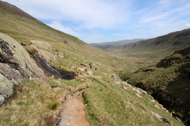
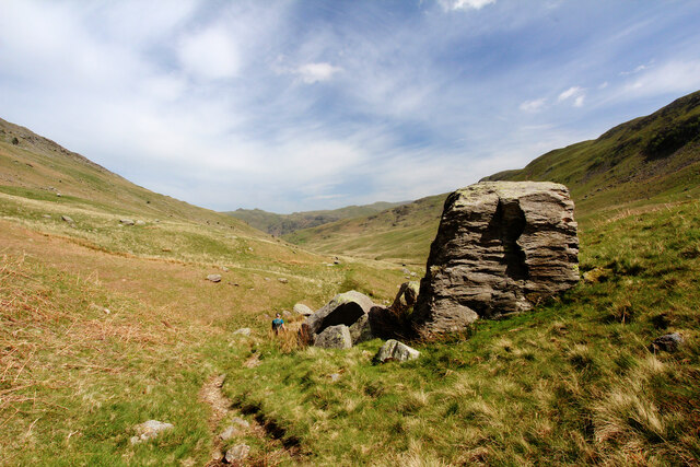
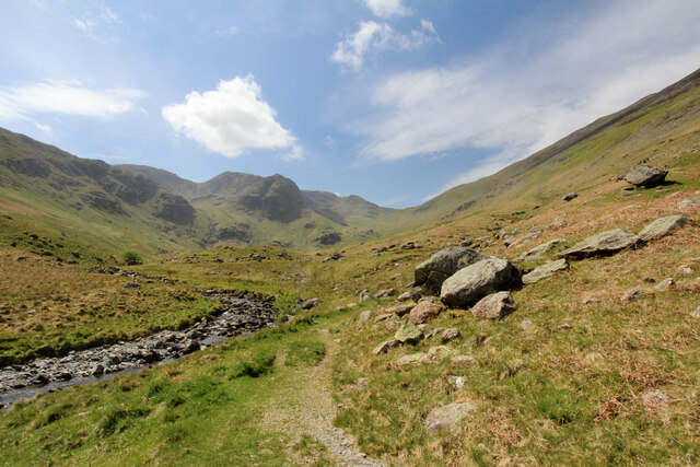
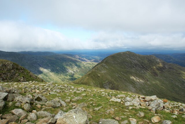
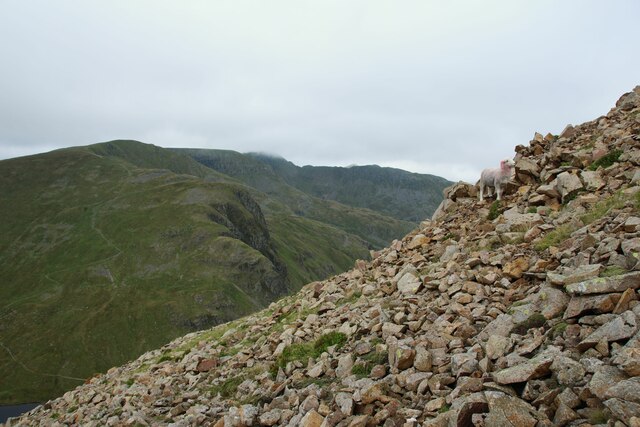
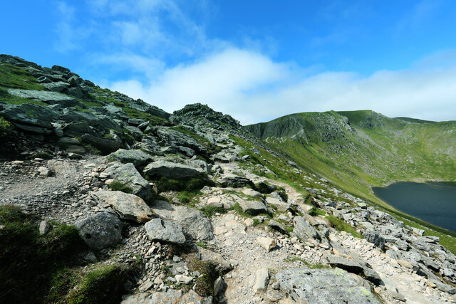
Situated on the western side of the valley, West Chockstone Gully is characterized by steep, craggy cliffs and a narrow, winding channel that cuts through the rugged landscape. The gully is formed by the erosion of the surrounding rock over thousands of years, resulting in a dramatic and awe-inspiring natural formation. Its name, "Chockstone," derives from the large boulders that are wedged between the cliffs, adding to the gully's distinctive character.

The gully's terrain offers a variety of climbing routes, ranging from moderate to highly technical, making it a magnet for rock climbers from both the UK and abroad. Its steep walls and challenging pitches make it an ideal destination for experienced climbers seeking a thrilling ascent. However, it is important to note that climbing in West Chockstone Gully requires appropriate skills, equipment, and knowledge of safety procedures due to the potential hazards associated with the sport.

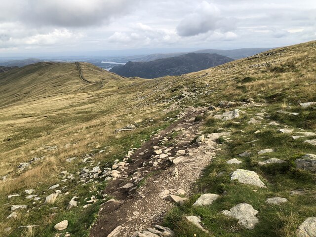
Aside from its climbing allure, West Chockstone Gully attracts hikers and nature enthusiasts who appreciate its breathtaking beauty and the opportunity to explore the surrounding area. The gully is nestled within the picturesque Westmorland Valley, surrounded by lush greenery, cascading waterfalls, and panoramic views of the Lake District's rolling hills.

Overall, West Chockstone Gully is a captivating natural wonder that offers a blend of adventure, beauty, and tranquility, making it a must-visit destination for outdoor enthusiasts and nature lovers alike.

If you have any feedback on the listing, please let us know in the comments section below.

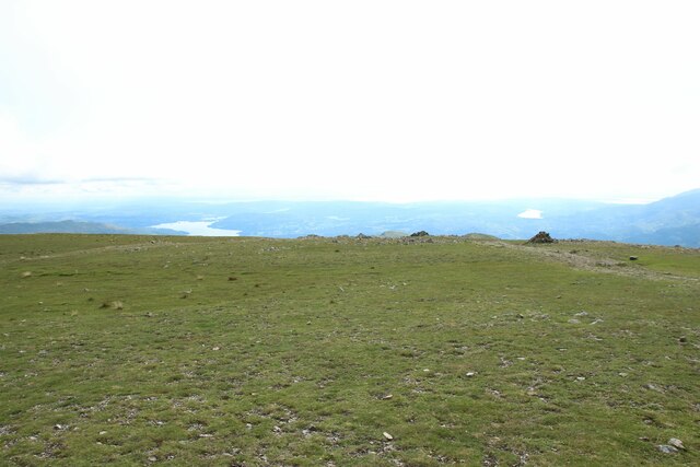
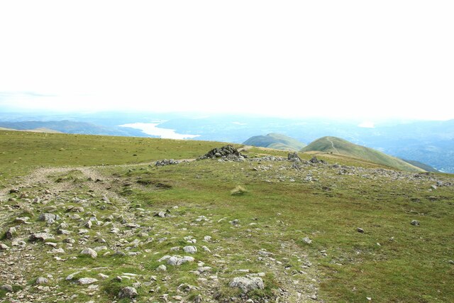
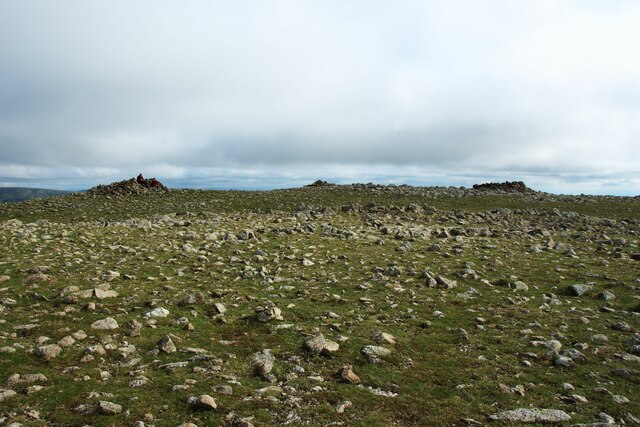
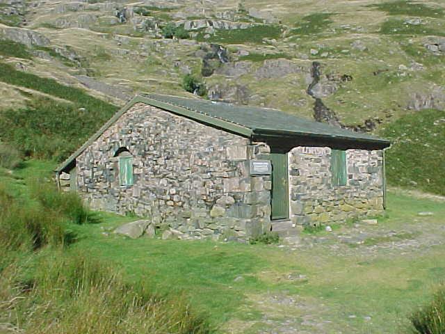
West Chockstone Gully Images

Images are sourced within 2km of 54.512516/-2.9828279 or Grid Reference NY3613. Thanks to Geograph Open Source API. All images are credited.

Climbing to Fairfield from Link Hause Once on the ridge that forms one side of the Fairfield horseshoe, there is little drop between the subsidiary summits of Dove Crag and Hart Crag and the main top. The first col is unnamed on the map, but north of Hart Crag is Link Hause and a short climb above Scrubby Crag to reach the summit area of Fairfield itself. Cairns may help route finding in thick weather, but this one doesn't seem to stand out well against its rocky background in ascent. It may be of more importance in descent when falling over Scrubby Crag is to be avoided.
Climbing to Fairfield from Link Hause
Once on the ridge that forms one side of the Fairfield horseshoe, there is little drop between the subsidiary summits of Dove Crag and Hart Crag and the main top. The first col is unnamed on the map, but north of Hart Crag is Link Hause and a short climb above Scrubby Crag to reach the summit area of Fairfield itself. Cairns may help route finding in thick weather, but this one doesn't seem to stand out well against its rocky background in ascent. It may be of more importance in descent when falling over Scrubby Crag is to be avoided.
Contemplating the way on from Cofa Pike Cofa Pike is a distinctly rough and rocky eminence, somewhat unnervingly loose if descending from Fairfield towards St. Sunday Crag. The dog is eyeing up the way on towards the next hill (as well she might, being a little unconfident as yet on scrambles, and unsure what is in store here). There's a very good scramble on the far end of St. Sunday Crag, but that was not our destination today, as we planned to drop into Deepdale via a path clearly shown on older maps, but which seems to have fallen into unpopularity in recent times. It is steep and loose at first, then boggy for much of its lower course, but has the great advantage from our point of view of actually leading back to our day's starting point near Brothers Water.
Contemplating the way on from Cofa Pike
Cofa Pike is a distinctly rough and rocky eminence, somewhat unnervingly loose if descending from Fairfield towards St. Sunday Crag. The dog is eyeing up the way on towards the next hill (as well she might, being a little unconfident as yet on scrambles, and unsure what is in store here). There's a very good scramble on the far end of St. Sunday Crag, but that was not our destination today, as we planned to drop into Deepdale via a path clearly shown on older maps, but which seems to have fallen into unpopularity in recent times. It is steep and loose at first, then boggy for much of its lower course, but has the great advantage from our point of view of actually leading back to our day's starting point near Brothers Water.
Path descending Deepdale Deepdale doesn't, from a distance, seem particularly deep and the footpath (not a public right of way, but this is all CROW Access Land) wends its way rather boggily between moraines for much of the way. This section, however, is drier and perched above a minor gorge, which undoubtedly does look deep seen from this distance, with a number of cascades and general splashiness, much the sort of thing favoured by Gill Scramblers.
Path descending Deepdale
Deepdale doesn't, from a distance, seem particularly deep and the footpath (not a public right of way, but this is all CROW Access Land) wends its way rather boggily between moraines for much of the way. This section, however, is drier and perched above a minor gorge, which undoubtedly does look deep seen from this distance, with a number of cascades and general splashiness, much the sort of thing favoured by Gill Scramblers.
Path descending Deepdale A less than distinct path (shown on older maps, but now intermittently missing on more recent mapping) drops steeply down from Deepdale Hause between Cofa Pike and St Sunday Crag, wending its way rather damply between moraines higher up the dale, then traversing above a gorge mid-dale before reaching this section, mostly dry underfoot, and on gentle slopes on the left bank of Deepdale Beck. Only when it meets the even fainter route down from the NE end of St Sunday Crag does it suddenly transform into a public right of way and become a much more convincing track.
Path descending Deepdale
A less than distinct path (shown on older maps, but now intermittently missing on more recent mapping) drops steeply down from Deepdale Hause between Cofa Pike and St Sunday Crag, wending its way rather damply between moraines higher up the dale, then traversing above a gorge mid-dale before reaching this section, mostly dry underfoot, and on gentle slopes on the left bank of Deepdale Beck. Only when it meets the even fainter route down from the NE end of St Sunday Crag does it suddenly transform into a public right of way and become a much more convincing track.
Path beside Deepdale Beck The path in the lower part of Deepdale (downstream of the rocky gorge) generally stays on boulder-studded slopes above the left bank of the beck, remaining a lot drier underfoot than the faint route in the upper dale which wends its way rather boggily between moraines. At the head of the dale, it is much steeper (and a bit loose in spots) just below Deepdale hause between Cofa Pike (a prominent eminence north of Fairfield, though somewhat dwarfed from this angle by the shady Greenhow End at the centre of the picture) and St. Sunday Crag. There are a number of crags, much loved by less famous climbers looking for new routes in the latter half of the twentieth century after the easier routes on bigger crags, and much harder lines elsewhere had long been claimed.
Path beside Deepdale Beck
The path in the lower part of Deepdale (downstream of the rocky gorge) generally stays on boulder-studded slopes above the left bank of the beck, remaining a lot drier underfoot than the faint route in the upper dale which wends its way rather boggily between moraines. At the head of the dale, it is much steeper (and a bit loose in spots) just below Deepdale hause between Cofa Pike (a prominent eminence north of Fairfield, though somewhat dwarfed from this angle by the shady Greenhow End at the centre of the picture) and St. Sunday Crag. There are a number of crags, much loved by less famous climbers looking for new routes in the latter half of the twentieth century after the easier routes on bigger crags, and much harder lines elsewhere had long been claimed.
Path between Hart Crag and Fairfield
Summit stone shelter on Fairfield
Summit shelter on Fairfield A roughly constructed shelter to protect resting passersby from wind on the exposed Lakeland summit.
Summit shelter on Fairfield
A roughly constructed shelter to protect resting passersby from wind on the exposed Lakeland summit.
Fairfield summit plateau The broad and flat grassy area at the peak of Fairfield. The oultline of Windermere can be seen in the distance.
Fairfield summit plateau
The broad and flat grassy area at the peak of Fairfield. The oultline of Windermere can be seen in the distance.
Path between Great Rigg and Fairfield A worn path close to the top of Fairfield which connects the summit with the top of Great Rigg.
Path between Great Rigg and Fairfield
A worn path close to the top of Fairfield which connects the summit with the top of Great Rigg.
Looking to St Sunday Crag from Fairfield Looking across the upland landscape from the top of Fairfield to St Sunday Crag.
Looking to St Sunday Crag from Fairfield
Looking across the upland landscape from the top of Fairfield to St Sunday Crag.
Fairfield summit plateau The plateau at the top of Fairfield featuring several cairns and summit shelters.
Fairfield summit plateau
The plateau at the top of Fairfield featuring several cairns and summit shelters.
Path between Fairfield and Grisedale Hause The public footpath connecting the summit of Fairfield and the much visited junction of paths at Grisedale Hause.
Path between Fairfield and Grisedale Hause
The public footpath connecting the summit of Fairfield and the much visited junction of paths at Grisedale Hause.
Scree on the western side of Fairfield A field of loose stone which needs to be negotiated following the path between Grisedale Hause and the top of Fairfield. The sheep helps to give the scene some scale.
Scree on the western side of Fairfield
A field of loose stone which needs to be negotiated following the path between Grisedale Hause and the top of Fairfield. The sheep helps to give the scene some scale.
Looking back along the path above Bleaberry Crag
Path over High Spying How After the hard work of climbing 700m from the shores of Ullswater at Glenridding, there's only 100m of up to reach Helvellyn, and it is all a lot more fun than what has gone before. Well, as long as you are one of those who feel happy on exposed scrambles, of course. This is the start of Striding Edge, and it is essential to stick rigidly to the crest at all times (there are skulkers' routes round quite a lot of it, really).
Path over High Spying How
After the hard work of climbing 700m from the shores of Ullswater at Glenridding, there's only 100m of up to reach Helvellyn, and it is all a lot more fun than what has gone before. Well, as long as you are one of those who feel happy on exposed scrambles, of course. This is the start of Striding Edge, and it is essential to stick rigidly to the crest at all times (there are skulkers' routes round quite a lot of it, really).
Ruthwaite Lodge Ruthwaite Lodge was restored by the maintenance team of Outward Bound Ullswater. On 26th March 1993 it was dedicated to the memory of Richard Read and Mike Evans.
Ruthwaite Lodge
Ruthwaite Lodge was restored by the maintenance team of Outward Bound Ullswater. On 26th March 1993 it was dedicated to the memory of Richard Read and Mike Evans.
The approach to St Sunday Crag Following the path from Thornhow End.
The approach to St Sunday Crag
Following the path from Thornhow End.
Show me another place!

West Chockstone Gully is located at Grid Ref: NY3613 (Lat: 54.512516, Lng: -2.9828279)

Administrative County: Cumbria

District: Eden

Police Authority: Cumbria

What 3 Words

///newest.nest.honeybees. Near Ambleside, Cumbria

Related Wikis

St Sunday Crag

St Sunday Crag is a fell in the English Lake District, part of the Fairfield group in the Eastern Fells. It is a prominent feature in the Patterdale skyline...

Fairfield (Lake District)

Fairfield is a fell in the English Lake District. It is the highest of a group of hills in the Eastern Fells, standing to the south of the Helvellyn range...

Dollywaggon Pike

Dollywaggon Pike is a fell in the English Lake District. It stands on the main spine of the Helvellyn range in the Eastern Fells, between Thirlmere and...

Birks (Lake District)

Birks is a fell in the English Lake District situated two kilometres south west of the village of Patterdale in the Eastern Fells. The fells summit sits...

Nearby Amenities

Located within 500m of 54.512516,-2.9828279
St Sunday Crag
Ele: 841
Natural: peak
Source: npe
Wikidata: Q7595497
Wikipedia: en:St Sunday Crag
Lat/Long: 54.5119679/-2.9758661
East Chockstone Gully
Place: locality
Lat/Long: 54.5147586/-2.9791707
West Chockstone Gully
Place: locality
Lat/Long: 54.5116416/-2.983239
Y Gully
Place: locality
Lat/Long: 54.5130775/-2.9809622
Pinnacle Ridge
Place: locality
Lat/Long: 54.5155894/-2.9771803
The data included in this document is from www.openstreetmap.org. The data is made available under ODbL.

Have you been to West Chockstone Gully?

Leave your review of West Chockstone Gully below (or comments, questions and feedback).