Red Cleuch

Valley in Selkirkshire

Scotland

Red Cleuch

Track and path beside Yarrow Water at Yarrow Bridge Looking south-westward.
Track and path beside Yarrow Water at Yarrow Bridge Credit: Peter Wood

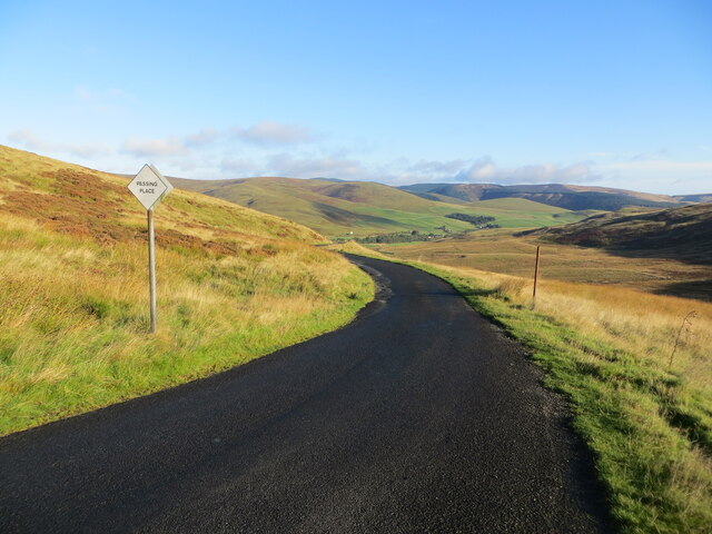
Red Cleuch is a picturesque valley located in Selkirkshire, Scotland. Nestled amidst the rolling hills and lush greenery, it is renowned for its stunning natural beauty and tranquil ambiance. The valley stretches for several miles, offering a peaceful retreat for nature enthusiasts and visitors seeking to escape the hustle and bustle of city life.

With its idyllic setting, Red Cleuch is a haven for outdoor activities. The valley is traversed by a meandering river, which provides opportunities for fishing and boating. The surrounding hills and forests are perfect for hiking, cycling, and wildlife spotting. Visitors can explore the numerous walking trails that wind through the valley, offering breathtaking views of the surrounding landscape.

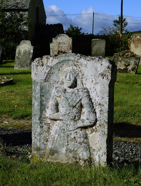
Red Cleuch is also steeped in history and culture. The area is dotted with ancient ruins and historical sites, including remnants of old settlements and fortifications. The valley has witnessed the passage of time, with traces of its rich past still visible today.

For those seeking tranquility and relaxation, Red Cleuch offers a peaceful atmosphere. The valley is known for its serene and unspoiled environment, making it an ideal destination for nature lovers and those seeking a break from the chaos of everyday life.

In conclusion, Red Cleuch is a stunning valley in Selkirkshire, Scotland, offering visitors a chance to immerse themselves in nature and experience the serenity of rural life. With its beautiful landscapes, outdoor activities, and rich history, it is a must-visit destination for those seeking a peaceful retreat amidst the Scottish countryside.

If you have any feedback on the listing, please let us know in the comments section below.

Red Cleuch Images

Images are sourced within 2km of 55.525882/-3.0077682 or Grid Reference NT3626. Thanks to Geograph Open Source API. All images are credited.

Track and path beside Yarrow Water at Yarrow Bridge Looking south-westward.
Track and path beside Yarrow Water at Yarrow Bridge
Looking south-westward.
Minor road descending to Yarrow Bridge Looking north-westward with an early morning sun casting a long shadow.
Minor road descending to Yarrow Bridge
Looking north-westward with an early morning sun casting a long shadow.
Minor road at Witchie Knowe Looking northward.
Minor road at Witchie Knowe
Looking northward.
Wallside track descending from Tower Hill at Witchie Knowe Looking westward.
Wallside track descending from Tower Hill at Witchie Knowe
Looking westward.
A low flying RAF special tail Hercules This shot was taken from Crook Hill as ZH887 flew over Yarrowford on a low flying sortie. The RAF celebrated its 100th birthday on 1st April 2018 and to mark the occasion one of each aircraft type was marked with an RAF 100 tail sticker. Low level enthusiasts considered this to be a cheap option when painted schemes were expected.
A low flying RAF special tail Hercules
This shot was taken from Crook Hill as ZH887 flew over Yarrowford on a low flying sortie. The RAF celebrated its 100th birthday on 1st April 2018 and to mark the occasion one of each aircraft type was marked with an RAF 100 tail sticker. Low level enthusiasts considered this to be a cheap option when painted schemes were expected.
The Glebe Stone in the Yarrow Valley This 1.4m high standing stone is on the site of a former large cairn that covered a quantity of decomposed bones.
The Glebe Stone in the Yarrow Valley
This 1.4m high standing stone is on the site of a former large cairn that covered a quantity of decomposed bones.
A grass track at Witchie Knowe This is a view towards Tower Hill.
A grass track at Witchie Knowe
This is a view towards Tower Hill.
A grazing field at Yarrow This is a view from the A708 towards Yarrow Bridge with Fastheugh Hill in the background.
A grazing field at Yarrow
This is a view from the A708 towards Yarrow Bridge with Fastheugh Hill in the background.
The Glebe Stone This 1.4m high standing stone is on the site of a former large cairn that covered a quantity of decomposed bones. Deuchar Hill is in the background to the left and Fastheugh Hill to the right.
The Glebe Stone
This 1.4m high standing stone is on the site of a former large cairn that covered a quantity of decomposed bones. Deuchar Hill is in the background to the left and Fastheugh Hill to the right.
A fine symbolic stone in Yarrow Kirkyard This carved stone is lying flat, face upwards. It depicts the deceased holding a Bible above a skull and hour-glass, which show death and the passage of time. The carvings are in good condition.
A fine symbolic stone in Yarrow Kirkyard
This carved stone is lying flat, face upwards. It depicts the deceased holding a Bible above a skull and hour-glass, which show death and the passage of time. The carvings are in good condition.
Part of a symbolic stone in Yarrow Kirkyard The sunken stone conceals the lower part of the symbolic carving. The whole portrayal is shown on another stone <a href="https://www.geograph.org.uk/photo/7268379">NT3527 : A fine symbolic stone in Yarrow Kirkyard</a> behind the kirk building.
Part of a symbolic stone in Yarrow Kirkyard
The sunken stone conceals the lower part of the symbolic carving. The whole portrayal is shown on another stone NT3527 : A fine symbolic stone in Yarrow Kirkyard behind the kirk building.
In Yarrow Kirkyard Yarrow Kirkyard contains some interesting old symbolic stones. The one on the left shows a winged soul, portraying life after death, above a skull and crossed bones, portraying man's mortalilty. The one on the right shows a portrait of the deceased. Both stones have sunk into the ground. See also <a href="https://www.geograph.org.uk/photo/7268382">NT3527 : Part of a symbolic stone in Yarrow Kirkyard</a> and <a href="https://www.geograph.org.uk/photo/7268379">NT3527 : A fine symbolic stone in Yarrow Kirkyard</a>
In Yarrow Kirkyard
Yarrow Kirkyard contains some interesting old symbolic stones. The one on the left shows a winged soul, portraying life after death, above a skull and crossed bones, portraying man's mortalilty. The one on the right shows a portrait of the deceased. Both stones have sunk into the ground. See also NT3527 : Part of a symbolic stone in Yarrow Kirkyard and NT3527 : A fine symbolic stone in Yarrow Kirkyard
Yarrow Kirkyard gravestone This old carved stone shows a full portrait of the deceased. It's not possible to read the details on the other side but the carving is typical of 18th century Scotland.
Yarrow Kirkyard gravestone
This old carved stone shows a full portrait of the deceased. It's not possible to read the details on the other side but the carving is typical of 18th century Scotland.
Yarrow Kirk This wee kirk in Ettrick & Yarrow Parish hosts monthly Sunday services. The graveyard contains some interesting old carved stones.
Yarrow Kirk
This wee kirk in Ettrick & Yarrow Parish hosts monthly Sunday services. The graveyard contains some interesting old carved stones.
Yarrow view Viewed looking towards Deuchar Hill. The local war memorial is shown on the right among the trees.
Yarrow view
Viewed looking towards Deuchar Hill. The local war memorial is shown on the right among the trees.
Yarrow Valley view An upstream view taken after a long spell of dry summer weather.
Yarrow Valley view
An upstream view taken after a long spell of dry summer weather.
Track near Deuchar Looking towards Welldean Hill.
Track near Deuchar
Looking towards Welldean Hill.
A headstone detail at Yarrow Parish Kirkyard Lichen has obscured most of the inscription on this old headstone. For a view of the kirk and kirkyard, see <a href="https://www.geograph.org.uk/photo/7268391">NT3527 : Yarrow Kirk</a>.
A headstone detail at Yarrow Parish Kirkyard
Lichen has obscured most of the inscription on this old headstone. For a view of the kirk and kirkyard, see NT3527 : Yarrow Kirk.
Show me another place!

Red Cleuch is located at Grid Ref: NT3626 (Lat: 55.525882, Lng: -3.0077682)

Unitary Authority: The Scottish Borders

Police Authority: The Lothians and Scottish Borders

What 3 Words

///materials.freezing.scoring. Near Innerleithen, Scottish Borders

Nearby Locations

Red Cleuch Wester Kershope

Related Wikis

Yarrow, Scottish Borders

Yarrow is a place and parish in the Scottish Borders area of Scotland and in the former county of Selkirkshire.The name "Yarrow" may derive from the Celtic...

Kirkhope Tower

Kirkhope Tower is a Scottish Pele, located in the Ettrick Valley, in the historic county of Selkirkshire, now a division of the Scottish Borders. The tower...

Selkirkshire

Selkirkshire or the County of Selkirk (Scottish Gaelic: Siorrachd Shalcraig) is a historic county and registration county of Scotland. It borders Peeblesshire...

Ettrickbridge

Ettrickbridge (Scottish Gaelic: Drochaid Eadaraig) is a village situated in the Scottish Borders region of Scotland, 7 miles (11 km) from the nearby town...

Have you been to Red Cleuch?

Leave your review of Red Cleuch below (or comments, questions and feedback).