Birkie Cleuch

Valley in Peeblesshire

Scotland

Birkie Cleuch

Shaw Hill, Traquair The Southern Upland Way crosses the east side of the hill with Dean Plantation on its summit.
Shaw Hill, Traquair Credit: Jim Barton

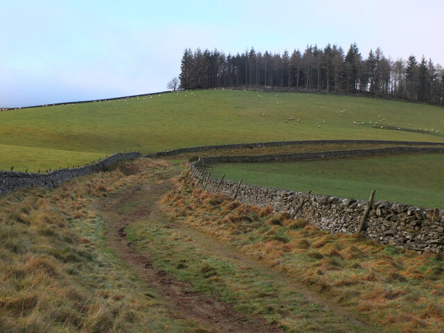
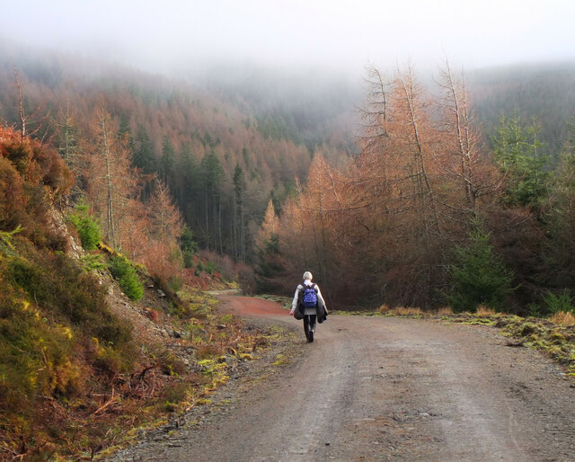
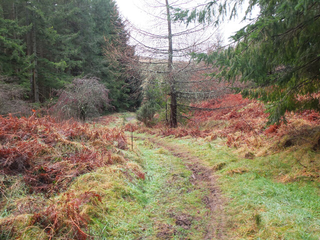
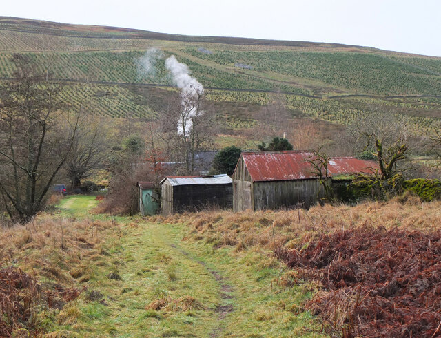
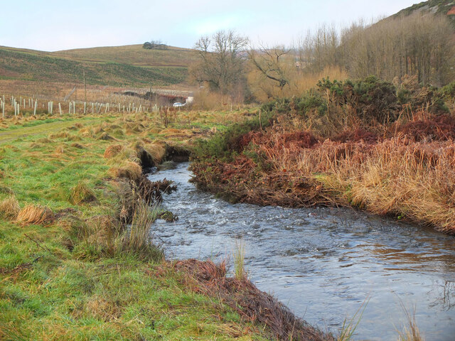
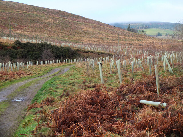
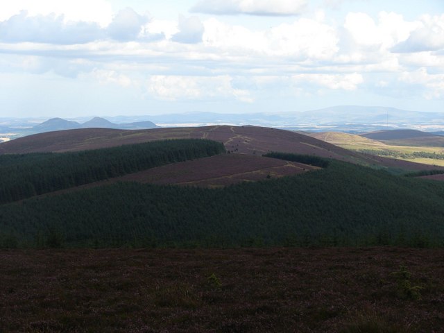
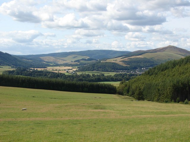
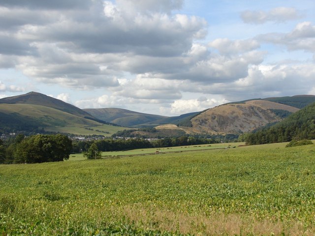
Birkie Cleuch is a picturesque valley located in Peeblesshire, Scotland. Nestled amidst the stunning Scottish Borders, this valley is renowned for its natural beauty and tranquil atmosphere. Birkie Cleuch stretches for approximately 3 miles, encompassing rolling hills, dense forests, and a meandering stream that flows through its heart.

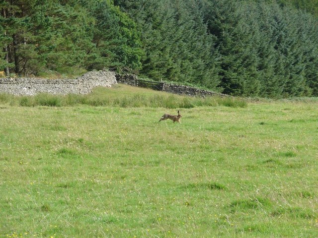
The valley is home to an abundance of wildlife, including red deer, otters, and various bird species, making it a popular spot for nature enthusiasts and birdwatchers. The diverse and rich ecosystem found in Birkie Cleuch is a testament to the area's unspoiled and pristine environment.

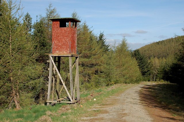
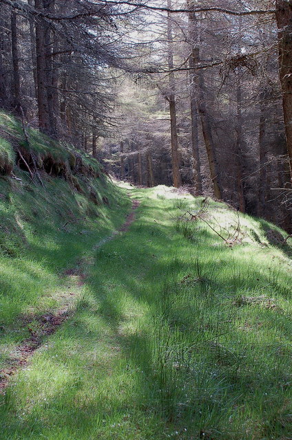
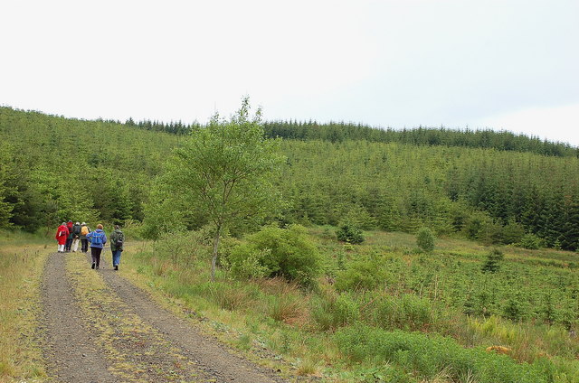
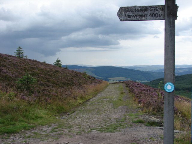
Visitors to Birkie Cleuch can explore its enchanting surroundings by following the walking trails that wind through the valley. These trails offer breathtaking views of the surrounding countryside, providing ample opportunities for hikers and nature lovers to immerse themselves in the serenity of the area.

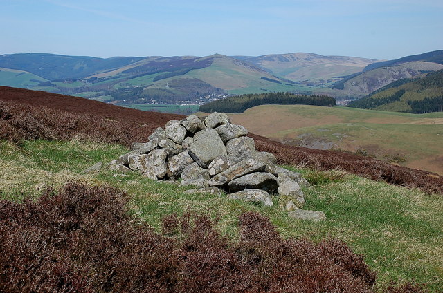
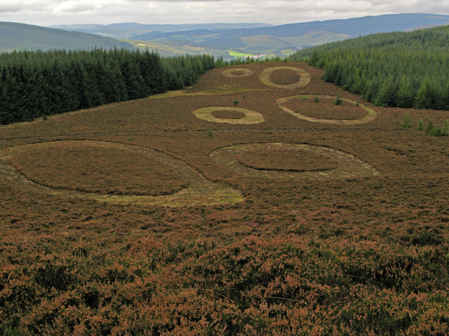
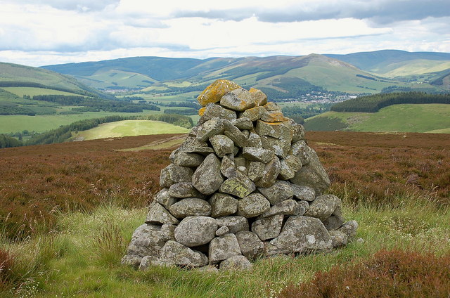
In addition to its natural wonders, Birkie Cleuch also holds historical significance. The remnants of ancient settlements and structures can be found scattered throughout the valley, offering glimpses into the region's past. Numerous archaeological sites, such as standing stones and burial mounds, provide insights into the early inhabitants of the area.

Birkie Cleuch, with its idyllic landscapes and rich history, offers a peaceful retreat for those seeking a break from the bustling city life. Whether it's a leisurely walk, wildlife spotting, or an exploration of ancient ruins, Birkie Cleuch promises an unforgettable experience in the heart of Scotland's natural splendor.

If you have any feedback on the listing, please let us know in the comments section below.

Birkie Cleuch Images

Images are sourced within 2km of 55.587055/-3.03288 or Grid Reference NT3433. Thanks to Geograph Open Source API. All images are credited.

Shaw Hill, Traquair The Southern Upland Way crosses the east side of the hill with Dean Plantation on its summit.
Shaw Hill, Traquair
The Southern Upland Way crosses the east side of the hill with Dean Plantation on its summit.
Forest road below Minch Moor A road contouring the western side of Elibank and Traquair Forest.
Forest road below Minch Moor
A road contouring the western side of Elibank and Traquair Forest.
Path to Camp Shiel A path, wet in places, connecting the forest road contouring Minch Moor with the track in the valley of the Fingland Burn.
Path to Camp Shiel
A path, wet in places, connecting the forest road contouring Minch Moor with the track in the valley of the Fingland Burn.
Cottage and outbuildings, Camp Shiel Compare with <a href="https://www.geograph.org.uk/photo/3590274">NT3432 : Path near Camp Shiel</a> taken in 2013 before the slope opposite was planted for forestry.
Cottage and outbuildings, Camp Shiel
Compare with NT3432 : Path near Camp Shiel taken in 2013 before the slope opposite was planted for forestry.
The Fingland Burn The burn drains the valley between Damhead Rig and west side of Minch Moor.
The Fingland Burn
The burn drains the valley between Damhead Rig and west side of Minch Moor.
New tree plantations, Damhead Coniferous and mixed woodlands have been planted over an area of nearly 300 hectares for Traquair House Charitable Trust - see the website <span class="nowrap"><a title="https://www.forestdirectltd.co.uk/project/damhead-traquair-estate/" rel="nofollow ugc noopener" href="https://www.forestdirectltd.co.uk/project/damhead-traquair-estate/">Link</a><img style="margin-left:2px;" alt="External link" title="External link - shift click to open in new window" src="https://s1.geograph.org.uk/img/external.png" width="10" height="10"/></span> for more details.
New tree plantations, Damhead
Coniferous and mixed woodlands have been planted over an area of nearly 300 hectares for Traquair House Charitable Trust - see the website LinkExternal link for more details.
Shooting platform, White Rig A hide for culling deer that browse on the young trees in the plantations.
Shooting platform, White Rig
A hide for culling deer that browse on the young trees in the plantations.
Sunlit forest, Scarf Rig On the signposted path from the forest road up to Black Rig.
Sunlit forest, Scarf Rig
On the signposted path from the forest road up to Black Rig.
Cairn on Damhead Rig Not shown on the 1:25,000 map; Innerleithen is in the valley with Lee Pen in the centre.
Cairn on Damhead Rig
Not shown on the 1:25,000 map; Innerleithen is in the valley with Lee Pen in the centre.
Walkers near the Plora Burn There are forest plantations in several stages of growth, and the mature trees are being logged.
Walkers near the Plora Burn
There are forest plantations in several stages of growth, and the mature trees are being logged.
Minch Moor Bothy The Minch Moor Bothy stands exactly beside the Southern Upland Way, west of Pipers Knowe and on the way to (or from) the 'Marilyn' of Minch Moor.
Minch Moor Bothy
The Minch Moor Bothy stands exactly beside the Southern Upland Way, west of Pipers Knowe and on the way to (or from) the 'Marilyn' of Minch Moor.
Heather moor with sculpture Approaching the summit of Minch Moor from the west by the Southern Upland Way one comes upon a series of mown, near circular shapes in the heather north of the path. Those who spend time on heather moors managed for grouse might see nothing unusual at first sight but the shapes are unusually precise in their cutting. Soon the truth is revealed; a notice informs that these shapes are part of a sculpture named 'Point of Resolution', by Charles Pouson, assisted by Sam Wade.
Heather moor with sculpture
Approaching the summit of Minch Moor from the west by the Southern Upland Way one comes upon a series of mown, near circular shapes in the heather north of the path. Those who spend time on heather moors managed for grouse might see nothing unusual at first sight but the shapes are unusually precise in their cutting. Soon the truth is revealed; a notice informs that these shapes are part of a sculpture named 'Point of Resolution', by Charles Pouson, assisted by Sam Wade.
View along the path back to the Cheese Well Looking back from the signpost for Minch Moor along the pathway towards the Cheese Well and Traquair.
View along the path back to the Cheese Well
Looking back from the signpost for Minch Moor along the pathway towards the Cheese Well and Traquair.
View from the top of Minch Moor Looking to the east side towards the Tweed valley, with The Cheviot in the far background on the right, as well as the Eildon Hills to the left.
View from the top of Minch Moor
Looking to the east side towards the Tweed valley, with The Cheviot in the far background on the right, as well as the Eildon Hills to the left.
View towards the River Tweed near Innerleithen A pleasant view of the River Tweed and surrounding farmland at the start of August.
View towards the River Tweed near Innerleithen
A pleasant view of the River Tweed and surrounding farmland at the start of August.
View towards Innerleithen Looking across from the S.U.W. pathway towards Pirn Craig, with Lee Pen on the far left.
View towards Innerleithen
Looking across from the S.U.W. pathway towards Pirn Craig, with Lee Pen on the far left.
A brown hare A brown hare on the move across the field next to the pathway.
A brown hare
A brown hare on the move across the field next to the pathway.
Cairn on Damhead Rig (2) A cairn on the crest of the ridge line, not shown on the 1:25,000 map.
Cairn on Damhead Rig (2)
A cairn on the crest of the ridge line, not shown on the 1:25,000 map.
Show me another place!

Birkie Cleuch is located at Grid Ref: NT3433 (Lat: 55.587055, Lng: -3.03288)

Unitary Authority: The Scottish Borders

Police Authority: The Lothians and Scottish Borders

What 3 Words

///silence.increases.harmless. Near Innerleithen, Scottish Borders

Nearby Locations

Stell Cleuch Birkie Cleuch

Related Wikis

Traquair

Traquair (Scottish Gaelic: Cille Bhrìghde) is a small village and civil parish in the Scottish Borders; until 1975 it was in the county of Peeblesshire...

Sir Walter Scott Way

The Sir Walter Scott Way is a 92-mile (148 km) long-distance footpath in the Scottish Borders. The route broadly follows the waymarked Southern Upland...

Quair Water

The Quair Water is a tributary of the River Tweed in the Scottish Borders area of Scotland. Its name is related to Traquair. == Etymology == The name Quair...

Traquair House

Traquair House, approximately 7 miles southeast of Peebles, is claimed to be the oldest continually inhabited house in Scotland. Whilst not strictly a...

Nearby Amenities

Located within 500m of 55.587055,-3.03288
Archman's Bog
Place: locality
Lat/Long: 55.5913855/-3.03346
The data included in this document is from www.openstreetmap.org. The data is made available under ODbL.

Have you been to Birkie Cleuch?

Leave your review of Birkie Cleuch below (or comments, questions and feedback).