Stell Cleuch

Valley in Peeblesshire

Scotland

Stell Cleuch

Shooting platform, White Rig A hide for culling deer that browse on the young trees in the plantations.
Shooting platform, White Rig Credit: Jim Barton

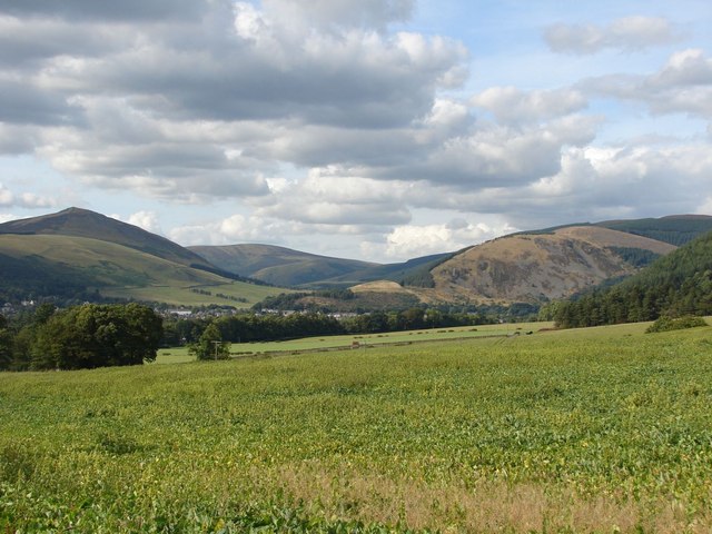
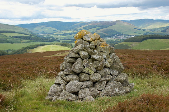
Stell Cleuch is a picturesque valley located in Peeblesshire, a historic county in the southern region of Scotland. Nestled in the rolling hills of the Scottish Borders, the valley stretches for approximately 3 miles and is renowned for its natural beauty and tranquil atmosphere.

Surrounded by lush greenery and dotted with charming countryside cottages, Stell Cleuch offers a serene escape from the hustle and bustle of city life. The valley is characterized by its meandering river, aptly named Stell Burn, which flows through the heart of the landscape, adding to its idyllic charm.

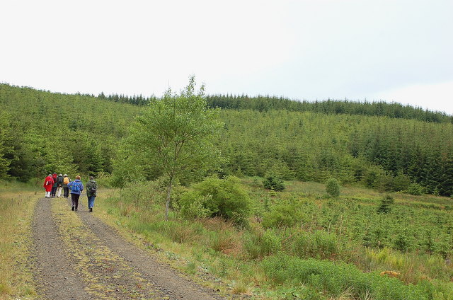
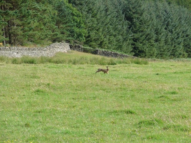
The valley is a haven for outdoor enthusiasts and nature lovers, offering a range of activities to enjoy. Visitors can embark on scenic hikes along the valley's trails, taking in breathtaking views of the surrounding hills and countryside. The river is also popular for fishing, with anglers coming to try their luck at catching trout or salmon.

Stell Cleuch is also rich in history, with several archaeological sites of interest. The remains of a medieval tower can be found in the valley, providing a glimpse into the area's past. Additionally, the valley has a strong agricultural heritage, with farming playing a significant role in the local economy.

Overall, Stell Cleuch is a hidden gem in Peeblesshire, offering a perfect blend of natural beauty, outdoor activities, and historical significance. Whether it's a leisurely stroll along the riverbanks or a challenging hike up the hills, visitors to Stell Cleuch are sure to be captivated by its untouched beauty and peaceful ambiance.

If you have any feedback on the listing, please let us know in the comments section below.
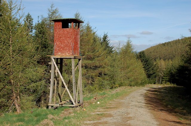
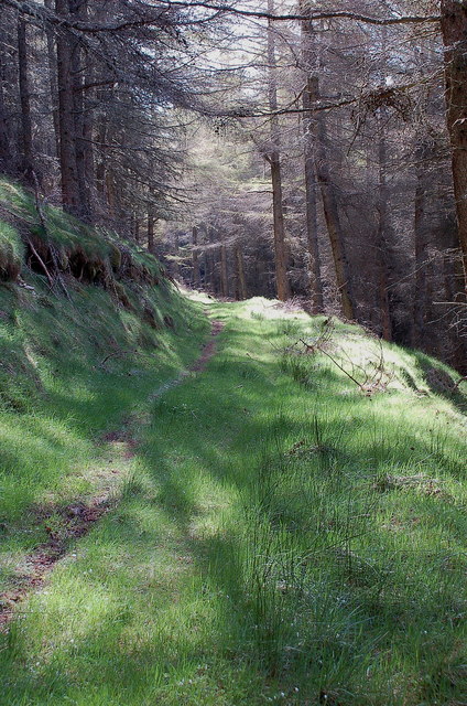
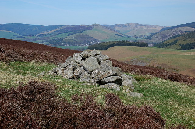
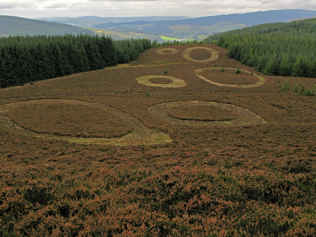
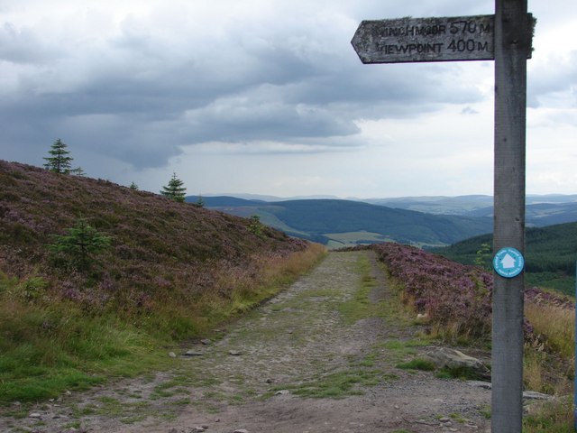
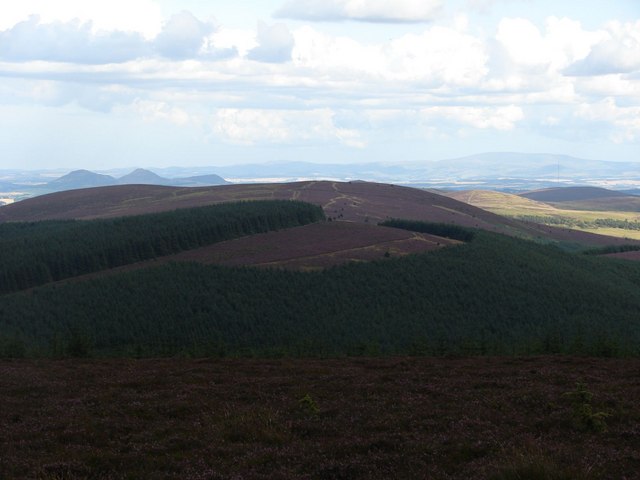
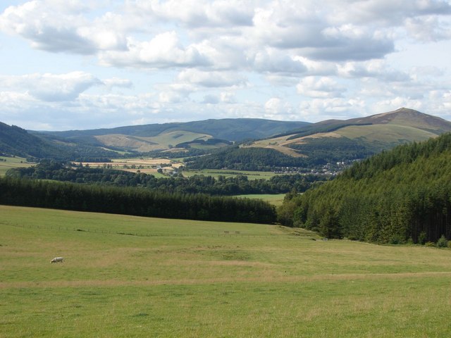
Stell Cleuch Images

Images are sourced within 2km of 55.586932/-3.0378586 or Grid Reference NT3433. Thanks to Geograph Open Source API. All images are credited.

Shooting platform, White Rig A hide for culling deer that browse on the young trees in the plantations.
Shooting platform, White Rig
A hide for culling deer that browse on the young trees in the plantations.
Sunlit forest, Scarf Rig On the signposted path from the forest road up to Black Rig.
Sunlit forest, Scarf Rig
On the signposted path from the forest road up to Black Rig.
Cairn on Damhead Rig Not shown on the 1:25,000 map; Innerleithen is in the valley with Lee Pen in the centre.
Cairn on Damhead Rig
Not shown on the 1:25,000 map; Innerleithen is in the valley with Lee Pen in the centre.
Walkers near the Plora Burn There are forest plantations in several stages of growth, and the mature trees are being logged.
Walkers near the Plora Burn
There are forest plantations in several stages of growth, and the mature trees are being logged.
Minch Moor Bothy The Minch Moor Bothy stands exactly beside the Southern Upland Way, west of Pipers Knowe and on the way to (or from) the 'Marilyn' of Minch Moor.
Minch Moor Bothy
The Minch Moor Bothy stands exactly beside the Southern Upland Way, west of Pipers Knowe and on the way to (or from) the 'Marilyn' of Minch Moor.
Heather moor with sculpture Approaching the summit of Minch Moor from the west by the Southern Upland Way one comes upon a series of mown, near circular shapes in the heather north of the path. Those who spend time on heather moors managed for grouse might see nothing unusual at first sight but the shapes are unusually precise in their cutting. Soon the truth is revealed; a notice informs that these shapes are part of a sculpture named 'Point of Resolution', by Charles Pouson, assisted by Sam Wade.
Heather moor with sculpture
Approaching the summit of Minch Moor from the west by the Southern Upland Way one comes upon a series of mown, near circular shapes in the heather north of the path. Those who spend time on heather moors managed for grouse might see nothing unusual at first sight but the shapes are unusually precise in their cutting. Soon the truth is revealed; a notice informs that these shapes are part of a sculpture named 'Point of Resolution', by Charles Pouson, assisted by Sam Wade.
View along the path back to the Cheese Well Looking back from the signpost for Minch Moor along the pathway towards the Cheese Well and Traquair.
View along the path back to the Cheese Well
Looking back from the signpost for Minch Moor along the pathway towards the Cheese Well and Traquair.
View from the top of Minch Moor Looking to the east side towards the Tweed valley, with The Cheviot in the far background on the right, as well as the Eildon Hills to the left.
View from the top of Minch Moor
Looking to the east side towards the Tweed valley, with The Cheviot in the far background on the right, as well as the Eildon Hills to the left.
View towards the River Tweed near Innerleithen A pleasant view of the River Tweed and surrounding farmland at the start of August.
View towards the River Tweed near Innerleithen
A pleasant view of the River Tweed and surrounding farmland at the start of August.
View towards Innerleithen Looking across from the S.U.W. pathway towards Pirn Craig, with Lee Pen on the far left.
View towards Innerleithen
Looking across from the S.U.W. pathway towards Pirn Craig, with Lee Pen on the far left.
A brown hare A brown hare on the move across the field next to the pathway.
A brown hare
A brown hare on the move across the field next to the pathway.
Cairn on Damhead Rig (2) A cairn on the crest of the ridge line, not shown on the 1:25,000 map.
Cairn on Damhead Rig (2)
A cairn on the crest of the ridge line, not shown on the 1:25,000 map.
Memorial cairn for Learmont Drysdale The plaque reads:

Learmont Drysdale
composer
1866 – 1909

For a short biography of Drysdale see <span class="nowrap"><a title="http://scottishcomposers.wordpress.com/2010/08/21/learmont-drysdale/" rel="nofollow ugc noopener" href="http://scottishcomposers.wordpress.com/2010/08/21/learmont-drysdale/">Link</a><img style="margin-left:2px;" alt="External link" title="External link - shift click to open in new window" src="https://s1.geograph.org.uk/img/external.png" width="10" height="10"/></span>

A plastic box, just visible at the base of the cairn, contains a Visitors’ Book. It explains that the cairn was dedicated in a ceremony held on 1st September 1937, attended by about 60 people. The plaque was unveiled by Sir Dan Godfrey, conductor of Bournemouth Municipal Orchestra. Also attending was the composer’s sister Janey Drysdale, who lived at the nearby cottage of the Hennel. She died in 1949, aged 87, following a fire at the cottage, which is now a roofless ruin.

The cairn was restored in the summer of 2008 by several people from Innerleithen, and the Visitors’ Book begun on 1st January 2009. Walter Baxter’s picture <a href="https://www.geograph.org.uk/photo/226952">NT3331 : Memorial Cairn on heather moorland near Hannel Bog</a> shows the cairn in 2006 before it was rebuilt.
Memorial cairn for Learmont Drysdale
The plaque reads: Learmont Drysdale composer 1866 – 1909 For a short biography of Drysdale see LinkExternal link A plastic box, just visible at the base of the cairn, contains a Visitors’ Book. It explains that the cairn was dedicated in a ceremony held on 1st September 1937, attended by about 60 people. The plaque was unveiled by Sir Dan Godfrey, conductor of Bournemouth Municipal Orchestra. Also attending was the composer’s sister Janey Drysdale, who lived at the nearby cottage of the Hennel. She died in 1949, aged 87, following a fire at the cottage, which is now a roofless ruin. The cairn was restored in the summer of 2008 by several people from Innerleithen, and the Visitors’ Book begun on 1st January 2009. Walter Baxter’s picture NT3331 : Memorial Cairn on heather moorland near Hannel Bog shows the cairn in 2006 before it was rebuilt.
Minch Moor
Minch Moor
Forest track above the Plora Burn A view down to the Tweed valley and Cairn Hill above Walkerburn. The track continues to contour a long way around, almost encircling the whole Minchmoor Forest.
Forest track above the Plora Burn
A view down to the Tweed valley and Cairn Hill above Walkerburn. The track continues to contour a long way around, almost encircling the whole Minchmoor Forest.
Timber stacks above Plora Burn Logging is in progress in this part of Traquair Forest, though not today (Saturday), otherwise access would have been restricted. Note the pattern of marks on the logs in the foreground made by the harvesting machine.
Timber stacks above Plora Burn
Logging is in progress in this part of Traquair Forest, though not today (Saturday), otherwise access would have been restricted. Note the pattern of marks on the logs in the foreground made by the harvesting machine.
Forest forwarder A specialised all-terrain vehicle for loading and hauling out logs cut by a harvester machine - see <a href="https://www.geograph.org.uk/photo/2718955">NT3535 : Forest harvester</a>. The hydraulic grab loads the logs onto the trailer, the load is brought out to the forest roadside and neatly stacked ready for the timber lorries.
Forest forwarder
A specialised all-terrain vehicle for loading and hauling out logs cut by a harvester machine - see NT3535 : Forest harvester. The hydraulic grab loads the logs onto the trailer, the load is brought out to the forest roadside and neatly stacked ready for the timber lorries.
Forest forwarder (2) A front view of a forwarder, not in use as the contractors were not working on Saturday. Calculated to bring out the latent small boy in ageing Geographers itching to have a go at the controls.
Forest forwarder (2)
A front view of a forwarder, not in use as the contractors were not working on Saturday. Calculated to bring out the latent small boy in ageing Geographers itching to have a go at the controls.
Show me another place!

Stell Cleuch is located at Grid Ref: NT3433 (Lat: 55.586932, Lng: -3.0378586)

Unitary Authority: The Scottish Borders

Police Authority: The Lothians and Scottish Borders

What 3 Words

///noisy.carry.undercuts. Near Innerleithen, Scottish Borders

Nearby Locations

Birkie Cleuch Stell Cleuch

Related Wikis

Traquair

Traquair (Scottish Gaelic: Cille Bhrìghde) is a small village and civil parish in the Scottish Borders; until 1975 it was in the county of Peeblesshire...

Sir Walter Scott Way

The Sir Walter Scott Way is a 92-mile (148 km) long-distance footpath in the Scottish Borders. The route broadly follows the waymarked Southern Upland...

Quair Water

The Quair Water is a tributary of the River Tweed in the Scottish Borders area of Scotland. Its name is related to Traquair. == Etymology == The name Quair...

Traquair House

Traquair House, approximately 7 miles southeast of Peebles, is claimed to be the oldest continually inhabited house in Scotland. Whilst not strictly a...

Have you been to Stell Cleuch?

Leave your review of Stell Cleuch below (or comments, questions and feedback).