Glen Prosen

Valley in Angus

Scotland

Glen Prosen

Minor road, Glen Prosen A minor road descending a wooded hillside towards the Prosen Water in Angus.
Minor road, Glen Prosen Credit: William Starkey

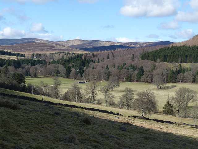
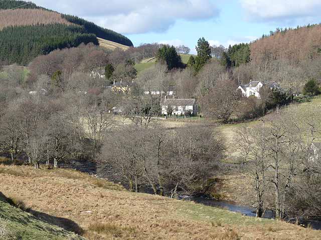
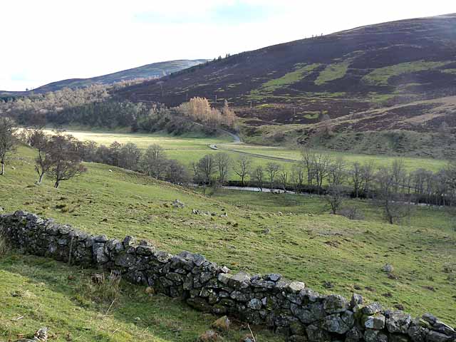
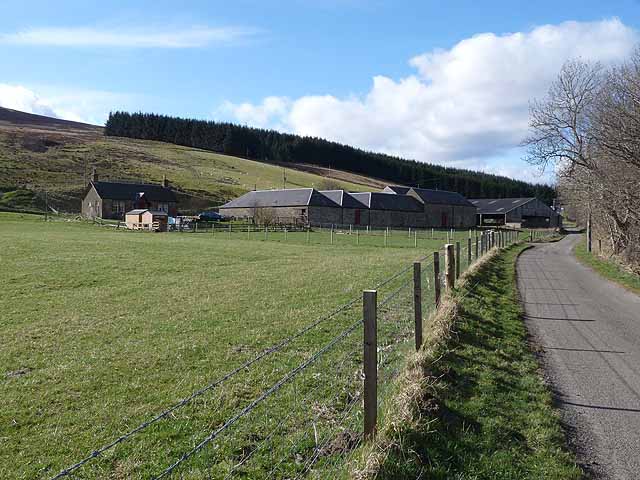
Glen Prosen is a picturesque valley located in the county of Angus, Scotland. Nestled within the stunning landscapes of the Cairngorms National Park, it offers visitors a tranquil and unspoiled natural environment to explore.

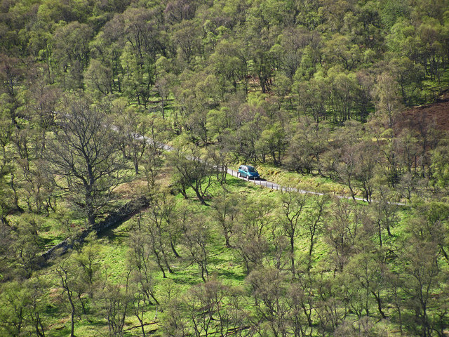
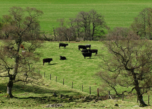
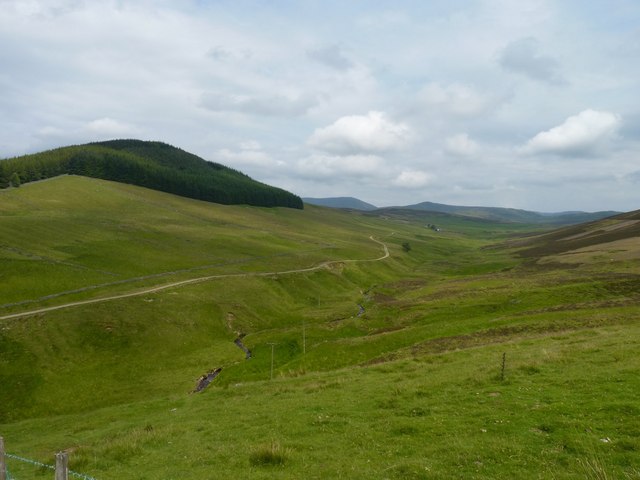
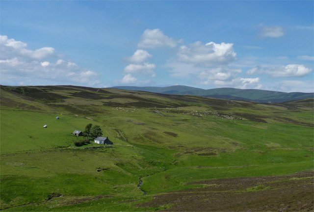
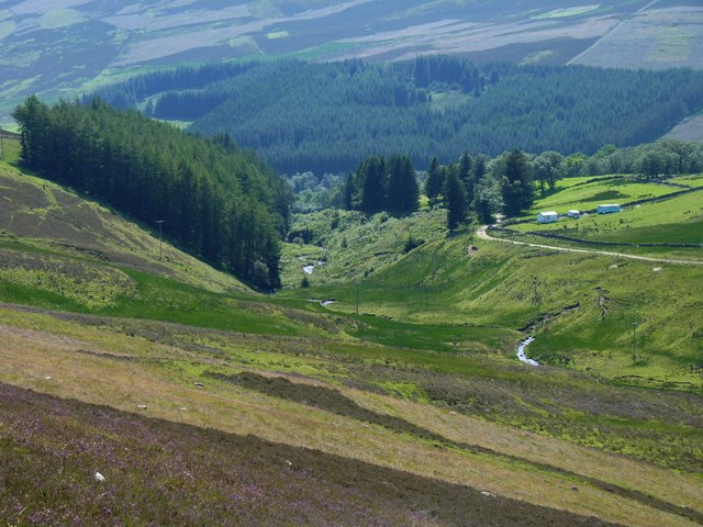
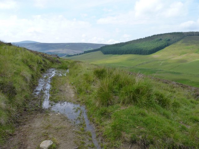
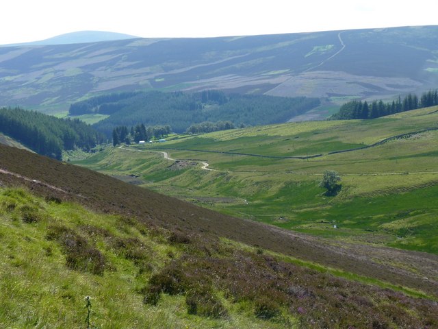
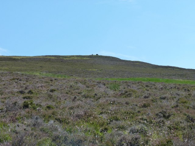
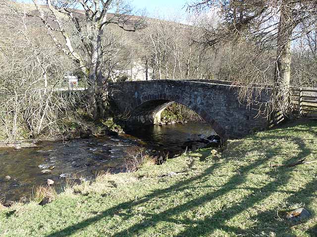
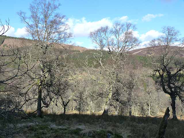
The valley is characterized by its rolling hills, dense forests, and meandering river, which flows through the heart of the glen. The landscape is a mix of open moorland, heather-covered hills, and scattered woodlands, providing a diverse habitat for a variety of wildlife.

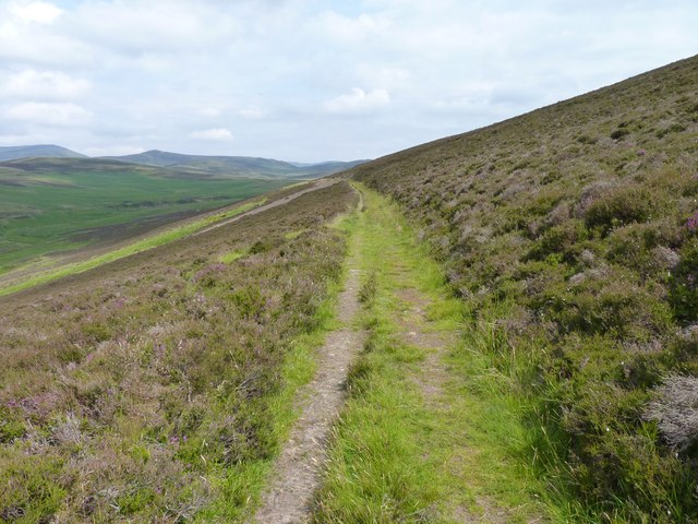
Glen Prosen is a popular destination for outdoor enthusiasts, offering numerous opportunities for hiking, cycling, and wildlife spotting. The area is crisscrossed with an extensive network of trails and paths, catering to all levels of fitness and experience. One of the most notable routes is the Glen Prosen Circular Walk, which takes visitors on a 14-mile journey around the valley, showcasing its natural beauty.

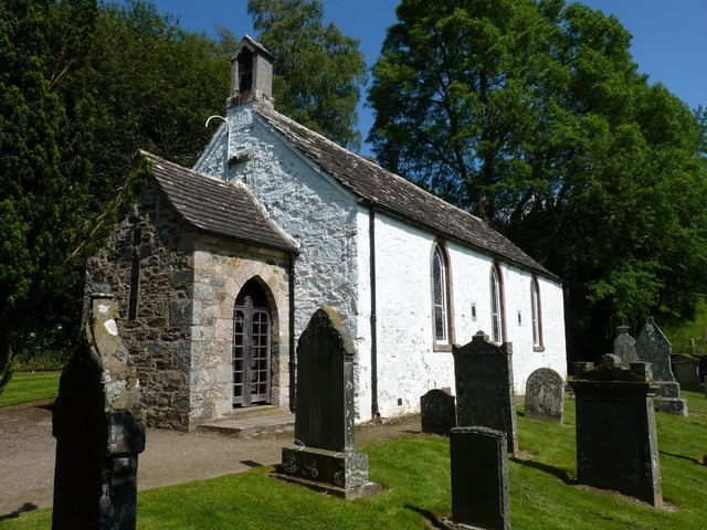
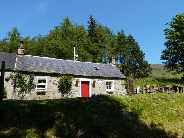
The valley is also home to several historic landmarks, including the picturesque Prosen Water Mill, which dates back to the early 19th century. The mill provides a fascinating glimpse into the area's industrial past and offers guided tours for visitors interested in its history.

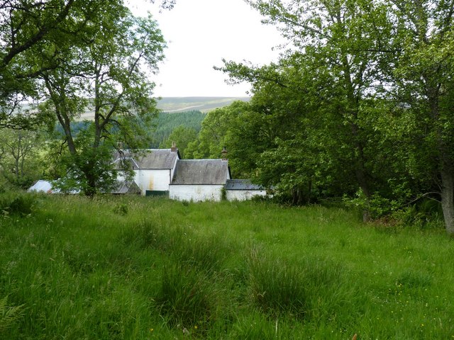
For those seeking a peaceful retreat, Glen Prosen offers a range of accommodation options, including cozy cottages, bed and breakfasts, and campsites. The local community is known for its warm hospitality, and visitors can expect a friendly welcome.

In summary, Glen Prosen is a captivating destination that showcases the natural beauty of Angus. With its stunning landscapes, abundant wildlife, and rich history, it is a must-visit for anyone seeking a tranquil and immersive outdoor experience.

If you have any feedback on the listing, please let us know in the comments section below.

Glen Prosen Images

Images are sourced within 2km of 56.777681/-3.1061505 or Grid Reference NO3265. Thanks to Geograph Open Source API. All images are credited.

Minor road, Glen Prosen A minor road descending a wooded hillside towards the Prosen Water in Angus.
Minor road, Glen Prosen
A minor road descending a wooded hillside towards the Prosen Water in Angus.
Grazing cattle, Glen Prosen.
Unusual war memorial The war memorial in Glen Prosen village takes the form of this Memorial Porch attached to Glen Prosen Kirk. The Cross of Sacrifice on the porch gable was formed by embedding slates into the wall itself. The names of the fallen are recorded on a bronze tablet inside the porch.
Unusual war memorial
The war memorial in Glen Prosen village takes the form of this Memorial Porch attached to Glen Prosen Kirk. The Cross of Sacrifice on the porch gable was formed by embedding slates into the wall itself. The names of the fallen are recorded on a bronze tablet inside the porch.
Buildings in Glen Prosen village Seen from the track onown as the Minister's Path that leads across the moor to Glen Clova.
Buildings in Glen Prosen village
Seen from the track onown as the Minister's Path that leads across the moor to Glen Clova.
Pitcarity cottage On the edge of the hamlet of Glen Prosen.
Pitcarity cottage
On the edge of the hamlet of Glen Prosen.
The Burn of Inchmill With the road to Glentairie and the forested Balnaboth Craig in the background.
The Burn of Inchmill
With the road to Glentairie and the forested Balnaboth Craig in the background.
Hill sheep A flock of newly-sheared sheep on the hillside near Glentairie Farm.
Hill sheep
A flock of newly-sheared sheep on the hillside near Glentairie Farm.
Burn of Inchmill glen North on Glen Prosen village.
Burn of Inchmill glen
North on Glen Prosen village.
The minister's path Tradition has it that the minister from Glen Prosen Kirk also preached in the Kirk of Glen Clova and made his way between them along this hill track across the moor. Some say he walked, some that he rode a pony and others that he used a pony and trap. But, unless the track has deteriorated greatly since the minister's day, I very much doubt if he could have negotiated it with a pony and trap.
The minister's path
Tradition has it that the minister from Glen Prosen Kirk also preached in the Kirk of Glen Clova and made his way between them along this hill track across the moor. Some say he walked, some that he rode a pony and others that he used a pony and trap. But, unless the track has deteriorated greatly since the minister's day, I very much doubt if he could have negotiated it with a pony and trap.
The ministers muddy path Tradition has it that the minister from Glen Prosen Kirk also preached in the Kirk of Glen Clova and made his way between them along this hill track across the moor. Some say he walked, some that he rode a pony and others that he used a pony and trap. But, unless the track has deteriorated greatly since the minister's day, I very much doubt if he could have negotiated it with a pony and trap.
The ministers muddy path
Tradition has it that the minister from Glen Prosen Kirk also preached in the Kirk of Glen Clova and made his way between them along this hill track across the moor. Some say he walked, some that he rode a pony and others that he used a pony and trap. But, unless the track has deteriorated greatly since the minister's day, I very much doubt if he could have negotiated it with a pony and trap.
Down into Glentairie Looking south and down into the glen, north of Glen Prosen village.
Down into Glentairie
Looking south and down into the glen, north of Glen Prosen village.
Looking towards Knachly Grouse moor in the foreground.
Looking towards Knachly
Grouse moor in the foreground.
Glen Prosen at Balnaboth Balnaboth is hidden in the trees on the far side of the valley. There are still patches of snow on the mountains at the head of the Glen, even on the south-facing slopes.
Glen Prosen at Balnaboth
Balnaboth is hidden in the trees on the far side of the valley. There are still patches of snow on the mountains at the head of the Glen, even on the south-facing slopes.
Glenprosen village Seen across the river.
Glenprosen village
Seen across the river.
Bridge over the Prosen Water Looking downstream, below Glenprosen village.
Bridge over the Prosen Water
Looking downstream, below Glenprosen village.
Woodland near Dalairn The wooded slopes of Blanaboth Craig can be seen on the far side of the valley.
Woodland near Dalairn
The wooded slopes of Blanaboth Craig can be seen on the far side of the valley.
Glen Prosen below Wester Dalinch A small floodplain occupies the floor of Glen Prosen at this point. The minor road up the western side of the Glen can be seen beyond the river.
Glen Prosen below Wester Dalinch
A small floodplain occupies the floor of Glen Prosen at this point. The minor road up the western side of the Glen can be seen beyond the river.
Wester Dalinch Farm A small floodplain occupies the floor of Glen Prosen at this point.
Wester Dalinch Farm
A small floodplain occupies the floor of Glen Prosen at this point.
Show me another place!

Glen Prosen is located at Grid Ref: NO3265 (Lat: 56.777681, Lng: -3.1061505)

Unitary Authority: Angus

Police Authority: Tayside

What 3 Words

///ruffle.short.confining. Near Kirriemuir, Angus

Nearby Locations

Old Mill Lade Glen Prosen

Related Wikis

Cat Law

Cat Law (671 m) is a hill in the southern Mounth of Scotland, north of Kirriemuir in Angus. A rounded peak, it lies above Strathmore in the south and offers...

Mile Hill, Dykehead

There is another Mile Hill nearby which is a MarilynMile Hill is located in Angus, Scotland, 1000 metres west of Dykehead. It is a circular hill rising...

Clova, Angus

Clova is a village in Glen Clova, Angus, Scotland. It lies on the River South Esk, some 12 miles (19 km) north of Kirriemuir. During the 1745 Jacobite...

Balintore Castle

Balintore Castle is a Victorian Category A listed building in Scotland. The castle occupies an elevated site in moorland above Balintore village, a few...

Nearby Amenities

Located within 500m of 56.777681,-3.1061505
Glenprosen Village (closed)
Naptan AtcoCode: 6490IM487
Naptan Bearing: S
Naptan BusStopType: CUS
Naptan CommonName: Prosen Village
Naptan Indicator: Prosen Village
Naptan Landmark: Prosen Village
Naptan NaptanCode: 26424596
Naptan Street: Glen Prosen
Naptan Verified: no
Source: naptan_import
Lat/Long: 56.7792753/-3.1020107
Telephone
Booth: K6
Covered: booth
Listed Status: Category B
Lat/Long: 56.7793987/-3.1020829
Post Box
Post Box Type: lamp
Lat/Long: 56.779384/-3.1021245
Bench
Lat/Long: 56.7784942/-3.1014432
Information: board
Tourism: information
Lat/Long: 56.7784303/-3.101446
Prosen Village
Alt Name: Glenprosen Village;Prosen
Name Gd: Gleann PrĂ sain
Old Name: Pitcarity
Place: village
Lat/Long: 56.7789767/-3.1013603
Power: pole
Lat/Long: 56.7752403/-3.1003809
Power: pole
Lat/Long: 56.7758504/-3.1010427
Power: pole
Lat/Long: 56.7764286/-3.1017
Power: pole
Lat/Long: 56.7769972/-3.1023509
Power: pole
Lat/Long: 56.7773305/-3.1031925
Power: pole
Lat/Long: 56.7776526/-3.1040621
Power: pole
Lat/Long: 56.7779736/-3.1049018
Power: pole
Lat/Long: 56.7782057/-3.1054318
Power: pole
Lat/Long: 56.7786392/-3.1063872
Power: pole
Lat/Long: 56.7790747/-3.1073482
Power: pole
Lat/Long: 56.7795174/-3.1082962
Power: pole
Lat/Long: 56.7798926/-3.1091285
Power: pole
Lat/Long: 56.7803087/-3.1100429
Power: pole
Lat/Long: 56.7807831/-3.1110095
Power: pole
Lat/Long: 56.7762951/-3.1004882
Power: pole
Lat/Long: 56.7764164/-3.1003361
Power: pole
Lat/Long: 56.7769419/-3.0996944
Power: pole
Lat/Long: 56.7775581/-3.0989387
Power: pole
Lat/Long: 56.7781118/-3.0988716
Power: pole
Lat/Long: 56.7786018/-3.0988247
Power: pole
Lat/Long: 56.7792743/-3.0987531
Power: pole
Lat/Long: 56.775805/-3.0994261
The data included in this document is from www.openstreetmap.org. The data is made available under ODbL.

Have you been to Glen Prosen?

Leave your review of Glen Prosen below (or comments, questions and feedback).