Rameldry Den

Valley in Fife

Scotland

Rameldry Den

Farmland by Greenside, Drummy Wood Looking across much of the square in a north direction towards Rameldry. Much of the square to the South of this position is old woodland.
Farmland by Greenside, Drummy Wood Credit: Jim Bain

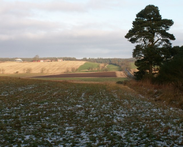
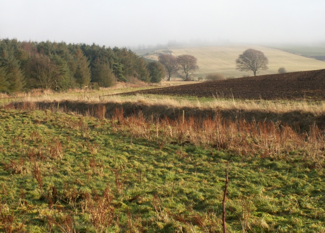
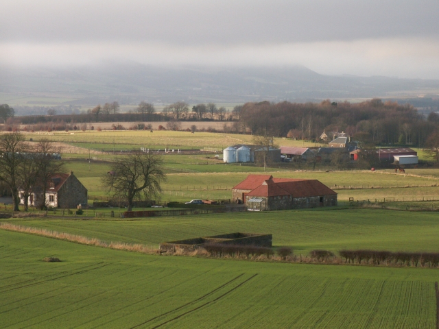
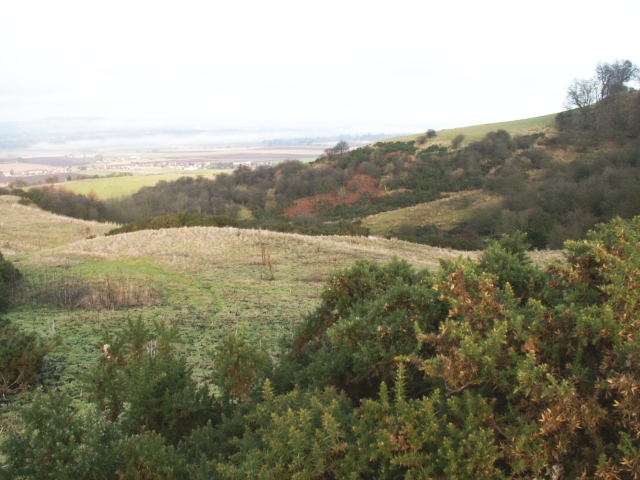
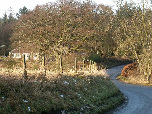
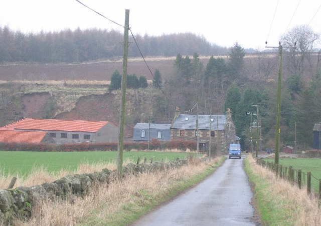
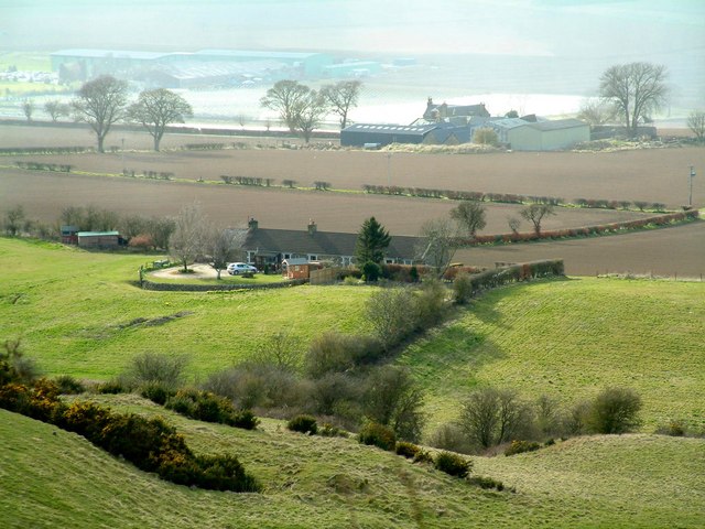
Rameldry Den is a picturesque valley located in the county of Fife, Scotland. Situated near the small village of Dairsie, this tranquil natural wonderland offers visitors a chance to escape the hustle and bustle of modern life and immerse themselves in the beauty of the Scottish countryside.

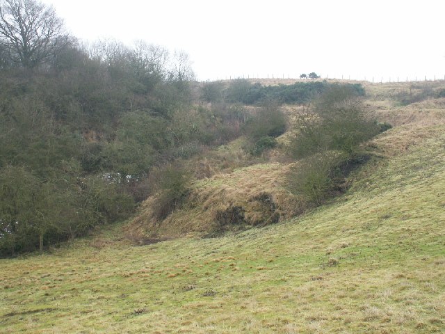
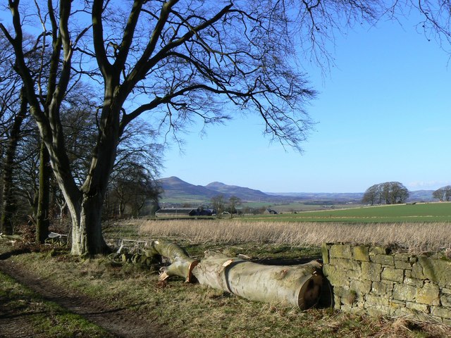
The den, which is a Scottish term for a wooded valley, is nestled between rolling hills and is crisscrossed by a meandering stream, adding to its charm. The area is known for its diverse ecosystem, with a rich variety of plant and animal species calling it home. Ancient trees line the den, providing shade and creating a peaceful ambiance for visitors to enjoy.

Rameldry Den is a popular destination for nature lovers, hikers, and birdwatchers. The network of trails that wind through the valley allows visitors to explore the area at their own pace, offering breathtaking views of the surrounding countryside along the way. The den is also home to several species of birds, including woodpeckers, owls, and various songbirds, making it a haven for birdwatching enthusiasts.

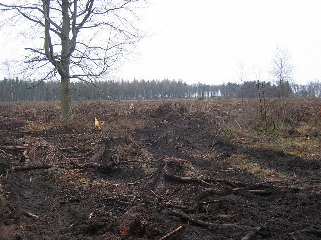
In addition to its natural beauty, Rameldry Den has historical significance as well. The den once housed a thriving mill industry, with several mills operating in the area during the 18th and 19th centuries. Although the mills are no longer in operation, remnants of their existence can still be seen, adding a touch of history to the landscape.

Overall, Rameldry Den is a hidden gem in Fife, offering visitors a chance to connect with nature, explore its trails, and soak in the tranquility of this Scottish valley.

If you have any feedback on the listing, please let us know in the comments section below.

Rameldry Den Images

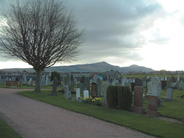
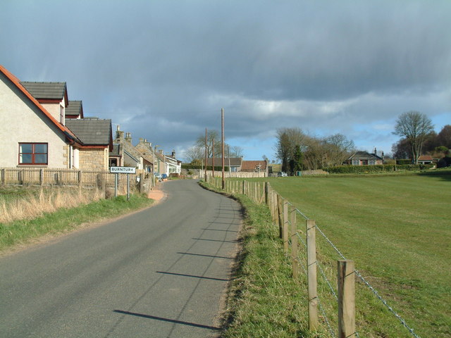
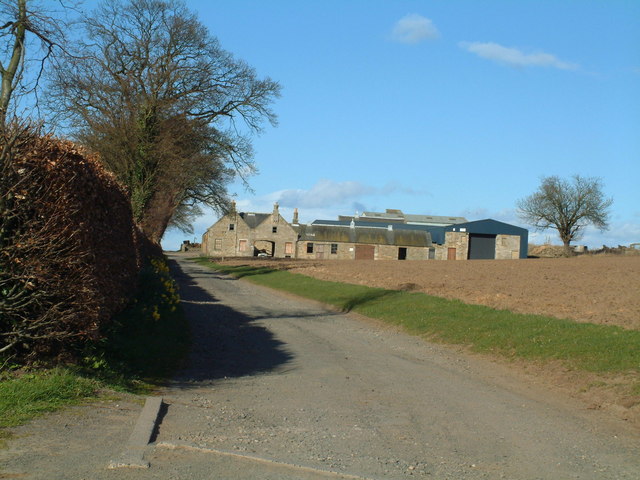
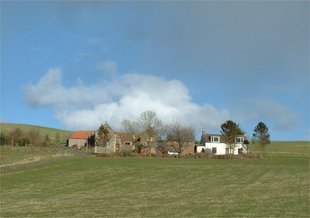
Images are sourced within 2km of 56.248328/-3.090916 or Grid Reference NO3206. Thanks to Geograph Open Source API. All images are credited.

Farmland by Greenside, Drummy Wood Looking across much of the square in a north direction towards Rameldry. Much of the square to the South of this position is old woodland.
Farmland by Greenside, Drummy Wood
Looking across much of the square in a north direction towards Rameldry. Much of the square to the South of this position is old woodland.
By Rameldry Rough grazing, burn, ploughed field and woodland all by Rameldry. Looking East towards the mist covered slopes of Clatto Hill 248mts
By Rameldry
Rough grazing, burn, ploughed field and woodland all by Rameldry. Looking East towards the mist covered slopes of Clatto Hill 248mts
Kettlehill Farm Looking out SW across the square. The mist covered Lomonds in the background.
Kettlehill Farm
Looking out SW across the square. The mist covered Lomonds in the background.
Burnside by Burnturk A steep hillside cut by this small burn. Looking North towards Pitlessie.
Burnside by Burnturk
A steep hillside cut by this small burn. Looking North towards Pitlessie.
Old workings by a burn High up on the burnside these old workings of some sort are grown over. An old road line can be seen above.
Old workings by a burn
High up on the burnside these old workings of some sort are grown over. An old road line can be seen above.
By Middlefield Midway between Rameldry Farm and Middlefield cross roads
By Middlefield
Midway between Rameldry Farm and Middlefield cross roads
Bird scarer, Ballinkirk A simple scarecrow amongst newly sown fields.
Bird scarer, Ballinkirk
A simple scarecrow amongst newly sown fields.
Drummy Wood Ride in this conifer wood which is currently undergoing a lot of clear felling. Looking south.
Drummy Wood
Ride in this conifer wood which is currently undergoing a lot of clear felling. Looking south.
Road in Drummy Wood. Looking north along a country land in Drummy  and Milldeans Wood.
Road in Drummy Wood.
Looking north along a country land in Drummy and Milldeans Wood.
Clearfell , Dykehead Wood. Part of the Drummy Wood forest block, now almost completely felled.
A view from 2009 can be seen here: <a href="https://www.geograph.org.uk/photo/1439915">NO3105 : Dykehead Wood</a>
Clearfell , Dykehead Wood.
Part of the Drummy Wood forest block, now almost completely felled. A view from 2009 can be seen here: NO3105 : Dykehead Wood
Rameldry Mill View NE along a minor road. Note the landslips on the bank.
Rameldry Mill
View NE along a minor road. Note the landslips on the bank.
Kingskettle Cemetery The Lomond Hills form the background skyline
Kingskettle Cemetery
The Lomond Hills form the background skyline
Coaltown of Burnturk There are many Fife villages known as 'Coaltown' of this or that. They were originally mining villages, but none of the pits or mines now remain active.
Coaltown of Burnturk
There are many Fife villages known as 'Coaltown' of this or that. They were originally mining villages, but none of the pits or mines now remain active.
Burnturk Farm From the corner of the farm road
Burnturk Farm
From the corner of the farm road
Fronthill Farm Situated a little up Cults Hill from Burnturk
Fronthill Farm
Situated a little up Cults Hill from Burnturk
Burnturk Cottages Situated behind (south-east of) Burnturk Farm, seen in the background
Burnturk Cottages
Situated behind (south-east of) Burnturk Farm, seen in the background
Telecom masts Erected on top of a 242 m hill near Downfield Farm.
Telecom masts
Erected on top of a 242 m hill near Downfield Farm.
Timber A felled tree beside a footpath near Kettlehill, with the Lomond Hills in the background.
Timber
A felled tree beside a footpath near Kettlehill, with the Lomond Hills in the background.
Show me another place!

Rameldry Den is located at Grid Ref: NO3206 (Lat: 56.248328, Lng: -3.090916)

Unitary Authority: Fife

Police Authority: Fife

What 3 Words

///desk.scratches.grunt. Near Kingskettle, Fife

Nearby Locations

Rameldry Den

Related Wikis

Balmalcolm

Balmalcolm is a small village in the Kettle parish of Fife, Scotland. Encompassed by the low-lying Howe of Fife, the village is roughly 5+1⁄2 miles (9...

Kingskettle

Kingskettle or often simply Kettle is a village and parish in Fife, Scotland. Encompassed by the Howe of Fife, the village is approximately 5.5 miles...

Kingskettle railway station

Kingskettle railway station served the village of Kingskettle, Fife, Scotland, from 1847 to 1967 on the Edinburgh and Northern Railway. == History == The...

Priestfield House

Priestfield House was a Victorian Country House near Cults, Fife, Scotland. == History == The estate, originally an outlying property of Crawford Priory...

Nearby Amenities

Located within 500m of 56.248328,-3.090916
Pet Burials
Landuse: cemetery
Lat/Long: 56.2487558/-3.0870211
Power: pole
Lat/Long: 56.2508642/-3.0848209
Power: pole
Lat/Long: 56.2503586/-3.0856412
Power: pole
Lat/Long: 56.2498616/-3.0864571
Power: pole
Lat/Long: 56.2493341/-3.0871615
Power: pole
Lat/Long: 56.2470219/-3.0982006
Power: pole
Lat/Long: 56.2469162/-3.096969
Power: pole
Lat/Long: 56.2468007/-3.0957003
Power: pole
Lat/Long: 56.2466816/-3.0944381
Power: pole
Lat/Long: 56.2465734/-3.0931519
Power: pole
Lat/Long: 56.2464628/-3.0919291
Power: pole
Lat/Long: 56.2463461/-3.0907041
Power: pole
Lat/Long: 56.2463923/-3.0897307
Power: pole
Lat/Long: 56.2466755/-3.0892823
Power: pole
Lat/Long: 56.2469648/-3.0888273
Power: pole
Lat/Long: 56.247254/-3.0883591
Power: pole
Lat/Long: 56.2475603/-3.0878757
The data included in this document is from www.openstreetmap.org. The data is made available under ODbL.

Have you been to Rameldry Den?

Leave your review of Rameldry Den below (or comments, questions and feedback).