Blawith Wood Bottom

Valley in Lancashire South Lakeland

England

Blawith Wood Bottom

The Cumbria Way near Beacon Fell The Cumbria Way crosses the bracken covered northern slopes of Beacon Fell, above Stable Harvey Moss (next photograph <a href="https://www.geograph.org.uk/photo/6920540">SD2791 : The Cumbria Way near Stable Harvey Moss</a>).
The Cumbria Way near Beacon Fell Credit: Adrian Taylor

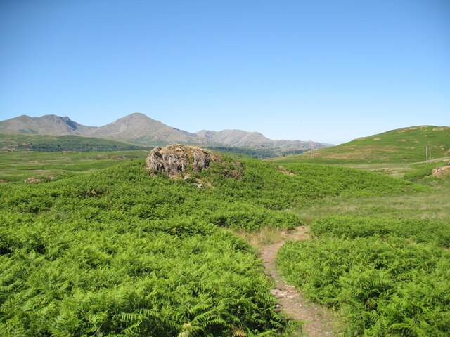
Blawith Wood Bottom is a picturesque valley located in Lancashire, England. Nestled within the larger Lake District National Park, this area is known for its stunning natural beauty and peaceful atmosphere. The valley is situated near the village of Blawith and is surrounded by rolling hills, dense woodlands, and meandering streams.

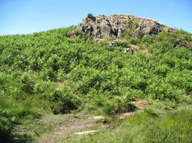
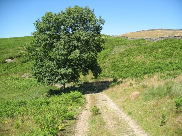
Blawith Wood Bottom is characterized by its lush vegetation and thriving wildlife. The valley is home to a variety of tree species, including oak, birch, and beech, which create a vibrant and colorful landscape throughout the year. This abundance of plant life provides a habitat for numerous bird species, such as woodpeckers, owls, and thrushes, making it a haven for birdwatchers and nature enthusiasts.

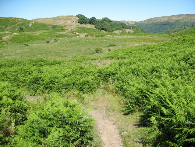
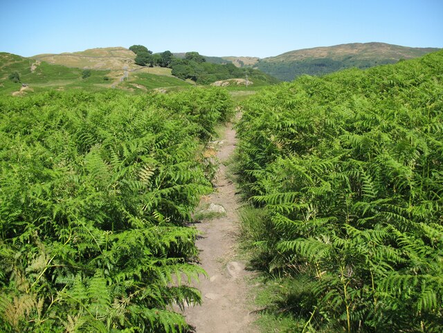
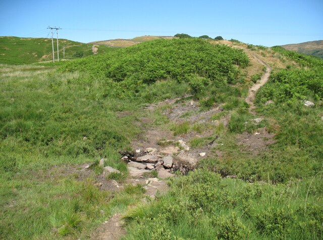
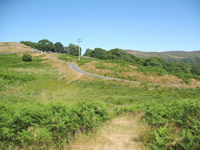
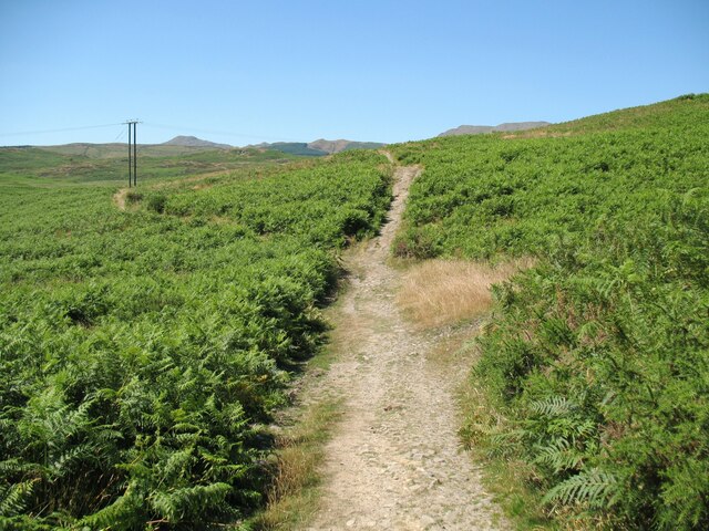
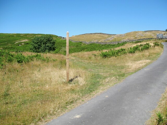
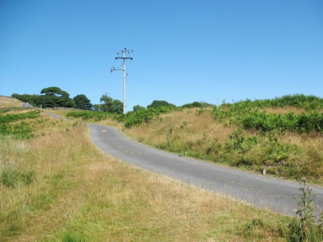
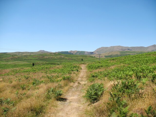
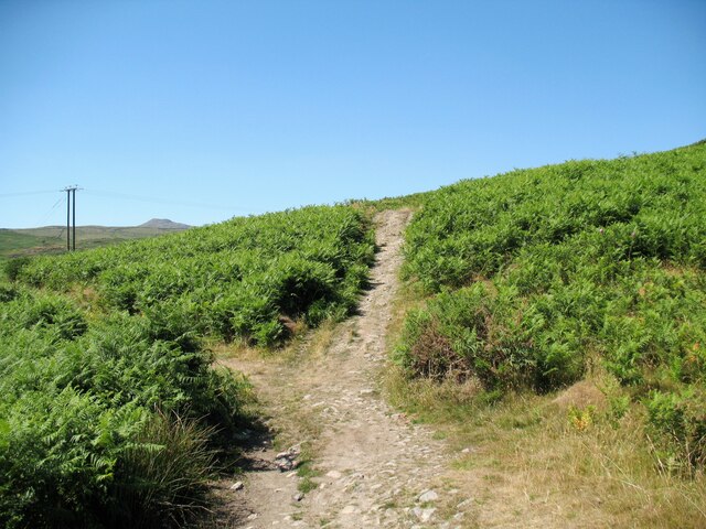
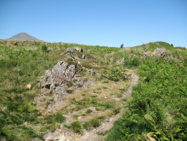
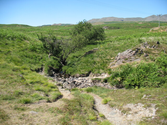
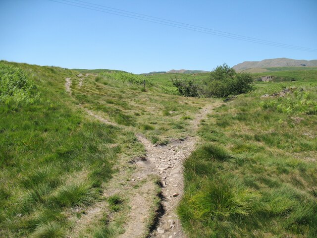
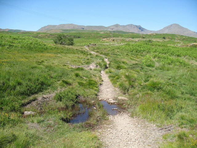
The valley is crisscrossed by several walking trails, offering visitors the opportunity to explore and experience the tranquility of the area. These paths lead to hidden gems, including secluded waterfalls and viewpoints that offer breathtaking vistas of the surrounding countryside. The valley is also intersected by a small stream, which adds to its charm and provides a peaceful soundtrack as it meanders through the woodland.

Blawith Wood Bottom is a popular destination for those seeking a peaceful retreat in nature. It offers a chance to escape the hustle and bustle of city life and immerse oneself in the beauty of the countryside. Whether it is a leisurely stroll, a picnic by the stream, or simply taking in the sights and sounds of the woodland, this valley provides a truly enchanting experience for all who visit.

If you have any feedback on the listing, please let us know in the comments section below.

Blawith Wood Bottom Images

Images are sourced within 2km of 54.308347/-3.1043722 or Grid Reference SD2890. Thanks to Geograph Open Source API. All images are credited.

The Cumbria Way near Beacon Fell The Cumbria Way crosses the bracken covered northern slopes of Beacon Fell, above Stable Harvey Moss (next photograph <a href="https://www.geograph.org.uk/photo/6920540">SD2791 : The Cumbria Way near Stable Harvey Moss</a>).
The Cumbria Way near Beacon Fell
The Cumbria Way crosses the bracken covered northern slopes of Beacon Fell, above Stable Harvey Moss (next photograph SD2791 : The Cumbria Way near Stable Harvey Moss).
The Cumbria Way near Beacon Fell The Cumbria Way long distance footpath descends towards Stable Harvey Moss and Torver Low Common before taking a more north-easterly direction lower down the slope (next photograph <a href="https://www.geograph.org.uk/photo/6915307">SD2791 : The Cumbria Way near Beacon Fell</a>).
The three main mountains in the background are Dow Crag (2,555’), Coniston Old Man (2,635’) and Wetherlam (2502’).  Helvellyn (3118') is visible in the distant right background.
Note: The height in feet of some of the Lake District mountains varies on different editions of the Ordnance Survey map and will depend upon the survey point used by the surveyors at the time; it is rarely the highest point on the mountain. The heights above are taken from the Ordnance Survey 1” map Sheet 88, revised 1962-63 B).
The Cumbria Way near Beacon Fell
The Cumbria Way long distance footpath descends towards Stable Harvey Moss and Torver Low Common before taking a more north-easterly direction lower down the slope (next photograph SD2791 : The Cumbria Way near Beacon Fell). The three main mountains in the background are Dow Crag (2,555’), Coniston Old Man (2,635’) and Wetherlam (2502’). Helvellyn (3118') is visible in the distant right background. Note: The height in feet of some of the Lake District mountains varies on different editions of the Ordnance Survey map and will depend upon the survey point used by the surveyors at the time; it is rarely the highest point on the mountain. The heights above are taken from the Ordnance Survey 1” map Sheet 88, revised 1962-63 B).
The Cumbria Way near Stable Harvey Moss The Cumbria Way long distance footpath passes through an area of bracken on the lower slopes of Beacon Fell, turning left to follow the main path (next photograph <a href="https://www.geograph.org.uk/photo/6925753">SD2791 : The Cumbria Way near Stable Harvey Moss</a>).
The Cumbria Way near Stable Harvey Moss
The Cumbria Way long distance footpath passes through an area of bracken on the lower slopes of Beacon Fell, turning left to follow the main path (next photograph SD2791 : The Cumbria Way near Stable Harvey Moss).
The Cumbria Way near Stable Harvey Moss The Cumbria Way long distance footpath passes through an area of bracken on the lower slopes of Beacon Fell (next photograph <a href="https://www.geograph.org.uk/photo/6920535">SD2791 : The Cumbria Way near Stable Harvey Moss</a>).
The Cumbria Way near Stable Harvey Moss
The Cumbria Way long distance footpath passes through an area of bracken on the lower slopes of Beacon Fell (next photograph SD2791 : The Cumbria Way near Stable Harvey Moss).
Black Beck near Stable Harvey Moss Black Beck drains the bog of Stable Harvey Moss and the southern part of Torver Low Common and flows into Coniston Water.
The Cumbria Way long distance footpath crosses the beck by a small ford (next photograph <a href="https://www.geograph.org.uk/photo/6927171">SD2891 : The Cumbria Way near Stable Harvey</a>).
Black Beck near Stable Harvey Moss
Black Beck drains the bog of Stable Harvey Moss and the southern part of Torver Low Common and flows into Coniston Water. The Cumbria Way long distance footpath crosses the beck by a small ford (next photograph SD2891 : The Cumbria Way near Stable Harvey).
The Cumbria Way near Stable Harvey Moss The Cumbria Way, a 74 mile long distance path from Ulverston to Carlisle crosses a small boggy stream below a rocky outcrop near Stable Harvey Moss (next photograph <a href="https://www.geograph.org.uk/photo/6925738">SD2791 : Black Beck near Stable Harvey Moss</a>).
The Cumbria Way near Stable Harvey Moss
The Cumbria Way, a 74 mile long distance path from Ulverston to Carlisle crosses a small boggy stream below a rocky outcrop near Stable Harvey Moss (next photograph SD2791 : Black Beck near Stable Harvey Moss).
The Cumbria Way near Stable Harvey Moss The Cumbria Way descends the lower slopes of Beacon Fell near Stable Harvey Moss towards a rocky outcrop (next photograph <a href="https://www.geograph.org.uk/photo/6925747">SD2791 : The Cumbria Way near Stable Harvey Moss</a>).
Dow Crag, Coniston Old Man and Wetherlam are in the background.
The Cumbria Way near Stable Harvey Moss
The Cumbria Way descends the lower slopes of Beacon Fell near Stable Harvey Moss towards a rocky outcrop (next photograph SD2791 : The Cumbria Way near Stable Harvey Moss). Dow Crag, Coniston Old Man and Wetherlam are in the background.
The Cumbria Way near Stable Harvey The Cumbria Way crosses low lying undulating ground near Stable Harvey Moss as it approaches the road near Stable Harvey (next photograph <a href="https://www.geograph.org.uk/photo/6929558">SD2891 : The road to Stable Harvey</a>).
The Cumbria Way near Stable Harvey
The Cumbria Way crosses low lying undulating ground near Stable Harvey Moss as it approaches the road near Stable Harvey (next photograph SD2891 : The road to Stable Harvey).
Public bridleway near Stable Harvey Moss The bridleway runs from Stable Harvey to Mill Bridge near Torver and bears left at the path junction ahead.  It is the route of The Cumbria Way long distance footpath (next photograph <a href="https://www.geograph.org.uk/photo/6930295">SD2891 : The Cumbria Way near Stable Harvey Moss</a>).
Public bridleway near Stable Harvey Moss
The bridleway runs from Stable Harvey to Mill Bridge near Torver and bears left at the path junction ahead. It is the route of The Cumbria Way long distance footpath (next photograph SD2891 : The Cumbria Way near Stable Harvey Moss).
Ash tree near Stable Harvey Moss The path in the foreground joins a bridleway from Stable Harvey to Mill Bridge beside the tree.  Northbound walkers following The Cumbria Way long distance path continue north-west along the bridleway (next photograph <a href="https://www.geograph.org.uk/photo/6927965">SD2891 : Public bridleway near Stable Harvey Moss</a>).
The grass is dry due to a prolonged spell of fine weather.
Ash tree near Stable Harvey Moss
The path in the foreground joins a bridleway from Stable Harvey to Mill Bridge beside the tree. Northbound walkers following The Cumbria Way long distance path continue north-west along the bridleway (next photograph SD2891 : Public bridleway near Stable Harvey Moss). The grass is dry due to a prolonged spell of fine weather.
Torver Low Common near Stable Harvey The path leaves the minor road from Brown Howe to Stable Harvey.  It is signposted for The Cumbria Way long distance path which has followed the minor road northwards for approximately 60m (65 yards) and walkers following The Cumbria Way normally take this route (next photograph <a href="https://www.geograph.org.uk/photo/6927980">SD2891 : Ash tree near Stable Harvey Moss</a>).
The signpost is mis-located as the public right of way (and the official route of The Cumbria Way) leaves the road some 55m (60 yards) further to the north east towards Stable Harvey Farm.  The land here is Access Land so no trespass is incurred.
The grass is parched due to a prolonged period of dry weather.
Torver Low Common near Stable Harvey
The path leaves the minor road from Brown Howe to Stable Harvey. It is signposted for The Cumbria Way long distance path which has followed the minor road northwards for approximately 60m (65 yards) and walkers following The Cumbria Way normally take this route (next photograph SD2891 : Ash tree near Stable Harvey Moss). The signpost is mis-located as the public right of way (and the official route of The Cumbria Way) leaves the road some 55m (60 yards) further to the north east towards Stable Harvey Farm. The land here is Access Land so no trespass is incurred. The grass is parched due to a prolonged period of dry weather.
The road to Stable Harvey Stable Harvey is a farm and is the only property served by a minor road from the A5084 near Brown Howe.
The Cumbria Way long distance path joins the road on Torver Low Common near Black Beck (next photograph <a href="https://www.geograph.org.uk/photo/6928292">SD2891 : Torver Low Common near Stable Harvey</a>).
The grass is parched after a prolonged period of dry weather.
The road to Stable Harvey
Stable Harvey is a farm and is the only property served by a minor road from the A5084 near Brown Howe. The Cumbria Way long distance path joins the road on Torver Low Common near Black Beck (next photograph SD2891 : Torver Low Common near Stable Harvey). The grass is parched after a prolonged period of dry weather.
Path on Tottle Bank Crossing the open ground of Torver Low Common below Tottle Bank, this path is an alternative route for The Cumbria Way, a 74 mile long distance trail between Ulverston and Carlisle (next photograph <a href="https://www.geograph.org.uk/photo/6938645">SD2892 : Bridleway, Tottle Bank</a>).
The grass is dry after a long period of dry weather.
Path on Tottle Bank
Crossing the open ground of Torver Low Common below Tottle Bank, this path is an alternative route for The Cumbria Way, a 74 mile long distance trail between Ulverston and Carlisle (next photograph SD2892 : Bridleway, Tottle Bank). The grass is dry after a long period of dry weather.
The Cumbria Way near Stable Harvey Moss The Cumbria Way long distance path follows a public bridleway from near Stable Harvey to Mere Beck on Torver Low Common.  The bridleway makes a turn to the left near Stable Harvey Moss and a path continues straight ahead which is an alternative route for walkers following The Cumbria Way (next photograph <a href="https://www.geograph.org.uk/photo/6930288">SD2891 : Path on Tottle Bank</a>).
The Cumbria Way near Stable Harvey Moss
The Cumbria Way long distance path follows a public bridleway from near Stable Harvey to Mere Beck on Torver Low Common. The bridleway makes a turn to the left near Stable Harvey Moss and a path continues straight ahead which is an alternative route for walkers following The Cumbria Way (next photograph SD2891 : Path on Tottle Bank).
The Cumbria Way near Mere Beck The Cumbria Way long distance path climbs away from the ford across Mere Beck over some rocky ground (next photograph <a href="https://www.geograph.org.uk/photo/6938191">SD2892 : The Cumbria Way, Torver Low Common</a>).
The Cumbria Way near Mere Beck
The Cumbria Way long distance path climbs away from the ford across Mere Beck over some rocky ground (next photograph SD2892 : The Cumbria Way, Torver Low Common).
Ford across Mere Beck A public footpath crosses Mere Beck by a stony ford between Tottle Bank and Anne Riggs on Torver Low Common.  It is the route of The Cumbria Way, a long distance trail from Ulverston to Carlisle (next photograph <a href="https://www.geograph.org.uk/photo/6931224">SD2892 : The Cumbria Way near Mere Beck</a>).
Ford across Mere Beck
A public footpath crosses Mere Beck by a stony ford between Tottle Bank and Anne Riggs on Torver Low Common. It is the route of The Cumbria Way, a long distance trail from Ulverston to Carlisle (next photograph SD2892 : The Cumbria Way near Mere Beck).
The Cumbria Way near Mere Beck The Cumbria Way follows a well-defined path across Torver Low Common, diverging right approaching Mere Beck (next photograph <a href="https://www.geograph.org.uk/photo/6931244">SD2892 : Ford across Mere Beck</a>).
The Cumbria Way near Mere Beck
The Cumbria Way follows a well-defined path across Torver Low Common, diverging right approaching Mere Beck (next photograph SD2892 : Ford across Mere Beck).
Ford on Torver Low Common This small ford crosses a tributary of Mere Beck on Torver Low Common.
Although not on the public bridleway, this path is a shortcut that has become an alternative route normally taken by walkers following The Cumbria Way long distance path (next photograph <a href="https://www.geograph.org.uk/photo/6931254">SD2892 : The Cumbria Way near Mere Beck</a>).  The bridleway and the official route of The Cumbria Way cross the same beck by the original ford 20m (21 yards) to the north east.
Ford on Torver Low Common
This small ford crosses a tributary of Mere Beck on Torver Low Common. Although not on the public bridleway, this path is a shortcut that has become an alternative route normally taken by walkers following The Cumbria Way long distance path (next photograph SD2892 : The Cumbria Way near Mere Beck). The bridleway and the official route of The Cumbria Way cross the same beck by the original ford 20m (21 yards) to the north east.
Show me another place!

Blawith Wood Bottom is located at Grid Ref: SD2890 (Lat: 54.308347, Lng: -3.1043722)

Administrative County: Cumbria

District: South Lakeland

Police Authority: Cumbria

What 3 Words

///robe.press.drifters. Near Ulverston, Cumbria

Related Wikis

Beacon Fell, Cumbria

Beacon Fell is a fell in the southern Lake District of England with an altitude of 836 feet (255 m). It is the subject of a chapter of Wainwright's book...

Peel Island, Cumbria

Peel Island (formerly known as Montague Island or the Gridiron) is one of the three islands of Coniston Water in the English Lake District, Cumbria. The...

Woodland Fell

Woodland Fell is an upland area in the south of the English Lake District, south of Torver, Cumbria. It is the subject of a chapter of Wainwright's book...

Nibthwaite

Nibthwaite is a village in the South Lakeland District in the county of Cumbria in the northwest of England. It is in the civil parish of Colton, and on...

Kelly Hall Tarn

Kelly Hall Tarn is a pool in Cumbria, England, to the west of Coniston Water. It is located about one km south-south-east of the village of Torver, on...

St John the Baptist's Church, Blawith

St John the Baptist's Church is a redundant Anglican church in the settlement of Blawith, Cumbria, England. It is located to the east of the A5084 road...

Blawith and Subberthwaite

Blawith and Subberthwaite is a civil parish in the South Lakeland district of Cumbria, England. It is situated in the Lake District National Park, and...

Top o'Selside

Top o'Selside is a hill in the Lake District in Cumbria, England. At 335 metres (1,099 ft), it is the highest point of the group of hills situated between...

Nearby Amenities

Located within 500m of 54.308347,-3.1043722
The Beacon
Ele: 257
Ele Feet: 843
Natural: peak
Wpt Description: 23-JUL-10 15:08:25
Wpt Symbol: Summit
Lat/Long: 54.3068532/-3.1109888
Blawith Wood Bottom
Place: locality
Lat/Long: 54.3084054/-3.1053898
Power: pole
Lat/Long: 54.3083899/-3.0970824
Power: pole
Lat/Long: 54.3088844/-3.0984449
Power: pole
Lat/Long: 54.3098436/-3.1013042
Power: pole
Lat/Long: 54.3119295/-3.1013981
Power: pole
Lat/Long: 54.3110329/-3.1011298
Power: pole
Lat/Long: 54.3093413/-3.1022188
Power: pole
Lat/Long: 54.3083852/-3.1028625
Power: pole
Lat/Long: 54.3119959/-3.1018654
Power: pole
Lat/Long: 54.3113841/-3.1018225
Power: pole
Lat/Long: 54.3101839/-3.102257
Power: pole
Lat/Long: 54.3093561/-3.1027478
Power: pole
Lat/Long: 54.3085487/-3.1032092
Power: pole
Lat/Long: 54.3077631/-3.103692
Power: pole
Lat/Long: 54.3045174/-3.1055266
Power: pole
Lat/Long: 54.3055033/-3.1049875
Power: pole
Lat/Long: 54.3066238/-3.1043706
Power: pole
Lat/Long: 54.3067421/-3.1039193
Power: pole
Lat/Long: 54.3058328/-3.1045362
Power: pole
Lat/Long: 54.3049377/-3.1050968
Ford: yes
Lat/Long: 54.3096279/-3.0990775
Information: guidepost
Tourism: information
Lat/Long: 54.310338/-3.0989082
Ford: yes
Lat/Long: 54.3081133/-3.1045457
Ford: yes
Lat/Long: 54.3113156/-3.104849
Ford: yes
Lat/Long: 54.3121959/-3.1019909
Ford: yes
Lat/Long: 54.3087793/-3.1017474
The data included in this document is from www.openstreetmap.org. The data is made available under ODbL.

Have you been to Blawith Wood Bottom?

Leave your review of Blawith Wood Bottom below (or comments, questions and feedback).