Boon Wood

Wood, Forest in Lancashire South Lakeland

England

Boon Wood

The Cumbria Way near Stable Harvey Moss The Cumbria Way long distance footpath passes through an area of bracken on the lower slopes of Beacon Fell, turning left to follow the main path (next photograph <a href="https://www.geograph.org.uk/photo/6925753">SD2791 : The Cumbria Way near Stable Harvey Moss</a>).
The Cumbria Way near Stable Harvey Moss Credit: Adrian Taylor

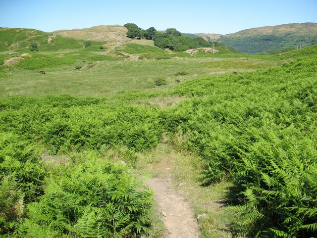
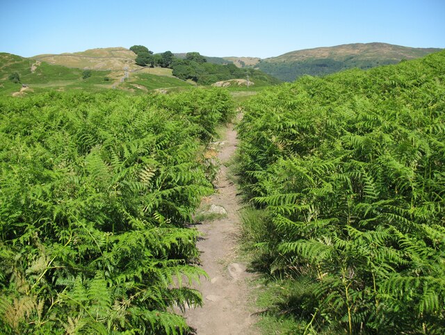
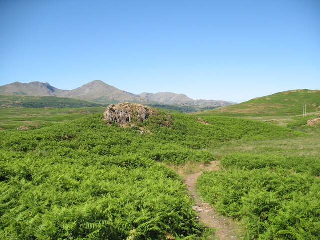
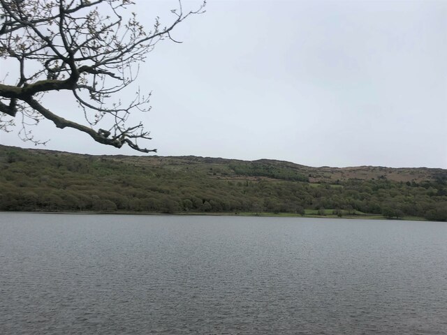
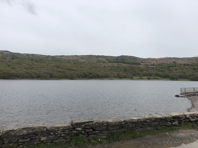
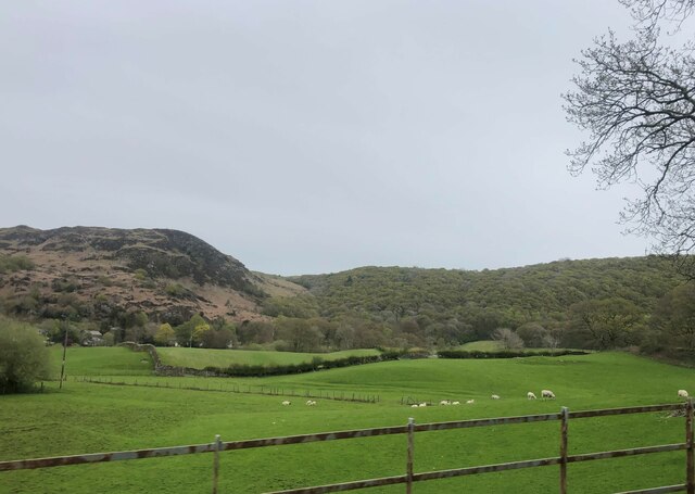
Boon Wood is a picturesque woodland located in the county of Lancashire, England. Situated near the village of Boon, the wood covers an area of approximately 50 acres and is a popular destination for both locals and tourists seeking a tranquil escape from the bustling city life.

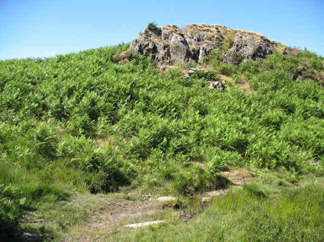
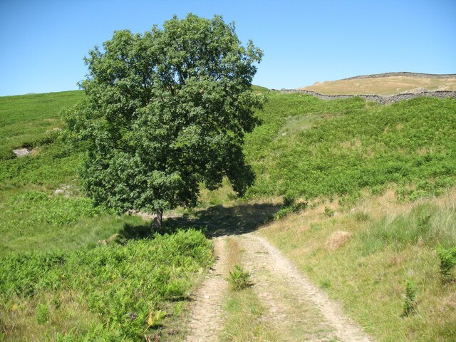
The woodland is primarily composed of deciduous trees, including oak, birch, and beech, which create a dense canopy, providing shade and shelter for the diverse wildlife that inhabits the area. It is a designated Site of Special Scientific Interest (SSSI) due to its rich biodiversity and the presence of rare plant species.

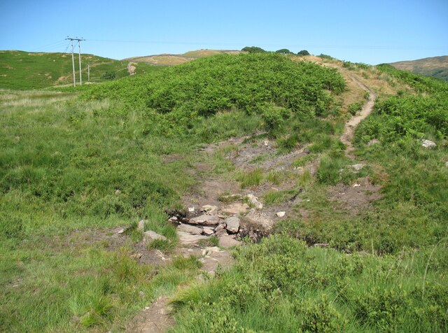
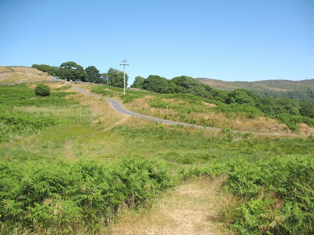
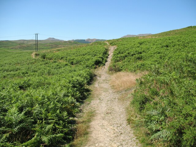
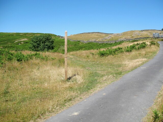
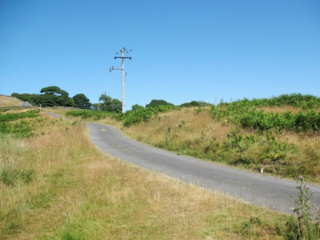
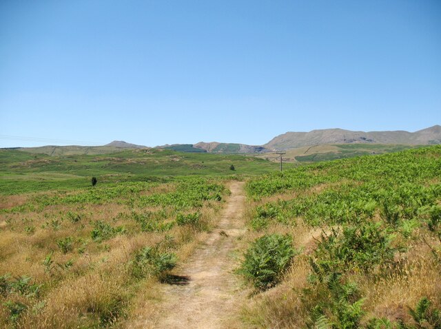
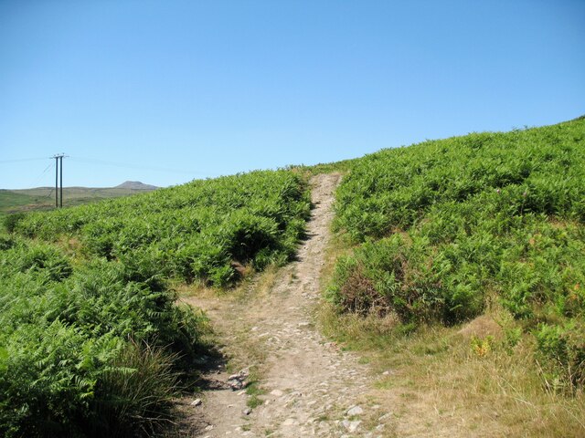
Visitors to Boon Wood can enjoy a network of well-maintained walking trails that wind through the forest, offering stunning views of the surrounding countryside. The paths are suitable for all ages and abilities, making it an ideal destination for families and nature enthusiasts alike.

The wood is also home to a variety of bird species, making it a fantastic spot for birdwatching. Common sightings include woodpeckers, owls, and various woodland songbirds. Nature lovers may also catch a glimpse of other native wildlife, such as squirrels, badgers, and foxes.

Boon Wood is easily accessible, with ample parking available nearby. There are also picnic areas and benches scattered throughout the woodland, allowing visitors to relax and soak in the peaceful atmosphere.

Overall, Boon Wood offers a serene and captivating experience for those looking to immerse themselves in the beauty of nature.

If you have any feedback on the listing, please let us know in the comments section below.

Boon Wood Images

Images are sourced within 2km of 54.301746/-3.094975 or Grid Reference SD2890. Thanks to Geograph Open Source API. All images are credited.

The Cumbria Way near Stable Harvey Moss The Cumbria Way long distance footpath passes through an area of bracken on the lower slopes of Beacon Fell, turning left to follow the main path (next photograph <a href="https://www.geograph.org.uk/photo/6925753">SD2791 : The Cumbria Way near Stable Harvey Moss</a>).
The Cumbria Way near Stable Harvey Moss
The Cumbria Way long distance footpath passes through an area of bracken on the lower slopes of Beacon Fell, turning left to follow the main path (next photograph SD2791 : The Cumbria Way near Stable Harvey Moss).
The Cumbria Way near Stable Harvey Moss The Cumbria Way long distance footpath passes through an area of bracken on the lower slopes of Beacon Fell (next photograph <a href="https://www.geograph.org.uk/photo/6920535">SD2791 : The Cumbria Way near Stable Harvey Moss</a>).
The Cumbria Way near Stable Harvey Moss
The Cumbria Way long distance footpath passes through an area of bracken on the lower slopes of Beacon Fell (next photograph SD2791 : The Cumbria Way near Stable Harvey Moss).
Black Beck near Stable Harvey Moss Black Beck drains the bog of Stable Harvey Moss and the southern part of Torver Low Common and flows into Coniston Water.
The Cumbria Way long distance footpath crosses the beck by a small ford (next photograph <a href="https://www.geograph.org.uk/photo/6927171">SD2891 : The Cumbria Way near Stable Harvey</a>).
Black Beck near Stable Harvey Moss
Black Beck drains the bog of Stable Harvey Moss and the southern part of Torver Low Common and flows into Coniston Water. The Cumbria Way long distance footpath crosses the beck by a small ford (next photograph SD2891 : The Cumbria Way near Stable Harvey).
The Cumbria Way near Stable Harvey Moss The Cumbria Way, a 74 mile long distance path from Ulverston to Carlisle crosses a small boggy stream below a rocky outcrop near Stable Harvey Moss (next photograph <a href="https://www.geograph.org.uk/photo/6925738">SD2791 : Black Beck near Stable Harvey Moss</a>).
The Cumbria Way near Stable Harvey Moss
The Cumbria Way, a 74 mile long distance path from Ulverston to Carlisle crosses a small boggy stream below a rocky outcrop near Stable Harvey Moss (next photograph SD2791 : Black Beck near Stable Harvey Moss).
The Cumbria Way near Stable Harvey Moss The Cumbria Way descends the lower slopes of Beacon Fell near Stable Harvey Moss towards a rocky outcrop (next photograph <a href="https://www.geograph.org.uk/photo/6925747">SD2791 : The Cumbria Way near Stable Harvey Moss</a>).
Dow Crag, Coniston Old Man and Wetherlam are in the background.
The Cumbria Way near Stable Harvey Moss
The Cumbria Way descends the lower slopes of Beacon Fell near Stable Harvey Moss towards a rocky outcrop (next photograph SD2791 : The Cumbria Way near Stable Harvey Moss). Dow Crag, Coniston Old Man and Wetherlam are in the background.
The Cumbria Way near Stable Harvey The Cumbria Way crosses low lying undulating ground near Stable Harvey Moss as it approaches the road near Stable Harvey (next photograph <a href="https://www.geograph.org.uk/photo/6929558">SD2891 : The road to Stable Harvey</a>).
The Cumbria Way near Stable Harvey
The Cumbria Way crosses low lying undulating ground near Stable Harvey Moss as it approaches the road near Stable Harvey (next photograph SD2891 : The road to Stable Harvey).
Public bridleway near Stable Harvey Moss The bridleway runs from Stable Harvey to Mill Bridge near Torver and bears left at the path junction ahead.  It is the route of The Cumbria Way long distance footpath (next photograph <a href="https://www.geograph.org.uk/photo/6930295">SD2891 : The Cumbria Way near Stable Harvey Moss</a>).
Public bridleway near Stable Harvey Moss
The bridleway runs from Stable Harvey to Mill Bridge near Torver and bears left at the path junction ahead. It is the route of The Cumbria Way long distance footpath (next photograph SD2891 : The Cumbria Way near Stable Harvey Moss).
Ash tree near Stable Harvey Moss The path in the foreground joins a bridleway from Stable Harvey to Mill Bridge beside the tree.  Northbound walkers following The Cumbria Way long distance path continue north-west along the bridleway (next photograph <a href="https://www.geograph.org.uk/photo/6927965">SD2891 : Public bridleway near Stable Harvey Moss</a>).
The grass is dry due to a prolonged spell of fine weather.
Ash tree near Stable Harvey Moss
The path in the foreground joins a bridleway from Stable Harvey to Mill Bridge beside the tree. Northbound walkers following The Cumbria Way long distance path continue north-west along the bridleway (next photograph SD2891 : Public bridleway near Stable Harvey Moss). The grass is dry due to a prolonged spell of fine weather.
Torver Low Common near Stable Harvey The path leaves the minor road from Brown Howe to Stable Harvey.  It is signposted for The Cumbria Way long distance path which has followed the minor road northwards for approximately 60m (65 yards) and walkers following The Cumbria Way normally take this route (next photograph <a href="https://www.geograph.org.uk/photo/6927980">SD2891 : Ash tree near Stable Harvey Moss</a>).
The signpost is mis-located as the public right of way (and the official route of The Cumbria Way) leaves the road some 55m (60 yards) further to the north east towards Stable Harvey Farm.  The land here is Access Land so no trespass is incurred.
The grass is parched due to a prolonged period of dry weather.
Torver Low Common near Stable Harvey
The path leaves the minor road from Brown Howe to Stable Harvey. It is signposted for The Cumbria Way long distance path which has followed the minor road northwards for approximately 60m (65 yards) and walkers following The Cumbria Way normally take this route (next photograph SD2891 : Ash tree near Stable Harvey Moss). The signpost is mis-located as the public right of way (and the official route of The Cumbria Way) leaves the road some 55m (60 yards) further to the north east towards Stable Harvey Farm. The land here is Access Land so no trespass is incurred. The grass is parched due to a prolonged period of dry weather.
The road to Stable Harvey Stable Harvey is a farm and is the only property served by a minor road from the A5084 near Brown Howe.
The Cumbria Way long distance path joins the road on Torver Low Common near Black Beck (next photograph <a href="https://www.geograph.org.uk/photo/6928292">SD2891 : Torver Low Common near Stable Harvey</a>).
The grass is parched after a prolonged period of dry weather.
The road to Stable Harvey
Stable Harvey is a farm and is the only property served by a minor road from the A5084 near Brown Howe. The Cumbria Way long distance path joins the road on Torver Low Common near Black Beck (next photograph SD2891 : Torver Low Common near Stable Harvey). The grass is parched after a prolonged period of dry weather.
Path on Tottle Bank Crossing the open ground of Torver Low Common below Tottle Bank, this path is an alternative route for The Cumbria Way, a 74 mile long distance trail between Ulverston and Carlisle (next photograph <a href="https://www.geograph.org.uk/photo/6938645">SD2892 : Bridleway, Tottle Bank</a>).
The grass is dry after a long period of dry weather.
Path on Tottle Bank
Crossing the open ground of Torver Low Common below Tottle Bank, this path is an alternative route for The Cumbria Way, a 74 mile long distance trail between Ulverston and Carlisle (next photograph SD2892 : Bridleway, Tottle Bank). The grass is dry after a long period of dry weather.
The Cumbria Way near Stable Harvey Moss The Cumbria Way long distance path follows a public bridleway from near Stable Harvey to Mere Beck on Torver Low Common.  The bridleway makes a turn to the left near Stable Harvey Moss and a path continues straight ahead which is an alternative route for walkers following The Cumbria Way (next photograph <a href="https://www.geograph.org.uk/photo/6930288">SD2891 : Path on Tottle Bank</a>).
The Cumbria Way near Stable Harvey Moss
The Cumbria Way long distance path follows a public bridleway from near Stable Harvey to Mere Beck on Torver Low Common. The bridleway makes a turn to the left near Stable Harvey Moss and a path continues straight ahead which is an alternative route for walkers following The Cumbria Way (next photograph SD2891 : Path on Tottle Bank).
Coniston Water from the A5084 At last a view of the lake - the A593 does not run alongside and it is not until you head south of Torver on the A5084 that the lake comes into view.
Coniston Water from the A5084
At last a view of the lake - the A593 does not run alongside and it is not until you head south of Torver on the A5084 that the lake comes into view.
Coniston Water Coniston Water is the fifth largest of the lakes, at five miles long, and with a maximum depth of 184 feet. It provided an important fish source for the monks of Furness Abbey who owned the lake and much of the surrounding land in the 13th and 14th Centuries.
Coniston Water
Coniston Water is the fifth largest of the lakes, at five miles long, and with a maximum depth of 184 feet. It provided an important fish source for the monks of Furness Abbey who owned the lake and much of the surrounding land in the 13th and 14th Centuries.
A glimpse of Coniston Water Towards the southern end of the lake. Boon Wood on the left
A glimpse of Coniston Water
Towards the southern end of the lake. Boon Wood on the left
Farmland at High Nibthwaite South of Coniston Water. The crag on the left is Brook Barrow
Farmland at High Nibthwaite
South of Coniston Water. The crag on the left is Brook Barrow
Wide valley of the River Crake
Show me another place!

Boon Wood is located at Grid Ref: SD2890 (Lat: 54.301746, Lng: -3.094975)

Administrative County: Cumbria

District: South Lakeland

Police Authority: Cumbria

What 3 Words

///treating.edge.hotspots. Near Ulverston, Cumbria

Related Wikis

Nibthwaite

Nibthwaite is a village in the South Lakeland District in the county of Cumbria in the northwest of England. It is in the civil parish of Colton, and on...

Beacon Fell, Cumbria

Beacon Fell is a fell in the southern Lake District of England with an altitude of 836 feet (255 m). It is the subject of a chapter of Wainwright's book...

Woodland Fell

Woodland Fell is an upland area in the south of the English Lake District, south of Torver, Cumbria. It is the subject of a chapter of Wainwright's book...

St John the Baptist's Church, Blawith

St John the Baptist's Church is a redundant Anglican church in the settlement of Blawith, Cumbria, England. It is located to the east of the A5084 road...

Peel Island, Cumbria

Peel Island (formerly known as Montague Island or the Gridiron) is one of the three islands of Coniston Water in the English Lake District, Cumbria. The...

Blawith and Subberthwaite

Blawith and Subberthwaite is a civil parish in the South Lakeland district of Cumbria, England. It is situated in the Lake District National Park, and...

North Lonsdale Rural District

North Lonsdale was a rural district in the county of Lancashire, England from 1894 to 1974. It was created in 1894 as the Ulverston Rural District, and...

Top o'Selside

Top o'Selside is a hill in the Lake District in Cumbria, England. At 335 metres (1,099 ft), it is the highest point of the group of hills situated between...

Nearby Amenities

Located within 500m of 54.301746,-3.094975
Source: NPE tracing
Whitewater: put_in
Lat/Long: 54.3021033/-3.0947286
Source: NPE tracing
Lat/Long: 54.3012644/-3.0943209
Source: NPE tracing
Lat/Long: 54.30115/-3.0942153
Source: NPE tracing
Lat/Long: 54.3007698/-3.0941707
Source: NPE tracing
Lat/Long: 54.300673/-3.0940527
Source: NPE tracing
Lat/Long: 54.300588/-3.093493
Source: NPE tracing
Lat/Long: 54.2988844/-3.0926449
Source: NPE tracing
Lat/Long: 54.2988102/-3.0924367
Source: NPE tracing
Lat/Long: 54.2986162/-3.0913986
Source: NPE tracing
Lat/Long: 54.2979024/-3.0910057
Lake Bank
Place: hamlet
Lat/Long: 54.2985875/-3.0957377
Source: NPE tracing
Lat/Long: 54.2997118/-3.0926901
Source: NPE tracing
Lat/Long: 54.3057371/-3.0924893
Source: NPE tracing
Lat/Long: 54.303936/-3.0943174
Source: NPE tracing
Lat/Long: 54.3055902/-3.0919283
Source: NPE tracing
Lat/Long: 54.304839/-3.0925184
Anna's Nab
Place: locality
Lat/Long: 54.3008726/-3.0904321
Nibthwaite Quay
Place: locality
Lat/Long: 54.2989131/-3.0891995
Barrier: kissing_gate
Lat/Long: 54.3015649/-3.0961555
Source: NPE tracing
Lat/Long: 54.3038846/-3.0947434
Fairholme Green
Place: locality
Lat/Long: 54.3016087/-3.098805
Long Scars
Place: locality
Lat/Long: 54.3029058/-3.0993841
Source: NPE tracing
Lat/Long: 54.3031425/-3.09475
Source: NPE tracing
Lat/Long: 54.3035995/-3.0947071
Ford: yes
Lat/Long: 54.3009819/-3.0947101
Ford: yes
Lat/Long: 54.3038665/-3.094874
Ford: yes
Lat/Long: 54.2997027/-3.1012471
Ford: yes
Lat/Long: 54.3014326/-3.0988617
Source: NPE tracing
Lat/Long: 54.3038875/-3.0948037
Source: NPE tracing
Lat/Long: 54.3038672/-3.0946658
Source: NPE tracing
Lat/Long: 54.3038875/-3.0948037
Defibrillator
Access: yes
Defibrillator Location: On the outside wall of a small wooden building at the entrance to the chalet park.
Emergency: defibrillator
Indoor: no
Lat/Long: 54.2994087/-3.0976428
The data included in this document is from www.openstreetmap.org. The data is made available under ODbL.

Have you been to Boon Wood?

Leave your review of Boon Wood below (or comments, questions and feedback).