Glen Quharity

Valley in Angus

Scotland

Glen Quharity

Hummocky ground at Coul There are a lot of humps, hollows and ridges in this area, all signs of glacial deposition where ice from the glens met lower ground and deposited material. These humps look like moraines, but might be an esker.
Hummocky ground at Coul Credit: Gordon Hatton

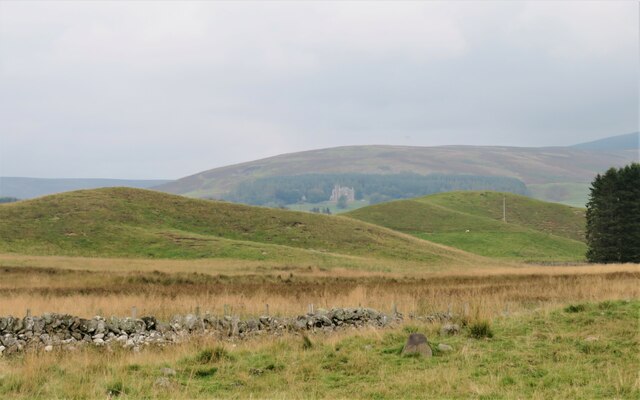
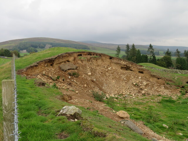
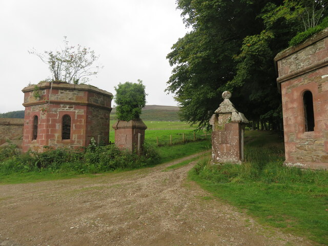
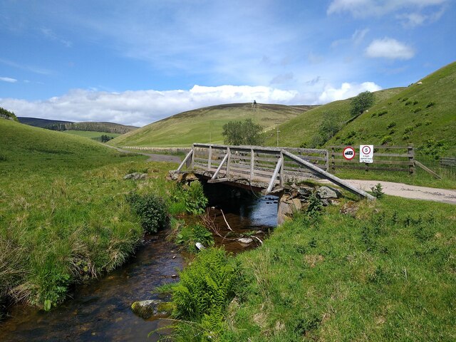
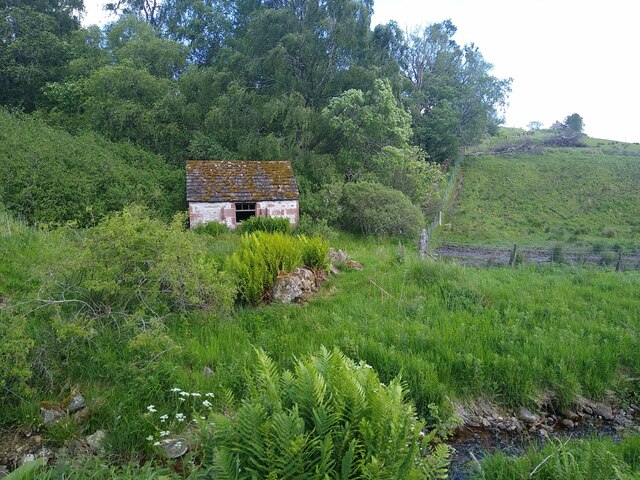
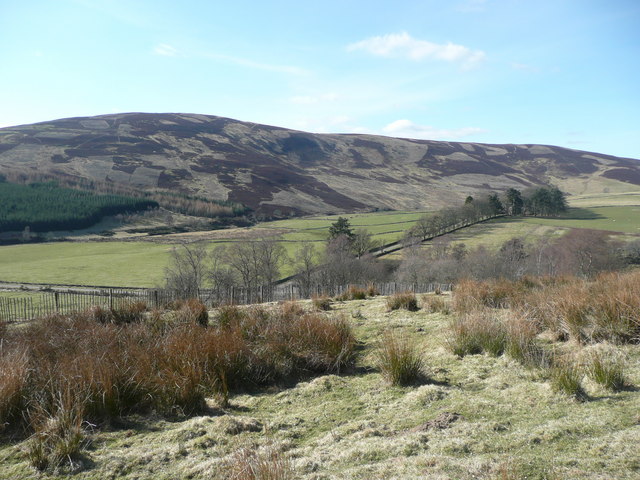
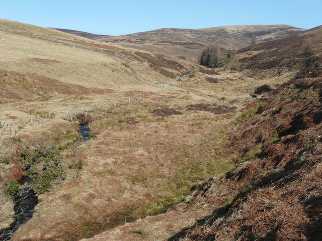
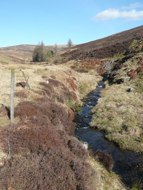
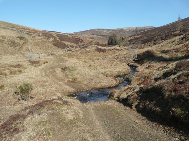
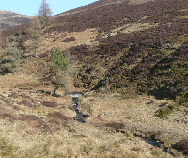
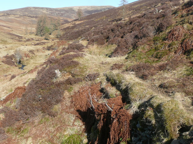
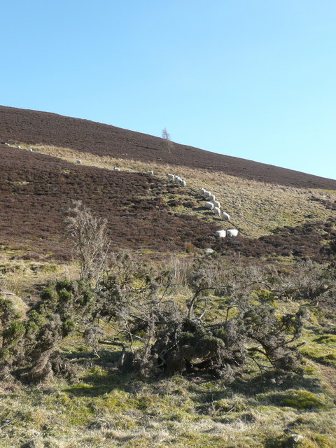
Glen Quharity is a valley located in the Angus region of Scotland. It is known for its picturesque landscapes, with rolling hills, lush greenery, and the Quharity Burn running through the valley. The valley is surrounded by the Angus Glens, providing a peaceful and serene environment for visitors and locals alike.

Glen Quharity is a popular destination for outdoor enthusiasts, offering a variety of activities such as hiking, mountain biking, and birdwatching. The valley is home to a diverse range of wildlife, including red deer, golden eagles, and red squirrels, making it a haven for nature lovers.

The small village of Quharity is located at the head of the valley, with a few scattered houses and farms dotting the landscape. The residents of Glen Quharity are known for their friendly and welcoming nature, making visitors feel at home in this tranquil setting.

Overall, Glen Quharity is a hidden gem in the Angus region, offering a peaceful retreat from the hustle and bustle of everyday life. Whether you are looking to explore the great outdoors or simply relax and unwind, Glen Quharity has something to offer for everyone.

If you have any feedback on the listing, please let us know in the comments section below.

Glen Quharity Images

Images are sourced within 2km of 56.719428/-3.1737843 or Grid Reference NO2859. Thanks to Geograph Open Source API. All images are credited.

Hummocky ground at Coul There are a lot of humps, hollows and ridges in this area, all signs of glacial deposition where ice from the glens met lower ground and deposited material. These humps look like moraines, but might be an esker.
Hummocky ground at Coul
There are a lot of humps, hollows and ridges in this area, all signs of glacial deposition where ice from the glens met lower ground and deposited material. These humps look like moraines, but might be an esker.
Rabbits just love moraines An exposed section of a glacial moraine at Coul with many different rocks embedded. The soft material is much liked by rabbits, as can be seen by the number of burrows in the mound.
Rabbits just love moraines
An exposed section of a glacial moraine at Coul with many different rocks embedded. The soft material is much liked by rabbits, as can be seen by the number of burrows in the mound.
Road at Easter Coul Minor road dropping downhill to cross Quharity Burn. Ahead is Balintore Castle.
Road at Easter Coul
Minor road dropping downhill to cross Quharity Burn. Ahead is Balintore Castle.
View to Balintore Castle On a grey day this grey castle looks ripe for a Hammer Horror Film location, but looking more closely one can see signs of restoration. All windows appear to be in and the castle's own website shows accommodation within. The castle dates from circa 1860 and was built as a rich man's shooting lodge.  A hundred years later it was abandoned due to dry rot and other expensive problems. Restoration is still ongoing, but it appears the worst of the problems have now been fixed. The castle is grade 'A' listed.
View to Balintore Castle
On a grey day this grey castle looks ripe for a Hammer Horror Film location, but looking more closely one can see signs of restoration. All windows appear to be in and the castle's own website shows accommodation within. The castle dates from circa 1860 and was built as a rich man's shooting lodge. A hundred years later it was abandoned due to dry rot and other expensive problems. Restoration is still ongoing, but it appears the worst of the problems have now been fixed. The castle is grade 'A' listed.
Balintore Castle gateway and drive The castle is undergoing an extensive restoration, but the gateway buildings have seen better days with damaged stonework and greenery growing out of cracks.
Balintore Castle gateway and drive
The castle is undergoing an extensive restoration, but the gateway buildings have seen better days with damaged stonework and greenery growing out of cracks.
Bridge across Burn of Dairy The path from Westerton has turned around and is now leading north-east.
Bridge across Burn of Dairy
The path from Westerton has turned around and is now leading north-east.
Tiny house A derelict hut at the crossroads in Westerton. Nobody lives here, I'm sure.
Tiny house
A derelict hut at the crossroads in Westerton. Nobody lives here, I'm sure.
The dark side of Balintore Castle Balintore Castle manages to sit right at the boundary between two squares. Most of the structure is in the square to the north, but this picture is showing the south-east corner which sits in this square. The castle is gradually being renovated, but this side is mostly still in a state of disarray. If you want to see the better side, approach the castle from the west, not the east.
The dark side of Balintore Castle
Balintore Castle manages to sit right at the boundary between two squares. Most of the structure is in the square to the north, but this picture is showing the south-east corner which sits in this square. The castle is gradually being renovated, but this side is mostly still in a state of disarray. If you want to see the better side, approach the castle from the west, not the east.
Balintore Castle
Balintore Castle
Looking up the glen of the Burn of Dairy Bank of Shiels on the right and Bodandere Hill on the left.
Looking up the glen of the Burn of Dairy
Bank of Shiels on the right and Bodandere Hill on the left.
Reeds in rough pasture Creigh Hill beyond the Glen Quharity.
Reeds in rough pasture
Creigh Hill beyond the Glen Quharity.
Dam on a hillside The dam no longer holds water, and its purpose is not immediately apparent, but there is also a defunct aqueduct from a weir on the Burn of Dairy.
Dam on a hillside
The dam no longer holds water, and its purpose is not immediately apparent, but there is also a defunct aqueduct from a weir on the Burn of Dairy.
Burn of Dairy Bodandere Hill on the horizon.
Burn of Dairy
Bodandere Hill on the horizon.
Burn of Dairy Craig Marloch on the left Back Garbets on the right.
Burn of Dairy
Craig Marloch on the left Back Garbets on the right.
Ford through Burn of Dairy The track heads for grouse butts on the moors.
Ford through Burn of Dairy
The track heads for grouse butts on the moors.
Weir on Burn of Dairy The overgrown aqueduct runs to the right and around the hillside to a dam.  
See: <a title="https://www.geograph.org.uk/photo/2324138" href="https://www.geograph.org.uk/photo/2324138">Link</a>
Weir on Burn of Dairy
The overgrown aqueduct runs to the right and around the hillside to a dam. See: Link
Track of defunct aqueduct From the weir,  <a title="https://www.geograph.org.uk/photo/2324206" href="https://www.geograph.org.uk/photo/2324206">Link</a>
to the dam,  <a title="https://www.geograph.org.uk/photo/2324138" href="https://www.geograph.org.uk/photo/2324138">Link</a>
Track of defunct aqueduct
From the weir, Link to the dam, Link
Line of sheep Heading up Craig of Balintore.
Line of sheep
Heading up Craig of Balintore.
Show me another place!

Glen Quharity is located at Grid Ref: NO2859 (Lat: 56.719428, Lng: -3.1737843)

Unitary Authority: Angus

Police Authority: Tayside

What 3 Words

///probable.toolkit.distracts. Near Alyth, Perth & Kinross

Nearby Locations

Balintore Glen Quharity

Related Wikis

Balintore, Angus

Balintore (Scottish Gaelic: Baile an Todhair) is a village in Angus, Scotland. It lies in Glen Isla, four miles north of the Loch of Lintrathen and seven...
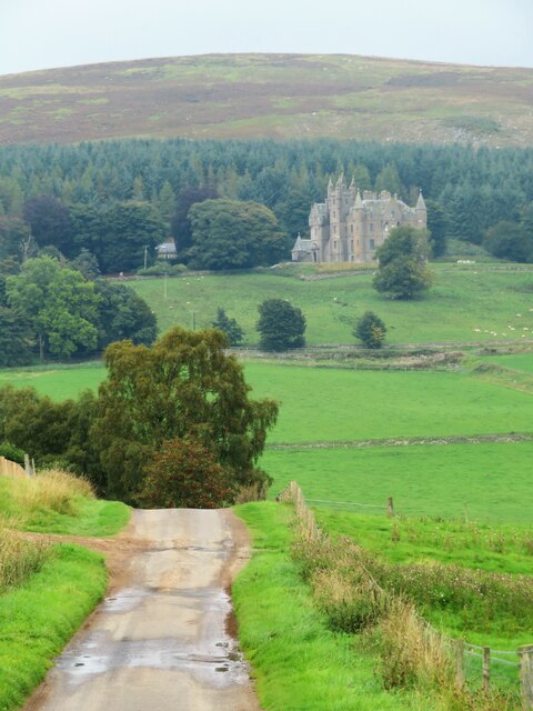
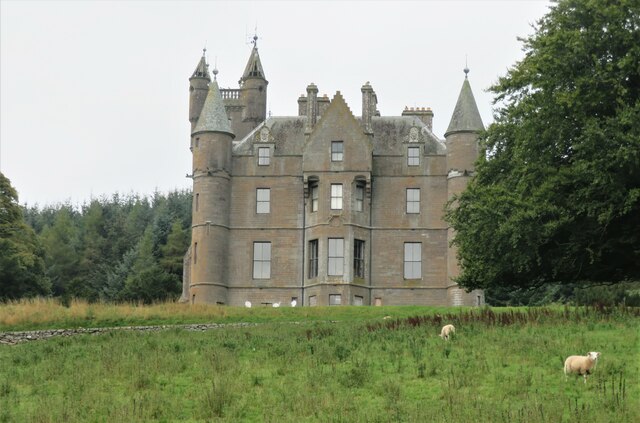
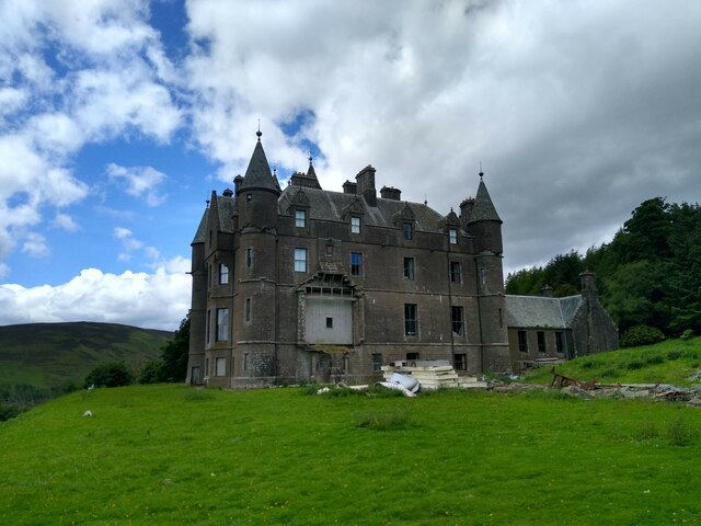
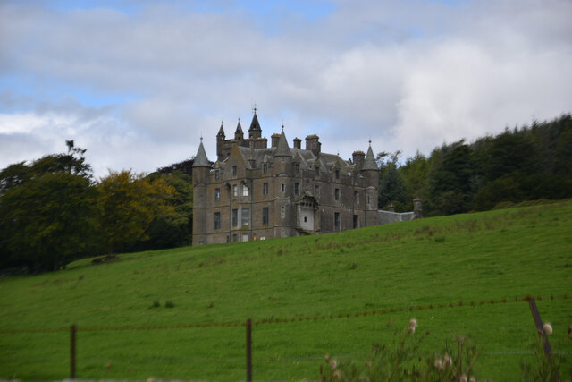
Balintore Castle

Balintore Castle is a Victorian Category A listed building in Scotland. The castle occupies an elevated site in moorland above Balintore village, a few...

Backwater Reservoir

Backwater Reservoir is a reservoir in north west Angus, Scotland. The reservoir's sole purpose is to provide drinking water, and as such, it supplies Angus...

Cat Law

Cat Law (671 m) is a hill in the southern Mounth of Scotland, north of Kirriemuir in Angus. A rounded peak, it lies above Strathmore in the south and offers...

Nearby Amenities

Located within 500m of 56.719428,-3.1737843
Loan
Place: locality
Lat/Long: 56.7228798/-3.1742983
Westerton
Place: isolated_dwelling
Lat/Long: 56.7214316/-3.1723886
Power: pole
Lat/Long: 56.7233187/-3.1769455
Power: pole
Lat/Long: 56.72294/-3.1761613
Power: pole
Lat/Long: 56.7225791/-3.175406
Power: pole
Lat/Long: 56.7221944/-3.1746074
Power: pole
Lat/Long: 56.7218177/-3.1738629
Power: pole
Lat/Long: 56.7213309/-3.1730932
Power: pole
Lat/Long: 56.7208431/-3.1723289
Power: pole
Lat/Long: 56.7203602/-3.1715754
Power: pole
Lat/Long: 56.71992/-3.1708888
Power: pole
Lat/Long: 56.7194679/-3.170186
Power: pole
Lat/Long: 56.7190247/-3.1694813
Power: pole
Lat/Long: 56.7189156/-3.1688362
Power: pole
Lat/Long: 56.7185309/-3.1681008
Power: pole
Lat/Long: 56.7181521/-3.1673618
Power: pole
Lat/Long: 56.7177664/-3.1665849
The data included in this document is from www.openstreetmap.org. The data is made available under ODbL.

Have you been to Glen Quharity?

Leave your review of Glen Quharity below (or comments, questions and feedback).