White Glen

Valley in Angus

Scotland

White Glen

Cairn atop Mayar
Cairn atop Mayar Credit: Steven Brown

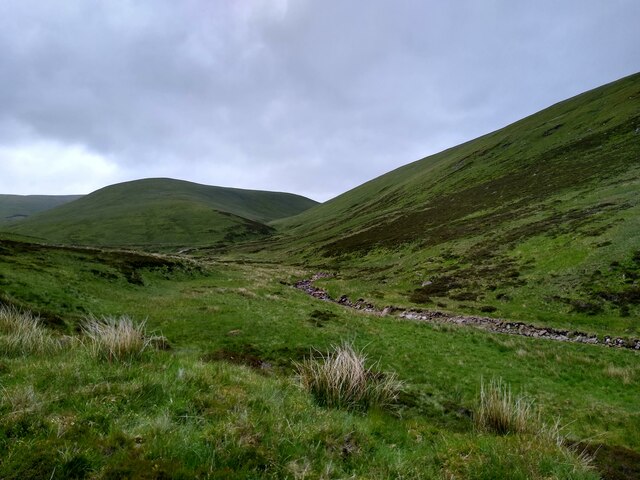
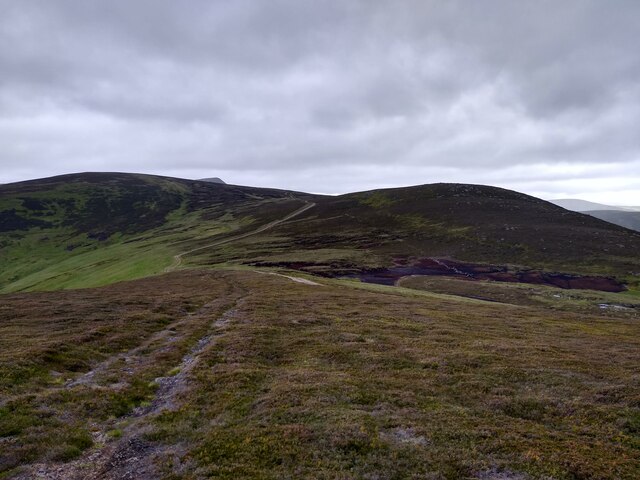
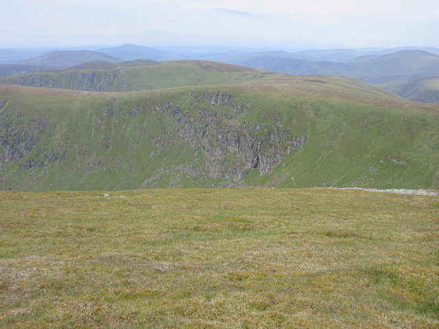
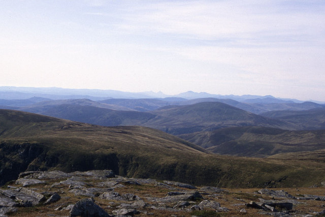
White Glen, Angus (Valley), located in the northern region of Scotland, is a picturesque and idyllic valley known for its stunning natural beauty. Nestled amidst the rolling hills of Angus, this tranquil glen spans over an area of approximately 10 square kilometers.

The valley is characterized by its lush green meadows, dense woodlands, and meandering streams that cut through the landscape, creating a serene and peaceful atmosphere. White Glen is particularly famous for its pristine white-sand beaches, which stretch along the banks of the River Esk, offering breathtaking views of the surrounding mountains.

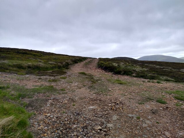
The valley is a haven for nature enthusiasts and outdoor adventurers, with a plethora of activities to indulge in. Hiking and trekking trails crisscross the area, allowing visitors to explore the valley's diverse flora and fauna. The glen is home to a variety of wildlife, including deer, foxes, and a plethora of bird species, making it an ideal spot for birdwatching.

Moreover, White Glen boasts a rich history, with several ancient ruins and archaeological sites scattered throughout the valley. These remnants provide insight into the area's past and its significance in local folklore.

The nearby town of Angus offers convenient access to amenities such as accommodation, restaurants, and shops, ensuring a comfortable stay for visitors. The valley's proximity to other popular attractions, such as the Cairngorms National Park and the Angus Glens, further enhances its appeal.

Overall, White Glen, Angus (Valley), with its stunning natural landscapes, abundant wildlife, and historical significance, is a captivating destination for those seeking tranquility and a connection with nature.

If you have any feedback on the listing, please let us know in the comments section below.

White Glen Images

Images are sourced within 2km of 56.832796/-3.2582261 or Grid Reference NO2371. Thanks to Geograph Open Source API. All images are credited.

Cairn atop Mayar
Cairn atop Mayar
View up Glen Cally This is the very northern end of Glen Cally, the burn to the right. It divides in two just a hundred metres further up, and then peters out. Or rather springs into existence. The same happens to the path. The spur in the middle of the image leads straight onto the Mayar plateau. Just two miles from here and you are in Corrie Fee, which seems so far away when you are walking in Glen Isla.
View up Glen Cally
This is the very northern end of Glen Cally, the burn to the right. It divides in two just a hundred metres further up, and then peters out. Or rather springs into existence. The same happens to the path. The spur in the middle of the image leads straight onto the Mayar plateau. Just two miles from here and you are in Corrie Fee, which seems so far away when you are walking in Glen Isla.
The plateau at the end of Glen Isla Coming down Mid Hill this is the view towards the next hills, Tarmach Cairn and Bawhelps, which are just little bumps in the large plateau that extends from here to Loch Muick in the north, Glen Shee in the west and who knows what in the east. The nose that shows up in the background is, if I'm not mistaken, part of Mayar.
The plateau at the end of Glen Isla
Coming down Mid Hill this is the view towards the next hills, Tarmach Cairn and Bawhelps, which are just little bumps in the large plateau that extends from here to Loch Muick in the north, Glen Shee in the west and who knows what in the east. The nose that shows up in the background is, if I'm not mistaken, part of Mayar.
Summit of Mid Hill This, I think, is the summit cairn of Mid Hill, a pretty non-descript hill at the end of Glen Isla, which leads onto a large plateau. This cairn is fairly small, not really a cairn. A bit further west is a larger stony structure, but this seems slightly higher.
Summit of Mid Hill
This, I think, is the summit cairn of Mid Hill, a pretty non-descript hill at the end of Glen Isla, which leads onto a large plateau. This cairn is fairly small, not really a cairn. A bit further west is a larger stony structure, but this seems slightly higher.
Four way crossroads The rare four way crossroads of bulldozed hill tracks. The track to the left leads onto the summit of Mid Hill. The one straight circumvents the summit and leads further onto the plateau. The one on the right leads to Craig Lair, and can then be used to get back to Glen Isla.
Four way crossroads
The rare four way crossroads of bulldozed hill tracks. The track to the left leads onto the summit of Mid Hill. The one straight circumvents the summit and leads further onto the plateau. The one on the right leads to Craig Lair, and can then be used to get back to Glen Isla.
Summit of Mayar Cairn on the summit of the Munro.
Summit of Mayar
Cairn on the summit of the Munro.
The Summit of Mayar 928m A Munro defined as a mountain in Scotland with a height over 3,000 feet (914.4 m), and which is on the Scottish Mountaineering Club (SMC) official list of Munros; there is no explicit topographical prominence requirement.
The Summit of Mayar 928m
A Munro defined as a mountain in Scotland with a height over 3,000 feet (914.4 m), and which is on the Scottish Mountaineering Club (SMC) official list of Munros; there is no explicit topographical prominence requirement.
Mayar Summit The loch in the far distance is the Backwater Reservoir.
Mayar Summit
The loch in the far distance is the Backwater Reservoir.
Mayar Summit Cairn Looking southwest past the cairn, the Lomond Hills were just discernible in the distance. Prosen Water is on the left in the glen of the same name. The reflection in the distance is from Backwater Reservoir.
Mayar Summit Cairn
Looking southwest past the cairn, the Lomond Hills were just discernible in the distance. Prosen Water is on the left in the glen of the same name. The reflection in the distance is from Backwater Reservoir.
Mayar Summit Mayar from the approach to Driesh. The crags in the centre foreground are the Black Skellies.
Mayar Summit
Mayar from the approach to Driesh. The crags in the centre foreground are the Black Skellies.
Summit cairn of Mayer Looking north-eastwards to the summit cairn on Mayer.
Summit cairn of Mayer
Looking north-eastwards to the summit cairn on Mayer.
South Craig Rocks and cliffs on South Craig, viewed from west of the summit of Mayer.
South Craig
Rocks and cliffs on South Craig, viewed from west of the summit of Mayer.
Kilbo Path, Cairn Dye Rutted section of the Kilbo Path coming down Cairn Dye.
Kilbo Path, Cairn Dye
Rutted section of the Kilbo Path coming down Cairn Dye.
Graveyard of stumps Remnants of the cleared forest on the Kilbo Path at King's Seat.
Graveyard of stumps
Remnants of the cleared forest on the Kilbo Path at King's Seat.
Kilbo, Glen Prosen The restored bothy at Kilbo in the upper reach of Glen Prosen.
Kilbo, Glen Prosen
The restored bothy at Kilbo in the upper reach of Glen Prosen.
South Craig and surrounding area as seen from Mayar
Summit of Mayar A cairn marking the 928m Munro summit, with extensive westward views
Summit of Mayar
A cairn marking the 928m Munro summit, with extensive westward views
Heather moorland east of Mayar The broad east ridge of Mayar extending towards the partly sunlit dome of Driesh: both mountains are Munros.
The sunlit hills at the left horizon are on the north-eastern side of Glen Clova.
Heather moorland east of Mayar
The broad east ridge of Mayar extending towards the partly sunlit dome of Driesh: both mountains are Munros. The sunlit hills at the left horizon are on the north-eastern side of Glen Clova.
Show me another place!

White Glen is located at Grid Ref: NO2371 (Lat: 56.832796, Lng: -3.2582261)

Unitary Authority: Angus

Police Authority: Tayside

What 3 Words

///state.nobody.dumplings. Near Inverey, Aberdeenshire

Nearby Locations

Broom Hill White Glen

Related Wikis

Mayar (mountain)

Mayar is a mountain in the Grampians, in Angus, Scotland. It is usually climbed together with its near neighbour, Driesh. At an elevation of 928 m, it...

Corrie Fee

Corrie Fee is a glacier-carved corrie situated at the head of Glen Clova in the Angus Glens of Scotland. It forms part of Corrie Fee National Nature Reserve...

Driesh

Driesh (Gaelic: Dris) is a mountain located in the Grampians of Scotland. Apart from Mount Keen (939 m/3,080 ft), it is the most easterly of the Munro...

Glen Doll

Glen Doll, also sometimes spelt Glendoll, lies within the Cairngorms National Park, Scotland, at the top of Glen Clova, in an area of steep hills, corries...

Have you been to White Glen?

Leave your review of White Glen below (or comments, questions and feedback).