Stert Combe

Valley in Somerset Somerset West and Taunton

England

Stert Combe

Pool Below Woodlands Hill
Pool Below Woodlands Hill Credit: Chris Andrews

Stert Combe is a beautiful valley located in the county of Somerset, England. Nestled amidst rolling hills and lush greenery, it is a picturesque and tranquil spot that offers visitors a chance to escape the hustle and bustle of everyday life.

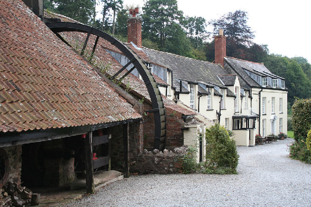
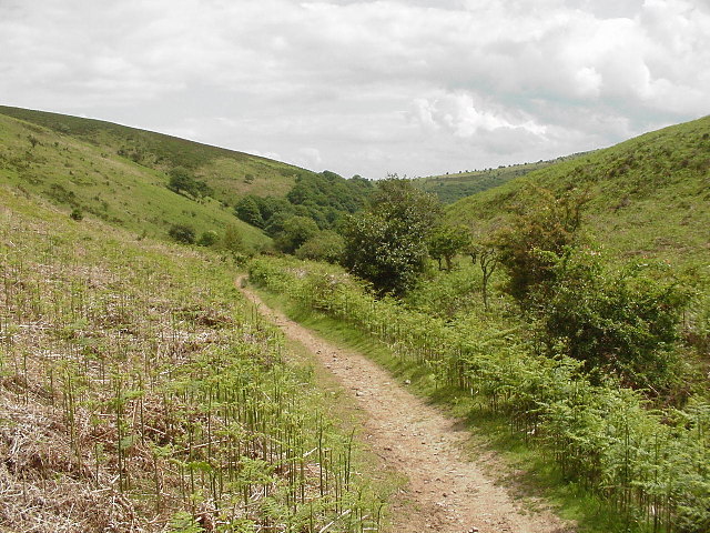
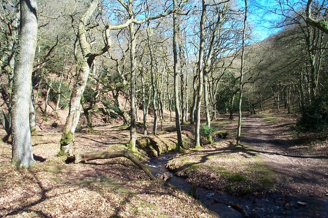
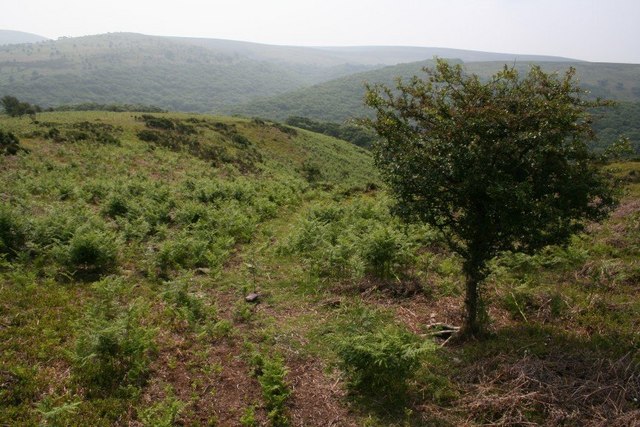
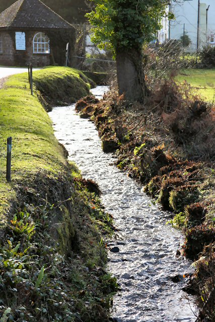
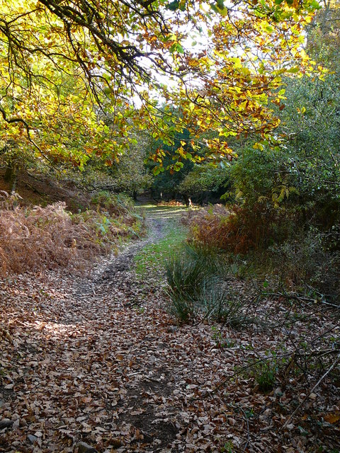
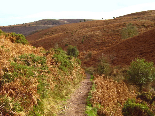
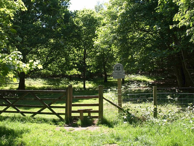
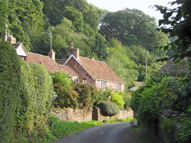
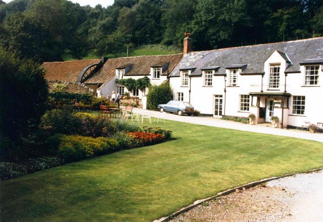
The valley is characterized by its steep slopes and narrow floor, which creates a sense of intimacy and seclusion. The surrounding countryside is dotted with charming cottages and farmhouses, adding to the area's rural charm.

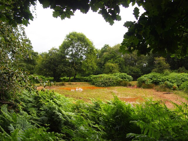
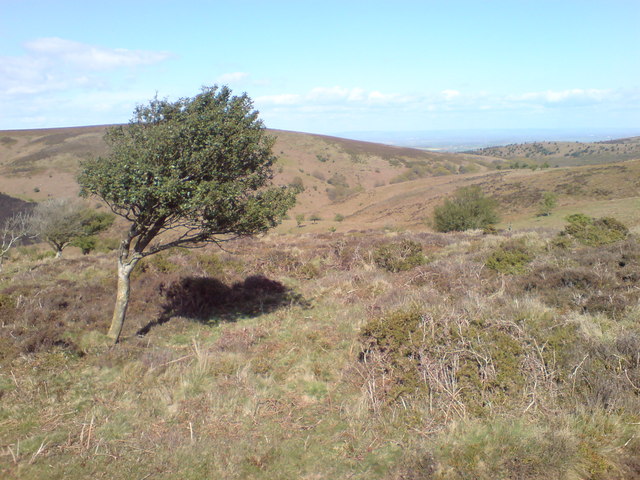
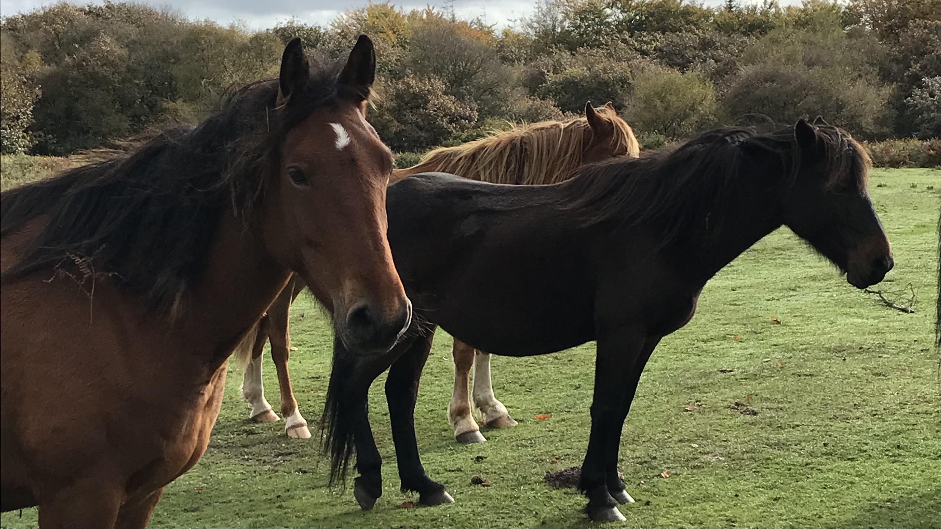
Stert Combe is known for its diverse wildlife, making it a haven for nature enthusiasts. The valley is home to a variety of bird species, including buzzards, owls, and skylarks. It is also home to several species of butterflies and wildflowers, providing a colorful and vibrant display during the warmer months.

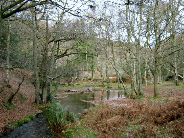
The valley is intersected by a gently flowing stream, which adds to its scenic beauty. The sound of the water cascading over rocks and the sight of small waterfalls create a tranquil and soothing atmosphere, perfect for relaxation and contemplation.

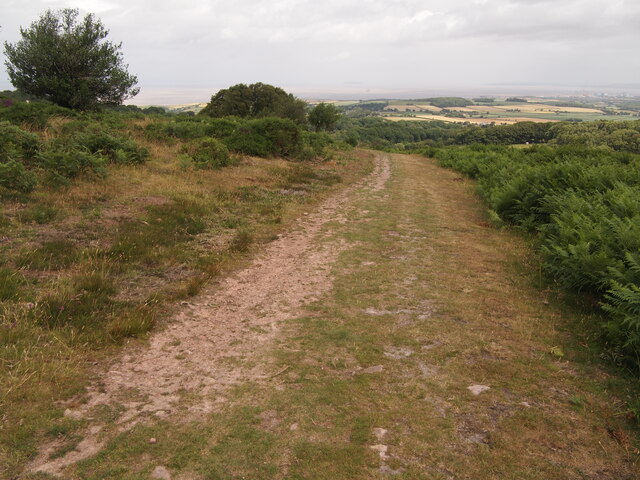
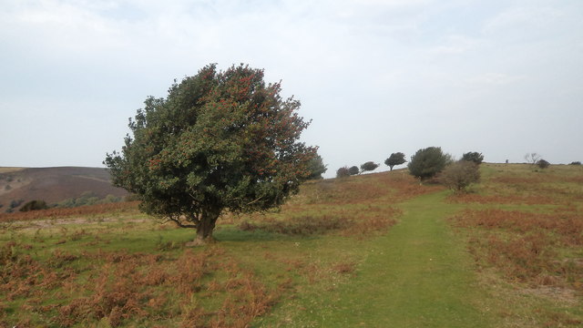
Stert Combe is a popular destination for hikers and walkers, with several scenic trails crisscrossing the valley. These paths offer stunning views of the surrounding countryside and provide an opportunity to explore the area's natural beauty up close.

Overall, Stert Combe is a hidden gem in Somerset, offering visitors a chance to immerse themselves in nature and experience the peace and tranquility of a rural valley. With its diverse wildlife, scenic beauty, and walking trails, it is a haven for outdoor enthusiasts and those seeking a break from the fast-paced modern world.

If you have any feedback on the listing, please let us know in the comments section below.
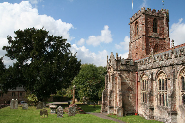
Stert Combe Images

Images are sourced within 2km of 51.144134/-3.222887 or Grid Reference ST1439. Thanks to Geograph Open Source API. All images are credited.

Pool Below Woodlands Hill
Track on Lower Hare Knap
Holford: waterwheel at Combe House Hotel The 26’ diameter overshot waterwheel was cast by Bridgwater ironfounder H Culverwell & Co in 1892 to replace an earlier wheel. It was used to grind oak bark for the tannery complex established here in the 1840s by James Hayman. When the tannery closed in 1900 the waterwheel was adapted to other uses such as grinding grain for grist, cutting chaff, chopping apples for the cider press and generating electricity. It also cracked stones in a nearby quarry. The gearing survives too. Combe House Hotel is open to non residents for lunches and teas
Holford: waterwheel at Combe House Hotel
The 26’ diameter overshot waterwheel was cast by Bridgwater ironfounder H Culverwell & Co in 1892 to replace an earlier wheel. It was used to grind oak bark for the tannery complex established here in the 1840s by James Hayman. When the tannery closed in 1900 the waterwheel was adapted to other uses such as grinding grain for grist, cutting chaff, chopping apples for the cider press and generating electricity. It also cracked stones in a nearby quarry. The gearing survives too. Combe House Hotel is open to non residents for lunches and teas
Top of Hodders Combe near Lady's Edge
Hodder's Combe. Ancient oak woodland lines the combe bottom.
Hodder's Combe.
Ancient oak woodland lines the combe bottom.
Hawthorn tree above Lady's Edge Climbing up on the path above Lady's Edge, a view back to the ridges of the Quantocks, with a hawthorn tree nicely placed for foreground interest.
Hawthorn tree above Lady's Edge
Climbing up on the path above Lady's Edge, a view back to the ridges of the Quantocks, with a hawthorn tree nicely placed for foreground interest.
Entrance to Combe House Hotel Looking back towards the road from the front of the hotel.
Entrance to Combe House Hotel
Looking back towards the road from the front of the hotel.
Stream in Holford Combe This stream used to drive the watermill at what is now Castle Combe Hotel.
Stream in Holford Combe
This stream used to drive the watermill at what is now Castle Combe Hotel.
Track down into Lady's Combe Just before heading in to the depths of the combe.
Track down into Lady's Combe
Just before heading in to the depths of the combe.
Lady's Edge The path from Bicknoller Post descending towards Sheppard's Combe.
Lady's Edge
The path from Bicknoller Post descending towards Sheppard's Combe.
Hodder's Combe The stream flowing towards Holford.
Hodder's Combe
The stream flowing towards Holford.
The  Holford Memorial Plantation In memory of villagers who died in WWII.
The Holford Memorial Plantation
In memory of villagers who died in WWII.
Looking North from the Top of Hodders Combe The view is even better than this in real life!
Looking North from the Top of Hodders Combe
The view is even better than this in real life!
Woodlands Hill A stile from the car park by the A39 into the oak woodland owned by the National Trust, although their website has nothing to say about the place, perhaps because there is no tearoom.
Woodlands Hill
A stile from the car park by the A39 into the oak woodland owned by the National Trust, although their website has nothing to say about the place, perhaps because there is no tearoom.
Holford Combe and Woodlands Hill
Combe House Hotel, Holford, in 1986
A Boundary Stone This is Longstone boundary stone, located on Longstone Hill in the Quantocks at approximately 290 metres above sea level.
A Boundary Stone
This is Longstone boundary stone, located on Longstone Hill in the Quantocks at approximately 290 metres above sea level.
Holly Tree A fine example of a mature and healthy holly tree, on Lower Hare Knap, on the Quantocks. I soon discovered a proliferation of healthy holly trees as I walked over the knap to Holford.
Holly Tree
A fine example of a mature and healthy holly tree, on Lower Hare Knap, on the Quantocks. I soon discovered a proliferation of healthy holly trees as I walked over the knap to Holford.
Show me another place!

Stert Combe is located at Grid Ref: ST1439 (Lat: 51.144134, Lng: -3.222887)

Administrative County: Somerset

District: Somerset West and Taunton

Police Authority: Avon and Somerset

What 3 Words

///mason.insulated.easygoing. Near Nether Stowey, Somerset

Related Wikis

Quantock Hills

The Quantock Hills west of Bridgwater in Somerset, England, consist of heathland, oak woodlands, ancient parklands and agricultural land. They were England...

Dowsborough

Dowsborough Camp (or Danesborough or Dawesbury) is an Iron Age hill fort on the Quantock Hills near Nether Stowey in Somerset, England. It has been designated...

Dead Woman's Ditch

Dead Woman's Ditch is an earthwork which has been scheduled as an ancient monument in Over Stowey, Somerset, England situated on the Quantock Hills. A...

Halsway Manor

Halsway Manor (also known as Halsway Court) is a manor house in Halsway, Somerset. It is owned by the Halsway Manor Society who operate the manor as a...

Crowcombe Court

Crowcombe Court in Crowcombe, Somerset, England is a large country house dating from 1724 to 1739. It is Grade I listed.It was built, in English regional...

Crowcombe

Crowcombe is a village and civil parish under the Quantock Hills in Somerset, England, 5.5 miles (9 km) southeast of Watchet, and 8 miles (13 km) from...
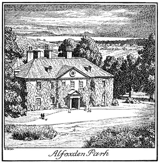
Alfoxton House

Alfoxton House, also known as Alfoxton Park or Alfoxden, is an 18th-century country house in Holford, Somerset, England, within the Quantock Hills Area...

Holford

Holford is a village and civil parish in West Somerset within the Quantock Hills Area of Outstanding Natural Beauty. It is located about 10 miles (16 km...

Nearby Amenities

Located within 500m of 51.144134,-3.222887
The data included in this document is from www.openstreetmap.org. The data is made available under ODbL.

Have you been to Stert Combe?

Leave your review of Stert Combe below (or comments, questions and feedback).