Gilshmuir Cleuch

Valley in Peeblesshire

Scotland

Gilshmuir Cleuch

View from Ladyurd Hill Ladyurd Hill belongs to an obscure category of hills called Donald Deweys. The Deweys were originally drawn up by a Mr Dewey for England and Wales only, then subsequently adopted in Scotland by various hill-list compilers in the early 2000s. The Donald Deweys  are Lowland hills lower than Donalds (which are Lowland hills starting at 610 metres, or 2000 feet, and follow no other real criteria other than being deemed important enough to be on his list by Percy Donald back in 1935) but at least 500 metres high, with a minimum prominence of 30 metres. There are 247 in total - I have yet to hear of anybody having done a 'round' of them.
Where the actual summit is,  is a matter of some debate. The OS map at the 1:25k scale puts it at the Southern end of the fairly long summit plateau, but confuse matters by showing it as being towards the Northern edge of the plateau on their 1:50k scale map.  Near to the Southern 'summit' are two shallow depressions; an 1850s OS map shows these as being at the site of an old whinstone quarry.
Whether the hill takes its name from the old farm below, or vice-versa is unclear. As is the meaning of 'urd', which also appears in other nearby placenames: Netherurd, Kirkurd and Lochurd. Wikipedia references an 1840s book which suggests it might mean quarter, which presumably would be as in 'living quarters', but other than that there is nothing to go on.
View from Ladyurd Hill Credit: Ian Dodds

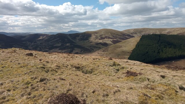
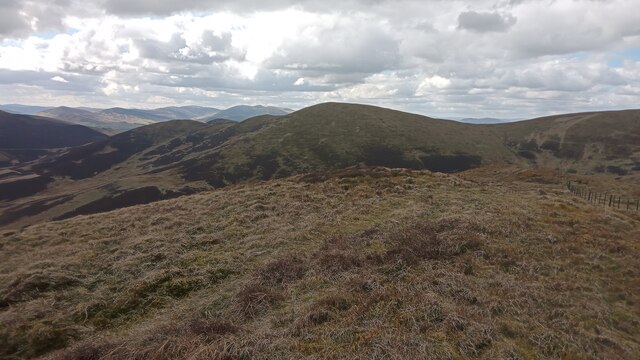
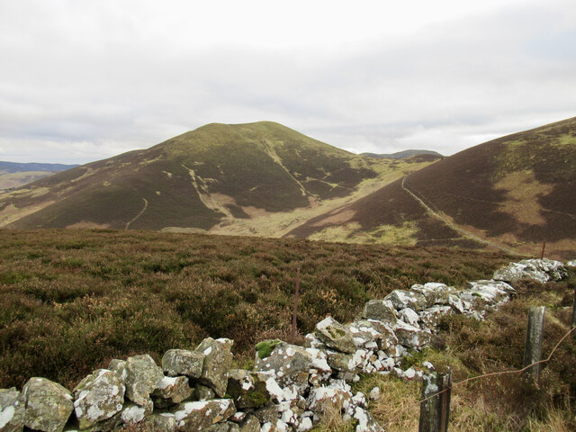
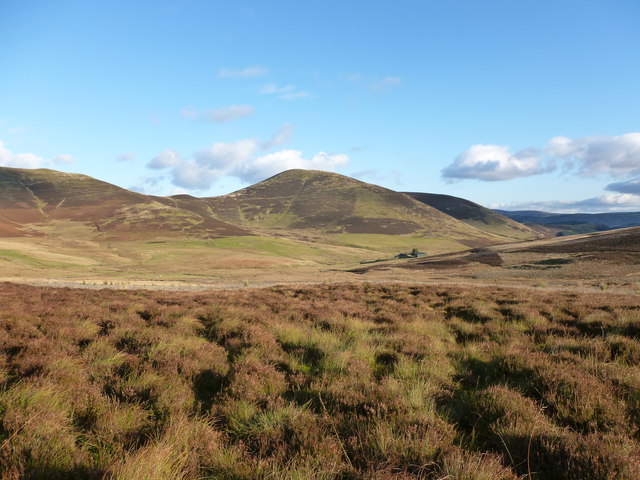
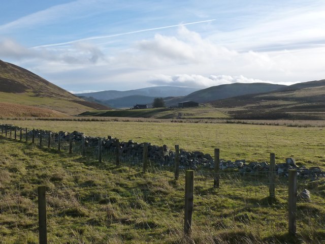
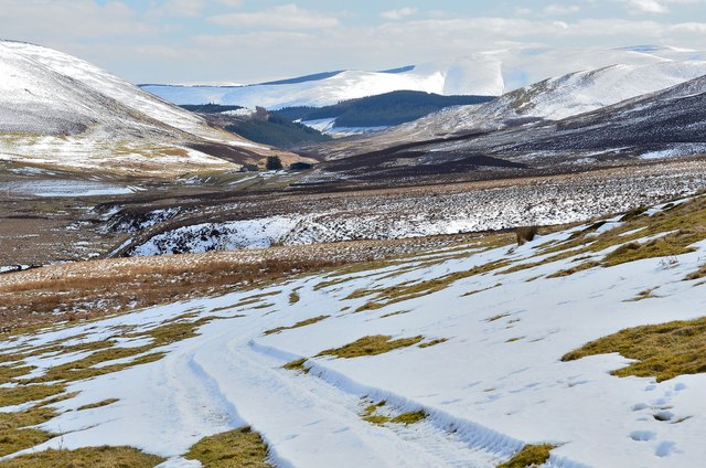
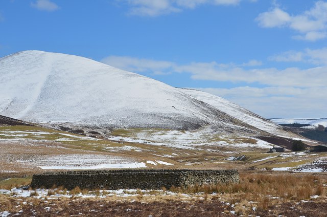
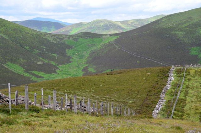
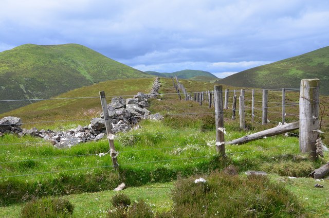
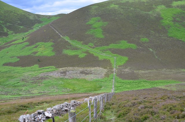
Gilshmuir Cleuch is a picturesque valley located in Peeblesshire, Scotland. Situated in the Southern Uplands, it is surrounded by rolling hills and offers stunning views of the surrounding countryside. The cleuch, a Scottish term for a steep-sided valley, is known for its natural beauty and tranquil atmosphere.

Covering an area of approximately 2 square kilometers, Gilshmuir Cleuch is home to a diverse range of flora and fauna. The valley is characterized by lush greenery, including native trees such as oak, birch, and rowan. Wildflowers, such as bluebells and primroses, add bursts of color to the landscape during the spring and summer months.

The cleuch is intersected by a small river that meanders through the valley, creating an idyllic scene. The river is home to various species of fish, including trout and salmon, making it a popular spot for anglers.

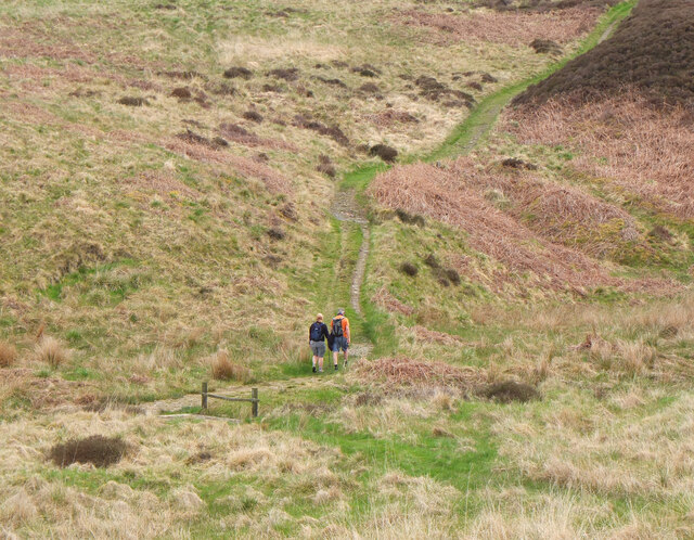
Gilshmuir Cleuch is also known for its walking trails, which attract both locals and tourists alike. The paths wind through the valley, offering visitors the opportunity to explore its natural wonders at their own pace. The cleuch is particularly famous for the Gilshmuir Cleuch Loop, a circular trail that allows hikers to experience the diversity of the landscape while enjoying breathtaking views.

Due to its remote location, Gilshmuir Cleuch offers a peaceful retreat away from the hustle and bustle of city life. The valley provides a unique opportunity to immerse oneself in nature and enjoy the tranquility of the Scottish countryside.

If you have any feedback on the listing, please let us know in the comments section below.

Gilshmuir Cleuch Images

Images are sourced within 2km of 55.654522/-3.3607056 or Grid Reference NT1440. Thanks to Geograph Open Source API. All images are credited.

View from Ladyurd Hill Ladyurd Hill belongs to an obscure category of hills called Donald Deweys. The Deweys were originally drawn up by a Mr Dewey for England and Wales only, then subsequently adopted in Scotland by various hill-list compilers in the early 2000s. The Donald Deweys  are Lowland hills lower than Donalds (which are Lowland hills starting at 610 metres, or 2000 feet, and follow no other real criteria other than being deemed important enough to be on his list by Percy Donald back in 1935) but at least 500 metres high, with a minimum prominence of 30 metres. There are 247 in total - I have yet to hear of anybody having done a 'round' of them.
Where the actual summit is,  is a matter of some debate. The OS map at the 1:25k scale puts it at the Southern end of the fairly long summit plateau, but confuse matters by showing it as being towards the Northern edge of the plateau on their 1:50k scale map.  Near to the Southern 'summit' are two shallow depressions; an 1850s OS map shows these as being at the site of an old whinstone quarry.
Whether the hill takes its name from the old farm below, or vice-versa is unclear. As is the meaning of 'urd', which also appears in other nearby placenames: Netherurd, Kirkurd and Lochurd. Wikipedia references an 1840s book which suggests it might mean quarter, which presumably would be as in 'living quarters', but other than that there is nothing to go on.
View from Ladyurd Hill
Ladyurd Hill belongs to an obscure category of hills called Donald Deweys. The Deweys were originally drawn up by a Mr Dewey for England and Wales only, then subsequently adopted in Scotland by various hill-list compilers in the early 2000s. The Donald Deweys are Lowland hills lower than Donalds (which are Lowland hills starting at 610 metres, or 2000 feet, and follow no other real criteria other than being deemed important enough to be on his list by Percy Donald back in 1935) but at least 500 metres high, with a minimum prominence of 30 metres. There are 247 in total - I have yet to hear of anybody having done a 'round' of them. Where the actual summit is, is a matter of some debate. The OS map at the 1:25k scale puts it at the Southern end of the fairly long summit plateau, but confuse matters by showing it as being towards the Northern edge of the plateau on their 1:50k scale map. Near to the Southern 'summit' are two shallow depressions; an 1850s OS map shows these as being at the site of an old whinstone quarry. Whether the hill takes its name from the old farm below, or vice-versa is unclear. As is the meaning of 'urd', which also appears in other nearby placenames: Netherurd, Kirkurd and Lochurd. Wikipedia references an 1840s book which suggests it might mean quarter, which presumably would be as in 'living quarters', but other than that there is nothing to go on.
View from Brown Dod A quirk of the classification of Britain's lesser hills - fun for those who, like me, like these kind of things, but bewildering for most -  is that there is a category of hills referred to as Dodds, which actually get their name due to a fairly boring acronym, and refers to British hills with a height of 500-599 metres with a 30 metre drop, and has absolutely nothing to to do with the words 'Dod' or  'Dodd' which occasionally appear in hill names.
Since my name is Ian Dodds I should probably step up my research into these things. It is generally accepted that'Dodd' and 'Dod' refer to smallish round hills.  Thankfully the internet has become slightly more forgiving about my surname etymology over the last few years. It used to be commonplace to find my family name described online as having derived from the hill name to mean 'small round man', or simply a 'stupid fellow'!
All family tree records on the male side lead to and stay in and around Durham, which is reported as being historically the place where most variations of the Dodds surname came from. I have not done much walking round there, so am not sure how many Dodd/Dod hill-names there are in the Durham area; I just know them from Southern Scotland and the Lake District. Irrespective of this, I think it is fair to say that my surname is based on ancestors having lived close to hilly areas, and has nothing whatsoever with us being dim-witted people!
View from Brown Dod
A quirk of the classification of Britain's lesser hills - fun for those who, like me, like these kind of things, but bewildering for most - is that there is a category of hills referred to as Dodds, which actually get their name due to a fairly boring acronym, and refers to British hills with a height of 500-599 metres with a 30 metre drop, and has absolutely nothing to to do with the words 'Dod' or 'Dodd' which occasionally appear in hill names. Since my name is Ian Dodds I should probably step up my research into these things. It is generally accepted that'Dodd' and 'Dod' refer to smallish round hills. Thankfully the internet has become slightly more forgiving about my surname etymology over the last few years. It used to be commonplace to find my family name described online as having derived from the hill name to mean 'small round man', or simply a 'stupid fellow'! All family tree records on the male side lead to and stay in and around Durham, which is reported as being historically the place where most variations of the Dodds surname came from. I have not done much walking round there, so am not sure how many Dodd/Dod hill-names there are in the Durham area; I just know them from Southern Scotland and the Lake District. Irrespective of this, I think it is fair to say that my surname is based on ancestors having lived close to hilly areas, and has nothing whatsoever with us being dim-witted people!
Looking towards Penvalla from Cat Hill Penvalla is a distinctively shaped hill above Harrow Hope.
Looking towards Penvalla from Cat Hill
Penvalla is a distinctively shaped hill above Harrow Hope.
North Ridge, Green Law
Green Law The quad bike track makes for easy walking here.
Green Law
The quad bike track makes for easy walking here.
Col between Green Law and Pyked Stane Hill Fence line and quad bike track running (almost) in parallel.
Col between Green Law and Pyked Stane Hill
Fence line and quad bike track running (almost) in parallel.
Penvalla and the farm of Stobo Hopehead A remote sheep farm high on the moor between Broughton and Stobo.
Penvalla and the farm of Stobo Hopehead
A remote sheep farm high on the moor between Broughton and Stobo.
Enclosure near Stobo Hopehead Looking towards a distant Pykestone Hill.
Enclosure near Stobo Hopehead
Looking towards a distant Pykestone Hill.
Ridge to Pyked Stane Hill A straightforward walk apart from a few snowdrifts with stretches of snow that suddenly collapse under one's weight - but it was April Fools Day after all.
Ridge to Pyked Stane Hill
A straightforward walk apart from a few snowdrifts with stretches of snow that suddenly collapse under one's weight - but it was April Fools Day after all.
Forest edge on Wether Law The top of the plantations that cover the NE side of Wether Law, Brown Dod and Flint Hill.
Forest edge on Wether Law
The top of the plantations that cover the NE side of Wether Law, Brown Dod and Flint Hill.
Stobo Hope from Brown Dod Snow cover is still extensive in the cold spring weather.
Stobo Hope from Brown Dod
Snow cover is still extensive in the cold spring weather.
Feeding trough in old sheepfold, Stobo Hope One of four sheepfolds marked in this square, there is nothing remaining except a circular grassy area.
Feeding trough in old sheepfold, Stobo Hope
One of four sheepfolds marked in this square, there is nothing remaining except a circular grassy area.
Track to Stobo Hopehead A tractor route over the snowy hillside towards the farm in the distance.
Track to Stobo Hopehead
A tractor route over the snowy hillside towards the farm in the distance.
Sheepfold below Penvalla The octagonal sheepfold shown in <a href="https://www.geograph.org.uk/photo/1750827">NT1340 : Another unusual fank</a> with Penvalla beyond and the isolated farmhouse of Stobo Hopehead to the right.
Sheepfold below Penvalla
The octagonal sheepfold shown in NT1340 : Another unusual fank with Penvalla beyond and the isolated farmhouse of Stobo Hopehead to the right.
Westwards from Riding Hill The view to Tinto in the distance across the col between Penvalla and Ladyurd Hill with Broomy Side straight ahead.
Westwards from Riding Hill
The view to Tinto in the distance across the col between Penvalla and Ladyurd Hill with Broomy Side straight ahead.
Summit fence, Cat Hill Cat Hill is a minor top (437m) on the ridge running NW from Riding Hill. Penvalla is the prominent summit to the left with Hammer Head in view straight ahead.
Summit fence, Cat Hill
Cat Hill is a minor top (437m) on the ridge running NW from Riding Hill. Penvalla is the prominent summit to the left with Hammer Head in view straight ahead.
Descent from Cat Hill Wainwright's maxim 'Watch where you are putting your feet' applies here on a heathery slope with concealed bumps and hollows and the occasional piece of old fence wire. <a href="https://www.geograph.org.uk/photo/1064945">NT1540 : Pass beneath Ladyurd Hill</a> shows this spot in a hard winter frost.
Descent from Cat Hill
Wainwright's maxim 'Watch where you are putting your feet' applies here on a heathery slope with concealed bumps and hollows and the occasional piece of old fence wire. NT1540 : Pass beneath Ladyurd Hill shows this spot in a hard winter frost.
Walkers on the John Buchan Way Walkers just across the Hopehead Burn on the climb to Hammer Rig.
Walkers on the John Buchan Way
Walkers just across the Hopehead Burn on the climb to Hammer Rig.
Show me another place!

Gilshmuir Cleuch is located at Grid Ref: NT1440 (Lat: 55.654522, Lng: -3.3607056)

Unitary Authority: The Scottish Borders

Police Authority: The Lothians and Scottish Borders

What 3 Words

///protects.hitters.crafts. Near West Linton, Scottish Borders

Related Wikis

Tarth Water

The Tarth Water is a river in Peebleshire, in the Scottish Borders. It forms part of the River Tweed system. The river with a total length of 7.1 miles...

Drochil Castle

Drochil Castle is a ruined castle in the Scottish Borders. It is located above the Lyne Water, 10 kilometres (6.2 mi) north-west of Peebles, and 8 kilometres...

Castle Craig Hospital

Castle Craig Hospital is a private residential drug and alcohol rehabilitation clinic. It is located in Peeblesshire, Scotland. Castle Craig is an 18th...

Kirkurd

Kirkurd is a parish in Peeblesshire in the Scottish Borders situated 3 miles south-east of Dolphinton and 6 miles north-east of Broughton. Tarth Water...

Nearby Amenities

Located within 500m of 55.654522,-3.3607056
The data included in this document is from www.openstreetmap.org. The data is made available under ODbL.

Have you been to Gilshmuir Cleuch?

Leave your review of Gilshmuir Cleuch below (or comments, questions and feedback).