Broughton Hope
Valley in Peeblesshire
Scotland
Broughton Hope

Broughton Hope is a small valley located in the region of Peeblesshire, Scotland. Nestled within the beautiful Scottish Borders, this picturesque valley is known for its stunning natural landscapes and peaceful ambiance. Surrounded by rolling hills, lush green meadows, and a meandering river, Broughton Hope offers a tranquil retreat for nature enthusiasts and those seeking a break from the hustle and bustle of city life.
The valley is home to a small village called Broughton, which has a rich history dating back several centuries. The village is characterized by its charming traditional stone cottages, a quaint church, and a few local shops and amenities. The residents of Broughton are known for their warm hospitality and strong community spirit.
The natural beauty of Broughton Hope makes it an ideal destination for outdoor activities. The surrounding hills and forests provide ample opportunities for hiking, cycling, and birdwatching. The river that runs through the valley is perfect for fishing and canoeing. The area is also known for its scenic drives, offering breathtaking views of the valley and the surrounding countryside.
For those interested in history and culture, Broughton Hope is home to a number of historical landmarks and sites. The nearby Broughton House, a grand country mansion, is open to the public and offers a glimpse into the area's rich past. Additionally, the village hosts various events and festivals throughout the year, showcasing traditional Scottish music, dance, and crafts.
Overall, Broughton Hope in Peeblesshire is a hidden gem that offers a perfect blend of natural beauty, tranquility, and cultural heritage. Whether you are seeking outdoor adventures or simply want to soak in the serene atmosphere, this valley is a must-visit destination for nature lovers and history enthusiasts alike.
If you have any feedback on the listing, please let us know in the comments section below.
Broughton Hope Images
Images are sourced within 2km of 55.629021/-3.3910163 or Grid Reference NT1238. Thanks to Geograph Open Source API. All images are credited.


Broughton Hope is located at Grid Ref: NT1238 (Lat: 55.629021, Lng: -3.3910163)
Unitary Authority: The Scottish Borders
Police Authority: The Lothians and Scottish Borders
What 3 Words
///charge.ordeals.differ. Near Biggar, South Lanarkshire
Nearby Locations
Related Wikis
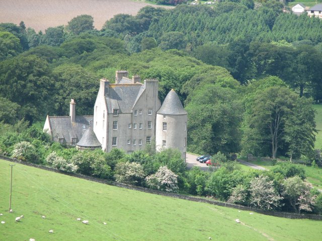
Broughton Place, Scottish Borders
Broughton Place is a historic house in the village of Broughton, Scottish Borders. It was designed by Basil Spence in the style of a 17th-century Scottish...
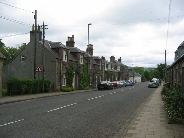
Broughton, Scottish Borders
Broughton is a village in Tweeddale in the historical county of Peeblesshire in the Scottish Borders council area, in the south of Scotland, in the civil...

Broughton railway station (Scotland)
Broughton railway station served the village of Broughton, Scottish Borders, Scotland from 1860 to 1950 on the Symington, Biggar and Broughton Railway...

Dreva on Tweed
Dreva on Tweed (or simply Dreva) is a hamlet in the Scottish Borders. It was historically in Peebles-shire. It is noted for the historical presence of...

Broughton, Glenholm and Kilbucho
Broughton, Glenholm and Kilbucho is a parish in Peeblesshire in the Scottish Borders, 11 miles south-west of Peebles, lying in the upper part of the valley...

Biggar Water
Biggar Water is a river in Lanarkshire and Peeblesshire, in the Southern Uplands of Scotland. It forms part of the River Tweed system. It rises, as Biggar...

Holms Water
The Holms Water is a river and a tributary of the Biggar Water, which is a tributary of the River Tweed, in the parish of Broughton, Glenholm and Kilbucho...

Drumelzier
Drumelzier (), is a village and civil parish on the B712 in the Tweed Valley in the Scottish Borders. The area of the village is extensive and includes...
Nearby Amenities
Located within 500m of 55.629021,-3.3910163Have you been to Broughton Hope?
Leave your review of Broughton Hope below (or comments, questions and feedback).