Gleann Beag

Valley in Perthshire

Scotland

Gleann Beag

The A93 in Gleann Beag The A93 Gleann Beag north of Spittal of Glenshee
The A93 in Gleann Beag Credit: Nigel Corby

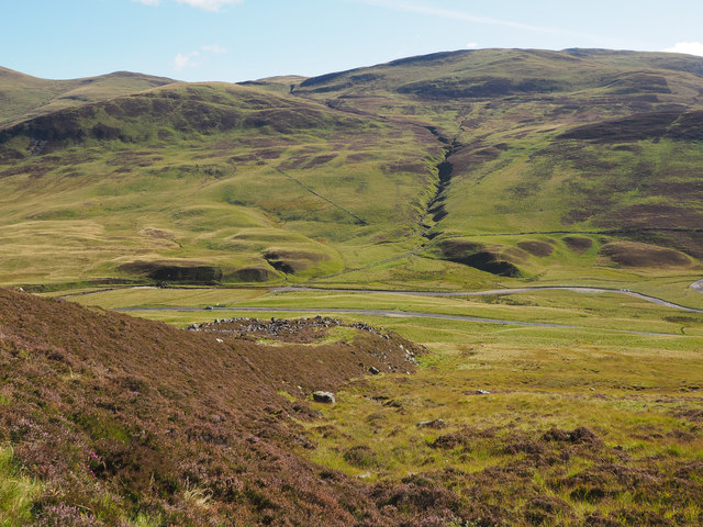
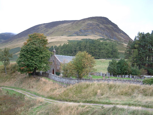
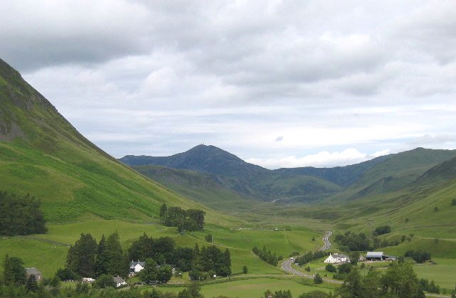
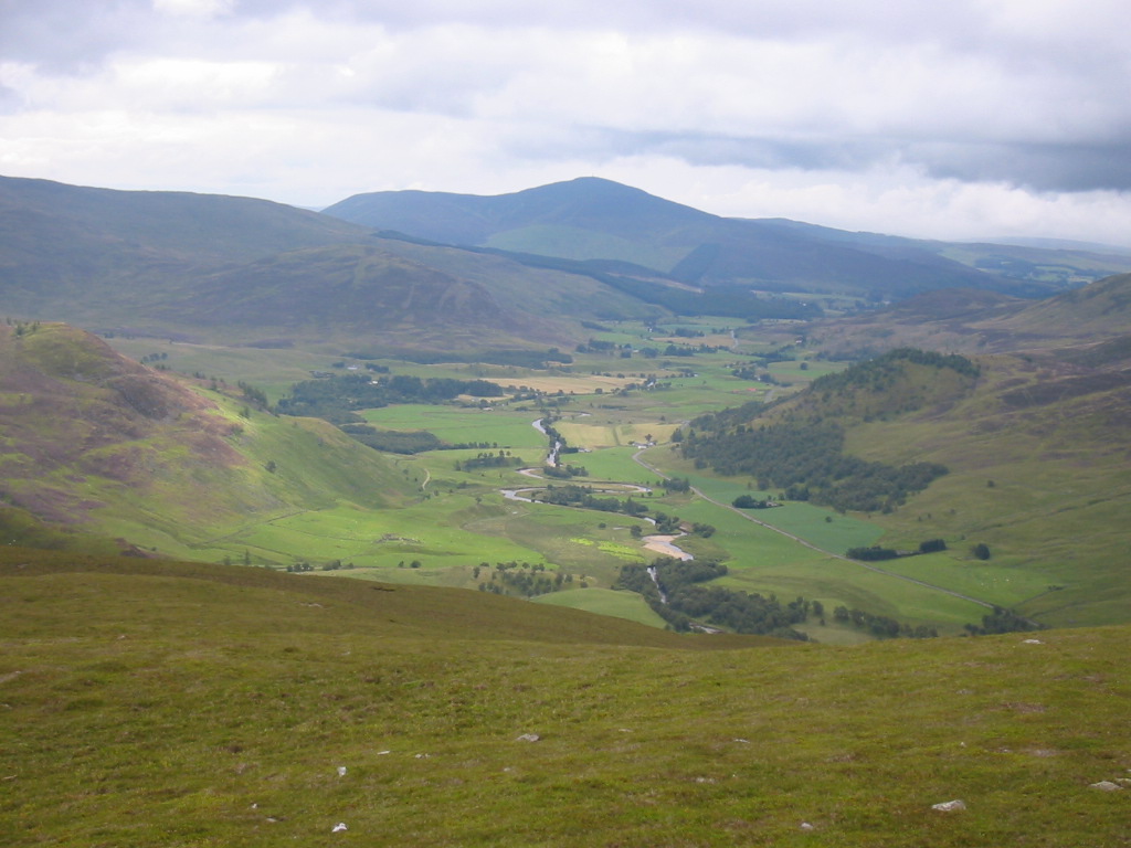
Gleann Beag is a picturesque valley located in the region of Perthshire, Scotland. Nestled amidst the stunning landscape of the Scottish Highlands, it is renowned for its breathtaking natural beauty and tranquil atmosphere. The valley stretches for several miles, surrounded by rolling hills, dense forests, and cascading waterfalls, making it a popular destination for outdoor enthusiasts and nature lovers.

The valley is home to a diverse range of flora and fauna, including rare species of birds, wildflowers, and ancient trees. Its rich biodiversity has led to the designation of Gleann Beag as a protected area, ensuring the preservation of its natural treasures.

Visitors can explore the valley through a network of walking trails that meander along the riverbanks and through the woodland. These trails offer stunning views of the surrounding landscape, with opportunities to spot wildlife and enjoy the peaceful atmosphere.

Gleann Beag is also notable for its historical significance, with several archaeological sites scattered throughout the area. Ruins of ancient settlements, standing stones, and burial mounds provide glimpses into the valley's past and its connection to early human civilizations.

The valley is easily accessible, with a well-maintained road leading to its entrance. Nearby amenities, including parking facilities and visitor centers, ensure convenience for those wishing to explore Gleann Beag.

Overall, Gleann Beag is a hidden gem in Perthshire, offering a serene escape from the hustle and bustle of everyday life. Its natural beauty, rich biodiversity, and historical significance make it a must-visit destination for anyone seeking an authentic Scottish Highland experience.

If you have any feedback on the listing, please let us know in the comments section below.

Gleann Beag Images

Images are sourced within 2km of 56.84088/-3.4373113 or Grid Reference NO1273. Thanks to Geograph Open Source API. All images are credited.

The A93 in Gleann Beag The A93 Gleann Beag north of Spittal of Glenshee
The A93 in Gleann Beag
The A93 Gleann Beag north of Spittal of Glenshee
View eastwards from the A93
Post-glacial debris flow (looking uphill) A narrow ridge of rocks runs down from Carn Dubh almost to the A93 road. If I have understood what I read correctly, this is a lateral levee, created when sediment slid down the hillside. Fine, free-flowing material pushed the larger boulders aside to create the ridge of rocks.

See <a href="https://www.geograph.org.uk/photo/4666808">NO1172 : Post-glacial debris flow (looking downhill)</a> for a view of the same feature below the track.
Post-glacial debris flow (looking uphill)
A narrow ridge of rocks runs down from Carn Dubh almost to the A93 road. If I have understood what I read correctly, this is a lateral levee, created when sediment slid down the hillside. Fine, free-flowing material pushed the larger boulders aside to create the ridge of rocks. See NO1172 : Post-glacial debris flow (looking downhill) for a view of the same feature below the track.
Post-glacial debris flow (looking downhill) This is <a href="https://www.geograph.org.uk/photo/4666795">NO1172 : Post-glacial debris flow (looking uphill)</a> looking downhill from the track, and across Gleann Beag.
Post-glacial debris flow (looking downhill)
This is NO1172 : Post-glacial debris flow (looking uphill) looking downhill from the track, and across Gleann Beag.
Glen Beag Looking across Allt a' Ghlinne Bhig to the lower slopes of Carn an Daimh.
Glen Beag
Looking across Allt a' Ghlinne Bhig to the lower slopes of Carn an Daimh.
The east slope of Ben Gulabin Looking uphill from just above the A93. The prominent hill on the skyline is Cairnwell (933 metres) in NO1377.
The east slope of Ben Gulabin
Looking uphill from just above the A93. The prominent hill on the skyline is Cairnwell (933 metres) in NO1377.
Looking towards Creagan Bheithe The summit of Creagan Bheithe (759 metres) is in NO1072, but most of the slopes leading up to it are in this square.
Looking towards Creagan Bheithe
The summit of Creagan Bheithe (759 metres) is in NO1072, but most of the slopes leading up to it are in this square.
Gleann Beag Looking across the glen to Carn Aig Mhala, a subsidiary top between Carn an Daimh to the right and Carn Ait to the left. The burn in a dark gorge on the right is Allt Gaineamhach, and on the left is Allt Crò na h-Airighe.
Gleann Beag
Looking across the glen to Carn Aig Mhala, a subsidiary top between Carn an Daimh to the right and Carn Ait to the left. The burn in a dark gorge on the right is Allt Gaineamhach, and on the left is Allt Crò na h-Airighe.
Gleann Beag Looking up the glen towards Cairnwell (933 metres) in NO1377. The ridge at upper left is Creag nan Eun, which is in this square. The name means 'crag of the birds'. According to the road signs, sheep larger than deer are apparently to be watched out for.
Gleann Beag
Looking up the glen towards Cairnwell (933 metres) in NO1377. The ridge at upper left is Creag nan Eun, which is in this square. The name means 'crag of the birds'. According to the road signs, sheep larger than deer are apparently to be watched out for.
Rhiedorrach An isolated house, the only one still inhabited between Spittal of Glenshee and the Cairnwell. Above it is Creagan Dearg, which means 'red crags' then the ridge of Creag nan Eun, 'crag of the birds', an appropriate name, for I watched a dozen or so Ravens flying along it.
Rhiedorrach
An isolated house, the only one still inhabited between Spittal of Glenshee and the Cairnwell. Above it is Creagan Dearg, which means 'red crags' then the ridge of Creag nan Eun, 'crag of the birds', an appropriate name, for I watched a dozen or so Ravens flying along it.
Allt Gorm Allt Gorm means either 'blue burn' or 'green burn' - Gaelic uses the same word for what English describes as two different colours. Its course runs diagonally across this view from upper left to lower right, and it joins Allt a' Ghlinne Bheag out of view to the right. The summit is Carn Ait (764 metres) in NO1473.
Allt Gorm
Allt Gorm means either 'blue burn' or 'green burn' - Gaelic uses the same word for what English describes as two different colours. Its course runs diagonally across this view from upper left to lower right, and it joins Allt a' Ghlinne Bheag out of view to the right. The summit is Carn Ait (764 metres) in NO1473.
A93 north of Spittal of Glenshee Wonderful view along Gleann Beag with the munro The Cairnwell dominating the skyline in the distance.
A93 north of Spittal of Glenshee
Wonderful view along Gleann Beag with the munro The Cairnwell dominating the skyline in the distance.
The road to Braemar from the Spittal of Glenshee
Track near Spittal of Glenshee Track leads up to the moors providing hill access.
Track near Spittal of Glenshee
Track leads up to the moors providing hill access.
Allt a'Charnaich The Burn rises beneath Ben Gulabin and flows into Allt a'Ghlinne Bhig.
Allt a'Charnaich
The Burn rises beneath Ben Gulabin and flows into Allt a'Ghlinne Bhig.
Ben Gulabin hill path Path breaks off from the main estate track and leads to the summit of Ben Gulabin.
Ben Gulabin hill path
Path breaks off from the main estate track and leads to the summit of Ben Gulabin.
Gleann Beag Looking southwards down Gleann Beag, with Bad an Lòin in the distance.
Gleann Beag
Looking southwards down Gleann Beag, with Bad an Lòin in the distance.
Allt a' Ghlinne Bhig The Allt a' Ghlinne Bhig viewed from the A93, with Bad an Lòin beyond.
Allt a' Ghlinne Bhig
The Allt a' Ghlinne Bhig viewed from the A93, with Bad an Lòin beyond.
Show me another place!

Gleann Beag is located at Grid Ref: NO1273 (Lat: 56.84088, Lng: -3.4373113)

Unitary Authority: Perth and Kinross

Police Authority: Tayside

What 3 Words

///segments.warbler.directive. Near Inverey, Aberdeenshire

Nearby Locations

Gleann Beag

Related Wikis

Ben Gulabin

Ben Gulabin (806 m) is a mountain in the Mounth area of the Grampian Mountains in Scotland. It is located on the eastern side of the main A93 road between...

Spittal of Glenshee

The Spittal of Glenshee (Scottish Gaelic: Spideal Ghlinn Sìdh, pronounced [ˈspitʲəl̪ˠ ʝliːɲ ˈʃiːʝ]) lies at the head of Glenshee in the highlands of eastern...

Shee Water

The Shee Water (Scottish Gaelic: Sìdh / Uisge Sìdh) is a river in the highland portion of eastern Perth and Kinross, Scotland. The Allt a' Ghlinne Bhig...

Càrn a' Gheòidh

Càrn a' Gheòidh or Càrn Gheòidh is a mountain in the Mounth region of the Scottish Highlands. It lies 15 km south of the town of Braemar. Its summit stands...

The Cairnwell

The Cairnwell (Scottish Gaelic: An Càrn Bhailg) is a mountain in the Eastern Highlands of Scotland, south of Braemar. It is often considered to be one...

Glen Shee

Glen Shee (Scottish Gaelic: Gleann Sith) is a glen in eastern Perthshire, Scotland. Shee Water flows through the glen. The head of the glen, where Gleann...
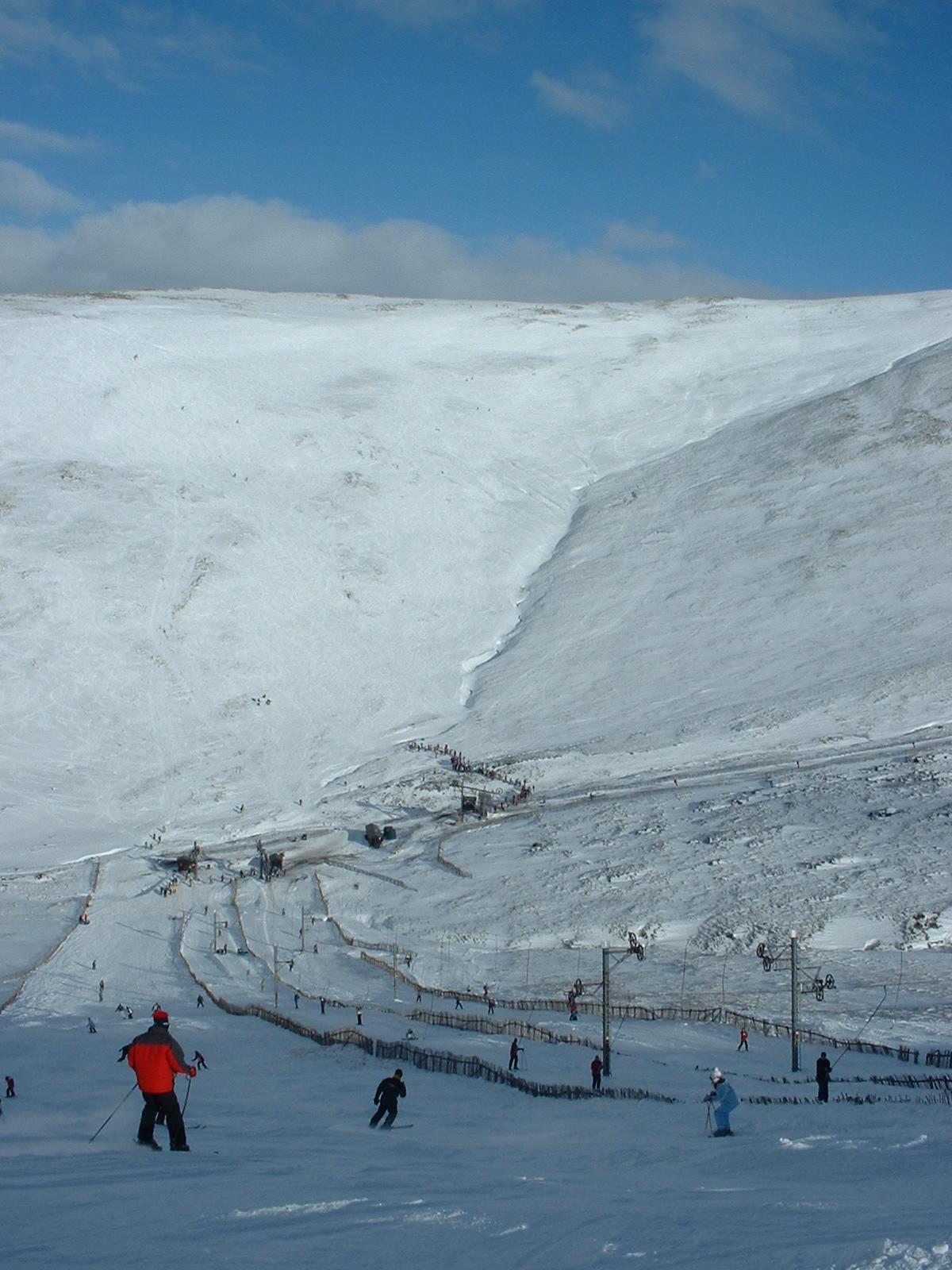
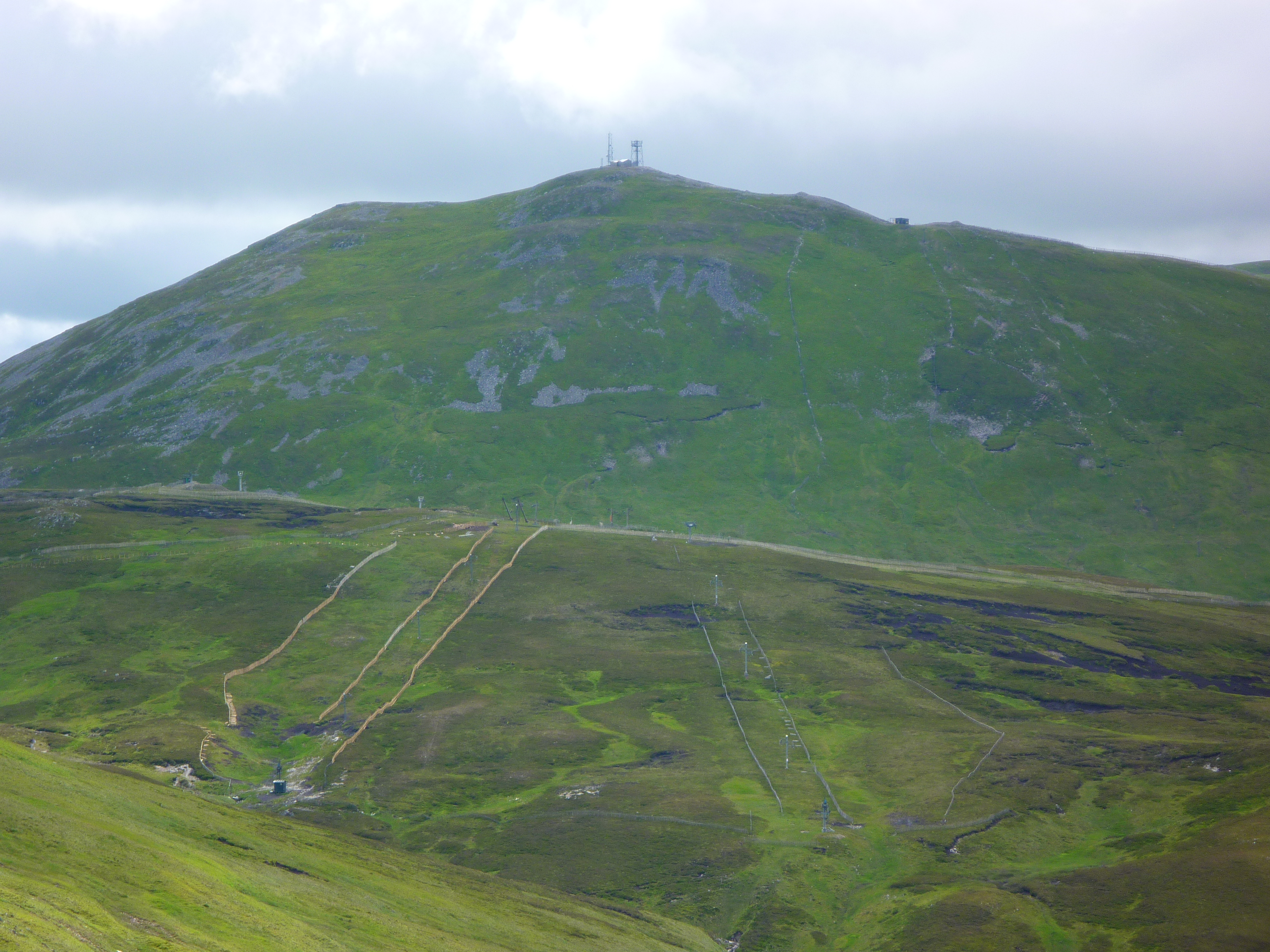
Glenshee Ski Centre

Glenshee Ski Centre is an alpine snowsports area in the Scottish Highlands. It is located above the Cairnwell Pass at the head of Glen Shee on either side...
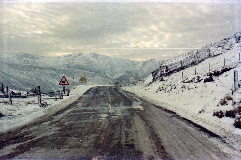
Cairnwell Pass

The Cairnwell Pass (Scottish Gaelic: Càrn a' Bhailg) is a mountain pass on the A93 road between Glen Shee, Perthshire, and Braemar, Aberdeenshire, in the...

Have you been to Gleann Beag?

Leave your review of Gleann Beag below (or comments, questions and feedback).