Black Cleuch

Valley in Peeblesshire

Scotland

Black Cleuch

Taking Flight Two geese have just taken flight after I surprised them at the edge of Fruid Reservoir. The hill to the left of the prominent wall is called Big Knock.
Taking Flight Credit: Adam Ward

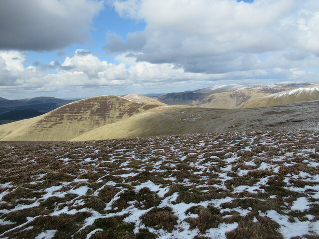
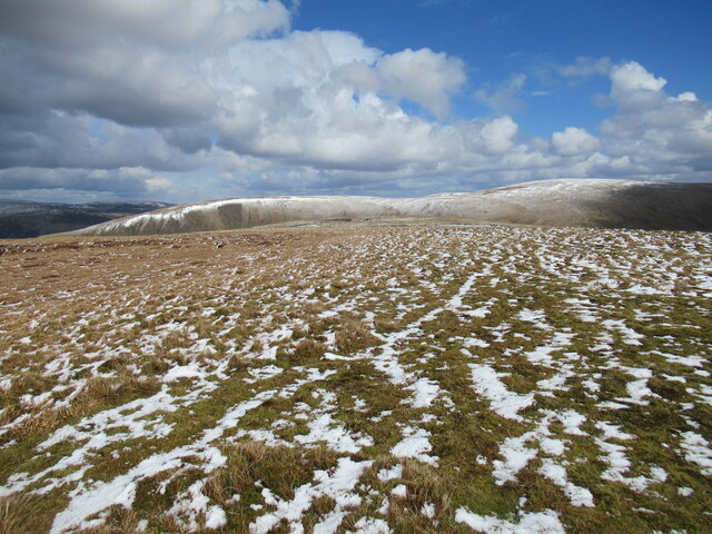
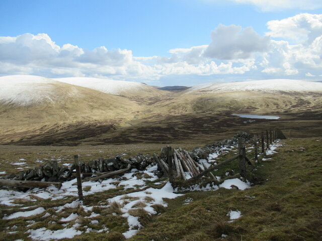
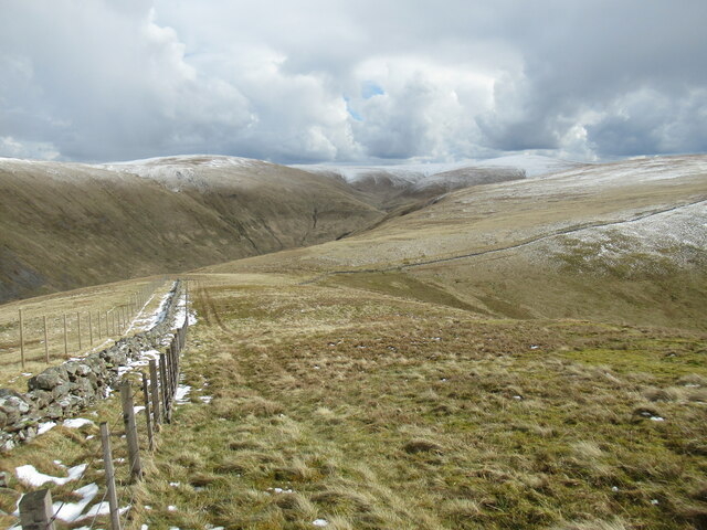
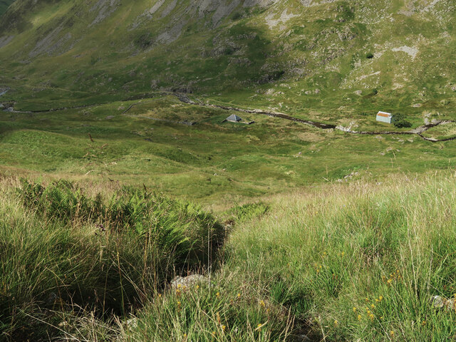
Black Cleuch is a picturesque valley located in the region of Peeblesshire in the Scottish Borders, United Kingdom. Nestled amidst rolling hills and stunning natural beauty, this valley offers a serene retreat for nature enthusiasts and outdoor adventurers alike.

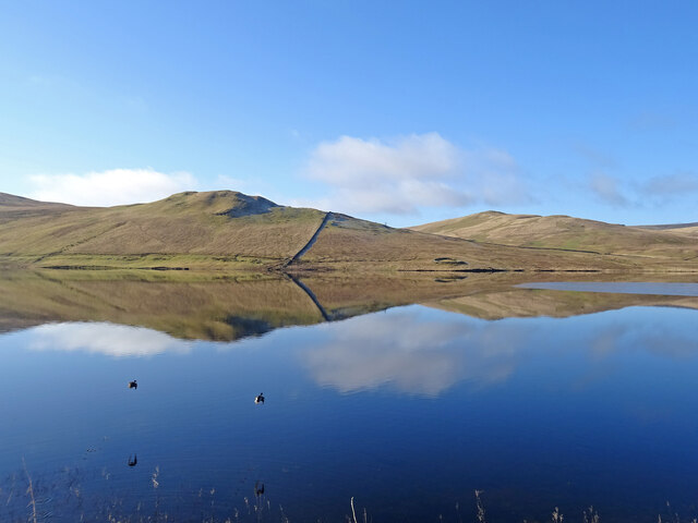
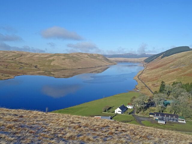
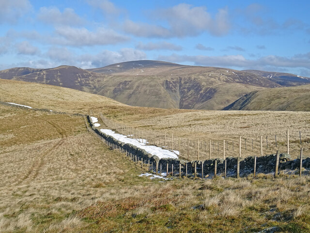
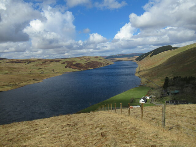
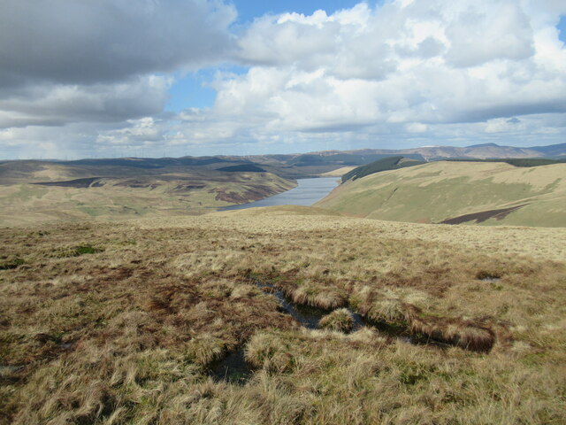
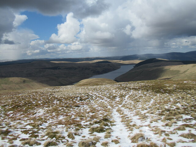
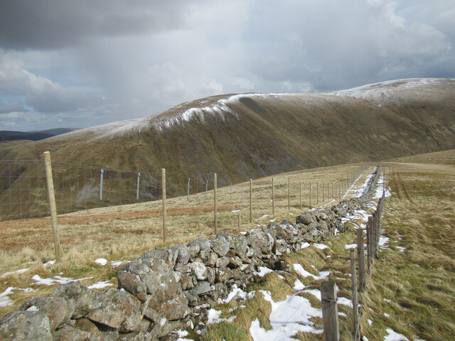
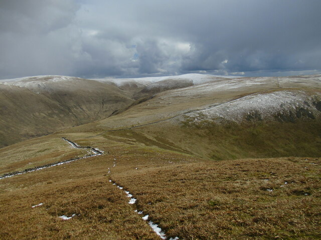
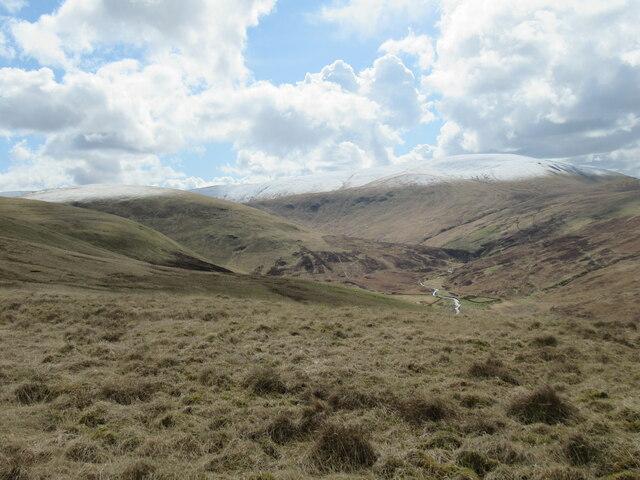
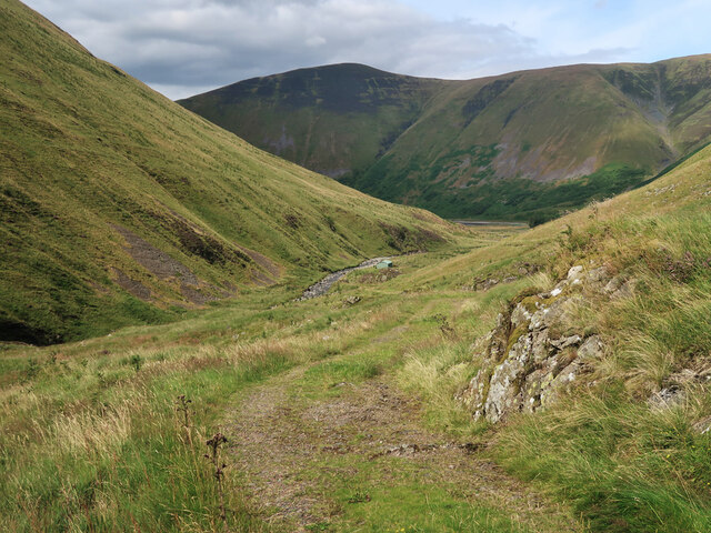
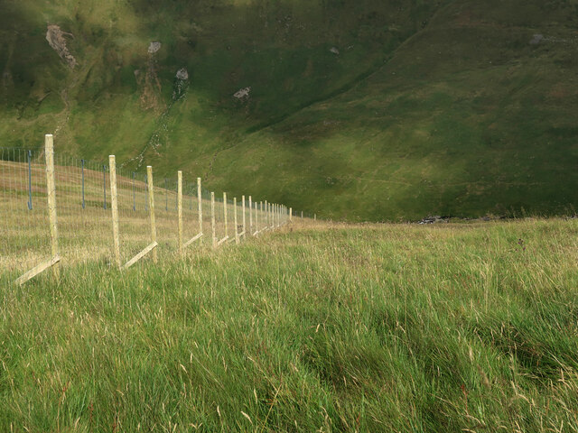
The valley is characterized by its impressive landscape, featuring a meandering river, lush green meadows, and dense woodlands. The Black Cleuch Burn, a small stream, winds its way through the valley, adding to its charm. The surrounding hills provide a dramatic backdrop to the scene, with their rugged peaks and rocky outcrops.

The area is home to a diverse range of flora and fauna, making it a haven for wildlife enthusiasts. Visitors may spot red deer, otters, and various bird species, including the elusive golden eagle. The valley's rich biodiversity is attributed to the pristine habitat and conservation efforts in the region.

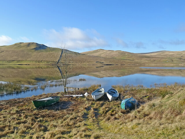
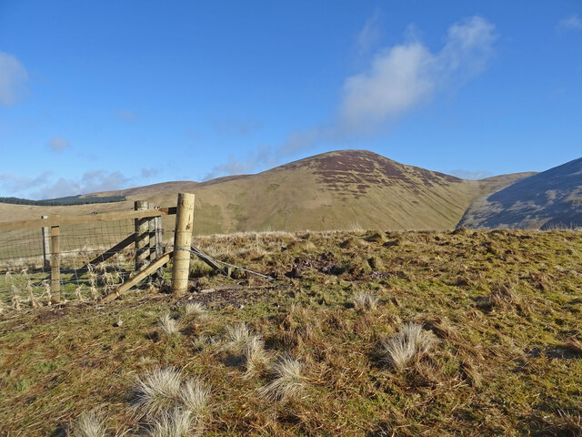
Black Cleuch is popular among hikers and walkers, offering numerous trails that cater to different skill levels. The paths meander through the valley, providing breathtaking views of the surrounding countryside. The Cleuch Trail, in particular, is a favorite among visitors, leading them along the river and through enchanting woodland.

For those seeking a peaceful retreat, Black Cleuch offers several camping and picnic spots, allowing visitors to immerse themselves in the tranquility of nature. The valley also provides opportunities for fishing, with the Black Cleuch Burn renowned for its brown trout.

Overall, Black Cleuch is a hidden gem in Peeblesshire, offering a truly immersive experience in nature, with its stunning landscapes, diverse wildlife, and a range of outdoor activities for all to enjoy.

If you have any feedback on the listing, please let us know in the comments section below.

Black Cleuch Images

Images are sourced within 2km of 55.446893/-3.3872244 or Grid Reference NT1217. Thanks to Geograph Open Source API. All images are credited.

Taking Flight Two geese have just taken flight after I surprised them at the edge of Fruid Reservoir. The hill to the left of the prominent wall is called Big Knock.
Taking Flight
Two geese have just taken flight after I surprised them at the edge of Fruid Reservoir. The hill to the left of the prominent wall is called Big Knock.
Boats by the Water Several dinghies are pulled up on the shores of Fruid Reservoir. The hills are reflected on the first day of spring.
Boats by the Water
Several dinghies are pulled up on the shores of Fruid Reservoir. The hills are reflected on the first day of spring.
Above Fruid Looking down the length of Fruid Reservoir from the lower slopes of Strawberry Hill with Fruid Farm at the bottom of the picture.
Above Fruid
Looking down the length of Fruid Reservoir from the lower slopes of Strawberry Hill with Fruid Farm at the bottom of the picture.
Erie Hill from Strawberry Hill From the summit of the curiously named Strawberry Hill above Fruid Reservoir looking across to the shapely Erie Hill. A glorious early spring day.
Erie Hill from Strawberry Hill
From the summit of the curiously named Strawberry Hill above Fruid Reservoir looking across to the shapely Erie Hill. A glorious early spring day.
View to Broad Law On the coll between Garelet Dod and Erie Hill there is this fine view of Broad Law the second highest hill in the Southern Uplands. There is a relatively new deer fence on the east side of the original wall so now there are 3 boundaries which seems a bit over the top.
View to Broad Law
On the coll between Garelet Dod and Erie Hill there is this fine view of Broad Law the second highest hill in the Southern Uplands. There is a relatively new deer fence on the east side of the original wall so now there are 3 boundaries which seems a bit over the top.
Fruid Reservoir viewed from Strawberry Hill The farm buildings at Fruid are visible below, with some of the turbines of the vast Clyde Wind Farm on the distant horizon.
Fruid Reservoir viewed from Strawberry Hill
The farm buildings at Fruid are visible below, with some of the turbines of the vast Clyde Wind Farm on the distant horizon.
Spur leading from Garelet Dod to Strawberry Hill The Fruid Reservoir is visible in the distance.
Spur leading from Garelet Dod to Strawberry Hill
The Fruid Reservoir is visible in the distance.
Wintry showers passing over Fruid Reservoir A cold day of snow and hail flurries and sunny intervals in a northerly airflow.
Wintry showers passing over Fruid Reservoir
A cold day of snow and hail flurries and sunny intervals in a northerly airflow.
Looking towards Erie Hill and Common Law A view from near the summit of Garelet Dod.
Looking towards Erie Hill and Common Law
A view from near the summit of Garelet Dod.
Summit plateau on Garelet Dod Carlavin Hill and Molls Cleuch Dod are visible in the distance. As often seems to happen in April, a warm spell has given way to the return of cold northerly winds and wintry showers.
Summit plateau on Garelet Dod
Carlavin Hill and Molls Cleuch Dod are visible in the distance. As often seems to happen in April, a warm spell has given way to the return of cold northerly winds and wintry showers.
Looking into the upper Games Hope Gameshope Loch is visible in the distance, with snow-covered hillsides above 600m. or so, during a spell of  cold spring weather with northerly winds and wintry showers.
Looking into the upper Games Hope
Gameshope Loch is visible in the distance, with snow-covered hillsides above 600m. or so, during a spell of cold spring weather with northerly winds and wintry showers.
Triple fence line on Erie Hill The old drystane dyke has been joined by a stob and wire fence and now a high deer fence, which seems a bit of overkill.
Triple fence line on Erie Hill
The old drystane dyke has been joined by a stob and wire fence and now a high deer fence, which seems a bit of overkill.
New deer fencing on Erie Hill The old drystane dyke has been joined by a stob and wire fence and now a high deer fence, which seems a bit of overkill. The metal plates on the deer fence are designed to make it more visible to birds in flight.

The flanks of Carlavin Hill and Molls Cleuch Dod form the backdrop.
New deer fencing on Erie Hill
The old drystane dyke has been joined by a stob and wire fence and now a high deer fence, which seems a bit of overkill. The metal plates on the deer fence are designed to make it more visible to birds in flight. The flanks of Carlavin Hill and Molls Cleuch Dod form the backdrop.
Narrow path on Erie Hill A path picked out in snow on Erie Hill, with the snow-topped higher hills between Moffat Dale and Tweedsmuir visible in the distance.
Narrow path on Erie Hill
A path picked out in snow on Erie Hill, with the snow-topped higher hills between Moffat Dale and Tweedsmuir visible in the distance.
The upper Fruid Water from Strawberry Hill Looking towards the Hart Fell group of hills, where a spell of cold northerly winds with snow showers has left decent snow cover above 600m. or so.
The upper Fruid Water from Strawberry Hill
Looking towards the Hart Fell group of hills, where a spell of cold northerly winds with snow showers has left decent snow cover above 600m. or so.
Track to Games Hope Looking back towards the start at the end of the Talla reservoir.
Track to Games Hope
Looking back towards the start at the end of the Talla reservoir.
Steep slope behind Gameshope bothy The ground has been planted with trees and shrubs by the Borders Forest Trust.
Steep slope behind Gameshope bothy
The ground has been planted with trees and shrubs by the Borders Forest Trust.
Fence on Speir Gairs The fence descends the steep slope down to the Games Hope Burn.
Fence on Speir Gairs
The fence descends the steep slope down to the Games Hope Burn.
Show me another place!

Black Cleuch is located at Grid Ref: NT1217 (Lat: 55.446893, Lng: -3.3872244)

Unitary Authority: The Scottish Borders

Police Authority: The Lothians and Scottish Borders

What 3 Words

///tweezers.mulled.star. Near Moffat, Dumfries & Galloway

Nearby Locations

Black Cleuch Garelet Dod

Related Wikis

Moffat Hills

The Moffat Hills are a range of hills in the Southern Uplands of Scotland. They form a roughly triangular shape with a west facing side, a north facing...

Talla Water

Talla Water is a river in the Scottish Borders area of Scotland, near Tweedsmuir. It feeds the Talla Reservoir, and is a tributary of the River Tweed....

Fruid Reservoir

Fruid is a small reservoir in the Scottish Borders area of Scotland, UK, near Menzion. It is formed by damming the Fruid Water, and supplements the contents...

Talla Reservoir

Talla Reservoir, located a mile from Tweedsmuir, Scottish Borders, Scotland, is an earth-work dam fed by Talla Water. The reservoir is supplemented by...

Hart Fell

Hart Fell is a hill in the Moffat Hills range, part of the Southern Uplands of Scotland. It lies north of the town of Moffat on the border with the Scottish...

Loch Skeen

Loch Skeen or Loch Skene is a loch in Dumfries and Galloway in the south of Scotland. It is located about 10 miles to the north-east of Moffat and feeds...

White Coomb

White Coomb is a hill in the Moffat Hills range, part of the Southern Uplands of Scotland. Its broad summit is the highest point in the range and the registration...

Victoria Lodge railway station

Victoria Lodge railway station served the village of Tweedsmuir, Scottish Borders, Scotland from 1897 to 1905 on the Symington, Biggar and Broughton Railway...

Have you been to Black Cleuch?

Leave your review of Black Cleuch below (or comments, questions and feedback).