Cwm Gelanedd

Valley in Brecknockshire

Wales

Cwm Gelanedd

Allt yr Esgair Near the summit of this elongated sandstone hill above Llangorse. A ruined stone wall encloses land later planted with conifers by the Forestry Commission. Looking southeast down the ridge.
Allt yr Esgair Credit: Richard Webb

Cwm Gelanedd is a picturesque valley located in the county of Brecknockshire, Wales. Nestled in the heart of the Brecon Beacons National Park, this valley offers breathtaking natural beauty and a tranquil atmosphere.

The valley is surrounded by rolling hills and rugged mountains, creating a dramatic backdrop for visitors to enjoy. The landscape is characterized by lush green meadows, dense woodlands, and sparkling streams that flow through the valley.

Cwm Gelanedd is a haven for outdoor enthusiasts, offering a wide range of activities. Hiking and walking trails crisscross the area, leading to stunning viewpoints and hidden waterfalls. The valley is also popular with cyclists, who can explore the scenic routes that wind through the surrounding countryside.

Wildlife is abundant in Cwm Gelanedd, with a diverse range of species calling the valley home. Visitors may spot red kites soaring overhead, deer grazing in the fields, or even rare birds such as the peregrine falcon.

For those seeking a more leisurely experience, Cwm Gelanedd offers several picnic spots where visitors can relax and take in the idyllic surroundings. The peacefulness of the valley makes it an ideal place for photography or simply unwinding in nature.

Overall, Cwm Gelanedd is a hidden gem in Brecknockshire, offering visitors a chance to immerse themselves in the beauty of the Welsh countryside. Its tranquil atmosphere and stunning landscapes make it a must-visit destination for nature lovers and outdoor enthusiasts alike.

If you have any feedback on the listing, please let us know in the comments section below.
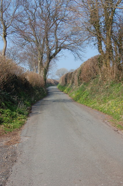
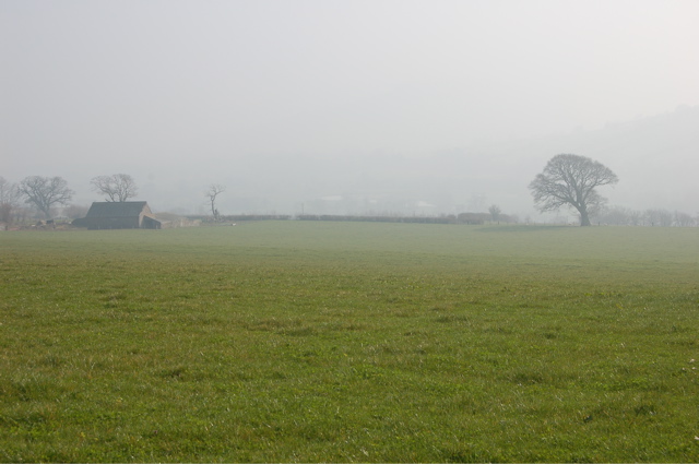
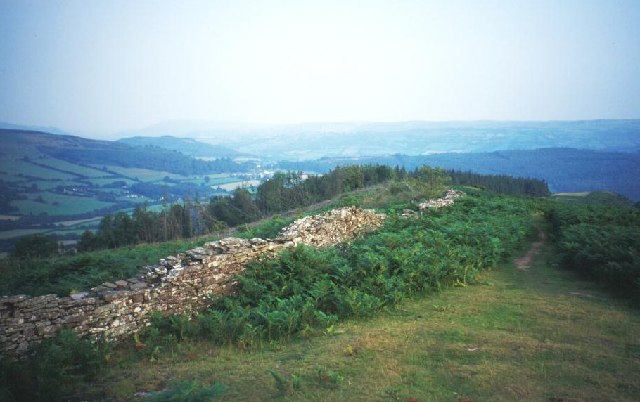
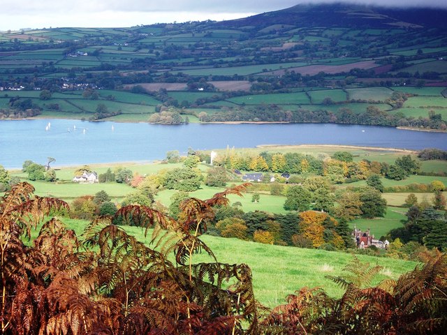
Cwm Gelanedd Images

Images are sourced within 2km of 51.916297/-3.2931362 or Grid Reference SO1124. Thanks to Geograph Open Source API. All images are credited.

Allt yr Esgair Near the summit of this elongated sandstone hill above Llangorse. A ruined stone wall encloses land later planted with conifers by the Forestry Commission. Looking southeast down the ridge.
Allt yr Esgair
Near the summit of this elongated sandstone hill above Llangorse. A ruined stone wall encloses land later planted with conifers by the Forestry Commission. Looking southeast down the ridge.
Hillside south-west of the Monmouthshire & Brecon Canal
Church of St Bridget Church of St Bridget, Llansantffraed. A victorian re-build of an earlier church to the south east of Brecon on the A40.
Church of St Bridget
Church of St Bridget, Llansantffraed. A victorian re-build of an earlier church to the south east of Brecon on the A40.
Tow path and canal between Pencelli and Talybont Upon Usk This part of the tow path is also a section of the Taff cycle trail.
Tow path and canal between Pencelli and Talybont Upon Usk
This part of the tow path is also a section of the Taff cycle trail.
Drawbridge One of the many drawbridges on the canal.
Drawbridge
One of the many drawbridges on the canal.
Bridge on the canal near Talybont-on-Usk One of the many bridges linking fields on either side of the canal between Pencelli and Talybont.
Bridge on the canal near Talybont-on-Usk
One of the many bridges linking fields on either side of the canal between Pencelli and Talybont.
Brynderwen trig
Brynderwen trig
Former culvert/ cattle creep
Former railway line The former Brecon & Merthyr Railway line between Talybont-on-Usk and Brecon.
Former railway line
The former Brecon & Merthyr Railway line between Talybont-on-Usk and Brecon.
Newton Farm Between the A40 and the former railway line.
Newton Farm
Between the A40 and the former railway line.
Debris from the flooding Usk The Afon Wysg/River usk rises and falls rapidly in response to heavy rain.  This field beside the A40 Abergavenny/Brecon road is littered with debris from earlier in the day when the swollen river extended across the full width of its floodplain.  The Romans avoided flooding problems by building their road over the top of the hill known as Yr Allt in the background.
Debris from the flooding Usk
The Afon Wysg/River usk rises and falls rapidly in response to heavy rain. This field beside the A40 Abergavenny/Brecon road is littered with debris from earlier in the day when the swollen river extended across the full width of its floodplain. The Romans avoided flooding problems by building their road over the top of the hill known as Yr Allt in the background.
Scethrog A little hamlet just off the A40 - no pub or church, just a public telephone box.
Scethrog
A little hamlet just off the A40 - no pub or church, just a public telephone box.
Country lane near Scethrog
Field near Maes-y-crwper farm Looking towards the misty Usk valley.
Field near Maes-y-crwper farm
Looking towards the misty Usk valley.
Lift Bridge on the Monmouthshire & Brecon Canal between Cross Oak and Pencelli In use by a local farmer to allow him access to his sheep on the other side of the canal.
Lift Bridge on the Monmouthshire & Brecon Canal between Cross Oak and Pencelli
In use by a local farmer to allow him access to his sheep on the other side of the canal.
Accommodation Bridge over the Monmouthshire & Brecon Canal near Pencelli
Former YHA Llangasty Youth Hostel at Pennorth, Llangorse Lake The proud Welsh farmhouse at Ty-Gwyn, Breconshire, was an early YHA hostel, operating from 1935 to 1946. Mrs M Davies, the warden, was famed for her Sunday teas.
Former YHA Llangasty Youth Hostel at Pennorth, Llangorse Lake
The proud Welsh farmhouse at Ty-Gwyn, Breconshire, was an early YHA hostel, operating from 1935 to 1946. Mrs M Davies, the warden, was famed for her Sunday teas.
Reservoir on Allt-yr-Esgair overlooking Usk valley
Show me another place!

Cwm Gelanedd is located at Grid Ref: SO1124 (Lat: 51.916297, Lng: -3.2931362)

Unitary Authority: Powys

Police Authority: Dyfed Powys

What 3 Words

///dollars.land.regret. Near Llangynidr, Powys

Nearby Locations

Cwm Gelanedd

Related Wikis

Newton, Brecknockshire

Newton (Welsh name Trenewydd) is a hamlet located between the market town of Brecon and the village of Llansantffraed, mid Wales, on the A40 road. It was...

Allt yr Esgair

Allt yr Esgair is a hill in the Brecon Beacons National Park in Powys, Wales. It is commonly referred to locally as simply 'The Allt'. The Welsh name signifies...

Nant Menasgin

The Nant Menasgin is a short river in Powys, Wales whose headwaters rise in Cwm Oergwm, beneath Fan y Bîg, in the central Brecon Beacons, and flow northeastwards...

Pencelli

Pencelli is a small village within the community of Talybont-on-Usk in the county of Powys, Wales, and the historic county of Brecknockshire. The Welsh...

Treberfydd

Treberfydd House is a Gothic Revival house, built in 1847–50 just south of Llangorse Lake in the Brecon Beacons National Park in South Wales, to the designs...

Llansantffraed

Llansantffraed (Llansantffraed-juxta-Usk) is a parish in the community of Talybont-on-Usk in Powys, Wales, near Brecon. The benefice of Llansantffraed...

Talybont-on-Usk railway station

Talybont-on-Usk railway station was a station in Talybont-on-Usk, Powys, Wales. The station was opened in 1863 and closed in 1962. == References == �...

Talybont-on-Usk

Talybont-on-Usk (Welsh: Tal-y-bont ar Wysg) is a village and community in Powys, Wales, in the historic county of Brecknockshire. It lies on both the...

Nearby Amenities

Located within 500m of 51.916297,-3.2931362
Power: pole
Lat/Long: 51.9151161/-3.2938734
Power: pole
Lat/Long: 51.915763/-3.2932806
Power: pole
Lat/Long: 51.9160889/-3.2920602
Power: pole
Lat/Long: 51.9156968/-3.2908934
Power: pole
Lat/Long: 51.9153146/-3.2898152
Power: pole
Lat/Long: 51.9149308/-3.2886967
Power: pole
Lat/Long: 51.9145767/-3.287589
The data included in this document is from www.openstreetmap.org. The data is made available under ODbL.

Have you been to Cwm Gelanedd?

Leave your review of Cwm Gelanedd below (or comments, questions and feedback).