Mere Cleuch

Valley in Dumfriesshire

Scotland

Mere Cleuch

Forestry road in Craigieburn Wood
Forestry road in Craigieburn Wood Credit: Steven Brown

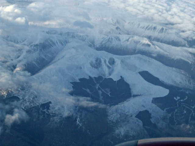
Mere Cleuch, located in Dumfriesshire, Scotland, is a picturesque valley nestled amidst the rolling hills of the Southern Uplands. This stunning natural landscape is renowned for its breathtaking beauty and tranquil atmosphere, attracting visitors from near and far.

The valley is characterized by its lush green meadows, dense woodlands, and meandering streams, which create a tapestry of colors and textures throughout the seasons. Mere Cleuch is particularly famous for its vibrant wildflower displays in the spring and summer months, with a variety of species including bluebells, primroses, and orchids decorating the valley floor.

The wildlife in Mere Cleuch is diverse and abundant, with numerous species calling the valley home. Visitors may spot red deer, foxes, and badgers roaming freely, while birdwatchers can delight in the sight of various avian species, including buzzards, kestrels, and owls.

For outdoor enthusiasts, Mere Cleuch offers a range of activities and attractions. The valley boasts several well-marked hiking trails, allowing visitors to explore its natural wonders at their own pace. Additionally, the nearby Loch Maben provides opportunities for fishing and boating, while the surrounding hills offer ideal conditions for mountain biking and horseback riding.

In summary, Mere Cleuch in Dumfriesshire is a captivating valley that showcases the beauty of Scotland's countryside. With its stunning landscapes, diverse wildlife, and recreational opportunities, it is a haven for nature lovers and outdoor enthusiasts alike.

If you have any feedback on the listing, please let us know in the comments section below.

Mere Cleuch Images

Images are sourced within 2km of 55.358108/-3.4114703 or Grid Reference NT1008. Thanks to Geograph Open Source API. All images are credited.

Forestry road in Craigieburn Wood
Between  Blue Cairn and Greygill Head A gentle broad ridge with a contrast between grass on one side of the fence and dyke and heather on the eastern side. The heather soon gives way to Sitka spruce.
Between Blue Cairn and Greygill Head
A gentle broad ridge with a contrast between grass on one side of the fence and dyke and heather on the eastern side. The heather soon gives way to Sitka spruce.
Forestry, Birnock Water A 1980s  and therefore still uniform forestry plantation upstream of Moffat.  It is getting less common seeing a big block without felled areas now, as big plantations fell out of favour in the mid 1980s. They are being planted again though, very much back in favour.
Forestry, Birnock Water
A 1980s and therefore still uniform forestry plantation upstream of Moffat. It is getting less common seeing a big block without felled areas now, as big plantations fell out of favour in the mid 1980s. They are being planted again though, very much back in favour.
The road in the Birnock Water forest A wet dark afternoon with a bit of a feel of Winter about it.
The road in the Birnock Water forest
A wet dark afternoon with a bit of a feel of Winter about it.
The Birnock Water View from the forest edge, upstream from here the glen is full of trees. Horrible weather.
The Birnock Water
View from the forest edge, upstream from here the glen is full of trees. Horrible weather.
Rough grazing upstream of Blaebeck Above the Birnock Water.
Rough grazing upstream of Blaebeck
Above the Birnock Water.
Auldton Fell from the Red Scars
Swatte Fell from the air A snow covered Swatte Fell, just north of Moffat, viewed from a Glasgow bound flight from Luton. The long finger of Roundstonefoot plantation can be seen on the right.
Swatte Fell from the air
A snow covered Swatte Fell, just north of Moffat, viewed from a Glasgow bound flight from Luton. The long finger of Roundstonefoot plantation can be seen on the right.
Swatte Fell from the air A snow covered Swatte Fell, just north of Moffat, viewed from a Glasgow bound flight from Luton. The long finger of Roundstonefoot plantation can be seen in the lower right corner.
Swatte Fell from the air
A snow covered Swatte Fell, just north of Moffat, viewed from a Glasgow bound flight from Luton. The long finger of Roundstonefoot plantation can be seen in the lower right corner.
Bench along the forest trail of Craigieburn Hill The second bench along the footpaths around the forest of Craigieburn Hill, near Moffat, Scotland.
Bench along the forest trail of Craigieburn Hill
The second bench along the footpaths around the forest of Craigieburn Hill, near Moffat, Scotland.
Sheep farming
Sheep farming
Moffat Well Discovered in 1633, the waters of this well were said to cure rheumatism, affections of the lungs and diseases of the skin.   In the last century visitors to the town would come to drink the waters.
Moffat Well
Discovered in 1633, the waters of this well were said to cure rheumatism, affections of the lungs and diseases of the skin. In the last century visitors to the town would come to drink the waters.
Blaebeck, near Moffat A small farm just past the end of the public road at Moffat Well.
Blaebeck, near Moffat
A small farm just past the end of the public road at Moffat Well.
Ruined wall and forest, Greygill Head. Although quite steep-sided and rocky to the S, the summit of Greygill Head is flat and boggy, with an old wall breaking through the heather.
Ruined wall and forest, Greygill Head.
Although quite steep-sided and rocky to the S, the summit of Greygill Head is flat and boggy, with an old wall breaking through the heather.
Grey Gill, Greygill Head The upper reaches of the burn above Common Craig
Grey Gill, Greygill Head
The upper reaches of the burn above Common Craig
Disused quarry, Greygill Head. Quite extensive workings, this must have been the source of some of the building stone for the town of Moffat
Disused quarry, Greygill Head.
Quite extensive workings, this must have been the source of some of the building stone for the town of Moffat
Gates, walls and fences, Stot Knowe The division between the rough grazing on the left and the heather slopes on the right is very distinctive.  Swatte Fell is seen in the far distance.
Gates, walls and fences, Stot Knowe
The division between the rough grazing on the left and the heather slopes on the right is very distinctive. Swatte Fell is seen in the far distance.
Birnock Water, near Merecleuch Hill Looking downstream.  The burn at this point is almost roofed over with small bushes of willow or alder.
Birnock Water, near Merecleuch Hill
Looking downstream. The burn at this point is almost roofed over with small bushes of willow or alder.
Show me another place!

Mere Cleuch is located at Grid Ref: NT1008 (Lat: 55.358108, Lng: -3.4114703)

Unitary Authority: Dumfries and Galloway

Police Authority: Dumfries and Galloway

What 3 Words

///encoded.quitter.reshaping. Near Moffat, Dumfries & Galloway

Nearby Locations

Mere Cleuch Archbank Hope

Related Wikis

Moffat

Moffat (Scottish Gaelic: Mofad) is a burgh and parish in Dumfriesshire, now part of the Dumfries and Galloway local authority area in Scotland. It lies...
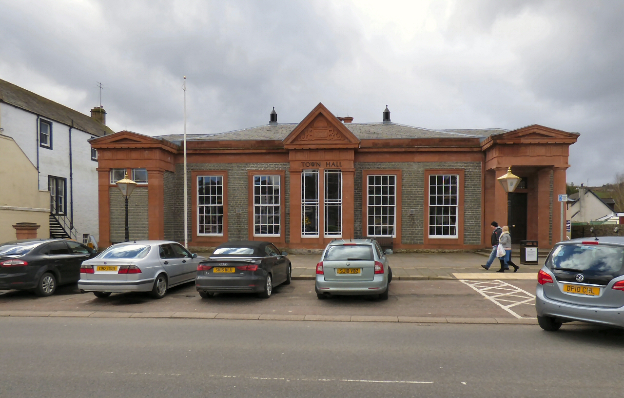
Moffat Town Hall

Moffat Town Hall is a municipal building in the High Street in Moffat, Dumfries and Galloway, Scotland. The structure, which is used as community events...

Moffat Museum

Moffat Museum is a community museum in Moffat, Scotland. It was established in the Old Moffat Bakehouse in 1984. The museum expanded into a neighbouring...

Moffat Academy

Moffat Academy is a school in Moffat, Dumfries and Galloway, Scotland. It educates children from nursery to Secondary 6. == History == Moffat Academy traces...

Have you been to Mere Cleuch?

Leave your review of Mere Cleuch below (or comments, questions and feedback).