Brawns Cleuch

Valley in Peeblesshire

Scotland

Brawns Cleuch

Fruid Farm at the head of the reservoir with Erie Hill slowly losing its snow cover during the day. So far it has been a rubbish Winter.
Fruid Credit: Richard Webb

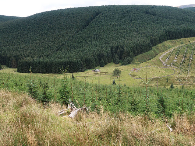
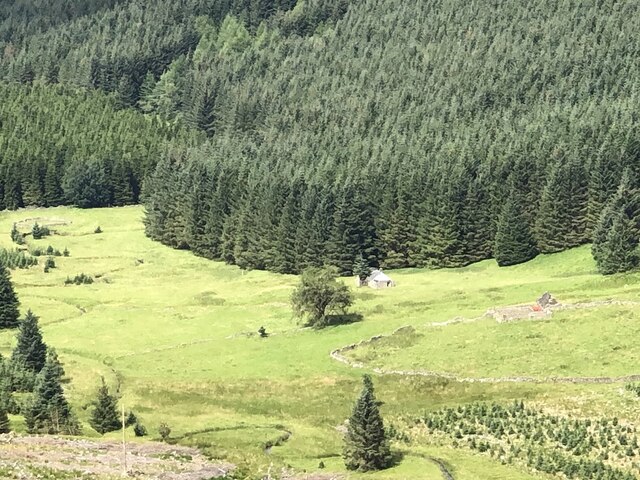
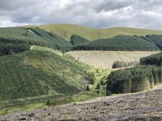
Brawns Cleuch is a picturesque valley located in Peeblesshire, Scotland. Situated in the scenic Scottish Borders region, this valley is known for its stunning natural beauty and rich historical heritage. Spanning approximately one mile in length, Brawns Cleuch is nestled between rolling hills and lush greenery.

The valley is characterized by its tranquil atmosphere and unspoiled landscapes. Visitors to Brawns Cleuch are greeted with breathtaking views of the surrounding countryside, with the Cleuch Burn meandering through the valley floor. The valley is home to a diverse range of plant and animal species, making it a haven for nature lovers and wildlife enthusiasts.

Brawns Cleuch has a fascinating history dating back centuries. The remains of an ancient Roman fort, known as Trimontium, can be found in the vicinity, providing a glimpse into the region's past. The valley also played a significant role during the Scottish Borders Reivers era, when it served as a hiding spot for raiders and outlaws.

Today, Brawns Cleuch offers plenty of recreational opportunities for visitors. Hiking and walking trails crisscross the valley, allowing visitors to explore its natural wonders at their own pace. The peacefulness and serenity of the area make it an ideal spot for picnics or simply enjoying the tranquility of the Scottish countryside.

In conclusion, Brawns Cleuch is a stunning valley in Peeblesshire, Scotland, renowned for its natural beauty, historical significance, and recreational opportunities. Whether one is seeking a peaceful retreat, a glimpse into history, or an outdoor adventure, Brawns Cleuch offers something for everyone.

If you have any feedback on the listing, please let us know in the comments section below.

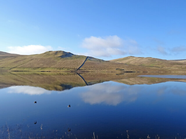
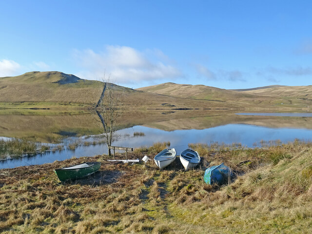
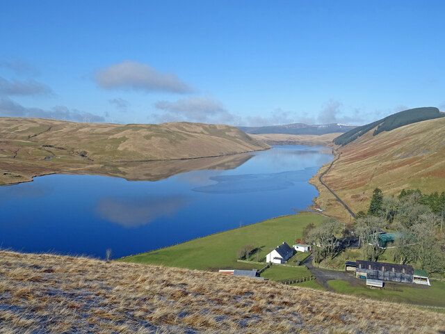
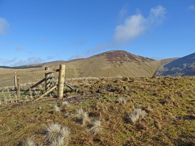
Brawns Cleuch Images

Images are sourced within 2km of 55.456009/-3.4158984 or Grid Reference NT1018. Thanks to Geograph Open Source API. All images are credited.

Fruid Farm at the head of the reservoir with Erie Hill slowly losing its snow cover during the day. So far it has been a rubbish Winter.
Fruid
Farm at the head of the reservoir with Erie Hill slowly losing its snow cover during the day. So far it has been a rubbish Winter.
Erie Hill View from the other side of Fruid Reservoir
Erie Hill
View from the other side of Fruid Reservoir
Ruins of Over Menzion An old sheep farm surrounded by forest.
Ruins of Over Menzion
An old sheep farm surrounded by forest.
Young trees on Scaddow Knowes Looking across Laird's Cleuch from the Silver Jubilee Road.
Young trees on Scaddow Knowes
Looking across Laird's Cleuch from the Silver Jubilee Road.
Silver Jubilee Road The logging road loop at the col with Colin Hill and Garelet Hill.  The views over Talla Reservoir stop or start here.
Silver Jubilee Road
The logging road loop at the col with Colin Hill and Garelet Hill. The views over Talla Reservoir stop or start here.
Menzion Forest Across the headwaters of the Menzion Burn to a distant Hart Fell.
Menzion Forest
Across the headwaters of the Menzion Burn to a distant Hart Fell.
Above the Auchenmade Burn On the Silver Jubilee Road, Menzion.
Above the Auchenmade Burn
On the Silver Jubilee Road, Menzion.
Silver Jubilee Road, Laird's Cleuch Headwater of the Menzion Burn with the ridge above Gameshope in the background.
Silver Jubilee Road, Laird's Cleuch
Headwater of the Menzion Burn with the ridge above Gameshope in the background.
Silver Jubilee Road, Laird's Cleuch Across Lairds Cleuch to further along the loop road.
Silver Jubilee Road, Laird's Cleuch
Across Lairds Cleuch to further along the loop road.
Bike on the Silver Jubilee Road A great wee gravel ride, but do it soon.  Last time I was here I saw a lot of spruce.  This time the forestry cycle allowed some amazing views from high in the Tweedsmuir Hills and there were no forestry operations or hostile signage.
Bike on the Silver Jubilee Road
A great wee gravel ride, but do it soon. Last time I was here I saw a lot of spruce. This time the forestry cycle allowed some amazing views from high in the Tweedsmuir Hills and there were no forestry operations or hostile signage.
Over Menzion Ruin, a relic from sheep farming here.
Over Menzion
Ruin, a relic from sheep farming here.
Menzion Forest View towards Broad Law.
Menzion Forest
View towards Broad Law.
Mezion Burn and Garelet Hill Forestry, Menzion.
Mezion Burn and Garelet Hill
Forestry, Menzion.
Hills Reflected Fruid Reservoir acting like a mirror on the first day of meteorological spring.
Across the reservoir is Shiel Dod, while to the left are Macrule Hill and Ballaman Hill. A grand day to be out in Borders hills.
Hills Reflected
Fruid Reservoir acting like a mirror on the first day of meteorological spring. Across the reservoir is Shiel Dod, while to the left are Macrule Hill and Ballaman Hill. A grand day to be out in Borders hills.
Taking Flight Two geese have just taken flight after I surprised them at the edge of Fruid Reservoir. The hill to the left of the prominent wall is called Big Knock.
Taking Flight
Two geese have just taken flight after I surprised them at the edge of Fruid Reservoir. The hill to the left of the prominent wall is called Big Knock.
Boats by the Water Several dinghies are pulled up on the shores of Fruid Reservoir. The hills are reflected on the first day of spring.
Boats by the Water
Several dinghies are pulled up on the shores of Fruid Reservoir. The hills are reflected on the first day of spring.
Above Fruid Looking down the length of Fruid Reservoir from the lower slopes of Strawberry Hill with Fruid Farm at the bottom of the picture.
Above Fruid
Looking down the length of Fruid Reservoir from the lower slopes of Strawberry Hill with Fruid Farm at the bottom of the picture.
Erie Hill from Strawberry Hill From the summit of the curiously named Strawberry Hill above Fruid Reservoir looking across to the shapely Erie Hill. A glorious early spring day.
Erie Hill from Strawberry Hill
From the summit of the curiously named Strawberry Hill above Fruid Reservoir looking across to the shapely Erie Hill. A glorious early spring day.
Show me another place!

Brawns Cleuch is located at Grid Ref: NT1018 (Lat: 55.456009, Lng: -3.4158984)

Unitary Authority: The Scottish Borders

Police Authority: The Lothians and Scottish Borders

What 3 Words

///stance.incline.grownup. Near Moffat, Dumfries & Galloway

Nearby Locations

Brawns Cleuch

Related Wikis

Fruid Reservoir

Fruid is a small reservoir in the Scottish Borders area of Scotland, UK, near Menzion. It is formed by damming the Fruid Water, and supplements the contents...

Talla Reservoir

Talla Reservoir, located a mile from Tweedsmuir, Scottish Borders, Scotland, is an earth-work dam fed by Talla Water. The reservoir is supplemented by...

Talla Water

Talla Water is a river in the Scottish Borders area of Scotland, near Tweedsmuir. It feeds the Talla Reservoir, and is a tributary of the River Tweed....

Fruid Water

Fruid Water is a river in the Scottish Borders area of Scotland. The valley it occupies has been dammed to form the Fruid Reservoir. The river is a tributary...

Nearby Amenities

Located within 500m of 55.456009,-3.4158984
Power: pole
Lat/Long: 55.4518562/-3.4137407
Power: pole
Lat/Long: 55.4523925/-3.4146482
Power: pole
Lat/Long: 55.4528303/-3.4153949
Power: pole
Lat/Long: 55.4532945/-3.4161628
Power: pole
Lat/Long: 55.4537168/-3.4168883
Power: pole
Lat/Long: 55.454139/-3.4175821
Power: pole
Lat/Long: 55.4545888/-3.4183267
Power: pole
Lat/Long: 55.455089/-3.4191834
Power: pole
Lat/Long: 55.4555172/-3.4199069
Power: pole
Lat/Long: 55.4559922/-3.4206832
Power: pole
Lat/Long: 55.4564384/-3.421449
Power: pole
Lat/Long: 55.4569614/-3.4223268
Power: pole
Lat/Long: 55.4574628/-3.4231645
The data included in this document is from www.openstreetmap.org. The data is made available under ODbL.

Have you been to Brawns Cleuch?

Leave your review of Brawns Cleuch below (or comments, questions and feedback).