Earn Cleuch

Valley in Peeblesshire

Scotland

Earn Cleuch

Derelict buildings at Southside Farm Looking East along the valley between Goseland Hill and Mitchell Hill with the currently disused farm buildings in the foreground.
Derelict buildings at Southside Farm Credit: David Thomson

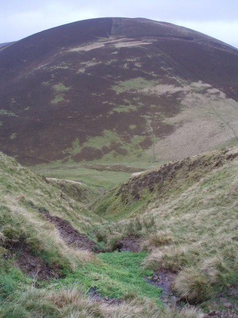
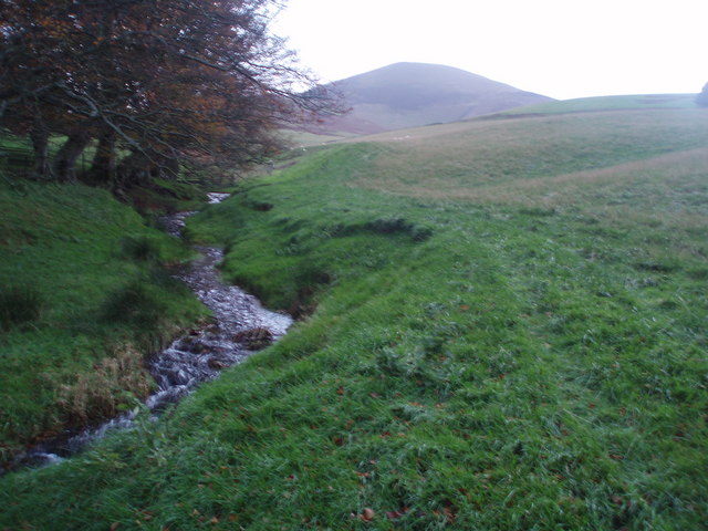
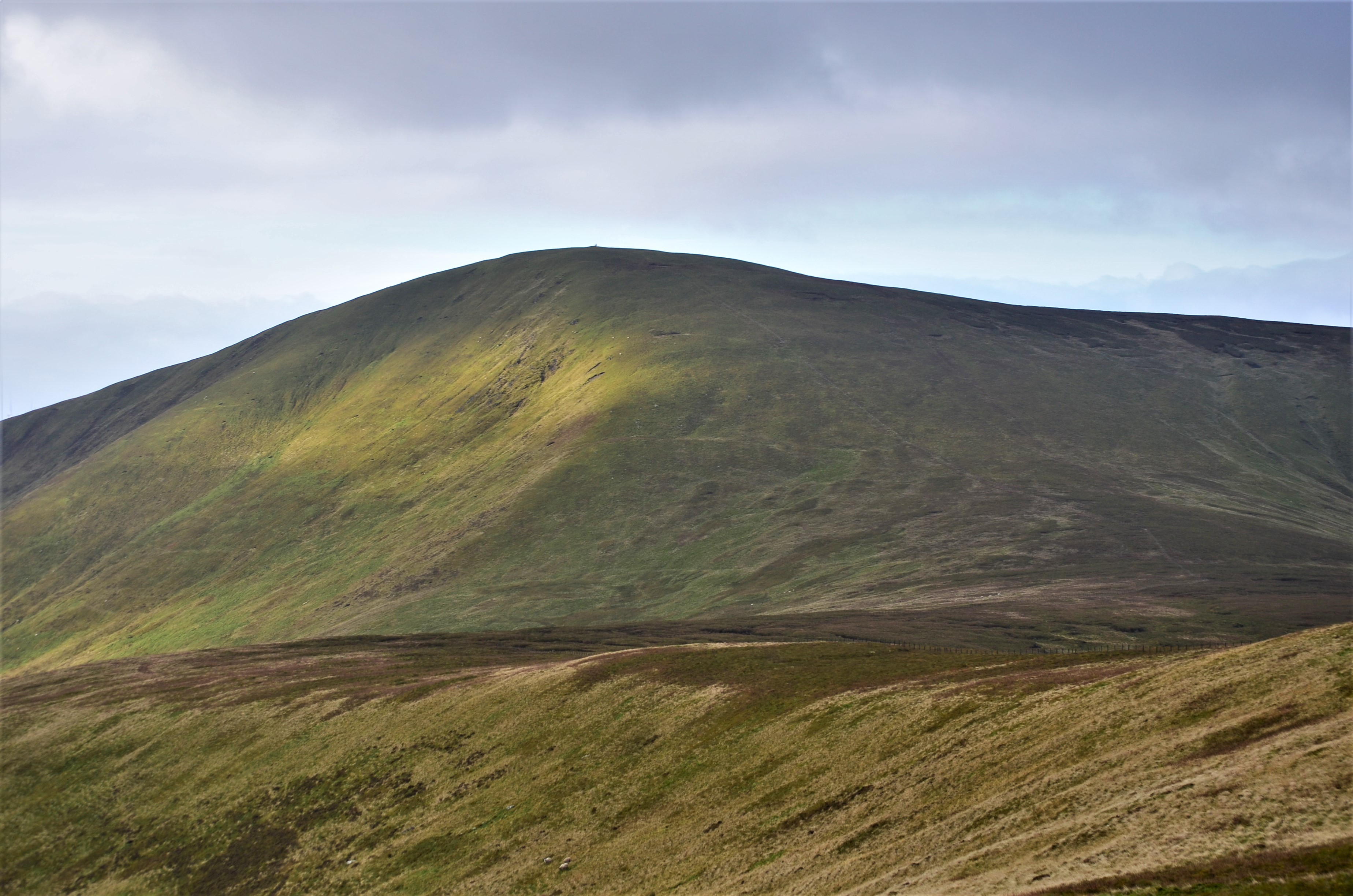
Earn Cleuch is a picturesque valley located in Peeblesshire, Scotland. Nestled within the Southern Uplands, this tranquil valley stretches roughly 2 miles in length and is surrounded by rolling hills and lush green landscapes. The valley is named after the Earn Water, a small river that winds its way through the area.

Known for its unspoiled beauty, Earn Cleuch offers stunning views and a sense of serenity that attracts visitors and nature enthusiasts alike. The valley is home to a diverse range of flora and fauna, including native Scottish wildlife such as red deer, otters, and various species of birds.

The walking trails in Earn Cleuch offer a chance to explore the valley's natural wonders, with paths that lead through ancient woodlands, meadows, and along the riverbank. The area is also popular for fishing, as the Earn Water is known for its abundance of trout and salmon.

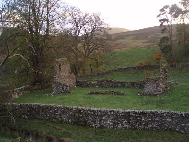
Historically, Earn Cleuch played a significant role in the local community's livelihood. The valley was once home to several small farms and mills, which utilized the river's resources for agriculture and industry. Today, remnants of these historical sites can still be seen, adding to the valley's charm and cultural heritage.

For those seeking a peaceful retreat or an opportunity to immerse themselves in nature, Earn Cleuch provides a serene escape in the heart of Peeblesshire. Its untouched landscapes and tranquil ambiance make it a perfect destination for outdoor enthusiasts and those looking to experience the beauty of the Scottish countryside.

If you have any feedback on the listing, please let us know in the comments section below.

Earn Cleuch Images

Images are sourced within 2km of 55.578854/-3.4974604 or Grid Reference NT0532. Thanks to Geograph Open Source API. All images are credited.

Derelict buildings at Southside Farm Looking East along the valley between Goseland Hill and Mitchell Hill with the currently disused farm buildings in the foreground.
Derelict buildings at Southside Farm
Looking East along the valley between Goseland Hill and Mitchell Hill with the currently disused farm buildings in the foreground.
Middle Rig Mosaic Nice mottled colours on the lower slopes of Cardon Hill south of Biggar in the Scottish Borders.
Middle Rig Mosaic
Nice mottled colours on the lower slopes of Cardon Hill south of Biggar in the Scottish Borders.
Manse Burn Head Fairly miserable day in the Scottish Borders looking across to Manse Burn Head from lower slopes of Cardon Hill
Manse Burn Head
Fairly miserable day in the Scottish Borders looking across to Manse Burn Head from lower slopes of Cardon Hill
Green Topped Fenceposts I was particularly struck by the sight of the lichen topped fenceposts as I climbed towards the top of Cardon Hill.
Green Topped Fenceposts
I was particularly struck by the sight of the lichen topped fenceposts as I climbed towards the top of Cardon Hill.
Scawdmans Hill Scawdmans Hill from gully of Saddle Nick north of Culter Fell.
Scawdmans Hill
Scawdmans Hill from gully of Saddle Nick north of Culter Fell.
Dreich Day A dreich (Scots for wet, dismal) day on the northern slopes of Scawdmans Hill.
The fence is the boundary between Scottish Borders and South Lanarkshire.
Dreich Day
A dreich (Scots for wet, dismal) day on the northern slopes of Scawdmans Hill. The fence is the boundary between Scottish Borders and South Lanarkshire.
When Two Tribes Go To War Two of the many prehistoric forts, settlements, enclosures, cairns and ring systems south of Biggar, Scottish Borders and South Lanarkshire - have a look at an OS map of this area.
Farmstead of Coulter Shaw can just be seen.
When Two Tribes Go To War
Two of the many prehistoric forts, settlements, enclosures, cairns and ring systems south of Biggar, Scottish Borders and South Lanarkshire - have a look at an OS map of this area. Farmstead of Coulter Shaw can just be seen.
Not so Dreich Half an hour after I was cursing being out on such a dreich day, there was lovely afternoon sunshine catching the larch amongst this plantation south of Biggar. You can also clearly see ancient cultivation terraces.
Not so Dreich
Half an hour after I was cursing being out on such a dreich day, there was lovely afternoon sunshine catching the larch amongst this plantation south of Biggar. You can also clearly see ancient cultivation terraces.
4wd Needed Sign of recent heavy rain just south of White Hill fort, Scottish Borders - I certainly had wet feet by now after 4 hours on the hill.
4wd Needed
Sign of recent heavy rain just south of White Hill fort, Scottish Borders - I certainly had wet feet by now after 4 hours on the hill.
Kilbucho Church I suspect the cemetery was used long after the church fell into ruin as there are several gravestones from the turn of the 19th century, unless the building has deteriorated rapidly - quite possible at 1000 feet up.
There are worse locations as a last resting place.
Hill in the distance is Cardons Hill.
Kilbucho Church
I suspect the cemetery was used long after the church fell into ruin as there are several gravestones from the turn of the 19th century, unless the building has deteriorated rapidly - quite possible at 1000 feet up. There are worse locations as a last resting place. Hill in the distance is Cardons Hill.
Cardon Hill View Cardon Hill seems to dominate the skyline round these parts, despite being basically a shoulder of Chapelgill.
Cardon Hill View
Cardon Hill seems to dominate the skyline round these parts, despite being basically a shoulder of Chapelgill.
Middle Rig Three ridges running north from Culter Fell, with Middle Rig in the middle.
Middle Rig
Three ridges running north from Culter Fell, with Middle Rig in the middle.
Ruined church, Kilbucho The old parish church has a long history, certainly back to the 13th century. These ruins probably date from the 18th c; the church was abandoned around 1810. The house just visible in the trees is the manse, built in 1751 and in very good repair still.

More information can be found from the Royal Commission on the Ancient and Historical Monuments of Scotland (RCAHMS) website:  canmore.rcahms.gov.uk
Ruined church, Kilbucho
The old parish church has a long history, certainly back to the 13th century. These ruins probably date from the 18th c; the church was abandoned around 1810. The house just visible in the trees is the manse, built in 1751 and in very good repair still. More information can be found from the Royal Commission on the Ancient and Historical Monuments of Scotland (RCAHMS) website: canmore.rcahms.gov.uk
Old church and cultivation terraces, Kilbucho There are three very well-marked terraces on the N side of the Mitchelhill Burn. The 1:25,000 map shows them continuing a few hundred metres further east.
Old church and cultivation terraces, Kilbucho
There are three very well-marked terraces on the N side of the Mitchelhill Burn. The 1:25,000 map shows them continuing a few hundred metres further east.
Butter Knowe and Black Hill Butter Knowe is the conical hillock - maybe a moraine feature? Black Hill beyond has the alternative name Gawky Hill on the 1:25,000 map.
Butter Knowe and Black Hill
Butter Knowe is the conical hillock - maybe a moraine feature? Black Hill beyond has the alternative name Gawky Hill on the 1:25,000 map.
Western top on White Hill Looking W from this subsidiary summit to Tinto's unmistakeable profile.
Western top on White Hill
Looking W from this subsidiary summit to Tinto's unmistakeable profile.
Valley of the Mitchelhill Burn A large valley for the small present-day burn, but there might be a post-glacial explanation for the river systems in this area.
Valley of the Mitchelhill Burn
A large valley for the small present-day burn, but there might be a post-glacial explanation for the river systems in this area.
Settlement site, White Hill According to RCAHMS (<span class="nowrap"><a title="www.canmore.rcahms.gov.uk)," rel="nofollow ugc noopener" href="http://www.canmore.rcahms.gov.uk),">Link</a><img style="margin-left:2px;" alt="External link" title="External link - shift click to open in new window" src="https://s1.geograph.org.uk/img/external.png" width="10" height="10"/></span> this is a palisaded enclosure, and is the largest such site in Southern Scotland. However, there is not much evident on the ground apart from the low terraces.
Settlement site, White Hill
According to RCAHMS (LinkExternal link this is a palisaded enclosure, and is the largest such site in Southern Scotland. However, there is not much evident on the ground apart from the low terraces.
Show me another place!

Earn Cleuch is located at Grid Ref: NT0532 (Lat: 55.578854, Lng: -3.4974604)

Unitary Authority: The Scottish Borders

Police Authority: The Lothians and Scottish Borders

What 3 Words

///sparkle.payout.fishnet. Near Biggar, South Lanarkshire

Nearby Locations

Earn Cleuch March Brae

Related Wikis

Coulter, South Lanarkshire

Coulter or Culter (both spellings in use, pronounced "Cooter" with no "l") is a small village and civil parish in South Lanarkshire, Scotland. It lies...

Culter Fell

Culter Fell is a hill in the Culter Hills range, part of the Southern Uplands of Scotland. It is the county top of the historic county of Lanarkshire,...

Kilbucho

Kilbucho (Scottish Gaelic: Cille Bheagha) is a small settlement in the parish of Broughton, Glenholm and Kilbucho in the Scottish Borders area of Scotland...

Unthank, South Lanarkshire

Unthank is a small village in South Lanarkshire, Scotland. == Note == The geographic coordinates are from the Ordnance Survey. == References ==

Have you been to Earn Cleuch?

Leave your review of Earn Cleuch below (or comments, questions and feedback).