March Brae

Downs, Moorland in Peeblesshire

Scotland

March Brae

Sheep and Pine Trees Evening light, looking south towards Culter Fell
Sheep and Pine Trees Credit: Chris Upson

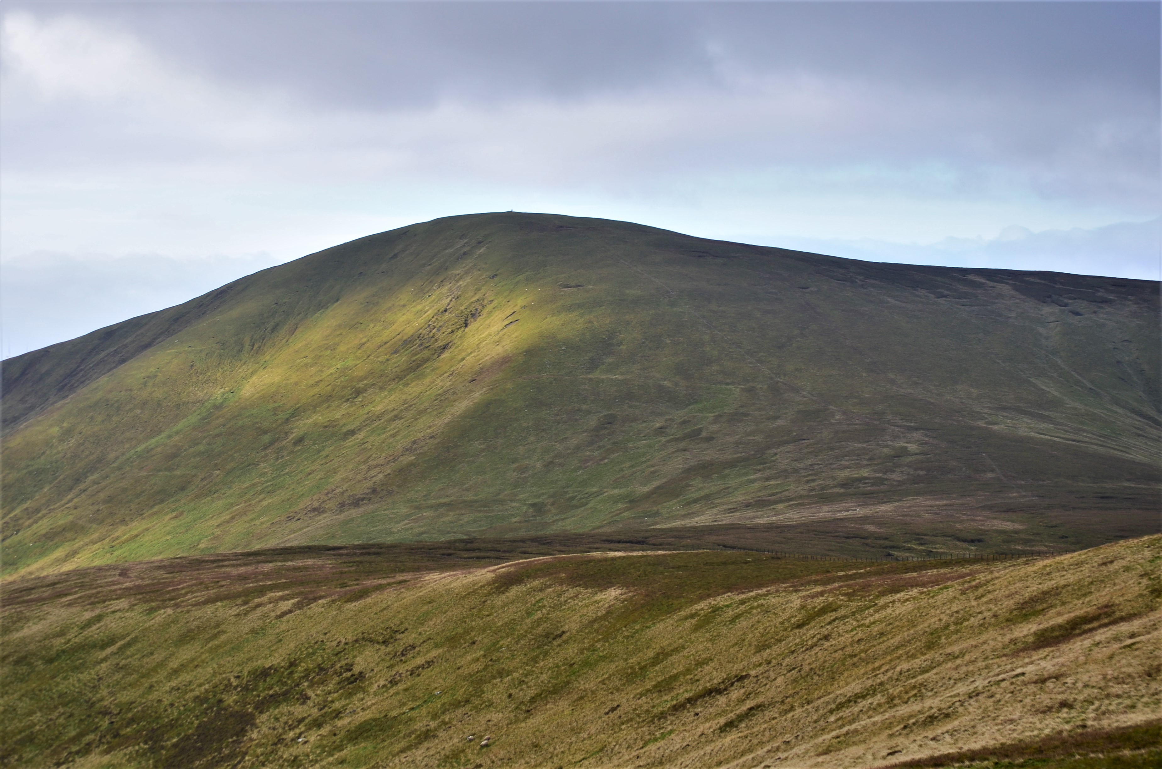
March Brae is a picturesque area located in Peeblesshire, Scotland. Situated amidst the stunning landscape of the Scottish Borders, it is known for its rolling downs and expansive moorland. March Brae offers breathtaking views of the surrounding countryside, making it a popular destination for nature enthusiasts and hikers.

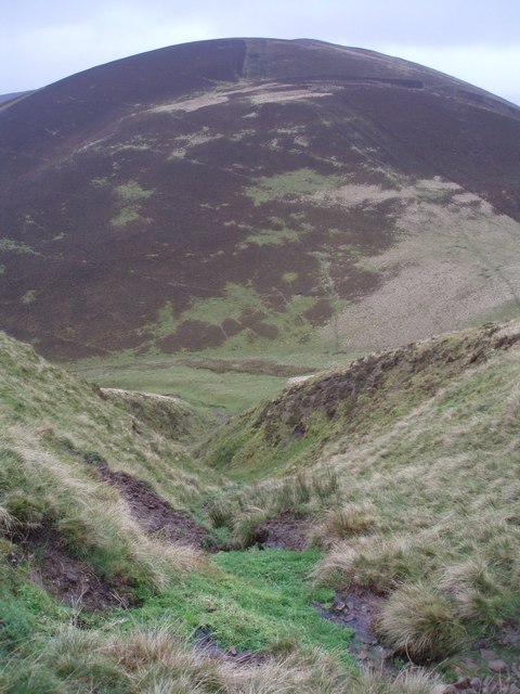
The downs of March Brae are characterized by their gently sloping hills, covered in lush green grass and scattered with patches of colourful wildflowers during the spring and summer seasons. These downs provide an idyllic setting for leisurely walks and picnics, allowing visitors to immerse themselves in the tranquility of the Scottish countryside.

The moorland of March Brae is a vast expanse of open land, covered in heather and scattered with rocky outcrops. This rugged terrain creates a unique and rugged beauty, attracting adventure seekers and nature lovers alike. The moorland is home to a variety of wildlife, including birds of prey, such as buzzards and kestrels, as well as smaller mammals like hares and foxes.

March Brae is also a designated nature reserve, known for its rich biodiversity. The area is home to a wide range of plant species, including rare and endangered ones. This makes it an important site for ecological research and conservation efforts.

Overall, March Brae in Peeblesshire offers a scenic and unspoiled landscape, providing visitors with the opportunity to enjoy the beauty and tranquility of the Scottish countryside.

If you have any feedback on the listing, please let us know in the comments section below.

March Brae Images

Images are sourced within 2km of 55.580413/-3.5081644 or Grid Reference NT0532. Thanks to Geograph Open Source API. All images are credited.

Sheep and Pine Trees Evening light, looking south towards Culter Fell
Sheep and Pine Trees
Evening light, looking south towards Culter Fell
Culter Water. Shingle banks on the Culter Water.
Culter Water.
Shingle banks on the Culter Water.
Derelict buildings at Southside Farm Looking East along the valley between Goseland Hill and Mitchell Hill with the currently disused farm buildings in the foreground.
Derelict buildings at Southside Farm
Looking East along the valley between Goseland Hill and Mitchell Hill with the currently disused farm buildings in the foreground.
Snaip Farm and the Culter Water Valley from Shaw Hill Looking south from the steep sided Shaw Hill.  At the left hand side of the frame some neolithic terracing above Nisbet farm can be seen
Snaip Farm and the Culter Water Valley from Shaw Hill
Looking south from the steep sided Shaw Hill. At the left hand side of the frame some neolithic terracing above Nisbet farm can be seen
Manse Burn Head Fairly miserable day in the Scottish Borders looking across to Manse Burn Head from lower slopes of Cardon Hill
Manse Burn Head
Fairly miserable day in the Scottish Borders looking across to Manse Burn Head from lower slopes of Cardon Hill
Scawdmans Hill Scawdmans Hill from gully of Saddle Nick north of Culter Fell.
Scawdmans Hill
Scawdmans Hill from gully of Saddle Nick north of Culter Fell.
Dreich Day A dreich (Scots for wet, dismal) day on the northern slopes of Scawdmans Hill.
The fence is the boundary between Scottish Borders and South Lanarkshire.
Dreich Day
A dreich (Scots for wet, dismal) day on the northern slopes of Scawdmans Hill. The fence is the boundary between Scottish Borders and South Lanarkshire.
When Two Tribes Go To War Two of the many prehistoric forts, settlements, enclosures, cairns and ring systems south of Biggar, Scottish Borders and South Lanarkshire - have a look at an OS map of this area.
Farmstead of Coulter Shaw can just be seen.
When Two Tribes Go To War
Two of the many prehistoric forts, settlements, enclosures, cairns and ring systems south of Biggar, Scottish Borders and South Lanarkshire - have a look at an OS map of this area. Farmstead of Coulter Shaw can just be seen.
Not so Dreich Half an hour after I was cursing being out on such a dreich day, there was lovely afternoon sunshine catching the larch amongst this plantation south of Biggar. You can also clearly see ancient cultivation terraces.
Not so Dreich
Half an hour after I was cursing being out on such a dreich day, there was lovely afternoon sunshine catching the larch amongst this plantation south of Biggar. You can also clearly see ancient cultivation terraces.
4wd Needed Sign of recent heavy rain just south of White Hill fort, Scottish Borders - I certainly had wet feet by now after 4 hours on the hill.
4wd Needed
Sign of recent heavy rain just south of White Hill fort, Scottish Borders - I certainly had wet feet by now after 4 hours on the hill.
Kilbucho Church I suspect the cemetery was used long after the church fell into ruin as there are several gravestones from the turn of the 19th century, unless the building has deteriorated rapidly - quite possible at 1000 feet up.
There are worse locations as a last resting place.
Hill in the distance is Cardons Hill.
Kilbucho Church
I suspect the cemetery was used long after the church fell into ruin as there are several gravestones from the turn of the 19th century, unless the building has deteriorated rapidly - quite possible at 1000 feet up. There are worse locations as a last resting place. Hill in the distance is Cardons Hill.
Snaip Bridge Looking through the railings of Snaip Bridge, over the Culter Water, to spruce and larch plantation on Shaw Hill.
Snaip Bridge
Looking through the railings of Snaip Bridge, over the Culter Water, to spruce and larch plantation on Shaw Hill.
Shaw Hill in Coulter A much more natural forestry scene than the usual dense plantings.
Shaw Hill in Coulter
A much more natural forestry scene than the usual dense plantings.
Culter Water Looking downstream, and north-east up the valley of the Kilbucho Burn, which flows from Broughton.
Culter Water
Looking downstream, and north-east up the valley of the Kilbucho Burn, which flows from Broughton.
The Culter Water valley
Woodland by the Culter Water A view upstream, from about 1 km north of Culter Allers Farm.
Woodland by the Culter Water
A view upstream, from about 1 km north of Culter Allers Farm.
Middle Rig Three ridges running north from Culter Fell, with Middle Rig in the middle.
Middle Rig
Three ridges running north from Culter Fell, with Middle Rig in the middle.
Shaw Hill (lots of colour) The summit plateau of Shaw Hill, seen from the slopes of Culter Fell. The hilltop is covered in dense Sitka spruce plantations, served by a road.
Shaw Hill (lots of colour)
The summit plateau of Shaw Hill, seen from the slopes of Culter Fell. The hilltop is covered in dense Sitka spruce plantations, served by a road.
Show me another place!

March Brae is located at Grid Ref: NT0532 (Lat: 55.580413, Lng: -3.5081644)

Unitary Authority: The Scottish Borders

Police Authority: The Lothians and Scottish Borders

What 3 Words

///roadshow.learning.necklaces. Near Biggar, South Lanarkshire

Nearby Locations

Earn Cleuch March Brae

Related Wikis

Coulter, South Lanarkshire

Coulter or Culter (both spellings in use, pronounced "Cooter" with no "l") is a small village and civil parish in South Lanarkshire, Scotland. It lies...

Unthank, South Lanarkshire

Unthank is a small village in South Lanarkshire, Scotland. == Note == The geographic coordinates are from the Ordnance Survey. == References ==

Culter Fell

Culter Fell is a hill in the Culter Hills range, part of the Southern Uplands of Scotland. It is the county top of the historic county of Lanarkshire,...

Boghall Castle

Boghall Castle was a 14th century castle to the south of Biggar, South Lanarkshire, Scotland. Boghall became ruinous in the 19th century. == History... ==

Nearby Amenities

Located within 500m of 55.580413,-3.5081644
March Brae
Created By: Potlatch 0.10f
Place: locality
Source: old map
Lat/Long: 55.5806379/-3.5080199
The data included in this document is from www.openstreetmap.org. The data is made available under ODbL.

Have you been to March Brae?

Leave your review of March Brae below (or comments, questions and feedback).