Barras

Settlement in Westmorland Eden

England

Barras

The road to Kaber
The road to Kaber Credit: John H Darch

Barras is a small village located in the county of Westmorland, in the North West of England. Situated in the picturesque countryside of the Eden Valley, it is a tranquil and rural community that offers a peaceful escape from the hustle and bustle of city life.

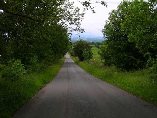
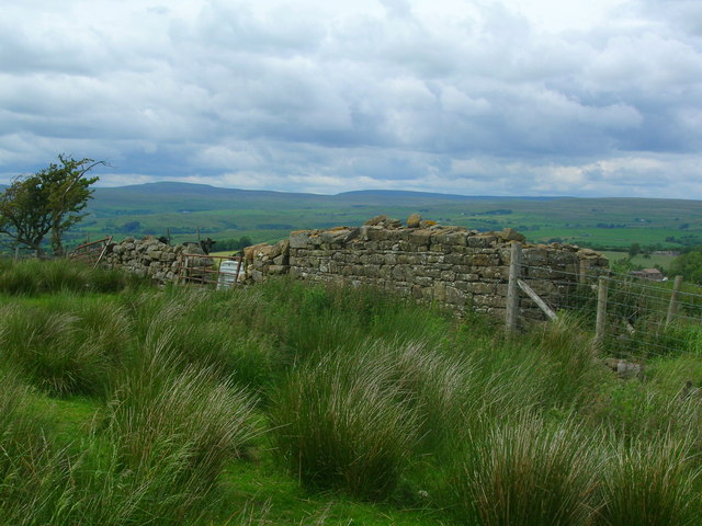
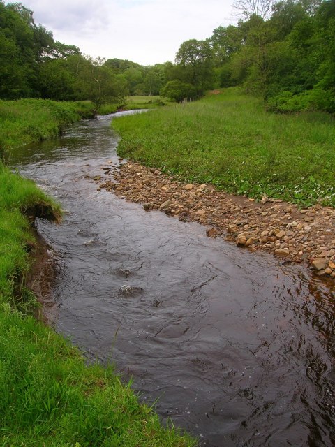
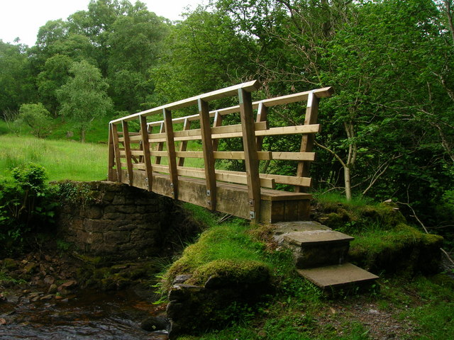
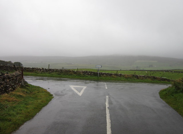
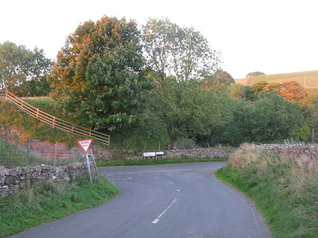
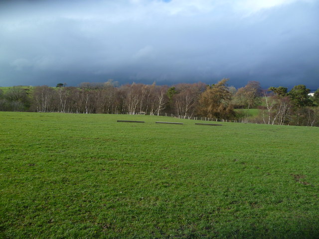
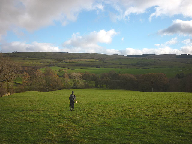
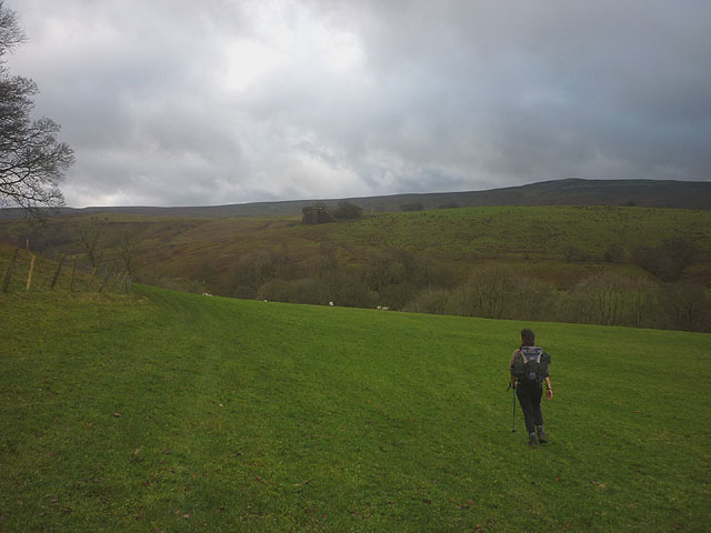
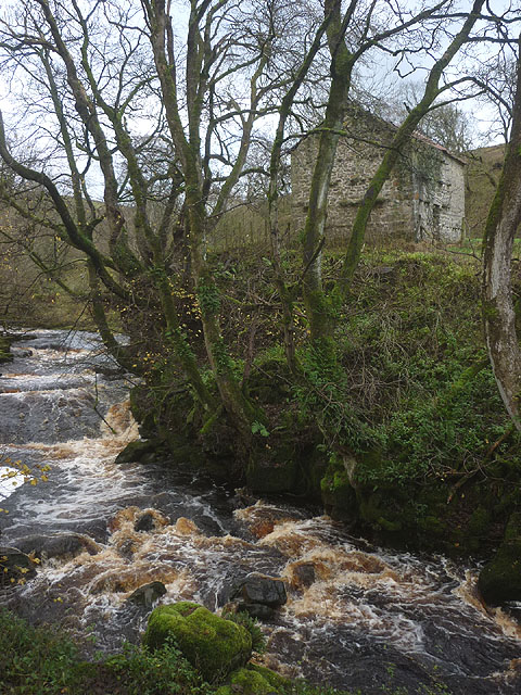
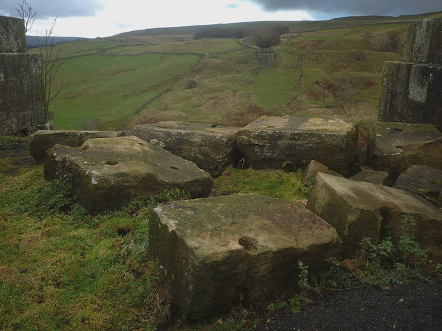
The village is surrounded by rolling hills, green meadows, and charming farmland, making it an idyllic spot for nature lovers and outdoor enthusiasts. The nearby River Eden adds to the beauty of the area, providing opportunities for fishing and riverside walks.

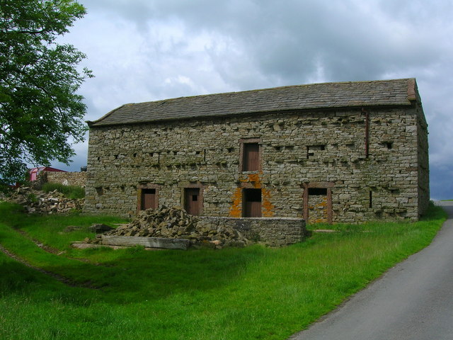
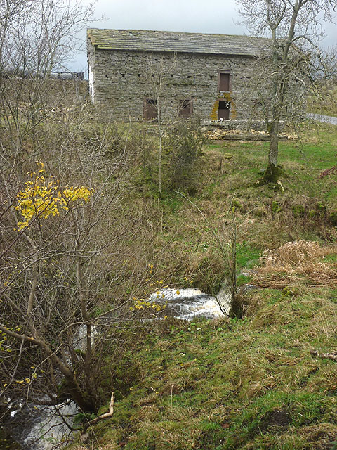
Barras has a rich history that dates back centuries. It was once a significant market town, where locals would gather to trade goods and produce. Today, the remnants of the market can still be seen, with the old market cross standing as a reminder of its past.

The village itself is small, with a close-knit community that values tradition and heritage. The architecture reflects the area's history, with quaint stone cottages and traditional farmhouses dotting the landscape. The local pub, which has been a focal point of the community for generations, offers a warm welcome to visitors and locals alike.

While Barras may be a quiet village, it is well-connected to nearby towns and cities. The market town of Appleby-in-Westmorland is just a short drive away, offering a wider range of amenities and services. The stunning Lake District National Park is also within reach, providing ample opportunities for outdoor adventures and exploration.

In summary, Barras is a charming village in Westmorland that offers a peaceful retreat in the heart of the countryside. With its rich history, beautiful surroundings, and close-knit community, it is a hidden gem worth exploring for those seeking a slower pace of life.

If you have any feedback on the listing, please let us know in the comments section below.

Barras Images

Images are sourced within 2km of 54.502786/-2.240988 or Grid Reference NY8411. Thanks to Geograph Open Source API. All images are credited.

The road to Kaber
The road to Kaber
Barn by Swine Gill
Barn by Swine Gill
Ruined barn west of River Belah Mickle Fell can be seen on the horizon.
Ruined barn west of River Belah
Mickle Fell can be seen on the horizon.
Argill Beck
Argill Beck
Footbridge over Argill Beck
Mousegill Beck Looking downstream from Mousegill Bridge. In the distance is the scarp slope of the Northern Pennines.
Mousegill Beck
Looking downstream from Mousegill Bridge. In the distance is the scarp slope of the Northern Pennines.
Green Lane joins the Bowes Road
Belah Viaduct ( Barras ) The stone buttresses of the once mighty Belah Viaduct, on the redundant railway to Kirkby Stephen from Barnard Castle.
Belah Viaduct ( Barras )
The stone buttresses of the once mighty Belah Viaduct, on the redundant railway to Kirkby Stephen from Barnard Castle.
T-Junction at Barras Approaching this junction along the road from Tan Hill Inn, you get advance warning because the junction is at the end of a steep hill on a bend.
T-Junction at Barras
Approaching this junction along the road from Tan Hill Inn, you get advance warning because the junction is at the end of a steep hill on a bend.
Tree Line, Hocker Gill Looking over an empty pasture towards the purple tinged birches growing in Hocker Gill
Tree Line, Hocker Gill
Looking over an empty pasture towards the purple tinged birches growing in Hocker Gill
Watercourse under Moudy Mea From the track to the radio station. An unnamed watercourse.
Watercourse under Moudy Mea
From the track to the radio station. An unnamed watercourse.
Track to Moudy Mea South Stainmore
Track to Moudy Mea
South Stainmore
Footpath above Hocker Gill The route passes through pastureland, crossing a tributary of the wooded gill before reaching the minor road beyond.
Footpath above Hocker Gill
The route passes through pastureland, crossing a tributary of the wooded gill before reaching the minor road beyond.
Waterfall and barn, Swine Gill Just below the road the beck falls over a substantial drop. It does not have a name on the map so I shall christen it 'Swine Gill Force' since it is certainly deserves to be noticed.
Waterfall and barn, Swine Gill
Just below the road the beck falls over a substantial drop. It does not have a name on the map so I shall christen it 'Swine Gill Force' since it is certainly deserves to be noticed.
Footpath to Powleyclose Bridge Below New Hall the path drops down towards the wooded Belah through pastureland. High on the far side is the southern abutment of the old Belah Viaduct.
Footpath to Powleyclose Bridge
Below New Hall the path drops down towards the wooded Belah through pastureland. High on the far side is the southern abutment of the old Belah Viaduct.
The River Belah at Powleyclose Bridge The river descends steeply over shelves and boulders of limestone and sandstone. Just above is an intact stone field barn.
The River Belah at Powleyclose Bridge
The river descends steeply over shelves and boulders of limestone and sandstone. Just above is an intact stone field barn.
Masonry blocks, Bela Viaduct These massive blocks of sandstone masonry have been left perched by the brink of the southern abutment. They were left here after the iron latticework span <span class="nowrap"><a title="http://www.forgottenrelics.co.uk/bridges/images/belah/belah-1.jpg" rel="nofollow ugc noopener" href="http://www.forgottenrelics.co.uk/bridges/images/belah/belah-1.jpg">Link</a><img style="margin-left:2px;" alt="External link" title="External link - shift click to open in new window" src="https://s1.geograph.org.uk/img/external.png" width="10" height="10"/></span> was dismantled in 1963. In the distance, across the great gulf of the Belah valley can be seen the northern abutment.
Masonry blocks, Bela Viaduct
These massive blocks of sandstone masonry have been left perched by the brink of the southern abutment. They were left here after the iron latticework span LinkExternal link was dismantled in 1963. In the distance, across the great gulf of the Belah valley can be seen the northern abutment.
Ruined signal box by the Belah Viaduct The roof beams have completely disappeared since 2008 <a href="https://www.geograph.org.uk/photo/958817">NY8310 : Belah Viaduct signal box</a>
Ruined signal box by the Belah Viaduct
The roof beams have completely disappeared since 2008 NY8310 : Belah Viaduct signal box
Show me another place!

Barras is located at Grid Ref: NY8411 (Lat: 54.502786, Lng: -2.240988)

Administrative County: Cumbria

District: Eden

Police Authority: Cumbria

What 3 Words

///penny.expert.swims. Near Kirkby Stephen, Cumbria

Nearby Locations

Barras

Related Wikis

Barras railway station

Barras railway station was situated on the South Durham & Lancashire Union Railway between Barnard Castle and Kirkby Stephen East. == History == The station...

Barras, Cumbria

Barras is a hamlet close to the River Belah, about 4 miles (6 kilometres) south-east of Brough, Cumbria, England. Until the creation of the new county...

Snowdrift at Bleath Gill

Snowdrift at Bleath Gill is a 1955 British Transport Film documentary directed by Kenneth Fairbairn. The 10-minute-long film presents a first-hand account...
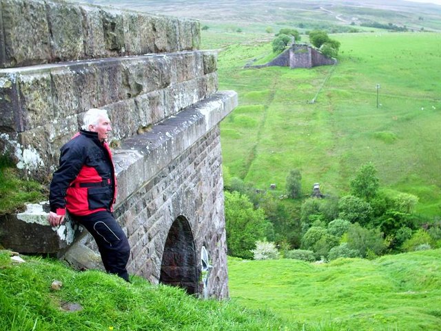
Belah Viaduct

The Belah Viaduct was a railway viaduct on the South Durham and Lancashire Union Railway, crossing the River Belah, in Cumbria, England, about 1 mile...

Battle of Stainmore

The Battle of Stainmore was probably fought between the Earldom of Bernicia, led by Oswulf, and the forces of the last Norse king of Jórvík (York), Eric...

Stainmore

Stainmore is a remote geographic area in the Pennines on the border of Cumbria, County Durham and North Yorkshire. The name is used for a civil parish...

A66 road

The A66 is a major road in Northern England, which in part follows the course of the Roman road from Scotch Corner to Penrith. It runs from east of Middlesbrough...

Stainmore Summit

Stainmore Summit is the highest point on the trans-Pennine South Durham & Lancashire Union Railway, also known as the Stainmore Railway in Northern England...

Nearby Amenities

Located within 500m of 54.502786,-2.240988
Barras
End Date: 1962-01-22
Historic Railway: station
Railway: site
Source: NPE
Start Date: 1861-03-26
Wikidata: Q4863249
Wikipedia: en:Barras railway station
Lat/Long: 54.5032314/-2.2417997
Barras
Is In Country Code: GB
Is In County: Cumbria
Is In Municipality: Eden
Place: hamlet
Source: NPE
Wikidata: Q2885493
Wikipedia: en:Barras, Cumbria
Lat/Long: 54.5028212/-2.2392989
Calva House
Local Ref: AT
Naptan AtcoCode: 090074631329
Naptan Bearing: E
Naptan BusStopType: CUS
Naptan CommonName: Calva House
Naptan Indicator: at
Naptan Landmark: entrance to Calva House
Naptan NaptanCode: cumdgjdm
Naptan Street: No name
Naptan Verified: no
Source: naptan_import
Lat/Long: 54.5039326/-2.2435784
Barras
End Date: 1962-01-22
Historic Railway: station
Railway: site
Source: NPE
Start Date: 1861-03-26
Wikidata: Q4863249
Wikipedia: en:Barras railway station
Lat/Long: 54.5013333/-2.2428734
Power: pole
Lat/Long: 54.5053314/-2.2349197
Power: pole
Lat/Long: 54.5026379/-2.2370968
Power: pole
Lat/Long: 54.50346/-2.2364205
Power: pole
Lat/Long: 54.5043682/-2.235683
Power: pole
Lat/Long: 54.5031655/-2.247985
Power: pole
Lat/Long: 54.5031666/-2.2463379
Power: pole
Lat/Long: 54.5031793/-2.2444476
Power: pole
Lat/Long: 54.5031884/-2.2428163
The data included in this document is from www.openstreetmap.org. The data is made available under ODbL.

Have you been to Barras?

Leave your review of Barras below (or comments, questions and feedback).