Church Combe

Valley in Somerset Somerset West and Taunton

England

Church Combe

Thatched cottage at Bossington c.1970
Thatched cottage at Bossington c.1970 Credit: Ronald Searle

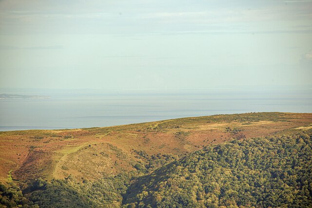
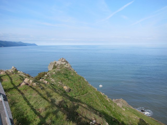
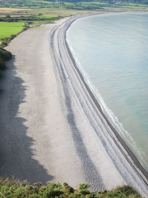
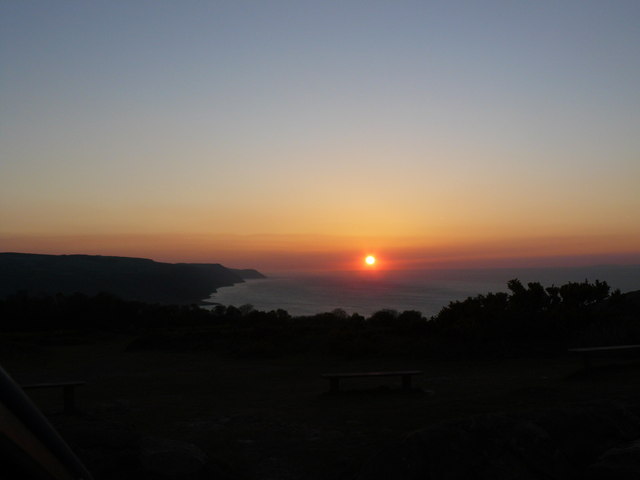
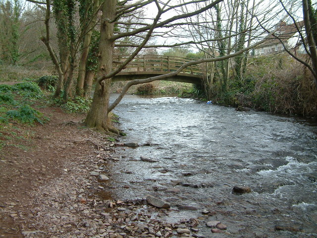
Church Combe is a picturesque valley located in Somerset, England. Situated in the beautiful countryside, it is surrounded by rolling hills and lush greenery, creating a serene and tranquil atmosphere. The valley is named after the small hamlet of Church Combe, which lies at its heart.

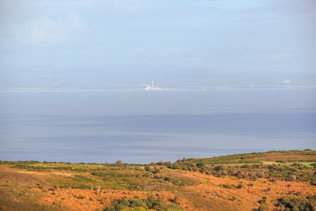
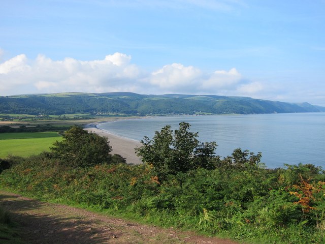
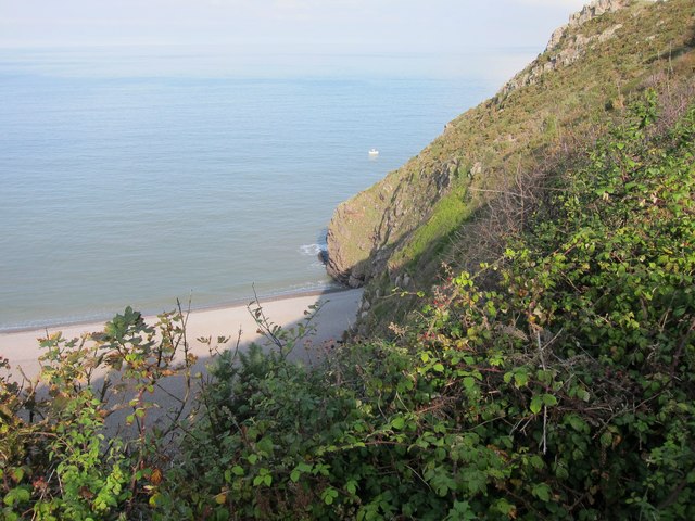
The area is known for its natural beauty and is a popular destination for nature lovers and hikers. Walking trails wind through the valley, offering stunning views of the surrounding landscape. The valley is also home to a variety of wildlife, including deer, foxes, and a wide range of bird species.

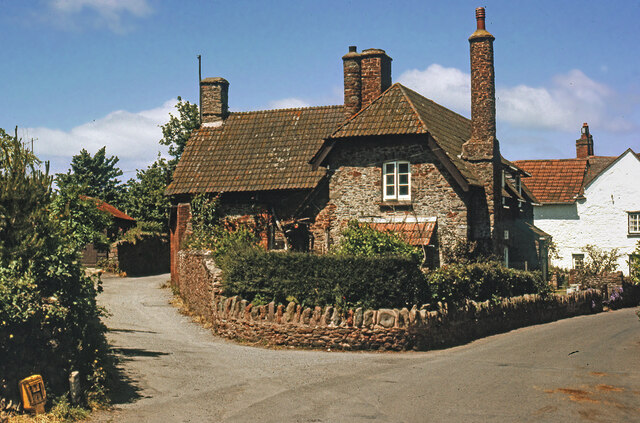
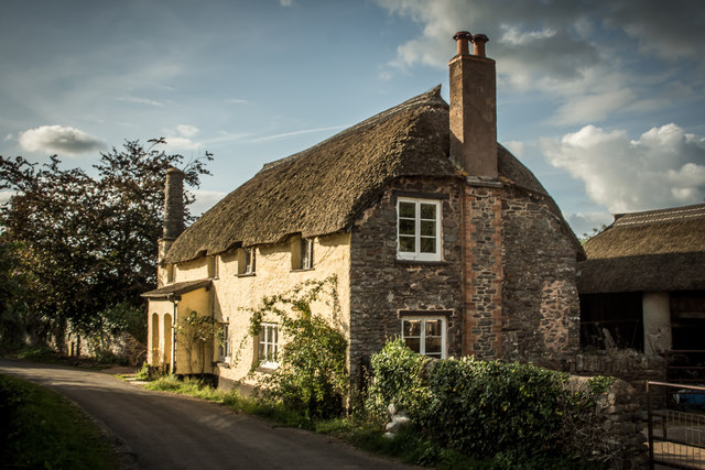
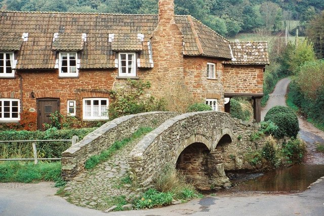
Church Combe is characterized by its charming rural scenery, with quaint cottages dotting the landscape. The village itself is small and consists of a few houses and a church, which dates back to the 12th century. The historic church, dedicated to St. Nicholas, is a popular attraction for visitors interested in exploring the area's rich history.

The valley is also known for its vibrant flora, with wildflowers blooming in abundance during the spring and summer months. The scent of fresh flowers fills the air, adding to the natural beauty of the surroundings.

Overall, Church Combe in Somerset offers a peaceful retreat from the hustle and bustle of city life. Its idyllic setting, rich history, and stunning natural beauty make it a must-visit destination for those seeking a true countryside experience.

If you have any feedback on the listing, please let us know in the comments section below.
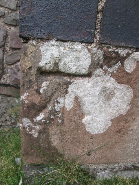
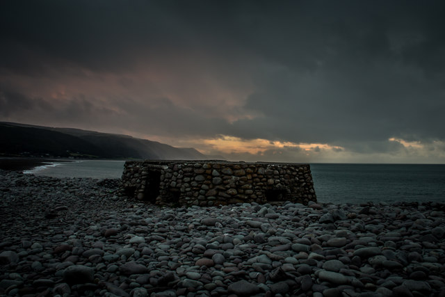
Church Combe Images

Images are sourced within 2km of 51.222108/-3.5720877 or Grid Reference SS9048. Thanks to Geograph Open Source API. All images are credited.

Thatched cottage at Bossington c.1970
Allerford's packhorse bridge The bridge now only carries those on foot, other traffic takes the ford alongside.
Allerford's packhorse bridge
The bridge now only carries those on foot, other traffic takes the ford alongside.
South West Coast Path The South West Coast Path National Trail - 630 miles of superb coastal walking. From Minehead on the edge of the Exmoor National Park to the shores of Poole Harbour in Dorset. It is the longest of all Britain's National Trails.
Website: <span class="nowrap"><a title="http://www.southwestcoastpath.com/" rel="nofollow ugc noopener" href="http://www.southwestcoastpath.com/">Link</a><img style="margin-left:2px;" alt="External link" title="External link - shift click to open in new window" src="https://s1.geograph.org.uk/img/external.png" width="10" height="10"/></span>
South West Coast Path
The South West Coast Path National Trail - 630 miles of superb coastal walking. From Minehead on the edge of the Exmoor National Park to the shores of Poole Harbour in Dorset. It is the longest of all Britain's National Trails. Website: LinkExternal link
Allerford Post Office c.1970 Still the village Post Office to this day. Allerford, along with Bossington and Selworthy, is contained within the National Trust’s Holnicote Estate, which takes in over 12,000 acres of Exmoor coast and countryside.
Allerford Post Office c.1970
Still the village Post Office to this day. Allerford, along with Bossington and Selworthy, is contained within the National Trust’s Holnicote Estate, which takes in over 12,000 acres of Exmoor coast and countryside.
Ordnance Survey Rivet This OS rivet can be found on the small dam. It marks a point 246.639m above mean sea level.
Ordnance Survey Rivet
This OS rivet can be found on the small dam. It marks a point 246.639m above mean sea level.
Luccombe : Bossington Hill Looking towards Bossington Hill and beyond to the Bristol Channel. The Prince of Wales Bridge and Severn Bridge can be seen in the very hazy distance.
Luccombe : Bossington Hill
Looking towards Bossington Hill and beyond to the Bristol Channel. The Prince of Wales Bridge and Severn Bridge can be seen in the very hazy distance.
Porlock : Bossington Hill Looking across to Bossington Hill and beyond to the Bristol Channel.
Porlock : Bossington Hill
Looking across to Bossington Hill and beyond to the Bristol Channel.
Porlock Bay from the South West Coastal Path Porlock Weir and Gore Point are visible in the distance.
Porlock Bay from the South West Coastal Path
Porlock Weir and Gore Point are visible in the distance.
The Eastern limit of Porlock Bay viewed from The South West Coastal Path
Hurlstone Point and Porlock Bay viewed from the South West Coastal Path
Bossington Beach and Porlock Bay viewed from the South West Coastal Path The true scale of this beach is only appreciated when you notice the two individuals walking along the shingle ridge in the centre. The stones are large and walking is very difficult.
Bossington Beach and Porlock Bay viewed from the South West Coastal Path
The true scale of this beach is only appreciated when you notice the two individuals walking along the shingle ridge in the centre. The stones are large and walking is very difficult.
A newly installed walkway to aid progress across a flooded salt marsh on the South West Coastal Path
Salt marsh, sewer pipe and dead trees beside the South West Coastal Path Porlock Weir and Gore Point are visible in the distance.
Salt marsh, sewer pipe and dead trees beside the South West Coastal Path
Porlock Weir and Gore Point are visible in the distance.
West Somerset's favourite sunset viewpoint? Overlooking Porlock Bay, with Foreland Point on the horizon. There must be quite a few viewpoints that people in West Somerset can go to view a sunset that promises to be spectacular. This is probably the most popular. The advantage of this location is its relative easy & quick accessibility, combined with quiet and serene surroundings. And the possibility of seeing deer on the move in the fading twilight.
West Somerset's favourite sunset viewpoint?
Overlooking Porlock Bay, with Foreland Point on the horizon. There must be quite a few viewpoints that people in West Somerset can go to view a sunset that promises to be spectacular. This is probably the most popular. The advantage of this location is its relative easy & quick accessibility, combined with quiet and serene surroundings. And the possibility of seeing deer on the move in the fading twilight.
Ordnance Survey Cut Mark This OS cut mark can be found on the SE face of the Lime Kiln. It marks a point 6.462m above mean sea level.
Ordnance Survey Cut Mark
This OS cut mark can be found on the SE face of the Lime Kiln. It marks a point 6.462m above mean sea level.
Ordnance Survey Cut Mark This OS cut mark can be found on the Methodist Chapel. It marks a point 17.654m above mean sea level.
Ordnance Survey Cut Mark
This OS cut mark can be found on the Methodist Chapel. It marks a point 17.654m above mean sea level.
Bossington Beach
Bossington Beach
Bossington Village
Bossington Village
Show me another place!

Church Combe is located at Grid Ref: SS9048 (Lat: 51.222108, Lng: -3.5720877)

Administrative County: Somerset

District: Somerset West and Taunton

Police Authority: Avon and Somerset

What 3 Words

///clattered.grub.winks. Near Porlock, Somerset

Related Wikis

River Aller

The River Aller is a small river on Exmoor in Somerset, England. It rises as several small streams around Tivington and Huntscott and flows through the...

Lynch Chapel Of Ease

The Anglican Lynch Chapel Of Ease in West Lynch, Selworthy, Somerset, England was built around 1530. It is a Grade II* listed building. == History == The...
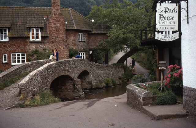
Allerford

Allerford is a village in the county of Somerset, England, located within Exmoor National Park, and is part of the parish of Selworthy in the district...

River Horner

The River Horner, also known as Horner Water, rises near Luccombe on Exmoor, Somerset, and flows past Porlock into Porlock Bay near Hurlstone Point on...

Hurlstone Point

Hurlstone point (grid reference SS898492) is a promontory of land between Porlock Weir and Minehead in the Exmoor National Park on the coast of Somerset...

West Somerset Rural Life Museum and Victorian School

The West Somerset Rural Life Museum is a small museum in Allerford, Somerset, England. The building was built in 1821 as the village school and was closed...
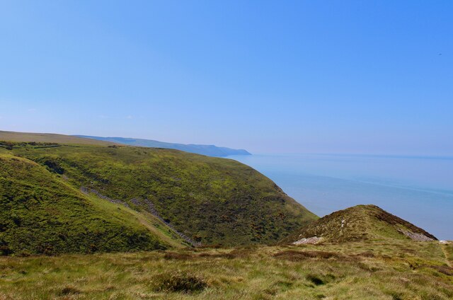
Selworthy Beacon

Selworthy Beacon is a hill and Marilyn of Exmoor in Somerset, England. It lies within the boundaries of Exmoor National Park, to the north of the village...

Coleridge Way

The Coleridge Way is a 51-mile (82 km) long-distance trail in Somerset and Devon, England. It was opened in April 2005, and the route links several sites...

Nearby Amenities

Located within 500m of 51.222108,-3.5720877
Barrier: kissing_gate
Foot: yes
Lat/Long: 51.2198389/-3.5763438
Barrier: kissing_gate
Foot: yes
Lat/Long: 51.2209047/-3.5785391
Bench
Lat/Long: 51.2213752/-3.5719917
Bench
Lat/Long: 51.2258751/-3.5752304
Bench
Lat/Long: 51.2237791/-3.5750333
Bench
Lat/Long: 51.2227846/-3.5740114
Bench
Lat/Long: 51.2202665/-3.5689233
Bench
Lat/Long: 51.2232292/-3.577984
Bossington Hill
Tourism: viewpoint
Lat/Long: 51.224706/-3.5719729
Man Made: cairn
Lat/Long: 51.2247375/-3.5720129
Shelter
Access: permissive
Lat/Long: 51.2210015/-3.5788531
The data included in this document is from www.openstreetmap.org. The data is made available under ODbL.

Have you been to Church Combe?

Leave your review of Church Combe below (or comments, questions and feedback).