Ceunant y Felin

Valley in Merionethshire

Wales

Ceunant y Felin

Llanymawddwy chapel
Llanymawddwy chapel Credit: David Purchase

Ceunant y Felin, located in Merionethshire, is a picturesque valley in Wales renowned for its natural beauty. Nestled within the Snowdonia National Park, this valley offers visitors a tranquil and idyllic setting to immerse themselves in the stunning landscape that Wales is known for.

The valley is characterized by its steep and dramatic cliffs, which are covered in lush greenery and dotted with cascading waterfalls. The river that runs through the valley, Afon Cwmnantcol, adds to its enchanting atmosphere, creating a soothing soundtrack of babbling water.

Ceunant y Felin is a haven for outdoor enthusiasts, with numerous walking trails that allow visitors to explore the valley's hidden treasures. The trails wind through ancient woodlands, providing opportunities to spot a variety of wildlife, including red squirrels, buzzards, and even the occasional otter.

The valley is also home to a rich history, with remnants of old mines and quarries serving as a reminder of its industrial past. The ruins of Felin Fawr, an old mill that once powered the local community, stand as a testament to the area's heritage.

For those seeking a peaceful escape from city life, Ceunant y Felin offers a retreat like no other. Its untouched beauty and tranquility make it an ideal destination for nature lovers, hikers, and those seeking a break from the hustle and bustle of everyday life.

If you have any feedback on the listing, please let us know in the comments section below.

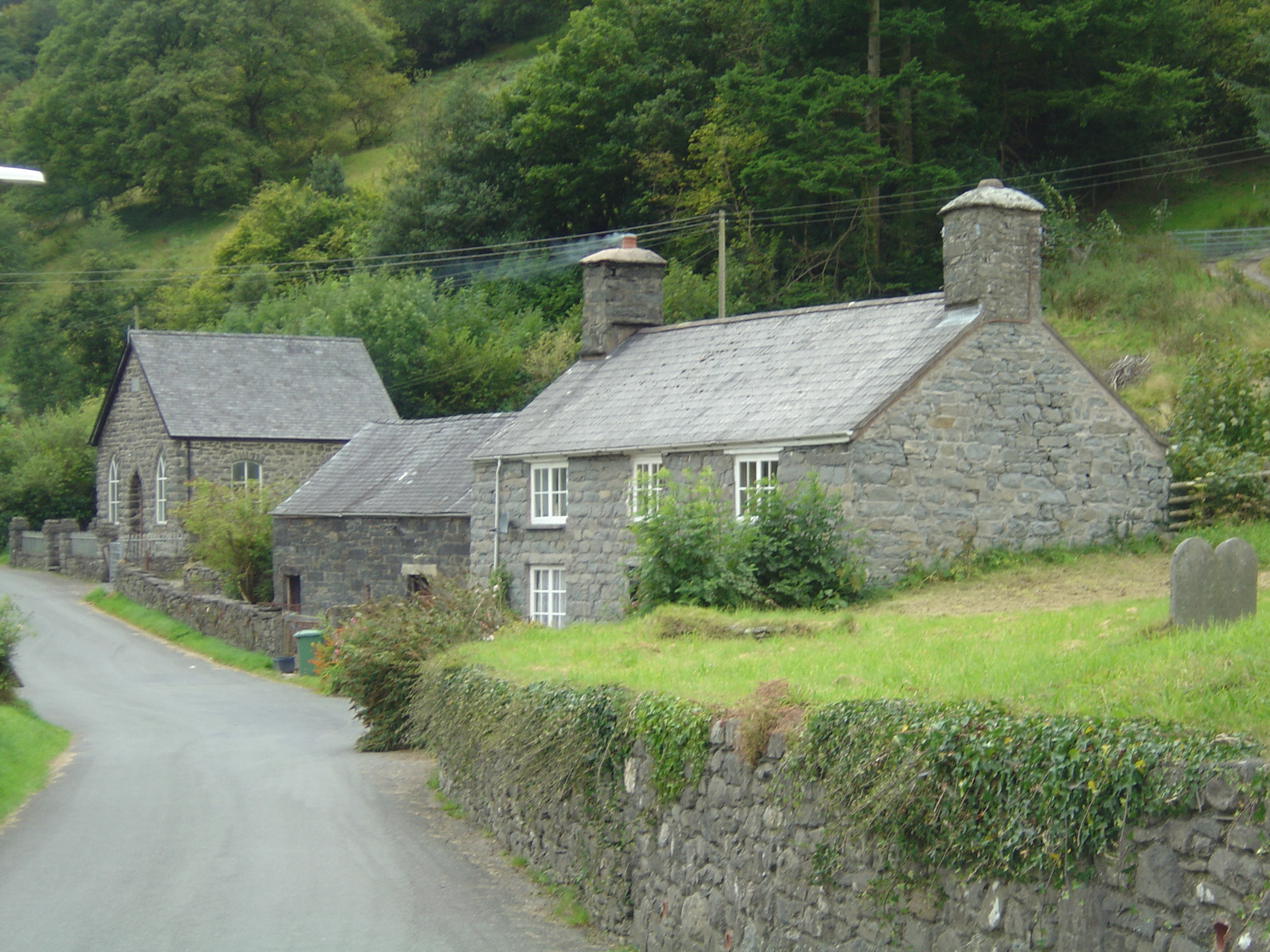
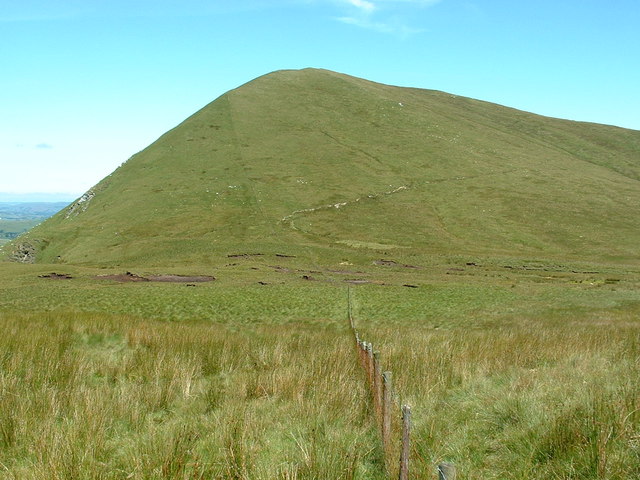
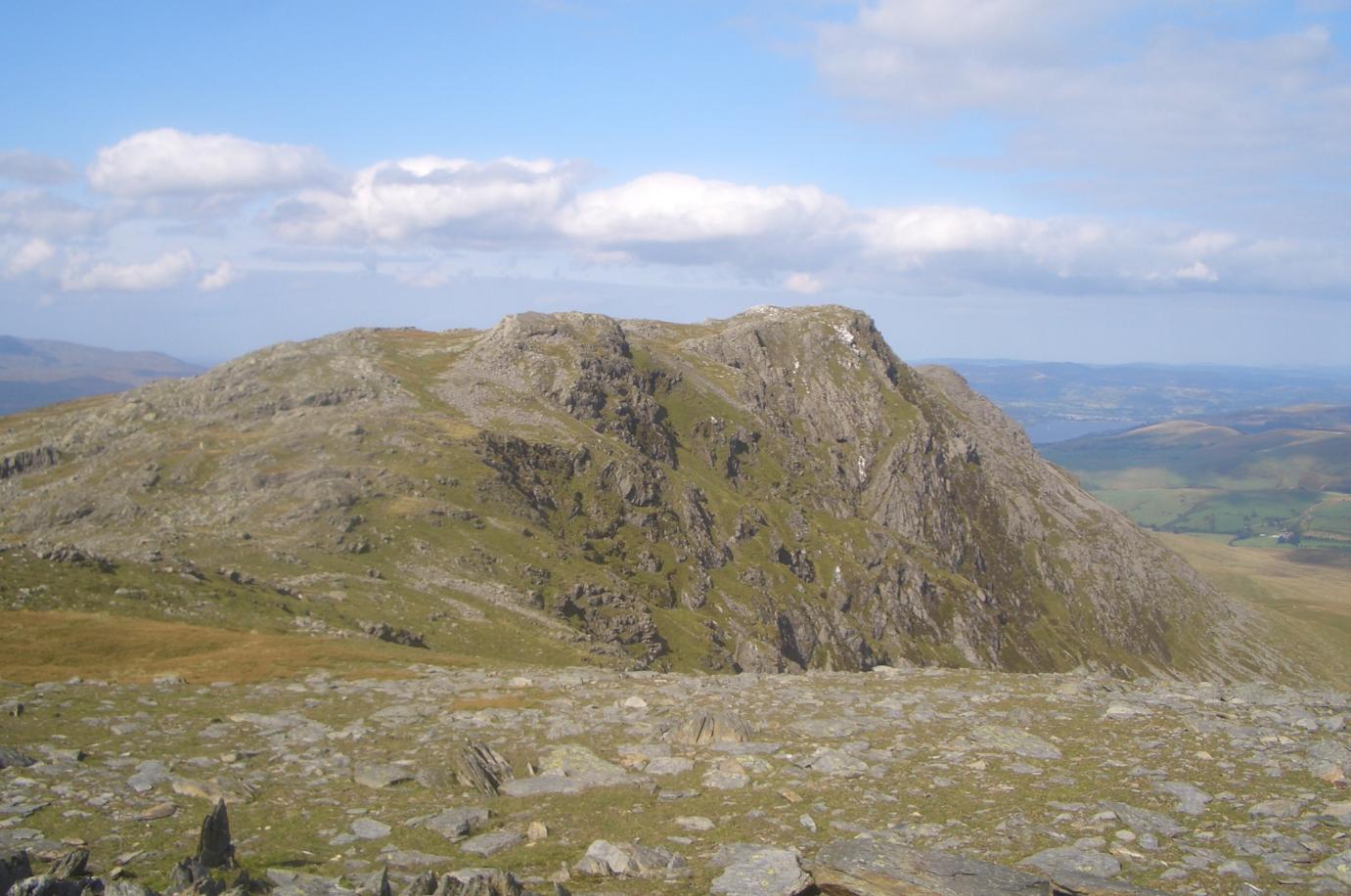
Ceunant y Felin Images

Images are sourced within 2km of 52.760734/-3.627009 or Grid Reference SH9019. Thanks to Geograph Open Source API. All images are credited.

Llanymawddwy chapel
Llanymawddwy chapel
Llanymawddwy The upper Dyfi, surrounded by steep sided flat topped hills.
Llanymawddwy
The upper Dyfi, surrounded by steep sided flat topped hills.
Trees and Pasture near Pennant Wenallt in the distance.
Trees and Pasture near Pennant
Wenallt in the distance.
St Tydecho, Llanymawddwy St Tydecho church in Llanymawddwy in the Dovey valley.
St Tydecho, Llanymawddwy
St Tydecho church in Llanymawddwy in the Dovey valley.
View to Feol y Bryn A field between woods in the Dovey valley with a view beyond to Feol y Bryn with Coed Cochion on the hillside.
View to Feol y Bryn
A field between woods in the Dovey valley with a view beyond to Feol y Bryn with Coed Cochion on the hillside.
Country road approaching Llanymawddwy Country road in the Dyfi/Dovey valley approaching Llanymawddwy.
Country road approaching Llanymawddwy
Country road in the Dyfi/Dovey valley approaching Llanymawddwy.
Llanymawddwy Arwydd pentref Llanymawddwy / Llanymawddwy village sign.
Llanymawddwy
Arwydd pentref Llanymawddwy / Llanymawddwy village sign.
Addoldy Bethesda, Llanymawddwy / Bethesda Chapel, Llanymawddwy Un o'r llefydd i'w addoli yn Llanymawddwy / One of the places to worship in  Llanymawddwy.
Addoldy Bethesda, Llanymawddwy / Bethesda Chapel, Llanymawddwy
Un o'r llefydd i'w addoli yn Llanymawddwy / One of the places to worship in Llanymawddwy.
Llanymawddwy Yr Eglwys yn Llanymawddwy / The Church in Llanymawddwy.
Llanymawddwy
Yr Eglwys yn Llanymawddwy / The Church in Llanymawddwy.
Caeau Beudy Roli / Beudy Roli fields Cwm Pen y Gelli y tu ol i gaeau Beudy Roli / Cwm Pen y Gelli behind Beudy Roli fields
Caeau Beudy Roli / Beudy Roli fields
Cwm Pen y Gelli y tu ol i gaeau Beudy Roli / Cwm Pen y Gelli behind Beudy Roli fields
Cwm Llygoed Golygfa lawr Cwm Llygoed tuag at Llanymawddwy / A  view down Cwm Llygoed towards Llanymawddwy.
Cwm Llygoed
Golygfa lawr Cwm Llygoed tuag at Llanymawddwy / A view down Cwm Llygoed towards Llanymawddwy.
A daffodil welcome to Llanymawddwy A very healthy crop greets travellers from the south.
A daffodil welcome to Llanymawddwy
A very healthy crop greets travellers from the south.
Ordnance Survey Flush Bracket (S0755) This OS cut mark can be found on the SW face of the church. It marks a point 153.507m above mean sea level.
Ordnance Survey Flush Bracket (S0755)
This OS cut mark can be found on the SW face of the church. It marks a point 153.507m above mean sea level.
Track heading north west Also a public footpath, it heads into the uplands east of Aran Fawddwy, eventually reaching Bwlch Sirddyn. In the days before open access land was established, this was the only public route into the area; those who strayed off it were liable to waylaid by eagle-eyed farmers. I know!
Track heading north west
Also a public footpath, it heads into the uplands east of Aran Fawddwy, eventually reaching Bwlch Sirddyn. In the days before open access land was established, this was the only public route into the area; those who strayed off it were liable to waylaid by eagle-eyed farmers. I know!
Start of the southern ascent of Bwlch y Groes This very steep switch back corner marks the start of the gruelling ascent of the road from Cwm Pennant to the summit of the Bwlch y Groes.
Start of the southern ascent of Bwlch y Groes
This very steep switch back corner marks the start of the gruelling ascent of the road from Cwm Pennant to the summit of the Bwlch y Groes.
Ordnance Survey Cut Mark This OS cut mark can be found on the north parapet of Pont y Pennant. It marks a point 157.891m above mean sea level.
Ordnance Survey Cut Mark
This OS cut mark can be found on the north parapet of Pont y Pennant. It marks a point 157.891m above mean sea level.
Stone Gatepost, Blaen-Pennant The large stone has a hole and slot possibly for wooden poles originally.
Stone Gatepost, Blaen-Pennant
The large stone has a hole and slot possibly for wooden poles originally.
Above Pennant Looking down the lovely Dyfi valley from the Bwlch y Groes road.
Above Pennant
Looking down the lovely Dyfi valley from the Bwlch y Groes road.
Show me another place!

Ceunant y Felin is located at Grid Ref: SH9019 (Lat: 52.760734, Lng: -3.627009)

Unitary Authority: Gwynedd

Police Authority: North Wales

What 3 Words

///pose.defeat.domain. Near Llanuwchllyn, Gwynedd

Related Wikis

Llanymawddwy

Llanymawddwy () is a village in the community of Mawddwy in south-east Gwynedd, Wales, which is to the north of the larger village of Dinas Mawddwy, on...

Bwlch y Groes

Bwlch y Groes (translates from Welsh as pass of the cross) is the second highest public road mountain pass in Wales, with a summit altitude of 545 metres...

Esgeiriau Gwynion

Esgeiriau Gwynion (Welsh for "white shanks") is a mountain in north Wales. It is the smallest of the three Marilyns that form the Aran range, the others...

Aber-Cywarch

Cywarch is a location at the head of Cwm Cywarch in the Snowdonia National Park, in Gwynedd, Wales. Several streams flow through the area, uniting to form...

Gwaun y Llwyni

Gwaun y Llwyni is a subsidiary summit of Aran Fawddwy in southern Snowdonia, Wales. It forms a part of the Aran mountain range. The peak's southern face...

Aran Benllyn

Aran Benllyn is a subsidiary summit of Aran Fawddwy in southern Snowdonia, North Wales, Wales, United Kingdom. It is the second highest peak in the Aran...

Foel Hafod-fynydd

Foel Hafod-fynydd is a subsidiary summit of Aran Fawddwy in southern Snowdonia, North Wales, Wales, United Kingdom. It tops the east ridge of Erw y Ddafad...

Pen yr Allt Uchaf

Pen yr Allt Uchaf is a subsidiary summit of Aran Fawddwy in the south of the Snowdonia National Park in Gwynedd, Wales. The summit is the highest point...

Nearby Amenities

Located within 500m of 52.760734,-3.627009
Llanmawddwy
Place: village
Source: npe
Lat/Long: 52.7594895/-3.6263672
Source: npe
Lat/Long: 52.7574585/-3.6227886
Place: farm
Lat/Long: 52.7619368/-3.6248291
Building: yes
Lat/Long: 52.759651/-3.6213979
Direction: SE
Generator Method: photovoltaic
Generator Output Electricity: yes
Generator Solar Modules: 36
Generator Source: solar
Generator Type: solar_photovoltaic_panel
Location: roof
Power: generator
Lat/Long: 52.7619195/-3.6251825
Post Box
Post Box Type: lamp
Royal Cypher: EIIR
Lat/Long: 52.7574702/-3.6270514
Telephone
Booth: KX100
Covered: booth
Operator: BT
Operator Wikidata: Q593786
Lat/Long: 52.7574546/-3.6270611
Information: board
Tourism: information
Lat/Long: 52.7574926/-3.6270327
Advertising: board
Lat/Long: 52.7573587/-3.6273103
The data included in this document is from www.openstreetmap.org. The data is made available under ODbL.

Have you been to Ceunant y Felin?

Leave your review of Ceunant y Felin below (or comments, questions and feedback).