Hoccombe Combe

Valley in Devon North Devon

England

Hoccombe Combe

Exmoor north of Brendon Two Gates Brendon Two Gates is where the road crosses a moorland boundary, which can be seen  as a dark line across the right of the picture
Exmoor north of Brendon Two Gates Credit: David Smith

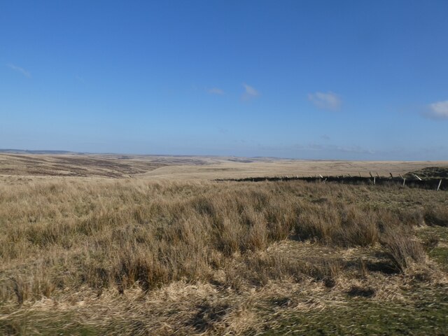
Hoccombe Combe, located in Devon, England, is a picturesque valley renowned for its natural beauty and tranquil atmosphere. Nestled within the Exmoor National Park, it offers visitors a glimpse into the stunning landscapes and diverse wildlife of the region. The combe, or valley, is situated between the villages of Exford and Simonsbath, making it easily accessible for those seeking a peaceful retreat.

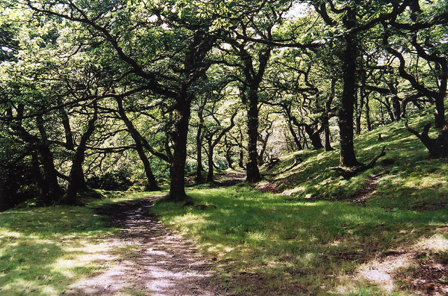
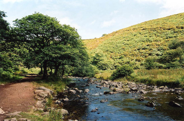
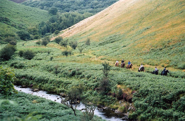
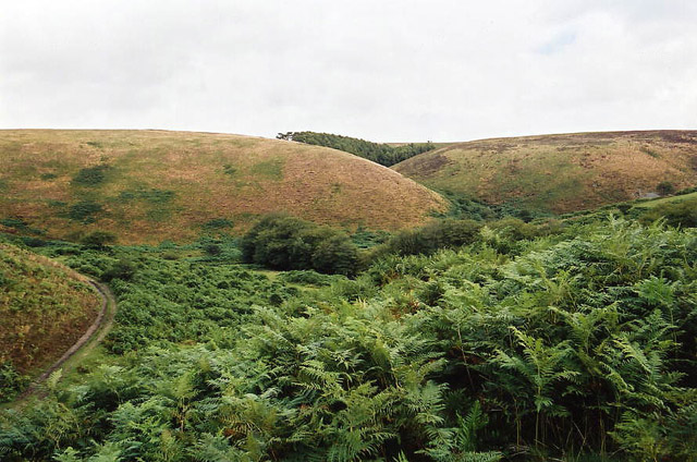
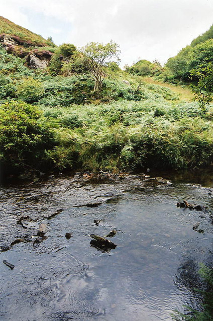
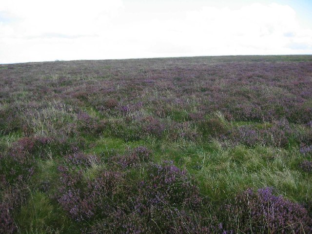
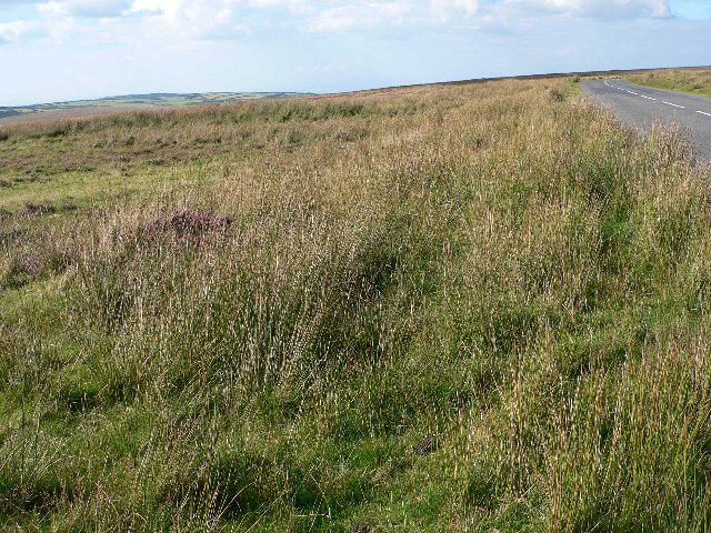
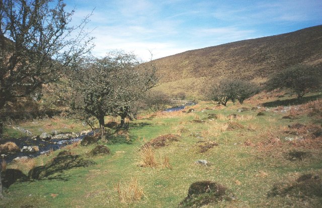
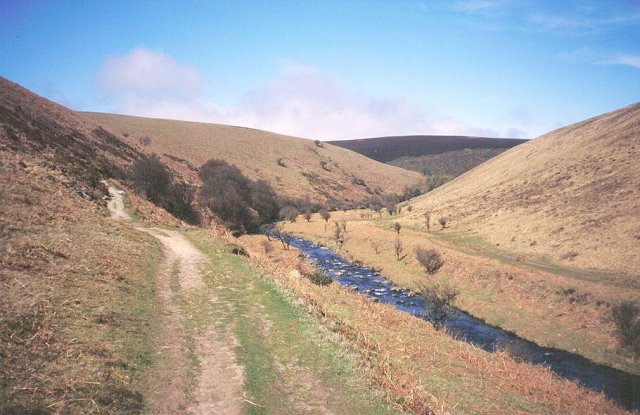
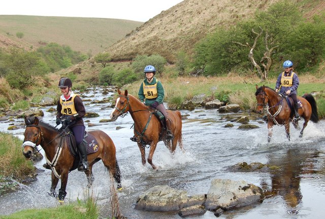
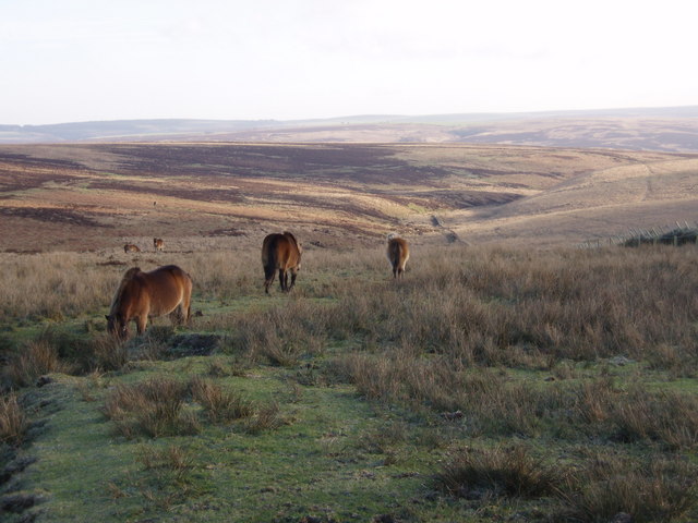
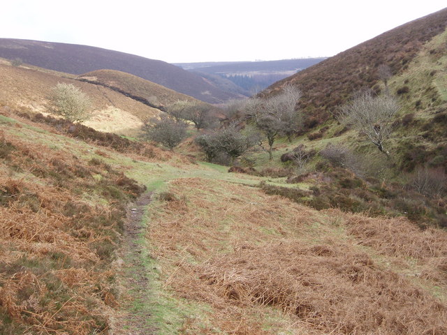
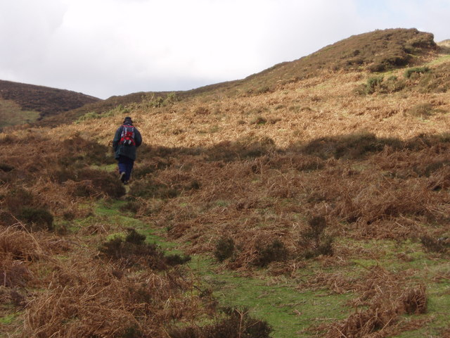
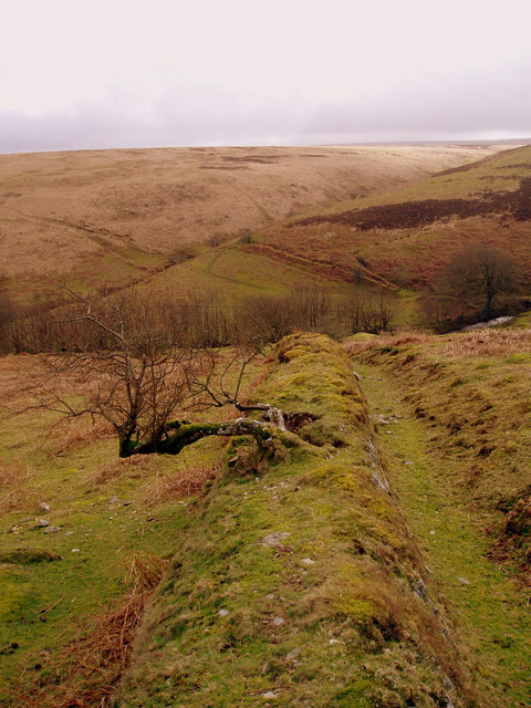
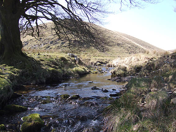
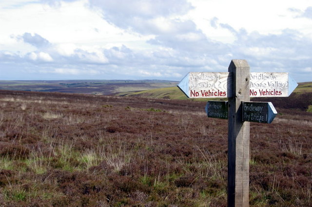
Hoccombe Combe is characterized by its steep slopes covered in dense woodlands, predominantly consisting of oak and beech trees. This creates a rich habitat for an array of wildlife, including red deer, birds of prey, and various species of butterflies. Adventurous hikers and nature enthusiasts are drawn to the area, as the combe features a network of footpaths and trails that meander through the verdant countryside, offering breathtaking views of the surrounding hills and valleys.

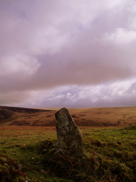
The combe is also known for its ancient history, with remnants of prehistoric settlements and burial mounds scattered throughout the area. Archaeological excavations have uncovered artifacts dating back thousands of years, providing valuable insights into the lives of the early inhabitants of the region.

Visitors to Hoccombe Combe can enjoy a peaceful picnic by the babbling streams that flow through the valley, or simply take a leisurely stroll through the enchanting woodland paths. The combe is particularly popular during the spring and summer months when the wildflowers are in full bloom, creating a vibrant and colorful landscape.

Overall, Hoccombe Combe offers an idyllic escape from the hustle and bustle of modern life, providing a haven for nature lovers and history enthusiasts alike.

If you have any feedback on the listing, please let us know in the comments section below.

Hoccombe Combe Images

Images are sourced within 2km of 51.186084/-3.7439188 or Grid Reference SS7844. Thanks to Geograph Open Source API. All images are credited.

Exmoor north of Brendon Two Gates Brendon Two Gates is where the road crosses a moorland boundary, which can be seen  as a dark line across the right of the picture
Exmoor north of Brendon Two Gates
Brendon Two Gates is where the road crosses a moorland boundary, which can be seen as a dark line across the right of the picture
Brendon: Badgworthy Wood Woodland on the walk south from Malmsmead to the 'Doone Country', beside Badgworthy Water
Brendon: Badgworthy Wood
Woodland on the walk south from Malmsmead to the 'Doone Country', beside Badgworthy Water
Brendon: Badgworthy Water With the Oare Water, Badgworthy Water combines to form the East Lyn, which meets the West Lyn at Lynmouth. By the path south from Malmsmead
Brendon: Badgworthy Water
With the Oare Water, Badgworthy Water combines to form the East Lyn, which meets the West Lyn at Lynmouth. By the path south from Malmsmead
Brendon: Badgworthy Water Badgworthy Water provides the border between west Somerset and north Devon. Riders on the Somerset bank in Oare parish
Brendon: Badgworthy Water
Badgworthy Water provides the border between west Somerset and north Devon. Riders on the Somerset bank in Oare parish
Brendon: site of medieval village Overlooking the site of a medieval village at the foot of Hoccombe Combe, in 'Doone Country', lost in the bracken
Brendon: site of medieval village
Overlooking the site of a medieval village at the foot of Hoccombe Combe, in 'Doone Country', lost in the bracken
Brendon: Badgworthy Water Looking east to the Somerset bank
Brendon: Badgworthy Water
Looking east to the Somerset bank
Heather on Brendon Common Looking North-East from B3223
Heather on Brendon Common
Looking North-East from B3223
Moorland near Brendon Two Gates Looking South, with B3223 on right.
Moorland near Brendon Two Gates
Looking South, with B3223 on right.
Badgworthy Water River, deep in the moor.  Heads north to join the East Lyn.
Badgworthy Water
River, deep in the moor. Heads north to join the East Lyn.
Badgworthy Water The river downstream and north of the medieval village.
Badgworthy Water
The river downstream and north of the medieval village.
Crossing Badgworthy Water Riders crossing in a south west direction heading towards the remains of the medieval village.
Crossing Badgworthy Water
Riders crossing in a south west direction heading towards the remains of the medieval village.
On Brendon Common Ponies grazing on the common above Hoccombe Water.
On Brendon Common
Ponies grazing on the common above Hoccombe Water.
Looking down Lankcombe The path leads down to the valley of Badgworthy Water, Little Black Hill on the left.
Looking down Lankcombe
The path leads down to the valley of Badgworthy Water, Little Black Hill on the left.
Upper Lank Combe Walking towards the ford.
Upper Lank Combe
Walking towards the ford.
Standing stone above Badgworthy Water Standing stone on Badgworthy Lees above Badgworthy Water which flows through the Doone Valley (made famous in RD Blackmore's "Lorna Doone"). There is also a deserted medieval village in the valley below this stone.
Standing stone above Badgworthy Water
Standing stone on Badgworthy Lees above Badgworthy Water which flows through the Doone Valley (made famous in RD Blackmore's "Lorna Doone"). There is also a deserted medieval village in the valley below this stone.
Field boundary looking South from Badgworthy Lees Field boundary looking South from Badgworthy Lees into Hoccombe Combe.
Field boundary looking South from Badgworthy Lees
Field boundary looking South from Badgworthy Lees into Hoccombe Combe.
Hoccombe Water, Exmoor Looking south west, at the confluence of the main water and (Lanacombe?) stream
Hoccombe Water, Exmoor
Looking south west, at the confluence of the main water and (Lanacombe?) stream
Bridleway Crossroads View East towards Great Black Hill, not that it stands out as one!
Bridleway Crossroads
View East towards Great Black Hill, not that it stands out as one!
Show me another place!

Hoccombe Combe is located at Grid Ref: SS7844 (Lat: 51.186084, Lng: -3.7439188)

Administrative County: Devon

District: North Devon

Police Authority: Devon and Cornwall

What 3 Words

///acquaint.landed.pocket. Near Lynton, Devon

Related Wikis

Lanacombe

Lanacombe is an area of Exmoor in Somerset, South West England. It is the site of several standing stones and cairns which have been scheduled as ancient...

North Exmoor SSSI

North Exmoor (grid reference SS800430) is a 12,005.3-hectare (29,666-acre) biological Site of Special Scientific Interest (SSSI) in Devon and Somerset...

Oare, Somerset

Oare is a village and civil parish on Oare Water on Exmoor in the Somerset West and Taunton district of Somerset, England. It is located 6 miles (10 km...

Malmsmead Bridge

Malmsmead Bridge is a 17th-century stone bridge which crosses Badgworthy Water in the hamlet of Malmsmead, on the road between Oare and Brendon. The Badgworthy...

Have you been to Hoccombe Combe?

Leave your review of Hoccombe Combe below (or comments, questions and feedback).