Cwm y Gâth

Valley in Montgomeryshire

Wales

Cwm y Gâth

Forestry barrier Access to Coed Pant y Bating.
Forestry barrier Credit: Alan Hughes

Cwm y Gâth is a picturesque valley located in the county of Montgomeryshire, Wales. Nestled in the heart of the Cambrian Mountains, this valley is renowned for its breathtaking natural beauty and tranquil surroundings.

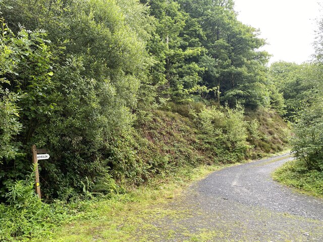
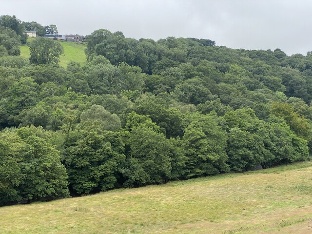
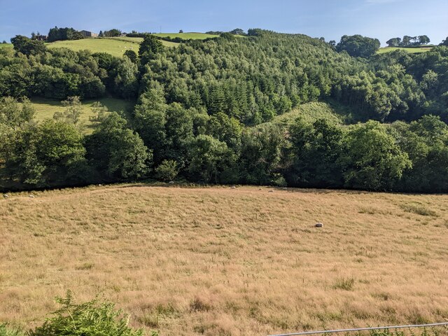
The valley is surrounded by rolling hills and steep slopes, covered in lush greenery and dotted with sheep farms. The River Gâth meanders through the valley, adding to its charm and providing a source of water for the local wildlife and vegetation.

Cwm y Gâth is a haven for nature enthusiasts and outdoor lovers. The valley boasts an abundance of wildlife, including rare bird species and small mammals. It is also home to a variety of plant life, with vibrant wildflowers adorning the landscape during the warmer months.

The valley offers numerous walking and hiking trails, providing visitors with the opportunity to explore its hidden gems. One of the most popular routes is the Cwm y Gâth Circular Trail, which takes hikers through the valley and offers stunning views of the surrounding mountains.

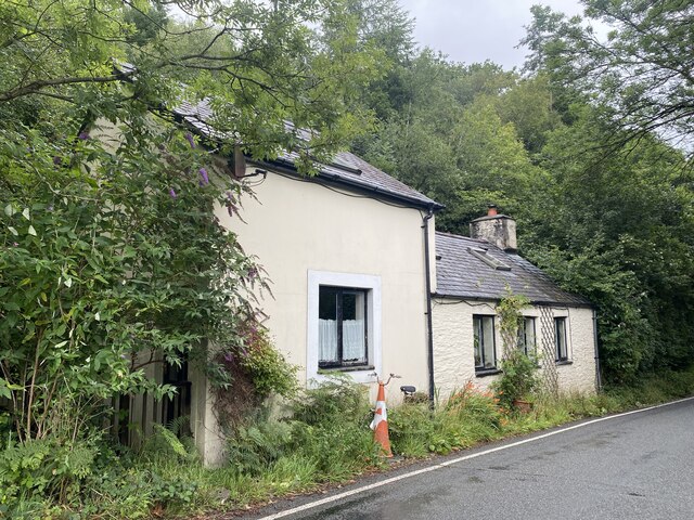
For those seeking a peaceful retreat, Cwm y Gâth has a number of holiday cottages and guesthouses available for rent. These accommodations allow visitors to immerse themselves in the tranquility of the valley, while still being within reach of nearby amenities and attractions.

In summary, Cwm y Gâth is a picturesque valley in Montgomeryshire, Wales, known for its natural beauty, diverse wildlife, and peaceful atmosphere. It is a perfect destination for nature lovers and those seeking a relaxing getaway amidst stunning scenery.

If you have any feedback on the listing, please let us know in the comments section below.

Cwm y Gâth Images

Images are sourced within 2km of 52.571191/-3.7986369 or Grid Reference SN7898. Thanks to Geograph Open Source API. All images are credited.

Forestry barrier Access to Coed Pant y Bating.
Forestry barrier
Access to Coed Pant y Bating.
Track to Caeheulon Farm
Y Bwthyn Tyr Peg Toll-house Cottage.

Odd that it doesn’t appear in the comprehensive list of Welsh turnpikes (296) <span class="nowrap"><a title="http://www.turnpikes.org.uk/Tollhouses%20of%20mid%20Wales.htm" rel="nofollow ugc noopener" href="http://www.turnpikes.org.uk/Tollhouses%20of%20mid%20Wales.htm">Link</a><img style="margin-left:2px;" alt="External link" title="External link - shift click to open in new window" src="https://s1.geograph.org.uk/img/external.png" width="10" height="10"/></span>
Y Bwthyn Tyr Peg
Toll-house Cottage. Odd that it doesn’t appear in the comprehensive list of Welsh turnpikes (296) LinkExternal link
Tyr Peg Welsh for ‘Turnpike’.  This shed appears to be connected with the adjacent Y Bwthyn Tyr Peg.  

Odd that it doesn’t appear in the comprehensive list of Welsh turnpikes (296) <span class="nowrap"><a title="http://www.turnpikes.org.uk/Tollhouses%20of%20mid%20Wales.htm" rel="nofollow ugc noopener" href="http://www.turnpikes.org.uk/Tollhouses%20of%20mid%20Wales.htm">Link</a><img style="margin-left:2px;" alt="External link" title="External link - shift click to open in new window" src="https://s1.geograph.org.uk/img/external.png" width="10" height="10"/></span>
Tyr Peg
Welsh for ‘Turnpike’. This shed appears to be connected with the adjacent Y Bwthyn Tyr Peg. Odd that it doesn’t appear in the comprehensive list of Welsh turnpikes (296) LinkExternal link
Road along the Afon Dulas valley
Woodland in the Dulas valley
Tree-lined road in the Dulas valley
Welcome to Forge/Bontfaen The English and Welsh names for the village are very different. The Welsh translates as (The) Stonebridge. 'The' has been lost over the years, but its one-time presence is shown by the mutation of 'pont' to 'bont'.
Welcome to Forge/Bontfaen
The English and Welsh names for the village are very different. The Welsh translates as (The) Stonebridge. 'The' has been lost over the years, but its one-time presence is shown by the mutation of 'pont' to 'bont'.
Looking down to the Afon Dulas
Grassland and woodland by the Afon Dulas
Looking down on Felin y coed
Woodland and fields near Coed Cae-heulen
Tree stumps in a field above Afon Dulas
Glyndwr's Way near Felindulas
Glyndwr's Way near Cefn Modfedd
Track to climbing up to Cae Heulen On the north side of the Machynlleth - Llanidloes road. The mapped public bridleway is a little distance further west.
Track to climbing up to Cae Heulen
On the north side of the Machynlleth - Llanidloes road. The mapped public bridleway is a little distance further west.
The valley of Afon Dulas, looking west Cattle pasture on the north bank, deciduous woodland on the south.
The valley of Afon Dulas, looking west
Cattle pasture on the north bank, deciduous woodland on the south.
The valley of Afon Dulas, looking south-west Cattle pasture on the north bank, deciduous woodland on the south.
The valley of Afon Dulas, looking south-west
Cattle pasture on the north bank, deciduous woodland on the south.
Show me another place!

Cwm y Gâth is located at Grid Ref: SN7898 (Lat: 52.571191, Lng: -3.7986369)

Unitary Authority: Powys

Police Authority: Dyfed Powys

What 3 Words

///trending.proudest.mops. Near Machynlleth, Powys

Nearby Locations

Cwm y Gâth Coed y Foel

Related Wikis

Forge, Powys

Forge (Welsh: "Y Bontfaen") is a village in the county of Powys, Wales near to Machynlleth. It lies on the southern Afon Dulas on the mountain road to...

Penegoes

Penegoes () is a village in Powys, Wales, between Cemmaes Road and Machynlleth, on the A489 road, and the primary settlement of the community of Cadfarch...

Aberhosan

Aberhosan () is a village in the Welsh principal area of Powys, located between the town of Machynlleth and village of Dylife. It is in the historic county...

Abercegir

Abercegir () is a small rural village in Powys, Wales. It lies approximately 4 miles east of the town of Machynlleth and is 81 miles (131 km) from Cardiff...

Nearby Amenities

Located within 500m of 52.571191,-3.7986369
Place: farm
Lat/Long: 52.5677673/-3.8005957
Post Box
Operator: Royal Mail
Post Box Type: lamp
Ref: SY20 104
Royal Cypher: EIIR
Royal Cypher Wikidata: Q33102113
Lat/Long: 52.5748776/-3.7974139
The data included in this document is from www.openstreetmap.org. The data is made available under ODbL.

Have you been to Cwm y Gâth?

Leave your review of Cwm y Gâth below (or comments, questions and feedback).