Barr Beacon

Settlement in Staffordshire

England

Barr Beacon

Doe Bank Park This "park" is really just a farmer's field that the council bought to provide a recreation area for the people of Pheasey. Unfortunately a lot of the recreation that goes on here isn't what the local aldermen had in mind.
Doe Bank Park Credit: Adrian Bailey

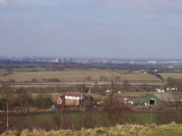
Barr Beacon is a prominent landmark located in Staffordshire, England. Situated near the town of Walsall, it stands at an elevation of 227 meters above sea level, offering breathtaking panoramic views of the surrounding areas. The beacon itself is a tower that was constructed in 1895 to commemorate the Diamond Jubilee of Queen Victoria.

The area around Barr Beacon is known for its natural beauty, featuring a diverse range of flora and fauna. It is home to several rare and protected species, making it a popular destination for nature enthusiasts and wildlife photographers. The beacon is surrounded by a sprawling country park, which covers an area of approximately 200 acres and provides ample opportunities for outdoor activities such as hiking, cycling, and picnicking.

In addition to its natural attractions, Barr Beacon is also steeped in history. It played a significant role in World War II, serving as a vital observation point for the British military. Today, visitors can explore remnants of the war, including a wartime observation post that has been preserved and is open to the public.

Barr Beacon holds a special place in the hearts of the local community, and various events and activities are organized throughout the year to celebrate its heritage. These include guided walks, educational programs, and community festivals, which bring people together and foster a sense of pride in this cherished landmark.

If you have any feedback on the listing, please let us know in the comments section below.

Barr Beacon Images

Images are sourced within 2km of 52.571661/-1.910699 or Grid Reference SP0697. Thanks to Geograph Open Source API. All images are credited.

Doe Bank Park This "park" is really just a farmer's field that the council bought to provide a recreation area for the people of Pheasey. Unfortunately a lot of the recreation that goes on here isn't what the local aldermen had in mind.
Doe Bank Park
This "park" is really just a farmer's field that the council bought to provide a recreation area for the people of Pheasey. Unfortunately a lot of the recreation that goes on here isn't what the local aldermen had in mind.
View towards Pheasey On the horizon you can see Birmingham city centre.
View towards Pheasey
On the horizon you can see Birmingham city centre.
West of Barr Beacon
West of Barr Beacon
Barr Beacon In recent years the Beacon has gained something of an unsavoury reputation, but this evening I took our daughter there for the first time and it was fine: windswept and peaceful. And the views are, of course, superb.
Barr Beacon
In recent years the Beacon has gained something of an unsavoury reputation, but this evening I took our daughter there for the first time and it was fine: windswept and peaceful. And the views are, of course, superb.
Great Barr countryside The view across three grid squares from the parish church. Beyond the pylons, the old hall and Beacon Heights.
Great Barr countryside
The view across three grid squares from the parish church. Beyond the pylons, the old hall and Beacon Heights.
Great Barr parish church An oasis of semi-peace (the M6 is too close to be ignored) in the West Midlands conurbation.
Great Barr parish church
An oasis of semi-peace (the M6 is too close to be ignored) in the West Midlands conurbation.
Chapel Lane, Great Barr Taken from Great Barr churchyard (just outside the gridsquare) this is a view NE along Chapel Lane towards the Beacon.
Chapel Lane, Great Barr
Taken from Great Barr churchyard (just outside the gridsquare) this is a view NE along Chapel Lane towards the Beacon.
View from Barr Beacon The beacon gives extensive views over north Birmingham and surrounding districts. This is looking over toward Walsall
View from Barr Beacon
The beacon gives extensive views over north Birmingham and surrounding districts. This is looking over toward Walsall
The Three Crowns, Sutton Road, Walsall This is the pub at the top of Three Crowns Hill which replaced a much older one which was on the opposite side of the road.
I would like to add that the pub has now closed and is awaiting conversion (or demolition) to flats.
The Three Crowns, Sutton Road, Walsall
This is the pub at the top of Three Crowns Hill which replaced a much older one which was on the opposite side of the road. I would like to add that the pub has now closed and is awaiting conversion (or demolition) to flats.
Moat Farm, Sutton Road, Walsall. So called because there are the remains of a moat in the farm yard.
Moat Farm, Sutton Road, Walsall.
So called because there are the remains of a moat in the farm yard.
Little Johnson's Lane, Aldridge, Walsall. Just a short lane between Beacon Road and Sutton Road which is used as a rat run to avoid the traffic lights at the top of Beacon Hill.
Little Johnson's Lane, Aldridge, Walsall.
Just a short lane between Beacon Road and Sutton Road which is used as a rat run to avoid the traffic lights at the top of Beacon Hill.
The Foley Arms Public House, Walsall Situated on Foley Road West, Streetly.
The Foley Arms Public House, Walsall
Situated on Foley Road West, Streetly.
Blue House Farm Although much of this square is now covered by housing this farm still survives in the SW corner of the square.
Blue House Farm
Although much of this square is now covered by housing this farm still survives in the SW corner of the square.
Old schoolroom At first sight this looks like it could be an old Tin Tabernacle however it is marked on the 1940s OS map as a school.  Although showing signs of age it is still in use by a printing company.
Old schoolroom
At first sight this looks like it could be an old Tin Tabernacle however it is marked on the 1940s OS map as a school. Although showing signs of age it is still in use by a printing company.
Wren's Nest from Barr Lakes Lane The buildings at Wren's Nest can be seen in the distance along with some of the inhabitants of the square in the foreground.
Wren's Nest from Barr Lakes Lane
The buildings at Wren's Nest can be seen in the distance along with some of the inhabitants of the square in the foreground.
The Farmer John's An urban pub come eatery beside the Aldridge Road in the south of the square.
The Farmer John's
An urban pub come eatery beside the Aldridge Road in the south of the square.
Factories to houses A new housing development on the site of former industrial premises beside the Aldridge Road.
Factories to houses
A new housing development on the site of former industrial premises beside the Aldridge Road.
Poet's corner A new housing estate built on the site of old sand pits just off Aldridge Road.
Poet's corner
A new housing estate built on the site of old sand pits just off Aldridge Road.
Show me another place!

Barr Beacon is located at Grid Ref: SP0697 (Lat: 52.571661, Lng: -1.910699)

Unitary Authority: Walsall

Police Authority: West Midlands

What 3 Words

///zone.taken.stole. Near Streetly, West Midlands

Nearby Locations

Barr Beacon Barr Beacon

Related Wikis

Barr Beacon

Barr Beacon is a hill on the edge of Walsall, West Midlands, England, very near the border with Birmingham. It gives its name to nearby Great Barr (the...

Barr Beacon Reservoir

Barr Beacon Reservoir is a covered, hill-top drinking water reservoir at Barr Beacon, Walsall, England, opened in 1899. It is operated by South Staffs...

Barr Beacon School

Barr Beacon School, formerly Barr Beacon Language College, is a mixed secondary school in Walsall, England, which acquired Academy status in 2011, when...

Pheasey

Pheasey is a residential area of Walsall Metropolitan Borough in the West Midlands of England, often considered to be part of Great Barr. The area was...
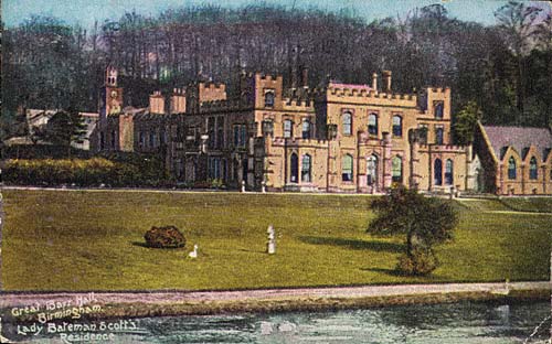
Great Barr Hall

Great Barr Hall is an 18th-century mansion situated at Pheasey, Walsall, on the border with Great Barr, Birmingham, West Midlands, England. It has associations...

St. Margaret's Church, Great Barr

The Church Of St Margaret (also known as St Margaret's Church), is the Anglican parish church of Great Barr and is located on Chapel Lane, Walsall, England...
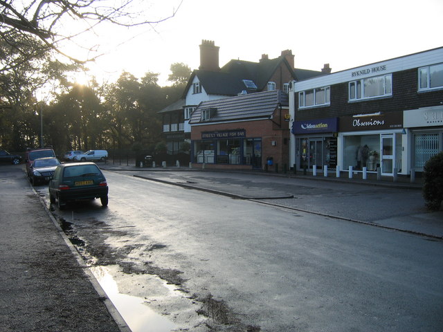
Streetly

Streetly is an area in the county of West Midlands, England which lies around 7 miles (11 km) to the north of Birmingham City Centre. It is uniquely located...

The Streetly Academy

The Streetly Academy (formerly known as The Streetly School) is a large co-educational secondary school in Streetly, West Midlands, England, on the border...
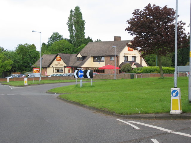
Nearby Amenities

Located within 500m of 52.571661,-1.910699
Maxheight: 2.77
Source: survey
Lat/Long: 52.56898/-1.9118418
Bus Stop
Beacon Rd / Bridle Lane
Bus: yes
Lit: no
Naptan AtcoCode: 43000588201
Naptan Bearing: S
Naptan BusStopType: MKD
Naptan CommonName: Bridle Lane
Naptan Indicator: adj
Naptan NaptanCode: nwmgwdam
Naptan PlusbusZoneRef: BHAMNWS
Naptan Status: ACT
Naptan StopType: BCT
Naptan Street: BEACON RD
Naptan Towards: Birmingham
Naptan Verified: yes
Public Transport: platform
Route Ref: 934;936
Shelter: no
Source: WMCA
Lat/Long: 52.5685486/-1.9122515
Bus Stop
Beacon Rd / Bridle Lane
Bus: yes
Lit: yes
Location: Beacon Road;Bridle Lane
Naptan AtcoCode: 43000588202
Naptan Bearing: N
Naptan BusStopType: MKD
Naptan CommonName: Bridle Lane
Naptan Indicator: opp
Naptan NaptanCode: nwmgwdap
Naptan PlusbusZoneRef: BHAMNWS
Naptan Status: ACT
Naptan StopType: BCT
Naptan Street: BEACON RD
Naptan Towards: Aldridge
Naptan Verified: yes
Public Transport: platform
Route Ref: 934;936
Shelter: no
Source: WMCA
Towards: Wlasall;Aldridge
Lat/Long: 52.5685991/-1.9125056
Bus Stop
Beacon Rd / Pinfold Lane
Asset Ref: 0588302
Bin: no
Bus: yes
Lit: yes
Location: Beacon Road;Pinfold Lane
Naptan AtcoCode: 43000588302
Naptan Bearing: N
Naptan BusStopType: MKD
Naptan CommonName: Pinfold Lane
Naptan Indicator: adj
Naptan NaptanCode: nwmgwdaw
Naptan PlusbusZoneRef: BHAMNWS
Naptan Status: ACT
Naptan StopType: BCT
Naptan Street: BEACON RD
Naptan Towards: Aldridge
Naptan Verified: yes
Public Transport: platform
Route Ref: 25;934;936
Shelter: no
Source: WMCA
Towards: Walsall;Aldridge
Lat/Long: 52.5751713/-1.9129483
Bus Stop
Pinfold Lane / Beacon Heights Caravan Park
NaPTANAreaCode: 43005801501
Asset Ref: 203507
Bench: yes
Bin: no
Bus: yes
Check Date Shelter: 2021-08-12
Lit: yes
Location: Pinfold Lane;Beacon Heights
Naptan AtcoCode: 43005801501
Naptan Bearing: S
Naptan BusStopType: MKD
Naptan CommonName: Beacon Heights Caravan Park
Naptan Indicator: opp
Naptan NaptanCode: nwmpwmgj
Naptan PlusbusZoneRef: BHAMNWS
Naptan Status: ACT
Naptan StopType: BCT
Naptan Street: PINFOLD LANE
Naptan Towards: Pheasey
Naptan Verified: yes
Public Transport: platform
Route Ref: 25
Shelter: yes
Shelter Ref: 203507
Source: WMCA
Tactile Paving: no
Towards: Both Directions
Lat/Long: 52.5683575/-1.9149424
Pinfold Lane / Beacon Heights Caravan Park
Location: Pinfold Lane;Beacon Heights
Naptan AtcoCode: 43005801502
Naptan Bearing: N
Naptan BusStopType: CUS
Naptan CommonName: Beacon Heights Caravan Park
Naptan Indicator: adj
Naptan NaptanCode: nwmwampj
Naptan Status: ACT
Naptan StopType: BCT
Naptan Street: PINFOLD LANE
Naptan Towards: Aldridge
Naptan Verified: yes
Route Ref: 25
Shelter: no
Source: WMCA
Lat/Long: 52.5683398/-1.9149933
Power: tower
Lat/Long: 52.5691341/-1.906516
Power: tower
Lat/Long: 52.5689262/-1.9056905
Power: tower
Lat/Long: 52.5717775/-1.9042515
Power: tower
Lat/Long: 52.5742326/-1.905402
Post Box
Collection Times: Mo-Fr 16:00, Sa 10:15
Postal Code: WS9
Ref: WS9 282
Royal Cypher: EIIR
Royal Cypher Wikidata: Q33102113
Source: GPS Survey
Lat/Long: 52.5683888/-1.9150418
Power: tower
Lat/Long: 52.568028/-1.9096332
Power: tower
Lat/Long: 52.5679898/-1.9082907
Fixme: need to locate exact path from here
Lat/Long: 52.5701322/-1.9052794
Blue Plaque: Barr Beacon Beeches
Historic: memorial
Operator: Walsall MBC
Lat/Long: 52.5725809/-1.9114339
Barr Beacon
Ele: 227
Natural: peak
Source: OS_OpenData_StreetView
Wikidata: Q4863102
Lat/Long: 52.574284/-1.9117596
Bus Stop
Beacon Rd / Pinfold Lane
Bin: no
Bus: yes
Lit: yes
Naptan AtcoCode: 43000588301
Naptan Bearing: S
Naptan BusStopType: MKD
Naptan CommonName: Pinfold Lane
Naptan Indicator: opp
Naptan NaptanCode: nwmgwdat
Naptan Status: ACT
Naptan StopType: BCT
Naptan Street: BEACON RD
Naptan Towards: Birmingham
Public Transport: platform
Route Ref: 934;936
Shelter: no
Source: WMCA
Tactile Paving: no
Lat/Long: 52.574101/-1.9127806
Barr Beacon War Memorial
Historic: memorial
Material: stone
Memorial: war_memorial
Tourism: viewpoint
Lat/Long: 52.5733895/-1.9110409
Access: permissive
Barrier: spikes
Bicycle: yes
Foot: yes
Horse: no
Material: metal
Motor Vehicle: yes
Lat/Long: 52.5734077/-1.9126269
Man Made: mast
Lat/Long: 52.5754566/-1.9106221
The data included in this document is from www.openstreetmap.org. The data is made available under ODbL.

Have you been to Barr Beacon?

Leave your review of Barr Beacon below (or comments, questions and feedback).