Cwm Bychan

Valley in Caernarfonshire

Wales

Cwm Bychan

Melynllyn Reservoir near Dulyn bothy.
Melynllyn Credit: Colin Kinnear

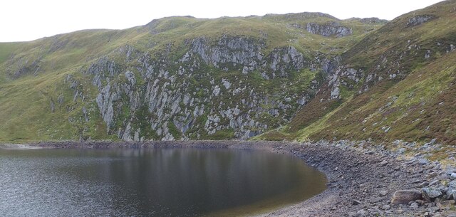
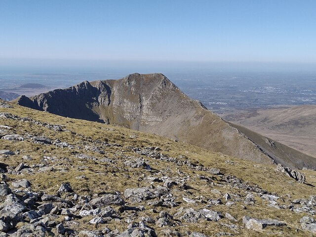
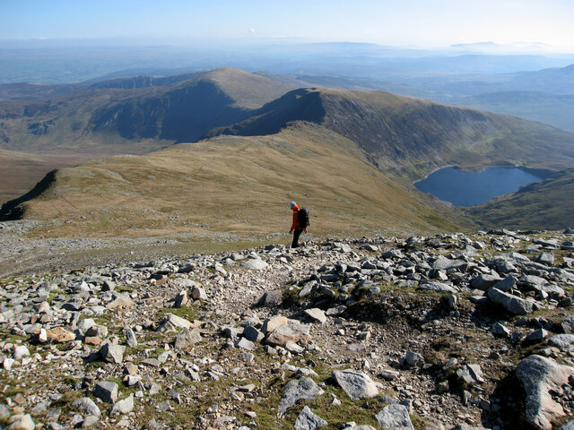
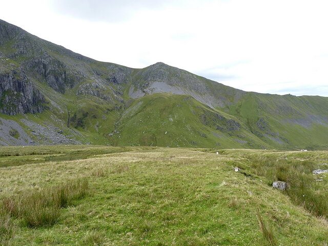
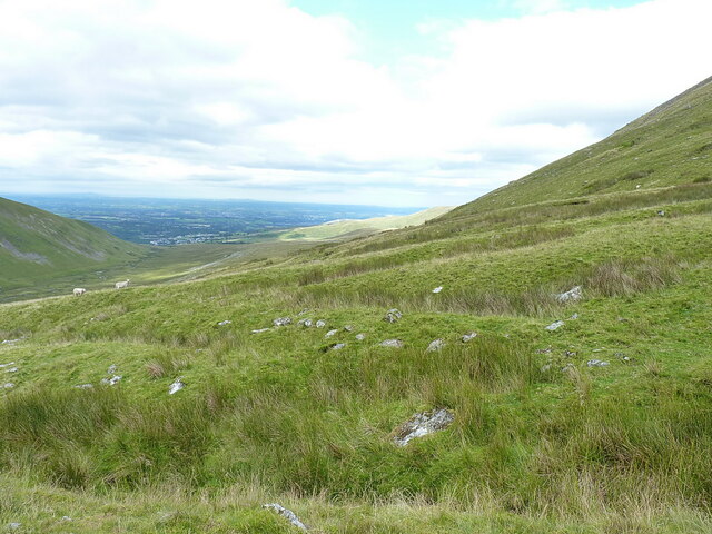
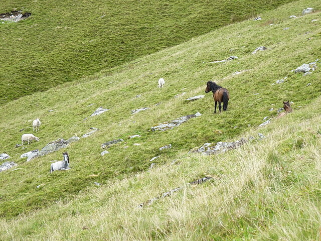
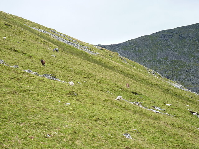
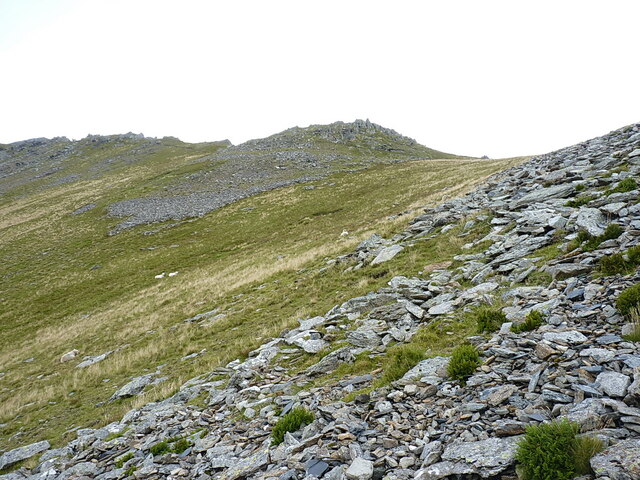
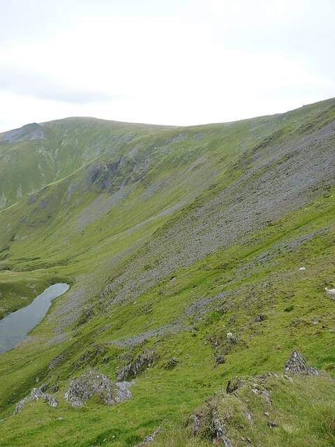
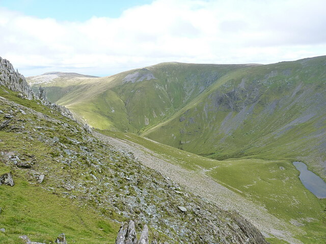
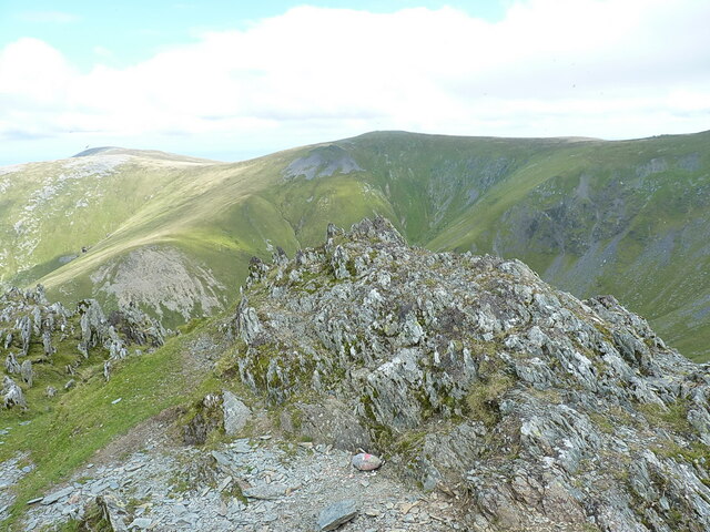
Cwm Bychan is a scenic valley located in the county of Caernarfonshire in Wales, United Kingdom. Nestled within Snowdonia National Park, the valley offers breathtaking natural beauty and a tranquil atmosphere. It is situated near the village of Beddgelert and is surrounded by picturesque mountains, including Moel Hebog and Moelwyn Mawr.

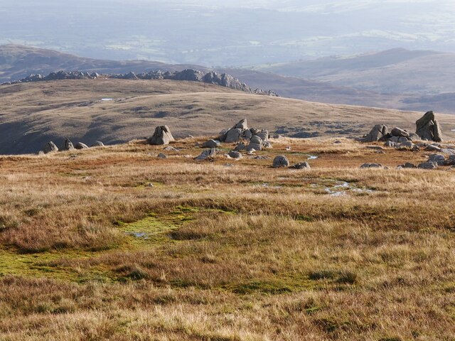
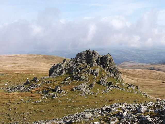
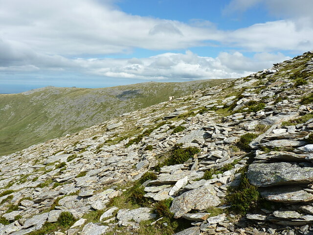
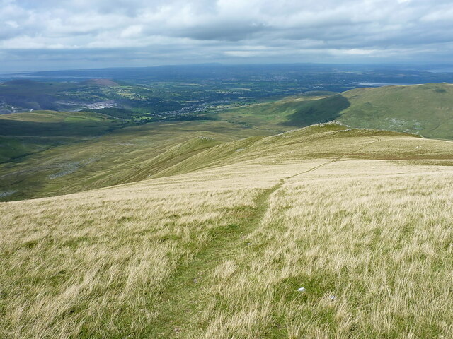
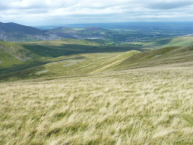
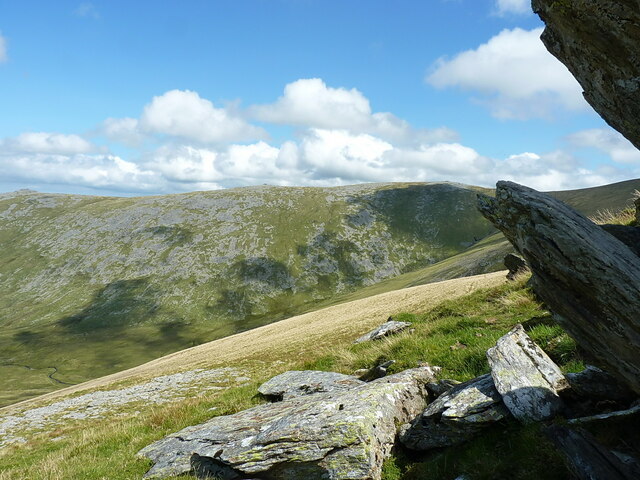
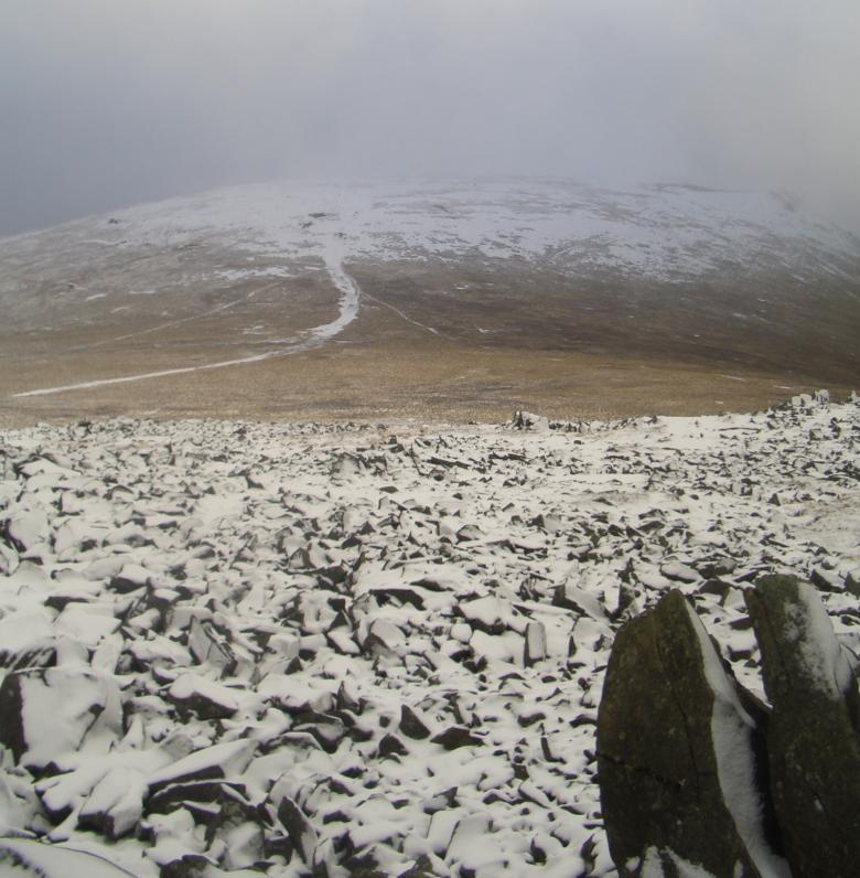
The valley is renowned for its idyllic landscape, characterized by lush green meadows, cascading waterfalls, and crystal-clear streams. It is a haven for nature enthusiasts and hikers, with numerous walking trails and paths crisscrossing the area. The popular 'Lon Gwyrfai' footpath passes through the valley, offering stunning views and an opportunity to explore the surrounding countryside.

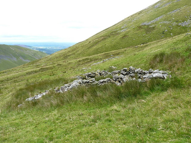
Cwm Bychan is also home to several notable archaeological sites, including ancient burial mounds and standing stones. These remnants of the past provide a glimpse into the rich history and cultural heritage of the region.

Visitors to Cwm Bychan can enjoy a range of outdoor activities, such as hiking, mountain biking, and fishing. The valley is also a popular spot for picnics and camping, with several designated camping areas available.

With its untouched natural beauty and serene atmosphere, Cwm Bychan is a must-visit destination for those seeking a peaceful escape and an opportunity to immerse themselves in the stunning Welsh countryside.

If you have any feedback on the listing, please let us know in the comments section below.

Cwm Bychan Images

Images are sourced within 2km of 53.171325/-3.9720678 or Grid Reference SH6865. Thanks to Geograph Open Source API. All images are credited.

Melynllyn Reservoir near Dulyn bothy.
Melynllyn
Reservoir near Dulyn bothy.
Rock Outcrops Above Melynllyn
Rock Outcrop, Carnedd Llewelyn
Descending from Carnedd Llewelyn This path traverses the top of Craig yr Ysfa, from there you can pass Ffynnon Llugwy reservoir to reach  the A5 road.
Descending from Carnedd Llewelyn
This path traverses the top of Craig yr Ysfa, from there you can pass Ffynnon Llugwy reservoir to reach the A5 road.
Downhill on the slopes of Carnedd Llewelyn Looking downhill, roughly along one branch of the Nant Ddu stream which lies in the gullies to my left or my right, towards Cwmglas Bach on the other side of the main Cwm Pen-llafar valley.
Downhill on the slopes of Carnedd Llewelyn
Looking downhill, roughly along one branch of the Nant Ddu stream which lies in the gullies to my left or my right, towards Cwmglas Bach on the other side of the main Cwm Pen-llafar valley.
Across the lower slopes of the western side of Carnedd Llewelyn Looking generally down the valley of Cwm Pen-llafar, towards Bethesda town.
Across the lower slopes of the western side of Carnedd Llewelyn
Looking generally down the valley of Cwm Pen-llafar, towards Bethesda town.
Sheepfold high on the hillside of Carnedd Llewelyn At an altitude of roughly 660m, 2165ft, this disused post-medieval sheepfold is in a ruinous state but still consists of two distinct and recognisable cells about 60 or 70 yards apart.
Sheepfold high on the hillside of Carnedd Llewelyn
At an altitude of roughly 660m, 2165ft, this disused post-medieval sheepfold is in a ruinous state but still consists of two distinct and recognisable cells about 60 or 70 yards apart.
Carneddau ponies grazing on Carnedd Llewelyn Ignoring the sheep, here we can see a few of the 200-300 strong herd of feral ponies that lives high on the Carneddau. There were a few more behind me <a href="https://www.geograph.org.uk/photo/7566122">SH6764 : More Carneddau ponies</a> as I took this picture
Carneddau ponies grazing on Carnedd Llewelyn
Ignoring the sheep, here we can see a few of the 200-300 strong herd of feral ponies that lives high on the Carneddau. There were a few more behind me SH6764 : More Carneddau ponies as I took this picture
More Carneddau ponies Taken from the same spot as <a href="https://www.geograph.org.uk/photo/7566115">SH6764 : Carneddau ponies grazing on Carnedd Llewelyn</a>, but looking across the hillside in the other direction, there were a further 3 or 4 ponies grazing that slope too.
More Carneddau ponies
Taken from the same spot as SH6764 : Carneddau ponies grazing on Carnedd Llewelyn, but looking across the hillside in the other direction, there were a further 3 or 4 ponies grazing that slope too.
Almost at the col After a long flog of about 1400ft straight up the hillside from Cwm Pen-llafar to the west, this boulder scree is almost at the col between Carnedd Llewelyn and Yr Elen. My approach route to the latter hill was a little unconventional, I accept that.
Almost at the col
After a long flog of about 1400ft straight up the hillside from Cwm Pen-llafar to the west, this boulder scree is almost at the col between Carnedd Llewelyn and Yr Elen. My approach route to the latter hill was a little unconventional, I accept that.
View downhill into Cwm Caseg Taken from the col between Carnedd Llewelyn and Yr Elen
View downhill into Cwm Caseg
Taken from the col between Carnedd Llewelyn and Yr Elen
View down into Cwm Caseg Taken from the south-eastern ridge of Yr Elen, across the deep Cwm Caseg on its eastern side. The lake lies at an altitude of about 2445ft, so is probably the 3rd highest substantial body of water in Wales, after <a href="https://www.geograph.org.uk/photo/5390836">SH6864 : Ffynnon Llyffant</a> and <a href="https://www.geograph.org.uk/photo/1488966">SH6758 : Llyn Caseg-fraith, with Tryfan beyond</a>.
View down into Cwm Caseg
Taken from the south-eastern ridge of Yr Elen, across the deep Cwm Caseg on its eastern side. The lake lies at an altitude of about 2445ft, so is probably the 3rd highest substantial body of water in Wales, after SH6864 : Ffynnon Llyffant and SH6758 : Llyn Caseg-fraith, with Tryfan beyond.
Summit rocks of Yr Elen The highest of three contenders for the actual summit. There's a rocky outcrop, sometimes sporting a small cairn, roughly 50m to the SSW which is 50cm lower, and a further cairn on a protrusion a little way to the WNW which is clearly lower than this point, by about 3m in fact.
Summit rocks of Yr Elen
The highest of three contenders for the actual summit. There's a rocky outcrop, sometimes sporting a small cairn, roughly 50m to the SSW which is 50cm lower, and a further cairn on a protrusion a little way to the WNW which is clearly lower than this point, by about 3m in fact.
Slatey boulder scree on the NW flank of Yr Elen Rocks and scree on the NW flank, composed mainly of the underlying slate that forms the backbone of the quarrying industry upon which Bethesda (and Llanberis) has grown up.
Slatey boulder scree on the NW flank of Yr Elen
Rocks and scree on the NW flank, composed mainly of the underlying slate that forms the backbone of the quarrying industry upon which Bethesda (and Llanberis) has grown up.
Grassy track down the hill towards Foel Ganol
The grassy western flank of Foel Ganol A view down the hillside into Cwm Pen-llafar, and Bethesda lower down
The grassy western flank of Foel Ganol
A view down the hillside into Cwm Pen-llafar, and Bethesda lower down
Amongst the rocks on Foel Ganol A good place to take a breather on the way down from Yr Elen, cook some lunch, and take in the fine surroundings for half an hour. Perfection; I could happily have fallen asleep under this rock outcrop.
Amongst the rocks on Foel Ganol
A good place to take a breather on the way down from Yr Elen, cook some lunch, and take in the fine surroundings for half an hour. Perfection; I could happily have fallen asleep under this rock outcrop.
Show me another place!

Cwm Bychan is located at Grid Ref: SH6865 (Lat: 53.171325, Lng: -3.9720678)

Unitary Authority: Gwynedd

Police Authority: North Wales

What 3 Words

///unites.outlooks.repayment. Near Bethesda, Gwynedd

Related Wikis

Foel Grach

Foel Grach is a mountain in the Carneddau range. It is the eighth-highest summit in Snowdonia as well as Wales, and is included in the Welsh 3000s. It...

Yr Elen

Yr Elen is a mountain in the Carneddau range in Snowdonia, Wales. It is the ninth highest mountain in Snowdonia. The average annual temperature of the...

Llyn Llyffant

Llyn Llyffant is the highest lake in Wales, located at grid reference SH 687 645. Its name translates into English as "frog lake". It lies at an elevation...

Carnedd Llewelyn

Carnedd Llewelyn, also spelled Carnedd Llywelyn, is a mountain massif in the Carneddau range in Snowdonia, north-west Wales. It is the highest point of...

Have you been to Cwm Bychan?

Leave your review of Cwm Bychan below (or comments, questions and feedback).