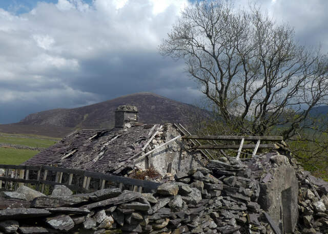
Avalanch Gully

Valley in Caernarfonshire

Wales

Avalanch Gully

Above Tal-y-mignedd-isaf
Above Tal-y-mignedd-isaf Credit: Chris Andrews

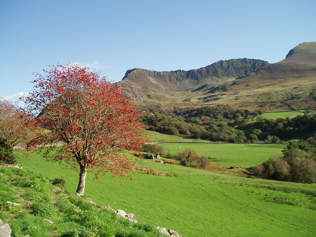
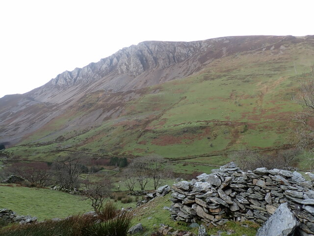
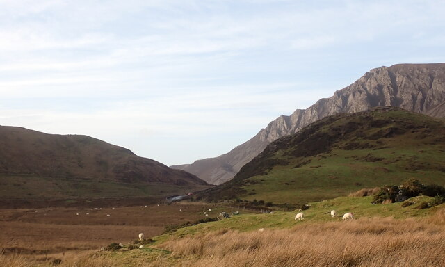
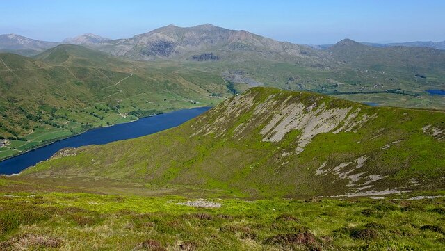
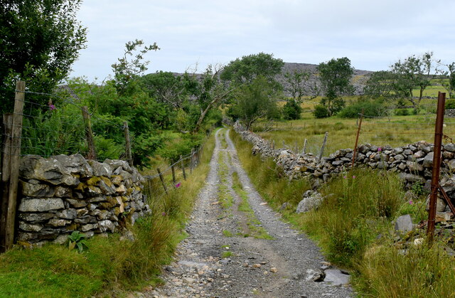
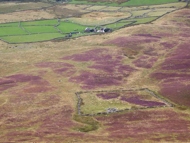
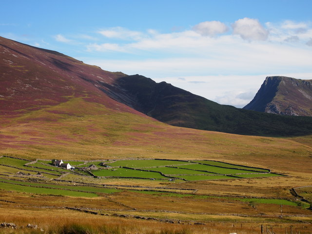
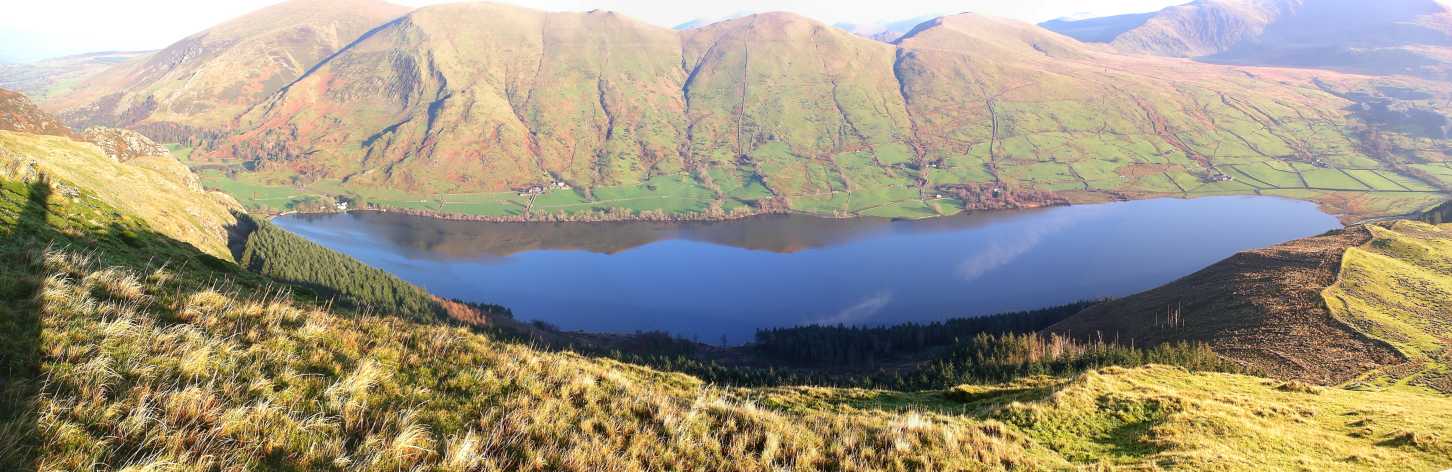
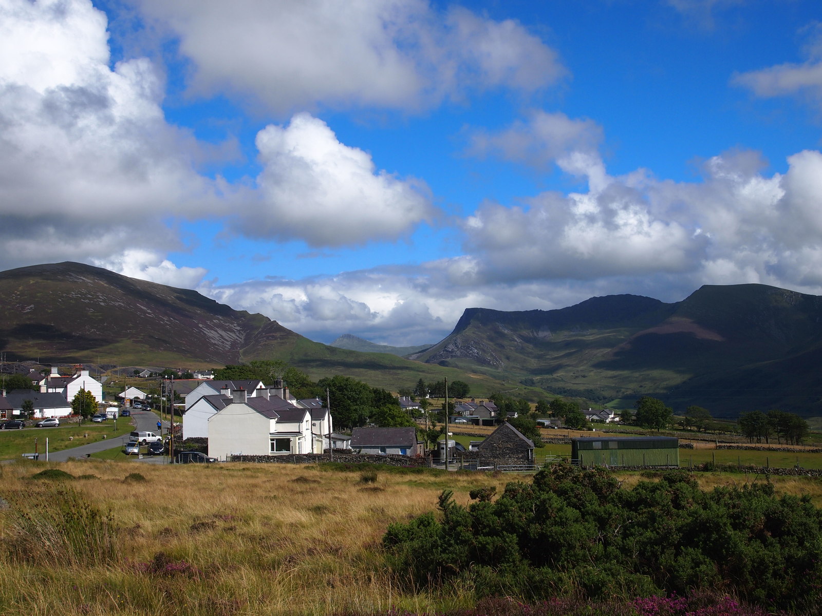
Avalanche Gully is a picturesque valley located in the county of Caernarfonshire, Wales. Nestled within the Snowdonia National Park, this stunning natural feature attracts visitors from all over the world who are seeking outdoor adventures and breathtaking landscapes.

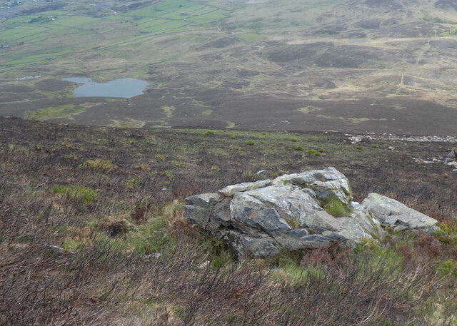
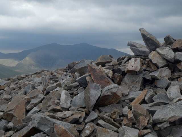
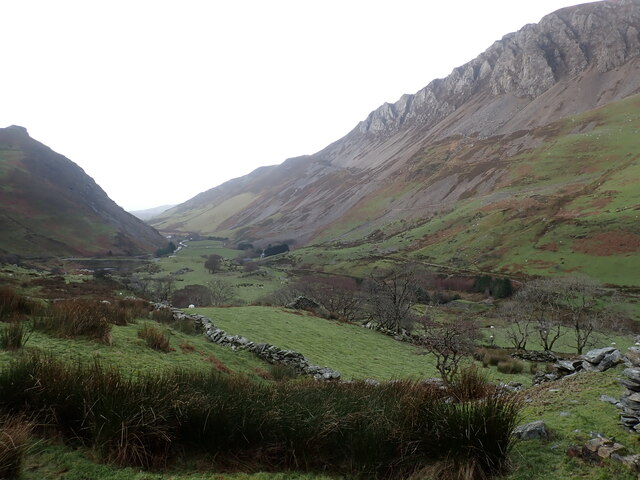
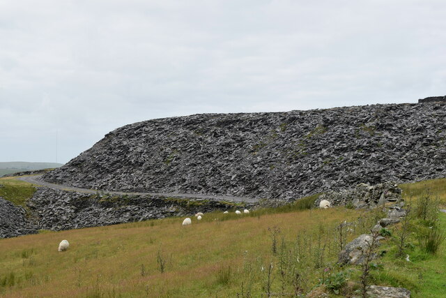
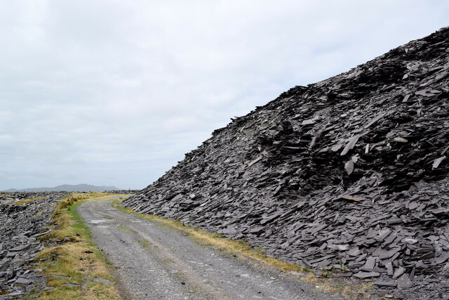
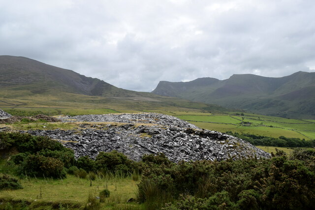
The valley is characterized by its rugged terrain, with steep slopes and rocky cliffs that create a dramatic and awe-inspiring landscape. The name "Avalanche Gully" is derived from the occasional snow avalanches that occur in the winter months, adding to the allure and excitement of the area.

The gully is home to a diverse range of flora and fauna, with rare and protected species finding refuge in its unspoiled natural environment. Hikers and nature enthusiasts can explore the valley's trails, which wind through lush forests, across crystal-clear streams, and up to panoramic viewpoints that offer stunning vistas of the surrounding mountains and valleys.

For those seeking a more adrenaline-fueled experience, Avalanche Gully also offers opportunities for rock climbing and mountaineering. The steep cliffs and challenging routes attract climbers of all levels, providing a thrilling and rewarding experience for those who dare to conquer its heights.

Furthermore, the valley is a popular destination for photographers and artists, who are drawn to its natural beauty and ever-changing light. The interplay between the towering cliffs, vibrant flora, and cascading waterfalls provides endless inspiration for creative endeavors.

Avalanche Gully is truly a gem within the Caernarfonshire region, offering visitors a unique and unforgettable experience of Wales' natural wonders.

If you have any feedback on the listing, please let us know in the comments section below.

Avalanch Gully Images

Images are sourced within 2km of 53.073359/-4.1878407 or Grid Reference SH5355. Thanks to Geograph Open Source API. All images are credited.

Above Tal-y-mignedd-isaf
Welsh Highland Railway train near Betws Garmon Welsh Highland Railway Garratt locomotive No.K1 about to pass under the A4085 in Nant-y-Betws with a train from Caernarfon to Rhyd-Ddu, which was the terminus of the line at the time.
Welsh Highland Railway train near Betws Garmon
Welsh Highland Railway Garratt locomotive No.K1 about to pass under the A4085 in Nant-y-Betws with a train from Caernarfon to Rhyd-Ddu, which was the terminus of the line at the time.
Tomenydd llechi Moel Tryfan / Moel Tryfan slate tips
Cors fynydd / An upland bog
Adfail ar Foel Tryfan / Ruin on Moel Tryfan
Maen ar Fynydd Mawr / A boulder on The Elephant
Carnedd ar gopa Mynydd Mawr / Cairn on the summit of The Elephant Snowdon is in the background.
Carnedd ar gopa Mynydd Mawr / Cairn on the summit of The Elephant
Snowdon is in the background.
Dyffryn Nantlle, Eryri Clogwyn y Barcut (438m), the Dyffryn Nantlle valley and the Craig y Bera cliffs. Ref:PC200076.
Dyffryn Nantlle, Eryri
Clogwyn y Barcut (438m), the Dyffryn Nantlle valley and the Craig y Bera cliffs. Ref:PC200076.
Craig y Bera cliffs, Eryri The Craig y Bera cliffs above the Dyffryn Nantlle valley. Ref:PC200077.
Craig y Bera cliffs, Eryri
The Craig y Bera cliffs above the Dyffryn Nantlle valley. Ref:PC200077.
Craig y Bera, Eryri Bryn Gwyn (291m), in front of the Craig y Bera Cliffs of Mynydd Mawr (698m), viewed from the B4418 road to the west of Rhyd-ddu. Ref:PC200079a2.
Craig y Bera, Eryri
Bryn Gwyn (291m), in front of the Craig y Bera Cliffs of Mynydd Mawr (698m), viewed from the B4418 road to the west of Rhyd-ddu. Ref:PC200079a2.
Foel Rudd and Llyn Cwellyn Descending Mynydd Mawr above the excellent Craig y Bera cliffs, Foel Rudd is a small rise on the eastern spur of the mountain. Llyn Cwellyn and the Snowdon group beyond.
Foel Rudd and Llyn Cwellyn
Descending Mynydd Mawr above the excellent Craig y Bera cliffs, Foel Rudd is a small rise on the eastern spur of the mountain. Llyn Cwellyn and the Snowdon group beyond.
Looking towards Hafod Caeronwy
Track to the slate waste There are waste heaps from abandoned slate mines everywhere...
Track to the slate waste
There are waste heaps from abandoned slate mines everywhere...
Sheep and slate waste Slate mining seemed to generate enormous quantities of waste, which have been dumped for the ages...
Sheep and slate waste
Slate mining seemed to generate enormous quantities of waste, which have been dumped for the ages...
Track past the slate waste The massive heap of slate waste associated with the former Pen-yr-orsedd Quarry (<span class="nowrap"><a title="https://en.wikipedia.org/wiki/Pen-yr-Orsedd_quarry" rel="nofollow ugc noopener" href="https://en.wikipedia.org/wiki/Pen-yr-Orsedd_quarry">Link</a><img style="margin-left:2px;" alt="External link" title="External link - shift click to open in new window" src="https://s1.geograph.org.uk/img/external.png" width="10" height="10"/></span> ) looks quite precarious...
Track past the slate waste
The massive heap of slate waste associated with the former Pen-yr-orsedd Quarry (LinkExternal link ) looks quite precarious...
Slate waste in the landscape Piles of waste from the former Pen-yr-orsedd Quarry catch the light with cwms bordering the south side of the Afon Drws-y-coed glacial valley in the background.
Slate waste in the landscape
Piles of waste from the former Pen-yr-orsedd Quarry catch the light with cwms bordering the south side of the Afon Drws-y-coed glacial valley in the background.
Bryn-castell, Abandoned Homestead
Castell Caeronwy A smallholding below Mynydd Mawr.
Castell Caeronwy
A smallholding below Mynydd Mawr.
Show me another place!

Avalanch Gully is located at Grid Ref: SH5355 (Lat: 53.073359, Lng: -4.1878407)

Unitary Authority: Gwynedd

Police Authority: North Wales

What 3 Words

///lads.pixies.nurses. Near Talysarn, Gwynedd

Related Wikis

Mynydd Mawr

Mynydd Mawr (Welsh for big mountain) is a mountain in Snowdonia, North Wales, approximately 7 km (4.3 mi) west of Snowdon itself, overlooking Llyn Cwellyn...

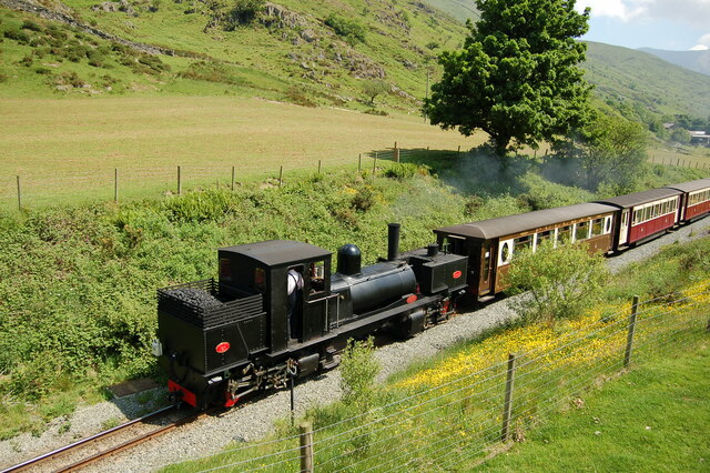
Plas-y-Nant railway station

Plas-y-Nant is an unstaffed halt on the narrow gauge Welsh Highland Railway. == History == A halt at Plas-y-Nant was first used in the 1920s but closed...
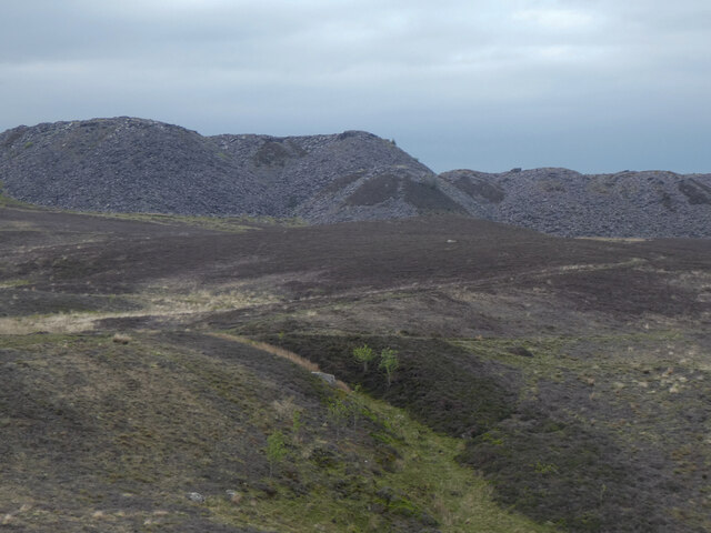
Alexandra quarry

Alexandra quarry was a slate quarry in North Wales, on the slopes of Moel Tryfan in north Gwynedd. It was part of one of the major slate quarrying regions...
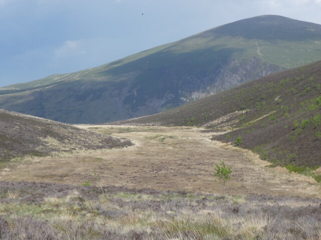
Moel Tryfan

Moel Tryfan (429 m / 1407 ft) is a small mountain near the villages of Rhosgadfan, Y Fron and Betws Garmon, in northern Gwynedd. The higher and more famous...

Betws Garmon

Betws Garmon is a community and small hamlet outside Waunfawr and near Beddgelert in Gwynedd, Wales. It has a population of 249.The summit of Snowdon...

Llyn Cwellyn

Llyn Cwellyn (Llyn Quellyn in some antiquated texts) is a reservoir in North Wales which supplies drinking water to parts of Gwynedd and Anglesey. It lies...

Ysgol Bronyfoel

Ysgol Bronyfoel was a Welsh daily co-educational primary school. The school was situated in the centre of the village Y Fron, Gwynedd, North Wales. It...

Y Fron

Y Fron, also known locally as Cesarea, after the chapel, is a country village on the south-west side of Moel Tryfan, overlooking the Nantlle Valley, in...

Nearby Amenities

Located within 500m of 53.073359,-4.1878407
Saxifrage Gully
Place: locality
Lat/Long: 53.0737264/-4.1856781
Avalanch Gully
Place: locality
Lat/Long: 53.0743557/-4.1873036
The data included in this document is from www.openstreetmap.org. The data is made available under ODbL.

Have you been to Avalanch Gully?

Leave your review of Avalanch Gully below (or comments, questions and feedback).