Glen Buckie

Valley in Perthshire

Scotland

Glen Buckie

View towards Tom na h-Analach
View towards Tom na h-Analach Credit: Mick Garratt

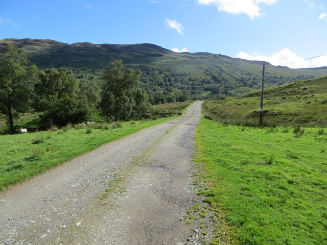
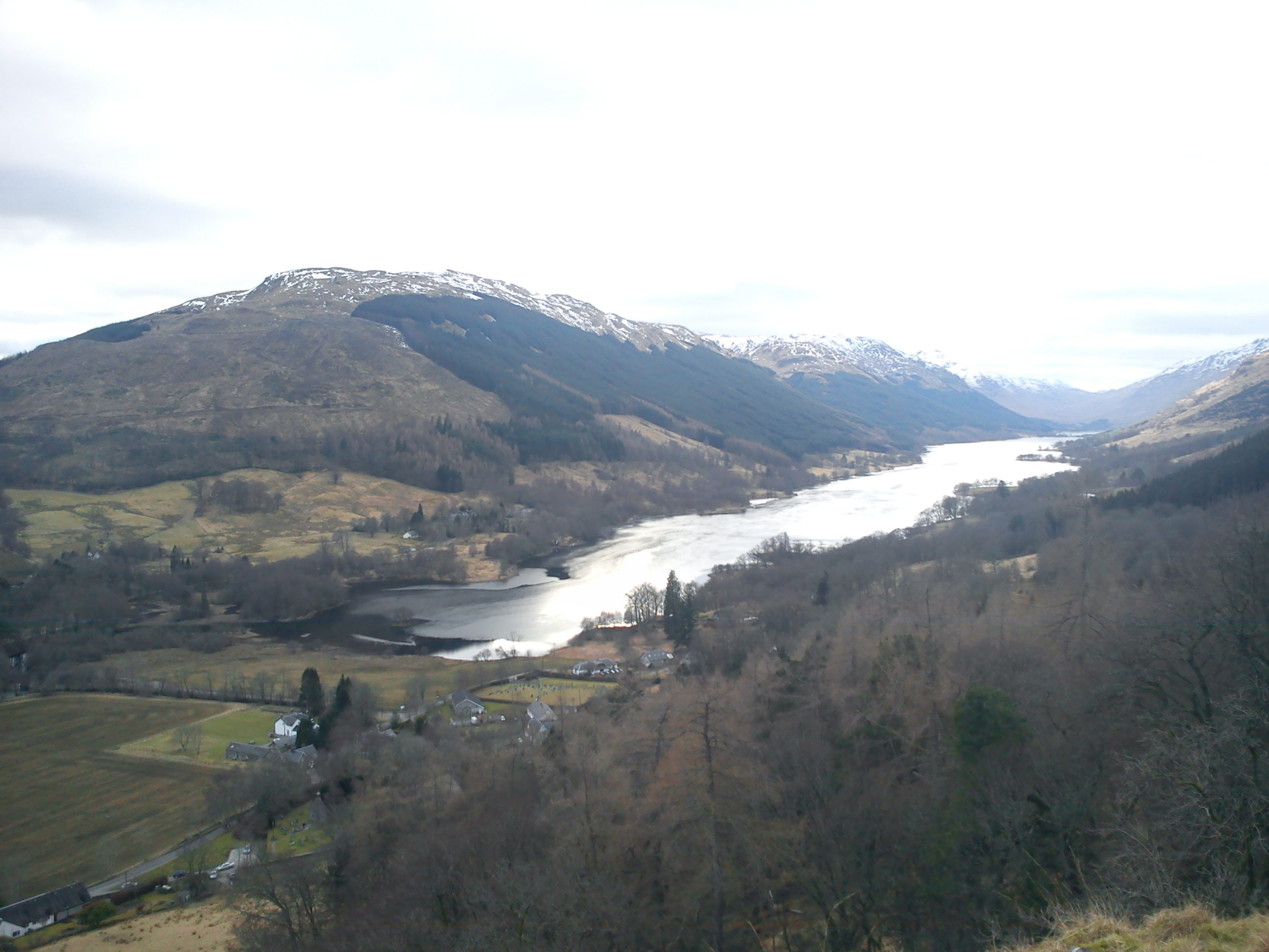
Glen Buckie, located in Perthshire, Scotland, is a picturesque valley nestled amidst the stunning landscape of the Scottish Highlands. Situated approximately 10 miles northwest of the town of Blairgowrie, Glen Buckie is renowned for its breathtaking natural beauty and tranquil ambiance.

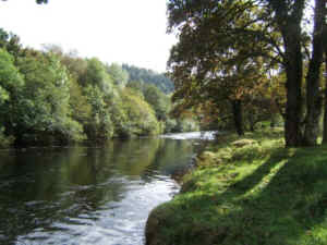
The valley is characterized by rolling hills, dense forests, and the meandering River Ericht, which runs through its heart. The area is a haven for outdoor enthusiasts, offering an array of activities such as hiking, cycling, and fishing. The nearby Glen Shee, one of Scotland's most popular skiing destinations, provides winter adventure opportunities for visitors.

Glen Buckie is also home to a diverse range of wildlife, including red deer, golden eagles, and otters, making it a haven for nature lovers and wildlife enthusiasts. The valley boasts various walking trails, allowing visitors to explore the area's natural wonders and soak in the serene atmosphere.

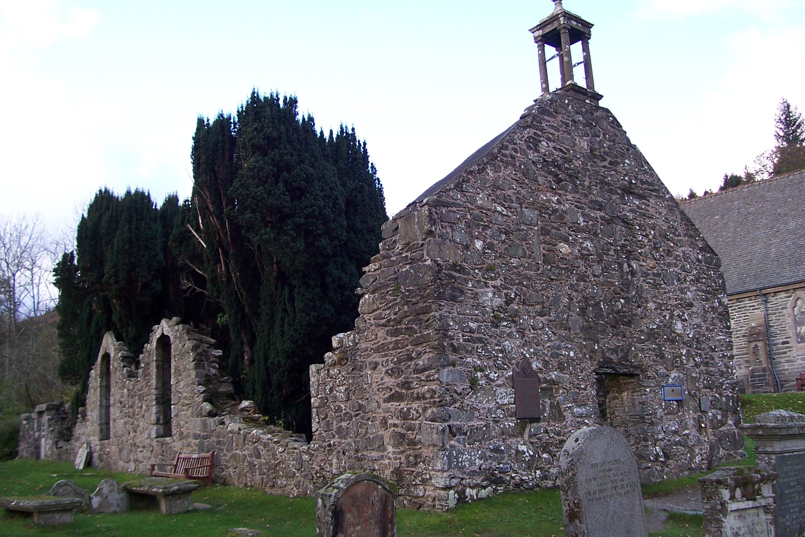
The charm of Glen Buckie extends beyond its natural beauty. The valley is dotted with quaint cottages and traditional Scottish architecture, providing a glimpse into the region's rich cultural heritage. The nearby hamlet of Bridge of Cally offers a range of amenities, including accommodation options, restaurants, and shops, ensuring visitors can enjoy a comfortable stay while immersing themselves in the valley's tranquility.

Overall, Glen Buckie, Perthshire, is a hidden gem of Scotland, offering a peaceful retreat amidst majestic landscapes, abundant wildlife, and a rich cultural heritage. Whether it's for adventure, relaxation, or exploration, this valley has something to offer to every visitor seeking solace in the lap of nature.

If you have any feedback on the listing, please let us know in the comments section below.

Glen Buckie Images

Images are sourced within 2km of 56.328213/-4.3705622 or Grid Reference NN5317. Thanks to Geograph Open Source API. All images are credited.

View towards Tom na h-Analach
View of Loch Lubnaig from An Sidhean
Loch Lubnaig from the climb up An Sidhean
Glen Buckie - Minor road between Balquhidder and  Ballimor Looking south-westward.
Glen Buckie - Minor road between Balquhidder and Ballimor
Looking south-westward.
Glen Buckie - Minor road near Tom an Eisg Looking north-eastward.
Glen Buckie - Minor road near Tom an Eisg
Looking north-eastward.
Glen Buckie - Minor road approaching Ballimore Looking south-westward.
Glen Buckie - Minor road approaching Ballimore
Looking south-westward.
Glen Buckie - Track giving access to Lianach and  Immeroin Looking eastward.
Glen Buckie - Track giving access to Lianach and Immeroin
Looking eastward.
Glen Buckie - The infant Calair Burn Looking south-westward from the road bridge at Ballimore.
Glen Buckie - The infant Calair Burn
Looking south-westward from the road bridge at Ballimore.
Farm at Ballimore Ballimore is in Glen Buckie on the north side of the Calair Burn; the farm is at the end of a public road that runs south from the village at Balquhidder.
Farm at Ballimore
Ballimore is in Glen Buckie on the north side of the Calair Burn; the farm is at the end of a public road that runs south from the village at Balquhidder.
Beinn an t-Sidhein (summit) The summit (NN 54699 17854) of Beinn an t-Sidhein is within 2m of the small summit cairn.
Beinn an t-Sidhein (summit)
The summit (NN 54699 17854) of Beinn an t-Sidhein is within 2m of the small summit cairn.
An Sidhein (hill) An Sidhein from the bealach between Beinn an t-Sidhein and An Sidhein.
An Sidhein (hill)
An Sidhein from the bealach between Beinn an t-Sidhein and An Sidhein.
Beginning of Brig o' Turk track at Ballimore Looking towards the Braes of Balquhidder.
Beginning of Brig o' Turk track at Ballimore
Looking towards the Braes of Balquhidder.
Silver birch sapling, Ballimore Looking towards the western flank of Beinn an t-Sidhein (the 'fairy hill').
Silver birch sapling, Ballimore
Looking towards the western flank of Beinn an t-Sidhein (the 'fairy hill').
Road to Ballimore This dead-end road by the Calair Burn leads to the farm of Ballimore (the 'big town' or 'big settlement', from the Gaelic 'baile mor').

Benvane can be seen in the distance.
Road to Ballimore
This dead-end road by the Calair Burn leads to the farm of Ballimore (the 'big town' or 'big settlement', from the Gaelic 'baile mor'). Benvane can be seen in the distance.
Benvane from the flanks of An Sidhean Good snow cover from snowfalls a few days previously.
Benvane from the flanks of An Sidhean
Good snow cover from snowfalls a few days previously.
Buachaille Breige The Northern extension of Beinn an t-Sidhein ridge carries the name Buachaille Breige, which apparently means the 'false herdsman'.  Meall an t-Seallaidh is the hill in the background.
Buachaille Breige
The Northern extension of Beinn an t-Sidhein ridge carries the name Buachaille Breige, which apparently means the 'false herdsman'. Meall an t-Seallaidh is the hill in the background.
An Sidhean The rocky knoll of An Sidhean is probably the most distinctive feature of Beinn an t-Sidhein.
An Sidhean
The rocky knoll of An Sidhean is probably the most distinctive feature of Beinn an t-Sidhein.
The Calair burn With Beinn an t-Sidhein in the background.
The Calair burn
With Beinn an t-Sidhein in the background.
Show me another place!

Glen Buckie is located at Grid Ref: NN5317 (Lat: 56.328213, Lng: -4.3705622)

Unitary Authority: Stirling

Police Authority: Forth Valley

What 3 Words

///depth.seasonal.dummy. Near Callander, Stirling

Nearby Locations

Glen Buckie

Related Wikis

Strathyre railway station

Strathyre was a railway station located at the head of Loch Lubnaig, Stirling, in Strathyre. == History == This station opened on 1 June 1870 along with...

Strathyre

Strathyre (; from Scottish Gaelic: Srath Eadhair) is a district and settlement in the Stirling local government district of Scotland. It forms the south...

River Balvaig

The River Balvaig (Scottish Gaelic: "Abhainn Balbhaig") is a short river, approximately 8 km (5.0 mi) long, draining from the head of Loch Voil near Balquhidder...

Balquhidder

Balquhidder ( ; Scottish Gaelic: Both Chuidir [ˌpɔˈxutʲɪɾʲ] or Both Phuidir [ˌpɔˈfutʲɪɾʲ]) is a small village in Perthshire located 10 miles (16 km) north...

Auchtubh

Auchtubh is a hamlet in the Stirling council area of Scotland, less than 1 mile (2 kilometres) to the east of the village of Balquhidder. Auchtubh consisted...

Loch Voil

Loch Voil (Scottish Gaelic: Loch a' Bheothail) is a small freshwater loch that lies to the west of Balquhidder in the Stirling council area of Scotland...

Benvane

Benvane (Scottish Gaelic: Beinn Bhàn) is a mountain in the Trossachs, in Stirling council area, Scotland. It lies within Loch Lomond and The Trossachs...

Kingshouse railway station

Kingshouse was a railway station located at the hamlet of Kingshouse, Stirling where the road from Balquhidder joins the A84. The only building of note...

Nearby Amenities

Located within 500m of 56.328213,-4.3705622
Power: pole
Lat/Long: 56.3253745/-4.3663446
Power: pole
Lat/Long: 56.3261571/-4.3662803
Power: pole
Lat/Long: 56.3269562/-4.366238
Power: pole
Lat/Long: 56.3275955/-4.3661957
Power: pole
Lat/Long: 56.3282027/-4.3661456
Power: pole
Lat/Long: 56.3288376/-4.3661299
Power: pole
Lat/Long: 56.3294542/-4.3660861
Power: pole
Lat/Long: 56.3300874/-4.3660532
Power: pole
Lat/Long: 56.3311834/-4.3659748
Power: pole
Lat/Long: 56.3317671/-4.3660532
Power: pole
Lat/Long: 56.3257932/-4.3667895
Power: pole
Lat/Long: 56.3277901/-4.3778636
Power: pole
Lat/Long: 56.3280064/-4.3762437
Power: pole
Lat/Long: 56.3282904/-4.3740098
Power: pole
Lat/Long: 56.3284502/-4.3728364
Power: pole
Lat/Long: 56.3286248/-4.3714641
Power: pole
Lat/Long: 56.3288723/-4.3700573
Power: pole
Lat/Long: 56.3291068/-4.3688464
Power: pole
Lat/Long: 56.3292397/-4.3681602
Power: pole
Lat/Long: 56.3293787/-4.3668427
The data included in this document is from www.openstreetmap.org. The data is made available under ODbL.

Have you been to Glen Buckie?

Leave your review of Glen Buckie below (or comments, questions and feedback).