Abthorpe

Settlement in Northamptonshire

England

Abthorpe

St John the Baptist's, Abthorpe
St John the Baptist's, Abthorpe Credit: Andrew Smith

Abthorpe is a small village located in the county of Northamptonshire, England. It is situated approximately 7 miles south-west of Towcester and 10 miles west of Milton Keynes. With a population of around 200 residents, Abthorpe offers a peaceful and rural setting.

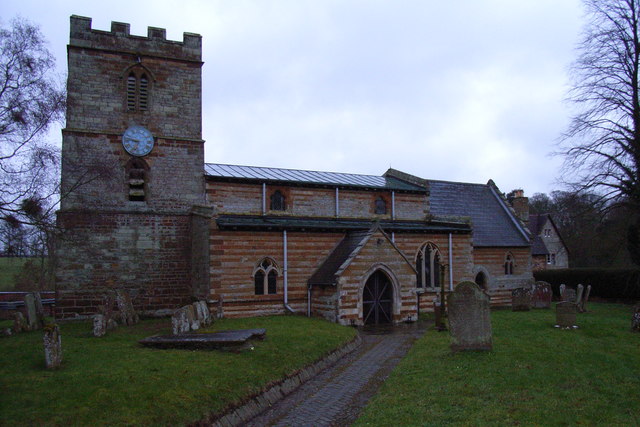
The village is known for its picturesque surroundings, surrounded by rolling hills and lush countryside. It is home to a mix of architectural styles, ranging from traditional thatched cottages to more modern homes. The centerpiece of Abthorpe is the St. John the Baptist Church, a beautiful medieval church that dates back to the 13th century. The church features stunning stained glass windows and a historic tower.

Despite its small size, Abthorpe has a strong sense of community. The village has a local pub, The New Inn, which serves as a gathering place for locals and visitors alike. It offers a warm and friendly atmosphere, and traditional English pub food.

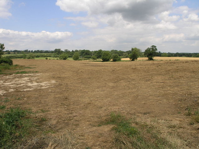
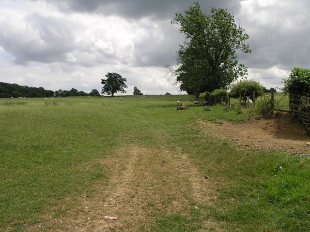
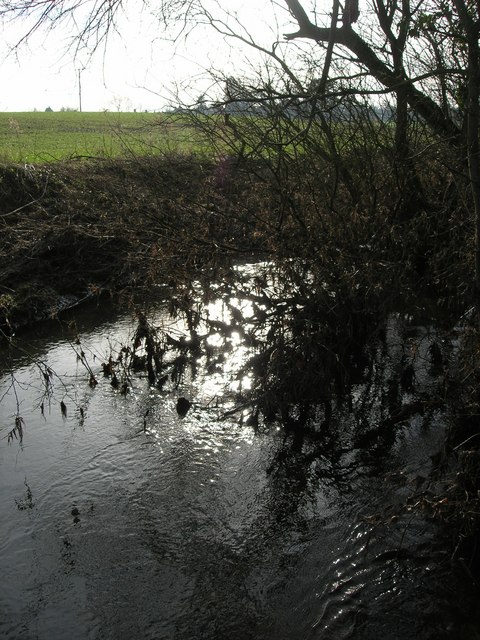
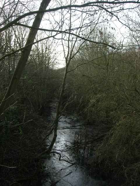
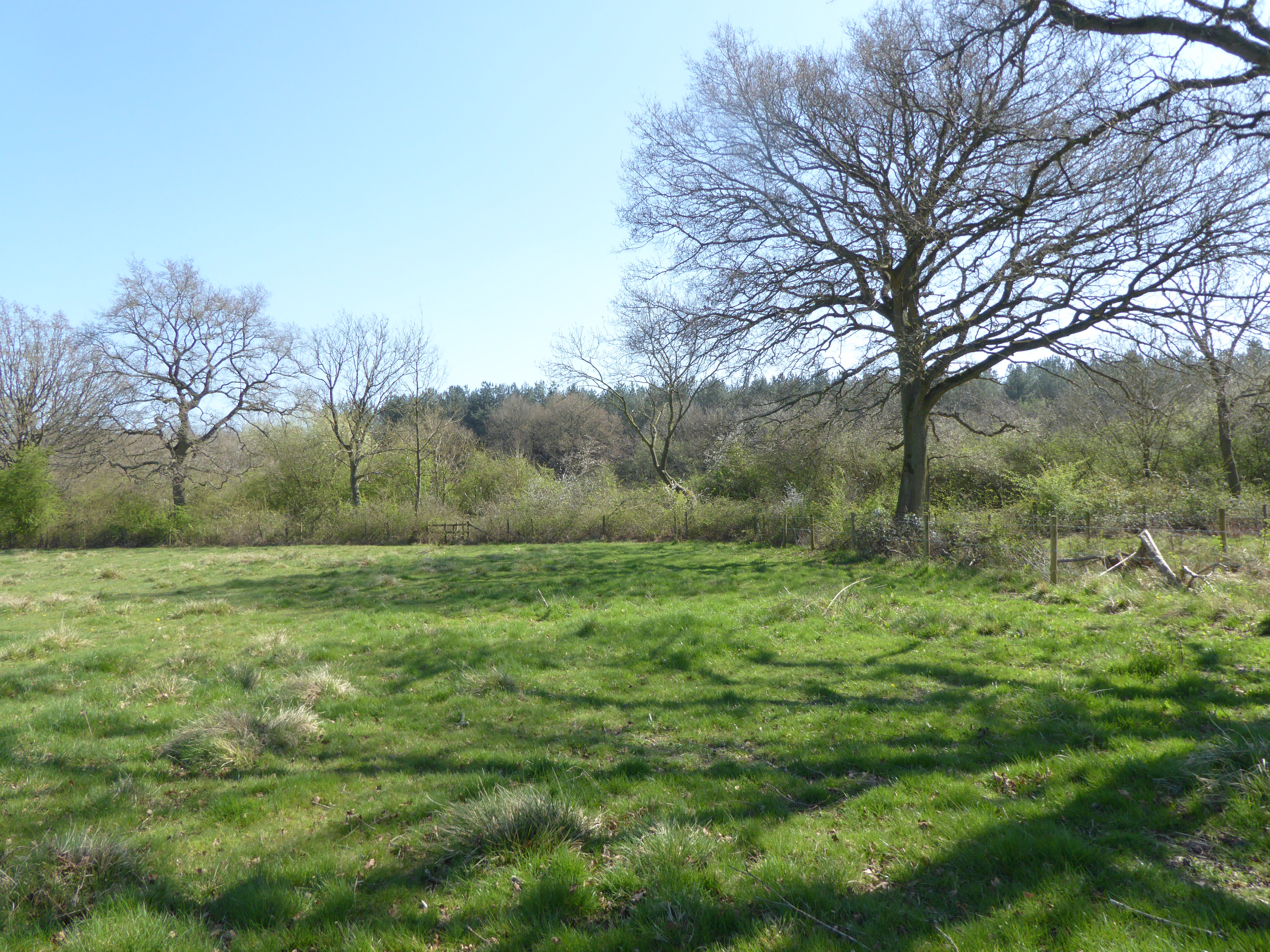
Surrounded by nature, Abthorpe offers plenty of opportunities for outdoor activities. The village is surrounded by walking and cycling trails, allowing residents and visitors to explore the beautiful countryside. The nearby Tove Valley provides further opportunities for outdoor enthusiasts, with its riverside walks and wildlife.

Overall, Abthorpe is a charming village that offers a peaceful and idyllic lifestyle. Its beautiful surroundings, sense of community, and proximity to nature make it an attractive place to live or visit for those seeking a slower pace of life in the heart of the English countryside.

If you have any feedback on the listing, please let us know in the comments section below.
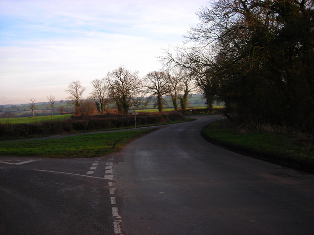
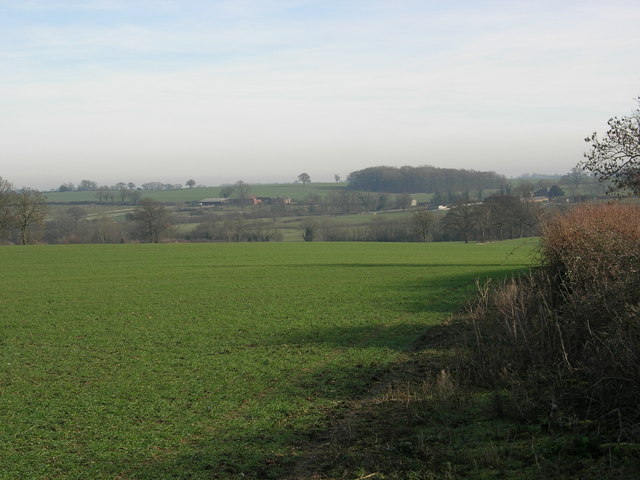
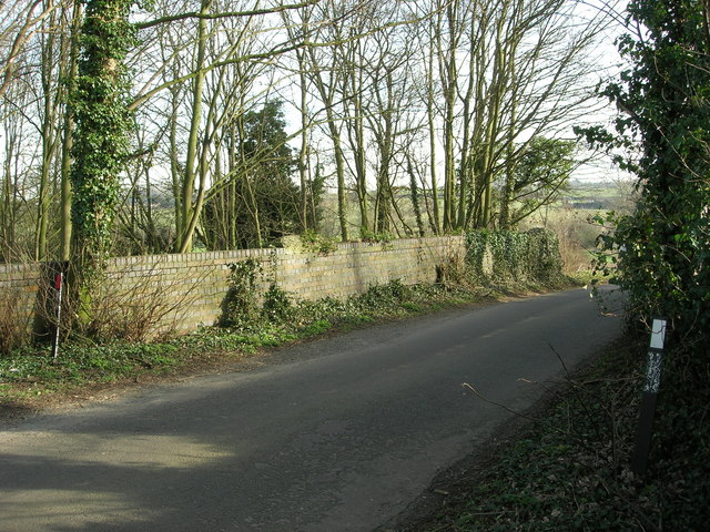
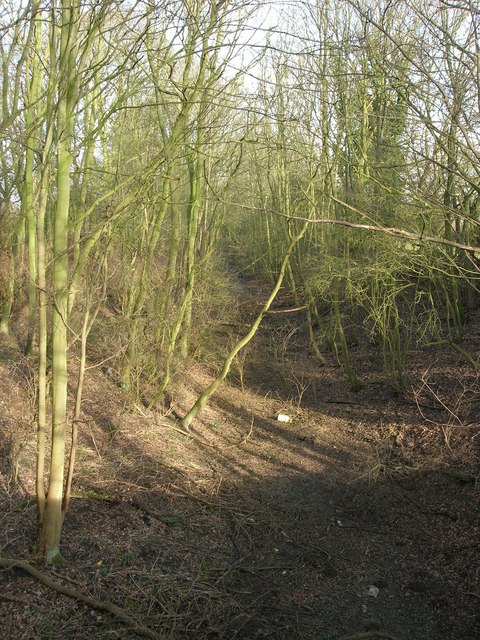
Abthorpe Images

Images are sourced within 2km of 52.112483/-1.052747 or Grid Reference SP6446. Thanks to Geograph Open Source API. All images are credited.

St John the Baptist's, Abthorpe
Station now Barn This barn is built close to the site of the former Wappenham railway station.  It appears to be built on the former track bed.
Station now Barn
This barn is built close to the site of the former Wappenham railway station. It appears to be built on the former track bed.
Steep Track This steep farm track climbs up to farm buildings behind the trees.
Steep Track
This steep farm track climbs up to farm buildings behind the trees.
Field to the River The River Tove runs in the bottom of this shallow valley.  A footpath across this field follows along the course of the river.
Field to the River
The River Tove runs in the bottom of this shallow valley. A footpath across this field follows along the course of the river.
Bridleway to Handley This bridleway climbs up the River Tove valley on its way to Handley Barn.
Bridleway to Handley
This bridleway climbs up the River Tove valley on its way to Handley Barn.
River Tove
River Tove
Dismantled Railway The track bed is now flooded and looks more like a stream.
Dismantled Railway
The track bed is now flooded and looks more like a stream.
Junction The road from Bradden joins the Blakesley-Abthorpe road and then the Slapton road peels off to the right.
Junction
The road from Bradden joins the Blakesley-Abthorpe road and then the Slapton road peels off to the right.
Winter field
Winter field
Bridge over dismantled railway Bridge carrying the Blakesley-Abthorpe road
Bridge over dismantled railway
Bridge carrying the Blakesley-Abthorpe road
Dismantled railway line
River Tove River Tove from Ox Bridge.
River Tove
River Tove from Ox Bridge.
Main bridleway through Bucknell Wood This wide metalled track leads all the way down to the car park at the other end.  The track continues behind the photographer,  but as only a smaller, rough bridleway.  Other tracks lead off to the left and right.
Main bridleway through Bucknell Wood
This wide metalled track leads all the way down to the car park at the other end. The track continues behind the photographer, but as only a smaller, rough bridleway. Other tracks lead off to the left and right.
Mushroom carved from tree stump This is quite small (approximately 2 feet high) and off a small path,  so you can  only see it when you're almost on top of it.
Mushroom carved from tree stump
This is quite small (approximately 2 feet high) and off a small path, so you can only see it when you're almost on top of it.
Junction of many paths Bucknell Wood is full of paths and bridleways.  This is one of several points where many come together.
Junction of many paths
Bucknell Wood is full of paths and bridleways. This is one of several points where many come together.
Avenue of trees In the middle of Bucknell Woods is this planted venue of trees.
Avenue of trees
In the middle of Bucknell Woods is this planted venue of trees.
Bucknell Wood These woods are large and not commonly known,  so you can walk for hours and never meet anyone.  This board is on the edge of the small car park,  next to the picnic area.

Forestry Commission website for Bucknells Wood - <span class="nowrap"><a title="http://www.forestry.gov.uk/website/wildwoods.nsf/LUWebDocsByKey/EnglandNorthamptonshireWhittlewoodForestBucknellsWood" rel="nofollow ugc noopener" href="http://www.forestry.gov.uk/website/wildwoods.nsf/LUWebDocsByKey/EnglandNorthamptonshireWhittlewoodForestBucknellsWood">Link</a><img style="margin-left:2px;" alt="External link" title="External link - shift click to open in new window" src="https://s1.geograph.org.uk/img/external.png" width="10" height="10"/></span>
Bucknell Wood
These woods are large and not commonly known, so you can walk for hours and never meet anyone. This board is on the edge of the small car park, next to the picnic area. Forestry Commission website for Bucknells Wood - LinkExternal link
Bucknell Wood picnic area This picnic area, with several permanent tables, is next to the small car park.  The approach road is very rough - so drive carefully!
Bucknell Wood picnic area
This picnic area, with several permanent tables, is next to the small car park. The approach road is very rough - so drive carefully!
Show me another place!

Abthorpe is located at Grid Ref: SP6446 (Lat: 52.112483, Lng: -1.052747)

Unitary Authority: West Northamptonshire

Police Authority: Northamptonshire

What 3 Words

///hopping.asterisk.retiring. Near Silverstone, Northamptonshire

Nearby Locations

Abthorpe Slapton

Related Wikis

Abthorpe

Abthorpe is a village and civil parish in the valley of the River Tove in West Northamptonshire, England, about 4 miles (6.4 km) west of Towcester, 2 miles...

Slapton, Northamptonshire

Slapton is a small village in Northamptonshire, England, about 4 miles (6.4 km) from Towcester and the same from Silverstone. It is close to the A43 road...

South Northamptonshire (UK Parliament constituency)

South Northamptonshire is a constituency represented in the House of Commons of the UK Parliament since its 2010 recreation by Andrea Leadsom, a Conservative...

Wappenham railway station

Wappenham was a railway station on the Stratford-upon-Avon and Midland Junction Railway (SMJ) which served the Northamptonshire village of Wappenham between...

Bucknell Wood Meadows

Bucknell Wood Meadows is a 9.2-hectare (23-acre) biological Site of Special Scientific Interest north-west of Silverstone in Northamptonshire.This site...

Bradden

Bradden is a village and civil parish in West Northamptonshire, England, about 4 miles (6.4 km) west of Towcester. According to the 2001 census it had...

Wappenham

Wappenham is a linear village and civil parish in Northamptonshire, England. It is 5 miles (8 km) south-west of Towcester, north of Syresham and north...

Greens Norton Pocket Park

Greens Norton Pocket Park is a 2-hectare (4.9-acre) Local Nature Reserve in Greens Norton in Northamptonshire. It is owned and managed by Green Norton...

Nearby Amenities

Located within 500m of 52.112483,-1.052747
Barrier: stile
Steps: 1
Lat/Long: 52.1093963/-1.0561301
Barrier: stile
Foot: designated
Steps: 1
Lat/Long: 52.112442/-1.0521905
Barrier: stile
Steps: 2
Lat/Long: 52.1111118/-1.0494612
Barrier: stile
Steps: 1
Lat/Long: 52.1141584/-1.0543808
Barrier: stile
Note: dogflap on south side
Steps: 1
Lat/Long: 52.1147902/-1.0532459
Barrier: stile
Lat/Long: 52.1147594/-1.0570338
Barrier: stile
Lat/Long: 52.1150303/-1.0586569
Barrier: stile
Steps: 1
Lat/Long: 52.1153058/-1.0534088
Abthorpe
Is In Country: United Kingdom
Is In County: Northamptonshire
Is In District: South Northamptonshire
Place: village
Wikidata: Q2075242
Wikipedia: en:Abthorpe
Lat/Long: 52.113327/-1.0528913
Barrier: kissing_gate
Foot: yes
Lat/Long: 52.1105402/-1.0539775
Barrier: stile
Note: ...
Lat/Long: 52.111573/-1.0581614
Barrier: stile
Note: check
Steps: 2
Lat/Long: 52.1120055/-1.0551922
Barrier: stile
Steps: 1
Lat/Long: 52.113149/-1.0568966
Barrier: stile
Note: ...
Steps: 1
Lat/Long: 52.112781/-1.0554611
Barrier: stile
Note: ...
Steps: 1
Lat/Long: 52.112975/-1.0550147
Barrier: stile
Note: dog flap to north side
Steps: 1
Lat/Long: 52.1151921/-1.0523986
Barrier: stile
Note: dog_flap + ...
Steps: 1
Lat/Long: 52.1140816/-1.054626
Power: pole
Lat/Long: 52.1142695/-1.054827
Power: pole
Lat/Long: 52.1145168/-1.0568556
Power: pole
Lat/Long: 52.1148742/-1.0533378
Barrier: stile
Note: Dog gap (gilateen)
Steps: 1
Lat/Long: 52.1093814/-1.0561673
Barrier: stile
Steps: 1
Lat/Long: 52.1093176/-1.0536469
Post Box
Operator: Royal Mail
Post Box Design: type_m
Post Box Type: lamp
Ref: NN12 371
Lat/Long: 52.1134293/-1.0524474
Power: pole
Lat/Long: 52.1148516/-1.0532671
Barrier: stile
Note: check
Lat/Long: 52.1134707/-1.0559456
Barrier: stile
Steps: 1
Lat/Long: 52.1136607/-1.0555978
Barrier: footgate
Bicycle: yes
Foot: yes
Horse: yes
Lat/Long: 52.1138289/-1.0553075
Note: wrong, needs correcting
Lat/Long: 52.1124065/-1.0522684
Pump
Man Made: pumping_station
Lat/Long: 52.1134803/-1.0525131
Bench
Lat/Long: 52.1135633/-1.0523734
Power: pole
Lat/Long: 52.1155312/-1.051549
Defibrillator
Booth: K6
Covered: booth
Defibrillator Location: inside old red phone box on village green, Abthorpe
Disused Amenity: telephone
Emergency: defibrillator
Listed Status: Grade II
Man Made: telephone_box
Lat/Long: 52.1134414/-1.0524268
Barrier: footgate
Bicycle: yes
Foot: yes
Horse: yes
Lat/Long: 52.1136927/-1.0499345
Barrier: footgate
Bicycle: yes
Foot: yes
Horse: yes
Lat/Long: 52.1140295/-1.0518861
Man Made: water_well
Lat/Long: 52.1136495/-1.0534633
Note: check here...
Lat/Long: 52.1145946/-1.053522
Barrier: stile
Note: 1 step
Lat/Long: 52.1156581/-1.05142
Restaurant
Stephen Casemore (Caterer)
Addr City: Towcester
Addr Country: GB
Addr Housenumber: 1
Addr Postcode: NN12 8QR
Addr Street: Silver Street
Addr Village: Abthorpe
Lat/Long: 52.1132607/-1.0540035
Direction: SSE
Generator Method: photovoltaic
Generator Output Electricity: yes
Generator Solar Modules: 18
Generator Source: solar
Generator Type: solar_photovoltaic_panel
Location: roof
Power: generator
Lat/Long: 52.1140195/-1.0499161
Direction: ESE
Generator Method: photovoltaic
Generator Output Electricity: yes
Generator Solar Modules: 10
Generator Source: solar
Generator Type: solar_photovoltaic_panel
Location: roof
Power: generator
Lat/Long: 52.1112877/-1.0542478
Direction: SSW
Generator Method: photovoltaic
Generator Output Electricity: yes
Generator Solar Modules: 17
Generator Source: solar
Generator Type: solar_photovoltaic_panel
Location: roof
Power: generator
Lat/Long: 52.1134389/-1.0496614
Direction: SW
Generator Method: photovoltaic
Generator Output Electricity: yes
Generator Solar Modules: 11
Generator Source: solar
Generator Type: solar_photovoltaic_panel
Location: roof
Power: generator
Lat/Long: 52.1127934/-1.0551604
Direction: 145
Generator Method: photovoltaic
Generator Output Electricity: yes
Generator Solar Modules: 5
Generator Source: solar
Generator Type: solar_photovoltaic_panel
Location: roof
Power: generator
Lat/Long: 52.1134174/-1.0502394
Direction: SE
Generator Method: photovoltaic
Generator Output Electricity: yes
Generator Solar Modules: 10
Generator Source: solar
Generator Type: solar_photovoltaic_panel
Location: roof
Power: generator
Lat/Long: 52.1127861/-1.0547173
Direction: 145
Generator Method: photovoltaic
Generator Output Electricity: yes
Generator Solar Modules: 15
Generator Source: solar
Generator Type: solar_photovoltaic_panel
Location: roof
Power: generator
Lat/Long: 52.1133917/-1.0503041
Direction: SE
Generator Method: photovoltaic
Generator Output Electricity: yes
Generator Solar Modules: 10
Generator Source: solar
Generator Type: solar_photovoltaic_panel
Location: roof
Power: generator
Lat/Long: 52.1127281/-1.054824
Direction: 145
Generator Method: photovoltaic
Generator Output Electricity: yes
Generator Solar Modules: 15
Generator Source: solar
Generator Type: solar_photovoltaic_panel
Location: roof
Power: generator
Lat/Long: 52.1126493/-1.053054
Direction: 105
Generator Method: photovoltaic
Generator Output Electricity: yes
Generator Solar Modules: 12
Generator Source: solar
Generator Type: solar_photovoltaic_panel
Location: roof
Power: generator
Lat/Long: 52.111597/-1.0535154
Power: pole
Lat/Long: 52.1140961/-1.0584414
Power: pole
Lat/Long: 52.115223/-1.0523361
Power: pole
Lat/Long: 52.1164103/-1.0492594
The data included in this document is from www.openstreetmap.org. The data is made available under ODbL.

Have you been to Abthorpe?

Leave your review of Abthorpe below (or comments, questions and feedback).