Falfarrocher Glen

Valley in Ayrshire

Scotland

Falfarrocher Glen

Girvan Valley From Craig Hill Looking up the Girvan Valley, showing the wooded slopes of Craigfin Hill in the distance.
Girvan Valley From Craig Hill Credit: Mary and Angus Hogg

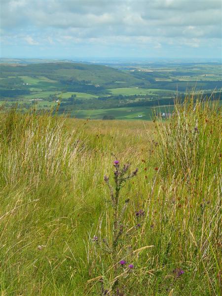
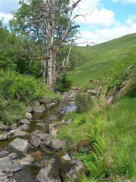
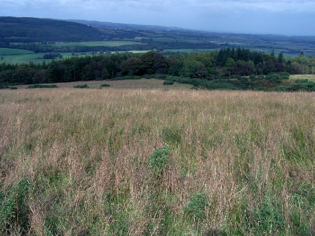
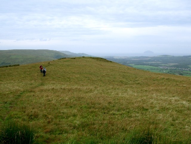
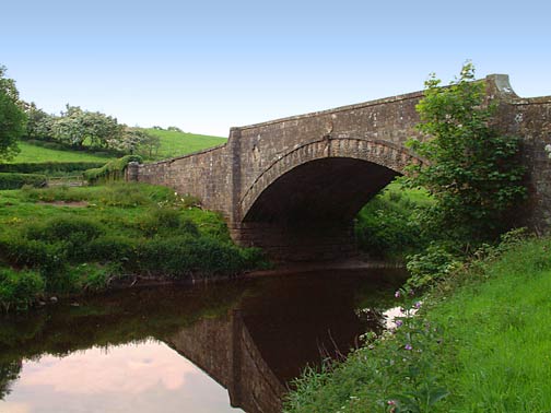
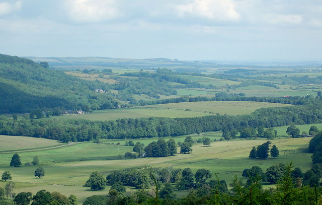
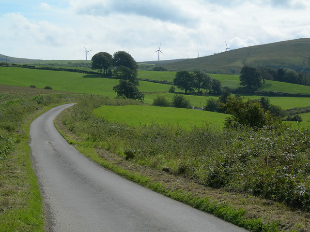
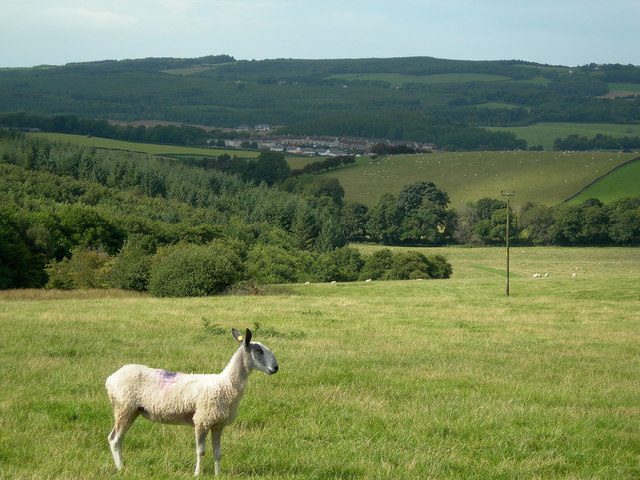
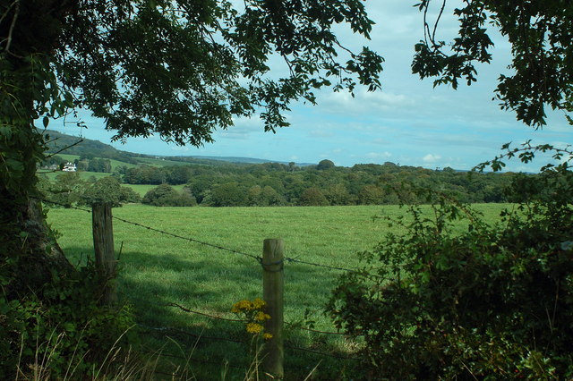
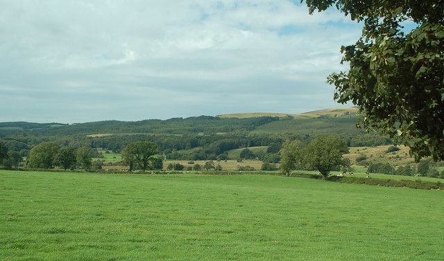
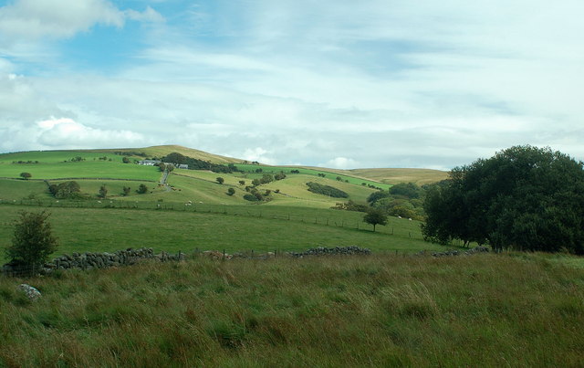
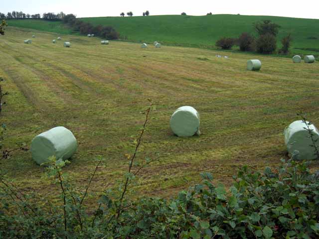
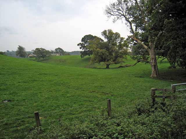
Falfarrocher Glen is a picturesque valley located in Ayrshire, Scotland. The glen is known for its stunning natural beauty, with lush greenery, towering trees, and a tranquil river running through it. The valley is surrounded by rolling hills and provides a peaceful escape from the hustle and bustle of urban life.

Falfarrocher Glen is a popular destination for hikers, nature enthusiasts, and photographers looking to explore the Scottish countryside. The glen offers a network of walking trails that wind through the valley, providing visitors with the opportunity to experience the diverse flora and fauna that call the area home.

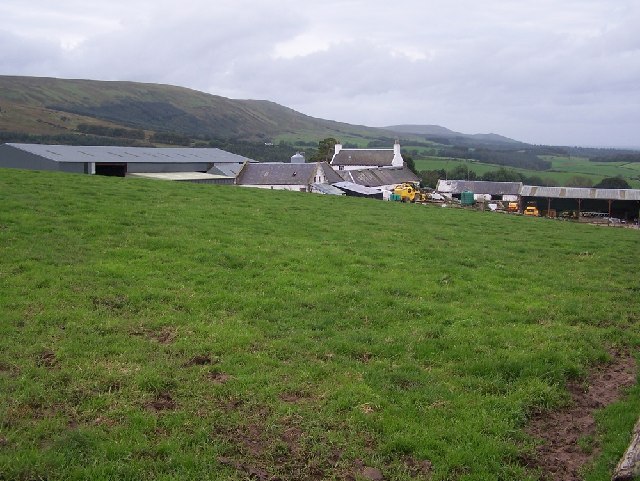
In addition to its natural beauty, Falfarrocher Glen also has a rich history, with archaeological sites dating back to ancient times. Visitors can explore ruins of old settlements and learn about the area's past through interpretive signs and guided tours.

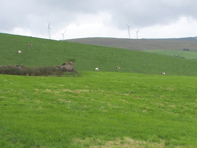
Overall, Falfarrocher Glen is a hidden gem in Ayrshire, offering visitors a chance to connect with nature and immerse themselves in the beauty of the Scottish landscape.

If you have any feedback on the listing, please let us know in the comments section below.

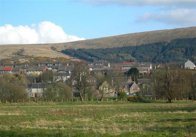
Falfarrocher Glen Images

Images are sourced within 2km of 55.280498/-4.6887447 or Grid Reference NS2901. Thanks to Geograph Open Source API. All images are credited.

Girvan Valley From Craig Hill Looking up the Girvan Valley, showing the wooded slopes of Craigfin Hill in the distance.
Girvan Valley From Craig Hill
Looking up the Girvan Valley, showing the wooded slopes of Craigfin Hill in the distance.
Delamford Burn The water level is unusually low, due to a lengthy spell of dry spring weather.
Delamford Burn
The water level is unusually low, due to a lengthy spell of dry spring weather.
Poundland Wood Lane through Poundland Wood, near Dailly
Poundland Wood
Lane through Poundland Wood, near Dailly
Barony Hill Trig point on Barony Hill, looking south west towards new wind turbines on Hadyard Hill.
Barony Hill
Trig point on Barony Hill, looking south west towards new wind turbines on Hadyard Hill.
Rough Grazing above Kilkerran Rough grazing viewed from track leading from quarries below Barony Hill to Glengee Wood
Rough Grazing above Kilkerran
Rough grazing viewed from track leading from quarries below Barony Hill to Glengee Wood
Below Barony Hill Looking west along ridge below Barony Hill towards Dailly and Ailsa Craig.
Below Barony Hill
Looking west along ridge below Barony Hill towards Dailly and Ailsa Craig.
Whitehill Farm
Whitehill Farm
Fields above Whitehill Farm The structure to the left is marked on OS maps as 'sheepfold. It is, in fact, the ruins of the original Whitehill Farm.
Fields above Whitehill Farm
The structure to the left is marked on OS maps as 'sheepfold. It is, in fact, the ruins of the original Whitehill Farm.
Aird Bridge Crossing the Water of Girvan and a haven for the midges!
Aird Bridge
Crossing the Water of Girvan and a haven for the midges!
Kilkerran estate Looking north over River Girvan valley from Glengee Wood
Kilkerran estate
Looking north over River Girvan valley from Glengee Wood
Towards Lindsayston The minor road from the B741 towards Lindsayston, with the new wind turbines on the skyline.
Towards Lindsayston
The minor road from the B741 towards Lindsayston, with the new wind turbines on the skyline.
Girvan Valley Grazing land and woodland in the lower Girvan Valley, with Dailly in the distance
Girvan Valley
Grazing land and woodland in the lower Girvan Valley, with Dailly in the distance
The Girvan valley near Moorston Farm Looking down into the Girvan valley from just east of Moorston
The Girvan valley near Moorston Farm
Looking down into the Girvan valley from just east of Moorston
Girvan valley near Moorston Farm Looking west into River Girvan floodplain from just east of Moorston Farm.
Girvan valley near Moorston Farm
Looking west into River Girvan floodplain from just east of Moorston Farm.
Dobbingstone Farm Looking east across improved upland farmland towards Dobbingstone Farm with Barony Hill in background
Dobbingstone Farm
Looking east across improved upland farmland towards Dobbingstone Farm with Barony Hill in background
Bales at Poundland
Bales at Poundland
Fields near Wallacetown
In the Girvan valley Maitland Farm can be seen in the distance. Viewed from the B741 Girvan to Maybole road.
In the Girvan valley
Maitland Farm can be seen in the distance. Viewed from the B741 Girvan to Maybole road.
Show me another place!

Falfarrocher Glen is located at Grid Ref: NS2901 (Lat: 55.280498, Lng: -4.6887447)

Unitary Authority: South Ayrshire

Police Authority: Ayrshire

What 3 Words

///nudge.tutored.stressed. Near Maybole, South Ayrshire

Nearby Locations

Falfarrocher Glen

Related Wikis

South Ayrshire

South Ayrshire (Scots: Sooth Ayrshire; Scottish Gaelic: Siorrachd Àir a Deas, pronounced [ˈʃirˠəxk aːɾʲ ə ˈtʲes̪]) is one of thirty-two council areas of...

Kilkerran House

Kilkerran House is an 18th-century private house near Maybole, Ayrshire, Scotland. It is a category A listed building set within grounds included in the...

Dalquharran Castle

Dalquharran Castle is a category A listed building in South Ayrshire, Scotland, designed by Robert Adam and completed around 1790. The first recorded lord...

Dailly

Dailly (Scottish Gaelic: Dail Mhaol Chiarain) is a village in South Ayrshire, Scotland. It is located on the Water of Girvan, five miles (eight kilometres...

Have you been to Falfarrocher Glen?

Leave your review of Falfarrocher Glen below (or comments, questions and feedback).