Nant Saethon

Valley in Caernarfonshire

Wales

Nant Saethon

Saethon Bach Cottage north of Mynytho
Saethon Bach Credit: Eirian Evans

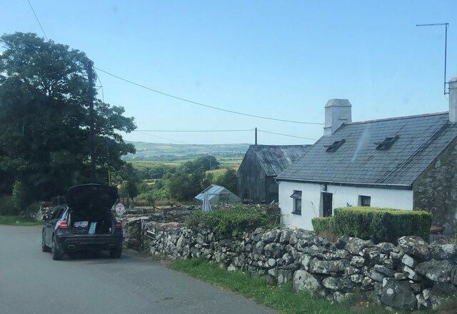
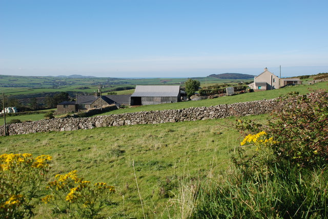
Nant Saethon is a small valley located in Caernarfonshire, Wales. Situated near the town of Caernarfon, the valley is known for its picturesque landscape and stunning views of the surrounding mountains. The valley is dotted with quaint cottages and farmhouses, adding to its charm and rural character.

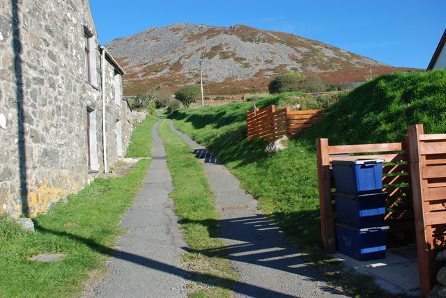
Nant Saethon is home to a variety of wildlife, including red kites, buzzards, and otters, making it a popular destination for nature enthusiasts and birdwatchers. The valley is also crisscrossed by several walking trails, offering visitors the opportunity to explore the area on foot and take in the natural beauty of the Welsh countryside.

The valley is surrounded by lush greenery and rolling hills, providing a peaceful and tranquil setting for those looking to escape the hustle and bustle of city life. The nearby village of Llanberis offers amenities such as shops, restaurants, and accommodation options for visitors to Nant Saethon.

Overall, Nant Saethon is a hidden gem in Caernarfonshire, offering a peaceful retreat for those seeking to reconnect with nature and enjoy the beauty of the Welsh countryside.

If you have any feedback on the listing, please let us know in the comments section below.

Nant Saethon Images

Images are sourced within 2km of 52.872813/-4.5374954 or Grid Reference SH2933. Thanks to Geograph Open Source API. All images are credited.
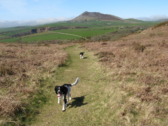
Saethon Bach Cottage north of Mynytho
Saethon Bach
Cottage north of Mynytho
Llwybr i Garn Fadryn - Path to Carn Fadryn
Garnfadryn Looking from the village towards Rhiw and the sea
Garnfadryn
Looking from the village towards Rhiw and the sea
Garnfadryn
Garnfadryn
Capel Garnfadryn Planning has been granted for conversion to a house and art studio, but the work appears to have come to a halt.
Capel Garnfadryn
Planning has been granted for conversion to a house and art studio, but the work appears to have come to a halt.
Ordnance Survey Cut Mark This OS cut mark can be found at the road junction on the NE facing wall. It marks a point 156.101m above mean sea level.
Ordnance Survey Cut Mark
This OS cut mark can be found at the road junction on the NE facing wall. It marks a point 156.101m above mean sea level.
Llwybr Garnfadryn / Path to Garnfadryn Llwybr yn arwain i lawr y waered at bentre Carnfadryn a enwyd ar ol bryn gerllaw. 

A path descending towards Carnfadryn village [trans. Madrun's cairn], named after a nearby hill.
Llwybr Garnfadryn / Path to Garnfadryn
Llwybr yn arwain i lawr y waered at bentre Carnfadryn a enwyd ar ol bryn gerllaw. A path descending towards Carnfadryn village [trans. Madrun's cairn], named after a nearby hill.
Llwybr Caerau Uchaf / Upper Caerau Path Cerddwyr yn dilyn llwybr cyhoeddus tuag at Ffarm Caerau Uchaf.

Walkers following a public footpath towards Caerau Uchaf Farm (trans. upper forts).
Llwybr Caerau Uchaf / Upper Caerau Path
Cerddwyr yn dilyn llwybr cyhoeddus tuag at Ffarm Caerau Uchaf. Walkers following a public footpath towards Caerau Uchaf Farm (trans. upper forts).
Tuag at Garn Bach / Towards Garn Bach Cerddwyr yn dilyn llwybr cyhoeddus tuag at Garn Bach, y bryncyn yn y pellter.

Walkers following a public footpath towards Garn Fach (trans. little rock), the hillock in the distance.
Tuag at Garn Bach / Towards Garn Bach
Cerddwyr yn dilyn llwybr cyhoeddus tuag at Garn Bach, y bryncyn yn y pellter. Walkers following a public footpath towards Garn Fach (trans. little rock), the hillock in the distance.
Copa Garn Bach / Summit of Garn Bach Cerddwyr ar gopa Gran Bach.

Walkers on the summit of Garn Bach (trans. little cairn).
Copa Garn Bach / Summit of Garn Bach
Cerddwyr ar gopa Gran Bach. Walkers on the summit of Garn Bach (trans. little cairn).
Dringo Garn Bach / Ascending Garn Bach Cerddwr yn dringo lan Garn Bach.

A walker ascending Garn Bach (trans. little cairn).
Dringo Garn Bach / Ascending Garn Bach
Cerddwr yn dringo lan Garn Bach. A walker ascending Garn Bach (trans. little cairn).
Modern Milestone by the B4415, Nant Saethon Stone post by the B4415, in parish of Llanengan (Gwynedd District), Nant Saethon, East side of road, North of Inkerman Bridge and West of Carn Saethon hillfort. Modern replica of a Caernarvon chamfered milestone.

Inscription reads:-
.......MLS.
PWLLHELI 6
SARN 5
ABERDARON 11

To be surveyed

Milestone Society National ID: CAE_PWAD06
Modern Milestone by the B4415, Nant Saethon
Stone post by the B4415, in parish of Llanengan (Gwynedd District), Nant Saethon, East side of road, North of Inkerman Bridge and West of Carn Saethon hillfort. Modern replica of a Caernarvon chamfered milestone. Inscription reads:- .......MLS. PWLLHELI 6 SARN 5 ABERDARON 11 To be surveyed Milestone Society National ID: CAE_PWAD06
Footpath and Carn Fadryn A footpath runs in a northwesterly direction over the common, leading down to the unclassified road in the valley. It appears as if another track leads to Nanhoron Quarry <a href="https://www.geograph.org.uk/photo/1857842">SH2832 : Nanhoron Quarry</a> but this is an illusion since another, deep valley intervenes. In the distance the summit of Carn Fadryn looms <a href="https://www.geograph.org.uk/gridref/SH2735">SH2735</a>.
Footpath and Carn Fadryn
A footpath runs in a northwesterly direction over the common, leading down to the unclassified road in the valley. It appears as if another track leads to Nanhoron Quarry SH2832 : Nanhoron Quarry but this is an illusion since another, deep valley intervenes. In the distance the summit of Carn Fadryn looms SH2735.
Former village store, Garnfadryn The section of the house on the right operated as a village stores into the 1990's.
Former village store, Garnfadryn
The section of the house on the right operated as a village stores into the 1990's.
From Garn Bach - a view of Carn Fadryn
Carn Fadrun Fort Stone hut circles and fortifications in the area of the hill fort.
Carn Fadrun Fort
Stone hut circles and fortifications in the area of the hill fort.
Track to Bwlch Groes
Access road for Caerau Uchaf The quite lengthy access road to the farm at Caerau Uchaf leaves a minor road from which the image was recorded. The cloud-shadowed hill in the distance is Moel Caerau.
Access road for Caerau Uchaf
The quite lengthy access road to the farm at Caerau Uchaf leaves a minor road from which the image was recorded. The cloud-shadowed hill in the distance is Moel Caerau.
Show me another place!

Nant Saethon is located at Grid Ref: SH2933 (Lat: 52.872813, Lng: -4.5374954)

Unitary Authority: Gwynedd

Police Authority: North Wales

What 3 Words

///flattery.fulfilled.pint. Near Nefyn, Gwynedd

Related Wikis

Llanfihangel Bachellaeth

Llanfihangel Bachellaeth is a former civil parish in the Welsh county of Gwynedd. It was abolished in 1934, and incorporated into Buan. == References ==
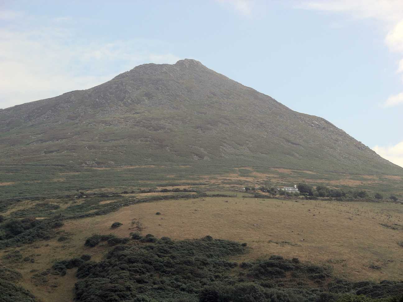
Carn Fadryn

Carn Fadryn, sometimes Carn Fadrun or Garn Fadryn, is a five-hectare Iron Age hillfort and is the name of the mountain on which the fort is situated. It...

Llaniestyn, Gwynedd

Llaniestyn is a village and former civil parish in the Welsh county of Gwynedd. The parish was abolished in 1934, and divided between Tudweiliog and Botwnnog...

Capel Newydd, Nanhoron

Capel Newydd in Nanhoron, near Llanengan, Gwynedd, is probably the oldest surviving Nonconformist chapel in North Wales. The chapel dates from 1770–1772...

Have you been to Nant Saethon?

Leave your review of Nant Saethon below (or comments, questions and feedback).