Coire Sheileach

Valley in Ross-shire

Scotland

Coire Sheileach

OS Trig Point on Meall an Fhuarain, Ross-shire The bracket on top of the Ordnance Survey trig pillar on Meall an Fhuarain (578m, 1896 ft).  Although generally smaller than surrounding peaks, Meall and Fhuarain offers splendid views in all directions.  The dark and rugged peaks in the background are the hills of the Assynt region.
OS Trig Point on Meall an Fhuarain, Ross-shire Credit: Andrew Tryon

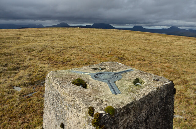
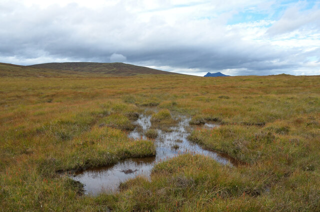
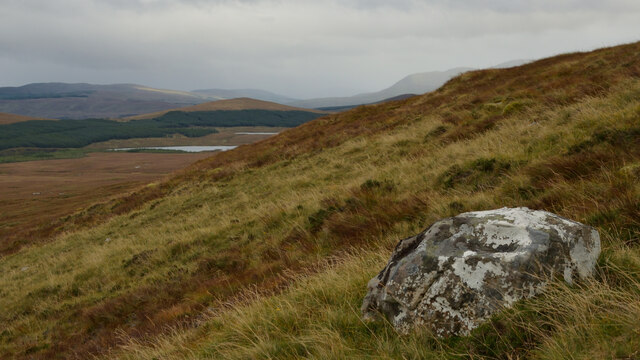
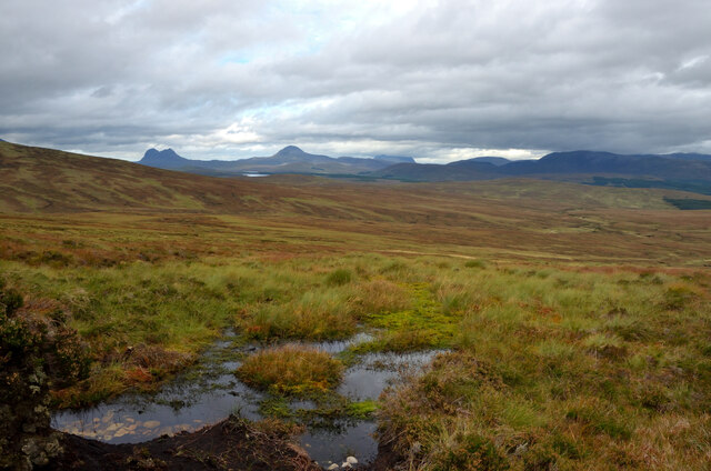
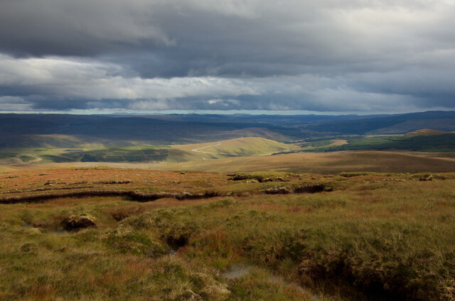
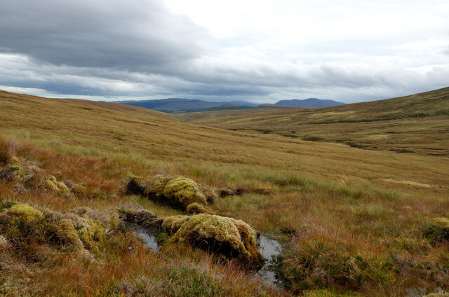
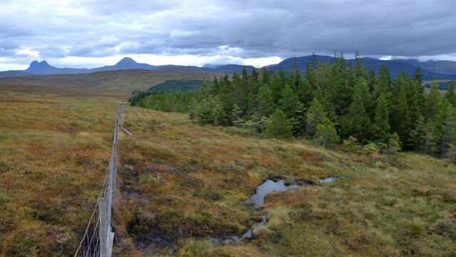
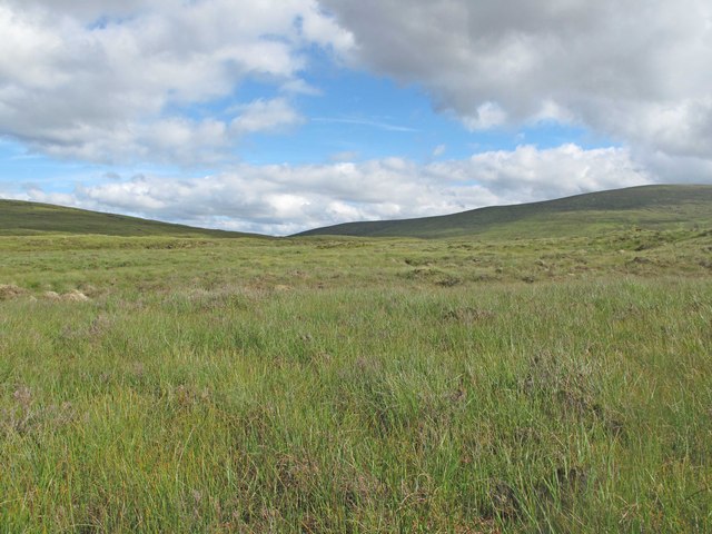
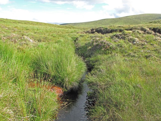
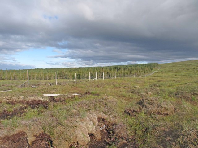
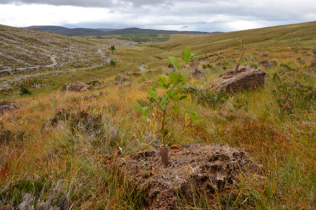
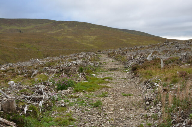
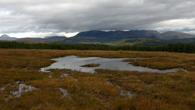
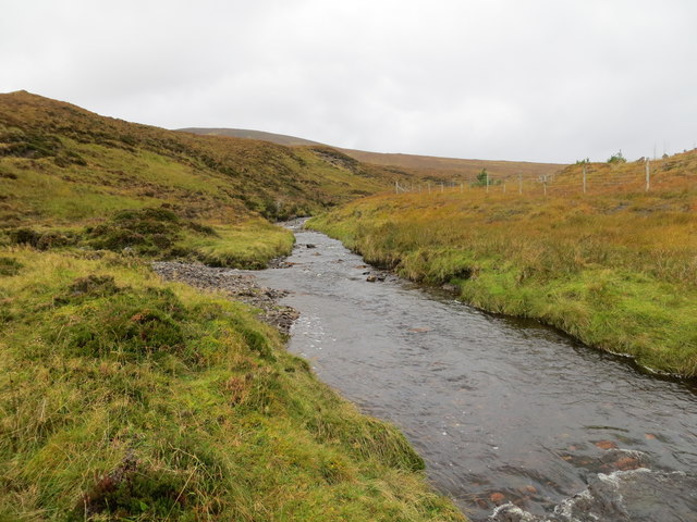
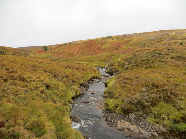
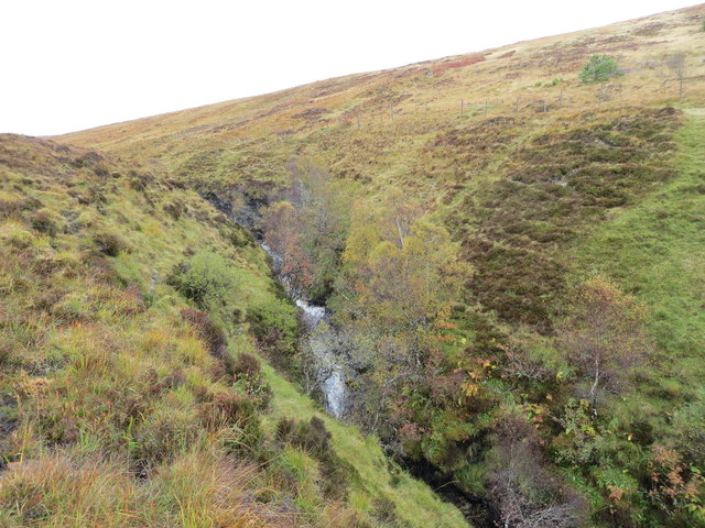
Coire Sheileach is a picturesque valley located in Ross-shire, Scotland. Surrounded by a stunning landscape of rolling hills and lush greenery, the valley is a popular destination for hikers and nature enthusiasts. The valley is home to a diverse range of flora and fauna, with many rare and endangered species making their home in the area.

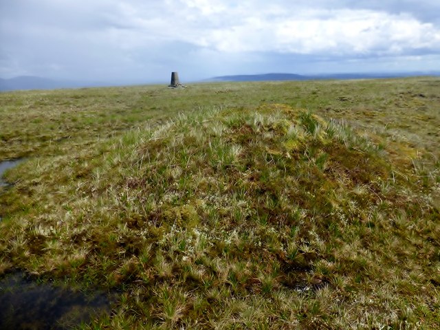
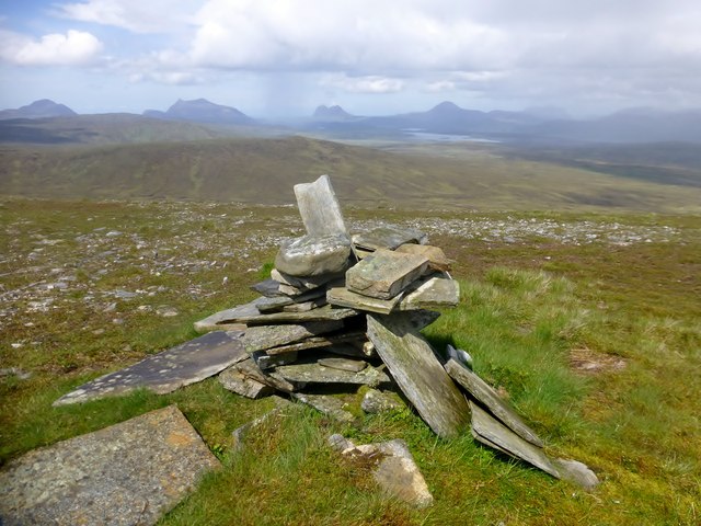
Coire Sheileach is known for its dramatic scenery, with towering cliffs and cascading waterfalls adding to the beauty of the landscape. The valley is also home to a number of ancient ruins and archaeological sites, offering visitors a glimpse into the rich history of the area.

Visitors to Coire Sheileach can enjoy a range of outdoor activities, including hiking, birdwatching, and photography. The valley is also a popular spot for picnicking and camping, with many visitors choosing to spend a night under the stars in this stunning natural setting.

Overall, Coire Sheileach is a hidden gem in the Scottish Highlands, offering visitors a peaceful and serene retreat from the hustle and bustle of everyday life.

If you have any feedback on the listing, please let us know in the comments section below.

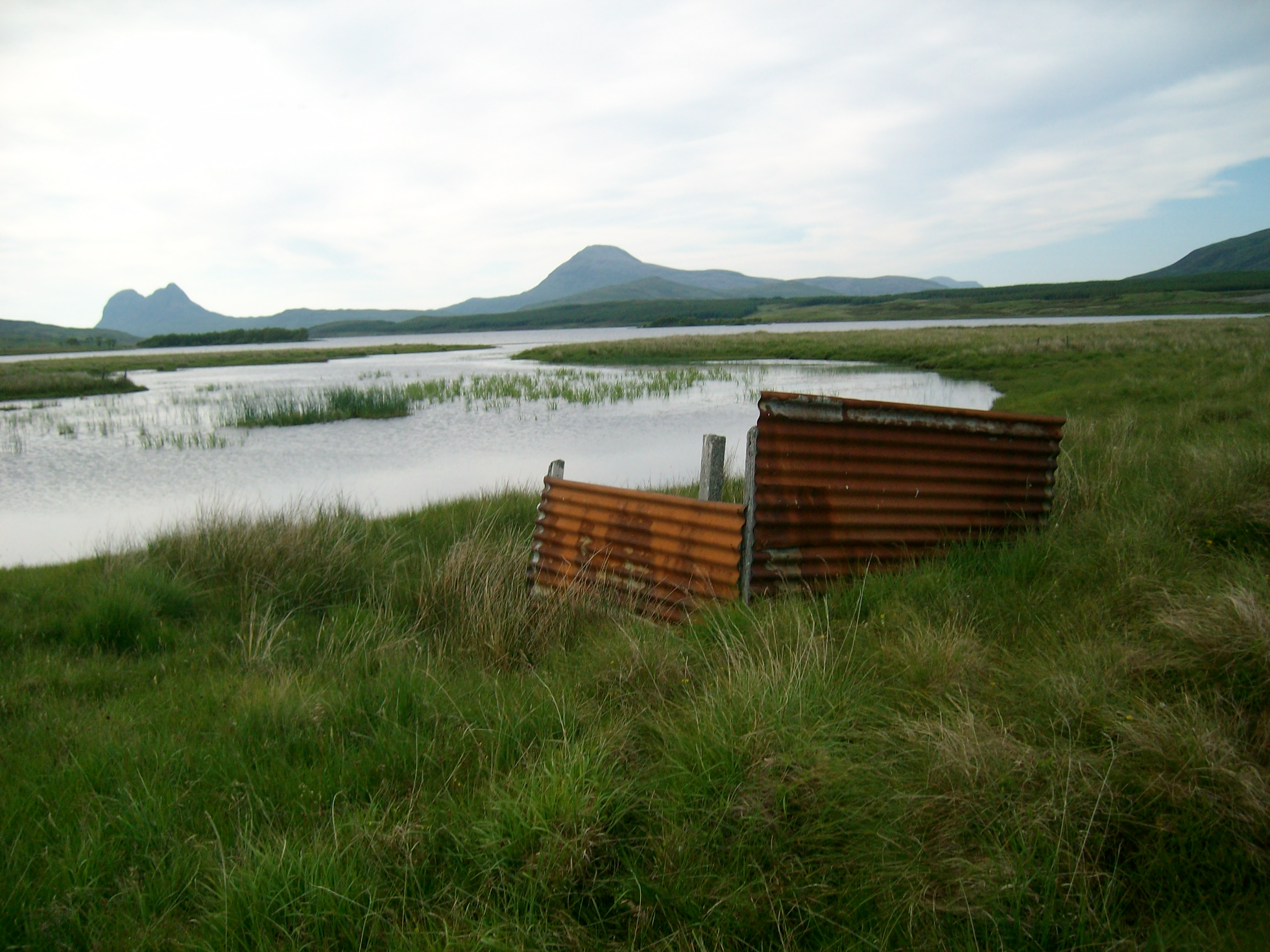
Coire Sheileach Images

Images are sourced within 2km of 57.988828/-4.8880568 or Grid Reference NC2903. Thanks to Geograph Open Source API. All images are credited.

OS Trig Point on Meall an Fhuarain, Ross-shire The bracket on top of the Ordnance Survey trig pillar on Meall an Fhuarain (578m, 1896 ft).  Although generally smaller than surrounding peaks, Meall and Fhuarain offers splendid views in all directions.  The dark and rugged peaks in the background are the hills of the Assynt region.
OS Trig Point on Meall an Fhuarain, Ross-shire
The bracket on top of the Ordnance Survey trig pillar on Meall an Fhuarain (578m, 1896 ft). Although generally smaller than surrounding peaks, Meall and Fhuarain offers splendid views in all directions. The dark and rugged peaks in the background are the hills of the Assynt region.
Boggy Moorland at Corrie Shelleach, Ross-shire In the valley Coire Sheallach between the hills Meallan Odhar and Meall an Fhuarain.
Boggy Moorland at Corrie Shelleach, Ross-shire
In the valley Coire Sheallach between the hills Meallan Odhar and Meall an Fhuarain.
A Boulder on the side of Meall an Fhuarain, Ross-shire Low down on the eastern slopes.
A Boulder on the side of Meall an Fhuarain, Ross-shire
Low down on the eastern slopes.
Boggy Moorland on the Northern Slopes of Meall an Fhuarain, Ross-shire In the background are the distinctive peaks of the Assynt, Suilven and Canisp.
Boggy Moorland on the Northern Slopes of Meall an Fhuarain, Ross-shire
In the background are the distinctive peaks of the Assynt, Suilven and Canisp.
Eastern Slopes of Meall an Fhuarain, Ross-shire Looking east over Strath Oykel.
Eastern Slopes of Meall an Fhuarain, Ross-shire
Looking east over Strath Oykel.
View down Coire Shelleach, Ross-shire The valley between the hills Meall Odhar (left) and Meall an Fhuarain (right).  The watercourse in the valley is Allt Coire Shelleach, which becomes the Garbh Allt, the River Conacher and finally the River Oykel which flows out through the Dornoch Firth on the east coast.
View down Coire Shelleach, Ross-shire
The valley between the hills Meall Odhar (left) and Meall an Fhuarain (right). The watercourse in the valley is Allt Coire Shelleach, which becomes the Garbh Allt, the River Conacher and finally the River Oykel which flows out through the Dornoch Firth on the east coast.
Forest Margin on Meallan Odhar, Ross-shire Balanced precariously on a deer fence, I liked the perspective this gave over the fence and the forest boundary.  The land to the right is Forestry Commission.  The land to the left is open moorland.  In the background are Suilven and Canisp, two of the peaks of the Assynt region.
Forest Margin on Meallan Odhar, Ross-shire
Balanced precariously on a deer fence, I liked the perspective this gave over the fence and the forest boundary. The land to the right is Forestry Commission. The land to the left is open moorland. In the background are Suilven and Canisp, two of the peaks of the Assynt region.
Grassy Moorland Moorland in the Allt Eileag catchment.
Grassy Moorland
Moorland in the Allt Eileag catchment.
Iron-rich Spring An iron-rich spring at the side of a tributary of the Allt a' Chaoruinn.
Iron-rich Spring
An iron-rich spring at the side of a tributary of the Allt a' Chaoruinn.
Forest Edge Peatland at the fence of the Allt Eileag Forest.
Forest Edge
Peatland at the fence of the Allt Eileag Forest.
Mossy Mound Summit Of Meall an Fhuarain Bagged with Tricky Speirs, Alex Cameron and Richard Tibbetts with Martin Richardson finally catching us up when we were half way back to the car. Great views from the top.
Name: Meall an Fhuarain
Hill number: 1080
Height: 578m / 1896ft
Area: 15A: Loch Broom to Strath Oykel
Class: Ma,5H
Grid ref: NC 28054 02365
Summit feature: mossy mound 25m SW of trig point
Drop: 341m
Col: 237m  NC191097
Mossy Mound Summit Of Meall an Fhuarain
Bagged with Tricky Speirs, Alex Cameron and Richard Tibbetts with Martin Richardson finally catching us up when we were half way back to the car. Great views from the top. Name: Meall an Fhuarain Hill number: 1080 Height: 578m / 1896ft Area: 15A: Loch Broom to Strath Oykel Class: Ma,5H Grid ref: NC 28054 02365 Summit feature: mossy mound 25m SW of trig point Drop: 341m Col: 237m NC191097
Cairn On Meall an Fhuarain The cairn on Meall an Fhuarain is a lovely viewpoint for Cul Mor, Suilven and Canisp.
Cairn On Meall an Fhuarain
The cairn on Meall an Fhuarain is a lovely viewpoint for Cul Mor, Suilven and Canisp.
Native Woodland Restoration near Strath Oykel, Ross-shire Newly planted saplings spaced out on a hillside above Strath Oykel, Scottish Highlands.  Unlike the monotonous plantations of previous decades, which consisted of uniform rows of heterogenous trees, the way to restore native woodland is to plant a mixture of species at random spacing.  For each tree a single excavator bucket of the peat soil is dug up and deposited on nearby ground, and the sapling is planted in it.
Native Woodland Restoration near Strath Oykel, Ross-shire
Newly planted saplings spaced out on a hillside above Strath Oykel, Scottish Highlands. Unlike the monotonous plantations of previous decades, which consisted of uniform rows of heterogenous trees, the way to restore native woodland is to plant a mixture of species at random spacing. For each tree a single excavator bucket of the peat soil is dug up and deposited on nearby ground, and the sapling is planted in it.
Cleared Forestry below Meall an Fhuarain, Ross-shire In the background is the eastern slope of Meall an Fhuarain.
Cleared Forestry below Meall an Fhuarain, Ross-shire
In the background is the eastern slope of Meall an Fhuarain.
Moorland Pool on Meall Odhar, Ross-shire A boggy pool of water on the moors above Strath Oykel.  The hills in the background are the peaks of Ben More Assynt, Sutherland.  The valley in between is Glen Oykel.
Moorland Pool on Meall Odhar, Ross-shire
A boggy pool of water on the moors above Strath Oykel. The hills in the background are the peaks of Ben More Assynt, Sutherland. The valley in between is Glen Oykel.
Garbh Allt
Garbh Allt
Garbh Allt and area of clearfell on the right
Waterfall on the Garbh Allt
Show me another place!

Coire Sheileach is located at Grid Ref: NC2903 (Lat: 57.988828, Lng: -4.8880568)

Unitary Authority: Highland

Police Authority: Highlands and Islands

What 3 Words

///stung.daffodils.slanting. Near Inchnadamph, Highland

Nearby Locations

Coire Sheileach

Related Wikis

Lubcroy

Lubcroy is a lodge in Glen Oykel, in Sutherland, Scottish Highlands and is in the Scottish council area of Highland.The A837 road passes through Lubcroy...

Rhidorroch

Rhidorroch (Scottish Gaelic: An Ruigh Dhorcha) is a deer forest east of Ullapool, Ross-shire, Scotland, centred on the extended catchment of the Ullapool...

Loch Borralan

Loch Borralan is a freshwater loch in the Assynt District of Sutherland in the Highland Council Area, northern Scotland.It is located adjacent to the A837...

Loch Urigill

Loch Urigill is a freshwater loch near Elphin at the southern tip of the Assynt District in north-west Sutherland, Scotland.It's 2 miles from Elphin and...

Have you been to Coire Sheileach?

Leave your review of Coire Sheileach below (or comments, questions and feedback).