Valley of the Rocks

Valley in Anglesey

Wales

Valley of the Rocks

Porth Dafarch Caravan Park The Anglesey Coastal Path (formally the Isle of Anglesey Coastal Path) is a 200-kilometre (124 mi) long-distance footpath around the island of Anglesey in North Wales. The route is part of the Wales Coast Path. The path logo is a flying tern. <a href="https://www.geograph.org.uk/photo/4380990">SH5186 : Anglesey Coastal Path Logo</a>
Wikipedia: <span class="nowrap"><a title="http://en.wikipedia.org/wiki/Anglesey_Coastal_Path" rel="nofollow ugc noopener" href="http://en.wikipedia.org/wiki/Anglesey_Coastal_Path">Link</a><img style="margin-left:2px;" alt="External link" title="External link - shift click to open in new window" src="https://s1.geograph.org.uk/img/external.png" width="10" height="10"/></span>
Porth Dafarch Caravan Park Credit: Mat Fascione

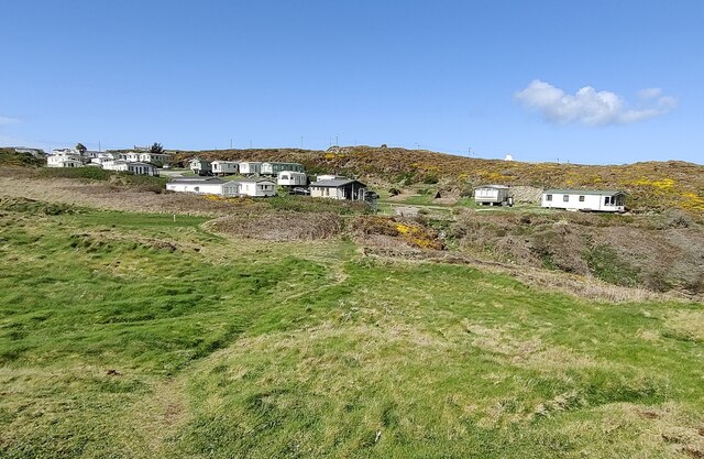
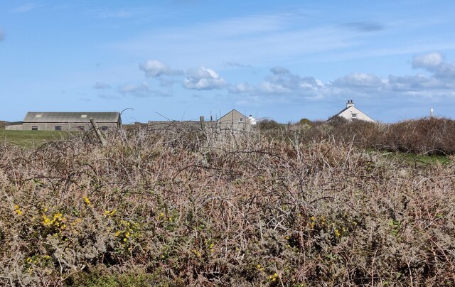
Valley of the Rocks is a scenic and picturesque natural attraction located in Anglesey, an island in Northwest Wales. Situated on the northwest coast of the island, the valley is renowned for its stunning beauty and dramatic landscape.

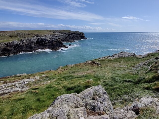
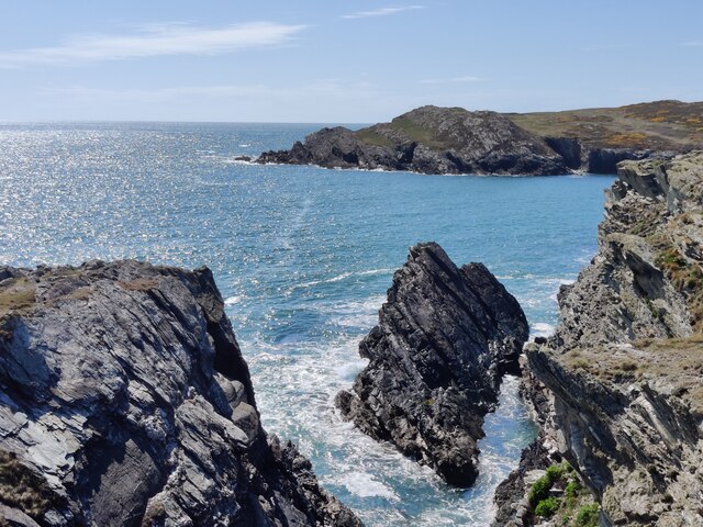
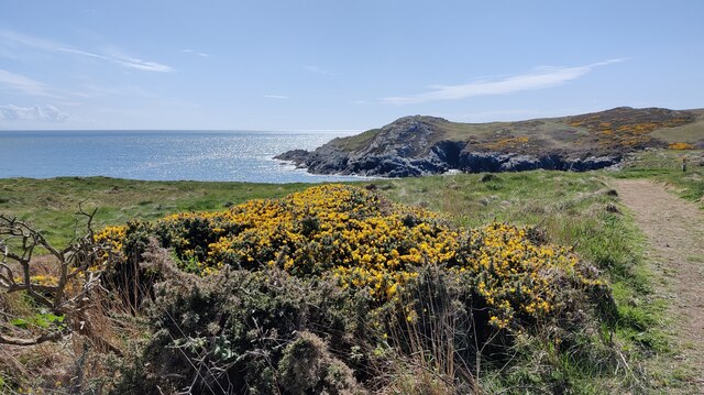
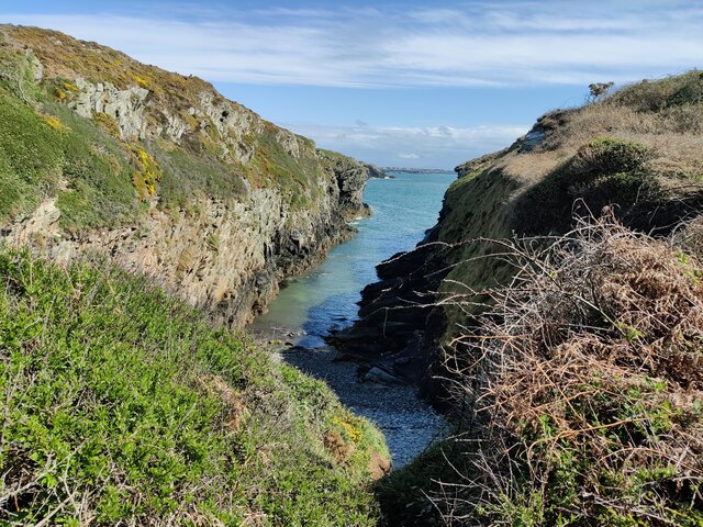
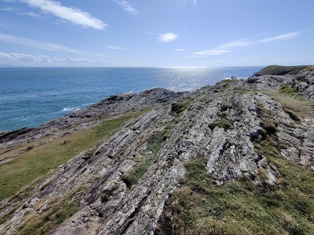
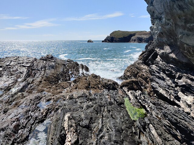
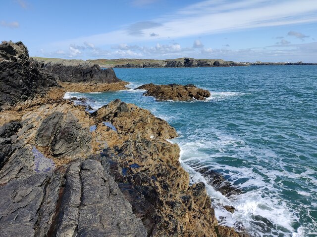
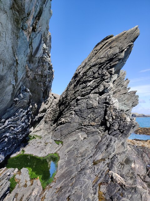
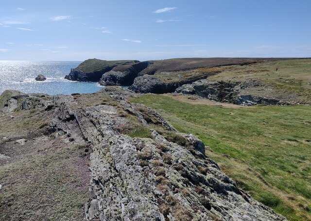
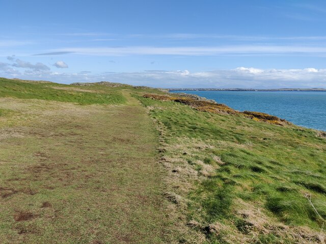
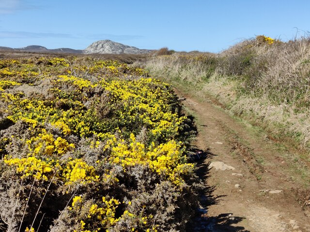
The Valley of the Rocks is characterized by towering cliffs, rugged rock formations, and a rugged coastline that stretches for approximately 2 miles (3.2 kilometers). The valley gets its name from the unique geological formations formed by the erosion of the cliffs over thousands of years. The rocks stand tall and proud, creating an awe-inspiring sight for visitors.

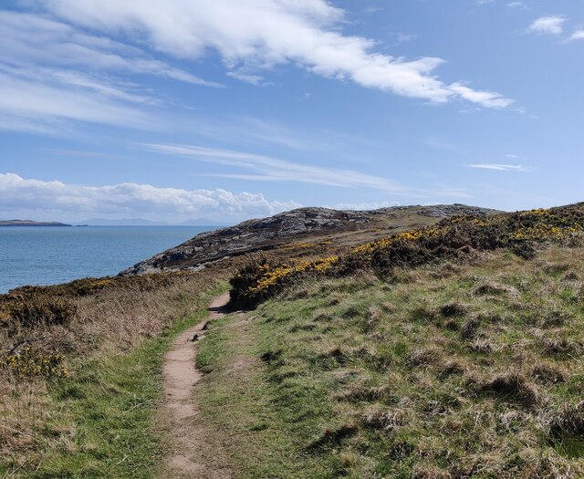
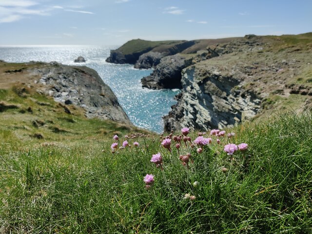
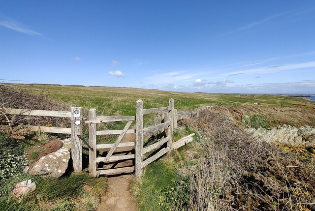
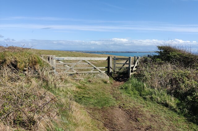
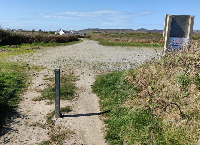
The valley is a popular destination for hikers, nature lovers, and photographers due to its breathtaking views and abundant wildlife. Visitors can enjoy a leisurely walk along the coastal path, taking in the stunning vistas of the Irish Sea and the surrounding countryside. The area is teeming with various species of birds, including puffins, razorbills, and guillemots, making it a haven for birdwatchers.

In addition to its natural beauty, Valley of the Rocks also holds historical significance. The remnants of an Iron Age fort can be found on the cliffs, adding an element of intrigue to the site. The valley is also home to a charming tearoom where visitors can enjoy a cup of tea and indulge in homemade cakes while admiring the panoramic views.

Overall, Valley of the Rocks in Anglesey is a must-visit destination for those seeking stunning natural scenery, wildlife encounters, and a touch of history.

If you have any feedback on the listing, please let us know in the comments section below.

Valley of the Rocks Images

Images are sourced within 2km of 53.292696/-4.644277 or Grid Reference SH2380. Thanks to Geograph Open Source API. All images are credited.

Porth Dafarch Caravan Park The Anglesey Coastal Path (formally the Isle of Anglesey Coastal Path) is a 200-kilometre (124 mi) long-distance footpath around the island of Anglesey in North Wales. The route is part of the Wales Coast Path. The path logo is a flying tern. <a href="https://www.geograph.org.uk/photo/4380990">SH5186 : Anglesey Coastal Path Logo</a>
Wikipedia: <span class="nowrap"><a title="http://en.wikipedia.org/wiki/Anglesey_Coastal_Path" rel="nofollow ugc noopener" href="http://en.wikipedia.org/wiki/Anglesey_Coastal_Path">Link</a><img style="margin-left:2px;" alt="External link" title="External link - shift click to open in new window" src="https://s1.geograph.org.uk/img/external.png" width="10" height="10"/></span>
Porth Dafarch Caravan Park
The Anglesey Coastal Path (formally the Isle of Anglesey Coastal Path) is a 200-kilometre (124 mi) long-distance footpath around the island of Anglesey in North Wales. The route is part of the Wales Coast Path. The path logo is a flying tern. SH5186 : Anglesey Coastal Path Logo Wikipedia: LinkExternal link
Porth Dafarch on the Holy Island coast
Ogof Iron near Porth Dafarch
Anglesey Coast Path near Graig Lŵyd The Anglesey Coastal Path (formally the Isle of Anglesey Coastal Path) is a 200-kilometre (124 mi) long-distance footpath around the island of Anglesey in North Wales. The route is part of the Wales Coast Path. The path logo is a flying tern. <a href="https://www.geograph.org.uk/photo/4380990">SH5186 : Anglesey Coastal Path Logo</a>
Wikipedia: <span class="nowrap"><a title="http://en.wikipedia.org/wiki/Anglesey_Coastal_Path" rel="nofollow ugc noopener" href="http://en.wikipedia.org/wiki/Anglesey_Coastal_Path">Link</a><img style="margin-left:2px;" alt="External link" title="External link - shift click to open in new window" src="https://s1.geograph.org.uk/img/external.png" width="10" height="10"/></span>
Anglesey Coast Path near Graig Lŵyd
The Anglesey Coastal Path (formally the Isle of Anglesey Coastal Path) is a 200-kilometre (124 mi) long-distance footpath around the island of Anglesey in North Wales. The route is part of the Wales Coast Path. The path logo is a flying tern. SH5186 : Anglesey Coastal Path Logo Wikipedia: LinkExternal link
Rocky shoreline near Porth Dafarch
Anglesey Coastal Path at Graig Lŵyd The Anglesey Coastal Path (formally the Isle of Anglesey Coastal Path) is a 200-kilometre (124 mi) long-distance footpath around the island of Anglesey in North Wales. The route is part of the Wales Coast Path. The path logo is a flying tern. <a href="https://www.geograph.org.uk/photo/4380990">SH5186 : Anglesey Coastal Path Logo</a>
Wikipedia: <span class="nowrap"><a title="http://en.wikipedia.org/wiki/Anglesey_Coastal_Path" rel="nofollow ugc noopener" href="http://en.wikipedia.org/wiki/Anglesey_Coastal_Path">Link</a><img style="margin-left:2px;" alt="External link" title="External link - shift click to open in new window" src="https://s1.geograph.org.uk/img/external.png" width="10" height="10"/></span>
Anglesey Coastal Path at Graig Lŵyd
The Anglesey Coastal Path (formally the Isle of Anglesey Coastal Path) is a 200-kilometre (124 mi) long-distance footpath around the island of Anglesey in North Wales. The route is part of the Wales Coast Path. The path logo is a flying tern. SH5186 : Anglesey Coastal Path Logo Wikipedia: LinkExternal link
Coastline at Graig Lŵyd
Rocks at Graig Lŵyd Also known as 'Mackerel Rock', a very popular spot for fishing.
Rocks at Graig Lŵyd
Also known as 'Mackerel Rock', a very popular spot for fishing.
Rocks at Graig Lŵyd Also known as 'Mackerel Rock', a very popular spot for fishing.
Rocks at Graig Lŵyd
Also known as 'Mackerel Rock', a very popular spot for fishing.
Rock formations at Graig Lŵyd
Coastline at Graig Lŵyd
Thrift at Graig Lŵyd
Anglesey Coast Path towards Graig Lŵyd The Anglesey Coastal Path (formally the Isle of Anglesey Coastal Path) is a 200-kilometre (124 mi) long-distance footpath around the island of Anglesey in North Wales. The route is part of the Wales Coast Path. The path logo is a flying tern. <a href="https://www.geograph.org.uk/photo/4380990">SH5186 : Anglesey Coastal Path Logo</a>
Wikipedia: <span class="nowrap"><a title="http://en.wikipedia.org/wiki/Anglesey_Coastal_Path" rel="nofollow ugc noopener" href="http://en.wikipedia.org/wiki/Anglesey_Coastal_Path">Link</a><img style="margin-left:2px;" alt="External link" title="External link - shift click to open in new window" src="https://s1.geograph.org.uk/img/external.png" width="10" height="10"/></span>
Anglesey Coast Path towards Graig Lŵyd
The Anglesey Coastal Path (formally the Isle of Anglesey Coastal Path) is a 200-kilometre (124 mi) long-distance footpath around the island of Anglesey in North Wales. The route is part of the Wales Coast Path. The path logo is a flying tern. SH5186 : Anglesey Coastal Path Logo Wikipedia: LinkExternal link
Gate along the Anglesey Coast Path The Anglesey Coastal Path (formally the Isle of Anglesey Coastal Path) is a 200-kilometre (124 mi) long-distance footpath around the island of Anglesey in North Wales. The route is part of the Wales Coast Path. The path logo is a flying tern. <a href="https://www.geograph.org.uk/photo/4380990">SH5186 : Anglesey Coastal Path Logo</a>
Wikipedia: <span class="nowrap"><a title="http://en.wikipedia.org/wiki/Anglesey_Coastal_Path" rel="nofollow ugc noopener" href="http://en.wikipedia.org/wiki/Anglesey_Coastal_Path">Link</a><img style="margin-left:2px;" alt="External link" title="External link - shift click to open in new window" src="https://s1.geograph.org.uk/img/external.png" width="10" height="10"/></span>
Gate along the Anglesey Coast Path
The Anglesey Coastal Path (formally the Isle of Anglesey Coastal Path) is a 200-kilometre (124 mi) long-distance footpath around the island of Anglesey in North Wales. The route is part of the Wales Coast Path. The path logo is a flying tern. SH5186 : Anglesey Coastal Path Logo Wikipedia: LinkExternal link
Gorse bushes and path at Clybyddiad Holyhead Mountain in the distance.
Gorse bushes and path at Clybyddiad
Holyhead Mountain in the distance.
Gate and path to Graig Lŵyd
Gof-du on Holy Island
Small parking area This small car park is used by anglers visiting the nearby 'Mackerel Rock'.
<a href="https://www.geograph.org.uk/photo/7159788">SH2279 : Rocks at Graig Lŵyd</a>
<a href="https://www.geograph.org.uk/photo/7159793">SH2279 : Rocks at Graig Lŵyd</a>
Small parking area
This small car park is used by anglers visiting the nearby 'Mackerel Rock'. SH2279 : Rocks at Graig Lŵyd SH2279 : Rocks at Graig Lŵyd
Show me another place!

Valley of the Rocks is located at Grid Ref: SH2380 (Lat: 53.292696, Lng: -4.644277)

Unitary Authority: Isle of Anglesey

Police Authority: North Wales

What 3 Words

///wanted.suiting.food. Near Holyhead, Isle of Anglesey

Related Wikis

Holyhead Hotspur F.C.

Holyhead Hotspur Football Club (Welsh: Clwb Pêl-droed Hotspur Caergybi) is a football club based in Holyhead, Anglesey. They currently play in the Ardal...

Holyhead Golf Club

Holyhead Golf Club is a golf course to the southeast of Holyhead, in Anglesey, northwestern Wales. It is a 6090-yard par-71 course, which was originally...

Porth Dafarch

Porth Dafarch is a small bay on the west coast of Anglesey in North Wales. The inlet is on the west side of Holy Island, Anglesey about 2 mi (3.2 km) southwest...

Penrhos Feilw Standing Stones

The Penrhos Feilw Standing Stones are a pair of standing stones on Holy Island west of Anglesey in north-west Wales. They are thought to date from the...

Nearby Amenities

Located within 500m of 53.292696,-4.644277
Turning Circle
Lat/Long: 53.2924074/-4.6427471
Direction: 165
Generator Method: photovoltaic
Generator Output Electricity: yes
Generator Solar Modules: 16
Generator Source: solar
Generator Type: solar_photovoltaic_panel
Location: roof
Power: generator
Lat/Long: 53.2903475/-4.6412127
The data included in this document is from www.openstreetmap.org. The data is made available under ODbL.

Have you been to Valley of the Rocks?

Leave your review of Valley of the Rocks below (or comments, questions and feedback).