Trearddur

Community in Anglesey

Wales

Trearddur

Towyn y Capel Beach, Trearddur Bay
Towyn y Capel Beach, Trearddur Bay Credit: David Dixon

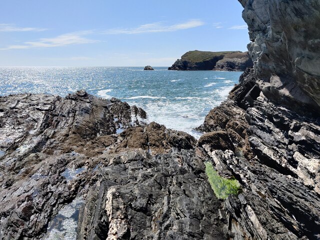
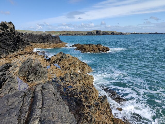
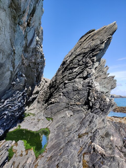
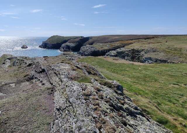
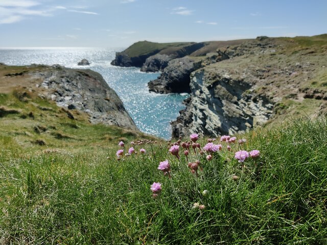
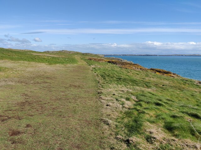
Trearddur is a small coastal community located on the west coast of the Isle of Anglesey, in North Wales. It is situated approximately two miles south of Holyhead, the largest town on the island. The community covers an area of about 2.5 square miles and is known for its stunning beaches and natural beauty.

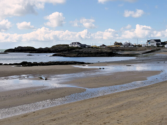
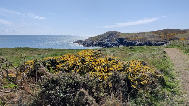
Trearddur is a popular destination for tourists, particularly during the summer months, due to its sandy beaches and clear blue waters. The main beach, Trearddur Bay, offers a range of water sports activities such as sailing, windsurfing, and kayaking. The beach is also popular for swimming and sunbathing.

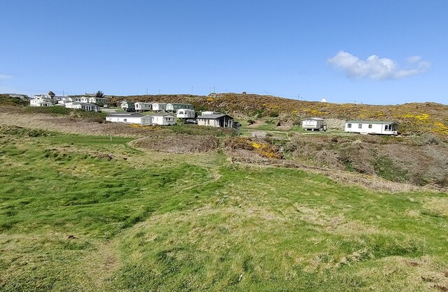
The community itself is home to a small population, with a mix of permanent residents and holiday homes. There are a few local amenities, including a small supermarket, a post office, and a handful of restaurants and cafes. The nearby town of Holyhead provides additional services and facilities, including a wider range of shops, schools, and healthcare facilities.

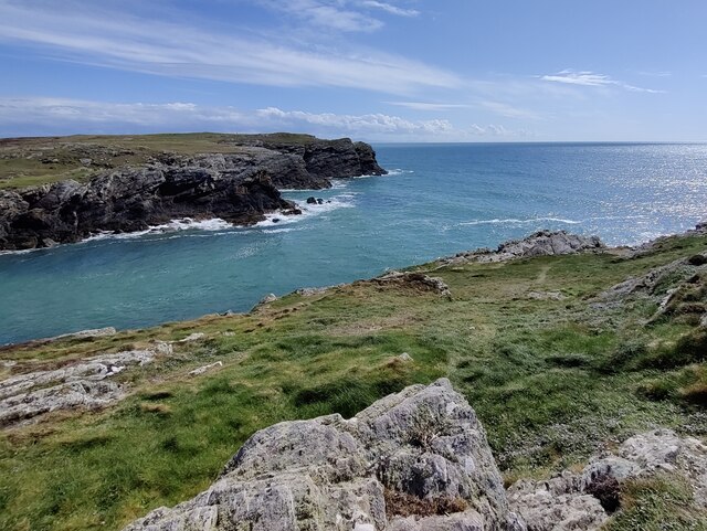
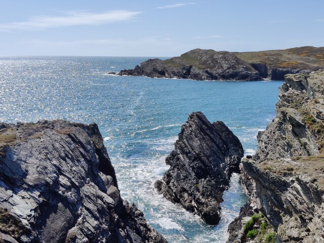
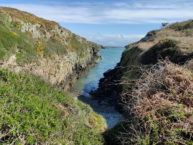
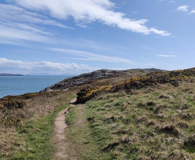
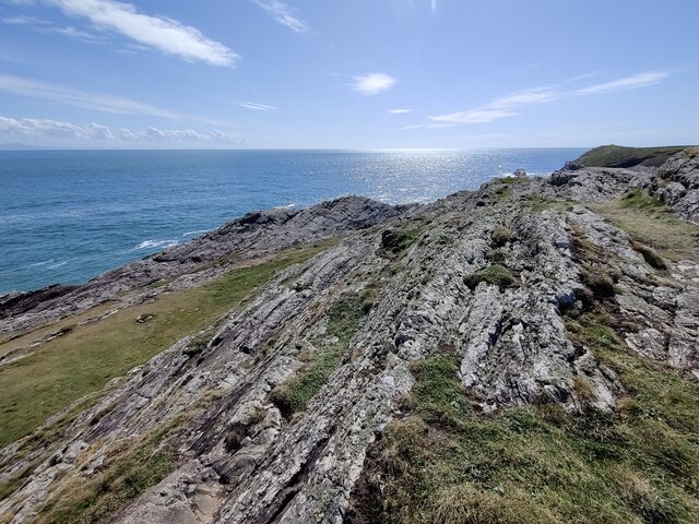
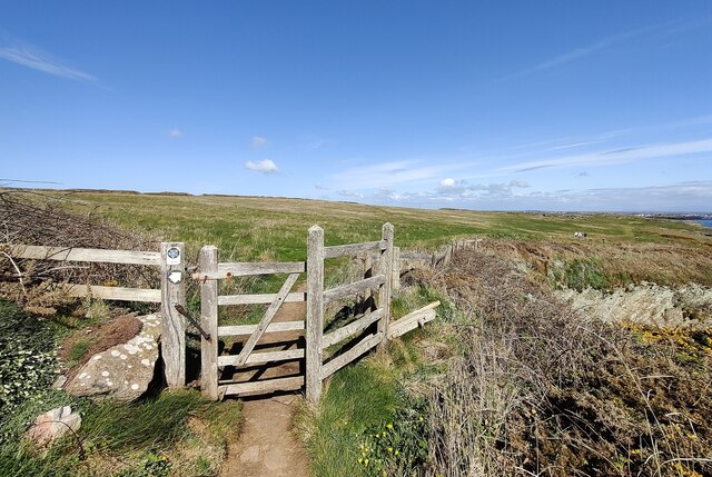
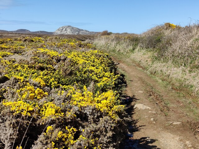
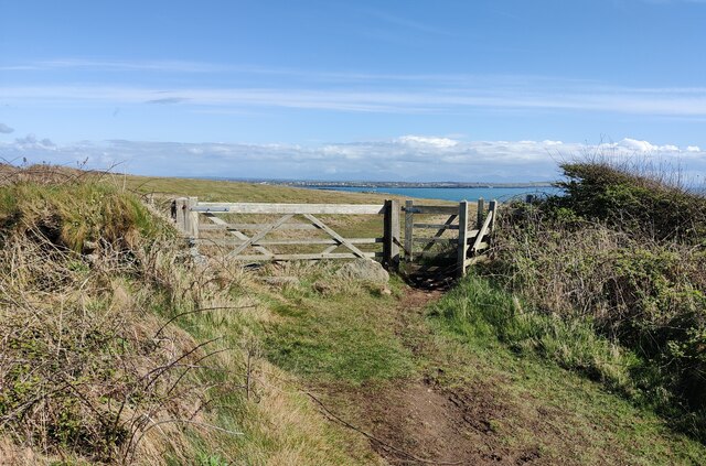
Trearddur is also known for its scenic coastal walks, with stunning views of the surrounding coastline and nearby Holyhead Mountain. The area is rich in wildlife, and visitors may spot seals, dolphins, and a variety of bird species.

Overall, Trearddur offers a peaceful and picturesque setting, making it an ideal destination for those seeking a coastal retreat or outdoor activities in a beautiful natural environment.

If you have any feedback on the listing, please let us know in the comments section below.

Trearddur Images

Images are sourced within 2km of 53.290705/-4.64216 or Grid Reference SH2380. Thanks to Geograph Open Source API. All images are credited.

Towyn y Capel Beach, Trearddur Bay
Trearddur Bay IRB Station RNLI station at Trearddur Bay.
Trearddur Bay IRB Station
RNLI station at Trearddur Bay.
Porth Dafarch Caravan Park The Anglesey Coastal Path (formally the Isle of Anglesey Coastal Path) is a 200-kilometre (124 mi) long-distance footpath around the island of Anglesey in North Wales. The route is part of the Wales Coast Path. The path logo is a flying tern. <a href="https://www.geograph.org.uk/photo/4380990">SH5186 : Anglesey Coastal Path Logo</a>
Wikipedia: <span class="nowrap"><a title="http://en.wikipedia.org/wiki/Anglesey_Coastal_Path" rel="nofollow ugc noopener" href="http://en.wikipedia.org/wiki/Anglesey_Coastal_Path">Link</a><img style="margin-left:2px;" alt="External link" title="External link - shift click to open in new window" src="https://s1.geograph.org.uk/img/external.png" width="10" height="10"/></span>
Porth Dafarch Caravan Park
The Anglesey Coastal Path (formally the Isle of Anglesey Coastal Path) is a 200-kilometre (124 mi) long-distance footpath around the island of Anglesey in North Wales. The route is part of the Wales Coast Path. The path logo is a flying tern. SH5186 : Anglesey Coastal Path Logo Wikipedia: LinkExternal link
Porth Dafarch on the Holy Island coast
Ogof Iron near Porth Dafarch
Anglesey Coast Path near Graig Lŵyd The Anglesey Coastal Path (formally the Isle of Anglesey Coastal Path) is a 200-kilometre (124 mi) long-distance footpath around the island of Anglesey in North Wales. The route is part of the Wales Coast Path. The path logo is a flying tern. <a href="https://www.geograph.org.uk/photo/4380990">SH5186 : Anglesey Coastal Path Logo</a>
Wikipedia: <span class="nowrap"><a title="http://en.wikipedia.org/wiki/Anglesey_Coastal_Path" rel="nofollow ugc noopener" href="http://en.wikipedia.org/wiki/Anglesey_Coastal_Path">Link</a><img style="margin-left:2px;" alt="External link" title="External link - shift click to open in new window" src="https://s1.geograph.org.uk/img/external.png" width="10" height="10"/></span>
Anglesey Coast Path near Graig Lŵyd
The Anglesey Coastal Path (formally the Isle of Anglesey Coastal Path) is a 200-kilometre (124 mi) long-distance footpath around the island of Anglesey in North Wales. The route is part of the Wales Coast Path. The path logo is a flying tern. SH5186 : Anglesey Coastal Path Logo Wikipedia: LinkExternal link
Rocky shoreline near Porth Dafarch
Anglesey Coastal Path at Graig Lŵyd The Anglesey Coastal Path (formally the Isle of Anglesey Coastal Path) is a 200-kilometre (124 mi) long-distance footpath around the island of Anglesey in North Wales. The route is part of the Wales Coast Path. The path logo is a flying tern. <a href="https://www.geograph.org.uk/photo/4380990">SH5186 : Anglesey Coastal Path Logo</a>
Wikipedia: <span class="nowrap"><a title="http://en.wikipedia.org/wiki/Anglesey_Coastal_Path" rel="nofollow ugc noopener" href="http://en.wikipedia.org/wiki/Anglesey_Coastal_Path">Link</a><img style="margin-left:2px;" alt="External link" title="External link - shift click to open in new window" src="https://s1.geograph.org.uk/img/external.png" width="10" height="10"/></span>
Anglesey Coastal Path at Graig Lŵyd
The Anglesey Coastal Path (formally the Isle of Anglesey Coastal Path) is a 200-kilometre (124 mi) long-distance footpath around the island of Anglesey in North Wales. The route is part of the Wales Coast Path. The path logo is a flying tern. SH5186 : Anglesey Coastal Path Logo Wikipedia: LinkExternal link
Coastline at Graig Lŵyd
Rocks at Graig Lŵyd Also known as 'Mackerel Rock', a very popular spot for fishing.
Rocks at Graig Lŵyd
Also known as 'Mackerel Rock', a very popular spot for fishing.
Rocks at Graig Lŵyd Also known as 'Mackerel Rock', a very popular spot for fishing.
Rocks at Graig Lŵyd
Also known as 'Mackerel Rock', a very popular spot for fishing.
Rock formations at Graig Lŵyd
Coastline at Graig Lŵyd
Thrift at Graig Lŵyd
Anglesey Coast Path towards Graig Lŵyd The Anglesey Coastal Path (formally the Isle of Anglesey Coastal Path) is a 200-kilometre (124 mi) long-distance footpath around the island of Anglesey in North Wales. The route is part of the Wales Coast Path. The path logo is a flying tern. <a href="https://www.geograph.org.uk/photo/4380990">SH5186 : Anglesey Coastal Path Logo</a>
Wikipedia: <span class="nowrap"><a title="http://en.wikipedia.org/wiki/Anglesey_Coastal_Path" rel="nofollow ugc noopener" href="http://en.wikipedia.org/wiki/Anglesey_Coastal_Path">Link</a><img style="margin-left:2px;" alt="External link" title="External link - shift click to open in new window" src="https://s1.geograph.org.uk/img/external.png" width="10" height="10"/></span>
Anglesey Coast Path towards Graig Lŵyd
The Anglesey Coastal Path (formally the Isle of Anglesey Coastal Path) is a 200-kilometre (124 mi) long-distance footpath around the island of Anglesey in North Wales. The route is part of the Wales Coast Path. The path logo is a flying tern. SH5186 : Anglesey Coastal Path Logo Wikipedia: LinkExternal link
Gate along the Anglesey Coast Path The Anglesey Coastal Path (formally the Isle of Anglesey Coastal Path) is a 200-kilometre (124 mi) long-distance footpath around the island of Anglesey in North Wales. The route is part of the Wales Coast Path. The path logo is a flying tern. <a href="https://www.geograph.org.uk/photo/4380990">SH5186 : Anglesey Coastal Path Logo</a>
Wikipedia: <span class="nowrap"><a title="http://en.wikipedia.org/wiki/Anglesey_Coastal_Path" rel="nofollow ugc noopener" href="http://en.wikipedia.org/wiki/Anglesey_Coastal_Path">Link</a><img style="margin-left:2px;" alt="External link" title="External link - shift click to open in new window" src="https://s1.geograph.org.uk/img/external.png" width="10" height="10"/></span>
Gate along the Anglesey Coast Path
The Anglesey Coastal Path (formally the Isle of Anglesey Coastal Path) is a 200-kilometre (124 mi) long-distance footpath around the island of Anglesey in North Wales. The route is part of the Wales Coast Path. The path logo is a flying tern. SH5186 : Anglesey Coastal Path Logo Wikipedia: LinkExternal link
Gorse bushes and path at Clybyddiad Holyhead Mountain in the distance.
Gorse bushes and path at Clybyddiad
Holyhead Mountain in the distance.
Gate and path to Graig Lŵyd
Show me another place!

Trearddur is located at Grid Ref: SH2380 (Lat: 53.290705, Lng: -4.64216)

Unitary Authority: Isle of Anglesey

Police Authority: North Wales

What 3 Words

///sunflower.additives.talent. Near Holyhead, Isle of Anglesey

Related Wikis

Holyhead Golf Club

Holyhead Golf Club is a golf course to the southeast of Holyhead, in Anglesey, northwestern Wales. It is a 6090-yard par-71 course, which was originally...

Porth Dafarch

Porth Dafarch is a small bay on the west coast of Anglesey in North Wales. The inlet is on the west side of Holy Island, Anglesey about 2 mi (3.2 km) southwest...

Holyhead Hotspur F.C.

Holyhead Hotspur Football Club (Welsh: Clwb PĂȘl-droed Hotspur Caergybi) is a football club based in Holyhead, Anglesey. They currently play in the Ardal...

Isallt Bach

Isallt Bach is a hamlet in the community of Trearddur, Anglesey, Wales, which is 138.7 miles (223.3 km) from Cardiff and 225.8 miles (363.4 km) from London...

Nearby Amenities

Located within 500m of 53.290705,-4.64216
Turning Circle
Lat/Long: 53.2924074/-4.6427471
Power: pole
Lat/Long: 53.2862879/-4.6412885
Power: pole
Lat/Long: 53.2867738/-4.6439146
Power: pole
Lat/Long: 53.2875061/-4.6444906
Power: pole
Lat/Long: 53.2882227/-4.6452244
Direction: 165
Generator Method: photovoltaic
Generator Output Electricity: yes
Generator Solar Modules: 16
Generator Source: solar
Generator Type: solar_photovoltaic_panel
Location: roof
Power: generator
Lat/Long: 53.2903475/-4.6412127
The data included in this document is from www.openstreetmap.org. The data is made available under ODbL.

Have you been to Trearddur?

Leave your review of Trearddur below (or comments, questions and feedback).