Barnsole

Settlement in Kent Dover

England

Barnsole

Flemings Water Supply Works, Fleming Road Planning permission has been granted by Dover District Council under application number DOV/21/01544 for the “change of use of land and erection of an ion exchange building, chemical dosing, changeover and wash-water kiosks, alterations to site access, bunds and associated plant and equipment”.
Flemings Water Supply Works, Fleming Road Credit: John Baker

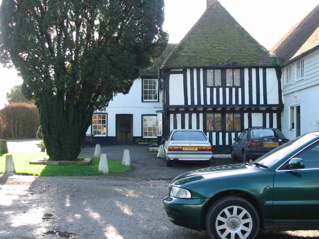
Barnsole is a small village located in the county of Kent, England. Situated on the outskirts of the town of Gillingham, Barnsole is surrounded by picturesque countryside, offering residents and visitors a tranquil and scenic setting.

Historically, Barnsole was primarily an agricultural village, with farming being the main occupation of its inhabitants. Over the years, the village has seen some development, but it has managed to maintain its rural charm and character. The village is known for its quaint cottages, some of which date back several centuries, adding to its traditional appeal.

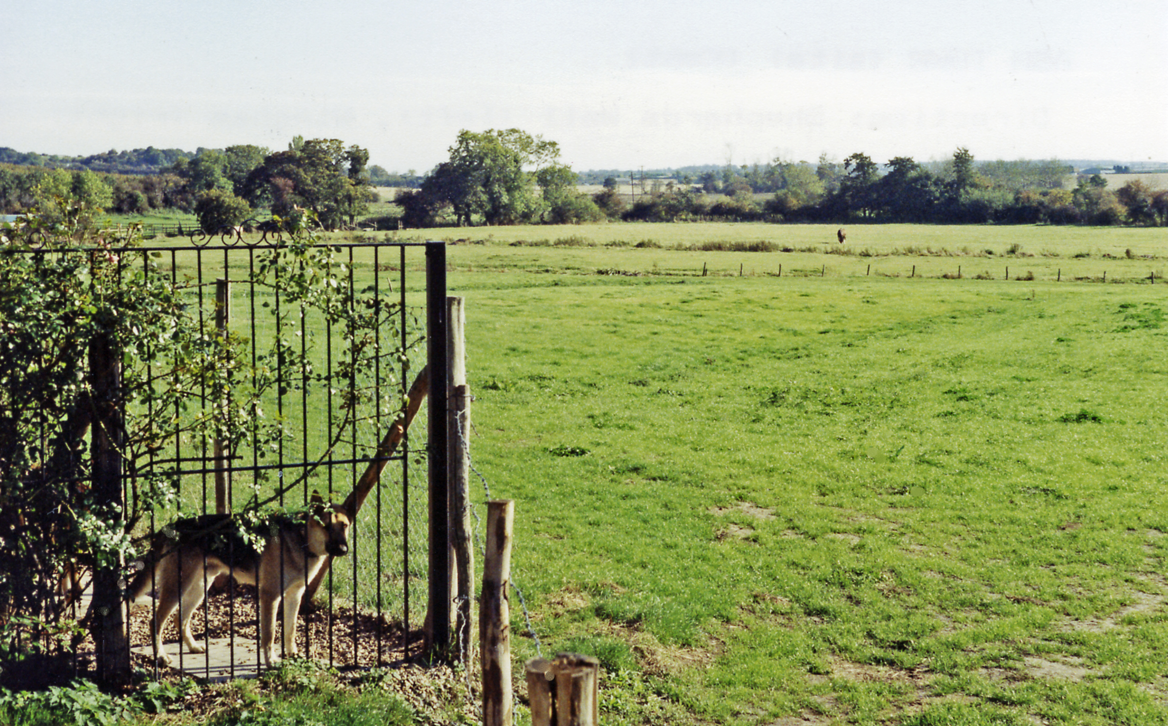
Despite its small size, Barnsole has a close-knit community, with a friendly and welcoming atmosphere. The village is home to a local pub, serving as a social hub for residents, as well as a place for visitors to experience the authentic village life. The surrounding countryside offers ample opportunities for outdoor activities such as walking, cycling, and horse riding.

Barnsole benefits from its proximity to Gillingham, which provides residents with access to a wider range of amenities and services. The town offers a variety of shops, supermarkets, restaurants, and leisure facilities, ensuring that residents have everything they need within reach.

Overall, Barnsole is a peaceful and idyllic village that provides a charming escape from the hustle and bustle of nearby towns. Its rural setting, friendly community, and convenient location make it an attractive place to live or visit for those seeking a slower pace of life in the beautiful Kent countryside.

If you have any feedback on the listing, please let us know in the comments section below.
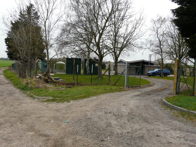
Barnsole Images

Images are sourced within 2km of 51.262513/1.266697 or Grid Reference TR2856. Thanks to Geograph Open Source API. All images are credited.

Flemings Water Supply Works, Fleming Road Planning permission has been granted by Dover District Council under application number DOV/21/01544 for the “change of use of land and erection of an ion exchange building, chemical dosing, changeover and wash-water kiosks, alterations to site access, bunds and associated plant and equipment”.
Flemings Water Supply Works, Fleming Road
Planning permission has been granted by Dover District Council under application number DOV/21/01544 for the “change of use of land and erection of an ion exchange building, chemical dosing, changeover and wash-water kiosks, alterations to site access, bunds and associated plant and equipment”.
Birnham, Hammill Road Planning permission has been approved by Dover District Council under application number DOV/22/00670 for the ”conversion of existing garage to habitable room, erection of play equipment, installation of a covered swimming pool, conversion of detached outbuilding to ancillary spa and alterations to existing elevations”.
Birnham, Hammill Road
Planning permission has been approved by Dover District Council under application number DOV/22/00670 for the ”conversion of existing garage to habitable room, erection of play equipment, installation of a covered swimming pool, conversion of detached outbuilding to ancillary spa and alterations to existing elevations”.
Elizabeth Drive Part of a housing estate, which has been named Hammill Park.
Elizabeth Drive
Part of a housing estate, which has been named Hammill Park.
An unusual signpost This is on the approach to Ash along Durlock Road. The fourth side has Hawaii 7357 miles. The signpost to the left looks more likely but presumably has been copied from somewhere else nearby and not brought here.
An unusual signpost
This is on the approach to Ash along Durlock Road. The fourth side has Hawaii 7357 miles. The signpost to the left looks more likely but presumably has been copied from somewhere else nearby and not brought here.
Drainless Rd
Drainless Rd
Crossroads, Drainless Rd
Roadsign
Roadsign
Beacon Lane
Beacon Lane
Hammill Rd
Hammill Rd
Woodash Garage
Woodash Garage
Forge Cottage
Forge Cottage
Drainless Rd
Drainless Rd
Farmland
Farmland
Pumping Station
Pumping Station
Ringlemere Oast Twin square kiln oast house.
Ringlemere Oast
Twin square kiln oast house.
Ringlemere Oast Twin square kiln oast house.
Ringlemere Oast
Twin square kiln oast house.
Ringlemere Farm
Ringlemere Farm
Show me another place!

Barnsole is located at Grid Ref: TR2856 (Lat: 51.262513, Lng: 1.266697)

Administrative County: Kent

District: Dover

Police Authority: Kent

What 3 Words

///lavender.shopper.reclined. Near Ash, Kent

Nearby Locations

Flemings Barnsole

Related Wikis

Barnsole

Barnsole is a village in East Kent, England, between Canterbury and Deal. The population of the village is included in the civil parish of Wingham. It...

Staple, Kent

Staple is a village and civil parish in east Kent, England. The village lies southwest of the nearby village of Ash and the town of Sandwich, and east...

Staple railway station

Staple railway station was a station on the East Kent Light Railway in southeast England, serving the village of Staple. It was located north of the village...

Ringlemere Cup

The Ringlemere Gold Cup is a Bronze Age vessel found in the Ringlemere barrow near Sandwich in the English county of Kent in 2001. == Description == The...

Ash Town railway station

Ash Town railway station was a railway station on the East Kent Light Railway. The station served the village of Ash. == History == Opened by the East...

Ringlemere barrow

The Ringlemere barrow is an archaeological site near Sandwich in the English county of Kent most famous as being the find site of the Ringlemere gold cup...

Ash, Dover District

Ash is a village and civil parish in the Dover district of east Kent about three miles west of Sandwich. The civil parish has a population of 2,767, increasing...

Woodnesborough railway station

Woodnesborough railway station was a railway station on the East Kent Light Railway. It opened on 16 October 1916 and closed to passenger traffic after...

Nearby Amenities

Located within 500m of 51.262513,1.266697
Post Box
Collection Times: Mo-Fr 09:00; Sa 07:00
Operator: Royal Mail
Operator Wikidata: Q638098
Post Box Mounting: brick_pillar
Post Box Type: lamp
Postal Code: CT3
Ref: CT3 367
Royal Cypher: EIIR
Royal Cypher Wikidata: Q33102113
Lat/Long: 51.2642652/1.262318
Vineyard
Barnsole Vinyard
Source: survey
Lat/Long: 51.264059/1.2683727
Barnsole
Is In: Kent, England, UK
Is In County: Kent
Is In District: Dover
Place: hamlet
Source: NPE maps
Wikidata: Q961956
Lat/Long: 51.2622072/1.2651698
Plant Nursery
Layham Garden Centre
Source: survey
Lat/Long: 51.2635294/1.2646772
Pub
The Black Pig
Addr City: Canterbury
Addr Postcode: CT3 1LE
Addr Street: Barnsole Road
Addr Village: Staple
Fhrs Id: 999959
Food: yes
Opening Hours: Mo-Sa 11:00-23:00; Su 12:00-19:00
Phone: +44 1304 813723
Source: survey
Source Addr: FHRS Open Data
Source Addr Postcode: http://www.theblackpigatstaple.com/
Source Phone: http://www.theblackpigatstaple.com/
Website: http://www.theblackpigatstaple.com/
Wikidata: Q26276775
Lat/Long: 51.2609201/1.2645359
Parking
Lat/Long: 51.2609759/1.2645721
Post Box
Collection Times: Mo-Fr 09:00; Sa 07:00
Operator: Royal Mail
Operator Wikidata: Q638098
Post Box Mounting: building
Post Box Type: wall
Ref: CT3 138
Royal Cypher: VR
Royal Cypher Wikidata: Q33102356
Source: survey
Lat/Long: 51.2608546/1.2648095
Power: pole
Lat/Long: 51.2612284/1.2671237
Power: pole
Lat/Long: 51.2596423/1.2702458
Power: pole
Lat/Long: 51.2601748/1.269191
Power: pole
Lat/Long: 51.2618176/1.2659382
Power: pole
Lat/Long: 51.2590665/1.2712811
Power: pole
Lat/Long: 51.2607102/1.2681235
Power: pole
Lat/Long: 51.2588651/1.2692239
Power: pole
Lat/Long: 51.2650165/1.2608126
Generator Output Electricity: yes
Generator Source: solar
Generator Type: solar_photovoltaic_panel
Location: roof
Power: generator
Lat/Long: 51.2642528/1.2632105
The data included in this document is from www.openstreetmap.org. The data is made available under ODbL.

Have you been to Barnsole?

Leave your review of Barnsole below (or comments, questions and feedback).