Lacey Green

Settlement in Cheshire

England

Lacey Green

Lindow Common sign Lindow Common is a Site of Special Scientific Interest (SSSI citation <span class="nowrap"><a title="http://www.sssi.naturalengland.org.uk/citation/citation_photo/1002734.pdf" rel="nofollow ugc noopener" href="http://www.sssi.naturalengland.org.uk/citation/citation_photo/1002734.pdf">Link</a><img style="margin-left:2px;" alt="External link" title="External link - shift click to open in new window" src="https://s1.geograph.org.uk/img/external.png" width="10" height="10"/></span>  ) on the western edge of Wilmslow, it is also designated a Local Nature Reserve (<span class="nowrap"><a title="http://www.lnr.naturalengland.org.uk/Special/lnr/lnr_details.asp?C=0&N=lindow&ID=264" rel="nofollow ugc noopener" href="http://www.lnr.naturalengland.org.uk/Special/lnr/lnr_details.asp?C=0&N=lindow&ID=264">Link</a><img style="margin-left:2px;" alt="External link" title="External link - shift click to open in new window" src="https://s1.geograph.org.uk/img/external.png" width="10" height="10"/></span>  Natural England)

The Common was once an area of heathland, where villagers could graze their cattle, but birch trees have overrun many areas, so that much of the Common is now under tree cover.

It is believed that this is the name Lindow which is also used for one of the historic parishes of Wilmslow and the adjacent Lindow Moss, is derived from Black Lake which lies in the middle of Lindow Common. The Welsh for Black Lake is llyn ddu.

Lindow Common is now managed by Cheshire East Council.

(adapted from <span class="nowrap"><a title="http://en.wikipedia.org/wiki/Lindow_Common" rel="nofollow ugc noopener" href="http://en.wikipedia.org/wiki/Lindow_Common">Link</a><img style="margin-left:2px;" alt="External link" title="External link - shift click to open in new window" src="https://s1.geograph.org.uk/img/external.png" width="10" height="10"/></span>  Wikipedia)
Lindow Common sign Credit: Bob Harvey

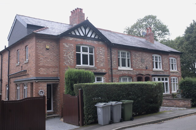
Lacey Green is a small and picturesque village located in the county of Cheshire, England. Situated approximately 6 miles south of the historic city of Chester, Lacey Green enjoys a tranquil and rural setting amidst the stunning Cheshire countryside.

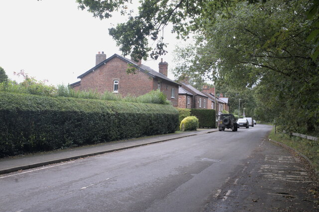
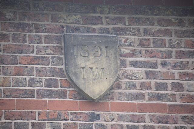
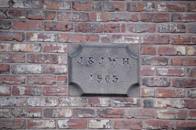
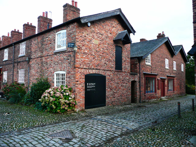
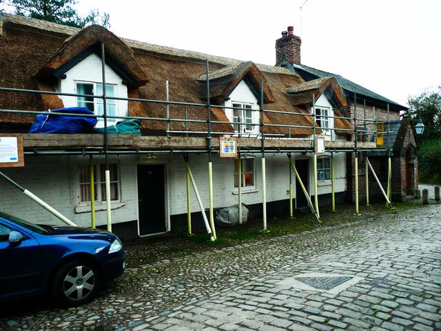
The village is characterized by its charming and well-preserved architectural heritage, with many buildings dating back to the 17th and 18th centuries. The quaint cottages and houses are predominantly made from local red sandstone, giving Lacey Green a distinct and timeless appeal.

Despite its small size, the village offers a range of amenities to its residents. These include a local pub, a primary school, and a village hall that serves as a community hub for various social events and activities. Lacey Green also benefits from being near to larger towns and cities, ensuring easy access to additional services and facilities.

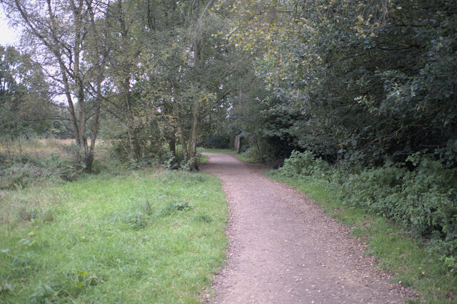
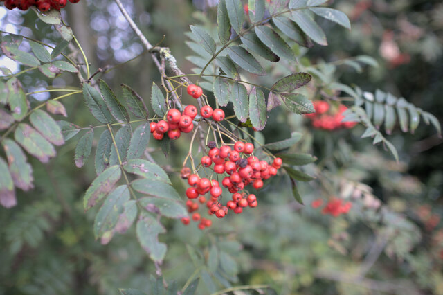
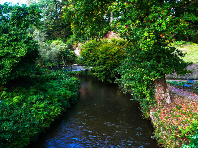
The surrounding countryside provides ample opportunities for outdoor activities such as walking, cycling, and horse riding. The area is known for its beautiful landscapes and is intersected by numerous footpaths and bridleways, allowing visitors to explore the natural beauty of the region.

Lacey Green is well-connected by road, with convenient access to major transport links. The M56 motorway is just a short drive away, providing easy connections to nearby cities such as Liverpool and Manchester. The village also benefits from regular bus services, allowing for convenient travel to neighboring areas.

In summary, Lacey Green is a peaceful and idyllic village in Cheshire, offering a charming blend of historical architecture, stunning countryside, and convenient access to nearby amenities.

If you have any feedback on the listing, please let us know in the comments section below.
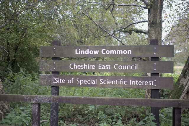
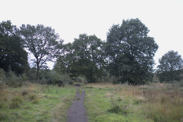
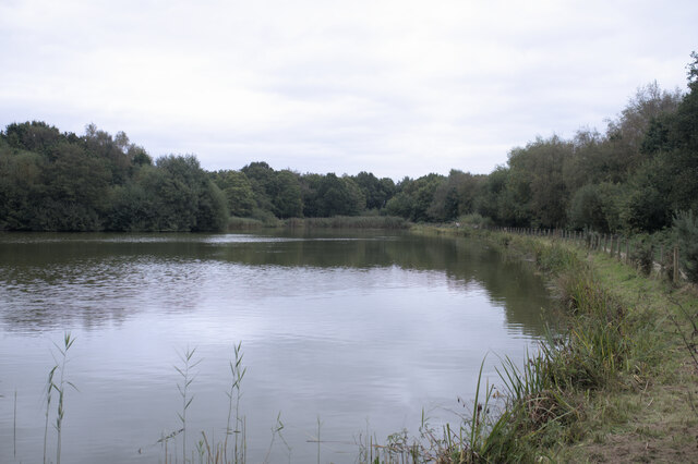
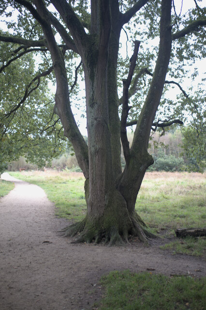
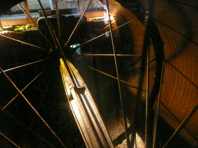
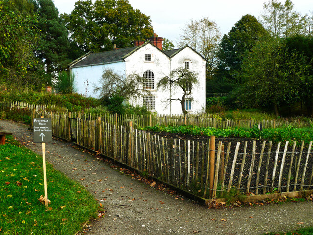
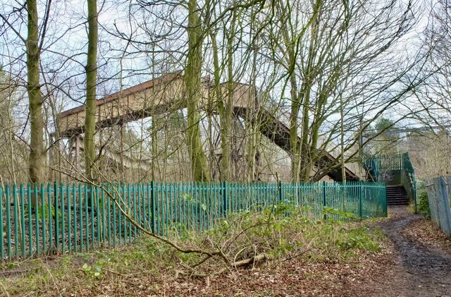
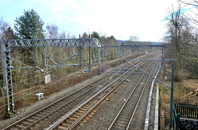
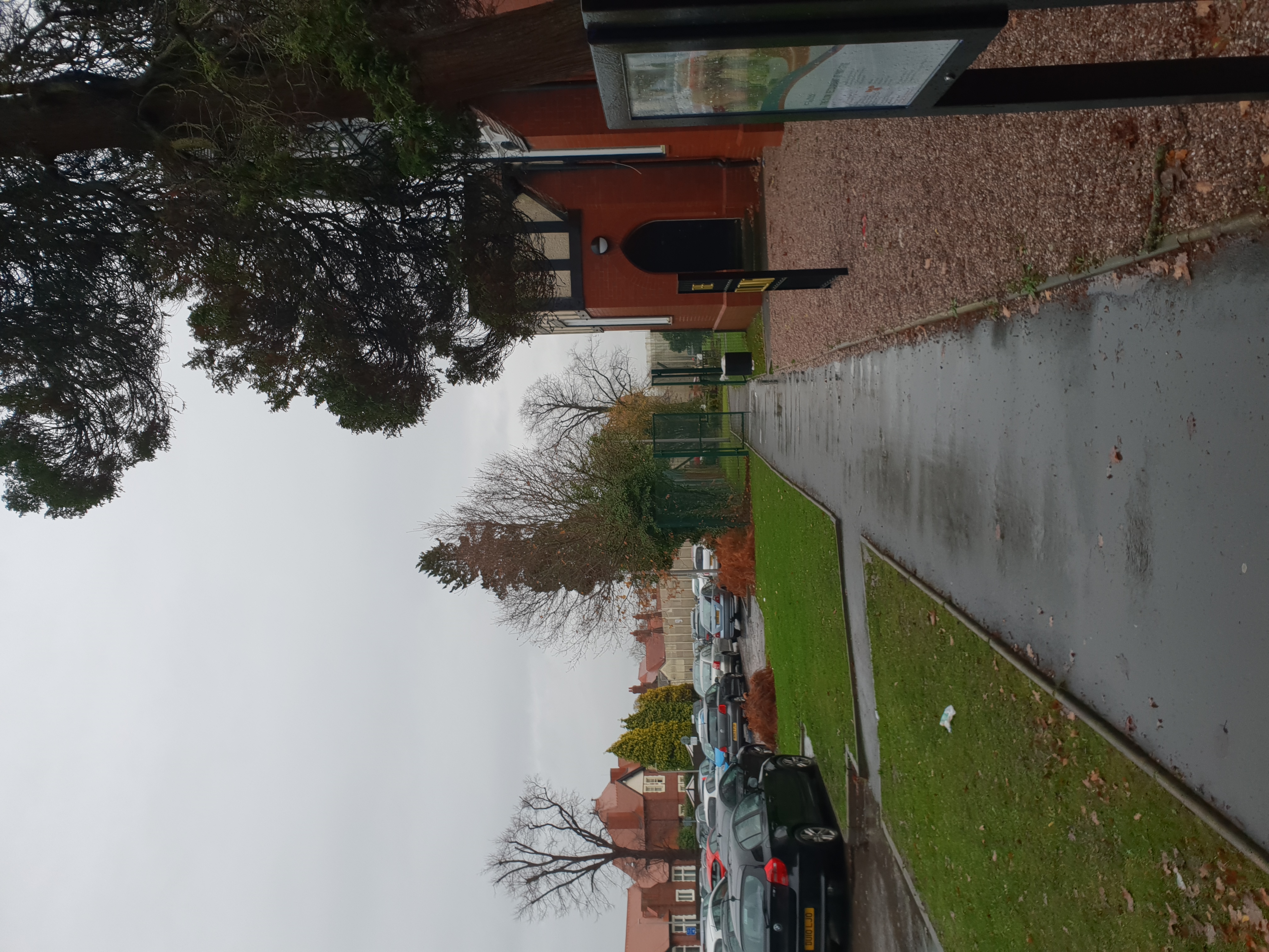
Lacey Green Images

Images are sourced within 2km of 53.337103/-2.229591 or Grid Reference SJ8482. Thanks to Geograph Open Source API. All images are credited.

Lindow Common sign Lindow Common is a Site of Special Scientific Interest (SSSI citation <span class="nowrap"><a title="http://www.sssi.naturalengland.org.uk/citation/citation_photo/1002734.pdf" rel="nofollow ugc noopener" href="http://www.sssi.naturalengland.org.uk/citation/citation_photo/1002734.pdf">Link</a><img style="margin-left:2px;" alt="External link" title="External link - shift click to open in new window" src="https://s1.geograph.org.uk/img/external.png" width="10" height="10"/></span>  ) on the western edge of Wilmslow, it is also designated a Local Nature Reserve (<span class="nowrap"><a title="http://www.lnr.naturalengland.org.uk/Special/lnr/lnr_details.asp?C=0&N=lindow&ID=264" rel="nofollow ugc noopener" href="http://www.lnr.naturalengland.org.uk/Special/lnr/lnr_details.asp?C=0&N=lindow&ID=264">Link</a><img style="margin-left:2px;" alt="External link" title="External link - shift click to open in new window" src="https://s1.geograph.org.uk/img/external.png" width="10" height="10"/></span>  Natural England)

The Common was once an area of heathland, where villagers could graze their cattle, but birch trees have overrun many areas, so that much of the Common is now under tree cover.

It is believed that this is the name Lindow which is also used for one of the historic parishes of Wilmslow and the adjacent Lindow Moss, is derived from Black Lake which lies in the middle of Lindow Common. The Welsh for Black Lake is llyn ddu.

Lindow Common is now managed by Cheshire East Council.

(adapted from <span class="nowrap"><a title="http://en.wikipedia.org/wiki/Lindow_Common" rel="nofollow ugc noopener" href="http://en.wikipedia.org/wiki/Lindow_Common">Link</a><img style="margin-left:2px;" alt="External link" title="External link - shift click to open in new window" src="https://s1.geograph.org.uk/img/external.png" width="10" height="10"/></span>  Wikipedia)
Lindow Common sign
Lindow Common is a Site of Special Scientific Interest (SSSI citation LinkExternal link ) on the western edge of Wilmslow, it is also designated a Local Nature Reserve (LinkExternal link Natural England) The Common was once an area of heathland, where villagers could graze their cattle, but birch trees have overrun many areas, so that much of the Common is now under tree cover. It is believed that this is the name Lindow which is also used for one of the historic parishes of Wilmslow and the adjacent Lindow Moss, is derived from Black Lake which lies in the middle of Lindow Common. The Welsh for Black Lake is llyn ddu. Lindow Common is now managed by Cheshire East Council. (adapted from LinkExternal link Wikipedia)
On Lindow Common Lindow Common is a Site of Special Scientific Interest (SSSI citation <span class="nowrap"><a title="http://www.sssi.naturalengland.org.uk/citation/citation_photo/1002734.pdf" rel="nofollow ugc noopener" href="http://www.sssi.naturalengland.org.uk/citation/citation_photo/1002734.pdf">Link</a><img style="margin-left:2px;" alt="External link" title="External link - shift click to open in new window" src="https://s1.geograph.org.uk/img/external.png" width="10" height="10"/></span>  ) on the western edge of Wilmslow, it is also designated a Local Nature Reserve (<span class="nowrap"><a title="http://www.lnr.naturalengland.org.uk/Special/lnr/lnr_details.asp?C=0&N=lindow&ID=264" rel="nofollow ugc noopener" href="http://www.lnr.naturalengland.org.uk/Special/lnr/lnr_details.asp?C=0&N=lindow&ID=264">Link</a><img style="margin-left:2px;" alt="External link" title="External link - shift click to open in new window" src="https://s1.geograph.org.uk/img/external.png" width="10" height="10"/></span>  Natural England)

The Common was once an area of heathland, where villagers could graze their cattle, but birch trees have overrun many areas, so that much of the Common is now under tree cover.

It is believed that this is the name Lindow which is also used for one of the historic parishes of Wilmslow and the adjacent Lindow Moss, is derived from Black Lake which lies in the middle of Lindow Common. The Welsh for Black Lake is llyn ddu.

Lindow Common is now managed by Cheshire East Council.

(adapted from <span class="nowrap"><a title="http://en.wikipedia.org/wiki/Lindow_Common" rel="nofollow ugc noopener" href="http://en.wikipedia.org/wiki/Lindow_Common">Link</a><img style="margin-left:2px;" alt="External link" title="External link - shift click to open in new window" src="https://s1.geograph.org.uk/img/external.png" width="10" height="10"/></span>  Wikipedia)
On Lindow Common
Lindow Common is a Site of Special Scientific Interest (SSSI citation LinkExternal link ) on the western edge of Wilmslow, it is also designated a Local Nature Reserve (LinkExternal link Natural England) The Common was once an area of heathland, where villagers could graze their cattle, but birch trees have overrun many areas, so that much of the Common is now under tree cover. It is believed that this is the name Lindow which is also used for one of the historic parishes of Wilmslow and the adjacent Lindow Moss, is derived from Black Lake which lies in the middle of Lindow Common. The Welsh for Black Lake is llyn ddu. Lindow Common is now managed by Cheshire East Council. (adapted from LinkExternal link Wikipedia)
The Black Lake Lindow Common is a Site of Special Scientific Interest (SSSI citation <span class="nowrap"><a title="http://www.sssi.naturalengland.org.uk/citation/citation_photo/1002734.pdf" rel="nofollow ugc noopener" href="http://www.sssi.naturalengland.org.uk/citation/citation_photo/1002734.pdf">Link</a><img style="margin-left:2px;" alt="External link" title="External link - shift click to open in new window" src="https://s1.geograph.org.uk/img/external.png" width="10" height="10"/></span>  ) on the western edge of Wilmslow, it is also designated a Local Nature Reserve (<span class="nowrap"><a title="http://www.lnr.naturalengland.org.uk/Special/lnr/lnr_details.asp?C=0&N=lindow&ID=264" rel="nofollow ugc noopener" href="http://www.lnr.naturalengland.org.uk/Special/lnr/lnr_details.asp?C=0&N=lindow&ID=264">Link</a><img style="margin-left:2px;" alt="External link" title="External link - shift click to open in new window" src="https://s1.geograph.org.uk/img/external.png" width="10" height="10"/></span>  Natural England)

The Common was once an area of heathland, where villagers could graze their cattle, but birch trees have overrun many areas, so that much of the Common is now under tree cover.

It is believed that this is the name Lindow which is also used for one of the historic parishes of Wilmslow and the adjacent Lindow Moss, is derived from Black Lake which lies in the middle of Lindow Common. The Welsh for Black Lake is llyn ddu.

Lindow Common is now managed by Cheshire East Council.

(adapted from <span class="nowrap"><a title="http://en.wikipedia.org/wiki/Lindow_Common" rel="nofollow ugc noopener" href="http://en.wikipedia.org/wiki/Lindow_Common">Link</a><img style="margin-left:2px;" alt="External link" title="External link - shift click to open in new window" src="https://s1.geograph.org.uk/img/external.png" width="10" height="10"/></span>  Wikipedia)
The Black Lake
Lindow Common is a Site of Special Scientific Interest (SSSI citation LinkExternal link ) on the western edge of Wilmslow, it is also designated a Local Nature Reserve (LinkExternal link Natural England) The Common was once an area of heathland, where villagers could graze their cattle, but birch trees have overrun many areas, so that much of the Common is now under tree cover. It is believed that this is the name Lindow which is also used for one of the historic parishes of Wilmslow and the adjacent Lindow Moss, is derived from Black Lake which lies in the middle of Lindow Common. The Welsh for Black Lake is llyn ddu. Lindow Common is now managed by Cheshire East Council. (adapted from LinkExternal link Wikipedia)
Multi-stemmed oak Lindow Common is a Site of Special Scientific Interest (SSSI citation <span class="nowrap"><a title="http://www.sssi.naturalengland.org.uk/citation/citation_photo/1002734.pdf" rel="nofollow ugc noopener" href="http://www.sssi.naturalengland.org.uk/citation/citation_photo/1002734.pdf">Link</a><img style="margin-left:2px;" alt="External link" title="External link - shift click to open in new window" src="https://s1.geograph.org.uk/img/external.png" width="10" height="10"/></span>  ) on the western edge of Wilmslow, it is also designated a Local Nature Reserve (<span class="nowrap"><a title="http://www.lnr.naturalengland.org.uk/Special/lnr/lnr_details.asp?C=0&N=lindow&ID=264" rel="nofollow ugc noopener" href="http://www.lnr.naturalengland.org.uk/Special/lnr/lnr_details.asp?C=0&N=lindow&ID=264">Link</a><img style="margin-left:2px;" alt="External link" title="External link - shift click to open in new window" src="https://s1.geograph.org.uk/img/external.png" width="10" height="10"/></span>  Natural England)

The Common was once an area of heathland, where villagers could graze their cattle, but birch trees have overrun many areas, so that much of the Common is now under tree cover.

It is believed that this is the name Lindow which is also used for one of the historic parishes of Wilmslow and the adjacent Lindow Moss, is derived from Black Lake which lies in the middle of Lindow Common. The Welsh for Black Lake is llyn ddu.

Lindow Common is now managed by Cheshire East Council.

(adapted from <span class="nowrap"><a title="http://en.wikipedia.org/wiki/Lindow_Common" rel="nofollow ugc noopener" href="http://en.wikipedia.org/wiki/Lindow_Common">Link</a><img style="margin-left:2px;" alt="External link" title="External link - shift click to open in new window" src="https://s1.geograph.org.uk/img/external.png" width="10" height="10"/></span>  Wikipedia)
Multi-stemmed oak
Lindow Common is a Site of Special Scientific Interest (SSSI citation LinkExternal link ) on the western edge of Wilmslow, it is also designated a Local Nature Reserve (LinkExternal link Natural England) The Common was once an area of heathland, where villagers could graze their cattle, but birch trees have overrun many areas, so that much of the Common is now under tree cover. It is believed that this is the name Lindow which is also used for one of the historic parishes of Wilmslow and the adjacent Lindow Moss, is derived from Black Lake which lies in the middle of Lindow Common. The Welsh for Black Lake is llyn ddu. Lindow Common is now managed by Cheshire East Council. (adapted from LinkExternal link Wikipedia)
Entering the common Lindow Common is a Site of Special Scientific Interest (SSSI citation <span class="nowrap"><a title="http://www.sssi.naturalengland.org.uk/citation/citation_photo/1002734.pdf" rel="nofollow ugc noopener" href="http://www.sssi.naturalengland.org.uk/citation/citation_photo/1002734.pdf">Link</a><img style="margin-left:2px;" alt="External link" title="External link - shift click to open in new window" src="https://s1.geograph.org.uk/img/external.png" width="10" height="10"/></span>  ) on the western edge of Wilmslow, it is also designated a Local Nature Reserve (<span class="nowrap"><a title="http://www.lnr.naturalengland.org.uk/Special/lnr/lnr_details.asp?C=0&N=lindow&ID=264" rel="nofollow ugc noopener" href="http://www.lnr.naturalengland.org.uk/Special/lnr/lnr_details.asp?C=0&N=lindow&ID=264">Link</a><img style="margin-left:2px;" alt="External link" title="External link - shift click to open in new window" src="https://s1.geograph.org.uk/img/external.png" width="10" height="10"/></span>  Natural England)

The Common was once an area of heathland, where villagers could graze their cattle, but birch trees have overrun many areas, so that much of the Common is now under tree cover.

It is believed that this is the name Lindow which is also used for one of the historic parishes of Wilmslow and the adjacent Lindow Moss, is derived from Black Lake which lies in the middle of Lindow Common. The Welsh for Black Lake is llyn ddu.

Lindow Common is now managed by Cheshire East Council.

(adapted from <span class="nowrap"><a title="http://en.wikipedia.org/wiki/Lindow_Common" rel="nofollow ugc noopener" href="http://en.wikipedia.org/wiki/Lindow_Common">Link</a><img style="margin-left:2px;" alt="External link" title="External link - shift click to open in new window" src="https://s1.geograph.org.uk/img/external.png" width="10" height="10"/></span>  Wikipedia)
Entering the common
Lindow Common is a Site of Special Scientific Interest (SSSI citation LinkExternal link ) on the western edge of Wilmslow, it is also designated a Local Nature Reserve (LinkExternal link Natural England) The Common was once an area of heathland, where villagers could graze their cattle, but birch trees have overrun many areas, so that much of the Common is now under tree cover. It is believed that this is the name Lindow which is also used for one of the historic parishes of Wilmslow and the adjacent Lindow Moss, is derived from Black Lake which lies in the middle of Lindow Common. The Welsh for Black Lake is llyn ddu. Lindow Common is now managed by Cheshire East Council. (adapted from LinkExternal link Wikipedia)
Berries on a Rowan Lindow Common is a Site of Special Scientific Interest (SSSI citation <span class="nowrap"><a title="http://www.sssi.naturalengland.org.uk/citation/citation_photo/1002734.pdf" rel="nofollow ugc noopener" href="http://www.sssi.naturalengland.org.uk/citation/citation_photo/1002734.pdf">Link</a><img style="margin-left:2px;" alt="External link" title="External link - shift click to open in new window" src="https://s1.geograph.org.uk/img/external.png" width="10" height="10"/></span>  ) on the western edge of Wilmslow, it is also designated a Local Nature Reserve (<span class="nowrap"><a title="http://www.lnr.naturalengland.org.uk/Special/lnr/lnr_details.asp?C=0&N=lindow&ID=264" rel="nofollow ugc noopener" href="http://www.lnr.naturalengland.org.uk/Special/lnr/lnr_details.asp?C=0&N=lindow&ID=264">Link</a><img style="margin-left:2px;" alt="External link" title="External link - shift click to open in new window" src="https://s1.geograph.org.uk/img/external.png" width="10" height="10"/></span>  Natural England)

The Common was once an area of heathland, where villagers could graze their cattle, but birch trees have overrun many areas, so that much of the Common is now under tree cover.

It is believed that this is the name Lindow which is also used for one of the historic parishes of Wilmslow and the adjacent Lindow Moss, is derived from Black Lake which lies in the middle of Lindow Common. The Welsh for Black Lake is llyn ddu.

Lindow Common is now managed by Cheshire East Council.

(adapted from <span class="nowrap"><a title="http://en.wikipedia.org/wiki/Lindow_Common" rel="nofollow ugc noopener" href="http://en.wikipedia.org/wiki/Lindow_Common">Link</a><img style="margin-left:2px;" alt="External link" title="External link - shift click to open in new window" src="https://s1.geograph.org.uk/img/external.png" width="10" height="10"/></span>  Wikipedia)
Berries on a Rowan
Lindow Common is a Site of Special Scientific Interest (SSSI citation LinkExternal link ) on the western edge of Wilmslow, it is also designated a Local Nature Reserve (LinkExternal link Natural England) The Common was once an area of heathland, where villagers could graze their cattle, but birch trees have overrun many areas, so that much of the Common is now under tree cover. It is believed that this is the name Lindow which is also used for one of the historic parishes of Wilmslow and the adjacent Lindow Moss, is derived from Black Lake which lies in the middle of Lindow Common. The Welsh for Black Lake is llyn ddu. Lindow Common is now managed by Cheshire East Council. (adapted from LinkExternal link Wikipedia)
Cottages on Racecourse road
Semidetached houses Houses in racecourse road.
Semidetached houses
Houses in racecourse road.
The entrance yard to Quarry Bank Mill, Styal Although now a National Trust property much of the machinery is still in use, and some of it is amazingly complicated, the result of years of 'brain-work' in the 19C.
The entrance yard to Quarry Bank Mill, Styal
Although now a National Trust property much of the machinery is still in use, and some of it is amazingly complicated, the result of years of 'brain-work' in the 19C.
The River Bollin at Quarry Bank Mill, Styal This is the river upstream of the packhorse bridge.
The River Bollin at Quarry Bank Mill, Styal
This is the river upstream of the packhorse bridge.
Inside the water wheel, Quarry Bank Mill, Styal This wheel is very wide, said to be the biggest in Europe. See <a href="https://www.geograph.org.uk/photo/2176475">SJ8382 : Waterwheel, Quarry Bank Mill</a> for more information.
Inside the water wheel, Quarry Bank Mill, Styal
This wheel is very wide, said to be the biggest in Europe. See SJ8382 : Waterwheel, Quarry Bank Mill for more information.
Warehouse and shop, Oak Cottages, Styal The shop is just a shop-front now, with a house behind. The same probably applies to the warehouse; perhaps the door leads to a garage now.
Warehouse and shop, Oak Cottages, Styal
The shop is just a shop-front now, with a house behind. The same probably applies to the warehouse; perhaps the door leads to a garage now.
The Apprentices House, Styal The apprentices were children who worked long hours in the mill for board and lodging but no pay. They did receive basic education and medical care, and were presumably offered employment at the end of their apprentice years. The house was built in 1790. The apprentice system was phased out between 1841 and 1847. See also the Wikipedia article.
The Apprentices House, Styal
The apprentices were children who worked long hours in the mill for board and lodging but no pay. They did receive basic education and medical care, and were presumably offered employment at the end of their apprentice years. The house was built in 1790. The apprentice system was phased out between 1841 and 1847. See also the Wikipedia article.
Farm Fold Cottages, Styal These were converted from farm buildings to mill workers' cottages in the late 18C. The building to the right was converted from a seed store to a Methodist chapel.
Farm Fold Cottages, Styal
These were converted from farm buildings to mill workers' cottages in the late 18C. The building to the right was converted from a seed store to a Methodist chapel.
Around Wilmslow (1) Railway footbridge
Around Wilmslow (1)
Railway footbridge
Around Wilmslow (2) Railway southwards: Manchester to Crewe line
Around Wilmslow (2)
Railway southwards: Manchester to Crewe line
Show me another place!

Lacey Green is located at Grid Ref: SJ8482 (Lat: 53.337103, Lng: -2.229591)

Unitary Authority: Cheshire East

Police Authority: Cheshire

What 3 Words

///tight.person.asleep. Near Wilmslow, Cheshire

Related Wikis

Lacey Green, Cheshire

Lacey Green is a council estate in the upmarket area of Wilmslow in the English county of Cheshire. The population at the 2011 Census was 4,718. It lies...

The Carrs Park

The Carrs Park is a park in Wilmslow, Cheshire, England. The park was gifted to the town by Henry Boddington and follows the path of the River Bollin....

HM Prison Styal

HM Prison Styal is a Closed Category prison for female adults and young offenders in Styal, Cheshire, England. The prison is operated by His Majesty's...

Styal Cottage Homes

Styal Cottage Homes were open from October 1898 to 1956 and housed destitute children from the Manchester area. They were established in Styal by the...

Nearby Amenities

Located within 500m of 53.337103,-2.229591
Barrier: swing_gate
Lat/Long: 53.3397176/-2.2296482
Post Box
Ref: SK9 287
Lat/Long: 53.3336764/-2.2306499
Barrier: stile
Lat/Long: 53.3363614/-2.236981
Bus Stop
Wilmslow, Manchester Road / Styal Road
Bus: yes
Naptan AtcoCode: 0600MA0562
Naptan Bearing: NE
Naptan CommonName: Styal Road
Naptan Crossing: Styal Road
Naptan Indicator: cnr
Naptan Landmark: House number 77
Naptan LocalityName: Wilmslow
Naptan NaptanCode: chepdwa
Naptan ShortCommonName: Styal Road
Naptan Street: Manchester Road
Naptan Verified: yes
Network: Cheshire East Council
Operator: Ansa Transport
Public Transport: platform
Source: naptan_import
Lat/Long: 53.333315/-2.2274767
Bus Stop
Wilmslow, Manchester Road / Styal Road
Bus: yes
Naptan AtcoCode: 0600MA0563
Naptan Bearing: SW
Naptan CommonName: Styal Road
Naptan Crossing: Styal Road
Naptan Indicator: opp
Naptan Landmark: Styal Road
Naptan LocalityName: Wilmslow
Naptan NaptanCode: chepdwd
Naptan ShortCommonName: Styal Road
Naptan Street: Manchester Road
Naptan Verified: yes
Network: Cheshire East Council
Operator: Ansa Transport
Public Transport: platform
Source: naptan_import
Lat/Long: 53.3330127/-2.2275257
Bus Stop
Wilmslow, Manchester Road / Bridgefield Avenue
Bus: yes
Naptan AtcoCode: 0600MA0564
Naptan Bearing: NE
Naptan CommonName: Bridgefield Avenue
Naptan Crossing: Bridgefield Avenue
Naptan Indicator: opp
Naptan Landmark: House number 107
Naptan LocalityName: Wilmslow
Naptan NaptanCode: chepdwg
Naptan ShortCommonName: Bridgefield Avenue
Naptan Street: Manchester Road
Naptan Verified: yes
Network: Cheshire East Council
Operator: Ansa Transport
Public Transport: platform
Source: naptan_import
Lat/Long: 53.3361423/-2.2252264
Bus Stop
Wilmslow, Manchester Road / Bridgefield Avenue
Bus: yes
Naptan AtcoCode: 0600MA0565
Naptan Bearing: SW
Naptan CommonName: Bridgefield Avenue
Naptan Crossing: Bridgefield Avenue
Naptan Indicator: cnr
Naptan Landmark: House number 122
Naptan LocalityName: Wilmslow
Naptan NaptanCode: chepdwj
Naptan ShortCommonName: Bridgefield Avenue
Naptan Street: Manchester Road
Naptan Verified: yes
Network: Cheshire East Council
Operator: Ansa Transport
Public Transport: platform
Source: naptan_import
Lat/Long: 53.3364447/-2.2247547
Bus Stop
Wilmslow, Manchester Road / Highfield Crescent
Bus: yes
Naptan AtcoCode: 0600MA0566
Naptan Bearing: NE
Naptan CommonName: Highfield Crescent
Naptan Crossing: Highfield Crescent
Naptan Indicator: cnr
Naptan Landmark: House number 5
Naptan LocalityName: Wilmslow
Naptan NaptanCode: chepdwm
Naptan ShortCommonName: Highfield Crescent
Naptan Street: Manchester Road
Naptan Verified: yes
Network: Cheshire East Council
Operator: Ansa Transport
Public Transport: platform
Source: naptan_import
Lat/Long: 53.3384239/-2.2233868
Bus Stop
Wilmslow, Manchester Road / Highfield Crescent
Bus: yes
Naptan AtcoCode: 0600MA0567
Naptan Bearing: SW
Naptan CommonName: Highfield Crescent
Naptan Crossing: Highfield Crescent
Naptan Indicator: opp
Naptan Landmark: Highfield Crescent
Naptan LocalityName: Wilmslow
Naptan NaptanCode: chepdwp
Naptan ShortCommonName: Highfield Crescent
Naptan Street: Manchester Road
Naptan Verified: yes
Network: Cheshire East Council
Operator: Ansa Transport
Public Transport: platform
Source: naptan_import
Lat/Long: 53.3383767/-2.2231253
Bus Stop
Wilmslow, Stanneylands Road / Manchester Road
Bus: yes
Naptan AtcoCode: 0600MA0568
Naptan Bearing: NW
Naptan CommonName: Manchester Road
Naptan Crossing: Manchester Road
Naptan Indicator: opp
Naptan Landmark: House number 25
Naptan LocalityName: Wilmslow
Naptan NaptanCode: chepdwt
Naptan ShortCommonName: Manchester Road
Naptan Street: Stanneylands Road
Naptan Verified: yes
Network: Cheshire East Council
Operator: Ansa Transport
Public Transport: platform
Source: naptan_import
Lat/Long: 53.3394755/-2.2239515
Bus Stop
Wilmslow, Stanneylands Road / Manchester Road
Bus: yes
Naptan AtcoCode: 0600MA0569
Naptan Bearing: SE
Naptan CommonName: Manchester Road
Naptan Crossing: Manchester Road
Naptan Indicator: nr
Naptan Landmark: House number 27
Naptan LocalityName: Wilmslow
Naptan NaptanCode: chepgad
Naptan ShortCommonName: Manchester Road
Naptan Street: Stanneylands Road
Naptan Verified: yes
Network: Cheshire East Council
Operator: Ansa Transport
Public Transport: platform
Source: naptan_import
Lat/Long: 53.3395775/-2.2239864
Bus Stop
Lacey Green, Barlow Road / Lacey Green
Bus: yes
Naptan AtcoCode: 0600MA0570
Naptan Bearing: NW
Naptan BusStopType: CUS
Naptan CommonName: Lacey Green
Naptan Crossing: Lacey Green
Naptan Indicator: NW-bound
Naptan Landmark: Lacey Green
Naptan LocalityName: Lacey Green
Naptan NaptanCode: chegapw
Naptan ShortCommonName: Lacey Green
Naptan Street: Barlow Road
Naptan Verified: yes
Network: Cheshire East Council
Operator: Ansa Transport
Public Transport: platform
Source: naptan_import
Lat/Long: 53.3357959/-2.2291295
Bus Stop
Lacey Green, Barlow Road / Lacey Green
Bus: yes
Naptan AtcoCode: 0600MA0571
Naptan Bearing: SE
Naptan BusStopType: CUS
Naptan CommonName: Lacey Green
Naptan Crossing: Lacey Green
Naptan Indicator: SE-bound
Naptan Landmark: Lacey Green
Naptan LocalityName: Lacey Green
Naptan NaptanCode: chegata
Naptan ShortCommonName: Lacey Green
Naptan Street: Barlow Road
Naptan Verified: yes
Network: Cheshire East Council
Operator: Ansa Transport
Public Transport: platform
Source: naptan_import
Lat/Long: 53.3358369/-2.2289001
Bus Stop
Lacey Green, Twinnies Road / Shops
Bus: yes
Naptan AtcoCode: 0600MA0578
Naptan Bearing: NE
Naptan CommonName: Shops
Naptan Crossing: Holly Bank Road
Naptan Indicator: opp
Naptan Landmark: Woks and Hoks
Naptan LocalityName: Lacey Green
Naptan NaptanCode: chepgat
Naptan ShortCommonName: Holly Bank Road
Naptan Street: Twinnies Road
Naptan Verified: yes
Network: Cheshire East Council
Operator: Ansa Transport
Public Transport: platform
Source: naptan_import
Lat/Long: 53.3380559/-2.2315787
Bus Stop
Lacey Green, Twinnies Road / Shops
Bus: yes
Naptan AtcoCode: 0600MA0579
Naptan Bearing: SW
Naptan CommonName: Shops
Naptan Crossing: Holly Bank Road
Naptan Indicator: o/s
Naptan Landmark: Shops
Naptan LocalityName: Lacey Green
Naptan NaptanCode: chepgaw
Naptan ShortCommonName: Lacey Green Shops
Naptan Street: Twinnies Road
Naptan Verified: yes
Network: Cheshire East Council
Operator: Ansa Transport
Public Transport: platform
Source: naptan_import
Lat/Long: 53.3381204/-2.2311807
Bus Stop
Lacey Green, Twinnies Road / Lacey Green
Bus: yes
Naptan AtcoCode: 0600MA0580
Naptan Bearing: NW
Naptan CommonName: Lacey Green
Naptan Crossing: Lacey Green
Naptan Indicator: cnr
Naptan Landmark: House number 86
Naptan LocalityName: Lacey Green
Naptan NaptanCode: chepgda
Naptan ShortCommonName: Lacey Green
Naptan Street: Twinnies Road
Naptan Verified: yes
Network: Cheshire East Council
Operator: Ansa Transport
Public Transport: platform
Source: naptan_import
Lat/Long: 53.3381446/-2.2272615
Bus Stop
Lacey Green, Twinnies Road / Lacey Green
Bus: yes
Naptan AtcoCode: 0600MA0581
Naptan Bearing: SE
Naptan CommonName: Lacey Green
Naptan Crossing: Lacey Green
Naptan Indicator: nr
Naptan Landmark: House number 93
Naptan LocalityName: Lacey Green
Naptan NaptanCode: chepgdg
Naptan ShortCommonName: Lacey Green
Naptan Street: Twinnies Road
Naptan Verified: yes
Network: Cheshire East Council
Operator: Ansa Transport
Public Transport: platform
Source: naptan_import
Lat/Long: 53.3381157/-2.2267822
Bus Stop
Lacey Green, Lacey Green / Mount Pleasant
Bus: yes
Naptan AtcoCode: 0600MA0582
Naptan Bearing: SW
Naptan CommonName: Mount Pleasant
Naptan Crossing: Mount Pleasant
Naptan Indicator: opp
Naptan Landmark: Anchor Court
Naptan LocalityName: Lacey Green
Naptan NaptanCode: chepgdj
Naptan ShortCommonName: Mount Pleasant
Naptan Street: Lacey Green
Naptan Verified: yes
Network: Cheshire East Council
Operator: Ansa Transport
Public Transport: platform
Source: naptan_import
Lat/Long: 53.3342401/-2.229998
Bus Stop
Lacey Green, Lacey Green / Mount Pleasant
Bus: yes
Naptan AtcoCode: 0600MA0583
Naptan Bearing: NE
Naptan BusStopType: CUS
Naptan CommonName: Mount Pleasant
Naptan Crossing: Mount Pleasant
Naptan Indicator: cnr
Naptan Landmark: House number 21
Naptan LocalityName: Lacey Green
Naptan NaptanCode: chepgdm
Naptan ShortCommonName: Mount Pleasant
Naptan Street: Lacey Green
Naptan Verified: yes
Network: Cheshire East Council
Operator: Ansa Transport
Public Transport: platform
Source: naptan_import
Lat/Long: 53.3342693/-2.2301799
Telephone
Phone: +44 1625 526344
Lat/Long: 53.3377443/-2.2318132
Post Box
Ref: SK9 633
Lat/Long: 53.3378379/-2.2316297
Addr Housenumber: 50
Addr Street: Styal Road
Lat/Long: 53.3344729/-2.2353088
Barrier: bollard
Lat/Long: 53.3396806/-2.2300586
Addr Housenumber: 2
Addr Street: Stanneylands Drive
Lat/Long: 53.3409358/-2.2276419
Addr Housenumber: 15
Addr Street: Stanneylands Drive
Lat/Long: 53.3406142/-2.2277766
Addr Housenumber: 6
Addr Street: Stanneylands Close
Lat/Long: 53.3398441/-2.2264355
Addr Housenumber: 7
Addr Street: Stanneylands Close
Lat/Long: 53.3397056/-2.2262933
Addr Housenumber: 1
Addr Street: Stanneylands Close
Lat/Long: 53.3398843/-2.2258145
Power: substation
Ref: 332207
Lat/Long: 53.3397994/-2.2252735
Addr Housenumber: 1
Addr Street: Stanneylands Drive
Lat/Long: 53.3402032/-2.2266169
Addr Housenumber: 2
Addr Street: Stanneylands Close
Lat/Long: 53.3400763/-2.2262559
Addr Housenumber: 26
Addr Street: Stanneylands Road
Lat/Long: 53.3408369/-2.2261549
Addr Housenumber: 49
Addr Street: Stanneylands Road
Lat/Long: 53.3408536/-2.2271462
Addr Housenumber: 51
Addr Street: Stanneylands Road
Lat/Long: 53.3411831/-2.2273801
Addr Housenumber: 1
Addr Street: Sefton Drive
Lat/Long: 53.3403536/-2.2247554
Addr Housenumber: 14
Addr Street: Stanneylands Road
Lat/Long: 53.3401836/-2.2249485
Addr Housenumber: 35
Addr Street: Stanneylands Road
Lat/Long: 53.3399993/-2.2255938
Addr Housenumber: 37
Addr Street: Stanneylands Road
Lat/Long: 53.3402115/-2.2260427
Addr Housenumber: 17
Addr Street: Stanneylands Road
Lat/Long: 53.3391472/-2.223433
Addr Housenumber: 12
Addr Street: Stanneylands Road
Lat/Long: 53.3399881/-2.2244996
Addr Housenumber: 33
Addr Street: Stanneylands Road
Lat/Long: 53.3395403/-2.2247292
Addr Housenumber: 31
Addr Street: Stanneylands Road
Lat/Long: 53.3394107/-2.2243382
Addr Housenumber: 1
Addr Street: Stanneylands Road
Lat/Long: 53.3390176/-2.2228419
Addr Housenumber: 15
Addr Street: Stanneylands Road
Lat/Long: 53.339165/-2.2232534
Addr Housenumber: 2
Addr Street: Sefton Drive
Lat/Long: 53.3402106/-2.2243439
Addr Housenumber: 53
Addr Street: Cranford Road
Lat/Long: 53.3351187/-2.2357816
Addr Housenumber: 55
Addr Street: Cranford Road
Lat/Long: 53.3351618/-2.2357845
Addr Housenumber: 57
Addr Street: Cranford Road
Lat/Long: 53.3351883/-2.2358728
Addr Housenumber: 59
Addr Street: Cranford Road
Lat/Long: 53.3351688/-2.2359384
Addr Housenumber: 61
Addr Street: Cranford Road
Lat/Long: 53.335147/-2.2360532
Addr Housenumber: 63
Addr Street: Cranford Road
Lat/Long: 53.3351753/-2.2360932
Addr Housenumber: 65
Addr Street: Cranford Road
Lat/Long: 53.3351688/-2.2361843
Addr Housenumber: 67
Addr Street: Cranford Road
Lat/Long: 53.3351371/-2.2362153
Addr Housenumber: 3
Addr Street: Newton Road
Lat/Long: 53.3353519/-2.2365293
Addr Housenumber: 5
Addr Street: Newton Road
Lat/Long: 53.3353954/-2.2364856
Addr Housenumber: 7
Addr Street: Newton Road
Lat/Long: 53.3354411/-2.2365002
Addr Housenumber: 1
Addr Street: Booth Road
Lat/Long: 53.3356165/-2.2365116
Addr Housenumber: 6
Addr Street: Newton Road
Lat/Long: 53.3355236/-2.2358134
Addr Housenumber: 4
Addr Street: Newton Road
Lat/Long: 53.3354773/-2.235786
Addr Housenumber: 9
Addr Street: Newton Road
Lat/Long: 53.3354727/-2.2364637
Addr Housenumber: 11
Addr Street: Newton Road
Lat/Long: 53.3354792/-2.2363908
Addr Housenumber: 13
Addr Street: Newton Road
Lat/Long: 53.3355227/-2.2363471
Addr Housenumber: 2
Addr Street: Booth Road
Lat/Long: 53.3357356/-2.2361058
Post Box
Collection Times: Mo-Fr 09:00; Sa 07:00
Ref: SK9 653
Lat/Long: 53.335591/-2.2359064
Addr Housenumber: 12
Addr Street: Newton Road
Lat/Long: 53.3356596/-2.235745
Addr Housenumber: 8
Addr Street: Newton Road
Lat/Long: 53.3355644/-2.2357587
Addr Housenumber: 15
Addr Street: Newton Road
Lat/Long: 53.3355685/-2.2363617
Addr Housenumber: 18
Addr Street: Stamford Road
Lat/Long: 53.3364711/-2.2364618
Addr Housenumber: 1
Addr Street: Stamford Road
Lat/Long: 53.3359737/-2.2358922
Addr Housenumber: 19
Addr Street: Stamford Road
Lat/Long: 53.336318/-2.2367893
Addr Housenumber: 31
Addr Street: Newton Road
Lat/Long: 53.3366709/-2.2361841
Addr Housenumber: 52
Addr Street: Newton Road
Lat/Long: 53.3368877/-2.2359919
Addr Housenumber: 43
Addr Street: Cranford Road
Lat/Long: 53.3350341/-2.2352087
Addr Housenumber: 45
Addr Street: Cranford Road
Lat/Long: 53.3349958/-2.2353724
Addr Housenumber: 51
Addr Street: Cranford Road
Lat/Long: 53.3350894/-2.2356572
Addr Housenumber: 18
Addr Street: Newton Road
Lat/Long: 53.3357951/-2.2355931
Addr Housenumber: 21
Addr Street: Cranford Road
Lat/Long: 53.3357058/-2.2345679
Addr Housenumber: 10
Addr Street: Newton Road
Lat/Long: 53.3356188/-2.2357177
Addr Housenumber: 16
Addr Street: Newton Road
Lat/Long: 53.3357004/-2.235622
Addr Housenumber: 14
Addr Street: Newton Road
Lat/Long: 53.335695/-2.2356949
Addr Housenumber: 2
Addr Street: Newton Road
Lat/Long: 53.3354665/-2.2356994
Addr Housenumber: 60
Addr Street: Cranford Road
Lat/Long: 53.3354126/-2.2353738
Addr Housenumber: 17
Addr Street: Newton Road
Lat/Long: 53.3363818/-2.2354507
Addr Housenumber: 2
Addr Street: Stamford Road
Lat/Long: 53.336165/-2.2356857
Addr Housenumber: 38
Addr Street: Newton Road
Lat/Long: 53.3365051/-2.2350093
Addr Housenumber: 28
Addr Street: Newton Road
Lat/Long: 53.336097/-2.2352514
Addr Housenumber: 30
Addr Street: Newton Road
Lat/Long: 53.336199/-2.2351588
Addr Housenumber: 36
Addr Street: Newton Road
Lat/Long: 53.336386/-2.2349595
Addr Housenumber: 46
Addr Street: Newton Road
Lat/Long: 53.3367644/-2.2356715
Addr Housenumber: 44
Addr Street: Newton Road
Lat/Long: 53.3366284/-2.2353084
Addr Housenumber: 13
Addr Street: Cranford Road
Lat/Long: 53.336317/-2.2338745
Addr Housenumber: 19
Addr Street: Cranford Road
Lat/Long: 53.3361342/-2.2341166
Addr Housenumber: 22
Addr Street: Cranford Road
Lat/Long: 53.336739/-2.2339784
Addr Housenumber: 11
Addr Street: Cranford Road
Lat/Long: 53.3369069/-2.2330479
Addr Housenumber: 1
Addr Street: Cranford Road
Lat/Long: 53.3371577/-2.2326065
Addr Housenumber: 2
Addr Street: Cranford Road
Lat/Long: 53.3373469/-2.232946
Addr Housenumber: 4
Addr Street: Lyme Avenue
Lat/Long: 53.3361687/-2.2332005
Addr Housenumber: 5
Addr Street: Lyme Avenue
Lat/Long: 53.3361769/-2.2333964
Addr Housenumber: 8
Addr Street: Lyme Avenue
Lat/Long: 53.3363456/-2.2336789
Addr Housenumber: 20
Addr Street: Prescott Road
Lat/Long: 53.336804/-2.2329818
Addr Housenumber: 1
Addr Street: Prescott Road
Lat/Long: 53.3360619/-2.2323336
Addr Housenumber: 8
Addr Street: Prescott Road
Lat/Long: 53.3364299/-2.2323381
Addr Housenumber: 12
Addr Street: Prescott Road
Lat/Long: 53.3365571/-2.2325614
Addr Housenumber: 10
Addr Street: Prescott Road
Lat/Long: 53.3365054/-2.2324748
Addr Housenumber: 11
Addr Street: Prescott Road
Lat/Long: 53.3363122/-2.2327801
Addr Housenumber: 1
Addr Street: Lyme Avenue
Lat/Long: 53.3363129/-2.2329544
Addr Housenumber: 2
Addr Street: Prescott Road
Lat/Long: 53.3362666/-2.2320591
Addr Housenumber: 14
Addr Street: Prescott Road
Lat/Long: 53.336651/-2.2327141
Addr Housenumber: 22
Addr Street: Marbury Road
Lat/Long: 53.334904/-2.2345883
Addr Housenumber: 24
Addr Street: Marbury Road
Lat/Long: 53.3348822/-2.2345154
Addr Housenumber: 14
Addr Street: Marbury Road
Lat/Long: 53.3351897/-2.2344744
Addr Housenumber: 20
Addr Street: Marbury Road
Lat/Long: 53.3350128/-2.2346886
Addr Housenumber: 19
Addr Street: Trafford Road
Lat/Long: 53.3357584/-2.2343892
Addr Housenumber: 12
Addr Street: Marbury Road
Lat/Long: 53.3352659/-2.2343559
Addr Housenumber: 19
Addr Street: Marbury Road
Lat/Long: 53.3347353/-2.2340279
Addr Housenumber: 21
Addr Street: Marbury Road
Lat/Long: 53.3347679/-2.2342511
Addr Housenumber: 23
Addr Street: Marbury Road
Lat/Long: 53.3347952/-2.2343195
Addr Housenumber: 11
Addr Street: Marbury Road
Lat/Long: 53.3351081/-2.2340233
Addr Housenumber: 13
Addr Street: Marbury Road
Lat/Long: 53.3349176/-2.2338274
Addr Housenumber: 1
Addr Street: Trafford Road
Lat/Long: 53.3351734/-2.2330564
Addr Housenumber: 11
Addr Street: Trafford Road
Lat/Long: 53.3353604/-2.233495
Addr Housenumber: 13
Addr Street: Trafford Road
Lat/Long: 53.3356393/-2.2340987
Addr Housenumber: 8
Addr Street: Trafford Road
Lat/Long: 53.3355747/-2.2331247
Addr Housenumber: 12
Addr Street: Trafford Road
Lat/Long: 53.3358337/-2.2331272
Addr Housenumber: 10
Addr Street: Trafford Road
Lat/Long: 53.3356922/-2.2332147
Addr Housenumber: 10
Addr Street: Trafford Road
Lat/Long: 53.335738/-2.2331673
Addr Housenumber: 2
Addr Street: Marbury Road
Lat/Long: 53.3355271/-2.234037
Addr Housenumber: 1
Addr Street: Marbury Road
Lat/Long: 53.3354155/-2.2336269
Addr Housenumber: 2
Addr Street: Trafford Road
Lat/Long: 53.3354591/-2.2328684
Addr Housenumber: 24
Addr Street: Trafford Road
Lat/Long: 53.3358876/-2.233831
Addr Housenumber: 32
Addr Street: Trafford Road
Lat/Long: 53.3360066/-2.2341158
Addr Housenumber: 18
Addr Street: Trafford Road
Lat/Long: 53.3359578/-2.2334334
Addr Housenumber: 20
Addr Street: Trafford Road
Lat/Long: 53.335923/-2.2335902
Addr Housenumber: 22
Addr Street: Trafford Road
Lat/Long: 53.3358816/-2.2336339
Addr Housenumber: 40
Addr Street: Egerton Road
Lat/Long: 53.3347514/-2.2334204
Addr Housenumber: 55
Addr Street: Egerton Road
Lat/Long: 53.3345555/-2.2329784
Addr Housenumber: 42
Addr Street: Egerton Road
Lat/Long: 53.3346262/-2.2333748
Addr Housenumber: 57
Addr Street: Egerton Road
Lat/Long: 53.3345772/-2.2332518
Addr Housenumber: 30
Addr Street: Egerton Road
Lat/Long: 53.3350153/-2.2330285
Addr Housenumber: 32
Addr Street: Egerton Road
Lat/Long: 53.3349745/-2.2330741
Addr Housenumber: 34
Addr Street: Egerton Road
Lat/Long: 53.3348929/-2.2332427
Addr Housenumber: 49
Addr Street: Egerton Road
Lat/Long: 53.3347133/-2.2327961
Addr Housenumber: 37
Addr Street: Egerton Road
Lat/Long: 53.3350942/-2.2324088
Addr Housenumber: 47
Addr Street: Egerton Road
Lat/Long: 53.3348248/-2.2327324
Addr Housenumber: 26
Addr Street: Egerton Road
Lat/Long: 53.3354998/-2.2325566
Addr Housenumber: 28
Addr Street: Egerton Road
Lat/Long: 53.335442/-2.232625
Addr Housenumber: 20
Addr Street: Egerton Road
Lat/Long: 53.3358059/-2.2325452
Addr Housenumber: 22
Addr Street: Egerton Road
Lat/Long: 53.3356971/-2.2325566
Addr Housenumber: 24
Addr Street: Egerton Road
Lat/Long: 53.3356562/-2.2324826
Addr Housenumber: 21
Addr Street: Egerton Road
Lat/Long: 53.3354343/-2.2319623
Addr Housenumber: 35
Addr Street: Egerton Road
Lat/Long: 53.335203/-2.2322539
Addr Housenumber: 19
Addr Street: Egerton Road
Lat/Long: 53.3356465/-2.23178
Addr Housenumber: 17
Addr Street: Egerton Road
Lat/Long: 53.3356874/-2.2318757
Addr Housenumber: 14
Addr Street: Egerton Road
Lat/Long: 53.3359555/-2.232306
Addr Housenumber: 15
Addr Street: Egerton Road
Lat/Long: 53.3359132/-2.2317937
Addr Housenumber: 12
Addr Street: Egerton Road
Lat/Long: 53.3362514/-2.2318333
Addr Housenumber: 1
Addr Street: Egerton Road
Lat/Long: 53.3363132/-2.2311558
Addr Housenumber: 2
Addr Street: Egerton Road
Lat/Long: 53.3364827/-2.2314574
Addr Housenumber: 125
Addr Street: Clough Avenue
Lat/Long: 53.3386148/-2.2276344
Addr Housenumber: 15
Addr Street: Styal View
Lat/Long: 53.3392977/-2.227994
Addr Housenumber: 48
Addr Street: Clough Avenue
Lat/Long: 53.3391068/-2.2276844
Addr Housenumber: 12
Addr Street: Styal View
Lat/Long: 53.3394945/-2.2283436
Addr Housenumber: 75
Addr Street: Clough Avenue
Lat/Long: 53.3397107/-2.2274422
Addr Housenumber: 85
Addr Street: Clough Avenue
Lat/Long: 53.339499/-2.2271275
Addr Housenumber: 36
Addr Street: Clough Avenue
Lat/Long: 53.339912/-2.2283436
Addr Housenumber: 22
Addr Street: Clough Avenue
Lat/Long: 53.3397122/-2.2286682
Addr Housenumber: 67
Addr Street: Clough Avenue
Lat/Long: 53.3398478/-2.2276669
Addr Housenumber: 77
Addr Street: Clough Avenue
Lat/Long: 53.3396361/-2.2273523
Addr Housenumber: 1
Addr Street: Styal View
Lat/Long: 53.3394915/-2.2276644
Addr Housenumber: 2
Addr Street: Styal View
Lat/Long: 53.3396615/-2.2280589
Addr Housenumber: 65
Addr Street: Clough Avenue
Lat/Long: 53.3399209/-2.2277743
Addr Housenumber: 57
Addr Street: Clough Avenue
Lat/Long: 53.3400581/-2.227999
Addr Housenumber: 123
Addr Street: Clough Avenue
Lat/Long: 53.3388355/-2.2274297
Power: substation
Ref: 331343
Lat/Long: 53.3387281/-2.2274496
Addr Housenumber: 38
Addr Street: Clough Avenue
Lat/Long: 53.3393007/-2.2273498
Addr Housenumber: 113
Addr Street: Clough Avenue
Lat/Long: 53.3389905/-2.227165
Addr Housenumber: 111
Addr Street: Clough Avenue
Lat/Long: 53.3390144/-2.2269502
Addr Housenumber: 99
Addr Street: Clough Avenue
Lat/Long: 53.3391575/-2.2266755
Addr Housenumber: 97
Addr Street: Clough Avenue
Lat/Long: 53.3392649/-2.2267155
Addr Housenumber: 87
Addr Street: Clough Avenue
Lat/Long: 53.3394438/-2.2269902
Addr Housenumber: 66
Addr Street: Twinnies Road
Lat/Long: 53.3384605/-2.2285655
Addr Housenumber: 47
Addr Street: Twinnies Road
Lat/Long: 53.3389532/-2.2293746
Addr Housenumber: 48
Addr Street: Twinnies Road
Lat/Long: 53.3386126/-2.2294845
Addr Housenumber: 73
Addr Street: Twinnies Road
Lat/Long: 53.3386699/-2.228171
Addr Housenumber: 1
Addr Street: Park Crescent
Lat/Long: 53.3382234/-2.2304564
Addr Housenumber: 30
Addr Street: Twinnies Road
Lat/Long: 53.3383467/-2.2304967
Addr Housenumber: 23
Addr Street: Park Crescent
Lat/Long: 53.3381783/-2.2297865
Addr Housenumber: 25
Addr Street: Park Crescent
Lat/Long: 53.3381783/-2.2296203
Addr Housenumber: 42
Addr Street: Twinnies Road
Lat/Long: 53.3385752/-2.2298722
Addr Housenumber: 46
Addr Street: Twinnies Road
Lat/Long: 53.3385722/-2.2296354
Addr Housenumber: 40
Addr Street: Twinnies Road
Lat/Long: 53.3385422/-2.2300182
Addr Housenumber: 47
Addr Street: Park Crescent
Lat/Long: 53.3381933/-2.2290058
Addr Housenumber: 49
Addr Street: Park Crescent
Lat/Long: 53.3382113/-2.2288597
Addr Housenumber: 55
Addr Street: Park Crescent
Lat/Long: 53.3382805/-2.2287187
Addr Housenumber: 1
Addr Street: Sycamore Close
Lat/Long: 53.3392244/-2.2289788
Addr Housenumber: 2
Addr Street: Clough Avenue
Lat/Long: 53.339069/-2.2293967
Addr Housenumber: 10
Addr Street: Clough Avenue
Lat/Long: 53.3392495/-2.2292079
Addr Housenumber: 12
Addr Street: Clough Avenue
Lat/Long: 53.3394247/-2.229019
Addr Housenumber: 5
Addr Street: Sycamore Close
Lat/Long: 53.3390728/-2.228737
Addr Housenumber: 6
Addr Street: Sycamore Close
Lat/Long: 53.3391643/-2.228459
Addr Housenumber: 8
Addr Street: Sycamore Close
Lat/Long: 53.3392557/-2.2283139
Addr Housenumber: 10
Addr Street: Sycamore Close
Lat/Long: 53.3389864/-2.2282392
Addr Housenumber: 9
Addr Street: Sycamore Close
Lat/Long: 53.3390249/-2.228178
Addr Housenumber: 58
Addr Street: Clough Avenue
Lat/Long: 53.3388165/-2.2279094
Addr Housenumber: 56
Addr Street: Clough Avenue
Lat/Long: 53.3388531/-2.2278482
Addr Housenumber: 54
Addr Street: Clough Avenue
Lat/Long: 53.3389301/-2.2278256
Addr Housenumber: 50
Addr Street: Clough Avenue
Lat/Long: 53.3389975/-2.2279417
Addr Housenumber: 20
Addr Street: Clough Avenue
Lat/Long: 53.3395931/-2.2288175
Addr Housenumber: 16
Addr Street: Twinnies Road
Lat/Long: 53.3380075/-2.231136
Addr Housenumber: 18
Addr Street: Twinnies Road
Lat/Long: 53.3380344/-2.2310844
Addr Housenumber: 14
Addr Street: Twinnies Road
Lat/Long: 53.3379709/-2.2311425
Addr Housenumber: 20
Addr Street: Twinnies Road
Lat/Long: 53.3380364/-2.2310232
Addr Housenumber: 26
Addr Street: Twinnies Road
Lat/Long: 53.3381605/-2.2308588
Addr Housenumber: 22
Addr Street: Twinnies Road
Lat/Long: 53.338097/-2.2309168
Addr Housenumber: 24
Addr Street: Twinnies Road
Lat/Long: 53.3381336/-2.2309104
Addr Housenumber: 28
Addr Street: Twinnies Road
Lat/Long: 53.3381624/-2.2307975
Addr Housenumber: 19
Addr Street: Clough Avenue
Lat/Long: 53.3392347/-2.2297906
Addr Housenumber: 1
Addr Street: Clough Avenue
Lat/Long: 53.3390101/-2.2300255
Addr Housenumber: 5
Addr Street: Clough Avenue
Lat/Long: 53.3391191/-2.2298996
Addr Housenumber: 25
Addr Street: Clough Avenue
Lat/Long: 53.3394152/-2.2295828
Addr Housenumber: 27
Addr Street: Clough Avenue
Lat/Long: 53.3395204/-2.2294758
Addr Housenumber: 37
Addr Street: Clough Avenue
Lat/Long: 53.3398287/-2.2291169
Addr Housenumber: 39
Addr Street: Clough Avenue
Lat/Long: 53.3399151/-2.2290035
Addr Housenumber: 45
Addr Street: Clough Avenue
Lat/Long: 53.3400392/-2.2288021
Addr Housenumber: 47
Addr Street: Clough Avenue
Lat/Long: 53.3401003/-2.228695
Addr Housenumber: 55
Addr Street: Clough Avenue
Lat/Long: 53.3402507/-2.228418
Addr Housenumber: 50
Addr Street: Barlow Road
Lat/Long: 53.3376441/-2.2325459
Addr Housenumber: 1
Addr Street: Twinnies Road
Lat/Long: 53.3376441/-2.232425
Addr Housenumber: 3
Addr Street: Twinnies Road
Lat/Long: 53.3377073/-2.232289
Addr Housenumber: 21
Addr Street: Twinnies Road
Lat/Long: 53.3381524/-2.2315385
Addr Housenumber: 23
Addr Street: Twinnies Road
Lat/Long: 53.3383118/-2.2312564
Addr Housenumber: 25
Addr Street: Twinnies Road
Lat/Long: 53.3383719/-2.2311607
Addr Housenumber: 27
Addr Street: Twinnies Road
Lat/Long: 53.3385193/-2.230919
Addr Housenumber: 68
Addr Street: Twinnies Road
Lat/Long: 53.3383088/-2.2281637
Addr Housenumber: 88
Addr Street: Twinnies Road
Lat/Long: 53.3379178/-2.2272369
Addr Housenumber: 96
Addr Street: Twinnies Road
Lat/Long: 53.3377915/-2.2268441
Addr Housenumber: 98
Addr Street: Twinnies Road
Lat/Long: 53.3377231/-2.2267446
Addr Housenumber: 102
Addr Street: Twinnies Road
Lat/Long: 53.3376569/-2.2265784
Addr Housenumber: 86
Addr Street: Twinnies Road
Lat/Long: 53.3380231/-2.2273075
Addr Housenumber: 45
Addr Street: Twinnies Road
Lat/Long: 53.3389133/-2.2302289
Addr Housenumber: 75
Addr Street: Twinnies Road
Lat/Long: 53.3384345/-2.2275297
Addr Housenumber: 83
Addr Street: Twinnies Road
Lat/Long: 53.3382992/-2.2271217
Addr Housenumber: 85
Addr Street: Twinnies Road
Lat/Long: 53.3382481/-2.2269857
Addr Housenumber: 95
Addr Street: Twinnies Road
Lat/Long: 53.3381218/-2.2265677
Addr Housenumber: 2
Addr Street: Park Drive
Lat/Long: 53.3380526/-2.228381
Addr Housenumber: 4
Addr Street: Park Drive
Lat/Long: 53.3380195/-2.2282802
Addr Housenumber: 6
Addr Street: Park Drive
Lat/Long: 53.3379684/-2.2280838
Addr Housenumber: 7
Addr Street: Clough Avenue
Lat/Long: 53.3392426/-2.2303278
Addr Housenumber: 11
Addr Street: Clough Avenue
Lat/Long: 53.3393942/-2.2306059
Addr Housenumber: 13
Addr Street: Clough Avenue
Lat/Long: 53.3393557/-2.2301747
Addr Housenumber: 17
Addr Street: Clough Avenue
Lat/Long: 53.3395289/-2.2299772
Addr Housenumber: 1
Addr Street: Carr Mill Court
Lat/Long: 53.3388234/-2.2310849
Addr Housenumber: 4
Addr Street: Carr Mill Court
Lat/Long: 53.338963/-2.2308431
Addr Housenumber: 5
Addr Street: Carr Mill Court
Lat/Long: 53.3390424/-2.2305973
Addr Housenumber: 8
Addr Street: Carr Mill Court
Lat/Long: 53.3391651/-2.2308068
Addr Housenumber: 1
Addr Street: Gregg Mews
Lat/Long: 53.3403054/-2.2282916
Addr Housenumber: 5
Addr Street: Gregg Mews
Lat/Long: 53.3403593/-2.228182
Addr Housenumber: 2
Addr Street: Gregg Mews
Lat/Long: 53.3401148/-2.228153
Addr Housenumber: 4
Addr Street: Gregg Mews
Lat/Long: 53.3400898/-2.2281175
Addr Housenumber: 1
Addr Street: Holly Bank Road
Lat/Long: 53.3381555/-2.2340208
Addr Housenumber: 4
Addr Street: Holly Bank Road
Lat/Long: 53.3382364/-2.233402
Addr Housenumber: 66
Addr Street: Barlow Road
Lat/Long: 53.3380042/-2.2333313
Addr Housenumber: 68
Addr Street: Barlow Road
Lat/Long: 53.338071/-2.233514
Addr Housenumber: 2
Addr Street: Holly Bank Road
Lat/Long: 53.3381344/-2.2335376
Addr Housenumber: 55
Addr Street: Barlow Road
Lat/Long: 53.3371631/-2.2324355
Addr Housenumber: 27
Addr Street: Barlow Road
Lat/Long: 53.3361884/-2.2307028
Addr Housenumber: 29
Addr Street: Barlow Road
Lat/Long: 53.336301/-2.2309209
Addr Housenumber: 31
Addr Street: Barlow Road
Lat/Long: 53.3363502/-2.2310093
Addr Housenumber: 33
Addr Street: Barlow Road
Lat/Long: 53.3366036/-2.2314041
Addr Housenumber: 52
Addr Street: Barlow Road
Lat/Long: 53.3377332/-2.2326771
Addr Housenumber: 13
Addr Street: Ashley Road
Lat/Long: 53.3380573/-2.2323764
Addr Housenumber: 15
Addr Street: Ashley Road
Lat/Long: 53.3380545/-2.2324519
Addr Housenumber: 17
Addr Street: Ashley Road
Lat/Long: 53.3380995/-2.2326169
Addr Housenumber: 26
Addr Street: Ashley Road
Lat/Long: 53.3381221/-2.2326735
Addr Housenumber: 24
Addr Street: Ashley Road
Lat/Long: 53.3382065/-2.2328149
Addr Housenumber: 22
Addr Street: Ashley Road
Lat/Long: 53.33826/-2.2328196
Addr Housenumber: 16
Addr Street: Ashley Road
Lat/Long: 53.3384205/-2.2324754
Addr Housenumber: 20
Addr Street: Ashley Road
Lat/Long: 53.3383445/-2.232664
Addr Housenumber: 18
Addr Street: Ashley Road
Lat/Long: 53.3383885/-2.2326142
Addr Housenumber: 9
Addr Street: Ashley Road
Lat/Long: 53.3381953/-2.2322114
Addr Housenumber: 11
Addr Street: Ashley Road
Lat/Long: 53.3381502/-2.2322774
Addr Housenumber: 1
Addr Street: Ashley Road
Lat/Long: 53.3384148/-2.2320087
Addr Housenumber: 7
Addr Street: Ashley Road
Lat/Long: 53.3382853/-2.2321973
Addr Housenumber: 75
Addr Street: Holly Bank Road
Lat/Long: 53.3384652/-2.2314277
Addr Housenumber: 1
Addr Street: Barlow Road
Lat/Long: 53.3357344/-2.2292353
Addr Housenumber: 30
Addr Street: Holly Bank Road
Lat/Long: 53.3388945/-2.2325828
Addr Housenumber: 45
Addr Street: Holly Bank Road
Lat/Long: 53.3392463/-2.2324473
Addr Housenumber: 43
Addr Street: Holly Bank Road
Lat/Long: 53.3392112/-2.2326771
Addr Housenumber: 32
Addr Street: Holly Bank Road
Lat/Long: 53.3389895/-2.2324591
Addr Housenumber: 34
Addr Street: Holly Bank Road
Lat/Long: 53.3390035/-2.2323235
Addr Housenumber: 2
Addr Street: Ashley Road
Lat/Long: 53.3387527/-2.2320417
Addr Housenumber: 36
Addr Street: Holly Bank Road
Lat/Long: 53.3389367/-2.2321467
Addr Housenumber: 38
Addr Street: Holly Bank Road
Lat/Long: 53.3388945/-2.2320819
Addr Housenumber: 24
Addr Street: Barlow Road
Lat/Long: 53.3364295/-2.2304737
Addr Housenumber: 33
Addr Street: Lacey Avenue
Lat/Long: 53.3344623/-2.2282295
Addr Housenumber: 34
Addr Street: Lacey Avenue
Lat/Long: 53.3344482/-2.2283238
Addr Housenumber: 35
Addr Street: Lacey Avenue
Lat/Long: 53.3344939/-2.2285595
Addr Housenumber: 1
Addr Street: Lacey Avenue
Lat/Long: 53.3351133/-2.2280939
Addr Housenumber: 42
Addr Street: Lacey Avenue
Lat/Long: 53.3350394/-2.2285241
Addr Housenumber: 41
Addr Street: Lacey Avenue
Lat/Long: 53.3349937/-2.2283886
Addr Housenumber: 23
Addr Street: Lacey Avenue
Lat/Long: 53.3351344/-2.2275989
Addr Housenumber: 32
Addr Street: Lacey Avenue
Lat/Long: 53.3345538/-2.2281057
Addr Housenumber: 36
Addr Street: Lacey Avenue
Lat/Long: 53.3345432/-2.2285831
Addr Housenumber: 37
Addr Street: Lacey Avenue
Lat/Long: 53.3346523/-2.2285477
Addr Housenumber: 40
Addr Street: Lacey Avenue
Lat/Long: 53.3348529/-2.2283414
Addr Housenumber: 14
Addr Street: Lacey Avenue
Lat/Long: 53.3355532/-2.2276519
Addr Housenumber: 14A
Addr Street: Lacey Avenue
Lat/Long: 53.335613/-2.2275812
Addr Housenumber: 22
Addr Street: Lacey Avenue
Lat/Long: 53.3352295/-2.2274869
Addr Housenumber: 19
Addr Street: Lacey Avenue
Lat/Long: 53.3351732/-2.2271392
Addr Housenumber: 17
Addr Street: Lacey Avenue
Lat/Long: 53.3353949/-2.227092
Addr Housenumber: 18
Addr Street: Lacey Avenue
Lat/Long: 53.3353773/-2.2270213
Addr Housenumber: 20
Addr Street: Lacey Avenue
Lat/Long: 53.3351943/-2.2272335
Addr Housenumber: 21
Addr Street: Lacey Avenue
Lat/Long: 53.3352541/-2.2274044
Addr Housenumber: 15
Addr Street: Lacey Avenue
Lat/Long: 53.335504/-2.2272688
Addr Housenumber: 16
Addr Street: Lacey Avenue
Lat/Long: 53.3354512/-2.2272629
Addr Housenumber: 1
Addr Street: Lacey Close
Lat/Long: 53.3357538/-2.2273749
Addr Housenumber: 2
Addr Street: Lacey Close
Lat/Long: 53.3360002/-2.2269565
Addr Housenumber: 2
Addr Street: Barlow Road
Lat/Long: 53.3360424/-2.2292361
Addr Housenumber: 4
Addr Street: Lacey Green
Lat/Long: 53.3340996/-2.2299947
Addr Housenumber: 2
Addr Street: Lacey Green
Lat/Long: 53.3338849/-2.2301126
Addr Housenumber: 2A
Addr Street: Lacey Green
Lat/Long: 53.3339658/-2.2300654
Addr Housenumber: 12
Addr Street: Lacey Green
Lat/Long: 53.3346168/-2.2295419
Addr Housenumber: 42
Addr Street: Lacey Green
Lat/Long: 53.3352174/-2.2288422
Addr Housenumber: 44
Addr Street: Lacey Green
Lat/Long: 53.3353333/-2.2287056
Addr Housenumber: 64
Addr Street: Lacey Green
Lat/Long: 53.3359012/-2.2281371
Addr Housenumber: 21
Addr Street: Lacey Green
Lat/Long: 53.3344423/-2.230226
Addr Housenumber: 19
Addr Street: Lacey Green
Lat/Long: 53.3343509/-2.2302643
Addr Housenumber: 17A
Addr Street: Lacey Green
Lat/Long: 53.3343379/-2.2303791
Addr Housenumber: 17
Addr Street: Lacey Green
Lat/Long: 53.3342236/-2.2304283
Addr Housenumber: 5
Addr Street: Lacey Green
Lat/Long: 53.3339755/-2.2304884
Addr Housenumber: 15
Addr Street: Lacey Green
Lat/Long: 53.3342073/-2.2303135
Addr Housenumber: 1
Addr Street: Lacey Green
Lat/Long: 53.333907/-2.2305485
Addr Housenumber: 27
Addr Street: Lacey Green
Lat/Long: 53.3346434/-2.229976
Addr Housenumber: 65
Addr Street: Lacey Green
Lat/Long: 53.3356487/-2.2288915
Addr Housenumber: 27
Addr Street: Nightingale Close
Lat/Long: 53.3347957/-2.2307495
Addr Housenumber: 26
Addr Street: Nightingale Close
Lat/Long: 53.3348183/-2.2308241
Addr Housenumber: 28
Addr Street: Nightingale Close
Lat/Long: 53.3348053/-2.2306957
Addr Housenumber: 31
Addr Street: Nightingale Close
Lat/Long: 53.3347978/-2.2305753
Addr Housenumber: 32
Addr Street: Nightingale Close
Lat/Long: 53.334756/-2.2305547
Addr Housenumber: 25
Addr Street: Nightingale Close
Lat/Long: 53.3348601/-2.2308447
Addr Housenumber: 24
Addr Street: Nightingale Close
Lat/Long: 53.3349223/-2.2308172
Addr Housenumber: 23
Addr Street: Nightingale Close
Lat/Long: 53.3349579/-2.2308344
Addr Housenumber: 30
Addr Street: Nightingale Close
Lat/Long: 53.3348751/-2.2306578
Addr Housenumber: 29
Addr Street: Nightingale Close
Lat/Long: 53.3348484/-2.2306452
Addr Housenumber: 21
Addr Street: Nightingale Close
Lat/Long: 53.334997/-2.2307003
Addr Housenumber: 22
Addr Street: Nightingale Close
Lat/Long: 53.3349614/-2.2306831
Addr Housenumber: 20
Addr Street: Nightingale Close
Lat/Long: 53.3349576/-2.2303125
Addr Housenumber: 19
Addr Street: Nightingale Close
Lat/Long: 53.3349841/-2.2303096
Addr Housenumber: 17
Addr Street: Nightingale Close
Lat/Long: 53.3351022/-2.2302953
Addr Housenumber: 18
Addr Street: Nightingale Close
Lat/Long: 53.3351321/-2.2302939
Addr Housenumber: 15
Addr Street: Nightingale Close
Lat/Long: 53.3352246/-2.2302754
Addr Housenumber: 16
Addr Street: Nightingale Close
Lat/Long: 53.335193/-2.2302782
Addr Housenumber: 6
Addr Street: Nightingale Close
Lat/Long: 53.3354536/-2.2303205
Addr Housenumber: 5
Addr Street: Nightingale Close
Lat/Long: 53.3354536/-2.2302617
Addr Housenumber: 2
Addr Street: Nightingale Close
Lat/Long: 53.3355357/-2.2303362
Addr Housenumber: 1
Addr Street: Nightingale Close
Lat/Long: 53.3355349/-2.2302803
Addr Housenumber: 12
Addr Street: Nightingale Close
Lat/Long: 53.3352597/-2.2301708
Addr Housenumber: 11
Addr Street: Nightingale Close
Lat/Long: 53.3352588/-2.2301135
Addr Housenumber: 10
Addr Street: Nightingale Close
Lat/Long: 53.3352734/-2.2300432
Addr Housenumber: 14
Addr Street: Nightingale Close
Lat/Long: 53.3353281/-2.2302037
Addr Housenumber: 13
Addr Street: Nightingale Close
Lat/Long: 53.3352991/-2.230208
Addr Housenumber: 9
Addr Street: Nightingale Close
Lat/Long: 53.3353068/-2.230039
Addr Housenumber: 7
Addr Street: Nightingale Close
Lat/Long: 53.3354111/-2.2300318
Addr Housenumber: 8
Addr Street: Nightingale Close
Lat/Long: 53.3354479/-2.2300132
Addr Housenumber: 3
Addr Street: Nightingale Close
Lat/Long: 53.3355332/-2.2301557
Addr Housenumber: 4
Addr Street: Nightingale Close
Lat/Long: 53.3355332/-2.2300998
Addr Housenumber: 48A
Addr Street: Barlow Road
Lat/Long: 53.3371255/-2.2318102
Addr Housenumber: 46
Addr Street: Barlow Road
Lat/Long: 53.3370521/-2.2316807
Addr Housenumber: 48
Addr Street: Barlow Road
Lat/Long: 53.337101/-2.231767
Addr Housenumber: 46A
Addr Street: Barlow Road
Lat/Long: 53.3370766/-2.2317239
Addr Housenumber: 44A
Addr Street: Barlow Road
Lat/Long: 53.3370235/-2.2316272
Addr Housenumber: 26
Addr Street: Barlow Road
Lat/Long: 53.3365709/-2.2307255
Addr Housenumber: 38
Addr Street: Barlow Road
Lat/Long: 53.3368503/-2.2313146
Addr Housenumber: 40
Addr Street: Barlow Road
Lat/Long: 53.3368992/-2.231401
Addr Housenumber: 38A
Addr Street: Barlow Road
Lat/Long: 53.3368747/-2.2313578
Addr Housenumber: 30
Addr Street: Barlow Road
Lat/Long: 53.3366725/-2.2309003
Addr Housenumber: 32
Addr Street: Barlow Road
Lat/Long: 53.3367214/-2.2309866
Addr Housenumber: 36A
Addr Street: Barlow Road
Lat/Long: 53.3368511/-2.2312044
Addr Housenumber: 34A
Addr Street: Barlow Road
Lat/Long: 53.3368022/-2.2311181
Addr Housenumber: 32A
Addr Street: Barlow Road
Lat/Long: 53.3367458/-2.2310297
Addr Housenumber: 34
Addr Street: Barlow Road
Lat/Long: 53.3367777/-2.231075
Addr Housenumber: 28A
Addr Street: Barlow Road
Lat/Long: 53.3366443/-2.230855
Addr Housenumber: 26A
Addr Street: Barlow Road
Lat/Long: 53.3365954/-2.2307687
Addr Housenumber: 28
Addr Street: Barlow Road
Lat/Long: 53.3366198/-2.2308119
Addr Housenumber: 30A
Addr Street: Barlow Road
Lat/Long: 53.3366969/-2.2309434
Addr Housenumber: 36
Addr Street: Barlow Road
Lat/Long: 53.3368266/-2.2311613
Addr Housenumber: 42
Addr Street: Barlow Road
Lat/Long: 53.3369501/-2.2314977
Addr Housenumber: 44
Addr Street: Barlow Road
Lat/Long: 53.3369991/-2.231584
Addr Housenumber: 42A
Addr Street: Barlow Road
Lat/Long: 53.3369746/-2.2315408
Addr Housenumber: 40A
Addr Street: Barlow Road
Lat/Long: 53.3369236/-2.2314441
Addr Housenumber: 2
Addr Street: Copperfields
Lat/Long: 53.3336387/-2.2261704
Addr Housenumber: 14
Addr Street: Copperfields
Lat/Long: 53.3333721/-2.2254355
Addr Housenumber: 1
Addr Street: Copperfields
Lat/Long: 53.3335704/-2.2250708
Addr Housenumber: 1
Addr Street: Osprey Drive
Lat/Long: 53.3336894/-2.2254235
Addr Housenumber: 11
Addr Street: Osprey Drive
Lat/Long: 53.3340482/-2.2250795
Addr Housenumber: 15
Addr Street: Osprey Drive
Lat/Long: 53.334121/-2.2250099
Addr Housenumber: 19
Addr Street: Osprey Drive
Lat/Long: 53.3343759/-2.2247921
Addr Housenumber: 17
Addr Street: Osprey Drive
Lat/Long: 53.3342043/-2.2249141
Addr Housenumber: 2
Addr Street: Osprey Drive
Lat/Long: 53.3338246/-2.2248139
Addr Housenumber: 6
Addr Street: Osprey Drive
Lat/Long: 53.33377/-2.2245439
Addr Housenumber: 18
Addr Street: Osprey Drive
Lat/Long: 53.3340118/-2.2246005
Addr Housenumber: 20
Addr Street: Osprey Drive
Lat/Long: 53.3340326/-2.2241433
Addr Housenumber: 32
Addr Street: Osprey Drive
Lat/Long: 53.3345501/-2.224091
Addr Housenumber: 75
Addr Street: Manchester Road
Lat/Long: 53.3331429/-2.2277884
Addr Housenumber: 77
Addr Street: Manchester Road
Lat/Long: 53.3333178/-2.2278042
Addr Housenumber: 77A
Addr Street: Manchester Road
Lat/Long: 53.333395/-2.2277497
Addr Housenumber: 79
Addr Street: Manchester Road
Lat/Long: 53.3334601/-2.2276273
Addr Housenumber: 81
Addr Street: Manchester Road
Lat/Long: 53.333521/-2.2275932
Addr Housenumber: 78
Addr Street: Manchester Road
Lat/Long: 53.3336145/-2.2266883
Addr Housenumber: 80
Addr Street: Manchester Road
Lat/Long: 53.3337689/-2.226593
Addr Housenumber: 76
Addr Street: Manchester Road
Lat/Long: 53.3333585/-2.2268516
Addr Housenumber: 82
Addr Street: Manchester Road
Lat/Long: 53.3338379/-2.2265454
Addr Housenumber: 86
Addr Street: Manchester Road
Lat/Long: 53.3340641/-2.2262972
Addr Housenumber: 106
Addr Street: Manchester Road
Lat/Long: 53.3354089/-2.225229
Addr Housenumber: 108
Addr Street: Manchester Road
Lat/Long: 53.3355958/-2.2250249
Addr Housenumber: 5
Addr Street: Bluebell Way
Note: no number visible, assumed number
Lat/Long: 53.3349945/-2.224222
Addr Housenumber: 2
Addr Street: Bluebell Way
Lat/Long: 53.3353805/-2.2246779
Addr Housenumber: 3
Addr Street: Bluebell Way
Lat/Long: 53.3353602/-2.2244465
Addr Housenumber: 4
Addr Street: Bluebell Way
Lat/Long: 53.3352139/-2.2240655
Addr Housenumber: 124
Addr Street: Manchester Road
Lat/Long: 53.3363556/-2.2243717
Addr Housenumber: 83
Addr Street: Manchester Road
Lat/Long: 53.3337103/-2.2274693
Addr Housenumber: 89
Addr Street: Manchester Road
Lat/Long: 53.3339491/-2.2273077
Addr Housenumber: 91
Addr Street: Manchester Road
Lat/Long: 53.3341725/-2.2272226
Addr Housenumber: 97
Addr Street: Manchester Road
Lat/Long: 53.3347718/-2.2268637
Addr Housenumber: 111
Addr Street: Manchester Road
Lat/Long: 53.3364442/-2.2254175
Dentist
Addr Housenumber: 109
Addr Street: Manchester Road
Healthcare: dentist
Lat/Long: 53.3362736/-2.2255536
Addr Housenumber: 107
Addr Street: Manchester Road
Lat/Long: 53.3360908/-2.2257032
Addr Housenumber: 115
Addr Street: Manchester Road
Lat/Long: 53.336948/-2.224982
Addr Housenumber: 113
Addr Street: Manchester Road
Lat/Long: 53.3368058/-2.2250977
Addr Housenumber: 111B
Addr Street: Manchester Road
Lat/Long: 53.3366758/-2.2252202
Addr Housenumber: 111A
Addr Street: Manchester Road
Lat/Long: 53.3365824/-2.225295
Addr Housenumber: 99
Addr Street: Manchester Road
Lat/Long: 53.335142/-2.2264279
Addr Housenumber: 99A
Addr Street: Manchester Road
Lat/Long: 53.3353338/-2.2266456
Addr Housenumber: 28
Addr Street: Highfield Estate
Lat/Long: 53.3379178/-2.2223568
Addr Housenumber: 1
Addr Street: Highfield Estate
Lat/Long: 53.3379682/-2.2231745
Addr Housenumber: 3
Addr Street: Highfield Estate
Lat/Long: 53.3380908/-2.2230755
Addr Housenumber: 4
Addr Street: Highfield Estate
Lat/Long: 53.3382112/-2.2229472
Addr Housenumber: 5
Addr Street: Highfield Estate
Lat/Long: 53.3382681/-2.2229068
Addr Housenumber: 6
Addr Street: Highfield Estate
Lat/Long: 53.3384083/-2.2228152
Addr Housenumber: 8
Addr Street: Highfield Estate
Lat/Long: 53.3385572/-2.2227125
Addr Housenumber: 29
Addr Street: Highfield Estate
Lat/Long: 53.3380229/-2.2224485
Addr Housenumber: 30
Addr Street: Highfield Estate
Lat/Long: 53.3380579/-2.2225218
Addr Housenumber: 31
Addr Street: Highfield Estate
Lat/Long: 53.3381346/-2.2224631
Addr Housenumber: 32
Addr Street: Highfield Estate
Lat/Long: 53.3382463/-2.2223091
Addr Housenumber: 1
Addr Street: Oak Mews
Lat/Long: 53.3386127/-2.2235963
Addr Housenumber: 2
Addr Street: Highfield Crescent
Lat/Long: 53.3383719/-2.2237064
Addr Housenumber: 7
Addr Street: Oak Mews
Lat/Long: 53.3388782/-2.2233763
Addr Housenumber: 8
Addr Street: Highfield Crescent
Lat/Long: 53.3386346/-2.2241189
Addr Housenumber: 16
Addr Street: Highfield Crescent
Lat/Long: 53.339015/-2.2238439
Addr Housenumber: 121
Addr Street: Manchester Road
Lat/Long: 53.3378649/-2.2240161
Addr Housenumber: 119A
Addr Street: Manchester Road
Lat/Long: 53.3377554/-2.2240963
Twyford's Funeral & Memorial Services
Addr Housenumber: 119
Addr Street: Manchester Road
Shop: funeral_directors
Lat/Long: 53.3376254/-2.2241766
Addr Housenumber: 13
Addr Street: Highfield Crescent
Lat/Long: 53.3385375/-2.2246487
Addr Housenumber: 1
Addr Street: Highfield Crescent
Lat/Long: 53.3380531/-2.2239245
Addr Housenumber: 21
Addr Street: Highfield Crescent
Lat/Long: 53.3390302/-2.224392
Addr Housenumber: 22
Addr Street: Deanway
Lat/Long: 53.3347059/-2.2232734
Addr Housenumber: 20
Addr Street: Deanway
Lat/Long: 53.3348592/-2.2231955
Addr Housenumber: 16
Addr Street: Bridgefield Avenue
Lat/Long: 53.3358665/-2.2225629
Addr Housenumber: 2
Addr Street: Deanway
Lat/Long: 53.3356146/-2.2227463
Addr Housenumber: 3
Addr Street: Bridgefield Avenue
Lat/Long: 53.3365131/-2.2235427
Addr Housenumber: 2
Addr Street: Bridgefield Avenue
Lat/Long: 53.3361436/-2.2234739
Addr Housenumber: 1
Addr Street: Bridgefield Avenue
Lat/Long: 53.3367423/-2.2235828
Addr Housenumber: 17
Addr Street: Suffolk Drive
Lat/Long: 53.3385081/-2.2271015
Addr Housenumber: 79
Addr Street: Lacey Green
Lat/Long: 53.3380591/-2.2263775
Addr Housenumber: 11
Addr Street: Suffolk Drive
Lat/Long: 53.3384512/-2.2266452
Addr Housenumber: 15
Addr Street: Suffolk Drive
Lat/Long: 53.3384722/-2.2267254
Addr Housenumber: 1
Addr Street: Suffolk Drive
Lat/Long: 53.3383315/-2.2260636
Addr Housenumber: 81
Addr Street: Lacey Green
Lat/Long: 53.3385381/-2.2260767
Addr Housenumber: 27
Addr Street: Suffolk Drive
Lat/Long: 53.3387266/-2.2267004
Addr Housenumber: 10
Addr Street: Suffolk Drive
Lat/Long: 53.3388278/-2.2265299
Addr Housenumber: 12
Addr Street: Suffolk Drive
Lat/Long: 53.3387823/-2.2265981
Addr Housenumber: 2
Addr Street: Suffolk Drive
Lat/Long: 53.3388039/-2.2261168
Addr Housenumber: 8
Addr Street: Suffolk Drive
Lat/Long: 53.3389931/-2.2263735
Addr Housenumber: 112
Addr Street: Lacey Green
Lat/Long: 53.3388899/-2.2253406
Addr Housenumber: 87
Addr Street: Lacey Green
Lat/Long: 53.3387464/-2.2259323
Addr Housenumber: 126
Addr Street: Lacey Green
Lat/Long: 53.3394512/-2.224952
Addr Housenumber: 89
Addr Street: Lacey Green
Lat/Long: 53.3393422/-2.2256456
Addr Housenumber: 91
Addr Street: Lacey Green
Lat/Long: 53.3393865/-2.2256127
Addr Housenumber: 93
Addr Street: Lacey Green
Lat/Long: 53.3395901/-2.2254641
Addr Housenumber: 68
Addr Street: Lacey Green
Lat/Long: 53.3360486/-2.2280336
Addr Housenumber: 65A
Addr Street: Lacey Green
Lat/Long: 53.3359199/-2.2287718
Addr Housenumber: 67
Addr Street: Lacey Green
Lat/Long: 53.3359887/-2.2286615
Addr Housenumber: 75
Addr Street: Lacey Green
Lat/Long: 53.3362851/-2.2283106
Power: substation
Ref: 333225
Lat/Long: 53.3364288/-2.2282855
Addr Housenumber: 92
Addr Street: Lacey Green
Lat/Long: 53.336943/-2.2269682
Addr Housenumber: 94
Addr Street: Lacey Green
Lat/Long: 53.3371563/-2.2266862
Addr Housenumber: 1
Addr Street: Lacey Grove
Lat/Long: 53.3368487/-2.2257323
Addr Housenumber: 2
Addr Street: Lacey Grove
Lat/Long: 53.3370163/-2.225612
Addr Housenumber: 3
Addr Street: Lacey Grove
Lat/Long: 53.3373037/-2.2256321
Heatherlea Guest House
Addr Housenumber: 106
Addr Postcode: SK9 4BN
Addr Street: Lacey Green
Fhrs Id: 891661
Source Addr Postcode: FHRS Open Data
Tourism: guest_house
Lat/Long: 53.3378672/-2.2259341
Addr Housenumber: 110
Addr Street: Lacey Green
Lat/Long: 53.3381591/-2.2256271
Addr Housenumber: 110A
Addr Street: Lacey Green
Lat/Long: 53.3383406/-2.2255812
Scout Hall
3rd Wilmslow Scout Group
Lat/Long: 53.3375931/-2.2274697
Addr Housenumber: 20
Addr Street: Styal Road
Lat/Long: 53.333733/-2.2302453
Addr Housenumber: 1
Addr Street: Cliff Side
Lat/Long: 53.3328188/-2.2291075
Addr Housenumber: 6
Addr Street: Cliff Side
Lat/Long: 53.3327943/-2.2297784
Addr Housenumber: 2
Addr Street: Cliff Side
Lat/Long: 53.3331541/-2.2294224
Addr Housenumber: 4
Addr Street: Cliff Side
Lat/Long: 53.3329783/-2.2295593
Addr Housenumber: 5
Addr Street: Styal Road
Lat/Long: 53.3330036/-2.228909
Addr Housenumber: 3
Addr Street: Styal Road
Lat/Long: 53.3329055/-2.2285146
Addr Housenumber: 1
Addr Street: Styal Road
Lat/Long: 53.3328663/-2.2282737
Addr Housenumber: 1A
Addr Street: Styal Road
Lat/Long: 53.3327354/-2.2281587
Addr Housenumber: 9
Addr Street: Styal Road
Lat/Long: 53.3333241/-2.2301029
Addr Housenumber: 7
Addr Street: Styal Road
Lat/Long: 53.3332457/-2.2297524
Addr Housenumber: 12
Addr Street: Styal Road
Lat/Long: 53.3336087/-2.2296374
Addr Housenumber: 14
Addr Street: Styal Road
Lat/Long: 53.3336479/-2.2298236
Addr Housenumber: 2
Addr Street: Styal Road
Lat/Long: 53.3331835/-2.2279615
Addr Housenumber: 2A
Addr Street: Styal Road
Lat/Long: 53.3332129/-2.2280929
Addr Housenumber: 4
Addr Street: Styal Road
Lat/Long: 53.333298/-2.2283668
Addr Housenumber: 48
Addr Street: Styal Road
Lat/Long: 53.3343805/-2.2348594
Addr Housenumber: 26
Addr Street: Styal Road
Lat/Long: 53.3339882/-2.2316031
Addr Housenumber: 26A
Addr Street: Styal Road
Lat/Long: 53.3340134/-2.2317266
Addr Housenumber: 28
Addr Street: Styal Road
Lat/Long: 53.3340806/-2.2319546
Addr Housenumber: 30A
Addr Street: Styal Road
Lat/Long: 53.3341231/-2.2321576
Addr Housenumber: 30
Addr Street: Styal Road
Lat/Long: 53.3341508/-2.2323333
Addr Housenumber: 24
Addr Street: Styal Road
Lat/Long: 53.3339405/-2.2313441
Addr Housenumber: 22
Addr Street: Styal Road
Lat/Long: 53.3338714/-2.23105
Addr Housenumber: 11
Addr Street: Styal Road
Lat/Long: 53.3334134/-2.230737
Addr Housenumber: 15
Addr Street: Styal Road
Lat/Long: 53.3334297/-2.230874
Addr Housenumber: 3
Addr Street: Bollin Hill
Lat/Long: 53.3331877/-2.2310218
Addr Housenumber: 2
Addr Street: Bollin Hill
Lat/Long: 53.3330932/-2.2316326
Addr Housenumber: 6
Addr Street: Bollin Hill
Lat/Long: 53.3328086/-2.231775
Addr Housenumber: 51
Addr Street: Bollin Hill
Lat/Long: 53.3340018/-2.2350027
Addr Housenumber: 3
Note: Not clear what street name should be here
Lat/Long: 53.3344252/-2.2316687
Addr Housenumber: 17
Addr Street: Styal Road
Lat/Long: 53.333537/-2.2313653
Addr Housenumber: 19
Addr Street: Styal Road
Lat/Long: 53.3335533/-2.2315241
Addr Housenumber: 14
Addr Street: Mount Pleasant
Lat/Long: 53.3342401/-2.2309326
Addr Housenumber: 22
Addr Street: Mount Pleasant
Lat/Long: 53.3344102/-2.231086
Addr Housenumber: 22A
Addr Street: Mount Pleasant
Lat/Long: 53.3344625/-2.2311462
Addr Housenumber: 1
Note: Not clear what street name should be here
Lat/Long: 53.3343729/-2.2315022
Addr Housenumber: 2
Note: Not clear what street name should be here
Lat/Long: 53.3343991/-2.2315898
Addr Housenumber: 6
Addr Street: Mount Pleasant
Note: probably a #2 and #4 round back, will resurvey
Lat/Long: 53.3340668/-2.2307902
Addr Housenumber: 10
Addr Street: Mount Pleasant
Lat/Long: 53.3341878/-2.2308888
Addr Housenumber: 42
Addr Street: Mount Pleasant
Lat/Long: 53.3347895/-2.2317213
Addr Housenumber: 7
Addr Street: Mount Pleasant
Note: presumably a #5 nearby will resurvey
Lat/Long: 53.3347261/-2.2320061
Addr Housenumber: 1
Addr Street: Mount Pleasant
Lat/Long: 53.3346267/-2.231879
Addr Housenumber: 3
Addr Street: Mount Pleasant
Lat/Long: 53.3345482/-2.2319403
Addr Housenumber: 44
Addr Street: Mount Pleasant
Lat/Long: 53.3348975/-2.2320334
Addr Housenumber: 46
Addr Street: Mount Pleasant
Lat/Long: 53.3349204/-2.2321594
Addr Housenumber: 30
Addr Street: Mount Pleasant
Lat/Long: 53.3346031/-2.2313817
Addr Housenumber: 28
Addr Street: Mount Pleasant
Lat/Long: 53.3348582/-2.2313324
Addr Housenumber: 24
Addr Street: Mount Pleasant
Lat/Long: 53.3346685/-2.2309052
Addr Housenumber: 31
Addr Street: Styal Road
Lat/Long: 53.3338877/-2.2344873
Addr Housenumber: 29A
Addr Street: Styal Road
Lat/Long: 53.3337255/-2.2342464
Addr Housenumber: 29
Addr Street: Styal Road
Lat/Long: 53.3336627/-2.2339265
Addr Housenumber: 25
Addr Street: Styal Road
Lat/Long: 53.3335528/-2.2330546
Addr Housenumber: 23
Addr Street: Styal Road
Lat/Long: 53.3335031/-2.2323273
Entrance: yes
Lat/Long: 53.3366491/-2.227923
Entrance: yes
Lat/Long: 53.3374555/-2.2269794
Entrance: yes
Lat/Long: 53.3375139/-2.2270722
Place Of Worship
Religion: christian
Lat/Long: 53.3371739/-2.2225528
Addr Housenumber: 126
Addr Street: Manchester Road
Lat/Long: 53.3373788/-2.2237298
Power: substation
Ref: 330959
Lat/Long: 53.336932/-2.2238737
Crossing
Crossing: traffic_signals
Crossing Ref: pelican
Kerb: lowered
Tactile Paving: yes
Lat/Long: 53.3336645/-2.2308115
Post Box
Collection Times: Mo-Fr 09:00, Sa 07:00
Ref: SK9 709D
Royal Cypher: EIIR
Royal Cypher Wikidata: Q33102113
Lat/Long: 53.3410051/-2.2269811
Lacey Green
Place: neighbourhood
Lat/Long: 53.3368311/-2.2294815
Parking
Access: private
Parking: surface
Surface: asphalt
Lat/Long: 53.3377329/-2.2336509
Access: yes
Leisure: pitch
Sport: soccer
Surface: grass
Lat/Long: 53.3373744/-2.2287297
The data included in this document is from www.openstreetmap.org. The data is made available under ODbL.

Have you been to Lacey Green?

Leave your review of Lacey Green below (or comments, questions and feedback).