Laceby Acres

Settlement in Lincolnshire

England

Laceby Acres

Water tower and blow wells, Grimsby: aerial 2022 (1)
Water tower and blow wells, Grimsby: aerial 2022 (1) Credit: Chris

Laceby Acres is a small village located in the North East Lincolnshire district of Lincolnshire, England. Situated approximately 4 miles northwest of the town of Grimsby, Laceby Acres is a predominantly residential area with a population of around 3,000 people.

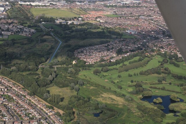
The village is known for its peaceful and picturesque surroundings, characterized by green fields and open countryside. It offers a tranquil escape from the hustle and bustle of nearby urban areas. Laceby Acres is easily accessible via the A46 road, which connects it to Grimsby and the wider Lincolnshire region.

Despite its small size, the village boasts a range of amenities to cater to its residents' needs. These include a primary school, a post office, a convenience store, and a pub. Additionally, there are several parks and recreational areas where residents can enjoy outdoor activities and spend quality time with their families.

Laceby Acres benefits from excellent transport links, with regular bus services connecting it to surrounding towns and villages. The nearby Grimsby Town railway station provides further connectivity to larger cities such as Lincoln, Sheffield, and Manchester.

The village is also within close proximity to various attractions and facilities, including the stunning Lincolnshire Wolds Area of Outstanding Natural Beauty, Cleethorpes beach, and the Grimsby Institute of Further and Higher Education.

Overall, Laceby Acres offers a peaceful and idyllic lifestyle, with a strong sense of community and a range of amenities to cater to its residents' needs.

If you have any feedback on the listing, please let us know in the comments section below.
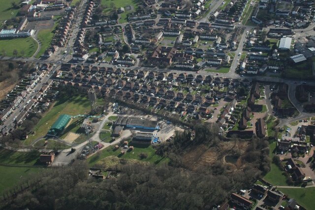
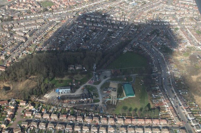
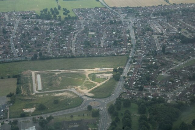
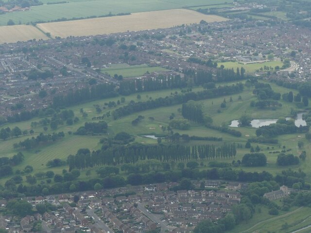
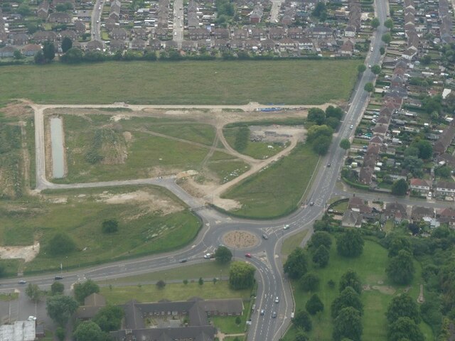
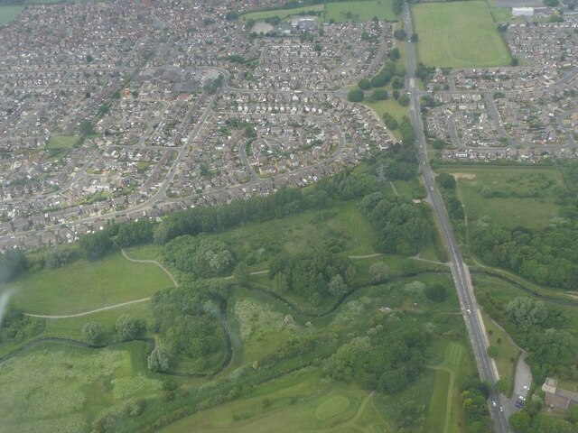
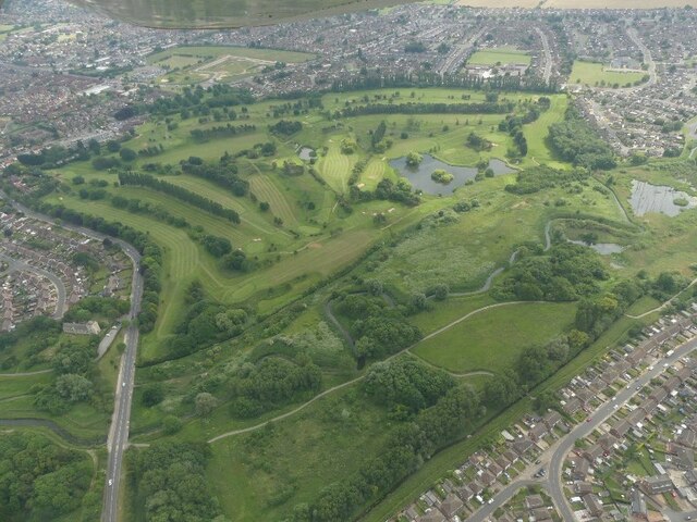
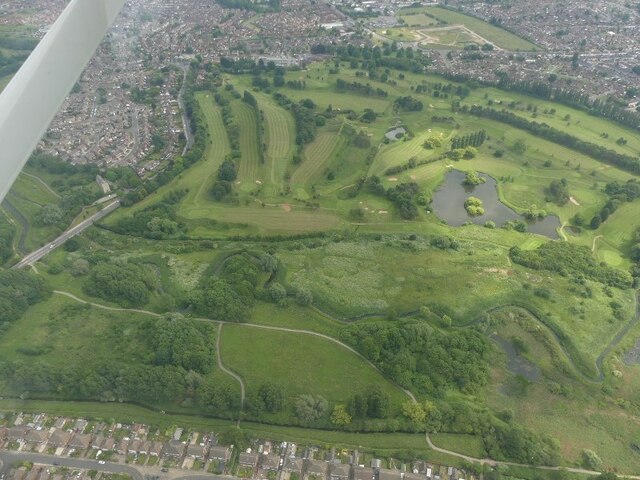
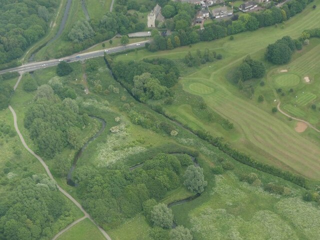
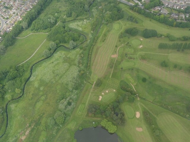
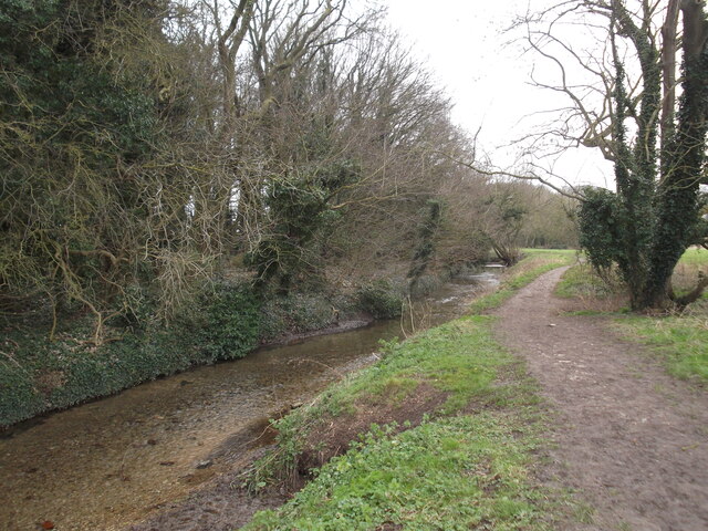
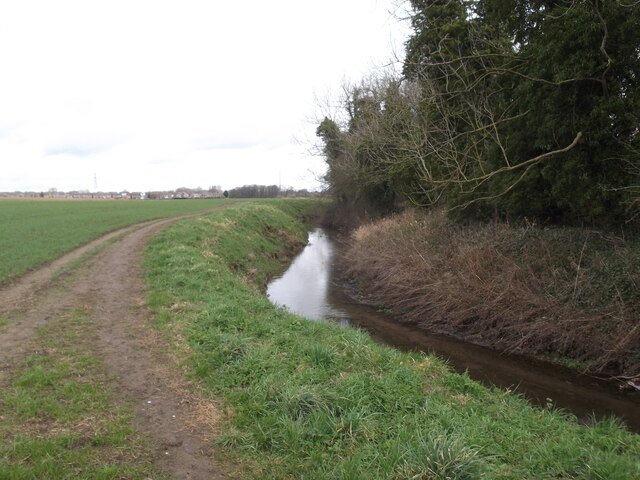
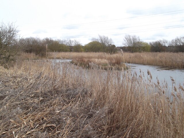
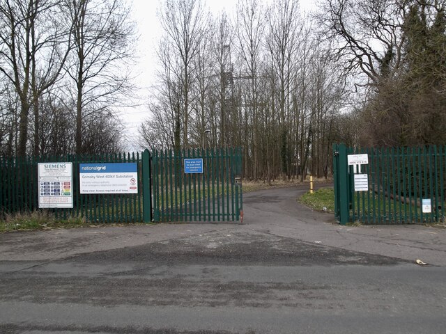
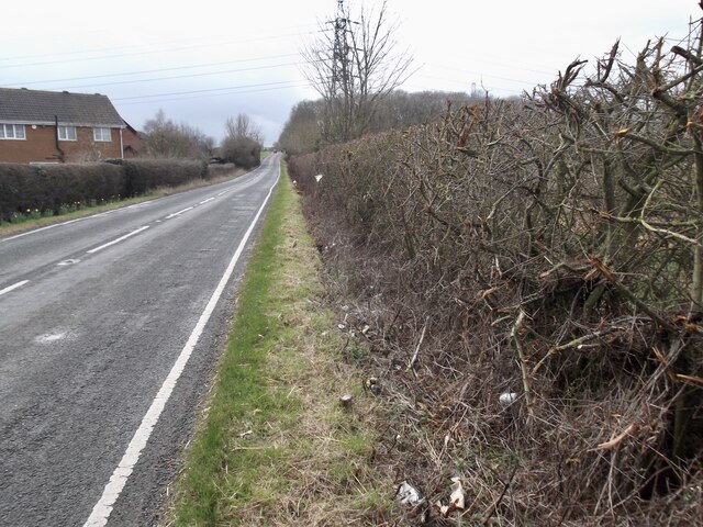
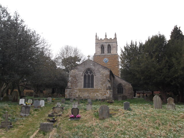
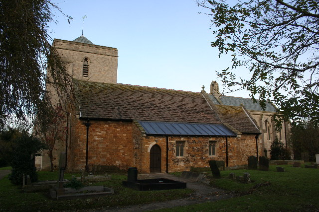
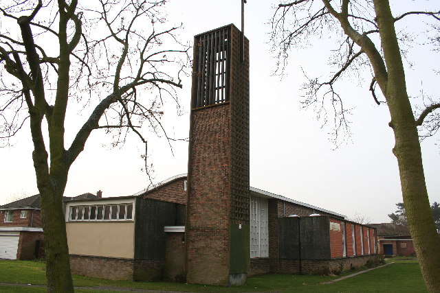
Laceby Acres Images

Images are sourced within 2km of 53.553519/-0.133713 or Grid Reference TA2307. Thanks to Geograph Open Source API. All images are credited.

Water tower and blow wells, Grimsby: aerial 2022 (1)
Water tower and blow wells, Grimsby: aerial 2022 (2)
Housing development, B1444/Cambridge Road, Grimsby: aerial 2022 (1)
Grimsby Golf Course: aerial 2022 (1)
Housing development, B1444/Cambridge Road, Grimsby: aerial 2022 (2)
Grimsby Golf Course: aerial 2022 (2)
Grimsby Golf Course: aerial 2022 (3)
Grimsby Golf Course: aerial 2022 (4)
Grimsby Golf Course: aerial 2022 (5)
Grimsby Golf Course: aerial 2022 (6)
Laceby Beck
Laceby Beck
Laceby Beck
Laceby Beck
Pond near Laceby Acres
Entrance to electricity sub-station
Road past Wybers Wood Recent savage cutting of the hedge has exposed a mass of rubbish.
Road past Wybers Wood
Recent savage cutting of the hedge has exposed a mass of rubbish.
St Nicholas Church, Great Coates
River Freshney, Little Coates and Grimsby Golf Club: aerial 2023
St.Michael's church, Little Coates, Lincs. A church of two halves ! One from the 13th century - the other from 1914.
St.Michael's church, Little Coates, Lincs.
A church of two halves ! One from the 13th century - the other from 1914.
Show me another place!

Laceby Acres is located at Grid Ref: TA2307 (Lat: 53.553519, Lng: -0.133713)

Division: Parts of Lindsey

Unitary Authority: North East Lincolnshire

Police Authority: Humberside

What 3 Words

///presuming.dreamers.stressed. Near Bradley, Lincolnshire

Nearby Locations

Laceby Acres

Related Wikis

Grimsby Borough F.C.

Grimsby Borough Football Club is a football club based in Grimsby, Lincolnshire, England. They are currently members of the Northern Premier League Division...

Little Coates

Little Coates is an area of western Grimsby, North East Lincolnshire, England. It is in the Yarborough ward of the North East Lincolnshire Unitary Council...

Bradley, Lincolnshire

Bradley is a village and civil parish in North East Lincolnshire, England. It is situated approximately 3 miles (5 km) south-west from Grimsby and 2 miles...

Nunsthorpe

Nunsthorpe (sometimes known locally as 'The Nunny', or by its nickname of Garden City) is a suburb and housing estate in the western part of Grimsby, North...

Nearby Amenities

Located within 500m of 53.553519,-0.133713
Power: pole
Source: NPE
Lat/Long: 53.5563009/-0.1376892
Bus Stop
Evesham Avenue
Bus: yes
Naptan AtcoCode: 228000004531
Naptan Bearing: E
Naptan CommonName: Evesham Avenue
Naptan Crossing: Evesham Avenue
Naptan Indicator: opp
Naptan NaptanCode: griwtap
Naptan Notes: none
Naptan PlusbusZoneRef: GRMSBYT
Naptan Street: Broadway
Naptan Verified: no
Public Transport: platform
Source: naptan_import
Lat/Long: 53.5547282/-0.1311221
Bus Stop
Evesham Avenue
Bus: yes
Naptan AtcoCode: 228000004532
Naptan Bearing: W
Naptan CommonName: Evesham Avenue
Naptan Crossing: Evesham Avenue
Naptan Indicator: adj
Naptan NaptanCode: griadat
Naptan Notes: none
Naptan PlusbusZoneRef: GRMSBYT
Naptan Street: Broadway
Naptan Verified: no
Public Transport: platform
Source: naptan_import
Lat/Long: 53.5549575/-0.1309931
Bus Stop
Broadway
Bus: yes
Naptan AtcoCode: 22800004528
Naptan Bearing: N
Naptan CommonName: Broadway
Naptan Crossing: Laceby Road
Naptan Indicator: N-bound
Naptan NaptanCode: gridwad
Naptan Notes: none
Naptan PlusbusZoneRef: GRMSBYT
Naptan Street: Broadway
Naptan Verified: no
Public Transport: platform
Source: naptan_import
Lat/Long: 53.5505231/-0.1327472
Bus Stop
Broadway
Bus: yes
Naptan AtcoCode: 22800004529
Naptan Bearing: S
Naptan CommonName: Broadway
Naptan Crossing: Laceby Road
Naptan Indicator: S-bound
Naptan NaptanCode: grijdad
Naptan Notes: none
Naptan PlusbusZoneRef: GRMSBYT
Naptan Street: Broadway
Naptan Verified: no
Public Transport: platform
Source: naptan_import
Lat/Long: 53.5504744/-0.1325078
Bus Stop
Laceby Acres School
Bus: yes
Naptan AtcoCode: 228000107606
Naptan Bearing: N
Naptan CommonName: Laceby Acres School
Naptan Indicator: opp
Naptan Landmark: Laceby Acres School
Naptan NaptanCode: grijtdw
Naptan Notes: none
Naptan PlusbusZoneRef: GRMSBYT
Naptan Street: Broadway
Naptan Verified: no
Public Transport: platform
Source: naptan_import
Lat/Long: 53.5536423/-0.133878
Bus Stop
Laceby Acres School
Bus: yes
Naptan AtcoCode: 228000107607
Naptan Bearing: S
Naptan CommonName: Laceby Acres School
Naptan Indicator: o/s
Naptan Landmark: Laceby Acres School
Naptan NaptanCode: grijwdw
Naptan Notes: none
Naptan PlusbusZoneRef: GRMSBYT
Naptan Street: Broadway
Naptan Verified: no
Public Transport: platform
Source: naptan_import
Lat/Long: 53.5532146/-0.1335496
Bus Stop
Nelson Way
Bus: yes
Naptan AtcoCode: 228000107608
Naptan Bearing: NE
Naptan CommonName: Nelson Way
Naptan Crossing: Nelson Way
Naptan Indicator: adj
Naptan NaptanCode: grimadw
Naptan Notes: none
Naptan PlusbusZoneRef: GRMSBYT
Naptan Street: Broadway
Naptan Verified: no
Public Transport: platform
Source: naptan_import
Lat/Long: 53.5551107/-0.1334963
Bus Stop
Nelson Way
Bus: yes
Naptan AtcoCode: 228000107609
Naptan Bearing: W
Naptan CommonName: Nelson Way
Naptan Crossing: Nelson Way
Naptan Indicator: opp
Naptan NaptanCode: grimgdw
Naptan Notes: none
Naptan PlusbusZoneRef: GRMSBYT
Naptan Street: Broadway
Naptan Verified: no
Public Transport: platform
Source: naptan_import
Lat/Long: 53.5551323/-0.1325744
Bus Stop
Pershore Avenue
Bus: yes
Naptan AtcoCode: 228000107610
Naptan Bearing: E
Naptan CommonName: Pershore Avenue
Naptan Crossing: Pershore Avenue
Naptan Indicator: E-bound
Naptan NaptanCode: grimjdw
Naptan Notes: none
Naptan PlusbusZoneRef: GRMSBYT
Naptan Street: St Michaels Road
Naptan Verified: no
Public Transport: platform
Source: naptan_import
Lat/Long: 53.5531191/-0.1291606
Bus Stop
Pershore Avenue
Bus: yes
Naptan AtcoCode: 228000107611
Naptan Bearing: W
Naptan CommonName: Pershore Avenue
Naptan Crossing: Pershore Avenue
Naptan Indicator: W-bound
Naptan NaptanCode: grimpdw
Naptan Notes: none
Naptan PlusbusZoneRef: GRMSBYT
Naptan Street: St Michaels Road
Naptan Verified: no
Public Transport: platform
Source: naptan_import
Lat/Long: 53.5530352/-0.1289681
Bus Stop
Longfield Road
Bus: yes
Naptan AtcoCode: 228000107612
Naptan Bearing: W
Naptan CommonName: Longfield Road
Naptan Crossing: Longfield Road
Naptan Indicator: adj
Naptan NaptanCode: grimtdw
Naptan Notes: none
Naptan PlusbusZoneRef: GRMSBYT
Naptan Street: St Michaels Road
Naptan Verified: no
Public Transport: platform
Source: naptan_import
Lat/Long: 53.5529565/-0.1268127
Bus Stop
Longfield Road
Bus: yes
Naptan AtcoCode: 228000107613
Naptan Bearing: E
Naptan CommonName: Longfield Road
Naptan Crossing: Longfield Road
Naptan Indicator: opp
Naptan NaptanCode: griwmga
Naptan Notes: none
Naptan PlusbusZoneRef: GRMSBYT
Naptan Street: St Michaels Road
Naptan Verified: no
Public Transport: platform
Source: naptan_import
Lat/Long: 53.553117/-0.1267301
Turning Circle
Lat/Long: 53.5515881/-0.1284728
Mini Roundabout
Direction: clockwise
Lat/Long: 53.5551496/-0.1332297
Turning Circle
Lat/Long: 53.5506651/-0.1302858
Turning Circle
Lat/Long: 53.552004/-0.1350977
Turning Circle
Lat/Long: 53.5527769/-0.1376631
Fast Food
Fai Wong
Addr City: Grimsby
Addr Country: GB
Addr Housenumber: 1
Addr Postcode: DN34 5XE
Addr Street: Gunners Way
Cuisine: chinese
Fhrs Authority: North East Lincolnshire
Fhrs Id: 675563
Fhrs Local Authority Id: 4004
Opening Hours: We-Su 17:00-22:00; Mo-Tu closed
Phone: +44 1472 870 668
Takeaway: only
Lat/Long: 53.5536187/-0.1347529
Crossing
Crossing: uncontrolled
Lat/Long: 53.5507503/-0.1383913
Crossing
Check Date Crossing: 2023-11-02
Crossing: uncontrolled
Lat/Long: 53.5505965/-0.1393274
Power: pole
Lat/Long: 53.5538405/-0.1412395
Power: pole
Lat/Long: 53.5541372/-0.1402364
Power: pole
Lat/Long: 53.5544623/-0.1391923
Power: pole
Lat/Long: 53.5550687/-0.1386953
Power: pole
Lat/Long: 53.5573636/-0.136804
Morrisons Daily
Addr City: Grimsby
Addr Country: GB
Addr Postcode: DN34 5QU
Addr Street: Gunners Way
Brand: Morrisons Daily
Brand Wikidata: Q99752411
Fhrs Authority: North East Lincolnshire
Fhrs Id: 1581860
Fhrs Local Authority Id: 178139
Opening Hours: Mo-Su 06:00-22:00
Operator: McColl's
Operator Wikidata: Q16997477
Payment Cash: yes
Payment Contactless: yes
Payment Credit Cards: yes
Payment Debit Cards: yes
Shop: convenience
Website: https://my.morrisons.com/storefinder/61320/morrisons-daily-grimsby-gunners-way
Lat/Long: 53.5534021/-0.1343254
Barrier: motorcycle_barrier
Foot: designated
Material: steel
Lat/Long: 53.5504714/-0.1371462
Atm
Opening Hours: 24/7
Lat/Long: 53.553397/-0.1344766
Post Box
Check Date: 2024-01-15
Collection Times: Mo-Fr 09:00; Sa 07:00
Image: https://i.postimg.cc/HsCSzFf3/DN34-274.jpg
Location: Broadway (Gunners Watch)
Operator: Royal Mail
Operator Wikidata: Q638098
Post Box Design: type_k
Post Box Type: pillar
Ref: DN34 274
Royal Cypher: EIIR
Royal Cypher Wikidata: Q33102113
Source: survey
Lat/Long: 53.5534313/-0.1338771
Post Box
Check Date: 2024-01-15
Collection Plate: CP1D
Collection Times: Mo-Fr 09:00; Sa 07:00
Image: https://i.postimg.cc/wTrgrZPs/DN34-158-D.jpg
Location: Broadway, outside No.108
Operator: Royal Mail
Operator Wikidata: Q638098
Post Box Design: type_b
Post Box Type: pillar
Ref: DN34 158D
Royal Cypher: EIIR
Royal Cypher Wikidata: Q33102113
Source: survey
Lat/Long: 53.5553051/-0.1292275
Post Box
Check Date: 2024-01-15
Collection Plate: CP7D
Collection Times: Mo-Fr 09:00; Sa 07:00
Image: https://i.postimg.cc/907Xj2qN/DN34-273-D.jpg
Location: Nelson Way, Victory Way
Operator: Royal Mail
Operator Wikidata: Q638098
Post Box Mounting: pier
Post Box Type: lamp
Ref: DN34 273D
Royal Cypher: EIIR
Royal Cypher Wikidata: Q33102113
Source: survey
Lat/Long: 53.5514937/-0.136731
Laceby Tanning & Beauty
Addr City: Grimsby
Addr Country: GB
Addr Housenumber: 2
Addr Postcode: DN34 5XE
Addr Street: Gunners Way
Beauty: tanning
Contact Facebook: https://www.facebook.com/people/Laceby-Tanning-Beauty/100063702107936/
Phone: +44 1472 277 261
Shop: beauty
Lat/Long: 53.5536799/-0.1346764
Morgans
Addr City: Grimsby
Addr Country: GB
Addr Housenumber: 4
Addr Postcode: DN34 5XE
Addr Street: Gunners Way
Contact Facebook: https://www.facebook.com/morgans.hairdressers/
Female: yes
Opening Hours: Tu, We, Fr, Sa 09:00-17:00; Th 09:30-18:00; Su-Mo closed
Phone: +44 1472 230 777
Shop: hairdresser
Lat/Long: 53.5537054/-0.1345289
Fast Food
Centro Pizza
Addr City: Grimsby
Addr Country: GB
Addr Housenumber: 5
Addr Postcode: DN34 5XE
Addr Street: Gunners Way
Cuisine: pizza
Fhrs Authority: North East Lincolnshire
Fhrs Id: 675630
Fhrs Local Authority Id: 41667
Phone: +44 1472 750 750
Takeaway: only
Lat/Long: 53.5536432/-0.134435
Charging Station
Morrisons
Fee: yes
Operator: GeniePoint
Socket Chademo: 1
Socket Chademo Output: 50kW
Socket Type2 Cable: 1
Socket Type2 Cable Output: 22kW
Socket Type2 Combo: 1
Socket Type2 Combo Output: 50kW
Lat/Long: 53.5502156/-0.1379795
The data included in this document is from www.openstreetmap.org. The data is made available under ODbL.

Have you been to Laceby Acres?

Leave your review of Laceby Acres below (or comments, questions and feedback).