Gleann Tarmsaig

Valley in Inverness-shire

Scotland

Gleann Tarmsaig

Dam and footbridge. Lochannan Lacasdail The wooden footbridge almost certainly replaces a former stone bridge which carried the road. There is now a modern road bridge out of shot on the right.
Dam and footbridge. Lochannan Lacasdail Credit: Richard Dorrell

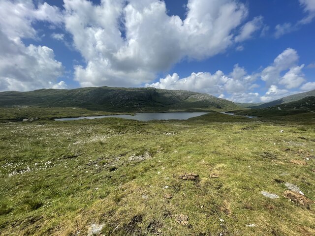
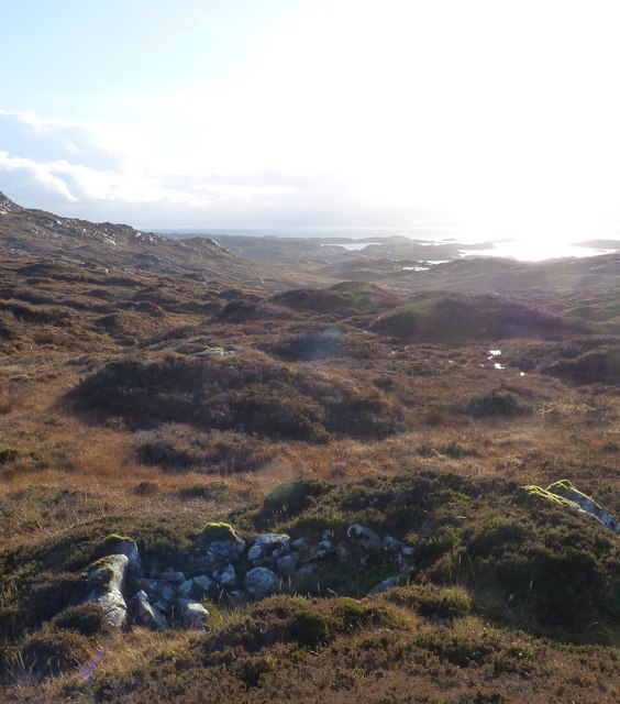
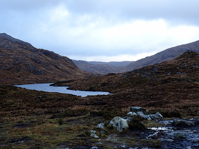
Gleann Tarmsaig is a picturesque valley located in Inverness-shire, Scotland. Situated in the heart of the Scottish Highlands, the valley is renowned for its stunning natural beauty and rugged landscapes. The glen stretches for approximately 15 miles, bordered by towering mountains and lush greenery.

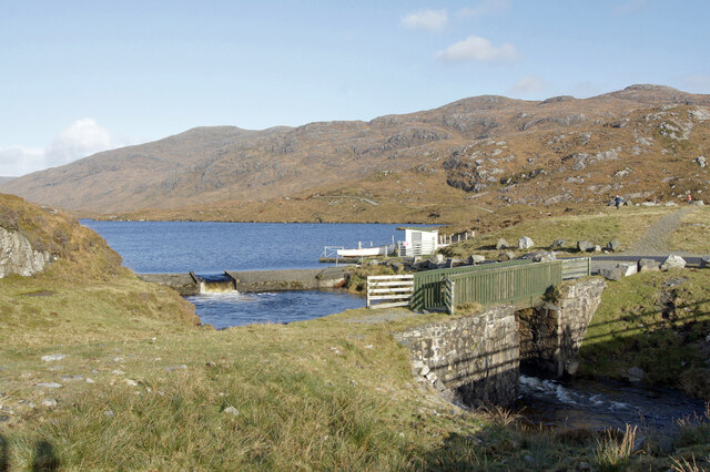
One of the prominent features of Gleann Tarmsaig is the River Tarmsaig, which meanders through the valley, adding to its charm and creating an idyllic atmosphere. The river is known for its crystal-clear waters, which make it a popular spot for fishing and water sports enthusiasts.

The valley is rich in wildlife, with several species of birds, mammals, and flora thriving in the area. It is not uncommon to spot red deer, golden eagles, and ptarmigans while exploring the glen. Moreover, the valley is home to various plant species, including heather, bilberry, and moss, enhancing its natural beauty.

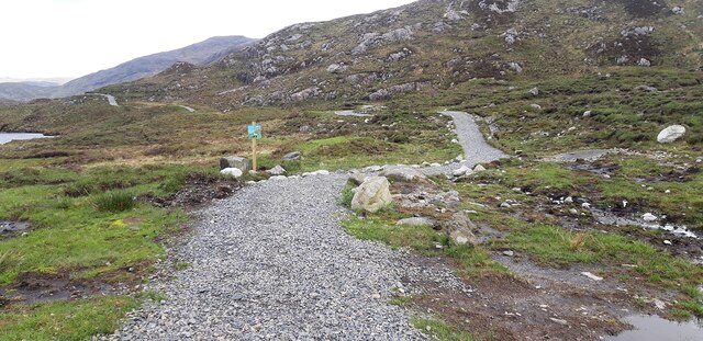
Gleann Tarmsaig offers a plethora of outdoor activities for visitors to enjoy. Hiking and mountain biking enthusiasts can explore the numerous trails that crisscross the valley, providing breathtaking views of the surrounding mountains and valleys. Additionally, the valley is a paradise for photographers, as it offers countless opportunities to capture the stunning landscapes and wildlife.

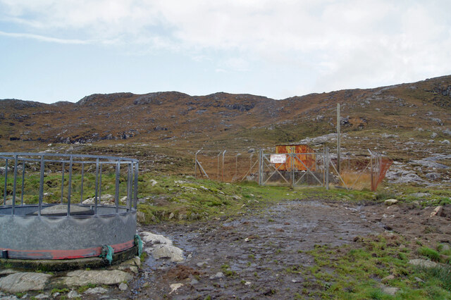
While Gleann Tarmsaig is predominantly a rural area, there are a few small settlements scattered throughout the valley, offering accommodation options and basic amenities for tourists. The valley attracts nature lovers, adventure seekers, and those seeking a peaceful retreat away from the hustle and bustle of city life.

In summary, Gleann Tarmsaig is a captivating valley in Inverness-shire that showcases the untouched beauty of the Scottish Highlands. Its scenic landscapes, diverse wildlife, and range of outdoor activities make it an ideal destination for nature enthusiasts and those looking to immerse themselves in the tranquility of the countryside.

If you have any feedback on the listing, please let us know in the comments section below.

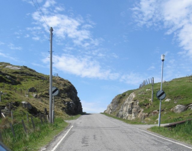
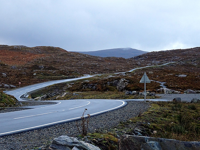
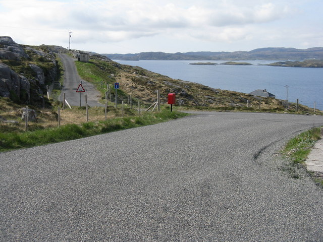
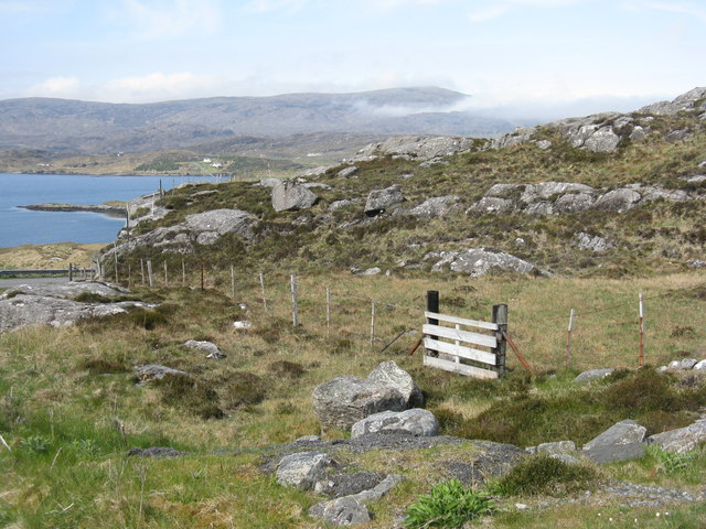
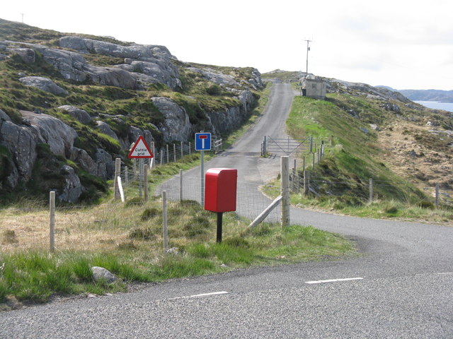
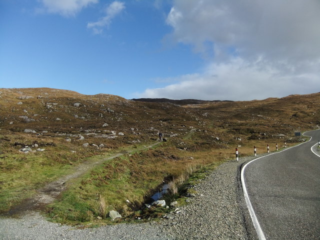
Gleann Tarmsaig Images

Images are sourced within 2km of 57.890914/-6.748924 or Grid Reference NG1898. Thanks to Geograph Open Source API. All images are credited.

Dam and footbridge. Lochannan Lacasdail The wooden footbridge almost certainly replaces a former stone bridge which carried the road. There is now a modern road bridge out of shot on the right.
Dam and footbridge. Lochannan Lacasdail
The wooden footbridge almost certainly replaces a former stone bridge which carried the road. There is now a modern road bridge out of shot on the right.
Explosives store The sign on the fence reads 'Explosives Store', though the rickety looking building within looks like it has seen better days, so I doubt any explosives are stored there now, and I have to wonder why they were ever there is the first place.
Explosives store
The sign on the fence reads 'Explosives Store', though the rickety looking building within looks like it has seen better days, so I doubt any explosives are stored there now, and I have to wonder why they were ever there is the first place.
Path around Lochanan Lacasdail This path looks brand new.
Path around Lochanan Lacasdail
This path looks brand new.
Harris Landscape Geocaching is a type of global treasure hunt of people looking for caches, or hidden stashes of objects. Geocaching may also be described as a series of hide-and-seek games, where hiders provide online clues for seekers. Seekers use global positioning system (GPS) devices to find hidden caches
Harris Landscape
Geocaching is a type of global treasure hunt of people looking for caches, or hidden stashes of objects. Geocaching may also be described as a series of hide-and-seek games, where hiders provide online clues for seekers. Seekers use global positioning system (GPS) devices to find hidden caches
View west along coast single-track with vernacular buildings
Abandoned (?) House Quite a few apparently abandoned or falling-apart buildings on Harris & Lewis
Abandoned (?) House
Quite a few apparently abandoned or falling-apart buildings on Harris & Lewis
New-ish cutting with road near Ceann a' Ghàraidh
An ruined shieling The island of Scalpay can be seen in the background
An ruined shieling
The island of Scalpay can be seen in the background
Loch a' Bhuna
Loch a' Bhuna
Bends in the road On the road from Scalpay to Tarbert.
Bends in the road
On the road from Scalpay to Tarbert.
Lochanan Lacasdail A seiries of lochs which extend a lot further than suggested by this image.
Lochanan Lacasdail
A seiries of lochs which extend a lot further than suggested by this image.
Post box at Urgha Beag At the turn off from the Scalpay road to Urgha Beag. Looking out to Bàgh Urgha Beag.
Post box at Urgha Beag
At the turn off from the Scalpay road to Urgha Beag. Looking out to Bàgh Urgha Beag.
Rocky hillside at Urgha Beag Looking out over Bàgh Urgha Beag.
Rocky hillside at Urgha Beag
Looking out over Bàgh Urgha Beag.
Urgha road end With post box, road signs and cattle grid.
Urgha road end
With post box, road signs and cattle grid.
Path to Reinigeadal
Path to Reinigeadal
House at Caolas Sgalpaigh Spelling according to the OS map, but the roadsign has Scalpaigh, with a 'c'. The anglicised version would be Kyle of Scalpay. Note the palm trees.
House at Caolas Sgalpaigh
Spelling according to the OS map, but the roadsign has Scalpaigh, with a 'c'. The anglicised version would be Kyle of Scalpay. Note the palm trees.
Carragreich: postbox № HS3 108 A small postbox, emptied at 9:30 each weekday and Saturday morning.
Carragreich: postbox № HS3 108
A small postbox, emptied at 9:30 each weekday and Saturday morning.
Folded gneiss, old path to Reinigeadal, Harris Folded gneiss, old path to Reinigeadal, North Harris. This rock is located by the side of the footpath, which was the only way to the isolated community until a road was built, approaching it from the north. Gneiss is the predominant rock type in Harris, and was formed around two billion years ago. The folds resulted from a sequence of mountain building events in the Precambrian.
Folded gneiss, old path to Reinigeadal, Harris
Folded gneiss, old path to Reinigeadal, North Harris. This rock is located by the side of the footpath, which was the only way to the isolated community until a road was built, approaching it from the north. Gneiss is the predominant rock type in Harris, and was formed around two billion years ago. The folds resulted from a sequence of mountain building events in the Precambrian.
Show me another place!

Gleann Tarmsaig is located at Grid Ref: NG1898 (Lat: 57.890914, Lng: -6.748924)

Unitary Authority: Na h-Eileanan an Iar

Police Authority: Highlands and Islands

What 3 Words

///entitles.gentle.diner. Near Tarbert, Na h-Eileanan Siar

Related Wikis

Sgeotasaigh

Scotasay (Scottish Gaelic: Sgeotasaigh) is small island in the Outer Hebrides of Scotland. It lies 1 kilometre (0.6 miles) off the east coast of Harris...

East Loch Tarbert

East Loch Tarbert (Scottish Gaelic: Loch an Tairbeairt) is a sea loch that lies to the east of Harris in the Outer Hebrides of Scotland. The loch contains...

Harris distillery

Harris distillery is a Scotch whisky and Gin distillery in Tarbert on the Isle of Harris, Scotland. The distillery was the first legal distillery ever...

Tarbert, Harris

Tarbert (Scottish Gaelic: An Tairbeart [ən̪ˠ ˈt̪ɛrʲɛbərˠʃt̪]) is the main community on Harris in the Western Isles of Scotland. The name means "isthmus...

Nearby Amenities

Located within 500m of 57.890914,-6.748924
Carragreich
Naptan AtcoCode: 6010731598
Naptan Bearing: SW
Naptan BusStopType: CUS
Naptan CommonName: Carragreich
Naptan Indicator: Village
Naptan Landmark: Road junction
Naptan NaptanCode: 94723676
Naptan Street: Unclassified road
Naptan Verified: no
Source: naptan_import
Lat/Long: 57.8915486/-6.7460974
Barrier: cattle_grid
Source: survey
Lat/Long: 57.8918265/-6.7461744
Turning Circle
Lat/Long: 57.8885594/-6.745745
Bagh a' Ghlinne
Natural: bay
Lat/Long: 57.8884607/-6.7498905
Material: wood
Power: pole
Lat/Long: 57.8941219/-6.754159
Material: wood
Power: pole
Lat/Long: 57.8934334/-6.7528635
Material: wood
Power: pole
Lat/Long: 57.8926787/-6.7524512
Material: wood
Power: pole
Lat/Long: 57.8923436/-6.7515849
Material: wood
Power: pole
Lat/Long: 57.8890848/-6.7465071
Material: wood
Power: pole
Lat/Long: 57.8913742/-6.7491333
Material: wood
Power: pole
Lat/Long: 57.8894894/-6.744367
Material: wood
Power: pole
Lat/Long: 57.8898858/-6.7453702
Material: wood
Power: pole
Lat/Long: 57.8902413/-6.7462551
Material: wood
Power: pole
Lat/Long: 57.8908342/-6.7468292
Material: wood
Power: pole
Lat/Long: 57.8890384/-6.7431656
Material: wood
Power: pole
Lat/Long: 57.888534/-6.7419182
Material: wood
Power: pole
Lat/Long: 57.8918131/-6.7502266
Power: pole
Lat/Long: 57.8887293/-6.7463066
Power: pole
Lat/Long: 57.8894704/-6.74672
Power: pole
Lat/Long: 57.8898768/-6.7469461
Power: pole
Lat/Long: 57.8910147/-6.7476078
The data included in this document is from www.openstreetmap.org. The data is made available under ODbL.

Have you been to Gleann Tarmsaig?

Leave your review of Gleann Tarmsaig below (or comments, questions and feedback).