Knotbury

Settlement in Staffordshire Staffordshire Moorlands

England

Knotbury

Lone tree in a sheep pasture at Spring Head
Lone tree in a sheep pasture at Spring Head Credit: Neil Theasby

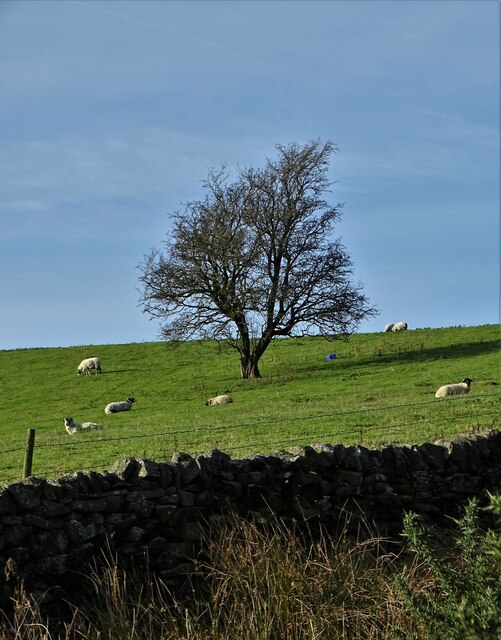
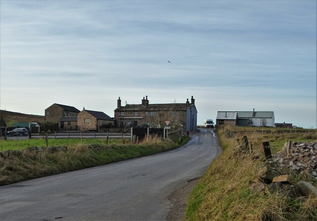
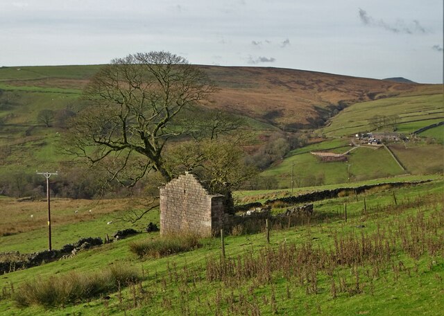
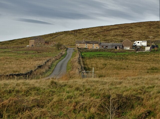
Knotbury is a small village located in the county of Staffordshire, England. Situated approximately 6 miles south of the town of Uttoxeter, Knotbury is nestled amidst the picturesque countryside that characterizes this part of the country. The village is surrounded by rolling hills, verdant meadows, and scenic woodlands, making it an idyllic setting for those seeking a peaceful retreat.

With a population of around 500 residents, Knotbury maintains a close-knit community atmosphere. The village is known for its charming old-world cottages, many of which date back several centuries. These quaint homes are complemented by a few small shops, including a local convenience store, providing essential amenities for the villagers.

Knotbury is steeped in history, with evidence of human habitation dating back to the Roman era. The village is home to a historic church, St. Mary's, which dates back to the 12th century. This beautiful medieval structure serves as a focal point for the community and is a popular destination for history enthusiasts and architecture aficionados.

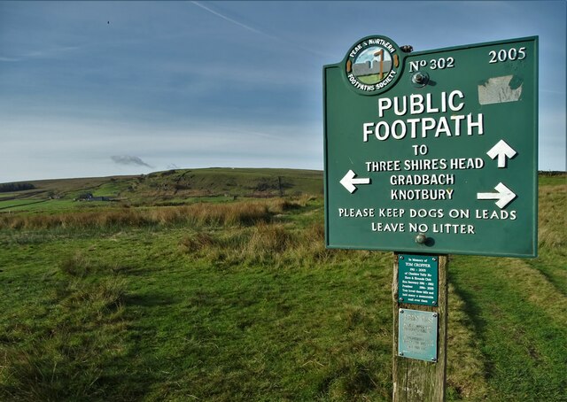
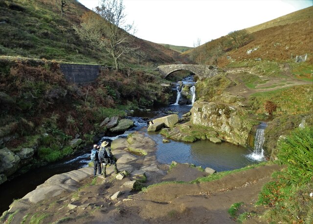
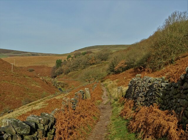
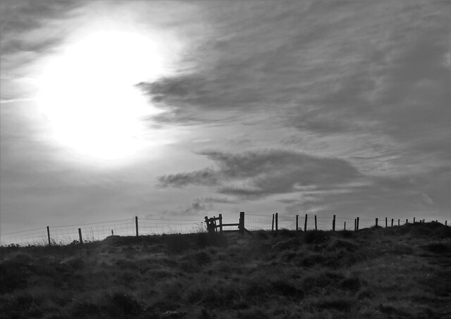
The natural surroundings of Knotbury offer ample opportunities for outdoor activities. The village is surrounded by numerous walking trails and bridleways, allowing residents and visitors to explore the stunning Staffordshire countryside. The nearby River Dove is a popular spot for fishing enthusiasts, known for its abundance of trout and grayling.

Although Knotbury may be small in size, its sense of community, rich history, and natural beauty make it a delightful place to visit or call home.

If you have any feedback on the listing, please let us know in the comments section below.
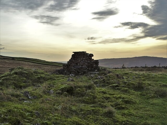
Knotbury Images

Images are sourced within 2km of 53.211836/-1.976009 or Grid Reference SK0168. Thanks to Geograph Open Source API. All images are credited.

Lone tree in a sheep pasture at Spring Head
View from the Longnor Road To "The Knights Table" inn - by the A53 Buxton/Leek road.
View from the Longnor Road
To "The Knights Table" inn - by the A53 Buxton/Leek road.
St Paul's Church, Flash In the parish of Quarnford, the construction of St Paul's Church began in 1743.
St Paul's Church, Flash
In the parish of Quarnford, the construction of St Paul's Church began in 1743.
Elderberry Cottage near Flash
Boulder in a field in the parish of Quarnford
Crippled tree near Spring Head With a light aircraft flying overhead
Crippled tree near Spring Head
With a light aircraft flying overhead
Junction of paths north of Spring Head
Cocket Knowl High in the Staffordshire moors.
Cocket Knowl
High in the Staffordshire moors.
Barn ruin below Turn Edge
Three Shires Head Bridge - crossing The River Dane This is where the ancient ceremonial counties of Cheshire, Staffordshire and Derbyshire meet. Three Shires Head is also known as Three Shires Heads - both versions are acceptable. The pool to the right is I think known as Panniers Pool - often braved by hardy swimmers.
Three Shires Head Bridge - crossing The River Dane
This is where the ancient ceremonial counties of Cheshire, Staffordshire and Derbyshire meet. Three Shires Head is also known as Three Shires Heads - both versions are acceptable. The pool to the right is I think known as Panniers Pool - often braved by hardy swimmers.
On the moorland track to Three Shires Head Along the valley of The River Dane
On the moorland track to Three Shires Head
Along the valley of The River Dane
A view of Blackclough Farm
View to Readyleech Green Farm
November View Weather-beaten signpost above the village of Flash, looking out over the Staffordshire moors towards Cheshire.
November View
Weather-beaten signpost above the village of Flash, looking out over the Staffordshire moors towards Cheshire.
Lonely ruin on Oliver Hill Long ago someone might have lived here but more likely it was a sheep barn.
Lonely ruin on Oliver Hill
Long ago someone might have lived here but more likely it was a sheep barn.
On the path to Oliver Hill
Sign on "The New Inn" in Flash Shame about the missing apostrophe and the unnecessary capital "V". Perhaps it was the altitude's fault.
Sign on "The New Inn" in Flash
Shame about the missing apostrophe and the unnecessary capital "V". Perhaps it was the altitude's fault.
Blackclough & Dane Valley Way
Show me another place!

Knotbury is located at Grid Ref: SK0168 (Lat: 53.211836, Lng: -1.976009)

Administrative County: Staffordshire

District: Staffordshire Moorlands

Police Authority: Staffordshire

What 3 Words

///pages.promoted.multiples. Near Buxton, Derbyshire

Nearby Locations

Knotbury Common Knotbury

Related Wikis

Three Shire Heads

Three Shire Heads (also known as Three Shires Head) is the point on Axe Edge Moor where Cheshire, Derbyshire and Staffordshire meet, at UK grid reference...

Oliver Hill (Peak District)

Oliver Hill is a hill, 513 metres (1,683 ft) high, in the Peak District in the county of Staffordshire in England. It is a treeless summit surrounded by...

Quarnford

Quarnford is a village and civil parish in the Staffordshire Moorlands district of Staffordshire, England. According to the 2001 census it had a population...

Flash, Staffordshire

Flash is a village in the Staffordshire Moorlands, England, and Peak District National Park. At 1,519 feet (463 m) above sea level, it is the highest village...

Nearby Amenities

Located within 500m of 53.211836,-1.976009
Barrier: stile
Material: wood
Source: survey;gps
Stile: stepover
Lat/Long: 53.2107359/-1.9814753
Barrier: stile
Material: wood
Source: survey;gps
Stile: stepover
Lat/Long: 53.210813/-1.9819307
Barrier: stile
Material: wood
Source: survey;gps
Stile: stepover
Lat/Long: 53.2114491/-1.9779087
Barrier: stile
Material: stone
Source: survey;gps
Stile: stepover
Lat/Long: 53.2114861/-1.9777963
Barrier: stile
Material: wood
Source: survey;gps
Stile: stepover
Lat/Long: 53.2130032/-1.9796398
Barrier: stile
Material: stone
Source: survey;gps
Stile: stepover
Lat/Long: 53.2132097/-1.9796536
Barrier: stile
Material: stone
Source: survey;gps
Stile: squeezer
Lat/Long: 53.21429/-1.9800059
Barrier: stile
Material: wood
Stile: ladder
Lat/Long: 53.213076/-1.9730001
The data included in this document is from www.openstreetmap.org. The data is made available under ODbL.

Have you been to Knotbury?

Leave your review of Knotbury below (or comments, questions and feedback).