Knossington

Settlement in Leicestershire Melton

England

Knossington

Cold Overton, St John the Baptist
Cold Overton, St John the Baptist Credit: Dave Kelly

Knossington is a village located in the county of Leicestershire, England. Situated approximately 10 miles east of the city of Leicester, it is a small and picturesque settlement with a population of around 300 people. The village is part of Harborough district and falls within the East Midlands region.

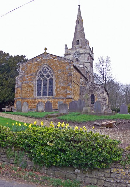
With its origins dating back to the medieval period, Knossington is rich in history and boasts several notable architectural landmarks. The centerpiece of the village is the All Saints Church, a Grade II listed building that dates back to the 13th century. This stunning church features a beautiful spire and is renowned for its intricate stained glass windows and ornate interior.

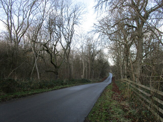
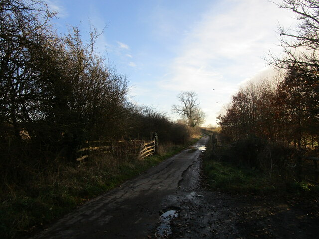
Knossington is surrounded by scenic countryside, offering ample opportunities for outdoor activities and exploration. The village is surrounded by rolling hills, lush fields, and charming woodlands, making it an ideal location for nature enthusiasts. Many footpaths and bridleways crisscross the area, providing fantastic walking and cycling routes.

Despite its small size, Knossington has a strong sense of community and offers a range of amenities for its residents. These include a village hall, a primary school, and a local pub. The village also hosts a number of events throughout the year, such as fairs and festivals, which bring the community together.

Overall, Knossington is a tranquil and picturesque village, steeped in history and natural beauty. Its close proximity to Leicester and its strong community spirit make it an attractive place to live for those seeking a peaceful rural lifestyle.

If you have any feedback on the listing, please let us know in the comments section below.

Knossington Images

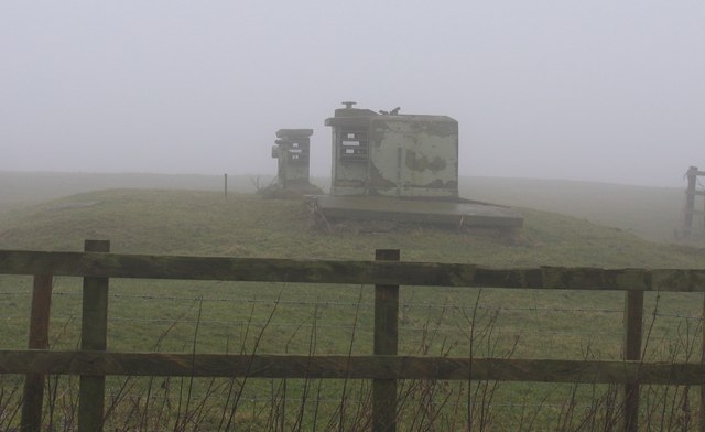
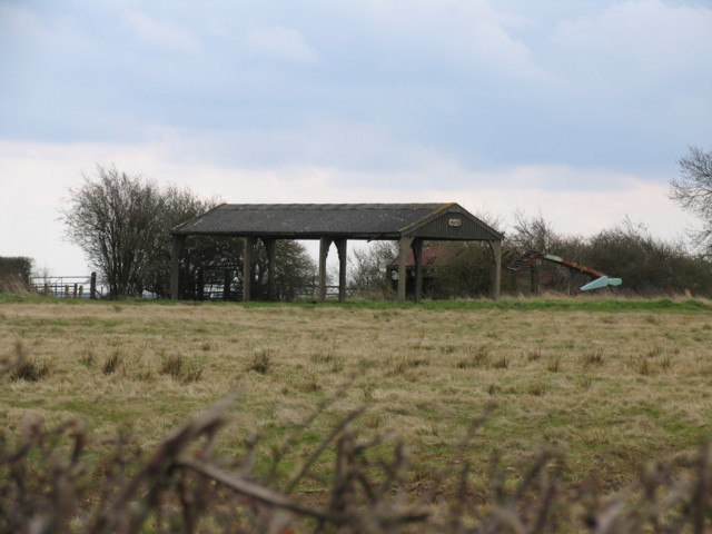
Images are sourced within 2km of 52.669121/-0.815213 or Grid Reference SK8008. Thanks to Geograph Open Source API. All images are credited.

Cold Overton, St John the Baptist
Sheep pasture near Owston
Bruce's Lane Signposted as a gated road to Somerby.
Bruce's Lane
Signposted as a gated road to Somerby.
Somerby Road Looking towards Knossington.
Somerby Road
Looking towards Knossington.
Entrance to Seven Cities Recycling Centre
Knossington Road near Owston
Crossroads near Knossington
Muddy entrance to a grass field near Furze Hill Farm
Owston Wood Road
Owston Wood Road
Bruce's Lane A public road though little more than a rough track.
Bruce's Lane
A public road though little more than a rough track.
Knossington, Leicestershire The Fox and Hounds and St Peter's Church, Somerby Road.
Knossington, Leicestershire
The Fox and Hounds and St Peter's Church, Somerby Road.
Coming into Cold Overton, Leicestershire Cold Overton Road from Knossington meets Somerby Road
Coming into Cold Overton, Leicestershire
Cold Overton Road from Knossington meets Somerby Road
Gates Nursery, Cold Overton A glimpse of the countryside beyond the greenhouses at this very large garden centre. Although it is so large its careful positioning on a slope facing out from the village means it doesn't dominate the tiny community. See <span class="nowrap"><a title="http://www.gatesnurseries.co.uk/" rel="nofollow ugc noopener" href="http://www.gatesnurseries.co.uk/">Link</a><img style="margin-left:2px;" alt="External link" title="External link - shift click to open in new window" src="https://s1.geograph.org.uk/img/external.png" width="10" height="10"/></span> for info on the garden centre and have a cup of tea at the lovely tea room while you are there, <span class="nowrap"><a title="http://homepage.ntlworld.com/thegalehouse/timefortea/tearooms/gates.htm" rel="nofollow ugc noopener" href="http://homepage.ntlworld.com/thegalehouse/timefortea/tearooms/gates.htm">Link</a><img style="margin-left:2px;" alt="External link" title="External link - shift click to open in new window" src="https://s1.geograph.org.uk/img/external.png" width="10" height="10"/></span>.
Gates Nursery, Cold Overton
A glimpse of the countryside beyond the greenhouses at this very large garden centre. Although it is so large its careful positioning on a slope facing out from the village means it doesn't dominate the tiny community. See LinkExternal link for info on the garden centre and have a cup of tea at the lovely tea room while you are there, LinkExternal link.
Church of St Peter, Knossington
Knossington Grange from the south west
Waiting for the bomb that never came Cold Overton Monitoring Post <span class="nowrap"><a title="http://www.subbrit.org.uk/cgi-bin/webdata_roc.pl?fid=988730925.004001&query=OS%2BGridRef%3DSK%26pagenum%3D3%26cgifunction%3DSearch&cgifunction=form" rel="nofollow ugc noopener" href="http://www.subbrit.org.uk/cgi-bin/webdata_roc.pl?fid=988730925.004001&query=OS%2BGridRef%3DSK%26pagenum%3D3%26cgifunction%3DSearch&cgifunction=form">Link</a><img style="margin-left:2px;" alt="External link" title="External link - shift click to open in new window" src="https://s1.geograph.org.uk/img/external.png" width="10" height="10"/></span>
Waiting for the bomb that never came
Cold Overton Monitoring Post LinkExternal link
Country road towards Withcote Keep going straight on and eventually Withcote is reached. Immediately to the right of the camera position is a council tip well away from any houses.
Country road towards Withcote
Keep going straight on and eventually Withcote is reached. Immediately to the right of the camera position is a council tip well away from any houses.
Barn near Knossington
Show me another place!

Knossington is located at Grid Ref: SK8008 (Lat: 52.669121, Lng: -0.815213)

Administrative County: Leicestershire

District: Melton

Police Authority: Leicestershire

What 3 Words

///oldest.crossing.lecturers. Near Langham, Rutland

Nearby Locations

Knossington

Related Wikis

Knossington

Knossington is a village and former civil parish, now in the parish of Knossington and Cold Overton, in the Melton borough of Leicestershire, England....

Cold Overton

Cold Overton is a village and former civil parish, now in the parish of Knossington and Cold Overton, in the Melton district of Leicestershire, England...
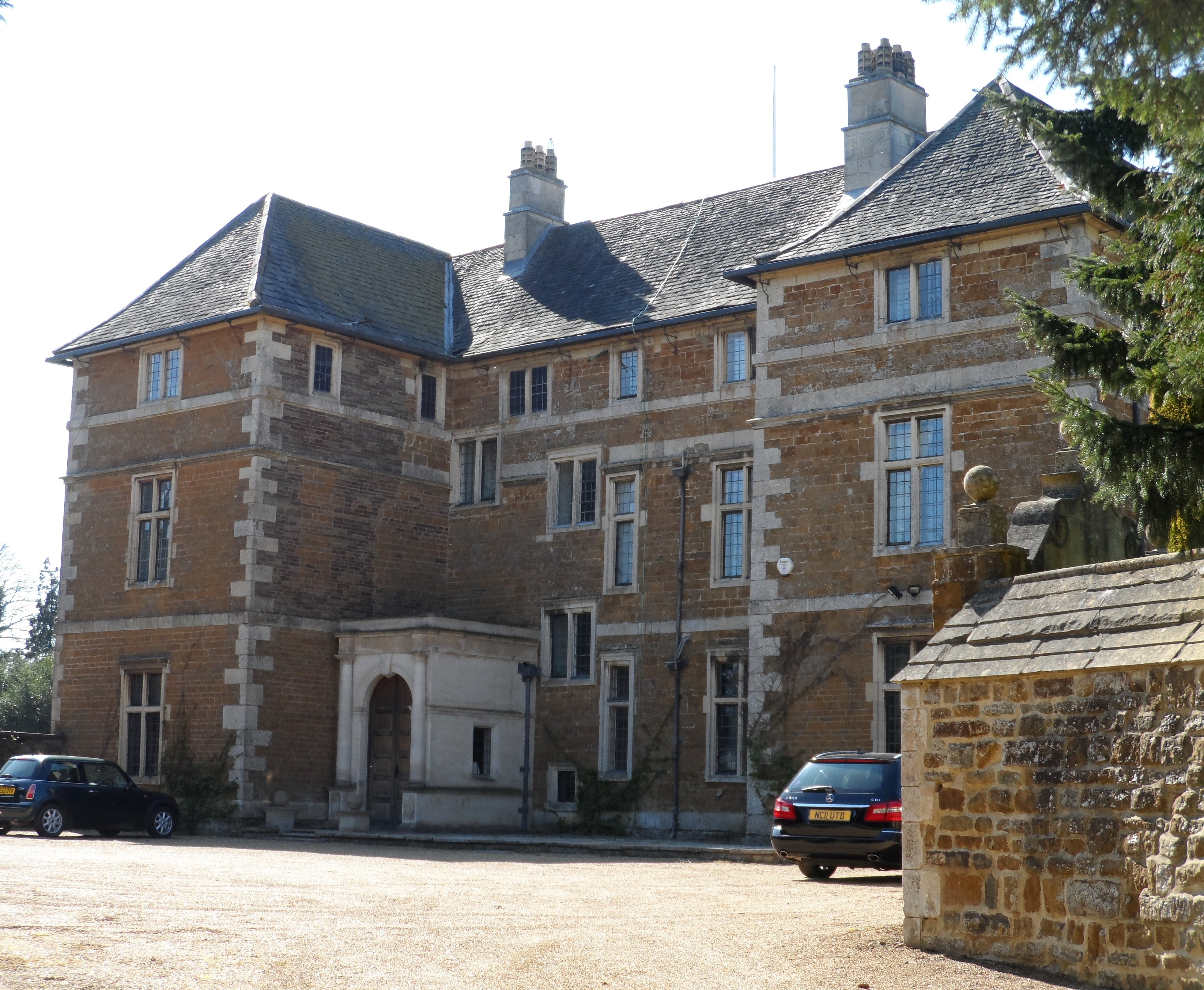
Cold Overton Hall

Cold Overton Hall is a country house in the village of Cold Overton, Leicestershire, England. Built c. 1664 for John St John, it is a Grade I listed building...

Flitteriss Park

Flitteriss Park is an ancient deer park in the English Midland counties of Leicestershire and Rutland west of Oakham. It is a modern livestock farm today...

Nearby Amenities

Located within 500m of 52.669121,-0.815213
Knossington
Is In County: Leicestershire
Is In District: Melton
Place: village
Wikidata: Q6423035
Lat/Long: 52.6700309/-0.8153971
Pub
Fox and Hounds
Addr City: Oakham
Addr Country: GB
Addr Housenumber: 6
Addr Postcode: LE15 8LY
Addr Street: Somerby Road
Addr Village: Knossington
Fhrs Authority: Melton
Fhrs Id: 27869
Fhrs Local Authority Id: 08260/0006/0/000
Source Addr: FHRS Open Data
Wikidata: Q26594079
Lat/Long: 52.6696161/-0.8162009
Bus Stop
Bus Shelter
Alt Name: Knossington - Main Street
Bus: yes
Naptan AltCommonName: Knossington - Main Street
Naptan AtcoCode: 260001502
Naptan Bearing: W
Naptan CommonName: Bus Shelter
Naptan Indicator: adj
Naptan Landmark: shelter
Naptan NaptanCode: leidpdap
Naptan Notes: Non-Hourly - County
Naptan Street: Main Street
Naptan Verified: no
Public Transport: platform
Shelter: yes
Source: naptan_import
Tactile Paving: no
Lat/Long: 52.6691342/-0.8159611
Bus Stop
Main Street
Alt Name: Knossington - opp Shelter
Bus: yes
Naptan AltCommonName: Knossington - opp Shelter
Naptan AtcoCode: 260001503
Naptan Bearing: E
Naptan BusStopType: CUS
Naptan CommonName: Main Street
Naptan Indicator: opposite
Naptan Landmark: shelter
Naptan NaptanCode: leidpdat
Naptan Notes: Non-Hourly - County
Naptan Street: Main Street
Naptan Verified: no
Public Transport: platform
Shelter: no
Source: naptan_import
Tactile Paving: no
Lat/Long: 52.6692686/-0.8159131
Bus Stop
Owston Road
Bus: yes
Naptan AtcoCode: 260080083
Naptan Bearing: SW
Naptan BusStopType: CUS
Naptan CommonName: Owston Road
Naptan Indicator: opp
Naptan Landmark: shelter
Naptan NaptanCode: leijwtwg
Naptan Notes: Non-Hourly - County
Naptan Street: Owston Road
Naptan Verified: no
Public Transport: platform
Shelter: no
Source: naptan_import
Tactile Paving: no
Lat/Long: 52.6689699/-0.8157141
Bus Stop
Owston Road
Bus: yes
Naptan AtcoCode: 260080084
Naptan Bearing: NE
Naptan CommonName: Owston Road
Naptan Indicator: outside
Naptan Landmark: shelter
Naptan NaptanCode: leijwtwj
Naptan Notes: Non-Hourly - County
Naptan Street: Owston Road
Naptan Verified: no
Public Transport: platform
Shelter: no
Source: naptan_import
Tactile Paving: no
Lat/Long: 52.6690256/-0.8158901
Post Box
Brand: Royal Mail
Brand Wikidata: Q638098
Brand Wikipedia: en:Royal Mail
Collection Times: Mo-Fr 16:10; Sa 10:00
Operator: Royal Mail
Operator Wikidata: Q638098
Post Box Type: wall
Ref: LE15 28
Royal Cypher: EIIR
Royal Cypher Wikidata: Q33102113
Source: survey
Lat/Long: 52.6691927/-0.8161597
Addr Housename: Bleak House
Source: OS OpenData StreetView
Lat/Long: 52.668837/-0.8102914
Addr Housename: The Bungalow
Source: OS OpenData StreetView
Lat/Long: 52.6659556/-0.8115287
Power: pole
Source: Bing
Lat/Long: 52.6723568/-0.8167406
Power: pole
Lat/Long: 52.6726593/-0.8184304
Defibrillator
Emergency: defibrillator
Note: emergency key for use on power failure adjacent to box
Ref Signed: no
Source: survey
Lat/Long: 52.6690545/-0.8154289
Generator Method: photovoltaic
Generator Output Electricity: yes
Generator Source: solar
Generator Type: solar_photovoltaic_panel
Location: roof
Power: generator
Lat/Long: 52.6703451/-0.8145516
Generator Method: photovoltaic
Generator Output Electricity: yes
Generator Source: solar
Generator Type: solar_photovoltaic_panel
Location: roof
Power: generator
Lat/Long: 52.6702638/-0.8149995
Generator Method: photovoltaic
Generator Output Electricity: yes
Generator Source: solar
Generator Type: solar_photovoltaic_panel
Location: roof
Power: generator
Lat/Long: 52.6702118/-0.8152462
Generator Method: photovoltaic
Generator Output Electricity: yes
Generator Source: solar
Generator Type: solar_photovoltaic_panel
Location: roof
Power: generator
Lat/Long: 52.6706558/-0.8146562
The data included in this document is from www.openstreetmap.org. The data is made available under ODbL.

Have you been to Knossington?

Leave your review of Knossington below (or comments, questions and feedback).